Showing 43 items matching "new bendigo gold project"
-
 Bendigo Historical Society Inc.
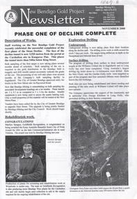
Document - Kangaroo Flat Gold Mine Collection: New Bendigo Gold Project Information Sheet
... Kangaroo Flat Gold Mine Collection: New Bendigo Gold Project Information Sheet...Bendigo...mining...gold...Kangaroo Flat...New Bendigo Gold Project...Information sheet for the New Bendigo Gold Project, detailing stages in the project. ...Bendigo mining gold Kangaroo Flat New Bendigo Gold Project portal decline Sheepshed line of reef Deborah line of reef Information sheet for the New Bendigo Gold Project, detailing stages in the project. ...Information sheet for the New Bendigo Gold Project, detailing stages in the project. On top of sheet: ' New Bendigo Gold Project Information Sheet, Facts and Figures on the project'. Plan of proposed mine on bottom right of information sheet showing decline position at end of 2003. Portal, Sheepshead line and Deborah line of reefs shown on plan. Across bottom of page 'This newsletter is published in the interests of keeping the public of Bendigo informed of the activities at the New Bendigo Gold Project'.bendigo mining n.l., bendigo, mining, gold, kangaroo flat, new bendigo gold project, portal, decline, sheepshed line of reef, deborah line of reef -
 Bendigo Historical Society Inc.
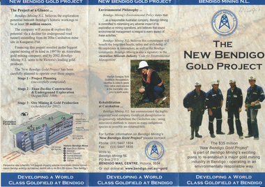
Flyer - Kangaroo Flat Gold Mine Collection: New Bendigo Gold Project, Unknown
... Kangaroo Flat Gold Mine Collection: New Bendigo Gold Project ...The New Bendigo Gold Project began surface workings at the Carshalton site in Kangaroo Flat, in 1998. ...On front: 'New Bendigo Gold Project, Bendigo Mining N.L'. Brochure details background of project, environmental philosophy, rehabilitation work, jobs in the economy and current activity on the New Bendigo Gold Project. ...The New Bendigo Gold Project began surface workings at the Carshalton site in Kangaroo Flat, in 1998. ...The New Bendigo Gold Project began surface workings at the Carshalton site in Kangaroo Flat, in 1998. A decline tunnel was constructed and designed to reach a depth of 800 m below the surface, passing underneath historic workings. The information brochure was produced to provide information to Bendigo community members.Colour trifold information brochure (2 copies). On front: 'New Bendigo Gold Project, Bendigo Mining N.L'. Brochure details background of project, environmental philosophy, rehabilitation work, jobs in the economy and current activity on the New Bendigo Gold Project. bendigo mining n.l., bendigo, mining, gold, kangaroo flat, environmental study -
 Bendigo Historical Society Inc.
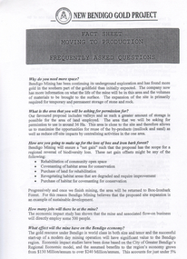
Document - Kangaroo Flat Gold Mine Collection: New Bendigo Gold Project Fact Sheets, no date
... Kangaroo Flat Gold Mine Collection: New Bendigo Gold Project Fact Sheets...Bendigo...mining...gold...Kangaroo Flat...New Bendigo Gold Project...Five double-sided fact sheets prepared for the New Bendigo Gold Project. Each sheet explains particular facts about the development of the project; planning permission, co-disposal, mullock emplacement, intensive leaching and beneficial reuse of mine by-products are given detailed explanations. ...Bendigo mining gold Kangaroo Flat New Bendigo Gold Project planning permission co-disposal mullock emplacement intensive leaching beneficial reuse of mining by-products Five double-sided fact sheets prepared for the New Bendigo Gold Project. ...Five double-sided fact sheets prepared for the New Bendigo Gold Project. Each sheet explains particular facts about the development of the project; planning permission, co-disposal, mullock emplacement, intensive leaching and beneficial reuse of mine by-products are given detailed explanations. Contact details are listed on the bottom of each sheet, for example 'Philipa Varris, Environment Manager, Bendigo Mining' and 'Colin Burns, Project Metallurgist, Bendigo Mining'.bendigo mining n.l., bendigo, mining, gold, kangaroo flat, new bendigo gold project, planning permission, co-disposal, mullock emplacement, intensive leaching, beneficial reuse of mining by-products -
 Bendigo Historical Society Inc.
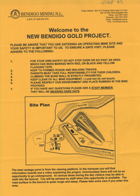
Document - Kangaroo Flat Gold Mine Collection: New Bendigo Gold Project, 2.9.2000
... Kangaroo Flat Gold Mine Collection: New Bendigo Gold Project...Bendigo...mining...gold...Kangaroo Flat...2002...New Bendigo Gold Project...New Bendigo Gold Project The Bendigo goldfield is centred on the urban area of Bendigo (population approximately 60 000) in central Victoria, 130 km north west of Melbourne, Australia. ... Mine Collection: New Bendigo Gold Project ...New Bendigo Gold Project The Bendigo goldfield is centred on the urban area of Bendigo (population approximately 60 000) in central Victoria, 130 km north west of Melbourne, Australia. Gold was discovered at Bendigo in 1851 and production continued through to 1954. The Bendigo goldfield is the second largest goldfield in total gold produced in Australia, after Kalgoorlie's Golden Mile with a total production of 22 million oz. The geology of the Bendigo Field consists of a series of tightly folded, interbedded sandstone and shale sediments. Within the sediments the gold mineralisation is hosted in quartz reefs or ribbons closely associated with anticline axes and reverse faulting. The gold within the quartz reefs is typically both coarse grained and erratically distributed.Two page document produced by Bendigo Mining N.L. on the occasion of their 2002 Open Day. Front page 'Welcome to the New Bendigo Giold Project' outlines the procedure involved in signing in and safety issues whilst on site. A site plan is provided. Second page is an information sheet, and provides facts and figures on the project to date. bendigo mining n.l., bendigo, mining, gold, kangaroo flat, 2002, new bendigo gold project, open day -
 Bendigo Historical Society Inc.
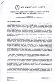
Document - Kangaroo Flat Gold Mine Collection: New Bendigo Gold Project Newsletters, no date
... Kangaroo Flat Gold Mine Collection: New Bendigo Gold Project Newsletters...Bendigo...mining...gold...Kangaroo Flat...New Bendigo Gold Project...Three New Bendigo Gold Project newsletters, dated November 2000, June 2002 and April 2003. ...Bendigo mining gold Kangaroo Flat New Bendigo Gold Project drilling rehabilitation Bree Darcy Sam McGowan Marilynh Sprague Philipa Varris Swan decline Three New Bendigo Gold Project newsletters, dated November 2000, June 2002 and April 2003. ...Three New Bendigo Gold Project newsletters, dated November 2000, June 2002 and April 2003. November 2000 newsletter is headed ' Phase One of Decline Complete' Articles include description of works, rehabilitation work, exploration drilling - underground and surface drilling and dewatering and safety. Map showing decline development superimposed on street map on back of sheet. June 2002 newsletter, headed 'Environmental Manager Joins the Team' describes the appointment and previous experience of Philipa Varris. The newsletter includes information on water treatment plant, new shaft below the surface and provides a personality profile of John Cahill (Frank) the Senior Geologist. April 2003 newsletter, headed 'Bendigo Mining Seeks Site Expansion for Production' provides facts on the Swan Decline, a mine public open day, bird watching at Woodvale, the advisory board and a personality profile on Phil Walklate, project draftsman. A decline development map is provided on bottom right of sheet. bendigo mining n.l., bendigo, mining, gold, kangaroo flat, new bendigo gold project, drilling, rehabilitation, bree darcy, sam mcgowan, marilynh sprague, philipa varris, swan decline -
 Bendigo Historical Society Inc.
Flyer - Kangaroo Flat Gold Mine Collection: New Bendigo Gold Project, Bendigo Mining NL, P.O. Box 2113, Mail Centre, Not dated
... Kangaroo Flat Gold Mine Collection: New Bendigo Gold Project ...On front: 'New Bendigo Gold Project.' On front: four miners dressed in overalls and hard hats. ...Bendigo mining gold Kangaroo Flat environmental study project planning decline construction and exploration mining and production Colour trifold information brochure (2 copies). On front: 'New ...Colour trifold information brochure (2 copies). On front: 'New Bendigo Gold Project.' On front: four miners dressed in overalls and hard hats. Brochure details stages of New Bendigo Gold Project including: project planning, decline construction and exploration, mining and production and environmental philosphy. A detailed map of the Bendigo Mining N.L. Carshalton Mine Site and a brief history of Bendigo gold discovery is included. bendigo mining n.l., bendigo, mining, gold, kangaroo flat, environmental study, project planning, decline construction and exploration, mining and production -
 Bendigo Historical Society Inc.
Document - Kangaroo Flat Gold Mine Collection: New Bendigo Gold Project Fact Sheet, Bendigo Mining NL, P.O. Box 2113, Mail Centre et al, Both documents undated
... Kangaroo Flat Gold Mine Collection: New Bendigo Gold Project Fact Sheet...Information regarding the New Bendigo Gold Project: 1. Five page Fact Sheet on the New Bendigo Gold Project moving to production, frequently asked questions re project and responses from Philipa Varris, Safety, Health and Environment Manager, Bendigo Mining. 2. ...Bendigo mining gold Kangaroo Flat information sheet Western mining Corporation Information regarding the New Bendigo Gold Project: 1. ...Bendigo Mining 1993 to present In the 1980s Bendigo Mining listed on the ASX with ownership of leases along the Deborah line of reef. In 1993, the Company consolidated ownership of the entire Goldfield when it purchased WMC’s interests. A detailed account of the recent history of Bendigo Mining is outlined in the Company History. Bendigo Mining NL website: https://www.bmnl.com.au/goldfield-history/Information regarding the New Bendigo Gold Project: 1. Five page Fact Sheet on the New Bendigo Gold Project moving to production, frequently asked questions re project and responses from Philipa Varris, Safety, Health and Environment Manager, Bendigo Mining. 2. One page information sheet on the New Bendigo Project, titled 'Information Sheet, facts and figures on the project'. bendigo mining n.l., bendigo, mining, gold, kangaroo flat, information sheet, western mining corporation -
 Bendigo Historical Society Inc.
Document - Kangaroo Flat Gold Mine Collection: New Bendigo Gold Project, Department of Conservation and Environment, April 1991
... Kangaroo Flat Gold Mine Collection: New Bendigo Gold Project...On top of sheet: welcome to the New Bendigo Gold Project. . A site plan and safety warnings are provided on the sheet. ...Bendigo mining gold Open day information day mine site safety boxcut bund wall One yellow page information sheet, issued by Bendigo Mining N.L. On top of sheet: welcome to the New Bendigo Gold Project ...One yellow page information sheet, issued by Bendigo Mining N.L. On top of sheet: welcome to the New Bendigo Gold Project. . A site plan and safety warnings are provided on the sheet. bendigo mining n.l., bendigo, mining, gold, open day, information day, mine site, safety, boxcut, bund wall -
 Bendigo Historical Society Inc.
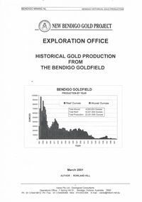
Document - NEW BENDIGO GOLD PROJECT: REPORT ON BENDIGO HISTORICAL GOLD PRODUCTION
... NEW BENDIGO GOLD PROJECT: REPORT ON BENDIGO HISTORICAL GOLD PRODUCTION...New Bendigo Gold Project -Bendigo Mining NL - Report on Bendigo Historical Gold Production from the Bendigo Goldfield -Exploration Office - dated March 2001 . ...Document NEW BENDIGO GOLD PROJECT: REPORT ON BENDIGO HISTORICAL GOLD PRODUCTION ...New Bendigo Gold Project -Bendigo Mining NL - Report on Bendigo Historical Gold Production from the Bendigo Goldfield -Exploration Office - dated March 2001 . Paper presented by Rowland Hill, Bendigo Mining NL, at BHS meeting, 2 November, 2001. 30 pages.document, gold, gold mines of bendigo & eaglehawk -
 Bendigo Historical Society Inc.
Document - NEW BENDIGO GOLD PROJECT: A COMPARATIVE STUDY OF MINE VENTILATION ON THE BENDIGO GOLDFIELD
... NEW BENDIGO GOLD PROJECT: A COMPARATIVE STUDY OF MINE VENTILATION ON THE BENDIGO GOLDFIELD...NEW BENDIGO GOLD PROJECT - a Comparative STUDY of historical and modern Mine Ventilation on the Bendigo Goldfield -dated October 2001 by Rowland L. ...Document NEW BENDIGO GOLD PROJECT: A COMPARATIVE STUDY OF MINE VENTILATION ON THE BENDIGO GOLDFIELD ...NEW BENDIGO GOLD PROJECT - a Comparative STUDY of historical and modern Mine Ventilation on the Bendigo Goldfield -dated October 2001 by Rowland L. Hill. Comparison of the air quality standards set in the 19 and 21 centuries . Paper presented by Rowland Hill, Bendigo Mining, at the BHS meeting Friday 2nd November, 2001.Rowland L. Hillgold mines -
 Bendigo Historical Society Inc.
Newspaper - Kangaroo Flat Gold Mine Collection: New Bendigo Gold Project
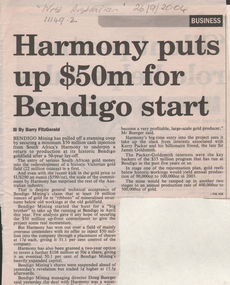
... Kangaroo Flat Gold Mine Collection: New Bendigo Gold Project ...New Bendigo Gold Project The Bendigo goldfield is centred on the urban area of Bendigo (population approximately 60 000) in central Victoria, 130 km north west of Melbourne, Australia. ...Doug Buerger, managing Director of Bendigo Mining, stated that the New Bendigo project has 'the potential to become a very profitable, large-scale gold producer'. ...Newspaper Kangaroo Flat Gold Mine Collection: New Bendigo Gold Project ...New Bendigo Gold Project The Bendigo goldfield is centred on the urban area of Bendigo (population approximately 60 000) in central Victoria, 130 km north west of Melbourne, Australia. Gold was discovered at Bendigo in 1851 and production continued through to 1954. The Bendigo goldfield is the second largest goldfield in total gold produced in Australia, after Kalgoorlie's Golden Mile with a total production of 22 million oz. The geology of the Bendigo Field consists of a series of tightly folded, interbedded sandstone and shale sediments. Within the sediments the gold mineralisation is hosted in quartz reefs or ribbons closely associated with anticline axes and reverse faulting. The gold within the quartz reefs is typically both coarse grained and erratically distributed.'Harmony puts up $50m for Bendigo start'. Newspaper article details the 'stunning coup' that Bendigo Mining has organised to secure a minimum $50m cash injection from South Africa's Harmony to 'return to production at its historic Bendigo goldfield after a 50 year lay-off'. Mr. Doug Buerger, managing Director of Bendigo Mining, stated that the New Bendigo project has 'the potential to become a very profitable, large-scale gold producer'. 'The Age' attributed at end of article. In pencil on top of article: 'West Australian 26/9/2004'bendigo mining n.l., bendigo, mining, gold, kangaroo flat, harmony, south africa, mining shares, doug buerger -
 Bendigo Historical Society Inc.
Document - Kangaroo Flat Gold Mine Collection: Historical Gold Production from Bendigo Goldfield, Rowland Hill, October 2001
... Bendigo...mining...gold...Kangaroo Flat...New Bendigo Gold Project...The author of this study, Rowland Hill, was a Geological Consultant working with the New Bendigo Gold Project, Bendigo. His Company was Varex Pty ltd....Twenty-six page report titled 'New Bendigo Gold Project, Exploration Office, Historical Gold Production from the Bendigo Goldfield', author Rowland Hill, March 2001. ...The author of this study, Rowland Hill, was a Geological Consultant working with the New Bendigo Gold Project, Bendigo. His Company was Varex Pty ltd. ...The author of this study, Rowland Hill, was a Geological Consultant working with the New Bendigo Gold Project, Bendigo. His Company was Varex Pty ltd.Twenty-six page report titled 'New Bendigo Gold Project, Exploration Office, Historical Gold Production from the Bendigo Goldfield', author Rowland Hill, March 2001. Table of contents includes: introduction, previous production statements, alluvial production, reef production, total Bendigo production, Bendigo versus Ballarat and references. bendigo mining n.l., bendigo, mining, gold, kangaroo flat, new bendigo gold project, alluvial production, reef production, rowland hill, varex pty ltd., historical gold production -
 Bendigo Historical Society Inc.
Document - Kangaroo Flat Gold Mine Collection: Historical and Modern Mine Ventilation, Rowland Hill, October 2001
... Bendigo...mining...gold...Kangaroo Flat...New Bendigo Gold Project...Five page document titled 'New Bendigo Gold Project, a Comparative Study of Historical and Modern Mine Ventilation on the Bendigo Goldfield, Rowland L. ...Bendigo mining gold Kangaroo Flat New Bendigo Gold Project mine ventilation rock temperature Victorian Department of Mines phthisis tuberculosis humidity Five page document titled 'New Bendigo Gold Project, a Comparative Study of Historical and Modern Mine Ventilation on the Bendigo Goldfield, Rowland L. ...Five page document titled 'New Bendigo Gold Project, a Comparative Study of Historical and Modern Mine Ventilation on the Bendigo Goldfield, Rowland L. Hill, Chief Mine Geologist, Bendigo Mining NL, (October 2001). Study compares ventilation practices for two periods of time, citing historical examples of ventilation in Bendigo mines in the 19th and early 20th century and compares them to modern practices. bendigo mining n.l., bendigo, mining, gold, kangaroo flat, new bendigo gold project, mine ventilation, rock temperature, victorian department of mines, phthisis, tuberculosis, humidity -
 Bendigo Historical Society Inc.
Document - Kangaroo Flat Gold Mine Collection: Bendigo Gold Project Newsletters, Bendigo Mining NL, November 2001, August 2002, October 2002, July 2005, February 2006 and May 2006
... New Bendigo Gold Project The Bendigo goldfield is centred on the urban area of Bendigo (population approximately 60 000) in central Victoria, 130 km north west of Melbourne, Australia. ...Six newsletters, "New Bendigo Gold Project", dated November 2001, August 2002, October 2002, July 2005, February 2006 and May 2006. ...New Bendigo Gold Project The Bendigo goldfield is centred on the urban area of Bendigo (population approximately 60 000) in central Victoria, 130 km north west of Melbourne, Australia. ...New Bendigo Gold Project The Bendigo goldfield is centred on the urban area of Bendigo (population approximately 60 000) in central Victoria, 130 km north west of Melbourne, Australia. Gold was discovered at Bendigo in 1851 and production continued through to 1954. The Bendigo goldfield is the second largest goldfield in total gold produced in Australia, after Kalgoorlie's Golden Mile with a total production of 22 million oz. The geology of the Bendigo Field consists of a series of tightly folded, interbedded sandstone and shale sediments. Within the sediments the gold mineralisation is hosted in quartz reefs or ribbons closely associated with anticline axes and reverse faulting. The gold within the quartz reefs is typically both coarse grained and erratically distributed. Source: https://www.ausimm.com/publications/conference-proceedings/eighth-underground-operators-conference-2002/new-bendigo-gold-project/Six newsletters, "New Bendigo Gold Project", dated November 2001, August 2002, October 2002, July 2005, February 2006 and May 2006. Newsletters highlight development of gold project; a map of the decline development, underground workings and personnel news is featured on most newsletters. bendigo mining n.l., bendigo, mining, gold, kangaroo flat, decline, swan decline, south decline, new moon plant eaglehawk, ventilation shaft, drilling, blasting, ground support, sandra burns, james lerk, underground development, rehabilitation, greg miller, alexandria reef -
 Bendigo Historical Society Inc.
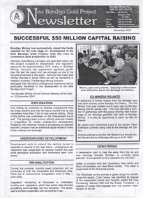
Photograph - Kangaroo Flat Gold Mine Collection: Unity Mining employees
... Gold Mine...Bendigo Mining NL...New Bendigo Gold Project...History House 11 Mackenzie Street Bendigo goldfields Kangaroo Flat Gold Mine Bendigo Mining NL New Bendigo Gold Project goldmining personnel Doug Buerger Colin Burns Unity Mining A3 laminated sheet with colour photographs of mine personnel. ...A3 laminated sheet with colour photographs of mine personnel. Fourteen men and one woman dressed in orange high-vis clothing and wearing hard hats. In background, part of processing plant with 'Unity Mining Limited' on side of tank. Kangaroo Flat Gold mine site in far background. kangaroo flat gold mine, bendigo mining nl, new bendigo gold project, goldmining, personnel, doug buerger, colin burns, unity mining -
 Bendigo Historical Society Inc.
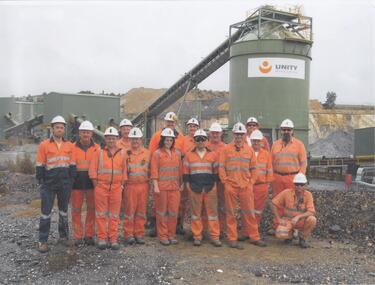
Photograph - Kangaroo Flat Gold Mine Collection: photo album 1998
... Gold Mine...Bendigo Mining NL...New Bendigo Gold Project...History House 11 Mackenzie Street Bendigo goldfields Kangaroo Flat Gold Mine Bendigo Mining NL New Bendigo Gold Project goldmining personnel Doug Buerger Colin Burns Tarnagulla New Moon displays box cut Unity Mining aerial photos 1998 Photo album, black cover, gold border. ...Photo album, black cover, gold border. One hundred colour photos, some with annotations. Label on front of album: Portal, machinery, underground shots 1998; drilling in Deborah St.; mines rescue vehicle; various staff; E.E.S. Displays; Board Meeting 1998. Staff photos: Rob Charlton, pump at Red, White Blue Cons.; Andrew Breen Workshop Manager; John Cahill; Patrick O'Boyle Mine Rescue Vehicle; John Cahill; Ben Clayton; Ricky Hannah; April Westcott; Ivette Maggs site clerk McMahons; Wayne Woodward; Fiona Hunt; Steve Woodall.kangaroo flat gold mine, bendigo mining nl, new bendigo gold project, goldmining, personnel, doug buerger, colin burns, tarnagulla, new moon, displays, box cut, unity mining, aerial photos, 1998 -
 Bendigo Historical Society Inc.
Photograph - Kangaroo Flat Gold Mine Collection: photo album 1998
... Gold Mine...Bendigo Mining NL...New Bendigo Gold Project...Kangaroo Flat Gold Mine Bendigo Mining NL New Bendigo Gold Project goldmining personnel Doug Buerger Colin Burns Tarnagulla New Moon displays box cut Unity Mining aerial photos Photo album, red cover with black binding. ...Photo album, red cover with black binding. Seventy colour photos, some with annotations. Label on front of album: 'Office Move 1998. Bendigo Show, E.E.S. Display, 'Board' on site 1998, Residents visit Tarnagulla, shaft shots, E.E.S Display Central Deborah, Drilling at New Moon, Box Cut (2), Aerial site photos Nov. 1998' Album includes mine personnel photos of Doug Berger, Geoff McDermott, John Cahill, Colin Burns, Ken Belfrage, Dean Turnbull, Courtney Chamberlain, 'The Boys' - Frank, Woody, Pratty and Jason, and Jason Bourke. Mining photos include: Carshalton site 24.7.98, drilling at New Moon and portal reef mining Tarnagulla 1998.kangaroo flat gold mine, bendigo mining nl, new bendigo gold project, goldmining, personnel, doug buerger, colin burns, tarnagulla, new moon, displays, box cut, unity mining, aerial photos -
 Bendigo Historical Society Inc.
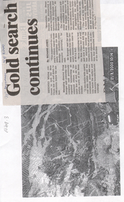
Newspaper - Kangaroo Flat Gold Mine Collection: Gold search continues, 2.9.2000
... New Bendigo Gold Project The Bendigo goldfield is centred on the urban area of Bendigo (population approximately 60 000) in central Victoria, 130 km north west of Melbourne, Australia. ...Bendigo Advertiser article attached to a photocopy of an underground rock formation. Photocopy date stamped 21.8.2000. Headline on newspaper article: 'Gold search continues'. Content describes exploration on the New Chum line of reef 'down to 1500 metres below the surface'. Doug Buerger is quoted discussing the 10 million ounce potential of the New Bendigo gold project...New Bendigo Gold Project The Bendigo goldfield is centred on the urban area of Bendigo (population approximately 60 000) in central Victoria, 130 km north west of Melbourne, Australia. ...New Bendigo Gold Project The Bendigo goldfield is centred on the urban area of Bendigo (population approximately 60 000) in central Victoria, 130 km north west of Melbourne, Australia. Gold was discovered at Bendigo in 1851 and production continued through to 1954. The Bendigo goldfield is the second largest goldfield in total gold produced in Australia, after Kalgoorlie's Golden Mile with a total production of 22 million oz. The geology of the Bendigo Field consists of a series of tightly folded, interbedded sandstone and shale sediments. Within the sediments the gold mineralisation is hosted in quartz reefs or ribbons closely associated with anticline axes and reverse faulting. The gold within the quartz reefs is typically both coarse grained and erratically distributed.Bendigo Advertiser article attached to a photocopy of an underground rock formation. Photocopy date stamped 21.8.2000. Headline on newspaper article: 'Gold search continues'. Content describes exploration on the New Chum line of reef 'down to 1500 metres below the surface'. Doug Buerger is quoted discussing the 10 million ounce potential of the New Bendigo gold project. The Garden Gully line of reef is being tested for unmined ribbons on the reefline. bendigo mining n.l., bendigo, mining, gold, kangaroo flat, doug buerger, garden gully reef, new chum reef -
 Bendigo Historical Society Inc.
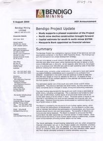
Document - Kangaroo Flat Gold Mine Collection: Bendigo Project Update ASX announcement, Bendigo Mining NL, 5 August 2005
... New Bendigo Gold Project The Bendigo goldfield is centred on the urban area of Bendigo (population approximately 60 000) in central Victoria, 130 km north west of Melbourne, Australia. ...New Bendigo Gold Project The Bendigo goldfield is centred on the urban area of Bendigo (population approximately 60 000) in central Victoria, 130 km north west of Melbourne, Australia. ...New Bendigo Gold Project The Bendigo goldfield is centred on the urban area of Bendigo (population approximately 60 000) in central Victoria, 130 km north west of Melbourne, Australia. Gold was discovered at Bendigo in 1851 and production continued through to 1954. The Bendigo goldfield is the second largest goldfield in total gold produced in Australia, after Kalgoorlie's Golden Mile with a total production of 22 million oz. The geology of the Bendigo Field consists of a series of tightly folded, interbedded sandstone and shale sediments. Within the sediments the gold mineralisation is hosted in quartz reefs or ribbons closely associated with anticline axes and reverse faulting. The gold within the quartz reefs is typically both coarse grained and erratically distributed. Source: https://www.ausimm.com/publications/conference-proceedings/eighth-underground-operators-conference-2002/new-bendigo-gold-project/Three page, double sided project update for the Bendigo project. On top of front page 'Bendigo Mining, 5 August 2005, ASX Announcement'. Content includes: summary of the project with the aim defined 'to deliver a south mine of 120,000 oz/y next year, increasing to 200,000 oz/y in 2011/12. At full capacity, after 2001/12, the project plan is to produce over 600,000 oz/y gold at cash operating costs of less than $200/0z utilising twin declines and plants'. Development strategy, funding, recent expenditures, key project details, production, processing, operating costs, development capital, maintenance capital are discussed in the project update. bendigo mining n.l., bendigo, mining, gold, kangaroo flat, swan decline, development strategy, funding, recent expenditures, key project details, production, processing, oeprating costs, development capital, maintenance capital, stock exchange, project update -
 Bendigo Historical Society Inc.
Letter - Kangaroo Flat Gold Mine Collection: Ralph Birrell, 3rd November, 1998
... Dr Ralph Birrell (20/3/1927 - 7/6/2014) was a lecturer at the Bendigo School of mines and the author of numerous books about mining in Victoria, particularly Bendigo, and books on various elements of Bendigo history. New Bendigo Gold Project The Bendigo goldfield is centred on the urban area of Bendigo (population approximately 60 000) in central Victoria, 130 km north west of Melbourne, Australia. ...Dr Ralph Birrell (20/3/1927 - 7/6/2014) was a lecturer at the Bendigo School of mines and the author of numerous books about mining in Victoria, particularly Bendigo, and books on various elements of Bendigo history. New Bendigo Gold Project The Bendigo goldfield is centred on the urban area of Bendigo (population approximately 60 000) in central Victoria, 130 km north west of Melbourne, Australia. ...Dr Ralph Birrell (20/3/1927 - 7/6/2014) was a lecturer at the Bendigo School of mines and the author of numerous books about mining in Victoria, particularly Bendigo, and books on various elements of Bendigo history. New Bendigo Gold Project The Bendigo goldfield is centred on the urban area of Bendigo (population approximately 60 000) in central Victoria, 130 km north west of Melbourne, Australia. Gold was discovered at Bendigo in 1851 and production continued through to 1954. The Bendigo goldfield is the second largest goldfield in total gold produced in Australia, after Kalgoorlie's Golden Mile with a total production of 22 million oz. The geology of the Bendigo Field consists of a series of tightly folded, interbedded sandstone and shale sediments. Within the sediments the gold mineralisation is hosted in quartz reefs or ribbons closely associated with anticline axes and reverse faulting. The gold within the quartz reefs is typically both coarse grained and erratically distributed.Three letters from Bendigo Mining N.L. 14th May 1998, 3 November 1998, and 22nd. April 1999, to Mr. Ralph Birrell from Bendigo Mining N.L. regarding the next meeting of the old miners club to be held at Bendigo mining's site offices. Signed by Shelley Saunders, Community Affairs Co-ordinator. On bottom of page: Registered and Secretarial Office, 61-65 Bull Street, Bendigo Vic 3550. Carshalton Site Office, Coonooer Street, Kangaroo Flat, Vic 3555.bendigo mining n.l., bendigo, mining, gold, kangaroo flat, ralph birrell, old miners group -
 Bendigo Historical Society Inc.
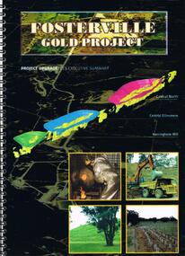
Document - FOSTERVILLE GOLD MINE COLLECTION: FOSTERVILLE GOLD PROJECT UPGRADE EXECUTIVE SUMMARUY
... BENDIGO Mining Fosterville Gold Mine Black cover book, wire binding, 13 pages of text and maps. On front: Fosterville Gold Project' Map of ore body on cover - Central North, Central Ellesmere, Harringtons Hill. Contents include: open pits, heap leaching, waste dumps, estimated project life, changes from previously approved project, estimated project life, main project components, expanded open pits and underground mines, processing sulphide ore, tailings storages, waste rock dumps. Principles of rehabilitation, site preparation, rehabilitation activities during operation and decommissioning activities. Environmental issues, and summary of proposed new ...Black cover book, wire binding, 13 pages of text and maps. On front: Fosterville Gold Project' Map of ore body on cover - Central North, Central Ellesmere, Harringtons Hill. Contents include: open pits, heap leaching, waste dumps, estimated project life, changes from previously approved project, estimated project life, main project components, expanded open pits and underground mines, processing sulphide ore, tailings storages, waste rock dumps. Principles of rehabilitation, site preparation, rehabilitation activities during operation and decommissioning activities. Environmental issues, and summary of proposed new operating conditions.bendigo, mining, fosterville gold mine -
 Bendigo Historical Society Inc.
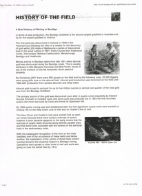
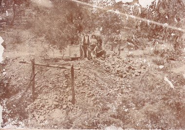
Document - LONG GULLY HISTORY GROUP COLLECTION: HISTORY OF THE FIELD (GOLD)
... BENDIGO...History...long gully history group...The Long Gully History Group - History of the Field (Gold)... Mrs Margaret Kennedy... Mrs Farrell... Edward Nucella Emmett... Cave and Amos... Victoria Quartz... new Chum Railway... Bendigo Amalgamated Gold Mies... Bendigo Mines Ltd... Deborah Mines... William Burrell... WMC... Williams United... Charshalton... Bendigo Mining NL... New Bendigo Project...History House 11 Mackenzie Street Bendigo goldfields BENDIGO History long gully history group The Long Gully History Group - History of the Field (Gold) Mrs Margaret Kennedy Mrs Farrell Edward Nucella Emmett Cave and Amos Victoria Quartz new Chum Railway Bendigo Amalgamated Gold Mies Bendigo Mines Ltd Deborah Mines William Burrell WMC Williams United Charshalton Bendigo Mining NL New Bendigo Project Trevor Clark Shelley Saunders Peter Wiseman New Bendigo - 10 Million Ounces of Gold Three pages of History of the Field, A Brief History of Mining in Bendigo. ...Three pages of History of the Field, A Brief History of Mining in Bendigo. The history starts in 1851 when gold was discovered along the Bendigo Creek to 1992 when Bendigo Mining NL purchased the licences and infrastructure from WMC. There are four small photos: Two men working a puddling machine; Victoria Hill - 1850's Open Cut; Victoria Hill Quartz Mine, and the Central Deborah Mine. There is also a web address in the top right corner.bendigo, history, long gully history group, the long gully history group - history of the field (gold), mrs margaret kennedy, mrs farrell, edward nucella emmett, cave and amos, victoria quartz, new chum railway, bendigo amalgamated gold mies, bendigo mines ltd, deborah mines, william burrell, wmc, williams united, charshalton, bendigo mining nl, new bendigo project, trevor clark, shelley saunders, peter wiseman, new bendigo - 10 million ounces of gold -
 The Beechworth Burke Museum
Photograph
... An emigrant from Cornwall with experience in the tin mining industry, 19 year old Roger Williams senior sailed to New Zealand in 1840, then to Australia where he spent time in the Bendigo Gold Fields before settling in Beechworth in the early 1860s. Mr Williams senior worked on various mining activities in the district, including the Rocky Mountain Tunnel project. ...An emigrant from Cornwall with experience in the tin mining industry, 19 year old Roger Williams senior sailed to New Zealand in 1840, then to Australia where he spent time in the Bendigo Gold Fields before settling in Beechworth in the early 1860s. Mr Williams senior worked on various mining activities in the district, including the Rocky Mountain Tunnel project. ...This image is a reproduction of an 1899 original depicting the 'Williams Good Luck Mine' on the Mopoke Reef (also called 'Morepork Gully') in the Dingle Ranges, approximately three miles from Beechworth. A large opening to a mine can be seen behind the men in the photograph, with a wheeled cart on a track leading to the men's position, where the soil and rocks have been hauled away. This photograph interestingly contains dogs alongside the miners. While dogs have been recorded as deterrents to thieves in the Victorian goldfields, these dogs appear as companions to these men. Following the discovery of gold at Beechworth in 1852, rushes quickly followed at surrounding creeks and gullies in the district. In the late nineteenth and early twentieth centuries, small syndicates of miners continued to work old or abandoned quartz reefs, often persisting without the assistance of heavy machinery to remove the large amounts of rock, in order to obtain yields at ever greater depths. The group of miners in this photograph are Mr. Roger Williams and Sons, who revived operations at the ‘Old Good Luck’ mine on the Mopoke Reef in the Dingle Range near Beechworth around 1892, working the site for more than two decades. An emigrant from Cornwall with experience in the tin mining industry, 19 year old Roger Williams senior sailed to New Zealand in 1840, then to Australia where he spent time in the Bendigo Gold Fields before settling in Beechworth in the early 1860s. Mr Williams senior worked on various mining activities in the district, including the Rocky Mountain Tunnel project. Conversant with the character of gold-bearing reefs in the area, the syndicate dug an eight hundred foot tunnel, digging down as far down as two hundred feet with little capital save their labour, to connect and provide better working access to the mass of reefs and veins in the vicinity. Progress was hampered by poor air quality charged with fumes from dynamite and large quantities of rock had to be crushed to obtain payable yields. The Victorian Goldfields are filled with ruins and remnants of the area's rich mining history, ranging from small alluvial diggings to the remains of huge mining companies. Site names often changed several times throughout the nineteenth and twentieth centuries. Some sites were abandoned and forgotten, others were worked continuously over many decades. The names of mines were often repeated at different locations throughout the Victorian Goldfields. For example, there is a Mopoke Gully heritage mine near Fryers Creek, Victoria. 'Mopoke' is a common onomatopoeic name for Morepork and Australian Boobook owls.This image has historical, social and research significance for patterns of emigration during of the Victorian Gold Rush, and the historical, social and environmental impacts of mining at Beechworth at the turn of the nineteenth and twentieth centuries. As gold became scarce and government support and large company investment waned, poor hard-working miners laboured intensively to make a living through periods of high unemployment. This image can be compared and studied alongside other historical mining photographs and objects in the Burke Museum Collection. It has potential to improve our understanding of miners working conditions and the shifting character of mining in the Beechworth district.Sepia coloured rectangular photograph printed on gloss photographic paper mounted on card. Obverse: Williams/ Good/ Luck Reverse: A02498/ 1997. 2498/ Good Luck/ Mine/ 1899/ Mopoke. burke museum, beechworth museum, beechworth, gold fields, gold rush, victorian gold rush, gold ming history, colonial australia, australian gold rushes, mining technology, beechworth historic district, indigo gold trail, migration, indigo shire, good luck gold mine, victorian goldfields, mining syndicates, gold fever, quartz-mining, small-scale mining, old good luck mine, mopoke gully, quartz reefs beechworth -
 The Beechworth Burke Museum
Photograph
... An emigrant from Cornwall with experience in the tin mining industry, 19 year old Roger Williams senior sailed to New Zealand in 1840, then to Australia where he spent time in the Bendigo Gold Fields before settling in Beechworth in the early 1860s. Mr Williams senior worked on various mining activities in the district, including the Rocky Mountain Tunnel project. ...An emigrant from Cornwall with experience in the tin mining industry, 19 year old Roger Williams senior sailed to New Zealand in 1840, then to Australia where he spent time in the Bendigo Gold Fields before settling in Beechworth in the early 1860s. Mr Williams senior worked on various mining activities in the district, including the Rocky Mountain Tunnel project. ...This image is a reproduction of an 1899 original depicting the 'Williams Good Luck Mine' on the Mopoke Reef (also called 'Morepork Gully') in the Dingle Ranges, approximately three miles from Beechworth. The foreground of the image is littered with piles of smashed rock and detritus, known as ‘mullock’, beside a reinforced mine shaft, a vertical access passageway allowing miners to enter the mine and haul ore out using lifting technology such as a poppet heads, whims or windlasses. A group of miners and a dog appear close to an open-sided miner’s hut. Following the discovery of gold at Beechworth in 1852, rushes quickly followed at surrounding creeks and gullies in the district. In the late nineteenth and early twentieth centuries, small syndicates of miners continued to work old or abandoned quartz reefs, often persisting without the assistance of heavy machinery to remove the large amounts of rock, in order to obtain yields at ever greater depths. The group of miners in this photograph are Mr. Roger Williams and Sons, who revived operations at the ‘Old Good Luck’ mine on the Mopoke Reef in the Dingle Range near Beechworth around 1892, working the site for more than two decades. An emigrant from Cornwall with experience in the tin mining industry, 19 year old Roger Williams senior sailed to New Zealand in 1840, then to Australia where he spent time in the Bendigo Gold Fields before settling in Beechworth in the early 1860s. Mr Williams senior worked on various mining activities in the district, including the Rocky Mountain Tunnel project. Conversant with the character of gold-bearing reefs in the area, the syndicate dug an eight hundred foot tunnel, digging down as far down as two hundred feet with little capital save their labour, to connect and provide better working access to the mass of reefs and veins in the vicinity. Progress was hampered by poor air quality charged with fumes from dynamite and large quantities of rock had to be crushed to obtain payable yields. The Victorian Goldfields are filled with ruins and remnants of the area's rich mining history, ranging from small alluvial diggings to the remains of huge mining companies. Site names often changed several times throughout the nineteenth and twentieth centuries. Some sites were abandoned and forgotten, others were worked continuously over many decades. The names of mines were often repeated at different locations throughout the Victorian Goldfields. For example, there is a Mopoke Gully heritage mine near Fryers Creek, Victoria. 'Mopoke' is a common onomatopoeic name for Morepork and Australian Boobook owls.This image has historical, social and research significance for patterns of emigration during of the Victorian Gold Rush, and the historical, social and environmental impacts of mining at Beechworth at the turn of the nineteenth and twentieth centuries. As gold became scarce and government support and large company investment waned, poor hard-working miners laboured intensively to make a living through periods of high unemployment. This image can be compared and studied alongside other historical mining photographs and objects in the Burke Museum Collection. It has potential to improve our understanding of miners working conditions and the shifting character of mining in the Beechworth district.Sepia coloured rectangular photograph printed on gloss photographic paper mounted on card.Obverse: Reverse: A02497/ 1997.2497/ 'Good/ Luck/ Mine'/ Morepork/ Gully/ Mrs Joyce/ Bright/ Tunnel/ 800 ft/ 1899. burke museum, beechworth museum, beechworth, gold fields, gold rush, victorian gold rush, gold ming history, colonial australia, australian gold rushes, mining technology, beechworth historic district, indigo gold trail, migration, indigo shire, good luck gold mine, victorian goldfields, mining syndicates, gold fever, quartz-mining, small-scale mining, old good luck mine, mopoke gully, quartz reefs beechworth -
 The Beechworth Burke Museum
Photograph - Photograph - Reproduction, Unknown
... An emigrant from Cornwall with experience in the tin mining industry, 19 year old Roger Williams senior sailed to New Zealand in 1840, then to Australia where he spent time in the Bendigo Gold Fields before settling in Beechworth in the early 1860s. Mr Williams senior worked on various mining activities in the district, including the Rocky Mountain Tunnel project. ...An emigrant from Cornwall with experience in the tin mining industry, 19 year old Roger Williams senior sailed to New Zealand in 1840, then to Australia where he spent time in the Bendigo Gold Fields before settling in Beechworth in the early 1860s. Mr Williams senior worked on various mining activities in the district, including the Rocky Mountain Tunnel project. ...This image is a reproduction of an 1899 original depicting the 'Williams Good Luck Mine' on the Mopoke Reef (also called 'Morepork Gully') in the Dingle Ranges, approximately three miles from Beechworth. The foreground of the image is littered with piles of smashed rock and detritus, known as ‘mullock’, beside a reinforced mine shaft, a vertical access passageway allowing miners to enter the mine and haul ore out using lifting technology such as a poppet heads, whims or windlasses. A group of miners and a dog appear close to an open-sided miner’s hut. Following the discovery of gold at Beechworth in 1852, rushes quickly followed at surrounding creeks and gullies in the district. In the late nineteenth and early twentieth centuries, small syndicates of miners continued to work old or abandoned quartz reefs, often persisting without the assistance of heavy machinery to remove the large amounts of rock, in order to obtain yields at ever greater depths. The group of miners in this photograph are Mr. Roger Williams and Sons, who revived operations at the ‘Old Good Luck’ mine on the Mopoke Reef in the Dingle Range near Beechworth around 1892, working the site for more than two decades. An emigrant from Cornwall with experience in the tin mining industry, 19 year old Roger Williams senior sailed to New Zealand in 1840, then to Australia where he spent time in the Bendigo Gold Fields before settling in Beechworth in the early 1860s. Mr Williams senior worked on various mining activities in the district, including the Rocky Mountain Tunnel project. Conversant with the character of gold-bearing reefs in the area, the syndicate dug an eight hundred foot tunnel, digging down as far down as two hundred feet with little capital save their labour, to connect and provide better working access to the mass of reefs and veins in the vicinity. Progress was hampered by poor air quality charged with fumes from dynamite and large quantities of rock had to be crushed to obtain payable yields. The Victorian Goldfields are filled with ruins and remnants of the area's rich mining history, ranging from small alluvial diggings to the remains of huge mining companies. Site names often changed several times throughout the nineteenth and twentieth centuries. Some sites were abandoned and forgotten, others were worked continuously over many decades. The names of mines were often repeated at different locations throughout the Victorian Goldfields. For example, there is a Mopoke Gully heritage mine near Fryers Creek, Victoria. 'Mopoke' is a common onomatopoeic name for Morepork and Australian Boobook owls. This image has historical, social and research significance for patterns of emigration during of the Victorian Gold Rush, and the historical, social and environmental impacts of mining at Beechworth at the turn of the nineteenth and twentieth centuries. As gold became scarce and government support and large company investment waned, poor hard-working miners laboured intensively to make a living through periods of high unemployment. This image can be compared and studied alongside other historical mining photographs and objects in the Burke Museum Collection. It has potential to improve our understanding of miners working conditions and the shifting character of mining in the Beechworth district. Black and white rectangular reproduction photograph printed on matte photographic paper.Obverse: Williams Good Luck Mine Beechworth / Roger! / Reverse: 6858 / burke museum, beechworth museum, beechworth, gold fields, gold rush, victorian gold rush, gold ming history, colonial australia, australian gold rushes, mining technology, beechworth historic district, indigo gold trail, migration, indigo shire, good luck gold mine, victorian goldfields, mining syndicates, gold fever, quartz-mining, small-scale mining, old good luck mine, mopoke gully, quartz reefs beechworth -
 Bendigo Historical Society Inc.
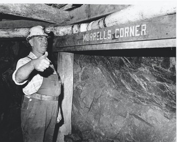
Photograph - AUSTIN COLLECTION: Ray Beer, Central Deborah Gold Mine
... Gold Mine. February 15th 2009: Bendigo Advertiser: 'MINING stalwart Raymond Beer has died at the age of 74 after a battle with cancer. He leaves behind an extended family and a legacy in Bendigo’s mining history. Ray was mine manager at the Central Deborah Gold Mine - appointed in 1978 - and led the team that made possible the underground project at the second level. He had a vision to allow visitors to go underground and experience Bendigo’s mining heritage first hand. Ray was responsible for developing the new...Bendigo goldfields Ray Beer was an employee of the Central Deborah Gold Mine. February 15th 2009: Bendigo Advertiser: 'MINING stalwart Raymond Beer has died at the age of 74 after a battle with cancer. He leaves behind an extended family and a legacy in Bendigo’s mining history. Ray was mine manager at the Central Deborah Gold Mine - appointed in 1978 - and led the team that made possible the underground project at the second level. He had a vision to allow visitors to go underground and experience Bendigo’s mining heritage first hand. Ray was responsible for developing the new ...Ray Beer was an employee of the Central Deborah Gold Mine. February 15th 2009: Bendigo Advertiser: 'MINING stalwart Raymond Beer has died at the age of 74 after a battle with cancer. He leaves behind an extended family and a legacy in Bendigo’s mining history. Ray was mine manager at the Central Deborah Gold Mine - appointed in 1978 - and led the team that made possible the underground project at the second level. He had a vision to allow visitors to go underground and experience Bendigo’s mining heritage first hand. Ray was responsible for developing the new battery, shaft and poppet head to make this a reality. It took persistence and lots of hard work. Friend and work colleague Bill McNamara said Ray was as good as 10 men. His enthusiasm and work ethic were unprecedented. Ray will be sadly missed by his wife, Thelma, six children, 15 grandchildren, seven brothers, three sisters, his extended family, and friends. He will be remembered for his kindness, tenacity and strength of character. In recognition of his contribution to Bendigo’s mining history, after more than 20 years of service at his retirement, a bronze life-sized statue was unveiled in his honour'. Central Deborah Gold Mine history: At its peak, Central Deborah Gold Mine reached a depth of 412 metres. It has 17 separate levels and 15 kilometres of drives and cross cuts (tunnels). The Central Deborah was very much a hands-on mine and the conditions that the miners worked in would be considered shocking by today's standards – being lowered underground in a cage with only two sides, often working ankle to knee deep in water, filling up to 32 ore trucks a shift by hand which were then pushed a mile or more along rails in the drives, working by carbide lamp, breathing in the fumes and rock dust and communication by bells. Geez, they were ironmen. However, at the time working conditions were considered to be among the best on the goldfields at Central Deborah, after all it was one of the only mines that had hot showers. Following Central Deborah Gold Mine's closure, the Bendigo skyline began to noticeably change. Obvious remnants of mining such as poppet heads, engine rooms, service quarters, battery houses and chimneys were steadily disappearing. After intense lobbying by the local community, the Bendigo City Council purchased the still very much intact Central Deborah Gold Mine in 1970 for a mere $6,000 to ensure that a vital link to Bendigo's historic golden past was maintained. The Bendigo Trust was then formed to oversee the operations of the Central Deborah Gold Mine, which led to the surface of the mine being opened to the public in 1971. Initially the surface was open for just 12 hours a week and as the demand for viewing a part of Bendigo's history increased, so did the opening hours. In 1974 the mine was gazetted as a Public Historical Purposes Reserve and attracted such visitors as H.R.H Prince Charles. By far the greatest shortcoming at this stage was that no one could view the underground workings, as these had become flooded. After what could only be described as a monumental effort by everyone involved, Level 2 of the mine was officially opened to the public by the Premier of Victoria, the Honourable John Cain, on 20 June 1986, which brought to fruition a long standing dream.Black and white photograph. Ray Beer, underground at Central Deborah Gold Mine, standing alongside wooden sign 'Murrell's Corner'. Sign is placed horizontally on timber supports, side of drive visible in background. Ray is wearing bib and brace overalls and hard hat with a belt around his waist. He is giving a 'thumbs up' sign. gold mining, central deborah gold mine, ray beer, mine manager -
 Bendigo Historical Society Inc.
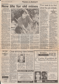
Newspaper - Kangaroo Flat Gold Mine Collection: Women in Mining
... History House 11 Mackenzie Street Bendigo goldfields Gold mining Bendigo 1994 women in mining Judith Webber Marilyn Sprague Goldfields Revegetation revegetation 'Herald Sun' articles, October 18th, 1994, titled 'Women in Business'. Three article on one page: 1. 'New Life for Old Mines', describes the revegetation projects ...'Herald Sun' articles, October 18th, 1994, titled 'Women in Business'. Three article on one page: 1. 'New Life for Old Mines', describes the revegetation projects undertaken by Marilyn Sprague of Goldfields Revegetation' on mine sites 2. 'One among rare breed', discusses the role of women in mining and the story of Judith Webber, who is head of the 8600 member Australasian Institute of Mining and Metallurgy 3, 'First task is to find what the job entails'. Rebecca Norton is a consulting mining engineer and certified mine manager; she discusses her experiences working in a mining environment. Two photos on page: 1. Marilyn Sprague pictured with native plants and 2. head shot of Judith Webbergold mining, bendigo, 1994, women in mining, judith webber, marilyn sprague, goldfields revegetation, revegetation -
 Bendigo Historical Society Inc.
Photograph - AUSTIN COLLECTION: RAY BEER, GAFFNEYS CREEK
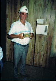
... Gold Mine. February 15th 2009: Bendigo Advertiser: 'MINING stalwart Raymond Beer has died at the age of 74 after a battle with cancer. He leaves behind an extended family and a legacy in Bendigo’s mining history. Ray was mine manager at the Central Deborah Gold Mine - appointed in 1978 - and led the team that made possible the underground project at the second level. He had a vision to allow visitors to go underground and experience Bendigo’s mining heritage first hand. Ray was responsible for developing the new...Bendigo goldfields Ray Beer was an employee of the Central Deborah Gold Mine. February 15th 2009: Bendigo Advertiser: 'MINING stalwart Raymond Beer has died at the age of 74 after a battle with cancer. He leaves behind an extended family and a legacy in Bendigo’s mining history. Ray was mine manager at the Central Deborah Gold Mine - appointed in 1978 - and led the team that made possible the underground project at the second level. He had a vision to allow visitors to go underground and experience Bendigo’s mining heritage first hand. Ray was responsible for developing the new ...Ray Beer was an employee of the Central Deborah Gold Mine. February 15th 2009: Bendigo Advertiser: 'MINING stalwart Raymond Beer has died at the age of 74 after a battle with cancer. He leaves behind an extended family and a legacy in Bendigo’s mining history. Ray was mine manager at the Central Deborah Gold Mine - appointed in 1978 - and led the team that made possible the underground project at the second level. He had a vision to allow visitors to go underground and experience Bendigo’s mining heritage first hand. Ray was responsible for developing the new battery, shaft and poppet head to make this a reality. It took persistence and lots of hard work. Friend and work colleague Bill McNamara said Ray was as good as 10 men. His enthusiasm and work ethic were unprecedented. Ray will be sadly missed by his wife, Thelma, six children, 15 grandchildren, seven brothers, three sisters, his extended family, and friends. He will be remembered for his kindness, tenacity and strength of character. In recognition of his contribution to Bendigo’s mining history, after more than 20 years of service at his retirement, a bronze life-sized statue was unveiled in his honour'.Colour photos : 2 photos, same image of Ray Beer, holding a gold ingot. Ray dressed in hard hat, casual clothing. Written on photo ' Ray Beer with 201 ozs of gold A.1. Mine, Gaffneys Creek'bendigo, mining, gaffneys creek, ray beer, central deborah gold mine -
 Bendigo Historical Society Inc.
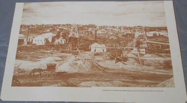
Photograph - Photograph of New Chum Line of Reef
... History House 11 Mackenzie Street Bendigo goldfields BHS Collection Bendigo Mines New Chum Line of Reef Mining On the back a drawing of a poppet head with the words: Bendigo gold project. ...BHS CollectionSepia coloured print of a photograph of the New Chum Line of Reef looking south from the Snobs Hill group of mines. The photo shows several poppet heads and chimneys, bridges and houses. New Chum Line of Reef. includes Victoria Hill possibly the richest spot on the field.On the back a drawing of a poppet head with the words: Bendigo gold project. A small map of Victoria is also printed on the back. bendigo mines, new chum line of reef, mining -
 Bendigo Historical Society Inc.
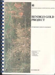
Booklet - Kangaroo Flat Gold Mine Collection: Western Mining Corporation Bendigo Gold Project Environmental Effects Statement December 1987, Western Mining Corporation, Bendigo Office, Western Mining Corporation Limited Bendigo Gold Project Environment Effect Statement December 1987, December 1987
... Bendigo Gold Project...Woodvale Evaporation Ponds...New...Bendigo Gold Project, Environment Effects Statement, December 1987. On front page, colour aerial photograph of Bendigo mining areas mentioned in report. Key on front page related to photograph: 1. Woodvale Evaporation Ponds. 2. New...History House 11 Mackenzie Street Bendigo goldfields Bendigo goldmining Bendigo Mining NL Bendigo Goldfield environmental effects statement Bendigo Gold Project Woodvale Evaporation Ponds New Moon North New Chum Carshalton South Nell Gwynne Western Mining Corporation Spiral bound booklet, plastic cover, black plastic binding, On front cover: Western Mining Corporation Bendigo Gold Project, Environment Effects Statement, December 1987. ...Spiral bound booklet, plastic cover, black plastic binding, On front cover: Western Mining Corporation Bendigo Gold Project, Environment Effects Statement, December 1987. On front page, colour aerial photograph of Bendigo mining areas mentioned in report. Key on front page related to photograph: 1. Woodvale Evaporation Ponds. 2. New Moon area. 3. North New Chum Williams United shaft. 4. Carshalton, Carshalton shaft. 5. South Nell Gwynne, North Bendigo shaft. Contents: historical perspective; Western Mining Corporation Ltd Bendigo activities; project outline, project approvals - controlling factors, elements of the mining project, surface based exploration, underground operations and surface support, mining areas and operations ore and mullock haulage, New Moon area, water management, environmental management. Planning and land use, socio-economic environment, physical environment and biological environment are examined and discussed. bendigo, goldmining, bendigo mining nl, bendigo goldfield, environmental effects statement, bendigo gold project, woodvale evaporation ponds, new moon, north new chum, carshalton, south nell gwynne, western mining corporation