Showing 80 items matching "plenty gorge"
-
 Greensborough Historical Society
Slide - Photograph, John Ramsdale, Near Plenty Gorge: Slide 100, 1990s
... Near Plenty Gorge: Slide 100...plenty gorge...Photograph shows bushland near Plenty Gorge...Greensborough Historical Society 34A Glenauburn Road Lower Plenty Lower Plenty melbourne Photograph shows bushland near Plenty Gorge Part of the John Ramsdale collection of slides and audio visual material. plenty gorge plenty gorge metropolitan park No maker's marks. ...Photograph shows bushland near Plenty GorgePart of the John Ramsdale collection of slides and audio visual material.Colour photograph scanned from slide.No maker's marks. No caption on slide.plenty gorge, plenty gorge metropolitan park -
 Greensborough Historical Society
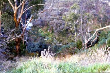
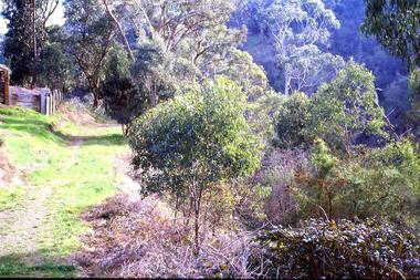
Slide - Photograph, John Ramsdale, Looking down on Plenty Gorge: Slide 38, 1990s
... Looking down on Plenty Gorge: Slide 38......plenty gorge...Photograph shows a view of the bushland at Plenty Gorge....Greensborough Historical Society 34A Glenauburn Road Lower Plenty Lower Plenty melbourne Photograph shows a view of the bushland at Plenty Gorge. Part of the John Ramsdale collection of slides and audio visual material. plenty gorge metropolitan park plenty gorge bushland No maker's marks. ...Photograph shows a view of the bushland at Plenty Gorge.Part of the John Ramsdale collection of slides and audio visual material.Colour photograph scanned from slide.No maker's marks. No caption on slide.plenty gorge metropolitan park, plenty gorge, bushland -
 Greensborough Historical Society
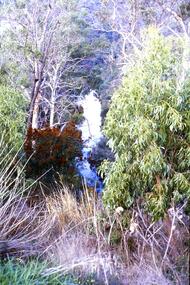
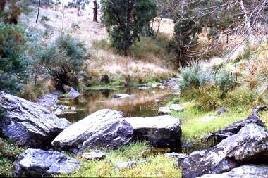
Slide - Photograph, John Ramsdale, Plenty Gorge: Slide 59, 1990s
... Plenty Gorge: Slide 59...plenty gorge...Photograph shows a river through bushland. This is in Plenty Gorge....Greensborough Historical Society 34A Glenauburn Road Lower Plenty Lower Plenty melbourne Photograph shows a river through bushland. This is in Plenty Gorge. Part of the John Ramsdale collection of slides and audio visual material. plenty gorge plenty gorge metropolitan park No maker's marks. ...Photograph shows a river through bushland. This is in Plenty Gorge.Part of the John Ramsdale collection of slides and audio visual material.Colour photograph scanned from slide.No maker's marks. No caption on slide.plenty gorge, plenty gorge metropolitan park -
 Greensborough Historical Society
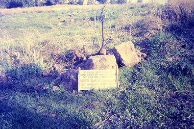
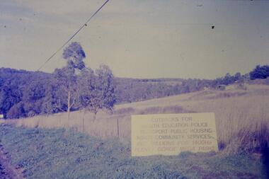
Slide - Photograph, John Ramsdale, Plenty Gorge sign: Slide 50, 1990s
... Plenty Gorge sign: Slide 50......plenty gorge...Photograph shows a sign accusing MMBW of taking land for mega park - Plenty Gorge Park...Greensborough Historical Society 34A Glenauburn Road Lower Plenty Lower Plenty melbourne Photograph shows a sign accusing MMBW of taking land for mega park - Plenty Gorge Park Part of the John Ramsdale collection of slides and audio visual material. plenty gorge metropolitan park plenty gorge melbourne and metropolitan board of works No maker's marks. ...Photograph shows a sign accusing MMBW of taking land for mega park - Plenty Gorge ParkPart of the John Ramsdale collection of slides and audio visual material.Colour photograph scanned from slide.No maker's marks. No caption on slide.plenty gorge metropolitan park, plenty gorge, melbourne and metropolitan board of works -
 Greensborough Historical Society
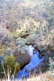
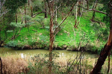
Slide - Photograph, John Ramsdale, Plenty Gorge: Slide 11, 1990s
... Plenty Gorge: Slide 11......plenty gorge metropolitan park...Photograph shows a river through bushland; this is the Plenty Gorge....Greensborough Historical Society 34A Glenauburn Road Lower Plenty Lower Plenty melbourne Photograph shows a river through bushland; this is the Plenty Gorge. Part of the John Ramsdale collection of slides and audio visual material. plenty river plenty gorge metropolitan park No maker's marks. ...Photograph shows a river through bushland; this is the Plenty Gorge.Part of the John Ramsdale collection of slides and audio visual material.Colour photograph scanned from slide.No maker's marks. No caption on slide.plenty river, plenty gorge metropolitan park -
 Greensborough Historical Society
Slide - Photograph, John Ramsdale, Plenty Gorge: Slide 106, 1990s
... Plenty Gorge: Slide 106......plenty gorge...Photograph shows a rocky area near river in Plenty Gorge....Greensborough Historical Society 34A Glenauburn Road Lower Plenty Lower Plenty melbourne Photograph shows a rocky area near river in Plenty Gorge. Part of the John Ramsdale collection of slides and audio visual material. plenty river plenty gorge No maker's marks. ...Photograph shows a rocky area near river in Plenty Gorge.Part of the John Ramsdale collection of slides and audio visual material.Colour photograph scanned from slide.No maker's marks. No caption on slide.plenty river, plenty gorge -
 Greensborough Historical Society
Slide - Photograph, John Ramsdale, Plenty Gorge with blackberries: Slide 87, 1990s
... Plenty Gorge with blackberries: Slide 87...plenty gorge...Photograph shows a track through trees and retaining wall. This is Plenty Gorge with blackberries in foreground....Greensborough Historical Society 34A Glenauburn Road Lower Plenty Lower Plenty melbourne Photograph shows a track through trees and retaining wall. This is Plenty Gorge with blackberries in foreground. Part of the John Ramsdale collection of slides and audio visual material. plenty gorge blackberries No maker's marks. ...Photograph shows a track through trees and retaining wall. This is Plenty Gorge with blackberries in foreground.Part of the John Ramsdale collection of slides and audio visual material.Colour photograph scanned from slide.No maker's marks. No caption on slide.plenty gorge, blackberries -
 Greensborough Historical Society
Booklet, Parks Victoria et al, Plenty Gorge Park fire recovery, 15/04/2020
... Plenty Gorge Park fire recovery...plenty gorge park...Community update on rehabilitation of the section of Plenty Gorge Park affected by a bushfire in December 2019...Greensborough Historical Society 34A Glenauburn Road Lower Plenty Lower Plenty melbourne Community update on rehabilitation of the section of Plenty Gorge Park affected by a bushfire in December 2019 plenty gorge park bushfires blue lake yellow gum park plenty 6 p. text and colour photographs and map Plenty Gorge Park fire recovery Booklet Booklet Parks Victoria Forest Fire Management Victoria ...Community update on rehabilitation of the section of Plenty Gorge Park affected by a bushfire in December 20196 p. text and colour photographs and mapplenty gorge park, bushfires, blue lake, yellow gum park, plenty -
 Greensborough Historical Society
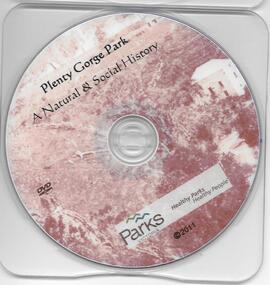
DVD, Plenty Gorge Park: a natural and social history / Parks Victoria, 2011_
... Plenty Gorge Park: a natural and social history / Parks Victoria....plenty gorge park...This DVD gives some detail of the Plenty Gorge Park, its natural environment and impact of man....Greensborough Historical Society 34A Glenauburn Road Lower Plenty Lower Plenty melbourne This DVD gives some detail of the Plenty Gorge Park, its natural environment and impact of man. plenty gorge park parks victoria plenty river 1 DVD. ...This DVD gives some detail of the Plenty Gorge Park, its natural environment and impact of man.1 DVD. plenty gorge park, parks victoria, plenty river -
 Greensborough Historical Society
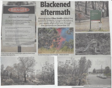
Newspaper - Newspaper Clipping, Diamond Valley Leader et al, Scorched Earth: attention turns to recovery plan after devastating Plenty Gorge fire, 29/01/2020
... Scorched Earth: attention turns to recovery plan after devastating Plenty Gorge fire...plenty gorge park...An eerie, blackened landscape remains after a bushfire ripped through more than 40 ha of the Plenty Gorge parklands in 2020....An eerie, blackened landscape remains after a bushfire ripped through more than 40 ha of the Plenty Gorge parklands in 2020. plenty gorge park bushfires News article 2 pages, black text and colour images. ...An eerie, blackened landscape remains after a bushfire ripped through more than 40 ha of the Plenty Gorge parklands in 2020.News article 2 pages, black text and colour images.plenty gorge park, bushfires -
 Greensborough Historical Society
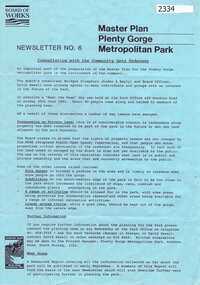
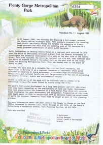
Newsletter, Melbourne & Metropolitan Board of Works, Master Plan Plenty Gorge Metropolitan Park, 1991_06
... Master Plan Plenty Gorge Metropolitan Park...plenty gorge park...The Parks Division of the Board was responsible for the preparation of a Master Plan for the management of the Plenty Gorge Metropolitan Park, comprising privately owned land and land owned by the Board and councils....The creation of the park by the Victorian government, to be managed by the Board of Works, guaranteed public access to a large area of land adjacent to the Plenty River Gorge. plenty gorge park plenty river Newsletter No. 6 2p. newsletter, black ink on blue paper Master Plan Plenty Gorge Metropolitan Park Newsletter Melbourne & Metropolitan Board of Works ...The Parks Division of the Board was responsible for the preparation of a Master Plan for the management of the Plenty Gorge Metropolitan Park, comprising privately owned land and land owned by the Board and councils.The creation of the park by the Victorian government, to be managed by the Board of Works, guaranteed public access to a large area of land adjacent to the Plenty River Gorge.2p. newsletter, black ink on blue paperNewsletter No. 6plenty gorge park, plenty river -
 Latrobe Regional Gallery
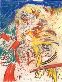
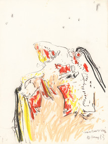
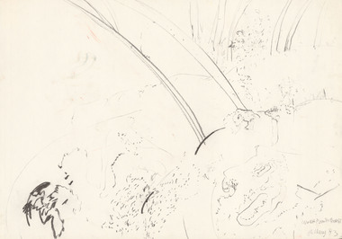
Drawing, BELLANY, John b. 1942, Port Seton d. 2013, Lower Plenty Gorge, 1983
... Lower Plenty Gorge...Signed, dated and titled 'Bellany '83 Lower Plenty Gorge' along bottom of drawing....Latrobe Regional Gallery 138 Commercial Road Morwell gippsland Signed, dated and titled 'Bellany '83 Lower Plenty Gorge' along bottom of drawing. Pastel on paper Lower Plenty Gorge Drawing Drawing BELLANY, John b. 1942, Port Seton d. 2013 ...Pastel on paperSigned, dated and titled 'Bellany '83 Lower Plenty Gorge' along bottom of drawing. -
 Latrobe Regional Gallery
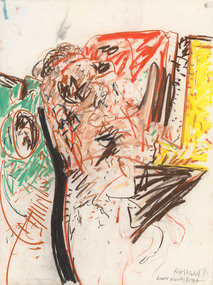
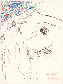
Drawing, BELLANY, John b. 1942, Port Seton d. 2013, Lower Plenty Gorge, 1983
... Lower Plenty Gorge...Titled, signed and dated 'Bellany '83 Lower Plenty Gorge' in lower right corner of drawing....Pastel on paper Lower Plenty Gorge Drawing Drawing BELLANY, John b. 1942, Port Seton d. 2013 ...Pastel on paperTitled, signed and dated 'Bellany '83 Lower Plenty Gorge' in lower right corner of drawing. -
 Latrobe Regional Gallery
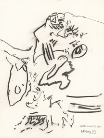
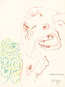
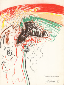
Drawing, BELLANY, John b. 1942, Port Seton d. 2013, Lower Plenty Gorge, 1983
... Lower Plenty Gorge...Titled, signed and dated 'Lower Plenty Gorge Bellany '83' in lower right corner of drawing....Charcoal on paper. Lower Plenty Gorge Drawing Drawing BELLANY, John b. 1942, Port Seton d. 2013 ...Charcoal on paper.Titled, signed and dated 'Lower Plenty Gorge Bellany '83' in lower right corner of drawing. -
 Latrobe Regional Gallery
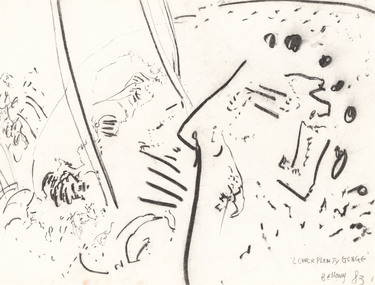
Drawing, BELLANY, John b. 1942, Port Seton d. 2013, Lower Plenty Gorge, 1983
... Lower Plenty Gorge...Titled, signed and dated 'Lower Plenty Gorge Bellany '83' in lower right corner of drawing. ...Pastel on paper Lower Plenty Gorge Drawing Drawing BELLANY, John b. 1942, Port Seton d. 2013 ...Pastel on paperTitled, signed and dated 'Lower Plenty Gorge Bellany '83' in lower right corner of drawing. -
 Latrobe Regional Gallery
Drawing, BELLANY, John b. 1942, Port Seton d. 2013, Lower Plenty Gorge, 1983
... Lower Plenty Gorge...Titled, signed and dated 'Lower Plenty Gorge Bellany '83' in lower right corner of drawing....Pastel on paper Lower Plenty Gorge Drawing Drawing BELLANY, John b. 1942, Port Seton d. 2013 ...Pastel on paperTitled, signed and dated 'Lower Plenty Gorge Bellany '83' in lower right corner of drawing. -
 Latrobe Regional Gallery
Drawing, BELLANY, John b. 1942, Port Seton d. 2013, Lower Plenty Gorge, 1983
... Lower Plenty Gorge...Titled, signed and dated 'Lower Plenty Gorge Bellany '83' in lower right section of drawing....Pastel on paper Lower Plenty Gorge Drawing Drawing BELLANY, John b. 1942, Port Seton d. 2013 ...Pastel on paperTitled, signed and dated 'Lower Plenty Gorge Bellany '83' in lower right section of drawing. -
 Latrobe Regional Gallery
Drawing, BELLANY, John b. 1942, Port Seton d. 2013, Lower Plenty Gorge, 1983
... Lower Plenty Gorge...Titled, signed and dated 'Lower Plenty Gorge Bellany '83' in lower right corner of drawing....Charcoal on paper Lower Plenty Gorge Drawing Drawing BELLANY, John b. 1942, Port Seton d. 2013 ...Charcoal on paperTitled, signed and dated 'Lower Plenty Gorge Bellany '83' in lower right corner of drawing. -
 Latrobe Regional Gallery
Drawing, BELLANY, John b. 1942, Port Seton d. 2013, Lower Plenty Gorge, 1983
... Lower Plenty Gorge...Titled, signed and dated 'Lower Plenty Gorge Bellany '83' in lower right corner of drawing....Pastel on paper Lower Plenty Gorge Drawing Drawing BELLANY, John b. 1942, Port Seton d. 2013 ...Pastel on paperTitled, signed and dated 'Lower Plenty Gorge Bellany '83' in lower right corner of drawing. -
 Eltham District Historical Society Inc
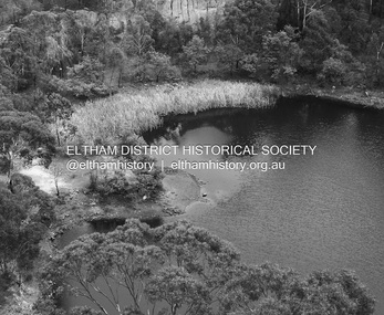
Photograph - Digital Photograph, Alan King, Blue Lake, Plenty Gorge Park, 2008
... Blue Lake, Plenty Gorge Park......Plenty Gorge Park....; p179 The dramatic steep-sided Plenty Gorge lies along the divide of two geological areas, and separates the Nillumbik Shire and the City of Whittlesea. ...Nillumbik Now and Then (Marshall-King) Collection Blue Lake Plenty Gorge Park Born digital image file Blue Lake, Plenty Gorge Park Photograph Digital Photograph Alan King Alan King Marguerite Marshall ...A quarry was transformed into the Blue Lake. Published: Nillumbik Now and Then / Marguerite Marshall 2008; photographs Alan King with Marguerite Marshall.; p179 The dramatic steep-sided Plenty Gorge lies along the divide of two geological areas, and separates the Nillumbik Shire and the City of Whittlesea. On the Nillumbik side are undulating hills and sedimentary rock, and in Whittlesea, lies a basalt plain formed by volcanic action up to two million years ago. This provides the Plenty Gorge Park with diverse vegetation and habitats, making it one of Greater Melbourne’s most important refuges for threatened and significant species. The park, established in 1986, consists of around 1350 hectares, and extends 11 kilometres along the Plenty River, from Greensborough to Mernda. It provides a wildlife corridor for around 500 native plant and 280 animal species. The area’s plentiful food and water attracted the Wurundjeri Aboriginal people and then European settlers. By 1837 squatters had claimed large runs of land for their sheep and cattle. The Plenty Valley was among the first in the Port Phillip District to be settled - mainly in the less heavily timbered west - and was proclaimed a settled district in 1841.But by the late 1880s, the settlers’ extensive land clearing for animal grazing, then agriculture, depleted the Wurundjeri’s traditional food sources, which helped to drive them away. Many Wurundjeri artefacts remain (now government protected), and so far 57 sites have been identified in the park, including scarred trees, burial areas and stone artefacts. Pioneer life could be very hard because of isolation, flooding, bushfires and bushrangers. Following the Black Thursday bushfires of 1851, basalt was quarried to build more fire-resistant homes. Gold discoveries in the early 1850s swelled the population, particularly around Smugglers Gully; but food production made more of an impact. In the late 1850s wheat production supplanted grazing. In the 1860s the government made small holdings available to poorer settlers. These had the greatest effect on the district, particularly in Doreen and Yarrambat, where orchards were established from the 1880s to 1914. Links with a prominent early family are the remains of Stuchbery Farm, by the river’s edge bounded by Smugglers Gully to the north and La Trobe Road, Yarrambat, to the east. The Stuchberys moved to the valley in 1890, and the family still lives in the area. In 1890, Alfred and Ada first lived in a tent where four children were born, then Alfred built the house and outbuildings around 1896. They planted an orchard, then a market garden, and developed a dairy. The family belonged to the local Methodist and tennis communities. Their grandson Walter, opened the Flying Scotsman Model Railway Museum in Yarrambat, which his widow, Vi, continues to run. Wal was also the Yarrambat CFA Captain for 22 years until 1987. Walter sold 24 hectares in 1976 for development - now Vista Court - and in 1990, the remaining 22.6 hectares for the park. Remaining are an early stone dairy and remnants of a stone barn, a pig sty and a well. Until it was destroyed by fire in 2003, a slab hut stood on the Happy Hollow Farm site, at the southern end of the park. The hut is thought to have been built in the Depression around 1893. This was a rare and late example of a slab hut with a domestic orchard close to Melbourne. Emmet Watmough and his family first occupied the hut, followed by a succession of families, until the Bell family bought it around 1948. There they led a subsistence lifestyle for 50 years, despite encroaching Melbourne suburbia. The Yellow Gum Recreation Area includes the Blue Lake, coloured turquoise at certain times of the year. Following the 1957 bushfires, this area was quarried by Reid Quarries Pty Ltd for Melbourne’s first skyscrapers, then by Boral Australia. However in the early 1970s water began seeping into the quarry forming the Blue Lake and the quarry was closed. The State Government bought the site in 1997 and opened it as a park in 1999.This collection of almost 130 photos about places and people within the Shire of Nillumbik, an urban and rural municipality in Melbourne's north, contributes to an understanding of the history of the Shire. Published in 2008 immediately prior to the Black Saturday bushfires of February 7, 2009, it documents sites that were impacted, and in some cases destroyed by the fires. It includes photographs taken especially for the publication, creating a unique time capsule representing the Shire in the early 21st century. It remains the most recent comprehenesive publication devoted to the Shire's history connecting local residents to the past. nillumbik now and then (marshall-king) collection, blue lake, plenty gorge park -
 Greensborough Historical Society
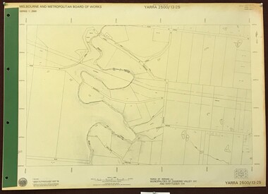
Map, Melbourne and Metropolitan Board of Works. Survey Division, MMBW, Yarra 2500 / 13.23. Plenty, Middle Gorge, 1978_04
... MMBW, Yarra 2500 / 13.23. Plenty, Middle Gorge.......plenty gorge park...Prominent streets include: Gorge Road, Kurrak Road and Browns Lane. Features include the Plenty River and Plenty Gorge Park....Prominent streets include: Gorge Road, Kurrak Road and Browns Lane. Features include the Plenty River and Plenty Gorge Park. mmbw melbourne and metropolitan board of works shire of diamond valley plenty - maps plenty gorge park MMBW Map in 1:2500 [scale] series. ...Melbourne and Metropolitan Board of Works. Yarra 2500 [base map] 13-23. Plenty / Middle Gorge. Parish of Morang 3183. Municipalities of Diamond Valley 257 and Whittlesea 239. Prominent streets include: Gorge Road, Kurrak Road and Browns Lane. Features include the Plenty River and Plenty Gorge Park.MMBW Map in 1:2500 [scale] series. Cream parchment with green tape reinforcing on edges and punched holes on left edge.mmbw, melbourne and metropolitan board of works, shire of diamond valley, plenty - maps, plenty gorge park -
 Greensborough Historical Society
Newsletter, Plenty Gorge Metropolitan Park Newsheet No. 1 August 1989, 1989_08
... Plenty Gorge Metropolitan Park Newsheet No. 1 August 1989...plenty gorge park...A long term project to develop the park further is to commence in 1990. plenty gorge park plenty river shire of whittlesea "With compliments of Sherryl Garbutt M.P. ...The Shire of Whittlesea obtained a grant from the federal government to investigate the potential development of a park to the west of the Plenty River in 1976. A regional tip site and the Shire of Diamond Valley's Yarrambat Park were handed over to the MMBW to form the existing Metropolitan Park in 1986. A long term project to develop the park further is to commence in 1990.2 p. text, map and col. illus."With compliments of Sherryl Garbutt M.P. Member for Greensborough" (rubber stamp)plenty gorge park, plenty river, shire of whittlesea -
 Greensborough Historical Society
Slide - Photograph, John Ramsdale, Plenty River, upstream from Gorge: Slide 42, 1990s
... Plenty River, upstream from Gorge: Slide 42...plenty gorge...Photograph shows creek bed with vegetation, upstream from Plenty Gorge....Greensborough Historical Society 34A Glenauburn Road Lower Plenty Lower Plenty melbourne Photograph shows creek bed with vegetation, upstream from Plenty Gorge. Part of the John Ramsdale collection of slides and audio visual material. plenty gorge plenty river mernda No caption. ...Photograph shows creek bed with vegetation, upstream from Plenty Gorge.Part of the John Ramsdale collection of slides and audio visual material.Colour photograph scanned from slide.No caption. Printed maker's mark on slide "Kodak Kodachrome Slide"plenty gorge, plenty river, mernda -
 Greensborough Historical Society
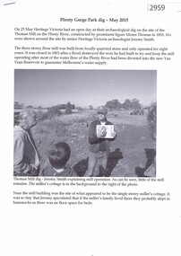
Article, John Gibson, Plenty Gorge Park dig May 2015, 23/05/2015
... Plenty Gorge Park dig May 2015...Article written by GHS member John Gibson. moses thomas flour mill plenty river 5 p., black text and photographs Plenty Gorge Park dig May 2015 Article John Gibson ...Account of a dig carried out by Heritage Victoria at the site of the Thomas flour mill, a three-story building with a small cottage built in 1855, which ceased operation in 1863. Article written by GHS member John Gibson.5 p., black text and photographsmoses thomas, flour mill, plenty river -
 Greensborough Historical Society
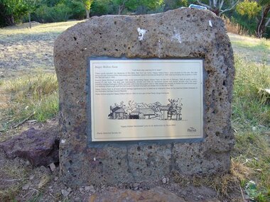
Photograph - Digital Image, Happy Hollow plaque, 05/02/1840o
... The land was later owned by Mrs Betty Bell and was purchased by Parks Victoria in 1994 to form part of the Plenty Gorge Parklands. This plaque was laid by Plenty Historical Society....Digital copy of colour photograph. Plaque at Plenty Gorge Parklands....The land was later owned by Mrs Betty Bell and was purchased by Parks Victoria in 1994 to form part of the Plenty Gorge Parklands. This plaque was laid by Plenty Historical Society. ...The land surrounding Happy Hollow farm at Plenty was purchased by Francis Wickham in 1840. The land was later subdivided and held by various owners including Charles Partington (1875) and John McLaughlin who leased the property in 1892 to Robert Emmett Whatmough who erected the first dwelling on the property. The land was later owned by Mrs Betty Bell and was purchased by Parks Victoria in 1994 to form part of the Plenty Gorge Parklands. This plaque was laid by Plenty Historical Society.Happy Hollow was an example of early settlement along the Plenty River.Digital copy of colour photograph. Plaque at Plenty Gorge Parklands.plenty river, happy hollow, happy hollow farm, robert emmett whatmough, betty bell, john mclaughlin, charles partington, parks victoria -
 Greensborough Historical Society
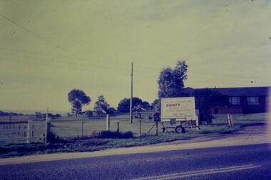
Slide - Photograph, John Ramsdale, Sign - Gorge Road: Slide 76, 1990s
... plenty gorge...Photograph shows an anti- Plenty Gorge Park sign in Gorge Road South Morang...Greensborough Historical Society 34A Glenauburn Road Lower Plenty Lower Plenty melbourne Photograph shows an anti- Plenty Gorge Park sign in Gorge Road South Morang Part of the John Ramsdale collection of slides and audio visual material. plenty gorge plenty gorge metropolitan park melbourne and metropolitan board of works No maker's marks. ...Photograph shows an anti- Plenty Gorge Park sign in Gorge Road South MorangPart of the John Ramsdale collection of slides and audio visual material.Colour photograph scanned from slide.No maker's marks. No caption on slide.plenty gorge, plenty gorge metropolitan park, melbourne and metropolitan board of works -
 Greensborough Historical Society
Slide - Photograph, John Ramsdale, Gorge Road sign: Slide 55, 1990s
... plenty gorge...Photograph shows house with anti-Plenty Gorge Park sign, Gorge Road South Morang...Greensborough Historical Society 34A Glenauburn Road Lower Plenty Lower Plenty melbourne Photograph shows house with anti-Plenty Gorge Park sign, Gorge Road South Morang Part of the John Ramsdale collection of slides and audio visual material. plenty gorge plenty gorge metropolitan park melbourne and metropolitan board of works No maker's marks. ...Photograph shows house with anti-Plenty Gorge Park sign, Gorge Road South MorangPart of the John Ramsdale collection of slides and audio visual material.Colour photograph scanned from slide.No maker's marks. No caption on slide.plenty gorge, plenty gorge metropolitan park, melbourne and metropolitan board of works -
 Greensborough Historical Society
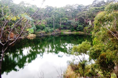
Photograph - Digital image, Marilyn Smith, Blue Lake 1, 19/06/2015
... ...plenty gorge park...Blue Lake is in Yellow Gum Park in the Plenty Gorge, north of Greensborough....Greensborough Historical Society 34A Glenauburn Road Lower Plenty Lower Plenty melbourne Blue Lake is in Yellow Gum Park in the Plenty Gorge, north of Greensborough. yellow gum park blue lake plenty gorge park Digital copy of colour photographs Blue Lake 1. ...Blue Lake is in Yellow Gum Park in the Plenty Gorge, north of Greensborough.Digital copy of colour photographsyellow gum park, blue lake, plenty gorge park -
 Greensborough Historical Society
Photograph - Digital image, Marilyn Smith, Blue Lake 2, 19/06/2015
... ...plenty gorge park...Blue Lake is in Yellow Gum Park in the Plenty Gorge, north of Greensborough....Greensborough Historical Society 34A Glenauburn Road Lower Plenty Lower Plenty melbourne Blue Lake is in Yellow Gum Park in the Plenty Gorge, north of Greensborough. yellow gum park blue lake plenty gorge park Digital copy of colour photographs Blue Lake 2. ...Blue Lake is in Yellow Gum Park in the Plenty Gorge, north of Greensborough.Digital copy of colour photographsyellow gum park, blue lake, plenty gorge park