
Showing 101 items matching "road construction - kew (vic)"
-
![No.2 [Steam] Roller, Kew City Council](/media/collectors/550653872162f11fb04854aa/items/5c31f69121ea670d8459a8b6/item-media/5c31f77a21ea670d845a8063/item-fit-380x285.jpg?cb=6) Kew Historical Society Inc
Kew Historical Society IncPhotograph, No.2 [Steam] Roller, Kew City Council, c.1950
... road construction - kew (vic)...The Number 2 Steamroller was used in public road building in Kew.It replaced the first Council steamroller which was used between 1915 and 1932. Rare photograph of a Kew City Council piece of road making machinery road construction - kew (vic) no.2 steamroller steamrollers - kew (vic) Reverse of photo: "KCC No 2 Roller 607S". ...The Number 2 Steamroller was used in public road building in Kew.It replaced the first Council steamroller which was used between 1915 and 1932.Rare photograph of a Kew City Council piece of road making machinerySmall black and white photograph of a steamroller used by the City of Kew in road construction from the 1930s to the 1950s.Reverse of photo: "KCC No 2 Roller 607S". Accompanying note: "20/3/84 Gift to the Society from Mr [?] who was K.C.C. [Kew City Council] driver of this "monster". Kew City Council No.2 Roller. Used in street construction 1950. Roller probably 1930 era."road construction - kew (vic), no.2 steamroller, steamrollers - kew (vic) -
 Ringwood and District Historical Society
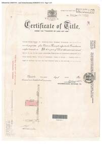
Document, Certificate of Title - W.G. Carter, Grandview Grove, Warranwood, Victoria, (later Bemboka Road) - part of Crown Section Twenty, Parish of Warrandyte, County of Evelyn - 1947
... Kew but later moved to Rosebud and sold the land without ever building on it. During the 1960s, Grandview Grove was renamed Bemboka Road. After retiring as a milkman, Bill moved to Rosebud, Vic, and in 1977, sold the property to the Anglican Church, who were looking to invest in the site in anticipation of proposed future residential development in the area. As nearby properties were subdivided during the 1980s, the house, which the Church had initially utilised as low-cost family accommodation, was modified internaly to become a church/Sunday school. By the early 2000s, construction...Kew but later moved to Rosebud and sold the land without ever building on it. During the 1960s, Grandview Grove was renamed Bemboka Road. After retiring as a milkman, Bill moved to Rosebud, Vic, and in 1977, sold the property to the Anglican Church, who were looking to invest in the site in anticipation of proposed future residential development in the area. As nearby properties were subdivided during the 1980s, the house, which the Church had initially utilised as low-cost family accommodation, was modified internaly to become a church/Sunday school. By the early 2000s, construction ...A4 copies of Landata Victoria Historical Search documents - Vol 7052 Fol 1410222. Includes Carter Family Tree property notes. William George Carter of Grandview Grove Ringwood, Nurseryman, is now the proprietor - three acres or thereabouts shown on map (12202a) - 14th March, 1947. Transfer B284834 Registered 21 September, 1961 - 1 acre shown on map (12202c) north of Plymouth Road. NOTES ON GRANDVIEW GROVE PROPERTY (Carter Family Tree extract) The Grandview Grove property was purchased by William (Bill) and Doreen Carter in 1947 as three acres of uncleared bushland. They had a 2 bedroom fibro-cement house built on the land which they informally called "Willoreen". With Doreen looking after sons Peter (born in 1940) and Robin (born in 1950), Bill worked locally at Croydon Dairy. The family spent much of their spare time clearing the land, where Bill then grew and sold fruit, flowers and berries, particularly strawberries, as a hobby and to supplement their income. Bill continued to do so while Peter and Robin were growing up, and after Doreen died in 1958. In 1961 Bill sold one of the three acres to one of his seven sisters, Grace, who lived in Kew but later moved to Rosebud and sold the land without ever building on it. During the 1960s, Grandview Grove was renamed Bemboka Road. After retiring as a milkman, Bill moved to Rosebud, Vic, and in 1977, sold the property to the Anglican Church, who were looking to invest in the site in anticipation of proposed future residential development in the area. As nearby properties were subdivided during the 1980s, the house, which the Church had initially utilised as low-cost family accommodation, was modified internaly to become a church/Sunday school. By the early 2000s, construction of a contemporary-design church and carparking area between the house and street alignment had been completed but the house remained as a detatched meeting room until falling into disrepair and was eventually demolished around 2010. -
 Kew Historical Society Inc
Album - Photograph Album, Photographs of the Construction of the Kew Heights Synthetic Green April-May 2005, 2005
... The collection illuminates two of the Victorian historic themes - 'Building community life' through forming community organisations and 'Shaping cultural and creative life' by participating in sport and recreation. kew heights sports club - 397 barkers road - kew (vic) bowling greens PHOTOGRAPHS OF THE CONSTRUCTION OF THE KEW HEIGHTS SYNTHETIC GREEN APRIL-MAY 2005. ...Sports Clubs in Kew in the final decades of the 19th century and in the early 20th century were often umbrella organisations with facilities for a number of sports. Typically in Kew, this included teams in lawn bowls, tennis and croquet. The Kew Bowling Club was formed in 1880 while the privately owned Auburn Heights Recreation Club was opened in 1904. By 1998, the two Clubs decided to amalgamate at the Auburn Heights site in Barkers Road, forming the Kew Heights Sports Club. The combined club was itself taken over by the Melbourne Cricket Club in 2012 becoming MCC Kew Sports Club. In 2017 MCC Kew closed and its landholding was subsequently sold to Carey Baptist Grammar School. Both the Kew and Auburn Heights Clubs assembled important collections. These historically significant and large collections were donated to the Society in 2020. The collections include manuscripts, pictures, trophies, plans, honour boards etc. The combined collections of the four sporting clubs making up the collection number hundreds of items that are historically significant locally. They are also significant to the sporting history of the greater Melbourne area and to the sports of lawn bowls and tennis in Australia in the 19th and 20th centuries. The collection illuminates two of the Victorian historic themes - 'Building community life' through forming community organisations and 'Shaping cultural and creative life' by participating in sport and recreation.Photographic album compiled by John Chapman about the construction of the synthetic green at Kew Heights Sports Club in 2005.PHOTOGRAPHS OF THE CONSTRUCTION OF THE KEW HEIGHTS SYNTHETIC GREEN APRIL-MAY 2005. PHOTOGRAPHED AND COMPILED BY JOHN CHAPMANkew heights sports club - 397 barkers road - kew (vic), bowling greens -
 Kew Historical Society Inc
Archive (Series) - Subject File, Eastern Freeway (Kew), 1979
... Typically files will contain primary and secondary sources. kew (vic) - history kew east (vic) - community groups kew (vic) - roads Archive file containing sundry newspaper files about protests against the freeway’s construction, land acquisition, speeding, noise etc. ...Organisation generatedReference, Research, InformationSecondary Values (KHS Imposed Order)Subject file containing sundry newspaper files about protests against the freeway’s construction, land acquisition, speeding, noise etc. There is also a CRB brochure of ‘Your Eastern Freeway Driver’s Guide’kew (vic) - history, kew east (vic) - community groups, kew (vic) - roadskew (vic) - history, kew east (vic) - community groups, kew (vic) - roads -
Kew Historical Society Inc
Archive (Sub-series) - Subject File, Kew Historical Society, Gardens (Kew), 1979
... kew (vic) garden design - kew (vic) kew horticultural society Correspondence and newspaper articles/clippings relating to historic gardens in Kew. The oldest item is a letter from the National Trust Victoria announcing their two-year garden study and seeking information on gardens in Kew. Mavis Rolley, Secretary of the Society, made handwritten notes in response, which are kept in the file. She refers to: the pear trees planted by William Oswin in c. 1845 near what is now the Burke Road Bridge (she notes that a search for the trees at the time of the construction ...Various partiesReference, Research, InformationSecondary Values (KHS Imposed Order)Correspondence and newspaper articles/clippings relating to historic gardens in Kew. The oldest item is a letter from the National Trust Victoria announcing their two-year garden study and seeking information on gardens in Kew. Mavis Rolley, Secretary of the Society, made handwritten notes in response, which are kept in the file. She refers to: the pear trees planted by William Oswin in c. 1845 near what is now the Burke Road Bridge (she notes that a search for the trees at the time of the construction of the Eastern Freeway was unsuccessful), a camellia planted by the Dannocks near the corner of Derby and High Street, a c.1876 pine tree in Field Place, Henty Court, an 1875 Moreton Bay fig at Tarring, Ruyton, a Moreton Bay fig at Roxeth, Trinity Grammar, an 1840s oak tree and a 120-year old olive tree at Fairholme, Barry Street, 1870 pine trees at D’Estaville, Barry Street, trees at Turinville, Barnard Grove, dating to 1846, pine trees dating from 1845-6 on the Willsmere Farm, red gums in Victoria Park, pine trees in the Cemetery dating from the 1860s, trees in the Alexandra Gardens and at Kew Primary School, palm trees at La Verna, Sackville Street dating from the 1890s, the trees and gardens at Ross House (Charleville), and the trees at Merridale, Sackville Street which date from the 1880s, a magnolia at Lalla Rookh. These dates are probably highly contestable. Other handwritten notes from 1979 about significant gardens included: 5 Molesworth Street, Red Bluff - Redmond Street (garden now destroyed), Campion House, Studley Park Road, Raheen, Studley Park Road, Ross House, Cotham Road (Charleville), 7 Adeney Avenue, 20-21 Belmont Avenue, 52 Mary Street, an Edna Walling garden on the corner of Argyle Road and Victor Avenue, Merridale, Sackville Street, Roseneath, and Reno, St John’s Parade.gardens - private - kew (vic), garden design - kew (vic), kew horticultural societygardens - private - kew (vic), garden design - kew (vic), kew horticultural society -
 Kew Historical Society Inc
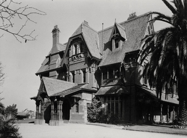
Photograph - Porte-cochere, 'Tara Hall', Studley Park Road, Marc Strizic (attrib), c.1960
... Kew (Vic) Byram -- Kew (Vic) Tara Hall - Kew (Vic) Studley Park road Typed inscription on reverse: "Goathland, also known as Tara Hall (Royal Women's Hospital, Melbourne)." Porte-cochere, Tara Hall, circa 1957. The main entrance to Tara Hall (previously named Byram, Goathland and Lowan). The entrance, through a porte-cochère, was located on the side of the house facing east. During construction ...'Lost Glories: a memorial to forgotten Australian buildings' was published by David Latta in 1986. It tells the story of a number of significant Australian buildings that had previously been demolished. A chapter in the book was devoted to Goathland, later known as Tara Hall. To supplement the text, he sourced photographs from a range of suppliers, chiefly the Royal Women's Hospital which had once owned Tara Hall, but had sold it in 1960. This is one of the photographs donated to KHS by the author. Porte-cochere, Tara Hall, circa 1957. The main entrance to Tara Hall (previously named Byram, Goathland and Lowan). The entrance, through a porte-cochère, was located on the side of the house facing east. During construction, commentators described the house as being in the ‘Elizabethan style’. The architectural style of the exterior, with its innovatory use of red brick and Italian tiles was more influenced by American models. Edward George Kilburn, of Ellerker & Kilburn, designed Byram for the industrialist George Ramsden in 1888. Typed inscription on reverse: "Goathland, also known as Tara Hall (Royal Women's Hospital, Melbourne)."goathland -- kew (vic), byram -- kew (vic), tara hall - kew (vic), studley park road -
 Kew Historical Society Inc
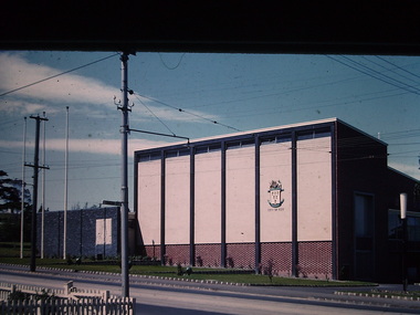
Photograph - Kew City Hall, Ron Setford
... road transport infrastructure during the 1970s with the construction of the Eastern Freeway. The photographer also took care to annotate and date most of his slides which enable the researcher to pinpoint temporal and spatial locations. Ron Setford Photographs -- Kew (Vic ...Ron Setford and his wife Grace Setford lived in Tanner Avenue, East Kew, from c.1946 to c.1995. A keen photographer, he recorded the changing face of Kew over a 20 year period. Apart from 30 photographs of built structures and places in Kew dating from 1960 and 1961, 145 of his 35mm colour slides chronicle the development of the Eastern Freeway through the Yarra Valley over a five year period from c.1972 to c.1977. This important collection was donated to the Society by his granddaughter in 2025.This collection of 175 35mm slides is of local and statewide significance, owing to its subject matter, particularly the major development of road transport infrastructure during the 1970s with the construction of the Eastern Freeway. The photographer also took care to annotate and date most of his slides which enable the researcher to pinpoint temporal and spatial locations.The Kew City Hall in Cotham Road, designed by Harold Bartlett, was intended as the initial phase in a scheme to develop an entire civic precinct. This was representative of a widely-held belief, of the immediate post-war era, that a district's civic centre should be precisely that – not just a single grand building for official use, but a dedicated precinct providing a range of community facilities as well as an administrative function. The Kew masterplan was later abandoned. The City Hall was designed to cater for public or official functions. Its interior had a small stage at one end for intimate theatrical productions, a larger stage at the other (with sunken orchestra pit) for musical performances, plus the most up-to-date equipment for live TV transmission.Nilron setford, photographs -- kew (vic.) -- 1960s -
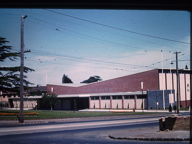 Kew Historical Society Inc
Photograph - Kew City Hall, Ron Setford, 1960
... road transport infrastructure during the 1970s with the construction of the Eastern Freeway. The photographer also took care to annotate and date most of his slides which enable the researcher to pinpoint temporal and spatial locations. Ron Setford Photographs -- Kew (Vic ...Ron Setford and his wife Grace Setford lived in Tanner Avenue, East Kew, from c.1946 to c.1995. A keen photographer, he recorded the changing face of Kew over a 20 year period. Apart from 30 photographs of built structures and places in Kew dating from 1960 and 1961, 145 of his 35mm colour slides chronicle the development of the Eastern Freeway through the Yarra Valley over a five year period from c.1972 to c.1977. This important collection was donated to the Society by his granddaughter in 2025.This collection of 175 35mm slides is of local and statewide significance, owing to its subject matter, particularly the major development of road transport infrastructure during the 1970s with the construction of the Eastern Freeway. The photographer also took care to annotate and date most of his slides which enable the researcher to pinpoint temporal and spatial locations.The Kew City Hall in Cotham Road, designed by Harold Bartlett, was intended as the initial phase in a scheme to develop an entire civic precinct. This was representative of a widely-held belief, of the immediate post-war era, that a district's civic centre should be precisely that – not just a single grand building for official use, but a dedicated precinct providing a range of community facilities as well as an administrative function. The Kew masterplan was later abandoned. The City Hall was designed to cater for public or official functions. Its interior had a small stage at one end for intimate theatrical productions, a larger stage at the other (with sunken orchestra pit) for musical performances, plus the most up-to-date equipment for live TV transmission."Kew Town Hall"ron setford, photographs -- kew (vic.) -- 1960s, kew town hall -
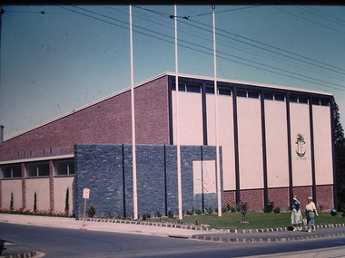 Kew Historical Society Inc
Photograph - Kew City Hall, Ron Setford, 1960
... road transport infrastructure during the 1970s with the construction of the Eastern Freeway. The photographer also took care to annotate and date most of his slides which enable the researcher to pinpoint temporal and spatial locations. Ron Setford Photographs -- Kew (Vic ...Ron Setford and his wife Grace Setford lived in Tanner Avenue, East Kew, from c.1946 to c.1995. A keen photographer, he recorded the changing face of Kew over a 20 year period. Apart from 30 photographs of built structures and places in Kew dating from 1960 and 1961, 145 of his 35mm colour slides chronicle the development of the Eastern Freeway through the Yarra Valley over a five year period from c.1972 to c.1977. This important collection was donated to the Society by his granddaughter in 2025.This collection of 175 35mm slides is of local and statewide significance, owing to its subject matter, particularly the major development of road transport infrastructure during the 1970s with the construction of the Eastern Freeway. The photographer also took care to annotate and date most of his slides which enable the researcher to pinpoint temporal and spatial locations.The Kew City Hall in Cotham Road, designed by Harold Bartlett, was intended as the initial phase in a scheme to develop an entire civic precinct. This was representative of a widely-held belief, of the immediate post-war era, that a district's civic centre should be precisely that – not just a single grand building for official use, but a dedicated precinct providing a range of community facilities as well as an administrative function. The Kew masterplan was later abandoned. The City Hall was designed to cater for public or official functions. Its interior had a small stage at one end for intimate theatrical productions, a larger stage at the other (with sunken orchestra pit) for musical performances, plus the most up-to-date equipment for live TV transmission.Nilron setford, photographs -- kew (vic.) -- 1960s, kew town hall -
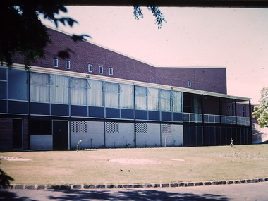 Kew Historical Society Inc
Photograph - Kew City Hall, Ron Setford, 1960
... road transport infrastructure during the 1970s with the construction of the Eastern Freeway. The photographer also took care to annotate and date most of his slides which enable the researcher to pinpoint temporal and spatial locations. Ron Setford Photographs -- Kew (Vic ...Ron Setford and his wife Grace Setford lived in Tanner Avenue, East Kew, from c.1946 to c.1995. A keen photographer, he recorded the changing face of Kew over a 20 year period. Apart from 30 photographs of built structures and places in Kew dating from 1960 and 1961, 145 of his 35mm colour slides chronicle the development of the Eastern Freeway through the Yarra Valley over a five year period from c.1972 to c.1977. This important collection was donated to the Society by his granddaughter in 2025.This collection of 175 35mm slides is of local and statewide significance, owing to its subject matter, particularly the major development of road transport infrastructure during the 1970s with the construction of the Eastern Freeway. The photographer also took care to annotate and date most of his slides which enable the researcher to pinpoint temporal and spatial locations.The Kew City Hall in Cotham Road, designed by Harold Bartlett, was intended as the initial phase in a scheme to develop an entire civic precinct. This was representative of a widely-held belief, of the immediate post-war era, that a district's civic centre should be precisely that – not just a single grand building for official use, but a dedicated precinct providing a range of community facilities as well as an administrative function. The Kew masterplan was later abandoned. The City Hall was designed to cater for public or official functions. Its interior had a small stage at one end for intimate theatrical productions, a larger stage at the other (with sunken orchestra pit) for musical performances, plus the most up-to-date equipment for live TV transmission.Nilron setford, photographs -- kew (vic.) -- 1960s, kew town hall -
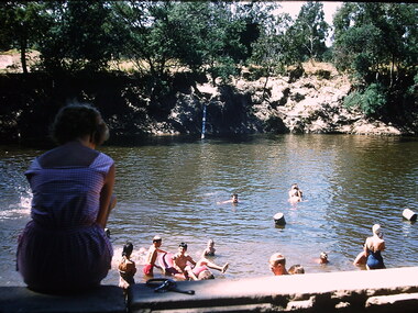 Kew Historical Society Inc
Photograph - Swimming in the Yarra River, Ron Setford, 1960-61
... road transport infrastructure during the 1970s with the construction of the Eastern Freeway. The photographer also took care to annotate and date most of his slides which enable the researcher to pinpoint temporal and spatial locations. Ron Setford Photographs -- Kew (Vic ...Ron Setford and his wife Grace Setford lived in Tanner Avenue, East Kew, from c.1946 to c.1995. A keen photographer, he recorded the changing face of Kew over a 20 year period. Apart from 30 photographs of built structures and places in Kew dating from 1960 and 1961, 145 of his 35mm colour slides chronicle the development of the Eastern Freeway through the Yarra Valley over a five year period from c.1972 to c.1977. This important collection was donated to the Society by his granddaughter in 2025.This collection of 175 35mm slides is of local and statewide significance, owing to its subject matter, particularly the major development of road transport infrastructure during the 1970s with the construction of the Eastern Freeway. The photographer also took care to annotate and date most of his slides which enable the researcher to pinpoint temporal and spatial locations.Nilron setford, photographs -- kew (vic.) -- 1960s, yarra river, recreation -- river swimming -
 Kew Historical Society Inc
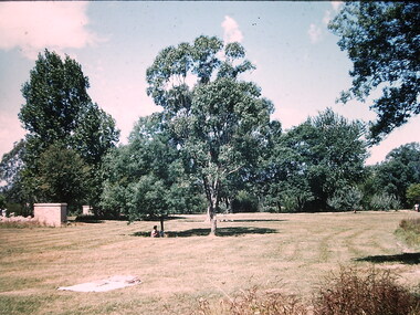
Photograph - Willsmere Park, Ron Setford, 1960
... road transport infrastructure during the 1970s with the construction of the Eastern Freeway. The photographer also took care to annotate and date most of his slides which enable the researcher to pinpoint temporal and spatial locations. Ron Setford Photographs -- Kew (Vic ...Ron Setford and his wife Grace Setford lived in Tanner Avenue, East Kew, from c.1946 to c.1995. A keen photographer, he recorded the changing face of Kew over a 20 year period. Apart from 30 photographs of built structures and places in Kew dating from 1960 and 1961, 145 of his 35mm colour slides chronicle the development of the Eastern Freeway through the Yarra Valley over a five year period from c.1972 to c.1977. This important collection was donated to the Society by his granddaughter in 2025.This collection of 175 35mm slides is of local and statewide significance, owing to its subject matter, particularly the major development of road transport infrastructure during the 1970s with the construction of the Eastern Freeway. The photographer also took care to annotate and date most of his slides which enable the researcher to pinpoint temporal and spatial locations.Nilron setford, photographs -- kew (vic.) -- 1960s, willsmere park -
 Kew Historical Society Inc
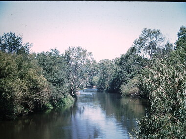
Photograph - Yarra River at Kew East, Ron Setford, 1960
... road transport infrastructure during the 1970s with the construction of the Eastern Freeway. The photographer also took care to annotate and date most of his slides which enable the researcher to pinpoint temporal and spatial locations. Ron Setford Photographs -- Kew (Vic ...Ron Setford and his wife Grace Setford lived in Tanner Avenue, East Kew, from c.1946 to c.1995. A keen photographer, he recorded the changing face of Kew over a 20 year period. Apart from 30 photographs of built structures and places in Kew dating from 1960 and 1961, 145 of his 35mm colour slides chronicle the development of the Eastern Freeway through the Yarra Valley over a five year period from c.1972 to c.1977. This important collection was donated to the Society by his granddaughter in 2025.This collection of 175 35mm slides is of local and statewide significance, owing to its subject matter, particularly the major development of road transport infrastructure during the 1970s with the construction of the Eastern Freeway. The photographer also took care to annotate and date most of his slides which enable the researcher to pinpoint temporal and spatial locations.Nilron setford, photographs -- kew (vic.) -- 1960s, yarra river -- kew east (vic.) -
 Kew Historical Society Inc
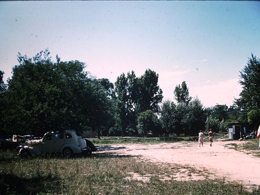
Photograph - Beach near Chipperfield's floating 'Pontoon', Ron Setford, 1960
... road transport infrastructure during the 1970s with the construction of the Eastern Freeway. The photographer also took care to annotate and date most of his slides which enable the researcher to pinpoint temporal and spatial locations. Ron Setford Photographs -- Kew (Vic ...Ron Setford and his wife Grace Setford lived in Tanner Avenue, East Kew, from c.1946 to c.1995. A keen photographer, he recorded the changing face of Kew over a 20 year period. Apart from 30 photographs of built structures and places in Kew dating from 1960 and 1961, 145 of his 35mm colour slides chronicle the development of the Eastern Freeway through the Yarra Valley over a five year period from c.1972 to c.1977. This important collection was donated to the Society by his granddaughter in 2025.This collection of 175 35mm slides is of local and statewide significance, owing to its subject matter, particularly the major development of road transport infrastructure during the 1970s with the construction of the Eastern Freeway. The photographer also took care to annotate and date most of his slides which enable the researcher to pinpoint temporal and spatial locations.Nilron setford, photographs -- kew (vic.) -- 1960s, yarra river -- kew east (vic.), chipperfield's boat house, chipperfield's floating pontoon -
 Kew Historical Society Inc
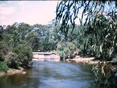
Photograph - Chipperfield's floating 'Pontoon' on the Yarra River, Ron Setford, 1960
... road transport infrastructure during the 1970s with the construction of the Eastern Freeway. The photographer also took care to annotate and date most of his slides which enable the researcher to pinpoint temporal and spatial locations. Ron Setford Photographs -- Kew (Vic ...Ron Setford and his wife Grace Setford lived in Tanner Avenue, East Kew, from c.1946 to c.1995. A keen photographer, he recorded the changing face of Kew over a 20 year period. Apart from 30 photographs of built structures and places in Kew dating from 1960 and 1961, 145 of his 35mm colour slides chronicle the development of the Eastern Freeway through the Yarra Valley over a five year period from c.1972 to c.1977. This important collection was donated to the Society by his granddaughter in 2025.This collection of 175 35mm slides is of local and statewide significance, owing to its subject matter, particularly the major development of road transport infrastructure during the 1970s with the construction of the Eastern Freeway. The photographer also took care to annotate and date most of his slides which enable the researcher to pinpoint temporal and spatial locations.Nilron setford, photographs -- kew (vic.) -- 1960s, yarra river -- kew east (vic.), chipperfield's boat house, chipperfield's floating pontoon -
 Kew Historical Society Inc
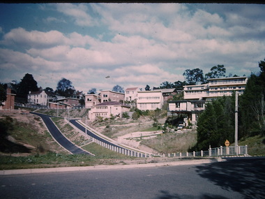
Photograph - Yarra Street, Kew, Ron Setford, 1960
... road transport infrastructure during the 1970s with the construction of the Eastern Freeway. The photographer also took care to annotate and date most of his slides which enable the researcher to pinpoint temporal and spatial locations. Ron Setford Photographs -- Kew (Vic ...Ron Setford and his wife Grace Setford lived in Tanner Avenue, East Kew, from c.1946 to c.1995. A keen photographer, he recorded the changing face of Kew over a 20 year period. Apart from 30 photographs of built structures and places in Kew dating from 1960 and 1961, 145 of his 35mm colour slides chronicle the development of the Eastern Freeway through the Yarra Valley over a five year period from c.1972 to c.1977. This important collection was donated to the Society by his granddaughter in 2025.This collection of 175 35mm slides is of local and statewide significance, owing to its subject matter, particularly the major development of road transport infrastructure during the 1970s with the construction of the Eastern Freeway. The photographer also took care to annotate and date most of his slides which enable the researcher to pinpoint temporal and spatial locations.Yarra Street was not made a trafficable thoroughfare until October 1956. Until then, the gully was used as a dump, a shortcut to the river, and for communal Guy Fawkes night bonfires. The open landscape in the photo reflects near-total clearing by the original estate owners for grazing livestock. Post-war homes fronting Stawell St dot the landscape. Of particular note are the Broons House (c.1952–54) by Anatol Kagan (top right), and the homes of two architects, Kurt Elsner (c.1950) (middle) and Geoffrey Danne (c.1954) (lower right). Dual carriageways made blocks accessible, but building was difficult due to steeply sloping land and complex drainage easements. Nevertheless, these challenges resulted in highly innovative designs, making Yarra Street the core of the Yarra Boulevard Heritage Precinct."Yarra St Kew"ron setford, photographs -- kew (vic.) -- 1960s, yarra street -- kew (vic.) -
 Kew Historical Society Inc
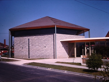
Photograph - St Paul's Church, Kew East, Ron Setford, 1961
... road transport infrastructure during the 1970s with the construction of the Eastern Freeway. The photographer also took care to annotate and date most of his slides which enable the researcher to pinpoint temporal and spatial locations. Ron Setford Photographs -- Kew (Vic ...Ron Setford and his wife Grace Setford lived in Tanner Avenue, East Kew, from c.1946 to c.1995. A keen photographer, he recorded the changing face of Kew over a 20 year period. Apart from 30 photographs of built structures and places in Kew dating from 1960 and 1961, 145 of his 35mm colour slides chronicle the development of the Eastern Freeway through the Yarra Valley over a five year period from c.1972 to c.1977. This important collection was donated to the Society by his granddaughter in 2025.This collection of 175 35mm slides is of local and statewide significance, owing to its subject matter, particularly the major development of road transport infrastructure during the 1970s with the construction of the Eastern Freeway. The photographer also took care to annotate and date most of his slides which enable the researcher to pinpoint temporal and spatial locations.Nilron setford, photographs -- kew (vic.) -- 1960s, st paul's church -- kew east (vic.) -
 Kew Historical Society Inc
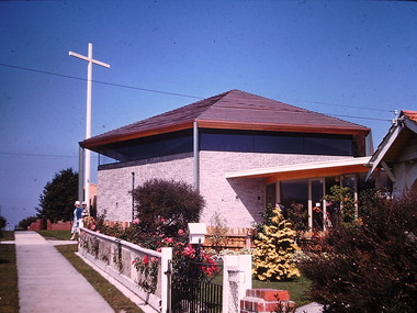
Photograph - St Paul's Church, Kew East, Ron Setford, 1961
... road transport infrastructure during the 1970s with the construction of the Eastern Freeway. The photographer also took care to annotate and date most of his slides which enable the researcher to pinpoint temporal and spatial locations. Ron Setford Photographs -- Kew (Vic ...Ron Setford and his wife Grace Setford lived in Tanner Avenue, East Kew, from c.1946 to c.1995. A keen photographer, he recorded the changing face of Kew over a 20 year period. Apart from 30 photographs of built structures and places in Kew dating from 1960 and 1961, 145 of his 35mm colour slides chronicle the development of the Eastern Freeway through the Yarra Valley over a five year period from c.1972 to c.1977. This important collection was donated to the Society by his granddaughter in 2025.This collection of 175 35mm slides is of local and statewide significance, owing to its subject matter, particularly the major development of road transport infrastructure during the 1970s with the construction of the Eastern Freeway. The photographer also took care to annotate and date most of his slides which enable the researcher to pinpoint temporal and spatial locations.Nilron setford, photographs -- kew (vic.) -- 1960s, st paul's church -- kew east (vic.) -
 Kew Historical Society Inc
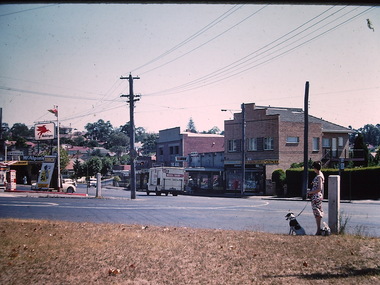
Photograph - North Kew Village, Ron Setford, 1960
... road transport infrastructure during the 1970s with the construction of the Eastern Freeway. The photographer also took care to annotate and date most of his slides which enable the researcher to pinpoint temporal and spatial locations. Ron Setford Photographs -- Kew (Vic ...Ron Setford and his wife Grace Setford lived in Tanner Avenue, East Kew, from c.1946 to c.1995. A keen photographer, he recorded the changing face of Kew over a 20 year period. Apart from 30 photographs of built structures and places in Kew dating from 1960 and 1961, 145 of his 35mm colour slides chronicle the development of the Eastern Freeway through the Yarra Valley over a five year period from c.1972 to c.1977. This important collection was donated to the Society by his granddaughter in 2025.This collection of 175 35mm slides is of local and statewide significance, owing to its subject matter, particularly the major development of road transport infrastructure during the 1970s with the construction of the Eastern Freeway. The photographer also took care to annotate and date most of his slides which enable the researcher to pinpoint temporal and spatial locations."Nth Kew Village"ron setford, photographs -- kew (vic.) -- 1960s, north kew village, willsmere village -
 Kew Historical Society Inc
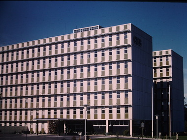
Photograph - Country Roads Board, Ron Setford, 1961
... road transport infrastructure during the 1970s with the construction of the Eastern Freeway. The photographer also took care to annotate and date most of his slides which enable the researcher to pinpoint temporal and spatial locations. Ron Setford Photographs -- Kew (Vic ...Ron Setford and his wife Grace Setford lived in Tanner Avenue, East Kew, from c.1946 to c.1995. A keen photographer, he recorded the changing face of Kew over a 20 year period. Apart from 30 photographs of built structures and places in Kew dating from 1960 and 1961, 145 of his 35mm colour slides chronicle the development of the Eastern Freeway through the Yarra Valley over a five year period from c.1972 to c.1977. This important collection was donated to the Society by his granddaughter in 2025.This collection of 175 35mm slides is of local and statewide significance, owing to its subject matter, particularly the major development of road transport infrastructure during the 1970s with the construction of the Eastern Freeway. The photographer also took care to annotate and date most of his slides which enable the researcher to pinpoint temporal and spatial locations.Nilron setford, photographs -- kew (vic.) -- 1960s, country roads board, vicroads, denmark street -- kew (vic.) -
 Kew Historical Society Inc
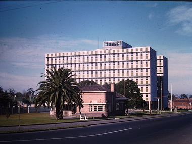
Photograph - Country Roads Board and Denmark Street Baby Health Centre, Ron Setford, 1961
... road transport infrastructure during the 1970s with the construction of the Eastern Freeway. The photographer also took care to annotate and date most of his slides which enable the researcher to pinpoint temporal and spatial locations. Ron Setford Photographs -- Kew (Vic ...Ron Setford and his wife Grace Setford lived in Tanner Avenue, East Kew, from c.1946 to c.1995. A keen photographer, he recorded the changing face of Kew over a 20 year period. Apart from 30 photographs of built structures and places in Kew dating from 1960 and 1961, 145 of his 35mm colour slides chronicle the development of the Eastern Freeway through the Yarra Valley over a five year period from c.1972 to c.1977. This important collection was donated to the Society by his granddaughter in 2025.This collection of 175 35mm slides is of local and statewide significance, owing to its subject matter, particularly the major development of road transport infrastructure during the 1970s with the construction of the Eastern Freeway. The photographer also took care to annotate and date most of his slides which enable the researcher to pinpoint temporal and spatial locations.A photograph providing a visual contrast of the pre and post-World War II architectural styles of the Denmark Street Baby Health Centre and two of the Country Roads Board office buildings. Each was built on part of the land fronting the Kew branch line. In May 1939, the Railway Commissioners agreed to lease a site at the Kew Railway Station for a Baby Health Centre. The single-storey cream brick building was designed by Roland Chipperfield. The Country Roads Board (1913–83), later renamed VicRoads, transferred its headquarters from the Royal Exhibition Building to Kew in 1961, following the completion of two modernist eight-storey office towers in 1960. The VicRoads buildings were closed in 2024, and there is ongoing debate about what replaces them.Nilron setford, photographs -- kew (vic.) -- 1960s, country roads board, vicroads, denmark street -- kew (vic.), denmark street baby health centre -
 Kew Historical Society Inc
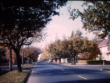
Photograph - Mont Albert Road, Ron Setford, 1961
... road transport infrastructure during the 1970s with the construction of the Eastern Freeway. The photographer also took care to annotate and date most of his slides which enable the researcher to pinpoint temporal and spatial locations. Ron Setford Photographs -- Kew (Vic ...Ron Setford and his wife Grace Setford lived in Tanner Avenue, East Kew, from c.1946 to c.1995. A keen photographer, he recorded the changing face of Kew over a 20 year period. Apart from 30 photographs of built structures and places in Kew dating from 1960 and 1961, 145 of his 35mm colour slides chronicle the development of the Eastern Freeway through the Yarra Valley over a five year period from c.1972 to c.1977. This important collection was donated to the Society by his granddaughter in 2025.This collection of 175 35mm slides is of local and statewide significance, owing to its subject matter, particularly the major development of road transport infrastructure during the 1970s with the construction of the Eastern Freeway. The photographer also took care to annotate and date most of his slides which enable the researcher to pinpoint temporal and spatial locations."Mont Albert Rd"ron setford, photographs -- kew (vic.) -- 1960s, mont albert road -
 Kew Historical Society Inc
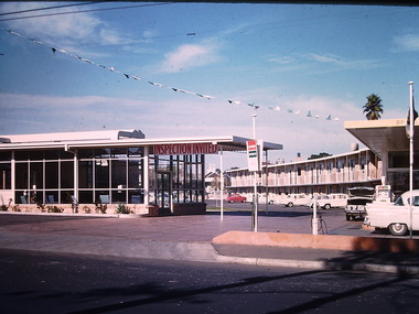
Photograph - California Motel, Barkers Road, Ron Setford, 1961
... road transport infrastructure during the 1970s with the construction of the Eastern Freeway. The photographer also took care to annotate and date most of his slides which enable the researcher to pinpoint temporal and spatial locations. Ron Setford Photographs -- Kew (Vic ...Ron Setford and his wife Grace Setford lived in Tanner Avenue, East Kew, from c.1946 to c.1995. A keen photographer, he recorded the changing face of Kew over a 20 year period. Apart from 30 photographs of built structures and places in Kew dating from 1960 and 1961, 145 of his 35mm colour slides chronicle the development of the Eastern Freeway through the Yarra Valley over a five year period from c.1972 to c.1977. This important collection was donated to the Society by his granddaughter in 2025.This collection of 175 35mm slides is of local and statewide significance, owing to its subject matter, particularly the major development of road transport infrastructure during the 1970s with the construction of the Eastern Freeway. The photographer also took care to annotate and date most of his slides which enable the researcher to pinpoint temporal and spatial locations.Opened in 1960, the California Motel at 138 Barkers Road, Hawthorn, was located opposite the entrance to Xavier College and built on the site of the former Barker railway station of the closed Kew branch line. The motel was advertised as “away from the hustle and bustle of the city and offering affordable accommodation for the business or leisure traveller”. Special amenities included air-conditioning, a business centre, and swimming pool. The motel had 82 suites. A possibly forgotten, but perhaps essential feature of the motel, was the Caltex Service Station at its entrance. The building was closed in April 2008, extensively vandalised and finally demolished in 2013."California Motel"ron setford, photographs -- kew (vic.) -- 1960s, california motel -- barkers road -- hawthorn (vic.) -
 Kew Historical Society Inc
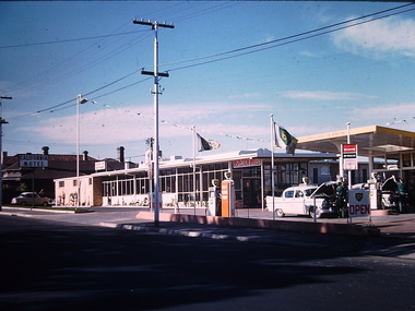
Photograph - California Motel, Barkers Road, Kew, Ron Setford, 1961
... road transport infrastructure during the 1970s with the construction of the Eastern Freeway. The photographer also took care to annotate and date most of his slides which enable the researcher to pinpoint temporal and spatial locations. Ron Setford Photographs -- Kew (Vic ...Ron Setford and his wife Grace Setford lived in Tanner Avenue, East Kew, from c.1946 to c.1995. A keen photographer, he recorded the changing face of Kew over a 20 year period. Apart from 30 photographs of built structures and places in Kew dating from 1960 and 1961, 145 of his 35mm colour slides chronicle the development of the Eastern Freeway through the Yarra Valley over a five year period from c.1972 to c.1977. This important collection was donated to the Society by his granddaughter in 2025.This collection of 175 35mm slides is of local and statewide significance, owing to its subject matter, particularly the major development of road transport infrastructure during the 1970s with the construction of the Eastern Freeway. The photographer also took care to annotate and date most of his slides which enable the researcher to pinpoint temporal and spatial locations.Opened in 1960, the California Motel at 138 Barkers Road, Hawthorn, was located opposite the entrance to Xavier College and built on the site of the former Barker railway station of the closed Kew branch line. The motel was advertised as “away from the hustle and bustle of the city and offering affordable accommodation for the business or leisure traveller”. Special amenities included air-conditioning, a business centre, and swimming pool. The motel had 82 suites. A possibly forgotten, but perhaps essential feature of the motel, was the Caltex Service Station at its entrance. The building was closed in April 2008, extensively vandalised and finally demolished in 2013.Nilron setford, photographs -- kew (vic.) -- 1960s, california hotel -- barkers road -- hawthorn (vic.), california motel -- barkers road -
 Kew Historical Society Inc
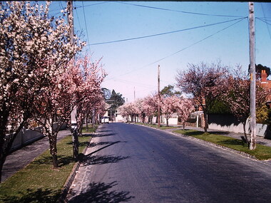
Photograph - Banool Avenue, Kew, Ron Setford, 1961
... road transport infrastructure during the 1970s with the construction of the Eastern Freeway. The photographer also took care to annotate and date most of his slides which enable the researcher to pinpoint temporal and spatial locations. Ron Setford Photographs -- Kew (Vic ...Ron Setford and his wife Grace Setford lived in Tanner Avenue, East Kew, from c.1946 to c.1995. A keen photographer, he recorded the changing face of Kew over a 20 year period. Apart from 30 photographs of built structures and places in Kew dating from 1960 and 1961, 145 of his 35mm colour slides chronicle the development of the Eastern Freeway through the Yarra Valley over a five year period from c.1972 to c.1977. This important collection was donated to the Society by his granddaughter in 2025.This collection of 175 35mm slides is of local and statewide significance, owing to its subject matter, particularly the major development of road transport infrastructure during the 1970s with the construction of the Eastern Freeway. The photographer also took care to annotate and date most of his slides which enable the researcher to pinpoint temporal and spatial locations.Nilron setford, photographs -- kew (vic.) -- 1960s, banool avenue -- kew (vic.) -
 Kew Historical Society Inc
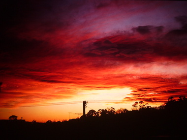
Photograph - Sunrise over Kew East, Ron Setford, 1969
... road transport infrastructure during the 1970s with the construction of the Eastern Freeway. The photographer also took care to annotate and date most of his slides which enable the researcher to pinpoint temporal and spatial locations. Ron Setford Photographs -- Kew (Vic ...Ron Setford and his wife Grace Setford lived in Tanner Avenue, East Kew, from c.1946 to c.1995. A keen photographer, he recorded the changing face of Kew over a 20 year period. Apart from 30 photographs of built structures and places in Kew dating from 1960 and 1961, 145 of his 35mm colour slides chronicle the development of the Eastern Freeway through the Yarra Valley over a five year period from c.1972 to c.1977. This important collection was donated to the Society by his granddaughter in 2025.This collection of 175 35mm slides is of local and statewide significance, owing to its subject matter, particularly the major development of road transport infrastructure during the 1970s with the construction of the Eastern Freeway. The photographer also took care to annotate and date most of his slides which enable the researcher to pinpoint temporal and spatial locations."Sunrise over East Kew [Aug69}"ron setford, photographs -- kew (vic.) -- 1960s, kew east -
 Kew Historical Society Inc
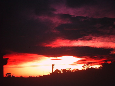
Photograph - Sunrise over Kew East, Ron Setford, 1969
... road transport infrastructure during the 1970s with the construction of the Eastern Freeway. The photographer also took care to annotate and date most of his slides which enable the researcher to pinpoint temporal and spatial locations. Ron Setford Photographs -- Kew (Vic ...Ron Setford and his wife Grace Setford lived in Tanner Avenue, East Kew, from c.1946 to c.1995. A keen photographer, he recorded the changing face of Kew over a 20 year period. Apart from 30 photographs of built structures and places in Kew dating from 1960 and 1961, 145 of his 35mm colour slides chronicle the development of the Eastern Freeway through the Yarra Valley over a five year period from c.1972 to c.1977. This important collection was donated to the Society by his granddaughter in 2025.This collection of 175 35mm slides is of local and statewide significance, owing to its subject matter, particularly the major development of road transport infrastructure during the 1970s with the construction of the Eastern Freeway. The photographer also took care to annotate and date most of his slides which enable the researcher to pinpoint temporal and spatial locations."Sunrise over East Kew [Aug69}"ron setford, photographs -- kew (vic.) -- 1960s, kew east -
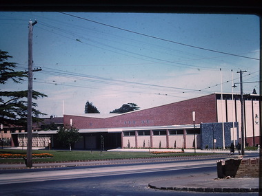 Kew Historical Society Inc
Photograph - Kew Civic Hall and World War II War Memorial, Ron Setford, 1960
... road transport infrastructure during the 1970s with the construction of the Eastern Freeway. The photographer also took care to annotate and date most of his slides which enable the researcher to pinpoint temporal and spatial locations. Ron Setford Photographs -- Kew (Vic ...Ron Setford and his wife Grace Setford lived in Tanner Avenue, East Kew, from c.1946 to c.1995. A keen photographer, he recorded the changing face of Kew over a 20 year period. Apart from 30 photographs of built structures and places in Kew dating from 1960 and 1961, 145 of his 35mm colour slides chronicle the development of the Eastern Freeway through the Yarra Valley over a five year period from c.1972 to c.1977. This important collection was donated to the Society by his granddaughter in 2025.This collection of 175 35mm slides is of local and statewide significance, owing to its subject matter, particularly the major development of road transport infrastructure during the 1970s with the construction of the Eastern Freeway. The photographer also took care to annotate and date most of his slides which enable the researcher to pinpoint temporal and spatial locations."Kew Town Hall"ron setford, photographs -- kew (vic.) -- 1960s, kew town hall -
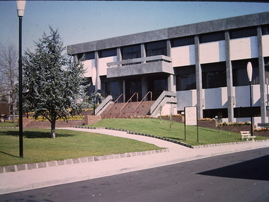 Kew Historical Society Inc
Photograph - Kew Civic Offices, Ron Setford, 1973
... road transport infrastructure during the 1970s with the construction of the Eastern Freeway. The photographer also took care to annotate and date most of his slides which enable the researcher to pinpoint temporal and spatial locations. Ron Setford Photographs -- Kew (Vic ...Ron Setford and his wife Grace Setford lived in Tanner Avenue, East Kew, from c.1946 to c.1995. A keen photographer, he recorded the changing face of Kew over a 20 year period. Apart from 30 photographs of built structures and places in Kew dating from 1960 and 1961, 145 of his 35mm colour slides chronicle the development of the Eastern Freeway through the Yarra Valley over a five year period from c.1972 to c.1977. This important collection was donated to the Society by his granddaughter in 2025.This collection of 175 35mm slides is of local and statewide significance, owing to its subject matter, particularly the major development of road transport infrastructure during the 1970s with the construction of the Eastern Freeway. The photographer also took care to annotate and date most of his slides which enable the researcher to pinpoint temporal and spatial locations."The "Taj-Mahal" / $1.250.000 Council Offices (we have to pay for it)"ron setford, photographs -- kew (vic.) -- 1960s, kew civic offices, kew town hall -
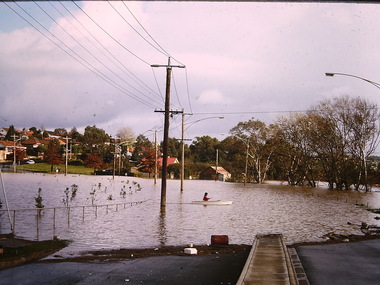 Kew Historical Society Inc
Photograph - Flooding, Kilby Road, Kew, Ron Setford, 1974
... road transport infrastructure during the 1970s with the construction of the Eastern Freeway. The photographer also took care to annotate and date most of his slides which enable the researcher to pinpoint temporal and spatial locations. Ron Setford Floods -- Kew (Vic ...Ron Setford and his wife Grace Setford lived in Tanner Avenue, East Kew, from c.1946 to c.1995. A keen photographer, he recorded the changing face of Kew over a 20 year period. Apart from 30 photographs of built structures and places in Kew dating from 1960 and 1961, 145 of his 35mm colour slides chronicle the development of the Eastern Freeway through the Yarra Valley over a five year period from c.1972 to c.1977. This important collection was donated to the Society by his granddaughter in 2025.This collection of 175 35mm slides is of local and statewide significance, owing to its subject matter, particularly the major development of road transport infrastructure during the 1970s with the construction of the Eastern Freeway. The photographer also took care to annotate and date most of his slides which enable the researcher to pinpoint temporal and spatial locations."Flood Kilby Road / May 74"ron setford, floods -- kew (vic.), kilby road -- kew (vic.)
