Showing 4699 items matching "road planning"
-
 Sunshine and District Historical Society Incorporated
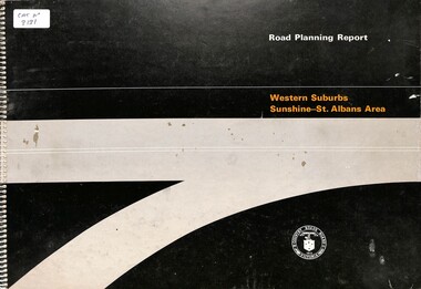
Document - Road Planning Report Western Suburbs Sunshine - St. Albans Area, Country Road Board Victoria, 1974
... Road Planning Report Western Suburbs Sunshine - St. ...Road Planning Report Western Suburbs Sunshine - St. ...Part of the Gwen Goedecke Collection Road Planning Report Western Suburbs Sunshine - St. ...Part of the Gwen Goedecke CollectionRoad Planning Report Western Suburbs Sunshine - St. Albans Area Country Road Board (CRB)Victoria -
 Eltham District Historical Society Inc
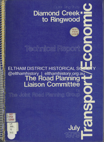
Book, The Joint Road Planning Group, Outer Ring Study, Diamond Creek to Ringwood: Technical Report Transport and Economic Evaluation, July 1979
... The Joint Road Planning Group...Eltham District Historical Society Inc 728 Main Rd Eltham melbourne melbourne ring road roads freeways Prepared for The Road Planning Liaison Committee by The Joint Road Planning Group. ...Prepared for The Road Planning Liaison Committee by The Joint Road Planning Group. The Outer Ring Study, Diamond Creek to Ringwood was a long term planning study carried out under the direction of the Road Planning Liaison Committee for the Government of Victoria. .. The basic aim of the .. Study was to determine the most appropriate future road system in the area between Diamond Creek and Ringwood, consistent with local and regional concerns and the environment of the area, with a view to seeking an emendment to the Metropolitan Planning Scheme to preserve the option to implement an appropriate road system some time in the future if this was considered necessary. This technical report discusses, in detail, the transport and economic aspects of the investigation.. the techniques used take into account the long term implications of a range of possible travel cost policies and options and land use strategies.non-fictionPrepared for The Road Planning Liaison Committee by The Joint Road Planning Group. The Outer Ring Study, Diamond Creek to Ringwood was a long term planning study carried out under the direction of the Road Planning Liaison Committee for the Government of Victoria. .. The basic aim of the .. Study was to determine the most appropriate future road system in the area between Diamond Creek and Ringwood, consistent with local and regional concerns and the environment of the area, with a view to seeking an emendment to the Metropolitan Planning Scheme to preserve the option to implement an appropriate road system some time in the future if this was considered necessary. This technical report discusses, in detail, the transport and economic aspects of the investigation.. the techniques used take into account the long term implications of a range of possible travel cost policies and options and land use strategies.melbourne ring road, roads, freeways -
 Eltham District Historical Society Inc
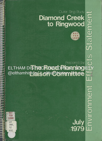
Book, The Road Planning Liaison Committee, Outer Ring Study, Diamond Creek to Ringwood: Environmental Effects Statement, July 1979
... The Road Planning Liaison Committee...Outer Ring Study, Diamond Creek to Ringwood: Environmental Effects Statement Book The Road Planning Liaison Committee ...Prepared by The Road Planning Liaison Committee. The Outer Ring Study, Diamond Creek to Ringwood was a long term planning study carried out under the direction of the Road Planning Liaison Committee for the Government of Victoria. .. The basic aim of the .. Study was to determine the most appropriate future road system in the area between Diamond Creek and Ringwood, consistent with local and regional concerns and the environment of the area, with a view to seeking an emendment to the Metropolitan Planning Scheme to preserve the option to implement an appropriate road system some time in the future if this was considered necessary.non-fictionPrepared by The Road Planning Liaison Committee. The Outer Ring Study, Diamond Creek to Ringwood was a long term planning study carried out under the direction of the Road Planning Liaison Committee for the Government of Victoria. .. The basic aim of the .. Study was to determine the most appropriate future road system in the area between Diamond Creek and Ringwood, consistent with local and regional concerns and the environment of the area, with a view to seeking an emendment to the Metropolitan Planning Scheme to preserve the option to implement an appropriate road system some time in the future if this was considered necessary.roads, freeways, melbourne ring road -
 Greensborough Historical Society
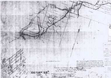
Document - Road Plan, Road acquisition, St Helena Road, 1859, 1889
... Road Plan...Road plan showing land acquisition for the road to Diamond Creek (NOT Diamond Creek Road), also known as Eltham Road and now known as St Helena Road....1 page. Copy of road plan...Copy of road plan Road acquisition, St Helena Road, 1859 Document Road Plan ...Road plan showing land acquisition for the road to Diamond Creek (NOT Diamond Creek Road), also known as Eltham Road and now known as St Helena Road.Shows the land through which St Helena Road runs, with original owners marked on plan.1 page. Copy of road planroad plans, st helena road greensborough, diamond creek -
 Sunshine and District Historical Society Incorporated
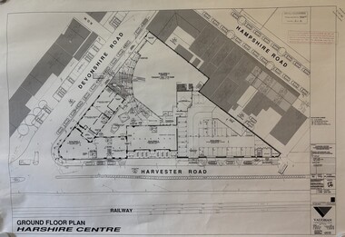
Plan - McKays Offices 2 Devonshire Road Redevelopment Plans
... Collection of proposed McKays Offices 2 Devonshire Road Redevelopment Plans...McKays Offices 2 Devonshire Road Redevelopment Plans...McKays Massey Harris Massey Ferguson Devonshire Road Sunshine McKays Offices 2 Devonshire Road Redevelopment Plans Collection of proposed McKays Offices 2 Devonshire Road Redevelopment Plans Plan McKays Offices 2 Devonshire Road Redevelopment Plans ...McKays Offices 2 Devonshire Road Redevelopment Plansh.v. mckays harris, h.v. mckays massey harris, massey ferguson, devonshire road, sunshine -
 Eltham District Historical Society Inc
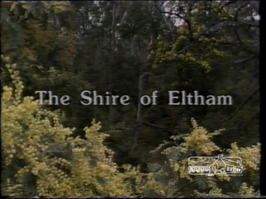
Film - Video (VHS), IMP Productions, The Shire of Etham - The Evergreen Shire (Series 69, Item 4), c.1985
... ...road planning...Also the Living and Learning Centre, St Andrews Markets and other local markets, the Eltham Leisure Centre, cricket and horse riding at Eltham Lower Park, the Infant Welfare Centre (part of the Eltham War Memorial), how residents are mindful of protecting their historical heritage, the CBA bank and Allwood House at Hurstbridge, Tracey Naughton about the Eltham "As we are" Community Banner project and the “River of Life banner”, the Parks and Gardens office in the former Police Residence building (now the Local History Centre), Alistair Knox Park, road planning and types of roads, tree canopy, Peck's Dam, green carparks, road drainage, Gordon Ford's garden and natural landscapes, and Were Street shops in Montmorency. ...Also the Living and Learning Centre, St Andrews Markets and other local markets, the Eltham Leisure Centre, cricket and horse riding at Eltham Lower Park, the Infant Welfare Centre (part of the Eltham War Memorial), how residents are mindful of protecting their historical heritage, the CBA bank and Allwood House at Hurstbridge, Tracey Naughton about the Eltham "As we are" Community Banner project and the “River of Life banner”, the Parks and Gardens office in the former Police Residence building (now the Local History Centre), Alistair Knox Park, road planning and types of roads, tree canopy, Peck's Dam, green carparks, road drainage, Gordon Ford's garden and natural landscapes, and Were Street shops in Montmorency. ...Shire of Eltham Archives: Series 69, Item 4 This video was produced for the Shire of Eltham by IMP Productions and provides a description of the shire, 277 square km on a north/northeast axis, some 25 km northeast of the centre of Melbourne with a population of around 40,000. Scenes include Yarra River, rural settings and urban settings, housing estates, Shillinglaw Cottage, Pigeon Bank at Kangaroo Ground, the Eltham Railway Trestle Bridge with reference to the fight by locals in the 1970s to save it from replacement, Montsalvat, mudbrick making and its use as a building material, the use of mudbrick in the Eltham Community Centre blending harmoniously with the environment. Emphasises people living in the area due to the qualities of life provided. Also the Living and Learning Centre, St Andrews Markets and other local markets, the Eltham Leisure Centre, cricket and horse riding at Eltham Lower Park, the Infant Welfare Centre (part of the Eltham War Memorial), how residents are mindful of protecting their historical heritage, the CBA bank and Allwood House at Hurstbridge, Tracey Naughton about the Eltham "As we are" Community Banner project and the “River of Life banner”, the Parks and Gardens office in the former Police Residence building (now the Local History Centre), Alistair Knox Park, road planning and types of roads, tree canopy, Peck's Dam, green carparks, road drainage, Gordon Ford's garden and natural landscapes, and Were Street shops in Montmorency. Planning for shopping facilities and carparks with a population of 40,000 growing to 55,000, Arthur Street Mall and carpark, local village feel in the shopping centre. Councillors and Council staff featured include Mary Grant, Bob Manuell, Rodney Roschellor, John Cohen, Alan Baker. Also scenes of Commercial Place, Diamond Valley Railway, Eltham Galley, Riverclay and canoeing on the Yarra intermingled with images of the shire from the Shire of Eltham Pioneers Photograph collection.VHS Video cassette Converted to MP4 file format 00:11:56; 79MBshire of eltham, video recording, shire of eltham archives, alistair knox park, allwood house, arthur street, arthur street mall, bob manuell, canoeing, carparks, cba bank, commercial place, council staff, councillors, cr. mary grant, cricket, diamond valley railway, eltham community banner project, eltham community centre, eltham galley, eltham leisure centre, eltham living and learning centre, eltham lower park, eltham railway trestle bridge, eltham war memorial, gordon ford garden, horse riding, housing estates, hurstbridge, infant welfare centre, john cohen, kangaroo ground, local history centre, montmorency, montsalvat, mudbrick, parks and gardens, peck's dam, pigeon bank, police residence, river of life banner, riverclay, road drainage, road planning, rodney roschellor, shillinglaw cottage, shire of eltham pioneers photograph collection, st andrews market, tracey naughton, tree canopy, were street, yarra river, alan baker -
 Bendigo Historical Society Inc.
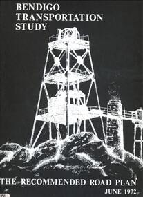
Book - BENDIGO TRANSPORTATION STUDY, 1972
... ...the recommended road plan...The Recommended Road Plan June 1972....The Recommended Road Plan June 1972. Book BENDIGO TRANSPORTATION STUDY ...Bendigo Transportation Study. The Recommended Road Plan June 1972.Rankine & Hill Consulting Engineers.bendigo, council, the recommended road plan, bendigo. -
 Whitehorse Historical Society Inc.
Pamphlet, Creating a New Strathdon Community, 2001
... A vision for the redevelopment of Strathdon's Jolimont Road site, contains Plans of Proposals for site development....Creating a New Strathdon Community: A vision for the redevelopment of Strathdon's Jolimont Road site, contains Plans of Proposals for site development....Whitehorse Historical Society Inc. 2-10 Deep Creek Road Mitcham melbourne A vision for the redevelopment of Strathdon's Jolimont Road site, contains Plans of Proposals for site development. ...Creating a New Strathdon Community.Creating a New Strathdon Community: A vision for the redevelopment of Strathdon's Jolimont Road site, contains Plans of Proposals for site development.Creating a New Strathdon Community.strathdon community, strathdon orchard, matheson, charles, matheson mary, aged people -
Port Melbourne Historical & Preservation Society
Map - Road plans for Fishermens Bend, R S Atkinson, 30 Apr 1946
... CRB Map outlining road plans for Fishermens Bend and including the site of the Commonwealth Aircraft Corporation, Aerodrome, General Holdens and C.S.R.I., 1946...Port Melbourne Historical & Preservation Society Port Melbourne Town Hall 333 Bay Street Port Melbourne melbourne transport - aviation and aerodrome industry - manufacturing fishermans bend CRB Map outlining road plans for Fishermens Bend and including the site of the Commonwealth Aircraft Corporation, Aerodrome, General Holdens and C.S.R.I., 1946 Map Road plans for Fishermens Bend R S Atkinson ...CRB Map outlining road plans for Fishermens Bend and including the site of the Commonwealth Aircraft Corporation, Aerodrome, General Holdens and C.S.R.I., 1946transport - aviation and aerodrome, industry - manufacturing, fishermans bend -
Whitehorse Historical Society Inc.
Map, Survey for road from Doncaster to Ringwood, 01/03/1867
... Survey in County of Bourke, Road Plan no. 390, showing early routes of Doncaster, Whitehorse and Mitcham Roads. ...Survey in County of Bourke, Road Plan no. 390, showing early routes of Doncaster, Whitehorse and Mitcham Roads. ...Survey in County of Bourke, Road Plan no. 390, showing early routes of Doncaster, Whitehorse and Mitcham Roads.Survey in County of Bourke, Road Plan no. 390, showing early routes of Doncaster, Whitehorse and Mitcham Roads. Measurement in chains. Surveyor: Thomas E. Rawlinson.Survey in County of Bourke, Road Plan no. 390, showing early routes of Doncaster, Whitehorse and Mitcham Roads. parish of nunawading, parish of bulleen, whitehorse road mitcham, doncaster road, doncaster east, mitcham road mitcham -
 Whitehorse Historical Society Inc.
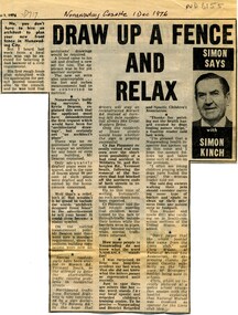
Article, Draw up a fence and relax, 1976
... Including musings on council requirements for fence plans, road traffic problems in Vermont South and the meanings of the acronym NADRASCA....Column by journalist Simon Kinch, including musings on council requirements for fence plans, road traffic problems in Vermont South and the meanings of the acronym NADRASCA...Whitehorse Historical Society Inc. 2-10 Deep Creek Road Mitcham melbourne Including musings on council requirements for fence plans, road traffic problems in Vermont South and the meanings of the acronym NADRASCA. ...Column by journalist Simon Kinch.Column by journalist Simon Kinch, including musings on council requirements for fence plans, road traffic problems in Vermont South and the meanings of the acronym NADRASCAColumn by journalist Simon Kinch.fences, vermont south, nadrasca -
Marysville & District Historical Society
THE TRIANGLE NEWS-VOL 36 NO 4-FEBRUARY 6 2009
... ...t.a.c. road safety...planning...Marysville & District Historical Society 39 Darwin Street Marysville yarra-valley-and-the-dandenong-ranges marysville victoria australia dr lachlan fraser running australian ultramarathon runners assocn deadline advertising rates diary dates snippets from history gallipoli park joe white alex white kerami guest house wandsworth kerami crescent environmental forum disclaimer fire calls indidj art gallery australian & aboriginal art church notices mops women of hope bible quote men's fellowship breakfast life centre alexandra falls family fellowship mount cathedral baptist church buxton 10th anniversary founding fellowship ivor & yvonne jones buxton memorial hall buxton weather graphs marysville fire brigade children's services team trash & treasure stall holders wirreanda festival mystic mountains tourism marysville golfers alexandra cinema narby day narbethong hall bushdance & dinner outreach services murrindindi shire brewers choice home brew david kitchen gluten free beer community health services maryor's chair energy efficient homes councillor comment health & wellbeing new shire officer environment strategy yarra valley grape grazing country touch t.a.c. road safety planning permit notice of application payment of rates & charges marysville real estate marysville medical clinic THE TRIANGLE NEWS-VOL 36 NO 4-FEBRUARY 6 2009 ...marysville, victoria, australia, dr lachlan fraser, running, australian ultramarathon runners assocn, deadline, advertising rates, diary dates, snippets from history, gallipoli park, joe white, alex white, kerami guest house, wandsworth, kerami crescent, environmental forum, disclaimer, fire calls, indidj art gallery, australian & aboriginal art, church notices, mops, women of hope, bible quote, men's fellowship breakfast, life centre alexandra, falls family fellowship, mount cathedral baptist church buxton, 10th anniversary founding fellowship, ivor & yvonne jones, buxton memorial hall, buxton weather graphs, marysville fire brigade, children's services team, trash & treasure stall holders, wirreanda festival, mystic mountains tourism, marysville golfers, alexandra cinema, narby day, narbethong hall, bushdance & dinner, outreach services, murrindindi shire, brewers choice home brew, david kitchen, gluten free beer, community health services, maryor's chair, energy efficient homes, councillor comment, health & wellbeing, new shire officer, environment strategy, yarra valley grape grazing, country touch, t.a.c. road safety, planning permit notice of application, payment of rates & charges, marysville real estate, marysville medical clinic -
Canterbury History Group
Map - Maling Road Urban Renewal Map 1972, 1972
... Road... Town Planning...Canterbury History Group 190A Canterbury Road Canterbury melbourne Canterbury Maling Road Town Planning Maps Photocopy of map of proposed urban renewal in Maling Road Canterbury 1971 Map Maling Road Urban Renewal Map 1972 ...Photocopy of map of proposed urban renewal in Maling Road Canterbury 1971canterbury, maling road, town planning, maps -
Canterbury History Group
Article, Maling Road centre action, 6/09/1989 12:00:00 AM
... Road... Town Planning...Canterbury History Group 190A Canterbury Road Canterbury melbourne Canterbury Maling Road Town Planning Norris> Julia Kullen> Gwenda Shops City of Boroondara Buckley> Kenn Theatres Cinemas Report from the Progress Press, 6 September 1989, on the reprieve won by Maling Road, Canterbury against the over development of the old cinema site. ...Report from the Progress Press, 6 September 1989, on the reprieve won by Maling Road, Canterbury against the over development of the old cinema site. Includes a black and white photograph of Julia Blake and Kenn Buckley.canterbury, maling road, town planning, norris> julia, kullen> gwenda, shops, city of boroondara, buckley> kenn, theatres, cinemas -
Canterbury History Group
Article, Main Street - A people approach
... Road... Town Planning...Canterbury History Group 190A Canterbury Road Canterbury melbourne Canterbury Surrey Hills Burwood Hartwell Shopping Centres Maling Road Town Planning City of Boroondara A discussion from the Camberwell City News, 1991 on the philosophy behind the Main Street programme adopted by the City of Camberwell to encourage community involvement in the improvement and revitalization of established shopping centres in the municipality. 2 pages Main Street - A people approach Article ...A discussion from the Camberwell City News, 1991 on the philosophy behind the Main Street programme adopted by the City of Camberwell to encourage community involvement in the improvement and revitalization of established shopping centres in the municipality.2 pagesA discussion from the Camberwell City News, 1991 on the philosophy behind the Main Street programme adopted by the City of Camberwell to encourage community involvement in the improvement and revitalization of established shopping centres in the municipality.canterbury, surrey hills, burwood, hartwell, shopping centres, maling road, town planning, city of boroondara -
Canterbury History Group
Article, Ready to take time in loo, 6/05/2002 12:00:00 AM
... Road... Town Planning...Canterbury History Group 190A Canterbury Road Canterbury melbourne Canterbury Maling Road Town Planning Toilets Newspaper cutting from the Progress Leader, 6 May 2002, re installation of Public Toilet in Maling Road car park. ...Newspaper cutting from the Progress Leader, 6 May 2002, re installation of Public Toilet in Maling Road car park.canterbury, maling road, town planning, toilets -
Canterbury History Group
Article, City finds site for super loo, 2/10/2000 12:00:00 AM
... Road... Town Planning...Canterbury History Group 190A Canterbury Road Canterbury melbourne Canterbury Maling Road Town Planning Toilets Newspaper cutting from Progress Press , 2 October 2000 re site of Public Toilets City finds site for super loo Article ...Newspaper cutting from Progress Press , 2 October 2000 re site of Public Toiletscanterbury, maling road, town planning, toilets -
 City of Moorabbin Historical Society (Operating the Box Cottage Museum)
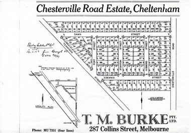
Flyer - Chesterville Road Estate, Cheltenham, 1947
... Chesterville Road Estate, Cheltenham - plan of subdivision...Example of the progress of the Municipality of Moorabbin Tennyson Street Port Street Dennis Street Station Street Dawn Street Hubbard Street Chesterville Road Cheltenham real estate auction Chesterville Road Estate, Cheltenham - plan of subdivision Photocopy of advertising flyer for sale of real estate sales - plan of building blocks for sale Flyer Chesterville Road Estate, Cheltenham ...Chesterville Road Estate, consisting of 101 building lots, was sold by private sale in late 1947.Example of the progress of the Municipality of MoorabbinPhotocopy of advertising flyer for sale of real estate sales - plan of building blocks for saleChesterville Road Estate, Cheltenham - plan of subdivisiontennyson street, port street, dennis street, station street, dawn street, hubbard street, chesterville road, cheltenham, real estate, auction -
Whitehorse Historical Society Inc.
Map, Burwood Road, Box Hill City, 15/02/1952 12:00:00 AM
... Between Greenwood Street and Middleborough Road. Marked as Survey Plan No 5442....Plan of subdivision of 19 blocks in Burwood Road, Burwood between Greenwood Street and Middleborough Road. ...Whitehorse Historical Society Inc. 2-10 Deep Creek Road Mitcham melbourne Between Greenwood Street and Middleborough Road. Marked as Survey Plan No 5442. Land Subdivision Burwood Road Burwood Greenwood Street Burwood Middleborough Road Burwood Plan of subdivision of 19 blocks in Burwood Road, Burwood. ...Plan of subdivision of 19 blocks in Burwood Road, Burwood.Plan of subdivision of 19 blocks in Burwood Road, Burwood between Greenwood Street and Middleborough Road. Marked as Survey Plan No 5442.Plan of subdivision of 19 blocks in Burwood Road, Burwood. land subdivision, burwood road, burwood, greenwood street, burwood, middleborough road, burwood -
 City of Moorabbin Historical Society (Operating the Box Cottage Museum)
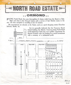
Flyer - North Road Estate, Ormond
... North Road Estate, Ormond - plan of subdivision.36...Example of the progress of the Municipality of Moorabbin North Road Wicklow St Leinster St ormond real estate North Road Estate, Ormond - plan of subdivision.36 Advertising flyer for auction of real estate sales - plan of building blocks for sale Flyer North Road Estate, Ormond ...At the end of World War One, there was a renewed interest in residential land and a number of estates opened up in the Municipality of Moorabbin.Example of the progress of the Municipality of MoorabbinAdvertising flyer for auction of real estate sales - plan of building blocks for saleNorth Road Estate, Ormond - plan of subdivision.36north road, wicklow st, leinster st, ormond, real estate -
Whitehorse Historical Society Inc.
Document, Nunawading South State School
... Photocopies of photos of the land before and during building. Road Plan. Notice from Native Plants Preservation Society....Photocopies of photos of the land before and during building. Road Plan. Notice from Native Plants Preservation Society. ...Documents relating to purchase of land to build Nunawading South State School. Land purchased from K.E. & L.A. Jones. Photocopies of photos of the land before and during building. Road Plan. Notice from Native Plants Preservation Society.nunawading south state school no. 4808, k.e. & l.a. jones, victoria. education department, native plants preservation society of victoria -
 Sunshine and District Historical Society Incorporated
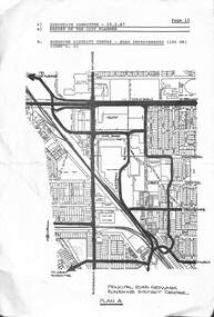
Document - Sunshine District Road Proposed Improvements 1987, 25th February 1987
... Executive Committee 25.2.87 Page 13|Report of the City Planner|Sunshine District Centre Road Improvements Plan A...This item was part of the Gwen Goedecke donation Executive Committee 25.2.87 Page 13|Report of the City Planner|Sunshine District Centre Road Improvements Plan A Extract from the City of Sunshine Executive Committee Report 25th February 1987 Page 13 Document Sunshine District Road Proposed Improvements 1987 ...This item was part of the Gwen Goedecke donationExecutive Committee 25.2.87 Page 13|Report of the City Planner|Sunshine District Centre Road Improvements Plan A -
Canterbury History Group
Article, Hush on first flush, 10/06/2002 12:00:00 AM
... Road... Toilets... Town Planning...Canterbury History Group 190A Canterbury Road Canterbury melbourne Canterbury Maling Road Toilets Town Planning Newspaper cutting from the Progress Leader 10 June 2002, re the operation of public toilets in Maling Road car park Hush on first flush Article ...Newspaper cutting from the Progress Leader 10 June 2002, re the operation of public toilets in Maling Road car parkcanterbury, maling road, toilets, town planning -
Canterbury History Group
Article, Win some, loos some, 23/07/2001 12:00:00 AM
... Road... Toilets... Town Planning...Canterbury History Group 190A Canterbury Road Canterbury melbourne Canterbury Maling Road Toilets Town Planning Newspaper cutting from the Progress Leader, 23 July 2001. discussion of future site and style of toilet Win some, loos some. ...Newspaper cutting from the Progress Leader, 23 July 2001. discussion of future site and style of toiletcanterbury, maling road, toilets, town planning -
Canterbury History Group
Article, Objector pans new loo site, 3/09/2001 12:00:00 AM
... Road... Toilets... Town Planning...Canterbury History Group 190A Canterbury Road Canterbury melbourne Canterbury Maling Road Toilets Town Planning Newspaper cutting from the Progress Leader, 3 September 2001. ...Newspaper cutting from the Progress Leader, 3 September 2001. Criticisim of Public Toilet sitecanterbury, maling road, toilets, town planning -
Canterbury History Group
Article, Lulu of a wait for loo, 23/01/2002 12:00:00 AM
... Road... Toilets... Town Planning...Canterbury History Group 190A Canterbury Road Canterbury melbourne Canterbury Maling Road Toilets Town Planning City of Boroondara Newspaper cutting from the Progress Press, 23 January 2002 of the opening of the public toilet in Maling Road car park by Boroondara Mayor Meredith Butler. ...Newspaper cutting from the Progress Press, 23 January 2002 of the opening of the public toilet in Maling Road car park by Boroondara Mayor Meredith Butler.canterbury, maling road, toilets, town planning, city of boroondara -
Canterbury History Group
Article, Water loo battle won, 7/01/2002 12:00:00 AM
... Road... Toilets... Town Planning...Canterbury History Group 190A Canterbury Road Canterbury melbourne Canterbury Maling Road Toilets Town Planning Bryson Street Victorian Civil and Administrative Tribunal City of Boroondara Newspaper cutting from the Progress Leader, 7 January 2002 on VCAT decision on toilet location Water loo battle won Article ...Newspaper cutting from the Progress Leader, 7 January 2002 on VCAT decision on toilet locationcanterbury, maling road, toilets, town planning, bryson street, victorian civil and administrative tribunal, city of boroondara -
 Eltham District Historical Society Inc
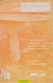
Book, A Review and Appraisal of the Diamond Creek to Ringwood Study, volume 2, working paper, by Loder and Bayly, 1979
... This report is a review and appraisal of the Outer Ring Road Study Diamond Creek to Ringwood prepared for The Road Planning Liaison Committee by the Joint Road Planning Group for the The City of Doncaster & Templestowe and The Shire of Eltham by Loder & Bayly Planning & Engineering Consultants. ...This report is a review and appraisal of the Outer Ring Road Study Diamond Creek to Ringwood prepared for The Road Planning Liaison Committee by the Joint Road Planning Group for the The City of Doncaster & Templestowe and The Shire of Eltham by Loder & Bayly Planning & Engineering Consultants. ...Volume 2: Working papers. This report is a review and appraisal of the Outer Ring Road Study Diamond Creek to Ringwood prepared for The Road Planning Liaison Committee by the Joint Road Planning Group for the The City of Doncaster & Templestowe and The Shire of Eltham by Loder & Bayly Planning & Engineering Consultants. "This paper attempts to set a framework for an evaluation of the recommended road link between Diamond Creek and Ringwood." Various perspectives are examined. Includes fold out maps.91 p, maps, 27 cm.melbourne ring road, roads, freeways -
 Kew Historical Society Inc
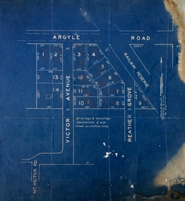
Plan - Subdivision Plan, Argyle Road, Heather Grove, Victor Avenue, Kew, c.1937
... These early plans were assembled by a local firm, Jas R Mather & McMillan, which had an office in Cotham Road. ...Undated blue subdivision plan in Kew of 14 lots facing Argyle Road, Heather Grove and Victor Road. ...These early plans were assembled by a local firm, Jas R Mather & McMillan, which had an office in Cotham Road. ...The Kew Historical Society's map collection includes a substantial number of real estate subdivision plans, mainly of Kew but also of surrounding suburbs in Melbourne. Most of the subdivision plans date from the 1920s and 1930s when the districts old homes and local farmland were being split up to accommodate residential growth in the postwar period. These early plans were assembled by a local firm, Jas R Mather & McMillan, which had an office in Cotham Road. Many of the plans, and sometimes photos, were annotated by the agents.Subdivision plans are historically important documents used as evidence for the growth of suburbs in Australia. They frequently provide information about when the land was sold as well as evidence relating to surveyors and real estate and financial agents. The numerous subdivision plans in the Kew Historical Society's collection represent working documents, ranging from the initial sketches made in planning a subdivision to printed plans on which auctioneers or agents listed the prices for which individual lots were sold. In a number of cases, the reverse of a subdivision plan in the collection includes a photograph of a house that was also for sale by the agent. These photographs provide significant heritage information relating house design and decoration, fencing and household gardens.The photograph may also be aesthetically significant depending on the importance of the photographic atelier.Undated blue subdivision plan in Kew of 14 lots facing Argyle Road, Heather Grove and Victor Road. The Plan identifies Tuxen & Miller as the surveyors. [Formerly catalogued as MAP.0059]subdivision plans - kew, argyle road - kew, heather grove - kew, victor avenue - kew -
 Dutch Australian Heritage Centre Victoria
Road Map, Nederland
... Falk Plan. Road Map. Netherlands. Repeated in Dutch, French and German....Dutch Australian Heritage Centre Victoria 60 Rosstown Road Carnegie melbourne Falk Plan. Road Map. Netherlands. ...Cleverly folded 1:250,000 road map produced in Dutch, French, German and English containing not only the Dutch road network but also much information of interest to tourists. It is enclosed in a brown imitation leather cover that closes with a stud. Optimal ease of use through patented Falk folding mode.Falk Plan. Road Map. Netherlands. Repeated in Dutch, French and German.