Showing 66 items matching "road reserve housing"
-
 Eltham District Historical Society Inc
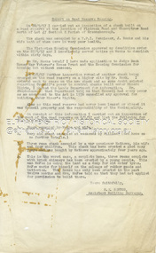
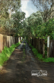
Document - Report, G.E. Newton, Road Reserve Housing, Aug. 1957
... Road Reserve Housing...Road reserve...Road Reserve Housing...Road Reserve Housing Document Report G.E. Newton ...Shack built on road reserve without permit Most probably up on Simms Road, Kinglake Other areas where illegal shacks were built were at the junction of Flat Rock Road and Cherry Tree Road, Hurstbridge. At times, Building Surveyor George E Newton would have to attend to these shacks for inspection and issue demolition orders Related to photos: EDHS_05580-1/2/3Record of various Shire of Eltham infrastructure works undertaken during the period of 1952-1962 involving bridge and road reconstruction projects, sometimes with Eltham Shire Council Project Reference numbers quoted. It was during this period that a number of significant improvements were made to roads and new bridges constructed within the shire that remain in place as of present day (2022). In many situations, the photos provide a tangible visible record of infrastructure that existed throughout the early days of the Shire. The album was put together by or under the direction of the Shire Engineer, J.A. McDonald.infrastructure, shire of eltham, building surveyor, cherry tree road, flat rock road, george e. newton, houses, hurstbridge, road reserve, road reserve housing, shack -
 Eltham District Historical Society Inc
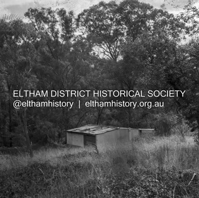
Negative - Photograph, J.A. McDonald, Road Reserve Housing, Mar. 1961
... Road Reserve Housing...Road reserve...Road Reserve Housing...Road Reserve Housing Negative Photograph J.A. McDonald ...Shack built on road reserve without permit Most probably up on Simms Road, Kinglake Other areas where illegal shacks were built wer at the junction of Flat Rock Road and Cherry Tree Road, Hurstbridge. At times, Building Surveyor George E Newton would have to attend to these shacks for inspection and issue demolition ordersRecord of various Shire of Eltham infrastructure works undertaken during the period of 1952-1962 involving bridge and road reconstruction projects, sometimes with Eltham Shire Council Project Reference numbers quoted. It was during this period that a number of significant improvements were made to roads and new bridges constructed within the shire that remain in place as of present day (2022). In many situations, the photos provide a tangible visible record of infrastructure that existed throughout the early days of the Shire. The album was put together by or under the direction of the Shire Engineer, J.A. McDonald.infrastructure, shire of eltham, 1961-03, building surveyor, cherry tree road, flat rock road, george e. newton, houses, hurstbridge, kinglake, road reserve, road reserve housing, scan - 120 format 6x6 negative, shack, simms road -
 Eltham District Historical Society Inc
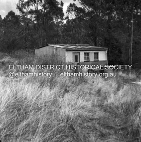
Negative - Photograph, J.A. McDonald, Road Reserve Housing, Mar. 1961
... Road Reserve Housing...Road reserve...Road Reserve Housing...Road Reserve Housing Negative Photograph J.A. McDonald ...Shack built on road reserve without permit Most probably up on Simms Road, Kinglake Other areas where illegal shacks were built wer at the junction of Flat Rock Road and Cherry Tree Road, Hurstbridge. At times, Building Surveyor George E Newton would have to attend to these shacks for inspection and issue demolition ordersRecord of various Shire of Eltham infrastructure works undertaken during the period of 1952-1962 involving bridge and road reconstruction projects, sometimes with Eltham Shire Council Project Reference numbers quoted. It was during this period that a number of significant improvements were made to roads and new bridges constructed within the shire that remain in place as of present day (2022). In many situations, the photos provide a tangible visible record of infrastructure that existed throughout the early days of the Shire. The album was put together by or under the direction of the Shire Engineer, J.A. McDonald.infrastructure, shire of eltham, 1961-03, building surveyor, cherry tree road, flat rock road, george e. newton, houses, hurstbridge, kinglake, road reserve, road reserve housing, scan - 120 format 6x6 negative, shack, simms road -
 Eltham District Historical Society Inc
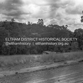
Negative - Photograph, J.A. McDonald, Road Reserve Housing, Mar. 1961
... Road Reserve Housing...Road reserve...Road Reserve Housing...Road Reserve Housing Negative Photograph J.A. McDonald ...Shack built on road reserve without permit Most probably up on Simms Road, Kinglake Other areas where illegal shacks were built were at the junction of Flat Rock Road and Cherry Tree Road, Hurstbridge. At times, Building Surveyor George E Newton would have to attend to these shacks for inspection and issue demolition ordersRecord of various Shire of Eltham infrastructure works undertaken during the period of 1952-1962 involving bridge and road reconstruction projects, sometimes with Eltham Shire Council Project Reference numbers quoted. It was during this period that a number of significant improvements were made to roads and new bridges constructed within the shire that remain in place as of present day (2022). In many situations, the photos provide a tangible visible record of infrastructure that existed throughout the early days of the Shire. The album was put together by or under the direction of the Shire Engineer, J.A. McDonald.infrastructure, shire of eltham, 1961-03, building surveyor, cherry tree road, flat rock road, george e. newton, houses, hurstbridge, kinglake, road reserve, road reserve housing, scan - 120 format 6x6 negative, shack, simms road -
 Warrnambool and District Historical Society Inc.
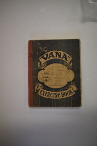
Tradesman’s Work Diary, Book, 1940s
... road This exercise book contains details on the work carried out by A.Greed, a tradesman undertaking small carpentry and repair jobs in the Warrnambool region. The works completed date from 17 April 1945 to 11 October 1949. Mr Greed apparently worked mostly for the Public Works Department and had contracts for schools including Ecklin South, Panmure, Cudgee, Dennington, Mailors Flat, Grasmere, and Warrnambool Technical School and for other public buildings including the Warrnambool Court House, the Police Station and Housing Commission buildings. Other contracts included ones for the Framlingham Aboriginal Reserve ...This exercise book contains details on the work carried out by A.Greed, a tradesman undertaking small carpentry and repair jobs in the Warrnambool region. The works completed date from 17 April 1945 to 11 October 1949. Mr Greed apparently worked mostly for the Public Works Department and had contracts for schools including Ecklin South, Panmure, Cudgee, Dennington, Mailors Flat, Grasmere, and Warrnambool Technical School and for other public buildings including the Warrnambool Court House, the Police Station and Housing Commission buildings. Other contracts included ones for the Framlingham Aboriginal Reserve, Callaghan’s Garage, the Caledonian Hotel, the Methodist Croquet Club and many private home owners. Details on the identity of ‘A. Greed’ are not known as there are several possibilities for the 1940s era. One clue is that an ‘E. Greed’ was also an employee.This exercise book is of some interest as an example of a tradesman’s handwritten details of his work as a carpenter and repair man in the 1940s in the Warrnambool area. There are many local names and businesses of interest mentioned in the exercise book. This is an exercise book with a grey cover with red binding. The dark blue printing on the front cover is enclosed in scroll patterns and the back cover has dark blue printing The cover is creased and has some ink splotches. The front cover has been stamped but the printing is now mostly illegible. The pages contain handwritten work and accounting information in black and blue ink. Some pages have been overwritten in red and black ink and pencil and there is one loose sheet.The Vana Exercise Booka.greed,, warrnambool tradesman, history of warrnambool -
 Glen Eira Historical Society
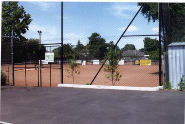
Photograph, Dalny Road, 5-17 Rear, Murrumbeena, 2001
... roads, shops and recreation facilities. In this respect it was the forerunner of the comprehensively planned housing estate of the post war era. The estate is distinguished by its aesthetic values, as is the earlier and comparable Hillcrest Estate, which are formed by a combination of restrained diversity in house styles, with the exception of no. 30 in the emerging International style, and by a landscaped garden environment. murrumbeena houses 1930's a.v. jennings av jennings jennings beauville estate jennings albert victor parks and reserves sports and recreations establishments clubhouses tennis clubs beauville tennis courts st patrick's tennis club sir albert victor jennings a v jennings construction co beauville estate heritage area glen eira city council architectural features jennings group limited land subdivision gardens beauville historic area dalny road Colour photograph of a tennis club house and a park on the Beauville Estate. ...Originally labelled "Beauville Estate, Established 1936, Still Thriving 65 years on, 10th March 2001", the Beauville Estate Album contains colour photographs of houses in the Estate. They were taken around the time of the Beauville Estate’s 65th Heritage Celebration held on 10/03/2001 and donated to the Caulfield Historical Society shortly afterwards. Photographer unknown. From Glen Eira’s Heritage Management Plan by Andrew Ward (1996) Vol 2 p78: "Beauville Avenue is unusual in that it is terminated in a cul-de-sac (see Section 3.9.2) whilst the design of the estate may well be unique for its time in that the houses back onto 6 tennis courts for public use. St. Patrick's Church, which adjoins the estate is a comparatively recent structure whilst the school has one building erected in 1930 and prior to the release of the Beauville lots." It also notes that St.Patrick's Church and School now run the tennis courts.City of Glen Eira’s Heritage Management Plan Vol 2 p79 (this is p84 of the pdf version) – HO12 Beauville Estate and environs, Murrumbeena: The Beauville Historic Area is important at the State level as the first large housing estate undertaken by the AV Jennings Construction Co, later Jennings Group Limited, Victoria’s largest home builder. It is important also as a very early estate development incorporating a range of features other than houses and including made roads, shops and recreation facilities. In this respect it was the forerunner of the comprehensively planned housing estate of the post war era. The estate is distinguished by its aesthetic values, as is the earlier and comparable Hillcrest Estate, which are formed by a combination of restrained diversity in house styles, with the exception of no. 30 in the emerging International style, and by a landscaped garden environment. Colour photograph of a tennis club house and a park on the Beauville Estate. murrumbeena, houses, 1930's, a.v. jennings, av jennings, jennings, beauville estate, jennings albert victor, parks and reserves, sports and recreations establishments, clubhouses, tennis clubs, beauville tennis courts, st patrick's tennis club, sir albert victor jennings, a v jennings construction co, beauville estate heritage area, glen eira city council, architectural features, jennings group limited, land subdivision, gardens, beauville historic area, dalny road -
 Glen Eira Historical Society
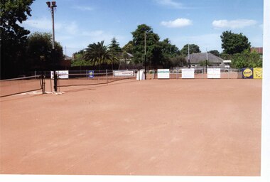
Photograph, Dalny Road, 5-17 Rear, Murrumbeena, 2001
... roads, shops and recreation facilities. In this respect it was the forerunner of the comprehensively planned housing estate of the post war era. The estate is distinguished by its aesthetic values, as is the earlier and comparable Hillcrest Estate, which are formed by a combination of restrained diversity in house styles, with the exception of no. 30 in the emerging International style, and by a landscaped garden environment. murrumbeena houses 1930's a.v. jennings av jennings jennings beauville estate parks and reserves sports and recreations establishments tennis courts sportsgrounds sir albert victor jennings a v jennings construction co beauville estate heritage area glen eira city council architectural features jennings group limited land subdivision gardens beauville historic area tennis clubs beauville tennis courts st patrick's tennis club dalny road Colour photograph of tennis courts and surrounding mesh fencing on the Beauville Estate. ...Originally labelled "Beauville Estate, Established 1936, Still Thriving 65 years on, 10th March 2001", the Beauville Estate Album contains colour photographs of houses in the Estate. They were taken around the time of the Beauville Estate’s 65th Heritage Celebration held on 10/03/2001 and donated to the Caulfield Historical Society shortly afterwards. Photographer unknown. From Glen Eira’s Heritage Management Plan by Andrew Ward (1996) Vol 2 p78: "Beauville Avenue is unusual in that it is terminated in a cul-de-sac (see Section 3.9.2) whilst the design of the estate may well be unique for its time in that the houses back onto 6 tennis courts for public use. St. Patrick's Church, which adjoins the estate is a comparatively recent structure whilst the school has one building erected in 1930 and prior to the release of the Beauville lots." It also notes that St.Patrick's Church and School now run the tennis courts.City of Glen Eira’s Heritage Management Plan Vol 2 p79 (this is p84 of the pdf version) – HO12 Beauville Estate and environs, Murrumbeena: The Beauville Historic Area is important at the State level as the first large housing estate undertaken by the AV Jennings Construction Co, later Jennings Group Limited, Victoria’s largest home builder. It is important also as a very early estate development incorporating a range of features other than houses and including made roads, shops and recreation facilities. In this respect it was the forerunner of the comprehensively planned housing estate of the post war era. The estate is distinguished by its aesthetic values, as is the earlier and comparable Hillcrest Estate, which are formed by a combination of restrained diversity in house styles, with the exception of no. 30 in the emerging International style, and by a landscaped garden environment. Colour photograph of tennis courts and surrounding mesh fencing on the Beauville Estate. murrumbeena, houses, 1930's, a.v. jennings, av jennings, jennings, beauville estate, parks and reserves, sports and recreations establishments, tennis courts, sportsgrounds, sir albert victor jennings, a v jennings construction co, beauville estate heritage area, glen eira city council, architectural features, jennings group limited, land subdivision, gardens, beauville historic area, tennis clubs, beauville tennis courts, st patrick's tennis club, dalny road -
 Glen Eira Historical Society
Photograph, Dalny Road, 5-17 Rear, Murrumbeena, 2001
... roads, shops and recreation facilities. In this respect it was the forerunner of the comprehensively planned housing estate of the post war era. The estate is distinguished by its aesthetic values, as is the earlier and comparable Hillcrest Estate, which are formed by a combination of restrained diversity in house styles, with the exception of no. 30 in the emerging International style, and by a landscaped garden environment. murrumbeena houses 1930's a.v. jennings av jennings jennings beauville estate parks and reserves sports and recreations establishments tennis courts sportsgrounds sir albert victor jennings a v jennings construction co beauville estate heritage area glen eira city council architectural features jennings group limited land subdivision gardens beauville historic area tennis clubs beauville tennis courts st patrick's tennis club dalny road Colour photograph of tennis courts with lights on the Beauville Estate. ...Originally labelled "Beauville Estate, Established 1936, Still Thriving 65 years on, 10th March 2001", the Beauville Estate Album contains colour photographs of houses in the Estate. They were taken around the time of the Beauville Estate’s 65th Heritage Celebration held on 10/03/2001 and donated to the Caulfield Historical Society shortly afterwards. Photographer unknown. From Glen Eira’s Heritage Management Plan by Andrew Ward (1996) Vol 2 p78: "Beauville Avenue is unusual in that it is terminated in a cul-de-sac (see Section 3.9.2) whilst the design of the estate may well be unique for its time in that the houses back onto 6 tennis courts for public use. St. Patrick's Church, which adjoins the estate is a comparatively recent structure whilst the school has one building erected in 1930 and prior to the release of the Beauville lots." It also notes that St.Patrick's Church and School now run the tennis courts. City of Glen Eira’s Heritage Management Plan Vol 2 p79 (this is p84 of the pdf version) – HO12 Beauville Estate and environs, Murrumbeena: The Beauville Historic Area is important at the State level as the first large housing estate undertaken by the AV Jennings Construction Co, later Jennings Group Limited, Victoria’s largest home builder. It is important also as a very early estate development incorporating a range of features other than houses and including made roads, shops and recreation facilities. In this respect it was the forerunner of the comprehensively planned housing estate of the post war era. The estate is distinguished by its aesthetic values, as is the earlier and comparable Hillcrest Estate, which are formed by a combination of restrained diversity in house styles, with the exception of no. 30 in the emerging International style, and by a landscaped garden environment. Colour photograph of tennis courts with lights on the Beauville Estate. murrumbeena, houses, 1930's, a.v. jennings, av jennings, jennings, beauville estate, parks and reserves, sports and recreations establishments, tennis courts, sportsgrounds, sir albert victor jennings, a v jennings construction co, beauville estate heritage area, glen eira city council, architectural features, jennings group limited, land subdivision, gardens, beauville historic area, tennis clubs, beauville tennis courts, st patrick's tennis club, dalny road -
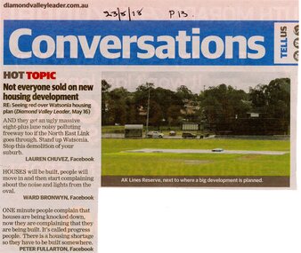 Greensborough Historical Society
Article - Newspaper Clipping, Diamond Valley Leader, Conversation column of Diamond Valley Leader 23/05/2018 p. 13, 22/05/2018
... Greensborough Historical Society 34A Glenauburn Road Lower Plenty Lower Plenty melbourne Critical remarks about the proposed housing development in the vicinity of A K Lines Reserve, Watsonia a k lines reserve houses in Watsonia north east link Watsonia - Places Three short reader contributions to "Conversations" column, with colour photograph of A K Lines Reserve Conversation column of Diamond Valley Leader 23/05/2018 p. 13 Article Newspaper Clipping Diamond Valley Leader ...Critical remarks about the proposed housing development in the vicinity of A K Lines Reserve, WatsoniaThree short reader contributions to "Conversations" column, with colour photograph of A K Lines Reservea k lines reserve, houses in watsonia, north east link, watsonia - places -
 Greensborough Historical Society
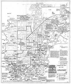
Map, Heidelberg: Historic River Landscape Assessment. Historical maps. Map E 1901-1934 "A Time of projects and improvements", 1985c
... Geographical area of around 35 sq. kilometres marked with physical features such as major roads, railways (new extension to Eltham), rivers and properties, also housing sub-divisions and community facilities such as hospitals, parks and sporting reserves and indications of new small scale industries such as dairying. ...Greensborough Historical Society 34A Glenauburn Road Lower Plenty Lower Plenty melbourne Geographical area of around 35 sq. kilometres marked with physical features such as major roads, railways (new extension to Eltham), rivers and properties, also housing sub-divisions and community facilities such as hospitals, parks and sporting reserves and indications of new small scale industries such as dairying. ...Geographical area of around 35 sq. kilometres marked with physical features such as major roads, railways (new extension to Eltham), rivers and properties, also housing sub-divisions and community facilities such as hospitals, parks and sporting reserves and indications of new small scale industries such as dairying. Bounded by Shire of Diamond Valley to the North, Darebin Creek to the West and Plenty River to the East. Black and white sketch map on white paperheidelberg, heidelberg - maps -
 Phillip Island and District Historical Society Inc.
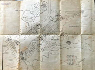
Map, Map of Summerland Golf Course, 15/12/1927
... housing estate, guest house and golf course. This area was acquired and all buildings, roads etc removed by the Victorian Government in the 1980s for a nature reserve for the penguins. ...housing estate, guest house and golf course. This area was acquired and all buildings, roads etc removed by the Victorian Government in the 1980s for a nature reserve for the penguins. ...Summerland Estate was created in the 1920s by A.K. T. Sampbell. It consisted of a housing estate, guest house and golf course. This area was acquired and all buildings, roads etc removed by the Victorian Government in the 1980s for a nature reserve for the penguins. This is believed to be the only time in the world when humans have been removed to benefit nature. HistoricalPurple leather covered fold out linen map with hand drawn diagram of the topography, layout of golf holes and club house Broken sand dunes, rough sandy hills, grassy hills and mounds, Swan Lake, Par for nine holes 34, Scratch score for nine holes 36, Drawn by A. Russell 12/12/1927summerland estate, a.k. t. sampbell, map, penguin reserve, summerland golf course -
 Eltham District Historical Society Inc
Slide, Quinn Estate near Sackville Reserve, Montmorency, c.Oct. 1980
... roads and infrastructure focussed on the Quinn Estate in Montmorency taken by Eltham Shire Council Planning and Engineering officers. They provide perspective of the changes in housing styles and road development that began sweeping in from the mid 1970s with increasing urbanisation of what was once more outlying suburbs and regions. quinn estate Housing estate Infrastructure Montmorency Roads Sackville Reserve Sackville Street Processed Oct 1980 35 mm colour positive transparency Mount - Kodak Kodachrome Card Quinn Estate near Sackville Reserve, Montmorency Slide Slide ...One of a series of images of roads and infrastructure focussed on the Quinn Estate in Montmorency taken by Eltham Shire Council Planning and Engineering officers. They provide perspective of the changes in housing styles and road development that began sweeping in from the mid 1970s with increasing urbanisation of what was once more outlying suburbs and regions.35 mm colour positive transparency Mount - Kodak Kodachrome CardProcessed Oct 1980quinn estate, housing estate, infrastructure, montmorency, roads, sackville reserve, sackville street -
 Eltham District Historical Society Inc
Slide, Belmont Crescent, Montmorency, c. Mar. 1981
... road infrastructure focussed on Belmont Crescent in Montmorency taken by Eltham Shire Council Planning and Engineering officers. They provide perspective of the changes in housing styles and road development that began sweeping in from the mid 1970s with increasing urbanisation of what was once more outlying suburbs and regions. All images have been identified with GPS infrastructure montmorency roads belmont crescent Aanensen Court Reserve ...One of a series of images of road infrastructure focussed on Belmont Crescent in Montmorency taken by Eltham Shire Council Planning and Engineering officers. They provide perspective of the changes in housing styles and road development that began sweeping in from the mid 1970s with increasing urbanisation of what was once more outlying suburbs and regions. All images have been identified with GPS35 mm colour positive transparency (1 of 8) Mount - Kodak Kodachrome CardProcessed Mar 1981infrastructure, montmorency, roads, belmont crescent, aanensen court reserve -
 Eltham District Historical Society Inc
Slide, Belmont Crescent, Montmorency, c. Mar. 1981
... road infrastructure focussed on Belmont Crescent in Montmorency taken by Eltham Shire Council Planning and Engineering officers. They provide perspective of the changes in housing styles and road development that began sweeping in from the mid 1970s with increasing urbanisation of what was once more outlying suburbs and regions. All images have been identified with GPS infrastructure montmorency roads belmont crescent aanensen court reserve ...One of a series of images of road infrastructure focussed on Belmont Crescent in Montmorency taken by Eltham Shire Council Planning and Engineering officers. They provide perspective of the changes in housing styles and road development that began sweeping in from the mid 1970s with increasing urbanisation of what was once more outlying suburbs and regions. All images have been identified with GPS35 mm colour positive transparency (1 of 8) Mount - Kodak Kodachrome CardProcessed Mar 1981infrastructure, montmorency, roads, belmont crescent, aanensen court reserve -
 Eltham District Historical Society Inc
Slide, Quinn Estate, Sackville Street, Montmorency, May 1983
... road sealing...footpaths and gutters...private street scheme...housing estate...montmorency...quinn estate...Sackville Reserve...Eltham District Historical Society Inc 728 Main Rd Eltham melbourne One of a series of images of roads and infrastructure taken by Eltham Shire Council Planning and Engineering officers, May 1983 specifically looking at Private Street Schemes post road construction/sealing operations roads infrastructure road sealing footpaths and gutters private street scheme housing estate montmorency quinn estate Sackville Reserve Sackville Street 35 mm colour positive transparency (1 of 21) Mount - Kodak Kodachrome Card Quinn Estate, Sackville Street, Montmorency Slide Slide ...One of a series of images of roads and infrastructure taken by Eltham Shire Council Planning and Engineering officers, May 1983 specifically looking at Private Street Schemes post road construction/sealing operations35 mm colour positive transparency (1 of 21) Mount - Kodak Kodachrome Cardroads, infrastructure, road sealing, footpaths and gutters, private street scheme, housing estate, montmorency, quinn estate, sackville reserve, sackville street -
 Eltham District Historical Society Inc
Photograph, Water Main Pipe Track (Madine Way-Bainbridge Drive), Eltham, 3 Sep 1981
... roads and houses in the Eltham East area, 3 September 1981 prior to construction of new water main; including views of existing damage to footpaths and gutters and general views of Beard Street. These images provide a perspective of housing estate developments and changes in housing styles and road development which began sweeping in from the mid 1970s with increasing urbanisation of what was once more outlying suburbs and regions. eltham infrastructure roads Bainbridge Drive Linear Reserve madine Way Water Main Pipe Track 35mm colour positive transparency (1 of 28) Mount - Kodak Kodachrome Card Water Main Pipe Track (Madine Way-Bainbridge Drive), Eltham Photograph Photograph ...Roll of film taken by Eltham Shire Council officers of roads and houses in the Eltham East area, 3 September 1981 prior to construction of new water main; including views of existing damage to footpaths and gutters and general views of Beard Street. These images provide a perspective of housing estate developments and changes in housing styles and road development which began sweeping in from the mid 1970s with increasing urbanisation of what was once more outlying suburbs and regions.35mm colour positive transparency (1 of 28) Mount - Kodak Kodachrome Cardeltham, infrastructure, roads, bainbridge drive linear reserve, madine way, water main pipe track -
 Eltham District Historical Society Inc
Photograph, Water Main Pipe Track (Madine Way-Bainbridge Drive), Eltham, 3 Sep 1981
... roads and houses in the Eltham East area, 3 September 1981 prior to construction of new water main; including views of existing damage to footpaths and gutters and general views of Beard Street. These images provide a perspective of housing estate developments and changes in housing styles and road development which began sweeping in from the mid 1970s with increasing urbanisation of what was once more outlying suburbs and regions. eltham infrastructure roads bainbridge drive linear reserve madine way water main pipe track 35mm colour positive transparency (1 of 28) Mount - Kodak Kodachrome Card Water Main Pipe Track (Madine Way-Bainbridge Drive), Eltham Photograph Photograph ...Roll of film taken by Eltham Shire Council officers of roads and houses in the Eltham East area, 3 September 1981 prior to construction of new water main; including views of existing damage to footpaths and gutters and general views of Beard Street. These images provide a perspective of housing estate developments and changes in housing styles and road development which began sweeping in from the mid 1970s with increasing urbanisation of what was once more outlying suburbs and regions.35mm colour positive transparency (1 of 28) Mount - Kodak Kodachrome Cardeltham, infrastructure, roads, bainbridge drive linear reserve, madine way, water main pipe track -
 Eltham District Historical Society Inc
Photograph, Slab hut, Warrandyte, Warrandyte Mystery Tour, 29 May 1994, 29/05/1994
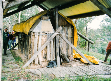
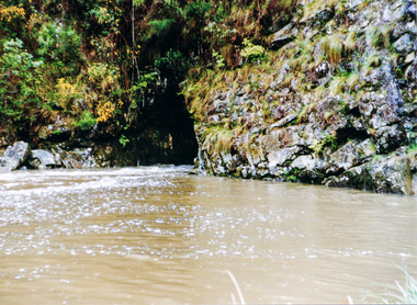
... road metal'. Warrandyte is proud to be the first declared Goldfield in 1851, and one of the longest surviving, into the 1920s. A pleasant drive across the Bridge and along Bradley's Lane to Norman's Reserve brought us to see another Tunnel at Pound Bend through which the Yarra was diverted to allow about three miles of river-bed to be used for prospecting for alluvial gold. Still on this side of the river we visited the Old Slab Hut in Castles Road. This remnant of miners' housing...road metal'. Warrandyte is proud to be the first declared Goldfield in 1851, and one of the longest surviving, into the 1920s. A pleasant drive across the Bridge and along Bradley's Lane to Norman's Reserve brought us to see another Tunnel at Pound Bend through which the Yarra was diverted to allow about three miles of river-bed to be used for prospecting for alluvial gold. Still on this side of the river we visited the Old Slab Hut in Castles Road. This remnant of miners' housing ...[article by Bettina Woodburn in EDHS Newsletter No. 97, July 1994:] THE WARRANDYTE MYSTERY TOUR MAY 29TH 1994 - Members of the Eltham Historical Society met at the Old Post Office, now converted into the Warrandyte Historical Museum, for a picnic lunch on the sunny back verandah overlooking the shimmering Yarra River. Interesting photographs and artefacts filled various rooms outlining the history of this area, and told tales of Aboriginal and more recent neighbours of the Eltham Shire. The weather was calm, cloudy mostly with only occasional sunny patches, but it wasn't cold, although the autumnal leaf colours had changed to wintry brown. "All Aboard" and we set off in the Warrandyte Community Bus (with the School Bus sign displayed at the rear) to learn about local places of "Pride and Joy” from Bruce our guide and Tom the driver. Almost directly opposite we entered Whipstick Gully to explore the first of the district's hidden treasures - the Victory, one of the largest of the six or so major mines, past the old quarry now used for abseiling practice. By torchlight we entered the rocky hillside and saw the seams of quartz the miners had followed in their search for gold. Stamping batteries, and there was one in this gully, converted discarded rock into 'road metal'. Warrandyte is proud to be the first declared Goldfield in 1851, and one of the longest surviving, into the 1920s. A pleasant drive across the Bridge and along Bradley's Lane to Norman's Reserve brought us to see another Tunnel at Pound Bend through which the Yarra was diverted to allow about three miles of river-bed to be used for prospecting for alluvial gold. Still on this side of the river we visited the Old Slab Hut in Castles Road. This remnant of miners' housing is preserved because it had been incorporated into a weatherboard house, and saved from the bulldozers - a last minute reprieve, for preservation, by the National Trust. Devastating bush fires have destroyed other old cottages built of wattle and daub, with bark roofs and stone fire-places. The Cairn commemorating the disclosure of Gold Discovery at Warrandyte on June 30th 1851 beside Anderson's Creek Road was our next point of historical interest. We drove on to South Warrandyte and circled back to above the ford on Anderson's Creek to the entrance of the 4th Hill Mine. Again we crept along with our torches, careful of the low roof-rock, and side shafts. At a junction in a large cavity we were able to stand, look up a long air-vent which some 'cavers' climb down, and marvel at, and experience an aspect of a miner's life. Outside we heard the same bird songs, the trills and bell-pealing, saw the same straggly eucalypts, and a silver leafed wattle in flower, native grasses and ferns, and the neat present day houses, often of Warrandyte stone, perhaps veneered only. The day ended pleasantly, seeing more of the Yarra from Everard Drive, and the water rushing out of the Tunnel at Pound Bend, before returning to afternoon tea or coffee at the Museum. A great day for all concerned - many thanks to the Organisers.Colour photographslab hut, warrandyte, "warrandyte miner's cottage" -
 Eltham District Historical Society Inc
Photograph, Pound Bend tunnel, Warrandyte, Warrandyte Mystery Tour, 29 May 1994, 29/05/1994
... road metal'. Warrandyte is proud to be the first declared Goldfield in 1851, and one of the longest surviving, into the 1920s. A pleasant drive across the Bridge and along Bradley's Lane to Norman's Reserve brought us to see another Tunnel at Pound Bend through which the Yarra was diverted to allow about three miles of river-bed to be used for prospecting for alluvial gold. Still on this side of the river we visited the Old Slab Hut in Castles Road. This remnant of miners' housing...road metal'. Warrandyte is proud to be the first declared Goldfield in 1851, and one of the longest surviving, into the 1920s. A pleasant drive across the Bridge and along Bradley's Lane to Norman's Reserve brought us to see another Tunnel at Pound Bend through which the Yarra was diverted to allow about three miles of river-bed to be used for prospecting for alluvial gold. Still on this side of the river we visited the Old Slab Hut in Castles Road. This remnant of miners' housing ...[article by Bettina Woodburn in EDHS Newsletter No. 97, July 1994:] THE WARRANDYTE MYSTERY TOUR MAY 29TH 1994 - Members of the Eltham Historical Society met at the Old Post Office, now converted into the Warrandyte Historical Museum, for a picnic lunch on the sunny back verandah overlooking the shimmering Yarra River. Interesting photographs and artefacts filled various rooms outlining the history of this area, and told tales of Aboriginal and more recent neighbours of the Eltham Shire. The weather was calm, cloudy mostly with only occasional sunny patches, but it wasn't cold, although the autumnal leaf colours had changed to wintry brown. "All Aboard" and we set off in the Warrandyte Community Bus (with the School Bus sign displayed at the rear) to learn about local places of "Pride and Joy” from Bruce our guide and Tom the driver. Almost directly opposite we entered Whipstick Gully to explore the first of the district's hidden treasures - the Victory, one of the largest of the six or so major mines, past the old quarry now used for abseiling practice. By torchlight we entered the rocky hillside and saw the seams of quartz the miners had followed in their search for gold. Stamping batteries, and there was one in this gully, converted discarded rock into 'road metal'. Warrandyte is proud to be the first declared Goldfield in 1851, and one of the longest surviving, into the 1920s. A pleasant drive across the Bridge and along Bradley's Lane to Norman's Reserve brought us to see another Tunnel at Pound Bend through which the Yarra was diverted to allow about three miles of river-bed to be used for prospecting for alluvial gold. Still on this side of the river we visited the Old Slab Hut in Castles Road. This remnant of miners' housing is preserved because it had been incorporated into a weatherboard house, and saved from the bulldozers - a last minute reprieve, for preservation, by the National Trust. Devastating bush fires have destroyed other old cottages built of wattle and daub, with bark roofs and stone fire-places. The Cairn commemorating the disclosure of Gold Discovery at Warrandyte on June 30th 1851 beside Anderson's Creek Road was our next point of historical interest. We drove on to South Warrandyte and circled back to above the ford on Anderson's Creek to the entrance of the 4th Hill Mine. Again we crept along with our torches, careful of the low roof-rock, and side shafts. At a junction in a large cavity we were able to stand, look up a long air-vent which some 'cavers' climb down, and marvel at, and experience an aspect of a miner's life. Outside we heard the same bird songs, the trills and bell-pealing, saw the same straggly eucalypts, and a silver leafed wattle in flower, native grasses and ferns, and the neat present day houses, often of Warrandyte stone, perhaps veneered only. The day ended pleasantly, seeing more of the Yarra from Everard Drive, and the water rushing out of the Tunnel at Pound Bend, before returning to afternoon tea or coffee at the Museum. A great day for all concerned - many thanks to the Organisers.Two colour photographswarrandyte, activities, pound bend -
 Eltham District Historical Society Inc
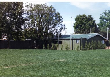
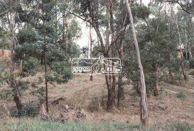
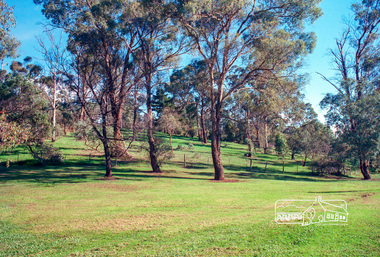
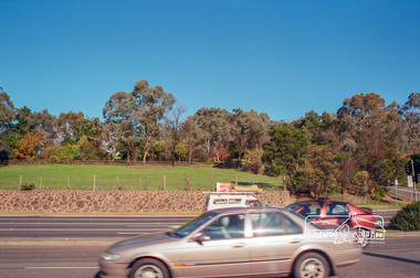
Photograph, Fitzsimons Lane Reserve bounded by Main Road, Bolton Street and Fitzsimons Lane, Eltham, c.May 2001
... Eltham District Historical Society Inc 728 Main Rd Eltham melbourne Now partially developed as the Monarch Ridge housing estate eltham streets main road fitzsimons lane reserve houses monarch ridge estate Agfa HDC 200 plus-2 Roll of 35mm colour negative film, 7 strips Fitzsimons Lane Reserve bounded by Main Road, Bolton Street and Fitzsimons Lane, Eltham Photograph Photograph ...Now partially developed as the Monarch Ridge housing estateRoll of 35mm colour negative film, 7 stripsAgfa HDC 200 plus-2eltham, streets, main road, fitzsimons lane reserve, houses, monarch ridge estate -
 Eltham District Historical Society Inc
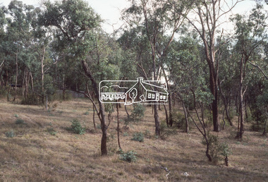
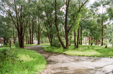
Photograph, Reserve bounded by Main Road, Bolton Street and Fitzsimons Lane, Eltham, c.May 2001
... Eltham District Historical Society Inc 728 Main Rd Eltham melbourne Now developed as the Monarch Ridge housing estate eltham streets main road fitzsimons lane reserve monarch ridge estate Agfa HDC 200 plus-2 Roll of 35mm colour negative film, 7 strips Reserve bounded by Main Road, Bolton Street and Fitzsimons Lane, Eltham Photograph Photograph ...Now developed as the Monarch Ridge housing estateRoll of 35mm colour negative film, 7 stripsAgfa HDC 200 plus-2eltham, streets, main road, fitzsimons lane reserve, monarch ridge estate -
 Eltham District Historical Society Inc
Photograph, Fitzsimons Lane Reserve bounded by Main Road, Bolton Street and Fitzsimons Lane, Eltham, c.May 2001
... Eltham District Historical Society Inc 728 Main Rd Eltham melbourne Now partially developed as the Monarch Ridge housing estate eltham streets main road fitzsimons lane reserve monarch ridge estate Agfa HDC 200 plus-2 Roll of 35mm colour negative film, 7 strips Fitzsimons Lane Reserve bounded by Main Road, Bolton Street and Fitzsimons Lane, Eltham Photograph Photograph ...Now partially developed as the Monarch Ridge housing estateRoll of 35mm colour negative film, 7 stripsAgfa HDC 200 plus-2eltham, streets, main road, fitzsimons lane reserve, monarch ridge estate -
 Eltham District Historical Society Inc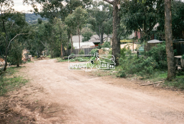
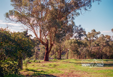
Photograph, Fitzsimons Lane Reserve bounded by Main Road, Bolton Street and Fitzsimons Lane, Eltham, c.May 2001
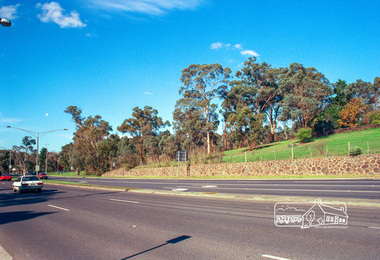
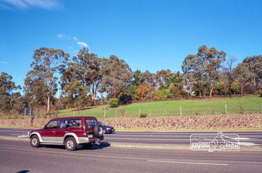
... Eltham District Historical Society Inc 728 Main Rd Eltham melbourne Viewed from Main Road just east of Bolton Street, approaching Fitzsimons Lane roundabout. Now partially developed as the Monarch Ridge housing estate eltham streets main road fitzsimons lane reserve houses monarch ridge estate Agfa HDC 200 plus-2 Roll of 35mm colour negative film, 7 strips Fitzsimons Lane Reserve bounded by Main Road, Bolton Street and Fitzsimons Lane, Eltham Photograph Photograph ...Viewed from Main Road just east of Bolton Street, approaching Fitzsimons Lane roundabout. Now partially developed as the Monarch Ridge housing estateRoll of 35mm colour negative film, 7 stripsAgfa HDC 200 plus-2eltham, streets, main road, fitzsimons lane reserve, houses, monarch ridge estate -
 Eltham District Historical Society Inc
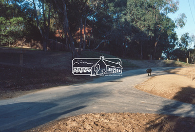
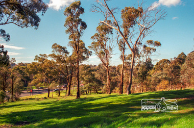
Photograph, Fitzsimons Lane Reserve bounded by Main Road, Bolton Street and Fitzsimons Lane, Eltham, c.May 2001
... Eltham District Historical Society Inc 728 Main Rd Eltham melbourne Viewed from Main Road just east of Bolton Street, approaching Fitzsimons Lane roundabout. Now partially developed as the Monarch Ridge housing estate eltham streets main road fitzsimons lane reserve houses monarch ridge estate Agfa HDC 200 plus-2 Roll of 35mm colour negative film, 7 strips Fitzsimons Lane Reserve bounded by Main Road, Bolton Street and Fitzsimons Lane, Eltham Photograph Photograph ...Viewed from Main Road just east of Bolton Street, approaching Fitzsimons Lane roundabout. Now partially developed as the Monarch Ridge housing estateRoll of 35mm colour negative film, 7 stripsAgfa HDC 200 plus-2eltham, streets, main road, fitzsimons lane reserve, houses, monarch ridge estate -
 Eltham District Historical Society Inc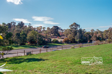
Photograph, Vacant land at 816 Heidelberg-Kinglake Road, Hurstbridge, c.1980, 1980c
... Eltham District Historical Society Inc 728 Main Rd Eltham melbourne Streetscape evolution; prior to development of reserve for housing units and redevelopment of shops opposite Hurstbridge Railway Station streets heidelberg-kinglake road hurstbridge railway station Kodak GB 200 5096 Roll of 35mm colour negative film, 4 strips Vacant land at 816 Heidelberg-Kinglake Road, Hurstbridge, c.1980 Photograph ...Streetscape evolution; prior to development of reserve for housing units and redevelopment of shops opposite Hurstbridge Railway StationRoll of 35mm colour negative film, 4 stripsKodak GB 200 5096streets, heidelberg-kinglake road, hurstbridge, railway station -
 Eltham District Historical Society Inc
Photograph, Milk Bar at 808 and vacant land at 816 Heidelberg-Kinglake Road, Hurstbridge, c.1980, 1980c
... Eltham District Historical Society Inc 728 Main Rd Eltham melbourne Streetscape evolution; prior to development of reserve for housing units and redevelopment of shops opposite Hurstbridge Railway Station streets heidelberg-kinglake road hurstbridge milk bar bendigo bank railway station Kodak GB 200 5096 Roll of 35mm colour negative film, 4 strips Milk Bar at 808 and vacant land at 816 Heidelberg-Kinglake Road, Hurstbridge, c.1980 Photograph ...Streetscape evolution; prior to development of reserve for housing units and redevelopment of shops opposite Hurstbridge Railway StationRoll of 35mm colour negative film, 4 stripsKodak GB 200 5096streets, heidelberg-kinglake road, hurstbridge, milk bar, bendigo bank, railway station -
 Eltham District Historical Society Inc
Photograph, Vacant land at 816 Heidelberg-Kinglake Road, Hurstbridge, c.1980, 1980c
... Eltham District Historical Society Inc 728 Main Rd Eltham melbourne Now fully developed as multiple units Streetscape evolution; prior to development of reserve for housing units and redevelopment of shops opposite Hurstbridge Railway Station streets heidelberg-kinglake road hurstbridge railway station Kodak GB 200 5096 Roll of 35mm colour negative film, 4 strips Vacant land at 816 Heidelberg-Kinglake Road, Hurstbridge, c.1980 Photograph ...Now fully developed as multiple unitsStreetscape evolution; prior to development of reserve for housing units and redevelopment of shops opposite Hurstbridge Railway StationRoll of 35mm colour negative film, 4 stripsKodak GB 200 5096streets, heidelberg-kinglake road, hurstbridge, railway station