
Showing 71 items matching "rocky mountain"
-
 The Beechworth Burke Museum
Photograph, est. 1860-1875
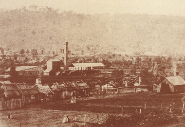
... ...rocky mountain mine...In 1875, the Rocky Mountain Extended Gold Sluicing Company Ltd was created, utilising the previous Rocky Mountain claim for the area near Lake Sambell. ...Reverse: Historic Beechworth / 7792.1 / ROCKY MOUNTAIN MINE / Viewed from the “Chinese Camp”, shown partly in the foreground, we see the central plant of the famous Rocky Mountain Mining Company. ...In 1875, the Rocky Mountain Extended Gold Sluicing Company Ltd was created, utilising the previous Rocky Mountain claim for the area near Lake Sambell. ...In 1875, the Rocky Mountain Extended Gold Sluicing Company Ltd was created, utilising the previous Rocky Mountain claim for the area near Lake Sambell. The company employed A.L Martin to survey an area for a tunnel underneath Beechworth and Johnson Stephens to dig it. The tunnel was built at a rate of 40 feet a month and eventually measured 800 metres. The tunnel was a true accomplishment both in the present and during the 19th century. It was considered to be a marvelous engineering feat. Beechworth is renowned for its hydraulic sluice method of mining. This involved soil being exposed to torrents of water from high-pressure hoses. From 1876 until its closure in 1921, the mine produced an astounding 47,926 ozs of gold. Companies like this were the source of income for many Chinese gold-diggers who sought to make their fortune on the goldfields of Beechworth. During the height of the rush, the town had around 7,000 Chinese inhabitants living on the outskirts of town as they were not permitted to live within Beechworth itself.The search for gold is ingrained into the history of Victoria and therefore, images like this one which portrays an open-cut sluicing site can reveal important information for society and technology for the date when the photograph was taken. This image is of important historical significance for its ability to convey information about sluicing and the methods used to find gold in 1910. It also shows a location where sluicing was undertaken which provides insight into the impact of sluicing on the environment at a time when it was done. This image of the Rocky Mountain mine is historically significant as the mining complex is now non-existent, with the only remains being the tunnel built in 1880 by the company, which was considered one of the greatest engineering feats of the time. The image also provides a first-hand look into the social and cultural networks at play during the 19th century with racial segregation of the Chinese at the 'Chinese Camp', as well as an insight into Beechworth's origins during the Gold Rush.A sepia rectangular photograph printed on matte photographic paper as a postcardReverse: Historic Beechworth / 7792.1 / ROCKY MOUNTAIN MINE / Viewed from the “Chinese Camp”, shown partly in the foreground, we see the central plant of the famous Rocky Mountain Mining Company. This extensive complex, of which nothing remains, was situated between Silver Creek and the present Lake Sambell area. The company was responsible for a tunnel cut through solid bedrock underneath the town of Beechworth and surfacing near the keystone bridge on the Wangaratta side. Completed in 1880 it was declared to be one of the greatest engineering feats in Australia. The tunnel is still basically intact today. / Series by Wooragee Graphics: Historic Beechworth. / COPYRIGHT BURKE MUSEUM / No.72 beechworth, rocky mountain mine, sluicing, gold rush, mining, gold -
 The Beechworth Burke Museum
Photograph - Photograph - Reproduction, 1890-1900
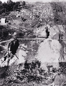
... ...rocky mountain mining co....The photograph appears to depict the of the entrance to the Rocky Mountain Tunnel. The Rocky Mountain Tunnel runs from opening of the tunnel, underneath the Beechworth town, to the Gorge. ...The photograph appears to depict the of the entrance to the Rocky Mountain Tunnel. The Rocky Mountain Tunnel runs from opening of the tunnel, underneath the Beechworth town, to the Gorge. ...The photograph appears to depict the of the entrance to the Rocky Mountain Tunnel. The Rocky Mountain Tunnel runs from opening of the tunnel, underneath the Beechworth town, to the Gorge. This tunnel drained the excess water from the upper Spring Creek Goldfield to allow for mining access in the area. The Rocky Mountain Co. blasted through the granite rock to create the original 400ft-long tunnel in 1859, but between 1867 and 1871, the Rocky Mountain Gold Sluicing Co. widened and extended it. At its completion, it measured 14ft deep, 6ft wide, and almost half a mile long. The mining surveyor at Beechworth called it 'without doubt, the greatest undertaking of the kind in the colony'. When the company became the Rocky Mountain Extended Gold Sluicing Co. in the mid-1870s, they continued the tunnelling work. The work was reportedly vital to mining being able to continue at Beechworth and may have established world records in tunnelling through hard rock. The entrance at the Gorge side of the tunnel can be seen from the Beechworth Gorge Walk. The tunnel continues to be an outfall drain for the lake and the town.The search for gold is ingrained into the history of Victoria and therefore, images like this one which portray an open cut sluicing site can reveal important information for society and technology for the date when the photograph was taken. This image is of important historical significance for its ability to convey information about sluicing and the methods used to find gold in the late 1800s and early 1900s. It also shows a location where sluicing was undertook which provides insight into the impact of sluicing on the environment at a time when it was done. The Burke Museum is home to a substantial collection of Australian mining photographs which can be used to gain a deeper understanding into life on the gold fields, technology used in mining, the miners themselves and the impact of the gold digging on the environment.A black and white rectangular reproduced photograph printed on matte photographic paper.7814beechworth, beechworth museum, burke museum, australian museum, mining, rocky mountain mining co., rocky mountain mining company, mine, mining company, rocky mountain mine, mine entrance, rocky mountain, gold, gold mining -
 The Beechworth Burke Museum
Container - Trunk, c1870
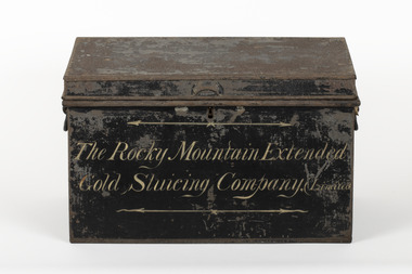
... A tin trunk used by the Rocky Mountain Extended Sluicing Company (Limited)....The Rocky Mountain Extended / Gold Slucing Company. ...A tin trunk used by the Rocky Mountain Extended Sluicing Company (Limited). ...A tin trunk used by the Rocky Mountain Extended Sluicing Company (Limited).Mining played an important role in the history of Beechworth, for the township was established in the mid-1850s after gold was discovered in the area. The success of goldmining lead to the growth and development of early Beechworth. The Rocky Mountain Company was a very successful gold mining company and had a big impact on the people and landscape of early Beechworth.A tin trunk painted in black with gold script painted on the front.The Rocky Mountain Extended / Gold Slucing Company. (Limited / BMM 8068 -
 The Beechworth Burke Museum
Photograph - Photograph - Reproduction, c. 1900
... ...rocky mountain mining co....This photograph shows an operator for the Rocky Mountain Mining Company holding a mining drill. ...This photograph shows an operator for the Rocky Mountain Mining Company holding a mining drill. ...This photograph shows an operator for the Rocky Mountain Mining Company holding a mining drill. The drill is likely a Ford's patent rock drill, used by the Rocky Mountain Extended Mining Company to dig the Rocky Mountain Tunnel that still exists beneath Beechworth as part of gold mining efforts. Work on the tunnel began in 1856 under Robert Dryburgh, but was met with trouble when the tail-race (a channel for removing water) fell. After the land changed hands a few times (see Beechworth: A Titan's Field, p. 99), the newly-launched Rocky Mountain Extended Gold Sluicing Company resumed the tunnelling works in June 1876, starting beneath Newtown bridge. Completed in December 1879, the tunnel was almost 800m long and cost a total of £13,500. The mine was closed in 1921 "after yielding 47,926 ozs of gold and paying £63,639 in dividends". The photograph appears to have been taken against a solid backdrop, rather than at a mine, possibly as a way to demonstrate the equipment the miners were using.The search for gold is ingrained into the history of Victoria and therefore, images like this one which portray the machinery and workers involved can reveal important information for society and technology for the date when the photograph was taken. This image is of important historical significance for its ability to convey information about the specific types of machines and the methods used to find gold in the late 1800s and early 1900s. The photograph also appears to have been taken out of the drill's standard operating context of a mine, which might convey information about how mining, drills, and mine workers were portrayed in a more presentation-like context. The Burke Museum is home to a substantial collection of Australian mining photographs which can be used to gain a deeper understanding into life on the gold fields, technology used in mining, the miners themselves and the impact of the gold digging on the environment.Black and white rectangular reproduced photograph printed on card.7815 / Copy 1/3 /beechworth, beechworth museum, burke museum, australian museum, mining, gold, rocky mountain mining co., rocky mountain mining company, mining machinery, drill, mining drill, mining company -
 The Beechworth Burke Museum
Photograph - Photograph - Reproduction
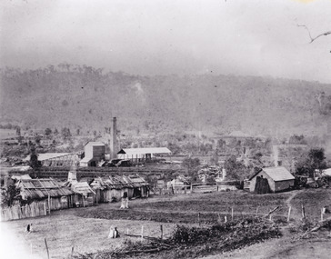
... ...rocky mountain mine...The photograph is a reproduction of a postcard from the Rocky Mountain Mining Company. In 1875, the Rocky Mountain Extended Gold Sluicing Company Ltd was created, utilising the previous Rocky Mountain claim for the area near Lake Sambell. ...The photograph is a reproduction of a postcard from the Rocky Mountain Mining Company. In 1875, the Rocky Mountain Extended Gold Sluicing Company Ltd was created, utilising the previous Rocky Mountain claim for the area near Lake Sambell. ...The photograph is a reproduction of a postcard from the Rocky Mountain Mining Company. In 1875, the Rocky Mountain Extended Gold Sluicing Company Ltd was created, utilising the previous Rocky Mountain claim for the area near Lake Sambell. The company employed A.L Martin to survey an area for a tunnel underneath Beechworth and Johnson Stephens to dig it. The tunnel was built at a rate of 40 feet a month and eventually measured 800 metres. The tunnel was a true accomplishment both in the present and during the 19th century. It was considered to be a marvelous engineering feat. Beechworth is renowned for its hydraulic sluice method of mining. This involved soil being exposed to torrents of water from high-pressure hoses. From 1876 until its closure in 1921, the mine produced an astounding 47,926 ozs of gold. Companies like this were the source of income for many Chinese gold-diggers who sought to make their fortune on the goldfields of Beechworth. During the height of the rush, the town had around 7,000 Chinese inhabitants living on the outskirts of town as they were not permitted to live within Beechworth itself.This image of the Rocky Mountain mine is historically significant as the mining complex is now non-existent, with the only remains being the tunnel built in 1880 by the company, which was considered one of the greatest engineering feats of the time. The image also provides a first-hand look into the social and cultural networks at play during the 19th century with racial segregation of the Chinese at the 'Chinese Camp', as well as an insight into Beechworth's origins during the Gold Rush.Black and white rectangular reproduced photograph printed on paperbeechworth, rocky mountain mine, sluicing, gold rush, mining, gold -
 The Beechworth Burke Museum
Photograph, Unknown
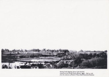
... ...Rocky Mountain Mining Co...The present day park and reserve occupies the site of the former Rocky Mountain Mining Company, an open-cut sluice mine that began operations in the mid-Nineteenth Century and operated until the early 1900s, through the peak of Victoria’s Gold Rush. ...The present day park and reserve occupies the site of the former Rocky Mountain Mining Company, an open-cut sluice mine that began operations in the mid-Nineteenth Century and operated until the early 1900s, through the peak of Victoria’s Gold Rush. ...The photograph shows Lake Sambell under construction. The present day park and reserve occupies the site of the former Rocky Mountain Mining Company, an open-cut sluice mine that began operations in the mid-Nineteenth Century and operated until the early 1900s, through the peak of Victoria’s Gold Rush. It was converted into a park and leisure area in the 1920s. Lake Sambell was formally opened to the public on Friday 5th October 1928 and was opened by the Victorian Government’s Minister of Lands, Mr Bailey, as part of initiatives to boost the economies and development of country towns. The lake was named after Mr L.H. Sambell, a shire engineer and secretary of the Forward Beechworth Committee who was involved in promoting the transformation of the mining site and promoting plantation forestry and tourism as alternative industries. £300 to begin the process was provided by Mr J. McConvill, a former resident of Beechworth, who is remembered in a street name adjacent to the lake. An article in the Ovens and Murray Advertiser on Saturday, 5th May, 1917, gives some insight into issues in the Rocky Mountain Mining Company’s final years. The writer details the 1917 annual meeting of the Rocky Mountain Mining Company, stating that locals present appeared ‘well pleased this important local industry is in such a prosperous condition and that future prospects are so encouraging’. The author describes plans to give workers a bonus as evidence of profit-sharing that would ‘bridge the gulf between capital and labour’. The article concludes, however, with the statement that ‘there is a little arithmetical puzzle in the report in connection with the dredging operations I have been unable to solve.'The photograph is significant as it contributes to knowledge about how Beechworth reinvented itself after the Gold rush period, and more broadly how country towns repurpose and redevelop infrastructure and facilities to meet the present needs of their populationBlack and white rectangular photograph printed on matte photographic paperObverse: Spring Creek diggings, (k)now Lake Sambell / Copied from the George Peach Albums, 19(2)30’s Oct 14 1931 / From the collection of Robert O’Hara Burke Memorial Museum /lake sambell, beechworth, rocky mountain mining co, lh sambell -
 The Beechworth Burke Museum
Photograph, 1960
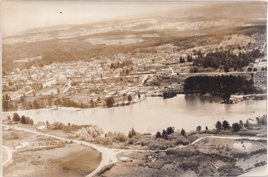
... ...Rocky Mountain Mining Company...It was created in the mid-1800s by the Rocky Mountain Mining company during the gold rush era and used as a mining site until the early 1900s, which brought Europeans into the area. ...It was created in the mid-1800s by the Rocky Mountain Mining company during the gold rush era and used as a mining site until the early 1900s, which brought Europeans into the area. ...Taken in 1960, depicted is an aerial view of Lake Sambell and the surrounding township. Lake Sambell is a beautiful Victorian recreation lake and urban park with a unique history. It was created in the mid-1800s by the Rocky Mountain Mining company during the gold rush era and used as a mining site until the early 1900s, which brought Europeans into the area. It was turned into a reserve for residents in 1920 and is considered an icon of Beechworth as it represents the development of the community, human endeavour, and the spirit of the landscape.This photograph represents what Lake Sambell looked like in 1960.Black and white reproduced rectangular photograph print on paper.lake sambell, #beechworth, beechworth 1960s, lake, victoria, australian landscape, mining, rocky mountain mining company -
 Halls Gap & Grampians Historical Society
Photograph - B/W
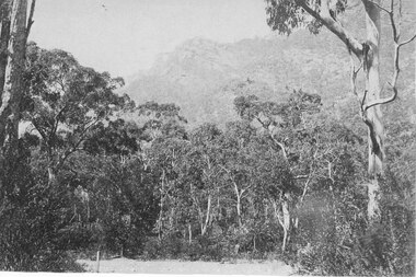
... A photo of bushland with rocky mountain rising behind...This is a photo of Chatauqua Peak, which is named after the Chautauquans, who held summer camps in Halls Gap in the 1890s SCENERY Grampians Ranges A photo of bushland with rocky mountain rising behind Photograph B/W ...This is a photo of Chatauqua Peak, which is named after the Chautauquans, who held summer camps in Halls Gap in the 1890sA photo of bushland with rocky mountain rising behindscenery, grampians ranges -
 The Beechworth Burke Museum
Photograph - Photograph - Reproduction, ca. 1900
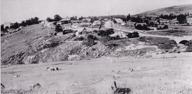
... ...rocky mountain mining company...The site in the photograph is associated with the Rocky Mountain Mining Company who constructed an eight hundred meter tunnel under the township between 1876-1880 to reduce water levels at Spring Creek, which had been subject to diversions since the earliest days of alluvial mining. ...The site in the photograph is associated with the Rocky Mountain Mining Company who constructed an eight hundred meter tunnel under the township between 1876-1880 to reduce water levels at Spring Creek, which had been subject to diversions since the earliest days of alluvial mining. ...This image shows the approach to Beechworth from the south-west via the Newtown Bridge. Numerous early buildings line the road as it bifurcates to become Ford and High Streets on the ridge above Spring Creek and Newtown Falls. The sloping, rocky terrain and water course along the gorge show evidence of the intense mining activity that occurred at the site. The Ovens Gold Rush at Beechworth started when gold was found at Spring Creek in February 1852, prompting an influx of miners from around the world. The population grew over 20,000 by 1857. While the earliest mining at Beechworth was similar to that in other Victorian goldfields like Ballarat and Bendigo, Beechworth is notable for its use of hydraulic sluicing as a major method of removing wash-dirt. Hydraulic sluicing employs high pressure jets of water to blast away large areas of earth and wash it down to be run through a sluice box. Gold gets caught in the sluice and the remaining slurry is washed away. This method of mining is extremely effective but causes significant environmental impacts and damage to waterways. Large water quantities were required for large-scale sluicing, and the long water races and deep tailraces that were constructed in the Beechworth area in the nineteenth century are nonetheless considered feats of engineering. The site in the photograph is associated with the Rocky Mountain Mining Company who constructed an eight hundred meter tunnel under the township between 1876-1880 to reduce water levels at Spring Creek, which had been subject to diversions since the earliest days of alluvial mining. Over four million ounces of gold (115 tones) were found at Beechworth between 1852 and 1868, and the wealth from the gold rushes built Beechworth and the nationally significant buildings that remain standing today.This image shows the early development of the Beechworth township above Spring Creek, where gold was discovered in 1852. Evidence of hydraulic sluicing, a uniquely predominant method at Beechworth, and water-works engineering are present in the landscape. By the 1870s, alluvial gold deposits were depleted and increasingly complex engineering was required so deeper shafts could reach bedrock. This image is significant for understanding changes to the landscape and the evolution of mining methods and engineering practices related to the extensive construction, manipulation and management of water networks. The shift from smaller scale alluvial mining to larger company dominance in the mining industry has implications for understanding wider social, economic, political and industrial changes in the region of Beechworth and within the context of the Victorian Gold Rush more broadly. A black and white rectangular reproduction photograph printed on photographic paper. burke museum, beechworth museum, beechworth, gold fields, gold rush, victorian gold rush, hydraulic sluicing, rocky mountain mining company, spring creek, netwown falls, mining tunnels, water races, tailraces, colonial australia, australian gold rushes, mining technology, beechworth historic district, indigo gold trail, migration, indigo shire, gold mining, gold mining history -
 The Beechworth Burke Museum
Photograph, unknown
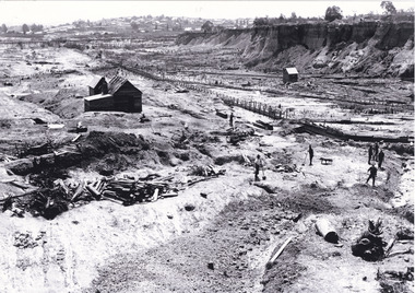
... Rocky Mountain Extended Gold Sluicing Company...This image is important for current research into the history of Beechworth and surrounding area including Victoria's North East. The Rocky Mountain Extended Gold Sluicing Company was a long running and very active mine that was one of the most successful and largest in the district. ...This reproduced photograph is of Pennyweight Flat near Beechworth, a notable area of the 1850's gold rush in Victoria. Donald Fletcher, migrating to Beechworth from Scotland in 1855, had substantial claims at Pennyweight Flat and was amongst the first in the district to utilise hydraulic sluicing and water diverting methods.The flat is said to have seen a flurry of 200 miners to the area around 1857, and by 1861 when work commenced on extending Fletcher's tail race the census recorded 644 people residing there (European males, females and Chinese).The search for gold is ingrained into the history of Victoria and therefore, images like this one which portray an open cut sluicing site can reveal important information for society and technology for the date when the photograph was taken. This image is of important historical significance for its ability to convey information about sluicing and the methods used to find gold in 1910. It also shows a location where sluicing was undertaken which provides insight into the impact of sluicing on the environment at a time when it was done. This image is important for current research into the history of Beechworth and surrounding area including Victoria's North East. The Rocky Mountain Extended Gold Sluicing Company was a long running and very active mine that was one of the most successful and largest in the district. Therefore, this image has the capacity to be beneficial for research into society and the motivations of those living and working in this region during this period and therefore, has social significance. The Beechworth Burke Museum has additional images relating to gold sluicing which can be analysed and studied alongside images like this one. When the mine closed in 1921, in a liquidation sale, Zwar purchased the tunnel and clear water supply that ran under the town of Beechworth. He directed the water to his tannery and over time built a major industry in leather works that was a major employer in Beechworth. In growing his leather business, Zwar installed crude oil engines for electricity in his factory. He oversaw working with local council to introduce electricity to Beechworth via a sub-station on Albert Street. In 1927 Electric street lamps replaced gas lamps in the streets of Beechworth. Black and white rectangular reproduced photograph printed on glossy photographic paperObverse: Reverse: 84.222.5/ digital print/ rocky mountain extended gold sluicing company, gold, sluicing, gold sluicing, hydraulic sluicing, gold mine, open cut mining, mining, gold mining, north-east victoria, beechworth, burke museum -
 Halls Gap & Grampians Historical Society
Photograph - Sepia
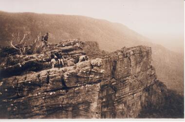
... Rocky mountain peak,four people on top of ridge, a mountain range in background. ...SCENERY Peaks Rocky mountain peak,four people on top of ridge, a mountain range in background. ...Rocky mountain peak,four people on top of ridge, a mountain range in background. Three of the people appear to be wearing scout uniforms.scenery, peaks -
 Lakes Entrance Historical Society
Photograph - Black Mountain Gelantipy Victoria, 1/03/1989 12:00:00 AM
... Colour photograph of Rocky Mountain opposite Rogers old house Black Mountain Gelantipy Victoria. ...Topography Vegetation Mountains Colour photograph of Rocky Mountain opposite Rogers old house Black Mountain Gelantipy Victoria. ...Colour photograph of Rocky Mountain opposite Rogers old house Black Mountain Gelantipy Victoria. Also a second photograph taken from a sl ightly different angle topography, vegetation, mountains -
 Bendigo Historical Society Inc.
Book - LYDIA CHANCELLOR :THE ROCKY MOUNTAINS OF CANADA
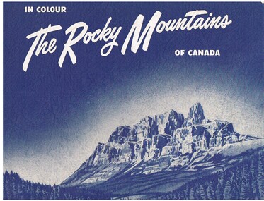
... A blue spiral bound soft covered book titled ' The Rocky Mountains of Canada.' It contains 18 colour plates of the mountains and their environs. ...Book LYDIA CHANCELLOR :THE ROCKY MOUNTAINS OF CANADA ...A blue spiral bound soft covered book titled ' The Rocky Mountains of Canada.' It contains 18 colour plates of the mountains and their environs. Montreal. Associated Screen News Limited. 18p.place, canada -
 Halls Gap & Grampians Historical Society
Postcard - B/W
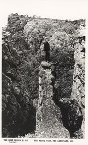
... Young man in suit standing on an outcrop of a rocky ledge,mountain scenery in background....Armadale, Vic SCENERY Grampians Ranges Young man in suit standing on an outcrop of a rocky ledge,mountain scenery in background. Postcard B/W ...Postcard of The Nerve Test, The Grampians,Vic. ---The Rose Series,P617. Published by the Rose Stereograph Co. Armadale, VicYoung man in suit standing on an outcrop of a rocky ledge,mountain scenery in background.scenery, grampians ranges -
 Halls Gap & Grampians Historical Society
Photograph - Sepia
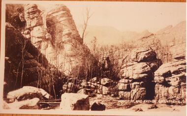
... Rocky formations. Mountain range in the background. Straggly trees in foreground beside large boulders....SCENERY Wonderland Range Rocky formations. Mountain range in the background. Straggly trees in foreground beside large boulders. ..."Wonderland Avenue, Grampians" printed in white on photograph.Rocky formations. Mountain range in the background. Straggly trees in foreground beside large boulders.scenery, wonderland range -
 Halls Gap & Grampians Historical Society
Postcard - Coloured
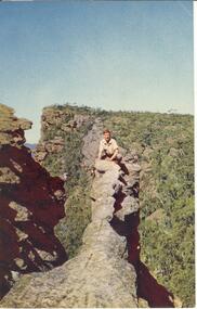
... Young man crouched on top of narrow rocky outcrop, mountains in background,steep ravines on either side....Young man crouched on top of narrow rocky outcrop, mountains in background,steep ravines on either side. ...The "Nerve Test" with Bellfield Peak beyond,the Grampians, Victoria. Postcard by Nuclorvue Productions Pty. Ltd.Young man crouched on top of narrow rocky outcrop, mountains in background,steep ravines on either side.Postcard/letter no date except Tuesday,7th.scenery, grampians ranges -
 Stawell Historical Society Inc
Postcard, Bellfield Peak in the Grampians -- Postcard
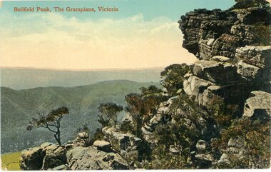
... Coloured Photograph of a rocky cliff face with mountain view in the background....Coloured Photograph of a rocky cliff face with mountain view in the background. Bellfield Peak in the Grampians -- Postcard Postcard ...Bellfield Peak The Grampians Victoria. c 1930's Photograph taken before Lake Bellfield was built.Coloured Photograph of a rocky cliff face with mountain view in the background.Bellfield Peak, The Grampians, Victoria. Post Card The Valentine & Sons' Publishing Co., Ltd., Melbourne. halls gap grampians -
 The Beechworth Burke Museum
Photograph, Unknown
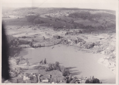
... It was created in the mid-1800s by the Rocky Mountain Mining company during the gold rush era and used as a mining site until the early 1900s, which brought Europeans into the area. ...It was created in the mid-1800s by the Rocky Mountain Mining company during the gold rush era and used as a mining site until the early 1900s, which brought Europeans into the area. ...Aerial view of Lake Sambell, Beechworth with town views. Lake Sambell is a beautiful Victorian recreation lake and urban park with a unique history. It was created in the mid-1800s by the Rocky Mountain Mining company during the gold rush era and used as a mining site until the early 1900s, which brought Europeans into the area. It was turned into a reserve for residents in 1920 and is considered an icon of Beechworth as it represents the development of the community, human endeavour, and the spirit of the landscape.This photograph represents Lake Sambell with town views.Black and white reproduced rectangular photograph print on paper.Reverse: Stampbeechworth lake, lake sambell, aerial photo, construction, australian landscape, #beechworth, victoria -
 The Beechworth Burke Museum
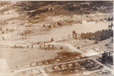
Photograph, 1960
... It was created in the mid-1800s by the Rocky Mountain Mining company during the gold rush era and used as a mining site until the early 1900s, which brought Europeans into the area. ...It was created in the mid-1800s by the Rocky Mountain Mining company during the gold rush era and used as a mining site until the early 1900s, which brought Europeans into the area. ...Taken in 1960, depicted is the construction of Lake Sambell, looking west across the lake. Lake Sambell is a beautiful Victorian recreation lake and urban park with a unique history. It was created in the mid-1800s by the Rocky Mountain Mining company during the gold rush era and used as a mining site until the early 1900s, which brought Europeans into the area. It was turned into a reserve for residents in 1920 and is considered an icon of Beechworth as it represents the development of the community, human endeavour, and the spirit of the landscape.This photograph represents additional construction to Lake Sambell as a recreational reserve.Black and white reproduced rectangular photograph print on paper.beechworth lake, lake, lake sambell, construction, #beechworth, australian landscape, beechworth 1960s, victoria -
 The Beechworth Burke Museum
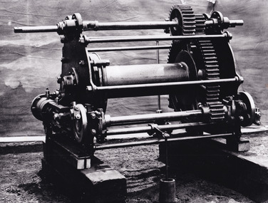
Photograph - Photograph - Reproduction, c.1870s
... Prior documentation records that this piece of equipment had connections to the Rocky Mountains Mining Company. Today, the Rocky Mountains Gold Mining company is famous in Beechworth for having been instrumental in the creation of the Rocky Mountain tunnel. ...Prior documentation records that this piece of equipment had connections to the Rocky Mountains Mining Company. Today, the Rocky Mountains Gold Mining company is famous in Beechworth for having been instrumental in the creation of the Rocky Mountain tunnel. ...This photograph shows a piece of gold mining equipment identified as a mine winch, possibly an air winch cylinder of 1870s RG Ford's Patent design. Throughout the history of mining for gold and other precious materials, the windlass or winch (pictured) was used to bring up buckets full of soil from the bottom of a mine. This soil was then searched for gold/metals before being relocated to a different area. Due to the size and complexity of this particular piece of equipment, this winch may have been used to raise and lower mine carts to the entrance of the mine (often used in coal mining) and could have been used in raising cages up and down (acting as elevators) containing miners if the mine was particularly deep. The actual use of this particular item in the Beechworth locality is undocumented but these are some possibilities based on the use of these pieces of equipment in other mining locations. Mining can have a largely detrimental impact to the environment and therefore, the study of machinery like the one depicted in this photograph can help researches to reconstruct the methods and technologies used in the late 1800s and early 1900s. This particular item appears to have been removed from it's original site where it would have been used to assist with mining. It is possible that this photograph has been taken for recording purposes or as part of a machinery exhibition. Prior documentation records that this piece of equipment had connections to the Rocky Mountains Mining Company. Today, the Rocky Mountains Gold Mining company is famous in Beechworth for having been instrumental in the creation of the Rocky Mountain tunnel. Construction for this tunnel began in 1859 when a group of 12 men blasted a 400ft long tailrace though the rock beneath the town of Beechworth. Today, the 800ft tunnel, completed in 1871, is a popular tourist attraction but during the decades of gold mining, the purpose of this tunnel was to divert water away from the main sluicing operations so miners could better access gold and precious materials. The tunnel was used for this purpose for many years, later becoming useful for the Zwar Brother's tannery and currently as an outfall drain for Lake Sambell. This area continued to be mined until the early 1900s. The period when this item was in use is unclear but it is estimated to have been in the 1870s based on the design and appearance of the image. The gold works at the Rocky Mountain Tunnel closed in the early 1920s but the impact of mining remains in Beechworth today and therefore the study of photographs like this one which contain mining equipment can further understanding of mining in this region.This photograph has historic and research potential for study on the gold mining of the Beechworth region and types of equipment used to locate gold after the initial gold rush of 1853-1854 which resulted in the discovery of the surface gold and required miners to dig deeper to access precious metals. The clarity of the photo, and its good preserved condition, means it can continue to be used for research. This photo is part of a collection of six photos all within the Burke Museum Collection which depict mining equipment.Square black and white photograph on card.7793.1beechworth, mining, goldmining, goldmining equipment, beechworth burke museum -
 The Beechworth Burke Museum
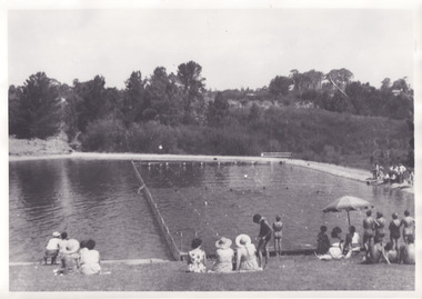
Photograph, 1960s
... It was created in the mid-1800s by the Rocky Mountain Mining company during the gold rush era and used as a mining site until the early 1900s, which brought Europeans into the area. ...It was created in the mid-1800s by the Rocky Mountain Mining company during the gold rush era and used as a mining site until the early 1900s, which brought Europeans into the area. ...Taken in the 1960s, depicted are approximately twenty-nine male and female spectators at a school swimming carnival on Lake Sambell near the caravan park. Lake Sambell is a beautiful Victorian recreation lake and urban park with a unique history. It was created in the mid-1800s by the Rocky Mountain Mining company during the gold rush era and used as a mining site until the early 1900s, which brought Europeans into the area. It was turned into a reserve for residents in 1920 and is considered an icon of Beechworth as it represents the development of the community, human endeavour, and the spirit of the landscape. This photograph represents the post-gold rush era use of Lake Sambell as a recreational reserve. Swimming carnivals were held at the lake and considered a social event for the Beechworth community.Black and white reproduced rectangular photograph print on paper.Reverse: Community/ Swimming pool 1960s/ near the caravan park/ Lakes?lake swimming pool, lake swimming, beechworth carnival processions, carnival, #beechworth, beechworth 1960s, victoria -
 The Beechworth Burke Museum
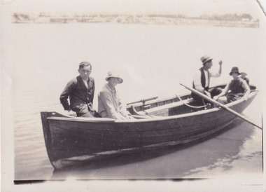
Photograph, 1920
... It was created in the mid-1800s by the Rocky Mountain Mining company during the gold rush era and used as a mining site until the early 1900s, which brought Europeans into the area. ...It was created in the mid-1800s by the Rocky Mountain Mining company during the gold rush era and used as a mining site until the early 1900s, which brought Europeans into the area. ...Taken in 1920, depicted are four people in a rowing boat on Lake Sambell, Beechworth. From left to right, it is believed that the names of the people are Eric Beard, Mrs Doris Beard, and S/L to Bert Beard. The last two figures are unknown. Lake Sambell is a beautiful Victorian recreation lake and urban park with a unique history. It was created in the mid-1800s by the Rocky Mountain Mining company during the gold rush era and used as a mining site until the early 1900s, which brought Europeans into the area. It was turned into a reserve for residents in 1920 and is considered an icon of Beechworth as it represents the development of the community, human endeavour, and the spirit of the landscape.This photograph represents the community's social use of the lake in 1920.Black and white rectangular photograph print on paper.Reverse: LAKE SAMBELL/ c 1920/ from LTOR/ 1 ERIC? - BERT'S SON/ 2 MRS DORIS BEARD/ 3 S/L TO BERT BEARD/ 4 #beechworth, lake sambell, lake sambell boating, beechworth lake, social, 1920, victoria -
 The Beechworth Burke Museum
Photograph
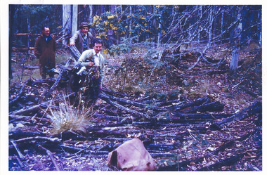
... Many companies such as the Rocky Mountain Extended Gold Sluicing Company Ltd and the Cocks Pioneer Gold &Tin Sluicing Company also set up mines in the area. ...Many companies such as the Rocky Mountain Extended Gold Sluicing Company Ltd and the Cocks Pioneer Gold &Tin Sluicing Company also set up mines in the area. ...This image shows an unknown location in the area of Beechworth that was possibly used as a sluicing mining site for gold during the Victorian Gold Rush. This era saw an influx of Chinese immigrants and Australian prospectors hoping to strike it rich on the fields. Many companies such as the Rocky Mountain Extended Gold Sluicing Company Ltd and the Cocks Pioneer Gold &Tin Sluicing Company also set up mines in the area. This site may be the location of one of these company's mines. The wooden logs are reminiscent of known sluicing operations in the era from that time. Sluicing involved the use of high-pressured hoses to clear away soil from earth that had been dug up by miners and was a popular method of excavation in the area, although it had severe impacts on the environment.The search for gold is ingrained into the history of Victoria and therefore, images like this one which portray an open cut sluicing site can reveal important information for society and technology for the date when the photograph was taken. This image is of important historical significance for its ability to convey information about sluicing and the methods used to find gold. It also shows a location where sluicing was undertook which provides insight into the impact of sluicing on the environment at a time when it was done.A colour rectangular photograph printed on glossy photographic paperReverse: 6855 /beechworth, gold rush, sluicing, mining -
 The Beechworth Burke Museum
Photograph, Unknown
... Here, he completed build on a tail-race in 1871 nearly as long as that of the Rocky Mountain Company, who held significant holdings within the area. ...Here, he completed build on a tail-race in 1871 nearly as long as that of the Rocky Mountain Company, who held significant holdings within the area. ...This photograph depicts the excavated area of alluvial gold mining locations One Mile Diggings and Pennyweight Flat near the Spring Creek precinct, Beechworth, significant locations of the 1850's Gold Rush which built Beechworth into a prosperous, regional town centre. Visible are a few miners, sheds, cliffs at rear and the road into town (Pine Hill). Water races are also visible, which is notable to the areas unique use of hydraulic sluicing as a mining method. Beechworth sluicer Donald Fletcher, a key figure of the town’s colonial history, first claim was a sluicing operation at Pennyweight Flat. Here, he completed build on a tail-race in 1871 nearly as long as that of the Rocky Mountain Company, who held significant holdings within the area. In 1859, the site and its surrounding areas were estimated to have a predominant European and Chinese population. In 1883 it was reported that 'thousands of tents' were pitched in the area. After all surface gold was exhausted, miners began to bore quartz until operations waned toward the turn of the century. In 1928 the mine was converted to what is today known as Lake Sambell. This photograph is historically significant as it provides insight into the landscape, working conditions and mining methods used for alluvial mining during the Beechworth Gold Rush.Sepia rectangular photograph printed on matte photographic paper unmounted.Reverse: 84.222.1 / page 41 62% (crossed out) / [ineligible] / One mile diggings where the large bank is view towards Pennyweight flat / [ineligible] 13one mile diggings, pennyweight flat, beechworth mining district, lake sambell, donald fletcher, hydraulic sluicing -
 The Beechworth Burke Museum
Photograph
... Here, he completed build on a tail-race in 1871 nearly as long as that of the Rocky Mountain Company, who held significant holdings within the area. ...Here, he completed build on a tail-race in 1871 nearly as long as that of the Rocky Mountain Company, who held significant holdings within the area. ...This photographic copy depicts the excavated area of alluvial gold mining locations One Mile Diggings and Pennyweight Flat near the Spring Creek precinct, Beechworth, significant locations of the 1850's Gold Rush which built Beechworth into a prosperous, regional town centre. Visible are a few miners, sheds, cliffs at rear and the road into town (Pine Hill). Water races are also visible, which is notable to the areas unique use of hydraulic sluicing as a mining method. Beechworth sluicer Donald Fletcher, a key figure of the town’s colonial history, first claim was a sluicing operation at Pennyweight Flat. Here, he completed build on a tail-race in 1871 nearly as long as that of the Rocky Mountain Company, who held significant holdings within the area. In 1859, the site and its surrounding areas were estimated to have a predominant European and Chinese population. In 1883 it was reported that 'thousands of tents' were pitched in the area. After all surface gold was exhausted, miners began to bore quartz until operations waned toward the turn of the century. In 1928 the mine was converted to what is today known as Lake Sambell. This photograph is historically significant as it provides insight into the landscape, working conditions and mining methods used for alluvial mining during the Beechworth Gold Rush.Black and white rectangular photograph printed on matte photographic paper unmounted.Reverse: 844.222.3 / Pennyweight flat goldfieldsone mile diggings, pennyweight flat, beechworth mining district, lake sambell, donald fletcher, hydraulic sluicing -
 The Beechworth Burke Museum
Photograph
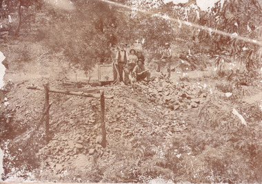
... Mr Williams senior worked on various mining activities in the district, including the Rocky Mountain Tunnel project. Conversant with the character of gold-bearing reefs in the area, the syndicate dug an eight hundred foot tunnel, digging down as far down as two hundred feet with little capital save their labour, to connect and provide better working access to the mass of reefs and veins in the vicinity. ...Mr Williams senior worked on various mining activities in the district, including the Rocky Mountain Tunnel project. Conversant with the character of gold-bearing reefs in the area, the syndicate dug an eight hundred foot tunnel, digging down as far down as two hundred feet with little capital save their labour, to connect and provide better working access to the mass of reefs and veins in the vicinity. ...This image is a reproduction of an 1899 original depicting the 'Williams Good Luck Mine' on the Mopoke Reef (also called 'Morepork Gully') in the Dingle Ranges, approximately three miles from Beechworth. A large opening to a mine can be seen behind the men in the photograph, with a wheeled cart on a track leading to the men's position, where the soil and rocks have been hauled away. This photograph interestingly contains dogs alongside the miners. While dogs have been recorded as deterrents to thieves in the Victorian goldfields, these dogs appear as companions to these men. Following the discovery of gold at Beechworth in 1852, rushes quickly followed at surrounding creeks and gullies in the district. In the late nineteenth and early twentieth centuries, small syndicates of miners continued to work old or abandoned quartz reefs, often persisting without the assistance of heavy machinery to remove the large amounts of rock, in order to obtain yields at ever greater depths. The group of miners in this photograph are Mr. Roger Williams and Sons, who revived operations at the ‘Old Good Luck’ mine on the Mopoke Reef in the Dingle Range near Beechworth around 1892, working the site for more than two decades. An emigrant from Cornwall with experience in the tin mining industry, 19 year old Roger Williams senior sailed to New Zealand in 1840, then to Australia where he spent time in the Bendigo Gold Fields before settling in Beechworth in the early 1860s. Mr Williams senior worked on various mining activities in the district, including the Rocky Mountain Tunnel project. Conversant with the character of gold-bearing reefs in the area, the syndicate dug an eight hundred foot tunnel, digging down as far down as two hundred feet with little capital save their labour, to connect and provide better working access to the mass of reefs and veins in the vicinity. Progress was hampered by poor air quality charged with fumes from dynamite and large quantities of rock had to be crushed to obtain payable yields. The Victorian Goldfields are filled with ruins and remnants of the area's rich mining history, ranging from small alluvial diggings to the remains of huge mining companies. Site names often changed several times throughout the nineteenth and twentieth centuries. Some sites were abandoned and forgotten, others were worked continuously over many decades. The names of mines were often repeated at different locations throughout the Victorian Goldfields. For example, there is a Mopoke Gully heritage mine near Fryers Creek, Victoria. 'Mopoke' is a common onomatopoeic name for Morepork and Australian Boobook owls.This image has historical, social and research significance for patterns of emigration during of the Victorian Gold Rush, and the historical, social and environmental impacts of mining at Beechworth at the turn of the nineteenth and twentieth centuries. As gold became scarce and government support and large company investment waned, poor hard-working miners laboured intensively to make a living through periods of high unemployment. This image can be compared and studied alongside other historical mining photographs and objects in the Burke Museum Collection. It has potential to improve our understanding of miners working conditions and the shifting character of mining in the Beechworth district.Sepia coloured rectangular photograph printed on gloss photographic paper mounted on card. Obverse: Williams/ Good/ Luck Reverse: A02498/ 1997. 2498/ Good Luck/ Mine/ 1899/ Mopoke. burke museum, beechworth museum, beechworth, gold fields, gold rush, victorian gold rush, gold ming history, colonial australia, australian gold rushes, mining technology, beechworth historic district, indigo gold trail, migration, indigo shire, good luck gold mine, victorian goldfields, mining syndicates, gold fever, quartz-mining, small-scale mining, old good luck mine, mopoke gully, quartz reefs beechworth -
 The Beechworth Burke Museum
Photograph - Photograph - Reproduction, Unknown
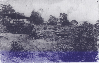
... Mr Williams senior worked on various mining activities in the district, including the Rocky Mountain Tunnel project. Conversant with the character of gold-bearing reefs in the area, the syndicate dug an eight hundred foot tunnel, digging down as far down as two hundred feet with little capital save their labour, to connect and provide better working access to the mass of reefs and veins in the vicinity. ...Mr Williams senior worked on various mining activities in the district, including the Rocky Mountain Tunnel project. Conversant with the character of gold-bearing reefs in the area, the syndicate dug an eight hundred foot tunnel, digging down as far down as two hundred feet with little capital save their labour, to connect and provide better working access to the mass of reefs and veins in the vicinity. ...This image is a reproduction of an 1899 original depicting the 'Williams Good Luck Mine' on the Mopoke Reef (also called 'Morepork Gully') in the Dingle Ranges, approximately three miles from Beechworth. The foreground of the image is littered with piles of smashed rock and detritus, known as ‘mullock’, beside a reinforced mine shaft, a vertical access passageway allowing miners to enter the mine and haul ore out using lifting technology such as a poppet heads, whims or windlasses. A group of miners and a dog appear close to an open-sided miner’s hut. Following the discovery of gold at Beechworth in 1852, rushes quickly followed at surrounding creeks and gullies in the district. In the late nineteenth and early twentieth centuries, small syndicates of miners continued to work old or abandoned quartz reefs, often persisting without the assistance of heavy machinery to remove the large amounts of rock, in order to obtain yields at ever greater depths. The group of miners in this photograph are Mr. Roger Williams and Sons, who revived operations at the ‘Old Good Luck’ mine on the Mopoke Reef in the Dingle Range near Beechworth around 1892, working the site for more than two decades. An emigrant from Cornwall with experience in the tin mining industry, 19 year old Roger Williams senior sailed to New Zealand in 1840, then to Australia where he spent time in the Bendigo Gold Fields before settling in Beechworth in the early 1860s. Mr Williams senior worked on various mining activities in the district, including the Rocky Mountain Tunnel project. Conversant with the character of gold-bearing reefs in the area, the syndicate dug an eight hundred foot tunnel, digging down as far down as two hundred feet with little capital save their labour, to connect and provide better working access to the mass of reefs and veins in the vicinity. Progress was hampered by poor air quality charged with fumes from dynamite and large quantities of rock had to be crushed to obtain payable yields. The Victorian Goldfields are filled with ruins and remnants of the area's rich mining history, ranging from small alluvial diggings to the remains of huge mining companies. Site names often changed several times throughout the nineteenth and twentieth centuries. Some sites were abandoned and forgotten, others were worked continuously over many decades. The names of mines were often repeated at different locations throughout the Victorian Goldfields. For example, there is a Mopoke Gully heritage mine near Fryers Creek, Victoria. 'Mopoke' is a common onomatopoeic name for Morepork and Australian Boobook owls. This image has historical, social and research significance for patterns of emigration during of the Victorian Gold Rush, and the historical, social and environmental impacts of mining at Beechworth at the turn of the nineteenth and twentieth centuries. As gold became scarce and government support and large company investment waned, poor hard-working miners laboured intensively to make a living through periods of high unemployment. This image can be compared and studied alongside other historical mining photographs and objects in the Burke Museum Collection. It has potential to improve our understanding of miners working conditions and the shifting character of mining in the Beechworth district. Black and white rectangular reproduction photograph printed on matte photographic paper.Obverse: Williams Good Luck Mine Beechworth / Roger! / Reverse: 6858 / burke museum, beechworth museum, beechworth, gold fields, gold rush, victorian gold rush, gold ming history, colonial australia, australian gold rushes, mining technology, beechworth historic district, indigo gold trail, migration, indigo shire, good luck gold mine, victorian goldfields, mining syndicates, gold fever, quartz-mining, small-scale mining, old good luck mine, mopoke gully, quartz reefs beechworth -
 The Beechworth Burke Museum
Photograph
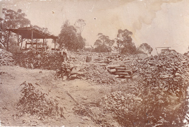
... Mr Williams senior worked on various mining activities in the district, including the Rocky Mountain Tunnel project. Conversant with the character of gold-bearing reefs in the area, the syndicate dug an eight hundred foot tunnel, digging down as far down as two hundred feet with little capital save their labour, to connect and provide better working access to the mass of reefs and veins in the vicinity. ...Mr Williams senior worked on various mining activities in the district, including the Rocky Mountain Tunnel project. Conversant with the character of gold-bearing reefs in the area, the syndicate dug an eight hundred foot tunnel, digging down as far down as two hundred feet with little capital save their labour, to connect and provide better working access to the mass of reefs and veins in the vicinity. ...This image is a reproduction of an 1899 original depicting the 'Williams Good Luck Mine' on the Mopoke Reef (also called 'Morepork Gully') in the Dingle Ranges, approximately three miles from Beechworth. The foreground of the image is littered with piles of smashed rock and detritus, known as ‘mullock’, beside a reinforced mine shaft, a vertical access passageway allowing miners to enter the mine and haul ore out using lifting technology such as a poppet heads, whims or windlasses. A group of miners and a dog appear close to an open-sided miner’s hut. Following the discovery of gold at Beechworth in 1852, rushes quickly followed at surrounding creeks and gullies in the district. In the late nineteenth and early twentieth centuries, small syndicates of miners continued to work old or abandoned quartz reefs, often persisting without the assistance of heavy machinery to remove the large amounts of rock, in order to obtain yields at ever greater depths. The group of miners in this photograph are Mr. Roger Williams and Sons, who revived operations at the ‘Old Good Luck’ mine on the Mopoke Reef in the Dingle Range near Beechworth around 1892, working the site for more than two decades. An emigrant from Cornwall with experience in the tin mining industry, 19 year old Roger Williams senior sailed to New Zealand in 1840, then to Australia where he spent time in the Bendigo Gold Fields before settling in Beechworth in the early 1860s. Mr Williams senior worked on various mining activities in the district, including the Rocky Mountain Tunnel project. Conversant with the character of gold-bearing reefs in the area, the syndicate dug an eight hundred foot tunnel, digging down as far down as two hundred feet with little capital save their labour, to connect and provide better working access to the mass of reefs and veins in the vicinity. Progress was hampered by poor air quality charged with fumes from dynamite and large quantities of rock had to be crushed to obtain payable yields. The Victorian Goldfields are filled with ruins and remnants of the area's rich mining history, ranging from small alluvial diggings to the remains of huge mining companies. Site names often changed several times throughout the nineteenth and twentieth centuries. Some sites were abandoned and forgotten, others were worked continuously over many decades. The names of mines were often repeated at different locations throughout the Victorian Goldfields. For example, there is a Mopoke Gully heritage mine near Fryers Creek, Victoria. 'Mopoke' is a common onomatopoeic name for Morepork and Australian Boobook owls.This image has historical, social and research significance for patterns of emigration during of the Victorian Gold Rush, and the historical, social and environmental impacts of mining at Beechworth at the turn of the nineteenth and twentieth centuries. As gold became scarce and government support and large company investment waned, poor hard-working miners laboured intensively to make a living through periods of high unemployment. This image can be compared and studied alongside other historical mining photographs and objects in the Burke Museum Collection. It has potential to improve our understanding of miners working conditions and the shifting character of mining in the Beechworth district.Sepia coloured rectangular photograph printed on gloss photographic paper mounted on card.Obverse: Reverse: A02497/ 1997.2497/ 'Good/ Luck/ Mine'/ Morepork/ Gully/ Mrs Joyce/ Bright/ Tunnel/ 800 ft/ 1899. burke museum, beechworth museum, beechworth, gold fields, gold rush, victorian gold rush, gold ming history, colonial australia, australian gold rushes, mining technology, beechworth historic district, indigo gold trail, migration, indigo shire, good luck gold mine, victorian goldfields, mining syndicates, gold fever, quartz-mining, small-scale mining, old good luck mine, mopoke gully, quartz reefs beechworth -
 Eltham District Historical Society Inc
Document - Folder, Mitchell, Jenni
... Newspaper article: "Rocky mountain high", ?1997. Jenni Mitchell's exhibition of Flinders Ranges work in Mains Restaurant, Eltham ?...Newspaper article: "Rocky mountain high", ?1997. Jenni Mitchell's exhibition of Flinders Ranges work in Mains Restaurant, Eltham ? ...Jenni Mitchell, daughter of Grace and Arthur Mitchell, is a painter. Contents Newspaper article: "Back to the drawing board", Diamond Valley News, 19 May 1981. Jenni Mitchell's early life. Newspaper article: "Jenni captures the cast and rugged desert", Diamond Valley News, 13 March 1984. Jenni Mitchell's exhibition of Wimmera paintings, 16-25 March 1984. Exhibition list: Jenni Mitchell studio exhibition, ?1984 ?1986. Newspaper article: "Jenni mingles with greats of art world", Diamond Valle News, 29 July 1986. Jenni Mitchell exhibitor in Melbourne Spoleto Festival exhibition, Ross House Gallery, Kew. Newspaper article: "Poet, painter a formidable duo", Diamond Valley News, 28 October 1986. A poem from Cornelis Vieeskens's book and story of connection to Grace Mitchell's art works. Newspaper article: "Eltham artist to stage her 20th solo exhibition", Diamond Valley News, 31 May 1995. Jenni Mitchell's "Survey Exhibition 1975-1995", at Dempsters Fine Art Gallery, Canterbury, opened by poet Judith Rodriguez on 2 June 1995 . Election flier: Jenni Mitchell, candidate for Eltham Council, 1989. Newspaper article: "Aiming to keep history alive", Diamond Valley News, 22 August 1989. Newly elected Eltham Councillor Jenni Mitchell's objectives. Newspaper article: "Poetry in paint", Diamond Valley News, 23 November 1992. Jenni Mitchell's exhibition of Australian contemporary writers at the National Poetry Festival at Montsalvat, December 1992. Newspaper article: "Eltham artist to stage her 20th solo exhibition", Diamond Valley News, 31 May 1995. Jenni Mitchell's exhibition, "Survey Exhibition 1995-1985" at Dempsters Fine Art Gallery, Canterbury, opened 2 June 1995. Newspaper article :Keen to get focus on art again", Diamond Valley News, 6 November 1996. Jenni Mitchell exhibiting in Nillumbik Festival's Artists Open Studios program 1996. Newspaper article: "Rocky mountain high", ?1997. Jenni Mitchell's exhibition of Flinders Ranges work in Mains Restaurant, Eltham ?1997. Newspaper article: "Inspired works", ?1999. Jenni Mitchell's exhibition of works from artist-in-residence at Bundanon and Riversdale, Adam Galleries, Melbourne until 8 September ?1999. Newspaper article: "Gone bush, in search of the still place", The Age, 2 May 2000. Jenni Mitchell's exhibition Portraits of Extraordinary People, Queens Hall, Parliament House until 12 May 2000. Booklet: "Sharing a History, an essay by JHenni Mitchell", produced in association with exhibition Captured at the Eltham Library Community Gallery, 22 February to 3 March 2002 Flier: "Artists Open Studio 2001-2002. Exhibition of artists participating in the Nillumbik Artists Open Studio Program at Eltham Wiregrass Gallery, 21 February to 7 March 2002. Newspaper article: "Not just white in sight", Diamond Valley Leader 3 September 2003. Jenni Mitchell's exhibition "To the Ice, Images from the Antarctic at Montsalvat until 7 October 2003. Newspaper article: "Works are poetry on canvas", Diamond Valley News, 2003. Jenni Mitchell's exhibition 'Desert, Ice and Poetry, at Montsalvat until 12 December 2003. Newspaper article: "In love with a world of ice", Herald Sun, 25 October 2003. Jenni Mitchell's exhibition 'Desert, Ice and Poetry, at Montsalvat until 12 December 2003. Newspaper article: "Display honours artist, wife", Diamond Valley Leader 28 July 2004. Jenni Mitchell had been student of Alan Martin, retrospective exhibition of Martin's work at Eltham Community Centre 31 July to 1 August 2004. Newspaper article: "Portrait due get to the heart of the matter", Diamond Valley Leader, 13 April 2005. Jenni Mitchell painted double portrait of Colin Royse and Allstair Royse for Archibald Prize. Newspaper article: "Brothers impress artist", Diamond Valley Voice 13 April 2005. Jenni Mitchell painted double portrait of Colin Royse and Allstair Royse for Archibald Prize. Newspaper article: "Poles apart but online", Diamond Valley Leader 2005. Jenni Mitchell's journey to the North Pole will have a website set up by Hugh Stubley and Stephen Pearce, Tribity Digital Solutions. Newspaper article: "Going to extremes for ideas", Diamond Valley Leader, 1 June 2005. Jenni Mitchell's exhibition "Images of the Antarctic" at Dickerson Gallery 7 June to 3 July 2005. Newspaper article: "Works are poetry on canvas", Diamond Valley News, ~2005. Jenni Mitchell's exhibition "Desert, Ice and Poetry" at Montsalvat until 12 December 2005. Newspaper article: "Places for painting", Diamond Valley Leader, 2 November 2005. Jenni Mitchell organising plein air painting workshops around Eltham for students. Newspaper article: "Spirit of past inspires artist", Diamond Valley Leader, 1 November 2006. Jenni Mitchell and Mervyn Hannan have opened a studio at Montsalvat, appealing for more volunteers. Newspaper article: "Art in Action", Heidelberg and Valley Weekly, 31 October 2006. Jenni Mitchell and Mervyn Hannan's Working Studio Gallery at Montsalvat. Newspaper article: "Honey lures art taste to sport", Diamond Valley Leader 11 July 2007. Jenni Mitchell's portrait of Gary Honey entered for Basil Sellers Art Prize., on show at Gateway Galleries Eltham as part of her Extra-Ordinary People series. Newspaper article: "Celebrate history and her story", Diamond Valley Leader, 20 February 2008. Jenni Mitchell and Grace Mitchell already nominated for a Nillumbik Women's Network publication. Newspaper article: "Aura of northern lights draws Eltham artist", Diamond Valley Leader, 13 January 2010. NewspaperJenni Mitchel will travel o a Norwegian cruise ship for six weeks. Newspaper article: "Brush with fame", Banyule and Nillumbik Weekly, 28 September 2010. Jenni Mitchell's house and studio, and her exhibition "From the Edge" at Montsalvat until 30 September 2010. Talk flier: "A visual presentation and floor talk" by Jenni Mitchell for her exhibition "From the Edge" 16 September 2010. Exhibtion flier: "From the Edge" exhibition of painting and photography by Jenni Mitchell, Montsalvat 3-30 September 2010. Newspaper article: "Home is where the art is", Diamond Valley Leader, 16 November 2011. Jenni Mitchell's early life with Grace Mitchell, and exhibition as part of Artists Open Studios. Newspaper article: "Artists visit Mongolia", Diamond Valley Leader, 25 April 2012. Jenni Mitchell and Mervyn Hannan will spend seven weeks in Mongolia, exhibiting at the National Museum of Mongolia. Flier: Open Studio, Jenni Mitchell, Mervyn Hannan, Grace Mitchell, 5-6 May 2012. Newspaper article: "Shared love fires artists", Diamond Valley Leader, 4 July 2012. Exhibition of works by Mongolian artist Tugsoyun Sodnom, Jenni Mitchell and Mervyn Hannan at Montsalvat. Newspaper article: "Tribute to an art legend", Diamond Valley Leader, 26 September 2012. Exhibition "Grace Mitchell" A selected Retrospective" to open at South Fine Art Studios and Gallery on 7 October 2012. Newsletter article: "Jenni Mitchell - My mother Grace", Eltham District Historical Society No.207 November 2012. Exhibition notes: "The Retro Eltham Show", Eltham South Fine Art Studios and Gallery, 14 April to 9 June 2013. Newspaper article: "Jenni salutes Mongolia", Diamond Valley Leader, 12 November 2013. Jenni Mitchell's exhibition "Two Mongolian Journeys" at Eltham South Fine Art Gallery until 24 December 2013. Flier: Eltham South Fine Art Studios and Gallery, 6 Mount Pleasant Road, undated. Newspaper article: "Moving on is not without a shockwave", Diamond Valley Leader, 26 October 2016. Jenni Mitchell and Mervyn Hannan are moving to Hamilton, selling their Mt Pleasant Road property and gallery Newspaper article: "Great Grampians, It's Jenni Mitchell and Mervyn Hannan!", Jenni Mitchell and Mervyn Hannan's exhibtion at Streamline Publishing's Gallery, opened by Vicki Ward, 7-28 September 2022.Newspaper clippings, A4 photocopies, etcjenni mitchell, grace mitchell, cornelis vieeskens, dempsters fine art gallery, judith rodriguez, montsalvat eltham, professor a d hope, judith wright, geoffrey eggleston, shelton lea, montsalvat poetry festival, artists open studios, mervyn hannan, south fine art studios and gallery, jennifer mitchell, ken taylor, nic taylor, ross house gallery kew, melbourne spoleto festival, brian pearce, robert wilson, bundanon, adam galleries, eltham wiregrass gallery, alan martin, eltham community gallery, eltham cemetery, cemeteries and crematoria bill, isla heddle, nillumbik cemetery trust, michael dobson, tpmy raimoc, belinda clarkson, friends of nillumbik, catherine dale, allstair royse, archibald prize, dickerson galley, hugh stubley, stephen pearce, trinity digital solutions, gateway galleries eltham, gary honey, basil sellers art prize, nillumbik women's network, warwick leeson, national museum of mongolia, tugsoyun sodnom, michelle morgan, zanzy community choir, eltham south fine art gallery, streamline publishing's gallery, vicki ward, sonia skipper, joe hannan, robert marshall, hamilton regional gallery, petschel house hamilton, colin rouse, st. katherine's church, st helena -
 Marysville & District Historical Society
Photograph (item) - Colour photograph, Unknown
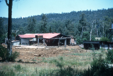
... Processing Mountain Ash and Manna Gum, it was a major local employer before ceasing operations in 1955. Early settlers initially used the harsh, rocky country of the Cathedral Range for grazing. ...Processing Mountain Ash and Manna Gum, it was a major local employer before ceasing operations in 1955. Early settlers initially used the harsh, rocky country of the Cathedral Range for grazing. ...A digital copy of a colour photograph of Cooks Mill in Victoria. Located in the Cathedral Range State Park near Marysville, Cooks Mill was established as Cathedral Mill in 1938. Processing Mountain Ash and Manna Gum, it was a major local employer before ceasing operations in 1955. Early settlers initially used the harsh, rocky country of the Cathedral Range for grazing. However, wild dogs and difficult terrain eventually ended this. In 1938, timber workers established the Cathedral Mill near the junction of Little River and Storm Creek. The mill was later renamed Cooks Mill and supported local milling operations through the 1940s and 1950s, supplying sawn timber to the Healesville railway station and Melbourne builders. The mill itself stopped operating in 1955, though logging continued in the surrounding forests until late 1971.A digital copy of a colour photograph of Cooks Mill in Victoria.marysville, victoria, australia, taggerty, cathedral range state park, cathedral mill, mountain ash, manna gum, little river, storm creek, cooks mill, healesville railway station, melbourne
