
Showing 145 items matching "roof plans"
-
 University of Melbourne, Burnley Campus Archives
Plan, 68-70 Dorcas St South Melbourne, 1989
... ...roof plans...Site/Roof plan by David Earle & Associates, Project No 1189 Drawing No A1. ...david earle South Melbourne roof plans Site/Roof plan by David Earle & Associates, Project No 1189 Drawing No A1. ...Site/Roof plan by David Earle & Associates, Project No 1189 Drawing No A1. Designed by D.F.david earle, south melbourne, roof plans -
 Kew Historical Society Inc
Slide - Architectural Drawing, Kew Public Offices, 1887
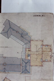
... DRAWING NO 1 / ROOF PLAN...They are historically and architecturally significant to the State Of Victoria because Watson and Harvey's designs exhibit diversity in integrating civil offices, they accommodate the apex of road junctions, and they demonstrate a departure from the contemporaneously favoured High Victorian Classical to the Queen Anne style in the design of civic buildings. kew court house kew police station kew post office architectural drawings khs - slides new public offices -- kew (vic.) architecture — queen anne style DRAWING NO 1 / ROOF PLAN 35mm colour transparency of an original plan by George Watson and John Henry Harvey, architects of the Department of Public Works (Victoria), in 1887 for New Public Offices at Kew. ...A civic campaign for new public offices developed in Kew in the 1880s. After much deliberation, the location chosen was the junction of Bulleen and Cotham Roads. The buildings were designed by George Watson and John Henry Harvey, architects within the Department of Public Works (Victoria). Building was commenced in 1887, and after one year, the buildings were opened. The Post Office was transferred to the new Commonwealth Government in 1901. The Police Station and Court House, sold by the Victorian Government to the City of Boroondara in 2007, are now a community cultural centre and performing arts venue.The buildings were listed on the Victorian Heritage Register Register (HO885) in 1991. They are historically and architecturally significant to the State Of Victoria because Watson and Harvey's designs exhibit diversity in integrating civil offices, they accommodate the apex of road junctions, and they demonstrate a departure from the contemporaneously favoured High Victorian Classical to the Queen Anne style in the design of civic buildings. 35mm colour transparency of an original plan by George Watson and John Henry Harvey, architects of the Department of Public Works (Victoria), in 1887 for New Public Offices at Kew. This plan was copied by the donor from an original held at the Commonwealth Archives in Brighton (Vic). The copy was made to illustrate a report that the donor made on ‘The functional planning design, building materials and construction methods of the Kew Post Office’ as part of course work at RMIT.DRAWING NO 1 / ROOF PLANkew court house, kew police station, kew post office, architectural drawings, khs - slides, new public offices -- kew (vic.), architecture — queen anne style -
 Kew Historical Society Inc
Slide - Architectural Drawing, Kew Public Offices, 1887
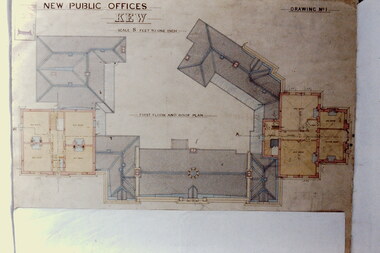
... NEW PUBLIC OFFICES KEW/ FIRST FLOOR & ROOF PLAN / DRAWING NO 1 / SCALE 8 FEET TO ONE INCH...They are historically and architecturally significant to the State Of Victoria because Watson and Harvey's designs exhibit diversity in integrating civil offices, they accommodate the apex of road junctions, and they demonstrate a departure from the contemporaneously favoured High Victorian Classical to the Queen Anne style in the design of civic buildings. kew court house kew police station kew post office architectural drawings khs - slides new public offices -- kew (vic.) architecture — queen anne style NEW PUBLIC OFFICES KEW/ FIRST FLOOR & ROOF PLAN / DRAWING NO 1 / SCALE 8 FEET TO ONE INCH 35mm colour transparency of an original plan by George Watson and John Henry Harvey, architects of the Department of Public Works (Victoria), in 1887 for New Public Offices at Kew. ...A civic campaign for new public offices developed in Kew in the 1880s. After much deliberation, the location chosen was the junction of Bulleen and Cotham Roads. The buildings were designed by George Watson and John Henry Harvey, architects within the Department of Public Works (Victoria). Building was commenced in 1887, and after one year, the buildings were opened. The Post Office was transferred to the new Commonwealth Government in 1901. The Police Station and Court House, sold by the Victorian Government to the City of Boroondara in 2007, are now a community cultural centre and performing arts venue.The buildings were listed on the Victorian Heritage Register Register (HO885) in 1991. They are historically and architecturally significant to the State Of Victoria because Watson and Harvey's designs exhibit diversity in integrating civil offices, they accommodate the apex of road junctions, and they demonstrate a departure from the contemporaneously favoured High Victorian Classical to the Queen Anne style in the design of civic buildings. 35mm colour transparency of an original plan by George Watson and John Henry Harvey, architects of the Department of Public Works (Victoria), in 1887 for New Public Offices at Kew. This plan was copied by the donor from an original held at the Commonwealth Archives in Brighton (Vic). The copy was made to illustrate a report that the donor made on ‘The functional planning design, building materials and construction methods of the Kew Post Office’ as part of course work at RMIT.NEW PUBLIC OFFICES KEW/ FIRST FLOOR & ROOF PLAN / DRAWING NO 1 / SCALE 8 FEET TO ONE INCHkew court house, kew police station, kew post office, architectural drawings, khs - slides, new public offices -- kew (vic.), architecture — queen anne style -
Stawell Historical Society Inc
Map - Plan, Earle and Partners, Restoration of Pleasant Creek Courthouse Stawell West 1974, 24/10/1974
... Drawing 2 is Gallery And Roof Plan. Drawing 4 Details...Drawing 2 is Gallery And Roof Plan. Drawing 4 Details Restoration of Pleasant Creek Courthouse Stawell West 1974 Map Plan Earle and Partners ...Drawing 1 Is not in Collection Drawing 5 Landscape Pal is 5092-13 A2 Sheets. Drawing 3 is Elevations. Drawing 2 is Gallery And Roof Plan. Drawing 4 Details24 Oct 74. And 25 Oct 74stawell historical -
Port Melbourne Historical & Preservation Society
Plan - Proposed extensions, Heath Street, Port Melbourne Town Hall, E J Pembroke, 15 Oct 1936
... Floor plans, elevations to Heath street; south end; roof plan for proposed extensions to supper room Town Hall 1936. ...Town Hall" Floor plans, elevations to Heath street; south end; roof plan for proposed extensions to supper room Town Hall 1936. ...Floor plans, elevations to Heath street; south end; roof plan for proposed extensions to supper room Town Hall 1936. Coloured plans."City of Port Melbourne . Proposed Extensions to Supper Room . Town Hall"port melbourne town hall, pembroke and turner, e j pembroke -
Port Melbourne Historical & Preservation Society
Plan - Floor Plans, Proposed Port Melbourne Library, Fred Cook, City Engineer, 1938
... From set of plans for the proposed Library - City of Port Melbourne 1938 4 sheets with ground floor plan, roof plan, 1st floor plan, side elevation, elevation. ...Built Environment - Civic City Engineers Fred COOK Port Melbourne Library "City of Port Melbourne Proposed Library":Fred Cook City Engineer From set of plans for the proposed Library - City of Port Melbourne 1938 4 sheets with ground floor plan, roof plan, 1st floor plan, side elevation, elevation. ...From set of plans for the proposed Library - City of Port Melbourne 1938 4 sheets with ground floor plan, roof plan, 1st floor plan, side elevation, elevation. Two on paper, hand coloured; two on tracing paper."City of Port Melbourne Proposed Library":Fred Cook City Engineerbuilt environment - civic, city engineers, fred cook, port melbourne library -
University of Melbourne, Burnley Campus Archives
Plan - Photocopy, Additions to Curator's Residence Royal Horticultural Gardens Burnley 1899, 1899
... Elevations and Ground and Roof Plan. Drawing No 1 Stamped GB 5169. Dated 6.6.99. ...Elevations and Ground and Roof Plan. Drawing No 1 Stamped GB 5169. Dated 6.6.99. ...Photocopy. Additions to Curator's Residence, Royal Horticultural Gardens, Burnley. Elevations and Ground and Roof Plan. Drawing No 1 Stamped GB 5169. Dated 6.6.99. From Public Records Office.burnley gardens, curator's residence -
Clunes Museum
Map - CLUNES TOWN HALL AND COURTHOUSE COMPLEX, FALKINGER ANDRONAS
... CLUNES TOWN HALL AND COURT HOUSE COMPLEX - PROPOSED REFURBISHMENT ARCHITECT DRAWINGS: ,1 SITE AND ROOF PLAN .2 GROUND FLOOR PLAN .3 EAST ELEVATION .4 WEST ELEVATION .5 ABC/FASCADES...TOWN HALL AND COURTHOUSE DRAWINGS PROPOSED REFURBISHMENT CLUNES TOWN HALL AND COURT HOUSE COMPLEX - PROPOSED REFURBISHMENT ARCHITECT DRAWINGS: ,1 SITE AND ROOF PLAN .2 GROUND FLOOR PLAN .3 EAST ELEVATION .4 WEST ELEVATION .5 ABC/FASCADES Map CLUNES TOWN HALL AND COURTHOUSE COMPLEX FALKINGER ANDRONAS ...CLUNES TOWN HALL AND COURT HOUSE COMPLEX - PROPOSED REFURBISHMENT ARCHITECT DRAWINGS: ,1 SITE AND ROOF PLAN .2 GROUND FLOOR PLAN .3 EAST ELEVATION .4 WEST ELEVATION .5 ABC/FASCADEStown hall and courthouse drawings, proposed refurbishment -
University of Melbourne, Burnley Campus Archives
Plan - Photocopy, New Cottage for Caretaker Royal Horticultural Gardens Burnley 1897, 1897
... New cottage for Caretaker, Royal Horticultural Gardens Burnley (1) Elevations, Ground floor and Roof plans. Drawing No 1 dated 5th March 1897 GB 5198. (2) Detail Drawings. ...New cottage for Caretaker, Royal Horticultural Gardens Burnley (1) Elevations, Ground floor and Roof plans. Drawing No 1 dated 5th March 1897 GB 5198. (2) Detail Drawings. ...Photocopies. New cottage for Caretaker, Royal Horticultural Gardens Burnley (1) Elevations, Ground floor and Roof plans. Drawing No 1 dated 5th March 1897 GB 5198. (2) Detail Drawings. Drawing No 2. From Public Records Office.Signed SEM (?) 5-1-97; J. Fisher, F.J. Moore (?) 5 Mar. 97caretaker's cottage, burnley gardens -
 Bendigo Historical Society Inc.
Plan - MARKS COLLECTION: PLAN OF ALTERATIONS AND ADDITIONS TO THE PRIVATE RESIDENCE OF GEO. LANSELL ESQR
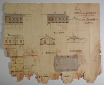
... Plan for the alteration and additions to Fortuna Villaa, the private residence of George Lansell Plan shows southern, eastern & western elevations, floor and roof plan for the additions to the residence Coloured hand drawn construction plan Plan is undated plan has severe damage on LHS and bottom of the sheet...It remained in the Lansell family until 1935 Fortuna Villa George Lansell Building plans C & T Ballerstedt Plan for the alteration and additions to Fortuna Villaa, the private residence of George Lansell Plan shows southern, eastern & western elevations, floor and roof plan for the additions to the residence Coloured hand drawn construction plan Plan is undated plan has severe damage on LHS and bottom of the sheet Plan MARKS COLLECTION: PLAN OF ALTERATIONS AND ADDITIONS TO THE PRIVATE RESIDENCE OF GEO. ...Fortuna Villa was owned from 1855 to 1871 by Christopher and Theodore Ballerstedt, Australia’s first mining magnates. In 1871 it was purchased by George Lansell (The Quartz King) being one of Australia’s most successful and adventurous nineteenth century gold mine owners and speculators. Lansell made numerous alterations and extensions to the building. It remained in the Lansell family until 1935Plan for the alteration and additions to Fortuna Villaa, the private residence of George Lansell Plan shows southern, eastern & western elevations, floor and roof plan for the additions to the residence Coloured hand drawn construction plan Plan is undated plan has severe damage on LHS and bottom of the sheetfortuna villa, george lansell, building plans, c & t ballerstedt -
 Bendigo Historical Society Inc.
Document - MARKS COLLECTION: PLAN FOR ALTERATIONS AND ADDITIONS TO FORTUNA
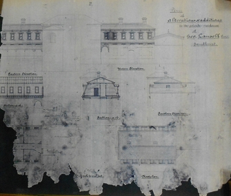
... Copy of plan: Written on top RH corner of plan 'plan for alteration and additions to the private residence of Geo Lansell Sandhurst' Plan shows western, southern, and eastern elevations, plus roof plan. Bottom section of plan damaged. ...BUILDINGS House fortuna villa Copy of plan: Written on top RH corner of plan 'plan for alteration and additions to the private residence of Geo Lansell Sandhurst' Plan shows western, southern, and eastern elevations, plus roof plan. Bottom section of plan damaged. On bottom of plan '1/8 inch to one foot.' ...Copy of plan: Written on top RH corner of plan 'plan for alteration and additions to the private residence of Geo Lansell Sandhurst' Plan shows western, southern, and eastern elevations, plus roof plan. Bottom section of plan damaged. On bottom of plan '1/8 inch to one foot.'buildings, house, fortuna villa -
 Ballarat Tramway Museum
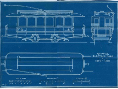
Plan, Ken McCarthy, "NSWGT - Electric trams 1,2,3 1890 - 1900", May. 1960
... Tramway cars 1,2,3,- Roof plan, front and side elevation - with side running trolley poles - 3/8"=1' scale with O gauge 1/4 and O gauge 3/8" scale marked. ...Tramway cars 1,2,3,- Roof plan, front and side elevation - with side running trolley poles - 3/8"=1' scale with O gauge 1/4 and O gauge 3/8" scale marked. ...Yields information about the nature of the trams that came from Sydney to Ballarat for the first electric tramcars and has a strong association with the person who prepared by the plan.Blueprint plan of NSW Govt. Tramway cars 1,2,3,- Roof plan, front and side elevation - with side running trolley poles - 3/8"=1' scale with O gauge 1/4 and O gauge 3/8" scale marked. (These cars become part of the 1905 ESCo Ballarat Fleet). Imaged by scanning in two halves and joining together - could do some further work.trams, tramways, nswgt, plans, tramcars, esco -
Stawell Historical Society Inc
Map - Drawings, Wendy Jacobs, Western Highway, 2014
... WD 1/13 - Site Plan WD 2/13 - Existing Conditions & Demolition Plan WD 3/13 - Floor Plan WD 4/13 - Elevations WD 5/13 - Sections AA & BB WD 6/13 - Sections CC WD 7/13 - Sections DD, EE & FF WD 9/13 - Roof Plan WD 10 /13 Reflected Ceiling Plan WD 12/13 - Toilet & Meeting Cup'd Details WD 13/13 - Details...WD 1/13 - Site Plan WD 2/13 - Existing Conditions & Demolition Plan WD 3/13 - Floor Plan WD 4/13 - Elevations WD 5/13 - Sections AA & BB WD 6/13 - Sections CC WD 7/13 - Sections DD, EE & FF WD 9/13 - Roof Plan WD 10 /13 Reflected Ceiling Plan WD 12/13 - Toilet & Meeting Cup'd Details WD 13/13 - Details Wendy Jacobs Architect & Heritage Consultant Nov 2014 Eleven (11) A1 Printed Maps Western Highway Map Drawings Wendy Jacobs ...WD 1/13 - Site Plan WD 2/13 - Existing Conditions & Demolition Plan WD 3/13 - Floor Plan WD 4/13 - Elevations WD 5/13 - Sections AA & BB WD 6/13 - Sections CC WD 7/13 - Sections DD, EE & FF WD 9/13 - Roof Plan WD 10 /13 Reflected Ceiling Plan WD 12/13 - Toilet & Meeting Cup'd Details WD 13/13 - DetailsEleven (11) A1 Printed MapsWendy Jacobs Architect & Heritage Consultant Nov 2014 -
 Vision Australia
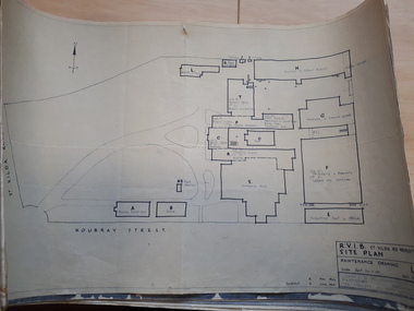
Plan - Image, RVIB Maintenance drawing, April 1963 - November 1966
... These plans include: 1 - St Kilda Road Property - a site map of the buildings and grounds with the names of the various areas added. 2 - St Kilda Road Central Building (copied from a RAAF drawing) showing rooms on the ground floor. 3 - St Kilda Road Central Building (copied from a RAAF drawing) showing rooms on the first floor. 4 - St Kilda Road Central Building roof plan. 5 - St Kilda Road Factories showing the layout on the ground floor. 6 - St Kilda Road Factories showing the layout on the first floor. 7 - St Kilda Road building showing all three floors of the building rented out to Alfred Hospital. 8 - St Kilda Road caretaker, factory, fundraising and rehabilitation training buildings. 9 - Raleigh Street, Prahran hostel layout for both girls and boys....These plans include: 1 - St Kilda Road Property - a site map of the buildings and grounds with the names of the various areas added. 2 - St Kilda Road Central Building (copied from a RAAF drawing) showing rooms on the ground floor. 3 - St Kilda Road Central Building (copied from a RAAF drawing) showing rooms on the first floor. 4 - St Kilda Road Central Building roof plan. 5 - St Kilda Road Factories showing the layout on the ground floor. 6 - St Kilda Road Factories showing the layout on the first floor. 7 - St Kilda Road building showing all three floors of the building rented out to Alfred Hospital. 8 - St Kilda Road caretaker, factory, fundraising and rehabilitation training buildings. 9 - Raleigh Street, Prahran hostel layout for both girls and boys. ...A series of maintenance drawings were made or copied by an architectural firm. These plans include: 1 - St Kilda Road Property - a site map of the buildings and grounds with the names of the various areas added. 2 - St Kilda Road Central Building (copied from a RAAF drawing) showing rooms on the ground floor. 3 - St Kilda Road Central Building (copied from a RAAF drawing) showing rooms on the first floor. 4 - St Kilda Road Central Building roof plan. 5 - St Kilda Road Factories showing the layout on the ground floor. 6 - St Kilda Road Factories showing the layout on the first floor. 7 - St Kilda Road building showing all three floors of the building rented out to Alfred Hospital. 8 - St Kilda Road caretaker, factory, fundraising and rehabilitation training buildings. 9 - Raleigh Street, Prahran hostel layout for both girls and boys.9 pages of plans of buildings on St Kilda road siteVarious - see individual plansmyer house, royal victorian institute for the blind, plans, raleigh street hostel, alfred hospital -
Stawell Historical Society Inc
Map - Drawings, Wendy Jacobs, Western Highway Community Precinct Development Structural Drawings, 2014
... 501 Slab and Footing Plan. 502 Slab and Footing Details. 505 Roof Framing Plan 506 Steel Framing Elevations - Sheet 1. 507 Steel Framing Elevations and Sections - Sheet 2 508 Steel Framing Details - Sheet 1 509 Steel Framing Details - Sheet 2 SN1 General Notes, Site map & Drawing Index Used in building Historical Society Building ...501 Slab and Footing Plan. 502 Slab and Footing Details. 505 Roof Framing Plan 506 Steel Framing Elevations - Sheet 1. 507 Steel Framing Elevations and Sections - Sheet 2 508 Steel Framing Details - Sheet 1 509 Steel Framing Details - Sheet 2 SN1 General Notes, Site map & Drawing Index Used in building Historical Society Building Wendy Jacobs Architect & Heritage consultant may 2014 Eight (8) A1 Printed plans Structural Drwaings Western Highway Community Precinct Development Structural Drawings Map Drawings Wendy Jacobs ...501 Slab and Footing Plan. 502 Slab and Footing Details. 505 Roof Framing Plan 506 Steel Framing Elevations - Sheet 1. 507 Steel Framing Elevations and Sections - Sheet 2 508 Steel Framing Details - Sheet 1 509 Steel Framing Details - Sheet 2 SN1 General Notes, Site map & Drawing Index Used in building Historical Society Building Eight (8) A1 Printed plans Structural DrwaingsWendy Jacobs Architect & Heritage consultant may 2014 -
 Flagstaff Hill Maritime Museum and Village
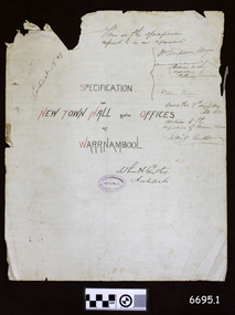
Legal record - Plans and Contract, Arthur H. Cutler, Architect, Warrnambool Town Hall, 1890-1892
... Cutler to Mayor and Councilors, Town of Warrnambool 3) Blueprint Sheet 4, Longitudinal Section, and profiles of Liebig Street and Timor Street, Warrnambool Town Hall, 4) Blueprint Sheet 3, First Floor & Balcony Plan, and Roof Plan 5) Blueprint Sheet 2, Ground Floor Plan, Warrnambool Town Hall 6) Contract, 26 June 1890, marked (Draft Copy Tow Hall Contract), Between Mayor, Councillors and Rate Payers, and William Kellas, Contractor...Cutler to Mayor and Councilors, Town of Warrnambool 3) Blueprint Sheet 4, Longitudinal Section, and profiles of Liebig Street and Timor Street, Warrnambool Town Hall, 4) Blueprint Sheet 3, First Floor & Balcony Plan, and Roof Plan 5) Blueprint Sheet 2, Ground Floor Plan, Warrnambool Town Hall 6) Contract, 26 June 1890, marked (Draft Copy Tow Hall Contract), Between Mayor, Councillors and Rate Payers, and William Kellas, Contractor Warrnambool Town Hall Legal record Plans and Contract Arthur H. ...This is a set of documents including three sheets of blueprint plans for the New Town Hall and Offices for Warrnambool, created in 1890 by the Architect Mr Arthur H. Cutler of Melbourne. The Contract was signed by the Town Mayor for Warrnambool, Mr William Simpson on May 7th 1890. Also, a Council copy of the Contract dated 26 June 1890, with the signatures and diagram where the two official stamps would be placed. The Foundation Stone was laid the following year by the next Mayor, John Hyland on February 24th 1891. The contractor for the building was granted to W. Kellas (William) of Warrnambool. The Town Hall and Offices were built on the corner of Liebig and Timor Streets in Warrnambool. On March 20th 1983 the new Performing Arts Centre was opened y the Mayor, Councillor R w Andreson, on the same site. The new building incorporates the 1890 Town Hall building. The plans, contracts, documents and various references to people on the documents are significant to the history of the City of Warrnambool and its community. The Warrnambool Town Hall building is also significant for the many community events held there over the decades after it was built. Appreciation for the significance of the almost century-old Town Hall building is demonstrated by its inclusion in the new Performing Arts Centre.Set of five documents that includes Plans for the Warrnambool Town Hall, the Contract cover page and a letter from the Architect to the Council. The Contract cover page and the Letter are hand written on cream-coloured paper with a waxy finish, with watermarks. 1) Contract Cover Page, 5th May 1890, Specification of the New Town Hall and Offices at Warrnambool. 2) Letter, 29th January 1892, from Architect Arthur H. Cutler to Mayor and Councilors, Town of Warrnambool 3) Blueprint Sheet 4, Longitudinal Section, and profiles of Liebig Street and Timor Street, Warrnambool Town Hall, 4) Blueprint Sheet 3, First Floor & Balcony Plan, and Roof Plan 5) Blueprint Sheet 2, Ground Floor Plan, Warrnambool Town Hall 6) Contract, 26 June 1890, marked (Draft Copy Tow Hall Contract), Between Mayor, Councillors and Rate Payers, and William Kellas, ContractorWatermarks on handwritten pages [horizontal lines], "36" "BUSBRIDGE'S / LOFT DRIED" Contract cover page, Oval stamp "CUTLER - 281 COLLINS ST. E. MELBOURNE - ARCHITECT " (other crossed out text) Handwritten script "This is the specifications referred to in our agreement" "Dated this 7th day of May A.D. 1890" Signed "W. Simpson Mayor" "Arthur H. Cutler Architect", [two Witnesses' signatures and others] Letter from Arthur Cutler, handwritten, has his address "472 Chancery Lane, Melbourne" CONTRACT of 26 June 1890: "The Mayor, Councillors and Rate Payers of Warrnambool" "William Kellas of Warrnambool" "Signed William Simpson, Maoyorr" "R F Kennedy, Councillor" "Wm Kellas" with diagrams where the round Common Seal and square Stamp would be applied.warrnambool, flagstaff hill, warrnambool, flagstaff hill maritime museum, maritime village, shipwreck coast, great ocean roaad, warrnamboo town hall, warrnambool council offices, mayor william simpson, arthur h cutler, architect, civic centre, town hall, performing arts centre, mayor john hyland, william kellas, mayor r w anderson, r f kennedy, contract -
 Sunshine and District Historical Society Incorporated
Archive - Gwen Mousley Collection - Plans for buildings, for St John's Deer Park - church hall & kindergarten,, 16/5/1951 & proposed toilet block for St John's, 9/7/74
... Folded plans 1) Blueprint + typed letter from Building Directorate, State of Victoria, 16 May 1951, issued to Church of England Trusts Corporation, Diocese of Melbourne, via Shire of Braybrook - building permit Church hall & kindergarten to be constructed of Mount Gambier limstone with an asbestos cement roof. 2) Plans on white paper re toilet block for St John's Church of England, Miles St, Deer Park prepared by B.& D. ...Kayser Folded plans 1) Blueprint + typed letter from Building Directorate, State of Victoria, 16 May 1951, issued to Church of England Trusts Corporation, Diocese of Melbourne, via Shire of Braybrook - building permit Church hall & kindergarten to be constructed of Mount Gambier limstone with an asbestos cement roof. 2) Plans on white paper re toilet block for St John's Church of England, Miles St, Deer Park prepared by B.& D. ...Signature of church wardens on 1951 blueprint: Chas F. Kennedy & S.A. Kayserst. johns church, deer park, miles street, church -
 Lakes Entrance Historical Society
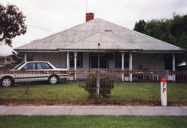
Photograph - Historic House 37 Myer Street. Lakes Entrance Victoria, 1999
... Built on square plan, hipped roof of corrugated iron extends to deep boxed eaves which cover front verandea. ...Built on square plan, hipped roof of corrugated iron extends to deep boxed eaves which cover front verandea. ...Some residents : 1942/43 Mining Engineer by name Cook bought house. Nurse Freda Daniel had it as a private hospital named 'Ardlui'. Holiday home of Dahlsen family of Bairnsdale. Mr & Mrs Crea (Snr) 1970's - early 1980's.Colour photograph of a timber and cement sheet dwelling at 37 Myer Street. Built on square plan, hipped roof of corrugated iron extends to deep boxed eaves which cover front verandea. Unusual sash windows contain eight panes top and bottom. Lakes Entrance Victoriafences, houses, heritage study -
 Melbourne Tram Museum
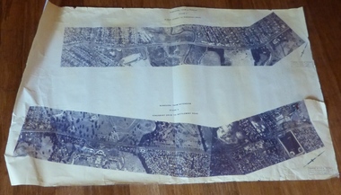
Drawing, Melbourne & Metropolitan Tramways Board (MMTB), Aerial photographs Bundoora Tram Extensions, Plenty Road – MMTB Drawings – 12/1979, Bundoora Extension – Metropolitan Transit Authority – 2/1983, John-Connell – Mott Hay and Anderson – Preliminary drawings for the Latrobe Modal Interchange – August 1984, 1979 to 1984
... Has written on rear at right hand end “Bundoora Tram Extension – Official MMTB Plans” 760H x 1190W Plenty Road – MMTB Drawings – 12/1979 P15123 Tyler St to Walsal Avenue P15124 Walsal Ave t McColl St P15125 McColl St to Dorrington Avenue Bundoora Extension – Metropolitan Transit Authority – 2/1983 P15400 Dorrington Avenue to Barwon Avenue P15401 Barwon Avenue to Nicholson Ave P15402 Nicholson St to Barling Park P15403 Barling Park to Darebin Creek P15404 Darebin Creek to Scott Grove P15405 Scott Grove to Clunes Street P15406 Clunes St to Cash St P15408 Cash St to Bundoora Park P15409 Bundoora Park to Larundel Hospital P15410 At Larundel Hospital P15411 Larundel Hospital to Marne Court P15412 Marne Court to Cherrywood Court P15413 Cherrywood Court to Morwell Ave P15414 Morwell Ave to Grimshaw St P15415 Grimshaw St to Nickson Street P15416 Nickson St to McLeans Road John-Connell – Mott Hay and Anderson – Preliminary drawings for the Latrobe Modal Interchange – August 1984. 8094-A-20 Set Out Plan and Paving Details 8094-A-21 Elevations 8094-A-22 Sections 8094-A-23 Roof Plan and Stormwater Layout 8094-A-24 Canopy Details 8094-A-25 Toilet Block and Waiting Room 8094-A-28 Miscellaneous Details...Has written on rear at right hand end “Bundoora Tram Extension – Official MMTB Plans” 760H x 1190W Plenty Road – MMTB Drawings – 12/1979 P15123 Tyler St to Walsal Avenue P15124 Walsal Ave t McColl St P15125 McColl St to Dorrington Avenue Bundoora Extension – Metropolitan Transit Authority – 2/1983 P15400 Dorrington Avenue to Barwon Avenue P15401 Barwon Avenue to Nicholson Ave P15402 Nicholson St to Barling Park P15403 Barling Park to Darebin Creek P15404 Darebin Creek to Scott Grove P15405 Scott Grove to Clunes Street P15406 Clunes St to Cash St P15408 Cash St to Bundoora Park P15409 Bundoora Park to Larundel Hospital P15410 At Larundel Hospital P15411 Larundel Hospital to Marne Court P15412 Marne Court to Cherrywood Court P15413 Cherrywood Court to Morwell Ave P15414 Morwell Ave to Grimshaw St P15415 Grimshaw St to Nickson Street P15416 Nickson St to McLeans Road John-Connell – Mott Hay and Anderson – Preliminary drawings for the Latrobe Modal Interchange – August 1984. 8094-A-20 Set Out Plan and Paving Details 8094-A-21 Elevations 8094-A-22 Sections 8094-A-23 Roof Plan and Stormwater Layout 8094-A-24 Canopy Details 8094-A-25 Toilet Block and Waiting Room 8094-A-28 Miscellaneous Details Aerial photographs Bundoora Tram Extensions, Plenty Road – MMTB Drawings – 12/1979, Bundoora Extension – Metropolitan Transit Authority – 2/1983, John-Connell – Mott Hay and Anderson – Preliminary drawings for the Latrobe Modal Interchange – August 1984. ...Set of drawings for the MMTB Plenty Road extension in 1979, MTA extension to Bundoora in 1983 and the Latrobe Uni Modal Interchange - 1984. Large print – Aerial photographs Bundoora Tram Extensions Stage 2 – Albert St to Kingsbury Drive Stage 3 – Kingsbury Drive to Settlement Road Has been rolled, left hand edge damaged, right hand edge torn Compiled by the ROW Division – 2/1981. Has written on rear at right hand end “Bundoora Tram Extension – Official MMTB Plans” 760H x 1190W Plenty Road – MMTB Drawings – 12/1979 P15123 Tyler St to Walsal Avenue P15124 Walsal Ave t McColl St P15125 McColl St to Dorrington Avenue Bundoora Extension – Metropolitan Transit Authority – 2/1983 P15400 Dorrington Avenue to Barwon Avenue P15401 Barwon Avenue to Nicholson Ave P15402 Nicholson St to Barling Park P15403 Barling Park to Darebin Creek P15404 Darebin Creek to Scott Grove P15405 Scott Grove to Clunes Street P15406 Clunes St to Cash St P15408 Cash St to Bundoora Park P15409 Bundoora Park to Larundel Hospital P15410 At Larundel Hospital P15411 Larundel Hospital to Marne Court P15412 Marne Court to Cherrywood Court P15413 Cherrywood Court to Morwell Ave P15414 Morwell Ave to Grimshaw St P15415 Grimshaw St to Nickson Street P15416 Nickson St to McLeans Road John-Connell – Mott Hay and Anderson – Preliminary drawings for the Latrobe Modal Interchange – August 1984. 8094-A-20 Set Out Plan and Paving Details 8094-A-21 Elevations 8094-A-22 Sections 8094-A-23 Roof Plan and Stormwater Layout 8094-A-24 Canopy Details 8094-A-25 Toilet Block and Waiting Room 8094-A-28 Miscellaneous DetailsOn rear of aerial photograph sheet - at right hand end “Bundoora Tram Extension – Official MMTB Plans” in felt pen.trams, tramways, plenty rd, bundoora, latrobe university, mmtb, construction, mta -
Stawell Historical Society Inc
Archive, Plans from the Dept. Works Ararat
... Archive 4262 Plans For Pleasent Creek 4262 - Existing Plans for Pleasent Creek 4262A - 2A Bellfield Unit 4262B - 2B Fyans Unit 4262C - 2C Nurses Unit 4262D - Biala Unit 4262E - Hostel Unit 4262F - Residence 3 & 4 (X2) 4262G - Residence 5 & 6 4262H - Nara Unit 4262I - Syme Unit 4262J - Lonsdale Unit 4262K - School Buildings 4262L - Recreation Building 4262M - Administration Building 4262N - Alexandra Building 42620 - L.T.O. building 4262P - Engineers Workshop & Laundry 4262Q - Sewing Room & Stores 4262R - Carpenters, Painters & Gardener's Workshops 4262S - 3 Existing Plans for Pleasent Creek Centre Stawell & Emergency Water Legend 4262T - 7 Existing Plans for Plesent Creek Stawell Centre Stawell Inc: Grid Squares 4262-1 73.5 X 56 CM Sheet No.1 New Dining Room Special School Amended Setout of Windows 4262-1A - 73.5 X 56 CM Sheet No. 2 Special School Stawell Joiners details 4262-1B - 73.5 X 56 CM Sheet No. 3 Pleasant Creek School: New Dining Room 4262-1C -73.5 X 56 CM Sheet No. 4 Pleasant Creek School Joinery details 4262-1D - 73.5 X 56 CM Sheet No. 5 Pleasant Creek School Joinery Details 4262-1E - 48 X 39 CM Section AA Pleasant Creek School Dining Room Stainless Steel Sinks & Drains 4262 -1F 50 X 69X5 CM School for Subnormal Children - Stawell Mental Hospital Elvation and Accordion 4262-1G 56 X 40 CM Sheet 6 Stawell Pleasant Creek School - Joinery Detail 4262-1H 75 X 54 CM Stawell Pleasant Creek School - Detail of Serving Window 4262 -1I 75 X 54 CM Stawell Hospital for the Insane - Cills to Windows, Store and soon to be Male Division 4262 -1J 50.5 X 24 CM Stawell Pleasant Creek School - deatils of Serving Window 4262 -2 39 X 34 CM Concongella School 1136 Sundry Works etc. 4262-2A 20 X 35 CM State School 1702 Joel Joel - Remodeling & Repairs Painting etc. 4262-2B 36 X 44.5 CM Mokepilly School Remodelling 4262-2C 21 X 34 CM 2951 Marnoo East - Sketch of Proposed Cloak Room 4262-2D 21 X 34 CM SS 2951 Marnoo East Elevation Showing New Cloak Room 4262-2E 40 X 39 CM Additions & Alterations to Concongella School 1136 4262-2F 21.3 X 33.5 CM School 2951 Marnoo East Elvation and Ground Plan 4262-2G 38 X 33.5 CM School 1554 Marnoo & Residence 4262-2H 21.5 33.5 CM Marnoo SS No 1554 Repairs and Painting 4262-2I 205 X 32 CM Marnoo School 1554 Alternative Drawingsfor building In Brick 4262-2J 50 X 43.5 CM New Concrete School 1554 Marnoo 4262-2K 62 X 56 CM Removal & Alterations to Marnoo's School No. 1554 4262-2L 49.5 X 33.5 CM Great Western School 860 - Teacher's Residence 4262-2M 20.5 X 33.5 CM Great western School 860 - Elevation & Ground Plan 4262-2N 20.5 X 33.5 CM Great Western School 860 - Shelter Sheds & Tank Stand 4262-2O 25.5 X 30 CM Great Western School 860 - Floor Plan 4262-2P 20 X 34 CM Residence to Great Western Schhool - Plastering & Painting etc,. 4262-2Q 59 X 50.5 CM Great Western School860 - Additions 4262-2R 21 X 33 CM Plan school 263 Glenorchy 4262-2S 21 X 33 CM Plan School 263 Glenorchy 4262-2T 35 X 38 CM Glenorchy School 263 Remodelling etc,. to Teacher's Residence 4262-2U 33.5 X 22 CM Repairs & Repainting School & Residence Glenorchy SS 263 4262-2V 53 X 34 CM Proposed Sleepout for Teachers Residence Glenorchy School 4262-2W 53.5 38 CM Glenorchy School No. 263 and Residence Raising School buildings etc,. 4262-2X 29 x 56 CM Glenorchy School 263 New Cloak Room etc. 4262-3 22 X 31 CM Drawing of Part of Builing 4262-3A 35 X 46 CM Stawell Roof Plan & Side Elevation 4262-3B 48 X 65 CM State School Drawing No 1 4262-3C 32 X 27 CM Renewal of Existing water Supply 4262-3E 61 X 40 CM Stawell Infant State School 503 - External Repairs & Renovations 4262-3F 48.5 X 53 CM Education Department Stawell State School Drawig No 2 Contract 181 4262-3G 73 X 55 CM Alterations & Additions S.S. 502 Stawell Drawing No.1 4262-3H 73 X 55 CM Alterations & Additions S.S. 502 Stawell Drawing No.2 4242-3I 73 X 55 CM Alterations & Additions S.S. 502 Stawell Drawing No.3 4262-3J 56 X 34 CM State School 502 Plan Clarifying & Chlorinating Chamber 4262-3K 33 X 21 CM Part Ground Plan StawellSchool 502 - Accordion Doors etc. 4262-3L 60 X 54 CM Accordion Door details for School at Stawell 502 4262-3M 69 X 52 CM Stawell State School No 502 External repairs - Renovations 4262-3N 72 X 55 CM Altereed & Additions State School 502 Drawing No 1 4262-30 35 X 21 CM Stawell School 502 New Wood Shed etc 4262-3P 68 X 34 CM Main School - New Gutters shown thus. ...Archive 4262 Plans For Pleasent Creek 4262 - Existing Plans for Pleasent Creek 4262A - 2A Bellfield Unit 4262B - 2B Fyans Unit 4262C - 2C Nurses Unit 4262D - Biala Unit 4262E - Hostel Unit 4262F - Residence 3 & 4 (X2) 4262G - Residence 5 & 6 4262H - Nara Unit 4262I - Syme Unit 4262J - Lonsdale Unit 4262K - School Buildings 4262L - Recreation Building 4262M - Administration Building 4262N - Alexandra Building 42620 - L.T.O. building 4262P - Engineers Workshop & Laundry 4262Q - Sewing Room & Stores 4262R - Carpenters, Painters & Gardener's Workshops 4262S - 3 Existing Plans for Pleasent Creek Centre Stawell & Emergency Water Legend 4262T - 7 Existing Plans for Plesent Creek Stawell Centre Stawell Inc: Grid Squares 4262-1 73.5 X 56 CM Sheet No.1 New Dining Room Special School Amended Setout of Windows 4262-1A - 73.5 X 56 CM Sheet No. 2 Special School Stawell Joiners details 4262-1B - 73.5 X 56 CM Sheet No. 3 Pleasant Creek School: New Dining Room 4262-1C -73.5 X 56 CM Sheet No. 4 Pleasant Creek School Joinery details 4262-1D - 73.5 X 56 CM Sheet No. 5 Pleasant Creek School Joinery Details 4262-1E - 48 X 39 CM Section AA Pleasant Creek School Dining Room Stainless Steel Sinks & Drains 4262 -1F 50 X 69X5 CM School for Subnormal Children - Stawell Mental Hospital Elvation and Accordion 4262-1G 56 X 40 CM Sheet 6 Stawell Pleasant Creek School - Joinery Detail 4262-1H 75 X 54 CM Stawell Pleasant Creek School - Detail of Serving Window 4262 -1I 75 X 54 CM Stawell Hospital for the Insane - Cills to Windows, Store and soon to be Male Division 4262 -1J 50.5 X 24 CM Stawell Pleasant Creek School - deatils of Serving Window 4262 -2 39 X 34 CM Concongella School 1136 Sundry Works etc. 4262-2A 20 X 35 CM State School 1702 Joel Joel - Remodeling & Repairs Painting etc. 4262-2B 36 X 44.5 CM Mokepilly School Remodelling 4262-2C 21 X 34 CM 2951 Marnoo East - Sketch of Proposed Cloak Room 4262-2D 21 X 34 CM SS 2951 Marnoo East Elevation Showing New Cloak Room 4262-2E 40 X 39 CM Additions & Alterations to Concongella School 1136 4262-2F 21.3 X 33.5 CM School 2951 Marnoo East Elvation and Ground Plan 4262-2G 38 X 33.5 CM School 1554 Marnoo & Residence 4262-2H 21.5 33.5 CM Marnoo SS No 1554 Repairs and Painting 4262-2I 205 X 32 CM Marnoo School 1554 Alternative Drawingsfor building In Brick 4262-2J 50 X 43.5 CM New Concrete School 1554 Marnoo 4262-2K 62 X 56 CM Removal & Alterations to Marnoo's School No. 1554 4262-2L 49.5 X 33.5 CM Great Western School 860 - Teacher's Residence 4262-2M 20.5 X 33.5 CM Great western School 860 - Elevation & Ground Plan 4262-2N 20.5 X 33.5 CM Great Western School 860 - Shelter Sheds & Tank Stand 4262-2O 25.5 X 30 CM Great Western School 860 - Floor Plan 4262-2P 20 X 34 CM Residence to Great Western Schhool - Plastering & Painting etc,. 4262-2Q 59 X 50.5 CM Great Western School860 - Additions 4262-2R 21 X 33 CM Plan school 263 Glenorchy 4262-2S 21 X 33 CM Plan School 263 Glenorchy 4262-2T 35 X 38 CM Glenorchy School 263 Remodelling etc,. to Teacher's Residence 4262-2U 33.5 X 22 CM Repairs & Repainting School & Residence Glenorchy SS 263 4262-2V 53 X 34 CM Proposed Sleepout for Teachers Residence Glenorchy School 4262-2W 53.5 38 CM Glenorchy School No. 263 and Residence Raising School buildings etc,. 4262-2X 29 x 56 CM Glenorchy School 263 New Cloak Room etc. 4262-3 22 X 31 CM Drawing of Part of Builing 4262-3A 35 X 46 CM Stawell Roof Plan & Side Elevation 4262-3B 48 X 65 CM State School Drawing No 1 4262-3C 32 X 27 CM Renewal of Existing water Supply 4262-3E 61 X 40 CM Stawell Infant State School 503 - External Repairs & Renovations 4262-3F 48.5 X 53 CM Education Department Stawell State School Drawig No 2 Contract 181 4262-3G 73 X 55 CM Alterations & Additions S.S. 502 Stawell Drawing No.1 4262-3H 73 X 55 CM Alterations & Additions S.S. 502 Stawell Drawing No.2 4242-3I 73 X 55 CM Alterations & Additions S.S. 502 Stawell Drawing No.3 4262-3J 56 X 34 CM State School 502 Plan Clarifying & Chlorinating Chamber 4262-3K 33 X 21 CM Part Ground Plan StawellSchool 502 - Accordion Doors etc. 4262-3L 60 X 54 CM Accordion Door details for School at Stawell 502 4262-3M 69 X 52 CM Stawell State School No 502 External repairs - Renovations 4262-3N 72 X 55 CM Altereed & Additions State School 502 Drawing No 1 4262-30 35 X 21 CM Stawell School 502 New Wood Shed etc 4262-3P 68 X 34 CM Main School - New Gutters shown thus. ...Archive 4262 Plans For Pleasent Creek 4262 - Existing Plans for Pleasent Creek 4262A - 2A Bellfield Unit 4262B - 2B Fyans Unit 4262C - 2C Nurses Unit 4262D - Biala Unit 4262E - Hostel Unit 4262F - Residence 3 & 4 (X2) 4262G - Residence 5 & 6 4262H - Nara Unit 4262I - Syme Unit 4262J - Lonsdale Unit 4262K - School Buildings 4262L - Recreation Building 4262M - Administration Building 4262N - Alexandra Building 42620 - L.T.O. building 4262P - Engineers Workshop & Laundry 4262Q - Sewing Room & Stores 4262R - Carpenters, Painters & Gardener's Workshops 4262S - 3 Existing Plans for Pleasent Creek Centre Stawell & Emergency Water Legend 4262T - 7 Existing Plans for Plesent Creek Stawell Centre Stawell Inc: Grid Squares 4262-1 73.5 X 56 CM Sheet No.1 New Dining Room Special School Amended Setout of Windows 4262-1A - 73.5 X 56 CM Sheet No. 2 Special School Stawell Joiners details 4262-1B - 73.5 X 56 CM Sheet No. 3 Pleasant Creek School: New Dining Room 4262-1C -73.5 X 56 CM Sheet No. 4 Pleasant Creek School Joinery details 4262-1D - 73.5 X 56 CM Sheet No. 5 Pleasant Creek School Joinery Details 4262-1E - 48 X 39 CM Section AA Pleasant Creek School Dining Room Stainless Steel Sinks & Drains 4262 -1F 50 X 69X5 CM School for Subnormal Children - Stawell Mental Hospital Elvation and Accordion 4262-1G 56 X 40 CM Sheet 6 Stawell Pleasant Creek School - Joinery Detail 4262-1H 75 X 54 CM Stawell Pleasant Creek School - Detail of Serving Window 4262 -1I 75 X 54 CM Stawell Hospital for the Insane - Cills to Windows, Store and soon to be Male Division 4262 -1J 50.5 X 24 CM Stawell Pleasant Creek School - deatils of Serving Window 4262 -2 39 X 34 CM Concongella School 1136 Sundry Works etc. 4262-2A 20 X 35 CM State School 1702 Joel Joel - Remodeling & Repairs Painting etc. 4262-2B 36 X 44.5 CM Mokepilly School Remodelling 4262-2C 21 X 34 CM 2951 Marnoo East - Sketch of Proposed Cloak Room 4262-2D 21 X 34 CM SS 2951 Marnoo East Elevation Showing New Cloak Room 4262-2E 40 X 39 CM Additions & Alterations to Concongella School 1136 4262-2F 21.3 X 33.5 CM School 2951 Marnoo East Elvation and Ground Plan 4262-2G 38 X 33.5 CM School 1554 Marnoo & Residence 4262-2H 21.5 33.5 CM Marnoo SS No 1554 Repairs and Painting 4262-2I 205 X 32 CM Marnoo School 1554 Alternative Drawingsfor building In Brick 4262-2J 50 X 43.5 CM New Concrete School 1554 Marnoo 4262-2K 62 X 56 CM Removal & Alterations to Marnoo's School No. 1554 4262-2L 49.5 X 33.5 CM Great Western School 860 - Teacher's Residence 4262-2M 20.5 X 33.5 CM Great western School 860 - Elevation & Ground Plan 4262-2N 20.5 X 33.5 CM Great Western School 860 - Shelter Sheds & Tank Stand 4262-2O 25.5 X 30 CM Great Western School 860 - Floor Plan 4262-2P 20 X 34 CM Residence to Great Western Schhool - Plastering & Painting etc,. 4262-2Q 59 X 50.5 CM Great Western School860 - Additions 4262-2R 21 X 33 CM Plan school 263 Glenorchy 4262-2S 21 X 33 CM Plan School 263 Glenorchy 4262-2T 35 X 38 CM Glenorchy School 263 Remodelling etc,. to Teacher's Residence 4262-2U 33.5 X 22 CM Repairs & Repainting School & Residence Glenorchy SS 263 4262-2V 53 X 34 CM Proposed Sleepout for Teachers Residence Glenorchy School 4262-2W 53.5 38 CM Glenorchy School No. 263 and Residence Raising School buildings etc,. 4262-2X 29 x 56 CM Glenorchy School 263 New Cloak Room etc. 4262-3 22 X 31 CM Drawing of Part of Builing 4262-3A 35 X 46 CM Stawell Roof Plan & Side Elevation 4262-3B 48 X 65 CM State School Drawing No 1 4262-3C 32 X 27 CM Renewal of Existing water Supply 4262-3E 61 X 40 CM Stawell Infant State School 503 - External Repairs & Renovations 4262-3F 48.5 X 53 CM Education Department Stawell State School Drawig No 2 Contract 181 4262-3G 73 X 55 CM Alterations & Additions S.S. 502 Stawell Drawing No.1 4262-3H 73 X 55 CM Alterations & Additions S.S. 502 Stawell Drawing No.2 4242-3I 73 X 55 CM Alterations & Additions S.S. 502 Stawell Drawing No.3 4262-3J 56 X 34 CM State School 502 Plan Clarifying & Chlorinating Chamber 4262-3K 33 X 21 CM Part Ground Plan StawellSchool 502 - Accordion Doors etc. 4262-3L 60 X 54 CM Accordion Door details for School at Stawell 502 4262-3M 69 X 52 CM Stawell State School No 502 External repairs - Renovations 4262-3N 72 X 55 CM Altereed & Additions State School 502 Drawing No 1 4262-30 35 X 21 CM Stawell School 502 New Wood Shed etc 4262-3P 68 X 34 CM Main School - New Gutters shown thus. State School 502 Stawell Renewals Eaves Guttering 4262-3Q 58 X 34 CM State School No 502. Stawell Block Plan 4262-3R 73 X 55 CM State School 502 Drawing No.2 4262-4 99 X 79 CM State of Victoria Public Works Department - Layout of heating System Administration Block and Toddlers Playroom. Pleasant Creek special School (2 Copies) 42624A 86 X 89.5 CM Existing Layout of Peasnt Creek Centre Fire Service Water Mains 4262-4B 87X 59.5 CM Department of Human Services Victoria Emergancy Schematic Palns Pleasant Creek Centre ( Plans also in 4262 & 4262-1?) Cover Sheet. Former Pleasant Creek Hospital site. Sometimes referred to as Pleasant Creek Special School and sometimes Pleasant Creet Training Centre.Plans of Schools and other Buildings -
 Eltham District Historical Society Inc
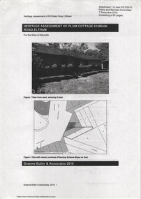
Document - Property Binder, 616 Main Road, Eltham; Plum Cottage
... Building Description This hipped roof 11 .5 square house is set high above Main Road on a characteristic-shape plan and has rammed earth or pise walls, timber joinery and a cement tiled roof. ...Building Description This hipped roof 11 .5 square house is set high above Main Road on a characteristic-shape plan and has rammed earth or pise walls, timber joinery and a cement tiled roof. ...Plum Cottage is covered by Heritage Overelay HO256 in the Nillumbuk Planning Scheme This two-lot land holding was created as a subdivision and sold to Charles Stuart McNeil by May 1955. Sometime in the period 1955-1960, the builder-designer, John Harcourt had created a pise house on the site, straddling the two subdivision lots. The designer, John M. Harcourt was a pioneer builder in pise-de-terre and mudbrick in the Eltham Shire, Eltham being synonymous with alternative lifestyles and building practises until the onset of suburbia in the late 20th and early 21st centuries. This hipped-roof house is set high above Main Road on a V-shape plan characteristic of the Arts & Crafts style, with rammed earth or pise walls, timber joinery and a cement tiled roof. The V shape plan was used by important English and Eltham Arts & Crafts designers. The use of natural materials such as stone and timber construction is an essential part of the Arts & Crafts style and Harcourt’s work. So too is the application of the style on both the exterior and interior of the house as a holistic concept. The house adjoins the Lim Joon adobe house built and designed by Alistair Knox in the same era (HO119), thus forming a distinctive pair, both using an uncommon plan form. This house was identified in the Shire of Shire of Eltham Heritage 1992 as contributory to the Eltham Gateway Conservation Area, then proposed as an urban conservation area (now Heritage Overlay Area). Land Ownership Emily Jane Smith of 12 Woodside Street Fitzroy owned Crown Allotments 1 & 2 Sections 14, 27 by August 1918, selling to William Henry Smith of 12 Woodside Street, Nth Fitzroy May 1921. (John) James Isherwood of Main Road, Eltham owned the property by 1928 (the year of his death) with the beneficiary of his estate and next owner of this site being his widow, Minnie Maria Isherwood of Cemetery Road, Eltham. His holding in Main Road included parts of what was described in rate records as allotments1 & 2 Section E6. In the late 1930s, early 1940s her son Alfred John Isherwood was also rated for the land around this site, with the rated nett annual value varying between £2 and £5. Alfred Isherwood also lived at Main Road, Eltham with his wife Ellen: her early death at the age of 24 was reported in the Argus of 1923. Part of the Isherwood land was divided off and sold to Charles Stuart McNeil by May1955. Sometime in the period 1955-1960, the builder-designer, John Harcourt had created a pise house on the site, straddling the two subdivision lots. The house is visible on an aerial photograph from 1960s. Reputedly the house was called Plum Cottage and erected for Harcourt’s mother-in-law. A garage was added in 1959. Charles McNeil died in1971 aged 87: he was the son of Don McNeil and Margaret Arkell. Available rate records from the construction era start in the of the 1970s (1972-3) and list Mr H.C. & M/S A.V. Charity at 616 Main Road Eltham of this property with a nett annual value of $740. More recent valuer's data describes the property as lots 1 & 2 LP25668, located in the Central Riding of Eltham Shire, owned by Ann Valerie Charity and later, in 1990, by the Chincarini family. Building Description This hipped roof 11 .5 square house is set high above Main Road on a characteristic-shape plan and has rammed earth or pise walls, timber joinery and a cement tiled roof. The V-shape plan was used by Important designers such as C.F.A. Voysey (UK) who interpreted medieval domestic architecture as part of the Arts & Crafts style of the late 19th and early 20th centuries. The pise walls are covered with a textured render while the cement roofing tiles are also seen in the Harcourt Hill examples. Reputedly the ceiling joists are of a deep section and span long lengths with no need for hanging beams in the roof space. The ceilings are low and panelled in main rooms with apparently Caneite soft board infill panels between the exposed ceiling beams. These are painted white but may have been stained at one time. The focus of the house is the large living area with its vast random stone fireplace. Significance Plum Cottage is significant to the locality of Eltham because: Historically: • Plum Cottage is closely associated with the important historical theme of earth construction evident in Eltham and elsewhere in the Shire since theear1y Arts & Crafts inspired creations at Penleigh Boyd's The Robins (1912, HO101) and those at Montsalvat (1934-, HO82) but more prominent from the Second War period when earth building in Eltham was promoted in national periodicals as an alternative building method that avoided the building materials shortages of that era; • The choice of the earth building technique also expresses the theme of refuge or alternative living, synonymous with Eltham in the early to mid 20th century; • as a good example of domestic architecture from John Harcourt who was the first major post Second War figure in an important phase of Eltham’s earth building development, using his characteristic Old English or Arts& Crafts style that relies in this case on the pise wall construction, pitched roof forms, exposed ceiling joists, half timbering, random stonework, and panelled internal wall finishes. Architecturally: • Plum Cottage's pise wall construction is uncommon among the early earth-walled structures in the Shire, that are mainly of adobe or mud brick, and as a building material is uncommon among the Shire’s suburban dwellings generally which are clad typically with either fired clay bricks or timber boarding. Aesthetically: • Plum Cottage is a good and well preserved example of a modern Old English or Arts & Crafts style earth-walled building in the Shire • For the proximity of the significant Lim Joon adobe house designed by Alistair Knox adjoining to the north, providing a distinctive earth wall house pair, with uncommon plan forms. Reference Heritage Assessment of Plum Cottage, 616 Main Road, Eltham; Graeme Butler & Associates 2010main road, eltham, property, houses, (john) james isherwood, alfred john isherwood, ann valerie charity, arts and crafts style, charles stuart mcneil, chincarini family, eltham gateway zone, emily jane smith, h.c. charity, heritage assessment, john harcourt, john m. harcourt, lim joon house, main road eltham, minnie maria isherwood, pise construction, plum cottage -
 Federation University Historical Collection
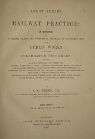
Book, Railway Practice: a collection of working plans and practical details of construction in the public works of the most celebrated engineers, 1847 (exact)
... The book includes (series 1 to 4)and it contains, roads, tramroads and railroads, bridges, aqueducts, viaducts, wharfs, warehouses, roofs, and sheds, canals, locks, sluices, & the various works on rivers, streams, etc., harbours, docks, piers and jetties, tunnels, cuttings and embankments, the several works connected with the drainage of marshes, marine sands, and the irrigation of land, water-works, gas-works, water-wheels, mills, engines. Railway Practice: a collection of working plans ...A green cloth hard cover book. Title and author's name are engraved in gold on spine. This is the 3rd edition, first series with black and white illustrations. It describes the engineering practices of the early days of British railroads. The book includes (series 1 to 4)and it contains, roads, tramroads and railroads, bridges, aqueducts, viaducts, wharfs, warehouses, roofs, and sheds, canals, locks, sluices, & the various works on rivers, streams, etc., harbours, docks, piers and jetties, tunnels, cuttings and embankments, the several works connected with the drainage of marshes, marine sands, and the irrigation of land, water-works, gas-works, water-wheels, mills, engines.civil engineering, railway practice, rail constructions, s c brees, western railway great britain, public works, railroads, canals, s.c. brees, samuel brees, samuel charles brees -
Federation University Historical Collection
Photograph - Black and White, Former Ballarat Library, c1960
... Plans for a new library building with tower and lantern roof abandoned due to lack of funds. ...Plans for a new library building with tower and lantern roof abandoned due to lack of funds. ...First known development on this site was the establishment of the Government Camp from the early 1850s. It was established to accommodate officials, troopers and police who were needed to administer the goldfields. Some permanent buildings were constructed. Lack of materials and bad weather prolonged the building of more permanent buildings and most men were still living in tents. Area was known as Camp Reserve. In 1864 a subdivision map shows the reserve be used for Public Buildings. Library applied for land on corner of Sturt and Camp Streets in 1878. 1880s plans show section of the reserve be used for a Free Library and Reading Room. Lease was granted and the old mining boardroom was initially used. Land for additional building to house a Museum and Art Gallery sought and agreement reached in 1882-3. Compensation paid to owners and library granted the land. Plans for a new library building with tower and lantern roof abandoned due to lack of funds. It wasn't until 1895 that a solution to funding was found and the library was able to begin constructing the complex of buildings on the Free Library Reserve. A number of changes have occurred since 1910s - the Classical Revival facade replaced with an angled facade in a stripped Classical style with Art Deco features and high parapet. Building is now part of Federation UniversityPhotograph of former library. Shows a two-storey rendered brick building in a Classical style. Some Art Deco features. Central pair of double windows with single window either side. High parapet above.government camp, goldfields, camp reserve, free library, reading room, sturt street, camp street, museum, art gallery, troopers, police, barracks, camp street -
 Flagstaff Hill Maritime Museum and Village
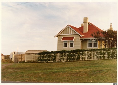
Photograph - Historical, Flagstaff Hill, Harbourmaster’s Quarters, 1970s
... plan to vacate, for other premises." Coloured photograph, glassy print, one of a set of five. Photograph shows the cream timber cottage, Harbourmaster’s quarters to the east of the lighthouse complex at Flagstaff Hill, Warrnambool. On the left of the red roofed ...The photograph shows a cottage, Harbourmaster’s quarters that still stands on the east of the Lady Bay Lighthouse and Historic Precinct at Flagstaff Hill in Warrnambool. The name was changed to the Lighthouse Lodge, and today guests can stay at the property. This photograph, a print, is one of a set of five that show the site of Flagstaff Hill. It is presumed to have been taken by John Lindsay, Founding Director of Flagstaff Hill Maritime Museum and Village. One of the photographs in the set has the pencil inscription "Photo J Lindsay". It was taken in the early 1970s during the initial stages of the development of Flagstaff Hill as a Museum and Maritime Village. The photographs belonged to the donor's grandparents, who lived in the Warrnambool district of Allansford/Naringal. The photograph is a record of the site and surrounds of Flagstaff Hill Maritime Museum and Village before its development and opening in 1975. It shows the cottage on the east of the Lighthouse Complex,. The building is now known as Lighthouse Lodge. The photograph is significant for recording the location and condition of the residence on the Hill.Coloured photograph, glassy print, one of a set of five. Photograph shows the cream timber cottage, Harbourmaster’s quarters to the east of the lighthouse complex at Flagstaff Hill, Warrnambool. On the left of the red roofed residence are iron buildings used, at the time, by the Lands Department. The photograph's paper has the printer's watermark on the back. The early 1970s photograph is presumed to have been by John Lindsay, Warrnambool.Label on the back: "WOODEN RESIDENCE TO THE EAST OF THE PROPERTY / The gun emplacements are immediately behind, and the iron huts to the left rear of the residence are used by the Lands Department who plan to vacate, for other premises."flagstaff hill, flagstaff hill maritime museum and village, warrnambool, maritime museum, maritime village, great ocean road, shipwreck coast, 1970s, photograph, flagstaff hill site, john lindsay, cannon emplacement, residence, wooden residence, timber residence, iron huts, lands department, light keeper -
 City of Moorabbin Historical Society (Operating the Box Cottage Museum)
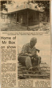
Photograph, Newspaper article, 'Reconstruction of Box Cottage’ 1984, 1984
... plan of the original pioneer cottage, and as many original items from that cottage’s long occupation have been incorporated. The photographs in Album 1 record the progress of the reconstruction from February 1984 to the First Public Open Day November 18th 1984 The Moorabbin Standard was the local newspaper for the City of Moorabbin during the 20thCentury until it was absorbed into The Leader Newspaper Group Pty Ltd. This article shows the builder Mr Arthur Smith working on the roof ...The original small, pioneer cottage was built in the late 1840s to early1850s, by an unknown pioneer. It was located on part of a 30 Acre allotment that was originally part of Dendy’s Special Survey granted in 1841. The doors and window sashes, (made of red deal joinery timber), as well as the brass locks and fittings, are from the original cottage, and were imported from England. The fire-place bricks are from the original cottage, and are sun-dried, (not kiln fired), and are hand-made. Convict marks can be seen on two bricks. There is a small display of external cladding shingles from the original pioneer cottage. These shingles were hand-split, and most likely made from locally collected timber The nails included in this display were used to fasten the shingles on the original cottage, and are also hand-made. The cottage was occupied by William Box and family from 1865 until 1914 when it was sold to William Reitman who resided there until 1950. The enamel nameplate, “Colonial”, on the wall of the cottage, was the name chosen for the original pioneer cottage by Mr William Reitman, when he purchased the property in around 1915, for 1200 Pounds approximately. In 1974 Mr Lewis, a timber specialist, found the dilapidated building on property he had recently purchased in Jasper Rd and suggested it be reconstructed and relocated. Moorabbin Council agreed and the cottage was rebuilt just about 250 metres from its original site. The cost of the rebuild was met by 'Victoria's 150th Committee, plus a small grant from the City of Moorabbin, and Mr Laurie Lewis donated much of the timber for the reconstruction. The re-constructed cottage plan has followed faithfully the original dimensions, and plan of the original pioneer cottage, and as many original items from that cottage’s long occupation have been incorporated. The photographs in Album 1 record the progress of the reconstruction from February 1984 to the First Public Open Day November 18th 1984The Moorabbin Standard was the local newspaper for the City of Moorabbin during the 20thCentury until it was absorbed into The Leader Newspaper Group Pty Ltd. This article shows the builder Mr Arthur Smith working on the roof shingles during the reconstruction of Box Cottage in Joyce Park Ormond May 1984. Mrs H. Deam and Mr A. Smith, CMHS members,kept this article to record the progress of the ‘Reconstruction’ from February 1984 to November 1984. A Moorabbin Standard Newspaper article, May 9th 1984, with 2 x black and white photographs of the builder, Mr Arthur Smith, working on the Roof shingles during the reconstruction of Box Cottage in Joyce Park , Ormond. Written on article ; Moorabbin Standard, May 9th Wed. 1984brighton, moorabbin, highett, ormond, mckinnon, cottages, pioneers, colonial, dendy henry, box william, box elizabeth, reitman william, convicts lewis timber co. ltd., deam h, smith arthur, museums, box alonzo, moody & smith builders highett, the moorabbin standard newspaper, the leader newspaper pty ltd., -
 City of Moorabbin Historical Society (Operating the Box Cottage Museum)
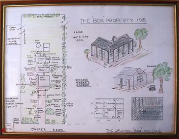
Drawing - Plan of Box Property c1915, c1985
... Plan of the Box Property c1915’ was drawn by a CMHS member in 1985 to educate members and visitors to Box Cottage Museum. The drawing shows the layout of the original pioneer cottage , the newer front house and the garden as well as the adjoining properties. It includes a detailed drawing of the Cottage roof...Plan of the Box Property c1915’ was drawn by a CMHS member in 1985 to educate members and visitors to Box Cottage Museum. The drawing shows the layout of the original pioneer cottage , the newer front house and the garden as well as the adjoining properties. It includes a detailed drawing of the Cottage roof ...This ‘Plan of the Box Property c1915’ was drawn by a CMHS member in 1985 to educate members and visitors to Box Cottage Museum. The drawing shows the layout of the original pioneer cottage , the newer front house and the garden as well as the adjoining properties. It includes a detailed drawing of the Cottage roof and rooms . A coloured drawing of a Plan of Box Property c1915 in a wooden frame box william, box elizabeth, brighton, cheltenham, moorabbin, pioneers, early settlers, market gardeners, ormond -
 Flagstaff Hill Maritime Museum and Village
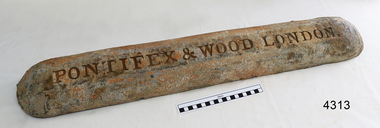
Functional object - Lead Ingot, circa 1878
... It was used for pipes and water tanks, roof flashing and guttering, window sealing and internal plumbing. Many large private residences and new public buildings were at planning or construction stage in the colony during this period. ...It was used for pipes and water tanks, roof flashing and guttering, window sealing and internal plumbing. Many large private residences and new public buildings were at planning or construction stage in the colony during this period. ...This lead ingot was donated to Flagstaff Hill Maritime Village in January 2015 by local residents who discovered the ingot in their garden after they purchased the property about 12 months ago The LOCH ARD cargo manifest lists “Pig lead 50 tons” comprising “944 pig and 37 rolls”. Subsequent classification has rendered this section of cargo as “Lead Ballast”. This could be true. The international price per ton of lead ore plunged from a high point of £17 in 1853 to a low of £8 in 1882. The cheaper price of lead at the time of the vessel’s loading in early 1878 may have meant it was considered as an alternative to other ballast material (traditionally stone) for the journey to Melbourne. Loch Line ships generally returned to Britain laden with Australian wool. Even though wool bales were “screwed in” to the hold to less than half their “pressed weight”, they still made an awkwardly light cargo for the passage around the Horn. The concentrated weight of lead pigs along the keel line would help steady and centre the ship, and perhaps the artefacts in this case were to be retained for this purpose, rather than being sold on to the ready colonial market. However this is conjecture. Demand for building materials in the gold and wool rich Colony of Victoria was high in the 1870s, and much of the LOCH ARD cargo was intended for the Melbourne International Exhibition in 1880, which was another example of buoyant economic conditions. In the nineteenth century lead was valued for its density (high ratio of weight to volume), flexibility (relative softness for working into shape), and durability (corrosion resistant and waterproofing properties). It was used for pipes and water tanks, roof flashing and guttering, window sealing and internal plumbing. Many large private residences and new public buildings were at planning or construction stage in the colony during this period. The LOCH ARD lead ingots could equally have been destined for this ready market. HISTORY OF THE LOCH ARD The LOCH ARD belonged to the famous Loch Line which sailed many ships from England to Australia. Built in Glasgow by Barclay, Curdle and Co. in 1873, the LOCH ARD was a three-masted square rigged iron sailing ship. The ship measured 262ft 7" (79.87m) in length, 38ft (11.58m) in width, 23ft (7m) in depth and had a gross tonnage of 1693 tons. The LOCH ARD's main mast measured a massive 150ft (45.7m) in height. LOCH ARD made three trips to Australia and one trip to Calcutta before its final voyage. LOCH ARD left England on March 2, 1878, under the command of Captain Gibbs, a newly married, 29 year old. She was bound for Melbourne with a crew of 37, plus 17 passengers and a load of cargo. The general cargo reflected the affluence of Melbourne at the time. On board were straw hats, umbrella, perfumes, clay pipes, pianos, clocks, confectionary, linen and candles, as well as a heavier load of railway irons, cement, lead and copper. There were items included that intended for display in the Melbourne International Exhibition in 1880. The voyage to Port Phillip was long but uneventful. At 3am on June 1, 1878, Captain Gibbs was expecting to see land and the passengers were becoming excited as they prepared to view their new homeland in the early morning. But LOCH ARD was running into a fog which greatly reduced visibility. Captain Gibbs was becoming anxious as there was no sign of land or the Cape Otway lighthouse. At 4am the fog lifted. A man aloft announced that he could see breakers. The sheer cliffs of Victoria's west coast came into view, and Captain Gibbs realised that the ship was much closer to them than expected. He ordered as much sail to be set as time would permit and then attempted to steer the vessel out to sea. On coming head on into the wind, the ship lost momentum, the sails fell limp and LOCH ARD's bow swung back. Gibbs then ordered the anchors to be released in an attempt to hold its position. The anchors sank some 50 fathoms - but did not hold. By this time LOCH ARD was among the breakers and the tall cliffs of Mutton Bird Island rose behind the ship. Just half a mile from the coast, the ship's bow was suddenly pulled around by the anchor. The captain tried to tack out to sea, but the ship struck a reef at the base of Mutton Bird Island, near Port Campbell. Waves broke over the ship and the top deck was loosened from the hull. The masts and rigging came crashing down knocking passengers and crew overboard. When a lifeboat was finally launched, it crashed into the side of LOCH ARD and capsized. Tom Pearce, who had launched the boat, managed to cling to its overturned hull and shelter beneath it. He drifted out to sea and then on the flood tide came into what is now known as LOCH ARD Gorge. He swam to shore, bruised and dazed, and found a cave in which to shelter. Some of the crew stayed below deck to shelter from the falling rigging but drowned when the ship slipped off the reef into deeper water. Eva Carmichael had raced onto deck to find out what was happening only to be confronted by towering cliffs looming above the stricken ship. In all the chaos, Captain Gibbs grabbed Eva and said, "If you are saved Eva, let my dear wife know that I died like a sailor". That was the last Eva Carmichael saw of the captain. She was swept off the ship by a huge wave. Eva saw Tom Pearce on a small rocky beach and yelled to attract his attention. He dived in and swam to the exhausted woman and dragged her to shore. He took her to the cave and broke open case of brandy which had washed up on the beach. He opened a bottle to revive the unconscious woman. A few hours later Tom scaled a cliff in search of help. He followed hoof prints and came by chance upon two men from nearby Glenample Station three and a half miles away. In a state of exhaustion, he told the men of the tragedy. Tom returned to the gorge while the two men rode back to the station to get help. By the time they reached LOCH ARD Gorge, it was cold and dark. The two shipwreck survivors were taken to Glenample Station to recover. Eva stayed at the station for six weeks before returning to Ireland, this time by steamship. In Melbourne, Tom Pearce received a hero's welcome. He was presented with the first gold medal of the Royal Humane Society of Victoria and a £1000 cheque from the Victorian Government. Concerts were performed to honour the young man's bravery and to raise money for those who lost family in the LOCH ARD disaster. Of the 54 crew members and passengers on board, only two survived: the apprentice, Tom Pearce and the young woman passenger, Eva Carmichael, who lost all of her family in the tragedy. Ten days after the LOCH ARD tragedy, salvage rights to the wreck were sold at auction for £2,120. Cargo valued at £3,000 was salvaged and placed on the beach, but most washed back into the sea when another storm developed. The wreck of LOCH ARD still lies at the base of Mutton Bird Island. Much of the cargo has now been salvaged and some was washed up into what is now known as LOCH ARD Gorge. Cargo and artefacts have also been illegally salvaged over many years before protective legislation was introduced. One of the most unlikely pieces of cargo to have survived the shipwreck was a Minton porcelain peacock - one of only nine in the world. The peacock was destined for the Melbourne International Exhibition in 1880. It had been well packed, which gave it adequate protection during the violent storm. Today, the Minton peacock can be seen at the Flagstaff Hill Maritime Museum in Warrnambool. From Australia's most dramatic shipwreck it has now become Australia's most valuable shipwreck artefact and is one of very few 'objects' on the Victorian State Heritage Register. The shipwreck of the LOCH ARD is of State significance ― Victorian Heritage Register S417 Flagstaff Hill’s collection of artefacts from LOCH ARD is significant for being one of the largest collections of artefacts from this shipwreck in Victoria. It is significant for its association with the shipwreck, which is on the Victorian Heritage Register (VHR S417). The collection is significant because of the relationship between the objects, as together they have a high potential to interpret the story of the LOCH ARD. The LOCH ARD collection is archaeologically significant as the remains of a large international passenger and cargo ship. The LOCH ARD collection is historically significant for representing aspects of Victoria’s shipping history and its potential to interpret sub-theme 1.5 of Victoria’s Framework of Historical Themes (living with natural processes). The collection is also historically significant for its association with the LOCH ARD, which was one of the worst and best known shipwrecks in Victoria’s history. Lead ingots (sometimes referred to as ‘lead ballast’ or ‘lead pigs), salvaged from the wreck of the LOCH ARD. Grey metal bars with flat base, rising in a curved moulded shape to form a smooth rounded upper face. The imprint of the maker runs along the upper surface in clearly legible capital lettering (height 3cm). Durable and heavy, with some marine staining, but in good condition. Stamped along curved surface, within oval border, "PONTIFEX & WOOD LONDON."flagstaff hill, warrnambool, shipwrecked coast, flagstaff hill maritime museum, maritime museum, shipwreck coast, flagstaff hill maritime village, great ocean road, loch line, loch ard, captain gibbs, eva carmichael, tom pearce, glenample station, mutton bird island, loch ard gorge, lead pigs, lead ingots, lead ballast, pontifex and wood, london, lead smelters -
 Ringwood and District Historical Society
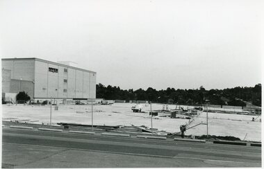
Photographs, Eastland Car park Construction, Ringwood, 1992-93
... Bond St. 11064D: 4.1.93 New Myer Eastland car park viewed from Safeway's Roof 11064E: 17.1.93 Eastland car park near where Esso Garage was 11064F: 21.2.92 Eastland car park from cnr of Adelaide St and Eastland B&W photograph taken by Ringwood Historical Research Group. Also added extract from Melways showing the roads before the Bypass (1987) showing the planned ...B&W photograph taken by Ringwood Historical Research Group. Also added extract from Melways showing the roads before the Bypass (1987) showing the planned Bypass cutting these two roads, and Melways (2018) showing new alignment with Bypass11064A: 21.2.92 Eastland car park development from near Safeway 11064B: 21.2.92 Eastland car park development from Adelaide St 11064C: 4.1.93 Eastland car park development from Warrandyte Road from Op. Bond St. 11064D: 4.1.93 New Myer Eastland car park viewed from Safeway's Roof 11064E: 17.1.93 Eastland car park near where Esso Garage was 11064F: 21.2.92 Eastland car park from cnr of Adelaide St and Eastland -
 Eltham District Historical Society Inc
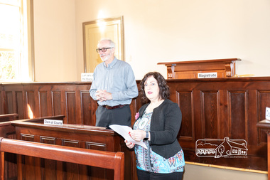
Photograph, Peter Pidgeon, Official opening of the restored Eltham Courthouse, 730 Main Road, Eltham, 23 Mar 2022
... Eltham Courthouse Officially Reopened (Jim Connor, EDHS Newsletter No. 263 April 2022) In the Conservation Management Plan prepared in 2006 for the Eltham Justice Precinct there is mention that more than 350 court houses have been built by the Public Works Department since 1856, when the Department was established. It also states Eltham was in an early group of 'Victorian Free Classical' structures, featuring a projecting entry porch and gabled roof. ...Eltham Courthouse Officially Reopened (Jim Connor, EDHS Newsletter No. 263 April 2022) In the Conservation Management Plan prepared in 2006 for the Eltham Justice Precinct there is mention that more than 350 court houses have been built by the Public Works Department since 1856, when the Department was established. It also states Eltham was in an early group of 'Victorian Free Classical' structures, featuring a projecting entry porch and gabled roof. ...Eltham Courthouse Officially Reopened (Jim Connor, EDHS Newsletter No. 263 April 2022) In the Conservation Management Plan prepared in 2006 for the Eltham Justice Precinct there is mention that more than 350 court houses have been built by the Public Works Department since 1856, when the Department was established. It also states Eltham was in an early group of 'Victorian Free Classical' structures, featuring a projecting entry porch and gabled roof. Characteristically, this group shares a simple, rectangular shape, central placement of the court room with smaller-scale offices set back at the sides or rear of the court room, arched openings, and decorative string courses. The Statement of Significance listed in the Victorian Heritage Register states: ‘The Eltham Court House dates from the time when the town was largely self-contained. It was initiated in response to itinerant gold prospectors who turned to crime when their quest was unsuccessful. This type of localised solution is characteristic of the self reliance preserved in Eltham today. The court house is an important symbol of the spirit which makes Eltham distinctive as a community.’ It also states: ‘The Eltham Court House, built in 1860, is one of only two intact examples in the state of this simple design with projecting entry.’ So with this background it is most appropriate this valued historic building has recently been the subject of a total restoration, as detailed in previous newsletters. This was a major project undertaken by Nillumbik Shire Council. At a small function in the Eltham Courthouse, on 23rd March 2022, Nillumbik Shire Council Mayor Fran Eyre declared the fully restored building officially reopened. In doing so the Mayor spoke about the earlier law and order function of the court and the importance of this building to the Eltham community. Wingrove Ward Councillor Geoff Paine then highlighted the importance of historical societies and groups within the shire and their valued activities in recording and preserving their local history. EDHS president Jim Connor thanked everyone involved with the project and provided an overview of the history of the courthouse. Michael Ioannides, Council’s project manager, spoke about how the restoration process proceeded and those involved in undertaking the works required. Cr. Natalie Duffy, various council officers, EDHS executive committee members, as well as representatives of the head contractor Ducon Building Services and the heritage advisors, RBA architects and Conservation Consultants, were also in attendance, as was a representative of Nillumbik U3A. After the formal part there was some light hearted interpretation of how past legal proceedings may, or may not have, occurred within this courthouse, before some refreshments were shared in the former second courthouse at the rear, which is now utilised by Nillumbik U3A. This was a successful celebration of a very worthwhile project.Born digital image (38)conservation consultants, cr. geoff paine, cr. natalie duffy, ducon building services, eltham courthouse, eltham district historical society, eltham justice precinct, jim connor, mayor cr. fran eyre, michael ioannides, nillumbik shire council, nillumbik u3a, opening ceremony, rba architects, restoration project -
 Eltham District Historical Society Inc
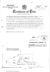
Archive Box, Shire of Eltham War Memorial
... Planning and building committee 12 March 2003 Application for construction of a viewing platform and road entry refurbishment and coach parking bay. 2. Envelope. Letters, paperwork and emails, mainly from Dennis Ward re roof...Planning and building committee 12 March 2003 Application for construction of a viewing platform and road entry refurbishment and coach parking bay. 2. Envelope. Letters, paperwork and emails, mainly from Dennis Ward re roof ...Material relating to the Shire of Eltham War Memorial located at Garden Hill, Kangaroo Ground. Also known as The Eltham Shire War Memorial Tower, Shire of Eltham Soldiers' Memorial and Kangaroo Ground War Memorial Park. Includes photocopies, newspaper clippings, correspondence and more beginning from early history 1919-2009. Contents: Archive Box 1 Folder 1 (Publication Proofs) The Tower of Remembrance and War Memorial Park On Garden Hill at Kangaroo Ground, Victoria 1919-2010 Folder 2 (Up to 1960) 1. Binder with plastic pockets. Photocopies. Minutes of the Kangaroo Ground War Memorial Bazaar Committee, 1922-1926 EDHS Newsletter No. 123 November 1998 PRESIDENT'S REPORT ACQUISITION FROM NILLUMBIK SHIRE'S MEMORABILIA Recently found in a storage box of old Shire of Eltham items was a school size, blue lined black covered writing book. It is recognized as the minute book and cash receipt book of the period 1922-1926 when the Memorial Park Committee, who it seems were part of the Shire of Eltham Soldier's Memorial League, was requested to raise funds for building the Shire of Eltham War Memorial Tower at Kangaroo Ground. History tells us that the tower, which is currently being refurbished, was officially opened by the Governor General of Australia, Lord Stonehaven on 11.11.26. The ladies invited to the first meeting at the Shire Hall did so on 21st September 1922. The minutes book reads: Present: Mesdames Bell, Bourchier, McMahon, Gosling, Cockcroft, Wraight, E Coutie, R Rogers, A Jones, AH White, Davies, Everitt and the Misses Lacey, Harris, N Weller, Gosling, Bell and D and G J Bourchier. These people became the Kangaroo Ground Memorial Bazaar Committee along with others named at further meetings. They conditionally accepted the role of raising funds, their condition being that the Bazaar Committee be given representation on any committee empowered to deal with the memorial in proportion to the amount of money raised by the bazaar'. The Andrew Ross Museum has the original book. We at Eltham District Historical Society have two photocopies for public perusal. 2. Transcriptions of newspaper articles 1919-1920. 6 pages. 3. Photocopy of program for thanksgiving service July 6th, 1919 held at Public Hall, Panton Hill. 4. Photocopies: a. Kangaroo Ground, The Advertiser, 17 Oct 1919 (working bee) b. The Advertiser August 1920 – advertisement for coach between Eltham and KG. c. Anzac Memorial Service, The Eltham & Whittlesea Shires Advertiser & Diamond Creek Advertiser, April 14, 1922 and April 28, 1922 d. Anzac Day services. April 27, 1923 e. Photocopy Anzac Commemoration, local newspaper, May 2, 1924 f. Shire of Eltham Memorial Service, The Advertiser April 23, 1926 g. Eltham Shire War Memorial Advertiser August 13,1926 h. Eltham Shire War Memorial The Advertiser October 26, 1926 i. Eltham The Advertiser, December 17, 1926 j. Kangaroo Ground April 26, 1929 5. Photocopy. Eltham War Memorial Tower article, The Advertiser, November 19, 1926 6. Typed transcription of parts of newspaper articles for three titles, November 1926 7. Transcription. Public Notice, October 16, 1926 8. Photocopy Kangaroo Ground Armistice Day local newspaper, November 25, 1927 9. Photocopy Kangaroo Ground Armistice Day local newspaper, November 16, 1928 10. Photocopy Kangaroo Ground, local newspaper, April 26 1929 11. 3 Original Copies. One Hardback. Dedication of memorial official brochure, 1951 original but damaged 12. Photocopy with notes from G.G. relating to the land transfer/acquisition/contract via White and Gepp. Folder 3 (1961-1970) 1. Original newspaper article: Place with a view at Kangaroo Ground, The Age, May 11, 1963, p18 Folder 4 (1981-1990) 1. Newspaper article, Memorial a fire watch. Diamond Valley News, March 16, 1982, 2 original copies. 2. Newspaper article. An Obvious Monument by Russell Yeoman article with photo: Network Nov/Dec 1984, p14. Folder 5 (1991-2000) 1. Original newspaper article: “Kangaroo Ground Tower is top spot”. Thought to be from a tourist information free newspaper, Mountain Country, Summer [1993] p39. 2. Newspaper article with reference to quoins – a contrasting edging or corner stone on the façade of a stone or brick house. Age August 2000 3. Program. Service program for Remembrance Day commemoration ceremony, 1996. 4. Speech by Harry Gilham for Remembrance Day commemoration ceremony, 1996 5. Newspaper article: Remembrance, Diamond Valley News, 20 November 1996 6. Word Document. A Tower of Strength by Dean Stewart April 1997 7. Newspaper articles: Tower group needed, Diamond Valley News, September 17, 1997, p3 and advertisement “Nillumbik, Nominations for Kangaroo Ground Memorial Tower and Grounds Advisory Committee”, Diamond Valley News, September 17, 1997 8. Newspaper article: Council apology; scaling new heights, 1997 about Aboriginal Reconciliation. Probably Diamond Valley News ca 1997. 9. Photocopy / Newspaper Article: Two newspaper clippings, “Memorial with a view” 30 April 1997 and “Funds boost to restore tower to its former glory”, Diamond Valley News, 3 December 1997. 10. Newspaper article: Kangaroo Ground Tower of Remembrance Nillumbik Mail, 9th August 2000 and Research notes (July 2000) by Harry Gilham pertaining to photo in August 2000 newspaper article. 11. Photocopy. Newspaper article: New lease of life for tower (Concept plan) Nillumbik Mail, September 27, 2000 12. Photocopy: 4 pages, War Memorials of Victoria; a pictorial record, c.1994 Folder 6 (2001-2010) 1. Newspaper article: $10,000 to start refurbishment, Nillumbik Mail, Feb 21, 2001 2. Circular. KG War Memorial Advisory committee circular August 2001 3. Newspaper article: Tower group retained 4. Program for re-dedication of the Kangaroo Ground War Memorial Tower 8th November 2001 with copies of pages 65-70 of from The Tower of Remembrance and War Memorial Park 1919-2001 (see Folder 1) - Speaking notes from the day from Nillumbik Shire Mayor, Cr. Sigmund Jorgensen and Harry Gilham and Speech by John Landy, Governor of Victoria 5. 2 pages of Harry Gilham notes – Draft of ‘book’ notes ‘Thank you’ for rededication ceremony to be held Thursday, Nov 8, 2001 - list of invitations, notifications and acknowledgements. 6. Proposed running sheet. Re-dedication of KGT. November 8, 2001 7. Newspaper article (2 copies) Century of war service, DVL November 14, 2001 page 6 8. Letter. Gov. John Landy to Harry Gilham. Thank you for visit. [2001] 9. Newsletter Clipping: Governor of Victoria re-dedicates KG War memorial Tower, Nillumbik News (NSC) Christmas 2001 10. Newspaper article: War Memorial to be restored: DVL November 19, 2003 11. Newspaper article: Memorial Facelift Sept 29 2004. 12. Folder. Collection of maps and context Yarra Water proposal to build water tanks 13. Newspaper clipping. Pressure on with new tank. Re installation of water tank near site. DVL March 2, 2005 14. Folder of emails and designs from Dennis Ward re poppies and prostrate rosemary for formal garden around base of tower April 2005 15. Folder. Letters and paperwork re the Victorian Government “Community Cabinet” and invitation for community groups to speak directly with a government minister. Actual submission not included in folder. 16. Newspaper clipping. Time to remember among the poppies, Diamond Valley Leader, 9 November 2005, p1 and 17. Newspaper clipping. Lone pine company for souls. DVL 9 November 2005 18. Folder. Restoring Community War Memorials Grants Program. Application and associated paperwork 2005/2006 January 2006 19. Newspaper article. Shared views. Valley Weekly, June 21 2006 20. Newspaper article: Kangaroo Ground, Restoration on schedule, DVL October 2006? 21. Newspaper article. Towering over the terrain. The Age August 8, 2009 22. Photocopy. Nillumbik Shire Council. Policy and service report re lease of land to Victoria Police for police radio communications and re-building of radio tower. December 9, 2009 23. Schematics: A3 photocopies, Kangaroo Ground memorial Tower, front and rear view, Tom Manley, 17 Apr 2001 Folder 7 (2011 on) 1. Magazine article and cover. Cover story – The Kangaroo Ground Memorial Tower, The Genealogist, March 2010 2. Newspaper article. (2 copies) Photo and caption. Diamond Valley Leader, July 14, 2010 3. Newspaper notice: Notice of application for a planning permit to construct radio communications tower, DVL, October 10, 2012 4. Copy. Reference enquiry to National Film and Sound Archive. 10 September 2012 5. Copy letter. Quotation/estimate for Shire of Nillumbik on renovation and underpinning of old care takers cottage, KG. 30 September, 2012 6. Story. The Kangaroo Ground Tower of Remembrance by Amy Shaw. Yarrambat Primary School Year 6 History speech, 2014. 7. Program: Remembrance Day service, 11th November 2014 8. Newspaper article. Tribute to bravery DVL, November 19, 2014. 9. Minutes. MAC meeting. 2 September 2016. Folder 8 (Interpretative Signs Grant 2000-2001) 1. Folder. Various including Letters. EDHS Grant project: Kangaroo Ground Park and Tower of Remembrance interpretative signage from Parks Victoria 2000-2001. Folder 9 (Miscellaneous) 1. Folder Gilham collection. Google earth images of Tower, Extract describing history of Tower, including honour roll for WW1 and WW2, 8 pages, Extract describing history of Tower, including honour roll for WW1 and WW2, 3 pages, 2002 and 2004; Kangaroo Ground Tower; Southwell-Keely M.; WAR MEMORIALS IN AUSTRALIA; 8 pages, https://web.archive.org/web/20080722161554/http://www.skp.com.au/memorials2/pages/30054.htm) 2. Letter. Undated, unsigned re application to council to proposed work to police radio masts behind caretaker’s cottage. 3. Brochure: Heritage Nillumbik. Includes cover photo and other information about site. Published by Nillumbik Shire Council. About 2006. 4. Folder of notes and photocopies of various Certificates of Title for property 5. Inward loan documents. Two. Andrew Ross Museum inward loan for collection items from “War Memorial Tower” 2003 6. Photocopies of postcards of Soldiers War Memorial: One taken c.1926 before completion around base, on colour print on paper (enlarged) of Soldiers War Memorial postcard c.1930s prior to gun placements with typed text pasted on and additional detail version mounted on card with handwritten explanatory notes by Harry Gilham. 7. Photocopy of photo of tower 1944 with guns in place from Gordon and explanatory notes plus A4 photo paper print of image (photoshopped cleaned up). 8. Miscellaneous photocopies of photos taken by Harry Gilham of Memorial Park entrance, model tower in font of tower entrance, caretaker’s cottage, spiral staircase, Menin Gate sign and possibly planting of Lone Pine. Folder 10 (Fire Spotting Operations) 1. Biographical notes on Herman Motschall 1969-1981 2. Newspaper article, Memorial Tower top site for fire spotter, Diamond Valley News, May 15, 1973. 3. Proper Officer's report on an addition to the Kangaroo Ground Memorial Tower for Fire Spotting purposes: "This report covers the history of the tower, its uses, and reasons why it should be put to greater use, benefiting the Shire Council and ratepayers" Includes detailed commentary around the proposal to use the Shire of Eltham War Memorial at Kangaroo Ground for fire spotting. From Shire of Eltham archives. H. J. Masefield Property Officer. 4. Eltham Shire Council meetings 14 and 24 September 1973 references to fire watching facilities. Summary of end of season reports from spotters 1965-1973. 5. Newspaper clipping; Memorial a fire watch by Marguerite Marshall Diamond Valley News 16 March 1982 6. Letter: Cover letter from Dennis Ward 20 Feb 2006 architect for CFA Cabin design and Proposal to upgrade the fire spotting cabin, 2007 including a cost and concept plan dated 7 February 2009. 7. Newspaper article. From that first puff of smoke – horror. Diamond Valley Leader, Feb 25, 2009, p. 7 8. Invitation: State Government announcement of refurbishment of KGWM Fire spotting tower 19 October 2009 9. Newspaper article. Tower– up, Black Saturday watch. Cover and page. Diamond Valley Leader, October 28, 2009 10. Invitation. Opening of newly upgraded fire spotting tower, 11 April 2010 11. Newspaper article. Incredible luxury at fire spotting tower, Diamond Valley Leader, April 21, 2010, p, 5 12. Printout of plan of base of tower including comms cabinet and ladder to CFA cabin. Dated 17/6/2010 Archive Box 2 Folder 11 (Moor-rul Viewing Platform) 1. Agenda. Planning and building committee 12 March 2003 Application for construction of a viewing platform and road entry refurbishment and coach parking bay. 2. Envelope. Letters, paperwork and emails, mainly from Dennis Ward re roof design for the viewing platform and order for poppy seeds. 2005 3. Newspaper article (enlarged and laminated). Stolen Red gum seats sap new project’s momentum. (Local paper), April 3, 2007 4. Convenor’s Notes – Opening of the Viewing Platform at Kangaroo Ground, Shire of Nillumbik 5. Folder. Nillumbik Reconciliation Charter. Opening of the Moor-rul viewing platform 17.4.2008. Compiled by Harry Gilham. Includes newspaper clipping, speech, photocopy of photos with captions. 6. Newspaper article. View from the hill is a thrill. Heidelberg and Diamond Valley Weekly, April 22, 2008 7. Newspaper article. A platform towards reconciliation. Diamond Valley Leader, 23 April 2008. 8. Newspaper article: 6 reasons to visit Hurstbridge, The Age, Jun 6 2012 9. Article: Aboriginal cultural values and heritage management issues 10. Folder: Material relating to design and construction of viewing platform Folder 12 - Shire of Nillumbik Advisory Committee 1. 2011 Diary, Harry Gilham, Kangaroo Ground Advisory Committee 2. Photocopy. Newspaper clipping. Nillumbik Council seeking nominations for new Kangaroo Ground Memorial Tower and grounds advisory committee. DVN 17 Sept 1997 3. Letter. From NSC to Dean Stewart re heritage listing status. 12 July 1998. 4. Business paper for NSC Council meeting: KG Memorial Tower and Grounds advisory committee, 12 March 2002. Includes Terms of Reference Folder 13 - Friends of Kangaroo Ground War Memorial Park Inc. 1. KG Tower and land occupational health & Safety (guidelines) for volunteers 2. Supplementary notes (not related to fire spotting) from Friends group or advisory group of Kangaroo Ground War Memorial Park including design of seating, proposed budget for works, hand written notes from meeting by H.G. about 1999. Folder 14 - Soldiers. 1. Folder of material pertaining to men from the Shire of Eltham who enlisted in WW1 and for whom the Shire of Eltham War Memorial was dedicated. 2. Folder on residents from Shire of Eltham who died in WW2 1939-1945 with listings of each from Commonwealth War Graves Commission, WW2 Nominal Roll for Eltham 3. Newspaper article: Mates join to recall past, Diamond Valley News, November 16, 1994 4. Newspaper article: Board replaced, Diamond Valley News, September 2, 1998 about Hurstbridge RSL Honour Roll Board 5. Newspaper article: Keeping the memories alive; VP Day honoured, Valley Weekly, August 17, 2005 6. Newspaper article: In our hearts; Tributes for war heroes, Diamond Valley Leader, November 9, 2005, p1 7. Newspaper article: Service honoured, Diamond Valley News, Leader, April 23, 2008 8. Newspaper article: Salute to last men standing, Diamond Valley Leader, April 20, 2011, p1 and Last of the world warriors, pp8-9 9. Newspaper article: We will remember, Diamond Valley Leader, April 25, 2012, p3 10. Newspaper article: Family legacy builds whole town, Diamond Valley Leader, Oct, 2013, p15 11. Photos and details of Honour Boards in the shire 12. Miscellaneous notes by Harry Gilham Folder 15 – Welcome Home Committee Meeting Minutes. 1. Extracts from Welcome Home Committee Meeting Minutes 18 August 1917 to 14 August 1919. Folder 16 – World War One Local Enlistments. 1. Lever arch binder containing records of local enlistments by name from the Diamond Valley including extracts from Commonwealth War Graves Commission records. Includes Newspaper article clipping "Digger's marker of respect: Temporary cross a poignant find after eight decades in dusty garage"; Sunday Herald Sun, November 10, 2024, p33 concerning Private Harry Conway who died April 1918 and whose tempory grave marker cros now housed at Montmorency-Eltham RSL. Archive Box with documentsharry gilham collection, fire spotting, kangaroo ground, shire of eltham war memorial, masefield h. j., cfa, kangaroo ground war memorial park, shire of eltham soldiers' memorial, eltham shire war memorial tower, harry conway, montmorency-eltham rsl sub-branch
