
Showing 41 items matching "route 34"
-
 Melbourne Tram Museum
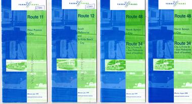
Ephemera - Timetable, Yarra Trams, Set of 15 Yarra Trams timetables, 7/1999 to 9/2001
... ... Route 34...Set of 15 Yarra Trams timetables, blue green cover with route number on cover, giving details of popular destination, check points, use of Metcards and contact details, tram hire, frequency, Some include maps. .1 - Route 11 - West Preston - City - July 1999 - 24 Pages .2 - Route 12 - South Melbourne and St Kilda Beach - City - July 1999 - 24 pages .3 - Route 48 and Route 34 - North Balwyn - City or via Latrobe St - East Melbourne, includes references to Routes 23, 24, 27 and 30 - July 1999 - 28 pages, includes a small map. .4 - ditto - August 2000 .5 - ditto - September 2001 .6 - Route 70 - Wattle Park - City - October 1999 - 24 pages .7 - Route 70 - Wattle Park - City via MCG - December 2000 - 24 pages - includes a map .8 - Route 75 - East Burwood - City - July 1999 - - 24 pages .9 - ditto - August 2000 .10 - Route 86 - Bundoora RMIT - Colonial Stadium via Bourke St - March 2000 - 28 page. .11 - Route 96 - St Kilda Beach - East Brunswick -March 2000 - 24 pages .12 - Route 109 - Mont Albert - Port Melbourne - July 1999 - includes references to route 23, 24, 27. 30 and 34 - 36 pages .13 - Route 109 - ditto includes La Trobe St services - September 2001 - 36 pages .14 - Route 112 - South Melbourne - St Kilda Beach to West Preston via City, including temporary combination of routes 11 and 12, route 11 and Route 12 - August 2000 - 48 pages. .15 - Route 112 - notes that it the combination of Routes 11 and 12 - September 2001 - 48 pages. .16 - Route 11 - West Preston - City - Nov. 1998 - 24 pages .17 - Route 48 - North Balwyn - City - Dec. 1998 - 24 pages .18 - Route 34 and 48 - North Balwyn - City and City LaTrobe - East Melbourne - August 2000 - 32 pages .19 - Route 109 - Port Melbourne - Mont Albert - Nov. 1998 - 24 pages....Trams tramways Yarra Trams Tram Services Timetables Route 11 Route 48 Route 34 Route 23 Route 24 Route 27 Route 30 Route 70 Route 75 Route 86 Route 96 Route 109 Route 112 Some have notes such as "OPR", and number notes and notes written inside about changes or errors in ink. ...Set of 15 Yarra Trams timetables, blue green cover with route number on cover, giving details of popular destination, check points, use of Metcards and contact details, tram hire, frequency, Some include maps. .1 - Route 11 - West Preston - City - July 1999 - 24 Pages .2 - Route 12 - South Melbourne and St Kilda Beach - City - July 1999 - 24 pages .3 - Route 48 and Route 34 - North Balwyn - City or via Latrobe St - East Melbourne, includes references to Routes 23, 24, 27 and 30 - July 1999 - 28 pages, includes a small map. .4 - ditto - August 2000 .5 - ditto - September 2001 .6 - Route 70 - Wattle Park - City - October 1999 - 24 pages .7 - Route 70 - Wattle Park - City via MCG - December 2000 - 24 pages - includes a map .8 - Route 75 - East Burwood - City - July 1999 - - 24 pages .9 - ditto - August 2000 .10 - Route 86 - Bundoora RMIT - Colonial Stadium via Bourke St - March 2000 - 28 page. .11 - Route 96 - St Kilda Beach - East Brunswick -March 2000 - 24 pages .12 - Route 109 - Mont Albert - Port Melbourne - July 1999 - includes references to route 23, 24, 27. 30 and 34 - 36 pages .13 - Route 109 - ditto includes La Trobe St services - September 2001 - 36 pages .14 - Route 112 - South Melbourne - St Kilda Beach to West Preston via City, including temporary combination of routes 11 and 12, route 11 and Route 12 - August 2000 - 48 pages. .15 - Route 112 - notes that it the combination of Routes 11 and 12 - September 2001 - 48 pages. .16 - Route 11 - West Preston - City - Nov. 1998 - 24 pages .17 - Route 48 - North Balwyn - City - Dec. 1998 - 24 pages .18 - Route 34 and 48 - North Balwyn - City and City LaTrobe - East Melbourne - August 2000 - 32 pages .19 - Route 109 - Port Melbourne - Mont Albert - Nov. 1998 - 24 pages.Some have notes such as "OPR", and number notes and notes written inside about changes or errors in ink. See History.trams, tramways, yarra trams, tram services, timetables, route 11, route 48, route 34, route 23, route 24, route 27, route 30, route 70, route 75, route 86, route 96, route 109, route 112 -
 Melbourne Tram Museum
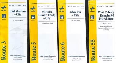
Ephemera - Timetable - The Met - set of 13, The Met, 1996
... ...route 34...All are revised issues of earlier timetables and dated Feb. 1996 unless noted otherwise. 1 - Route 3 - East Malvern - City 2 - Route 5 - Malvern Burke Road - City 3 - Route 6 - Glen Iris - City 4 - Route 55 - West Coburg - Domain Interchange 5 - Route 57 - West Maribyrnong - City 6 - Route 59 - Airport West - City 7 - Route 69 - Kew Cotham Road - St Kilda Beach 8 - Route 70 - Wattle Park - Princes Bridge 9 - Route 72 - Camberwell - Melbourne Uni - Dec. 1996 10 - Route 78, 79, North Richmond - St Kilda Beach or Prahran 11 - Route 82 - Moonee Ponds - Footscray 12 - Route 96 - St Kilda Beach - East Brunswick 13 - Route 34 - La Trobe St Services - includes routes that served La Trobe St....Yields information about some of The Met tram services Feb. 1996 timetables The Met route 3 route 5 route 6 route 55 rout 57 route 59 route 69 route 70 route 72 route 78 route 79 route 82 route 96 route 34 La Trobe St Set of 13 The Met timetables, DL size, printed in two colours. ...Set of 13 The Met timetables, with an image of the relevant depot manager, details of hiring a tram, The Met fare system, and a diagrammatic map. All are revised issues of earlier timetables and dated Feb. 1996 unless noted otherwise. 1 - Route 3 - East Malvern - City 2 - Route 5 - Malvern Burke Road - City 3 - Route 6 - Glen Iris - City 4 - Route 55 - West Coburg - Domain Interchange 5 - Route 57 - West Maribyrnong - City 6 - Route 59 - Airport West - City 7 - Route 69 - Kew Cotham Road - St Kilda Beach 8 - Route 70 - Wattle Park - Princes Bridge 9 - Route 72 - Camberwell - Melbourne Uni - Dec. 1996 10 - Route 78, 79, North Richmond - St Kilda Beach or Prahran 11 - Route 82 - Moonee Ponds - Footscray 12 - Route 96 - St Kilda Beach - East Brunswick 13 - Route 34 - La Trobe St Services - includes routes that served La Trobe St.Yields information about some of The Met tram services Feb. 1996Set of 13 The Met timetables, DL size, printed in two colours.timetables, the met, route 3, route 5, route 6, route 55, rout 57, route 59, route 69, route 70, route 72, route 78, route 79, route 82, route 96, route 34, la trobe st -
 Melbourne Tram Museum
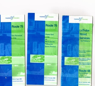
Ephemera - Timetable/s, Yarra Trams, Set of five timetable books - 2002. Provide details about Yarra Trams, Metcards, route map, timing points and route description, 8/2000 to 9/2002
... ... Route 34...Covers Route 48, 24, 27, 30 and 34. Has Route 48 on the reverse of the book. .4 - printed 28 page book, blue green cover stapled timetable for "Route 86 - Bundoora / RMIT - Colonial Stadium via Bourke St" tram service, dated September 2002. .5 - printed 32 page book, blue green cover stapled timetable for "Route 109 - Port Melbourne - Mont Albert" and La Trobe St services (back of booklet) tram services, dated September 2001....Trams tramways Tickets Yarra Trams Tram Services Timetables La Trobe St Route 70 Route 75 Route 109 Route 86 Route 86 Route 109 Route 48 Route 24 Route 27 Route 30 Route 34 Set of five timetable books - 2002. ...Set of five timetable books - 2002. Provide details about Yarra Trams, Metcards, route map, timing points and route description. .1 - printed 24 page book, blue green cover stapled timetable for "Route 75 - East Burwood - City" tram service, dated August 2000. .2 - printed 24 page book, blue green cover stapled timetable for "Route 70 - Wattle Park - City" tram service, dated December 2000. .3 - printed 24 page book, blue green cover stapled timetable for "La Trobe Street Services - East Melbourne" and "North Balwyn - City" tram service, dated September 2001. Covers Route 48, 24, 27, 30 and 34. Has Route 48 on the reverse of the book. .4 - printed 28 page book, blue green cover stapled timetable for "Route 86 - Bundoora / RMIT - Colonial Stadium via Bourke St" tram service, dated September 2002. .5 - printed 32 page book, blue green cover stapled timetable for "Route 109 - Port Melbourne - Mont Albert" and La Trobe St services (back of booklet) tram services, dated September 2001.trams, tramways, tickets, yarra trams, tram services, timetables, la trobe st, route 70, route 75, route 109, route 86, route 86, route 109, route 48, route 24, route 27, route 30, route 34 -
 The Beechworth Burke Museum
Photograph
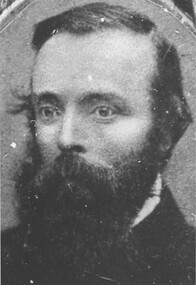
... route across the continent from the settled areas of Victoria to the Gulf of Carpentaria. Prior to leading this expedition, Burke was the superintendent of Police in Beechworth from 1858-1860. The Robert O’Hara Burke Memorial Museum was named in honour of Robert O’Hara Burke after his death at Coopers Creek in 1861 during expedition. This particular image of Robert O'Hara Burke features on the 'Pioneer Board' which is currently on display in the Museum. robert o'hara burke pioneers of beechworth pioneer board beechworth police superintendent Reverse: 34 ...This photograph is of Robert O'Hara Burke (6 May 1821 – c. 28 June 1861) who was an Irish soldier and police officer who achieved fame as an Australian explorer. He was the leader of the ill-fated Burke and Wills expedition, which was the first expedition to cross Australia from south to north, finding a route across the continent from the settled areas of Victoria to the Gulf of Carpentaria. Prior to leading this expedition, Burke was the superintendent of Police in Beechworth from 1858-1860. The Robert O’Hara Burke Memorial Museum was named in honour of Robert O’Hara Burke after his death at Coopers Creek in 1861 during expedition. This particular image of Robert O'Hara Burke features on the 'Pioneer Board' which is currently on display in the Museum. Black and white rectangular copy of a photograph. Image is printed on gloss photographic paper and has a white unprinted boarder. Reverse: 34 / Photo credit: Burke Museum / BEECHWORTH / 46% /robert o'hara burke, pioneers of beechworth, pioneer board, beechworth, police superintendent -
 Eltham District Historical Society Inc
Document, Russell Yeoman, Tour of Historic Buildings and Locations, 1978
... 34. WITHERS HOUSE This house was the home of famous artist Walter Withers who shifted here from Heidelberg in 1903. 35. ELTHAM HIGH SCHOOL This school celebrated its jubilee this year, having commenced as the Eltham Higher Elementary School 50 years ago. 36. DIAMOND CREEK FOOTWAY If returning from the High School to the town centre the footpath by the bank of the Diamond Creek provides a pleasant route...34. WITHERS HOUSE This house was the home of famous artist Walter Withers who shifted here from Heidelberg in 1903. 35. ELTHAM HIGH SCHOOL This school celebrated its jubilee this year, having commenced as the Eltham Higher Elementary School 50 years ago. 36. DIAMOND CREEK FOOTWAY If returning from the High School to the town centre the footpath by the bank of the Diamond Creek provides a pleasant route ...Self guided heritage tour information produced by the Shire of Eltham Historical Society for 1978 Eltham Community Festival of 36 locations each numbered on accompanying map. Locations and detail provided current to 1978: 1. ELTHAM SHOPPING CENTRE Whilst very little remains in the centre of historical importance, this area has interest as the "village" which developed over many years following the opening of the railway from Melbourne in 1902. Previously the shopping centre had been spread out over a long length of Main Road to the south. Shops have been continuously demolished or remodelled and the majority of buildings date from the 1950's or later. The recently erected Post Office replaced the "old" Post Office opened on the same site only in 1958. 2. WOOLWORTHS ELTHAM VILLAGE Part of the site of this modern shopping development was occupied by the former Eltham Shire Offices and Hall. The hall was paid for by public subscription whilst the Council raised a loan for the offices. The combined building was opened in 1941. It served as office and Council meeting place until 1965 and as the hall until its demolition in 1970. 3. ELTHAM WAR MEMORIAL The complex of buildings adjoining the present Shire Offices were financed by public subscription as a Memorial following World War II. Their construction and for many years their operation was organised by the now disbanded Eltham War Memorial Committee. The original buildings were the; Infant Welfare Centre, Children’s Library (now War Memorial Hall and Dental Clinic) and Kindergarten. In later years the Elderly Citizens Club was built at the rear. 4. ELTHAM SHIRE OFFICES These offices were opened in 1965 and extended in 1971 to provide additional office accommodation and the Eltham Library. They represent the last of a long line of offices and meeting places of the Eltham Shire Council and its predecessor the Eltham District Road Board. The building occupies the former site of Shillinglaw Cottage. The three tall cypress trees which stood in front of the Cottage have been retained as a feature of the office surrounds. 5. OUR LADY'S CHURCH AND SCHOOL The Catholic Church and School complex opposite the Shires Offices shows a number of stages in the development of Eltham township. The recently constructed church adjoins its predecessor (now the parish centre). Many years ago the Catholic Church was located opposite Wingrove Park and the present central site follows the northerly drift of the township. 6. SHILLINGLAW COTTAGE The Cottage was built in 1859 by George Stebbing, a local builder who was responsible for a number of other prominent buildings in the area. Its removal from the site of the Shire Offices and re-erection on the present site was financed by public subscription. It is built of handmade bricks laid in Flemish Bond with an unusual design featuring burnt "leader" bricks over the whole facade. The Cottage is occupied by Eltham Fleececrafts and will be open during the Festival and at other times during weekends. It is classified by the National Trust. 7. RAILWAY BRIDGE The timber trestle bridge over the Diamond Creek was built in 1901. Whilst all of its timbers have been replaced at various times over the years the only change to its character has been the addition of pylons and wiring for electric trains in 1923. It is one of very few similar bridges remaining in the metropolitan area. In 1976 a proposal to replace the bridge with an earth embankment and large culvert pipes was abandoned following community protests. The bridge, however, remains under threat because of the necessity for future deuplication of the railway line. 8. ELTHAM CENTPAL PARK The area between the railway and the creek has for many years been used as a park which included Eltham' s main football oval. The access road, Panther Place is named after Eltham's team playing in the Diamond Valley League. In recent years a large area extending to Bridge Street and locally known as the Town Park has been landscaped and added to the area. The excellent blending of the park with the natural landscape of the creek valley has earned a National Trust Landscape Classification. 9. OLD BAKERY On the southern corner of York Street and Main Road is an old house with a shop front which was for many years the local baker's shop. The brick bakery at the rear is of somewhat later vintage than the house. 10. BRIDGE STREET CUTTING Before reconstruction of Main Road this intersection had deep cutting embankments on all four corners, forming a distinctive feature of the entrance to Eltham. Roadworks and private development have levelled the land on the low side of the road. A memorial to the Eltham soldiers of World War I which was located at the north-western corner is now situated at the Eltham R.S.L. 11. HILLTOP MILK BAR For many years this was the site of the Eltham Post Office under the control of the Hunniford family and later their descendants the Burgoynes. It was transferred to this site in 1855, although at that time the building apparently fronted Bridge Str e et. The site contained Eltham's first telephone exchange. The post office was relocated in 1954 but the shop was operated until recently by the Burgoyne family who still own the surrounding land. 12. UNITING CHURCH and former C.B.A. BANK The former Methodist Church was built in 1880 by George Stebbing. The Sunday School extension was built in 1929 and there have been more recent extensions. The adjoining opportunity shop was built as a bank in 1874 and purchased by the Methodist Church in 1954. 13. R.S.L. HALL, TELEPHONE EXCHANGE These relatively recent buildings occupy the site of a row of shops forming part of the early ribbon of business development along Main Road. In front of the R.S.L. building is the World War I Memorial relocated from the corner of Bridge Street and Main Road. 14. ELTHAM COMMUNITY CENTRE Australia's first mudbrick "community building" was opened in April this year. Part of the site of the building was purchased in 1856 by Henry Dendy (of Brighton fame). At the rear of the land near the creek was a steam flour mill whilst Dendy's house was at the Main Road frontage of the land. His purchase totalled about 2 Ha (5 acres) and included land on the opposite side of Maria Street (Main Road). Dendy became a prominent member of the Eltham community and served one term as President of the Eltham District Road Board. In 1867 Dendy sold his land and business to William Ford of Malmsbury and shifted to Walhalla. The avenue of trees leading past the Community Centre to the creek may well have bordered the track to the mill. 15. ELTHAM HOTEL The original part of this hotel was built in 1927 following the burning of the former Watson's Eltham Hotel on the same site. The car park on the opposite side of Main Road was also the site of a hotel variously known over the years as; the Fountain of Friendship, the Fountain and the Evelyn Arms. As the Fountain of Friendship it was the first meeting place of the Eltham District Road Board in 1856. 16. ST. MARGARET'S CHURCH, PITT STREET In 1860 Henry Dendy was appointed Chairman of a committee to establish a church of England in Eltham. He donated part of his land in Pitt Street and in 1861 the church was opened. It was built by George Stebbing and remains in a well preserved state today. Th adjoining old vicarage is now named Dendy Hou se. A new mudbrick church hall is under construction on the site. The church and Dendy House are now listed on the Register of Historic Buildings. 17. NO. 86 PITT STREET Cottage built by George Stebbing and believed to be his home for some years in the 1850s. 18. LIVING AND LEARNING CENTRE The house was built in the 1850s with the kitchen at the front being added about 40 years later. By the creek below the house a number of early Eltham industries were located. These included a tannery and a brewery. 19. ELTHAM COURT HOUSE A Court of Petty Sessions was established in Eltham in 1858 and the present building dates from 1860. It is the oldest public building remaining in Eltham. In its early days the building was used as the meeting place and office of the Eltham District Road Board and as an overflow classroom for the local school. The Court House has been classified by the National Trust. The citation states that it is an example of the simple form of early brick Court House with gabled roof and porch. 20. LANDS DEPARTMENT OFFICE This building is the former police station and is probably of about the same age as the Court House. The lockup at the rear has been demolished but the old stables remain as garages. A licence was first granted for a police station at Eltham in 1856. 21. JARROLD COTTAGE The old Cottage opposite Dalton Street was formerly owned by the Jarrold family. Early records indicate that this was the building leased from the Jarrolds as a temporary police station prior to construction of the building on the corner of Brougham Street. The small building on the corner of the property was used as a boot repairer's shop. The elevated studio at the rear is a more recent construction by the present owners. 22. STATE SCHOOL RESIDENCE Erected in 1891 23. WINGROVE COTTAGE This building fills an important place in the history of Eltham and is now used as a medical clinic. It was built in 1858 for Charles S. Wingrove who was Secretary to the Eltham District Road Board and Shire Council from 1858 to 1904. During part of this period he was also Shire Engineer and was Secretary to the Heidelberg Road Board. The house was used as the office of the Board and Council for many years. Wingrove is buried in the cemetery at St. Helena. 24. WINGROVE PARK The parkland opposite Wingrove Cottage has been named after Charles Wingrove. The old Manna Gums are an outstanding feature of the park. 25. ELTHAM FRI.MARY SCHOOL NO. 209 The school first opened in the slab building in 1855 and operated from the present site since 1857. The oldest part of the present school is the stone building erected in 1876. The first school teacher, David Clark remained at the school until 1888. This school is the government township and has always been known as the Eltham School. An earlier school (no.371) known as Little Eltham School operated in Swan Street from 1853 to 1872. 26. "SHOESTRING" This house was built for school teacher David Clark. It has been extensively extended in recent years but the extensions do not detract from the character of the older part of the building. 27. ELTHAM CEMETERY The cemetery contains the graves of many of the district's pioneers . 28. MONTSALVAT This unique complex of buildings was commenced in 1935 by the late Justus Jorgensen and its development has extended over many years. Montsalvat has exerted a significant impact on Eltham The earth and stone construction of many of the buildings has influenced local architecture to a great extent and it has served as a "nerve centre" of the local artistic community. Montsalvat is open to the public for a small charge. 29. MAIN ROAD BRIDGE This location has been the main crossing of Diamond Creek since the earliest days of settlement. The present concrete bridge was erected in 1925 .and was preceded by a number of timber bridges. 30. ELTHAM LOWER PARK This park, being an unusually large flat area for Eltham, was originally the local racecourse. Horse races were held here from 1855 and the area was gazetted as a reserve for a racecourse and recreation reserve in 1857. The park is well known as a venue for school "bird days" and more recently as the site of the Diamond Valley Railway. This miniature railway features scale models of modern and old locomotives and rolling stock and has operated on this site since 1961 . Before that the railway operated at Chelsworth Park, Ivanhoe. 31. FALKINER HOUSE Frederick Falkiner was one of the earliest settlers in the Eltham township area and occupied a substantial leasehold prior to the first land sales. Early records show that Falkiner was the subject of a number of complaints from his neighbours but he has nevertheless been considered a prominent enough citizen to have a street named for him. This house was the home of Evelyn (Ely) Falkiner a member of Frederick's family. 32. WEST HOUSE Behind the large house on the hill is an early house built by the West family. This was relocated from a site near the front of the land by the present owner Mr. Fabbro. 33. FALKINER HOUSE This very old house is believed to have been the home of Frederick and may have been Eltham's first post office. Falkiner was the first post master for a short period. in 1854/55. 34. WITHERS HOUSE This house was the home of famous artist Walter Withers who shifted here from Heidelberg in 1903. 35. ELTHAM HIGH SCHOOL This school celebrated its jubilee this year, having commenced as the Eltham Higher Elementary School 50 years ago. 36. DIAMOND CREEK FOOTWAY If returning from the High School to the town centre the footpath by the bank of the Diamond Creek provides a pleasant route to finish your walk. The creek is a major tributary of the Yarra River. Together with its own major tributaries Arthurs Creek and Running Creek it commences on the southern slopes of the Dividing Range at Kinglake. It gives the name Diamond Valley to an area extending well beyond its actual drainage catchment.Recognition of the significance of various landmarks to the history of the Eltham community as of 1978‘shoestring’, 1978, bridge street cutting, burgoyne store, c.b.a. bank, diamond creek trail, eltham cemetery, eltham central park, eltham community centre, eltham community festival, eltham court house, eltham festival, eltham high school, eltham hotel, eltham lower park, eltham primary school, eltham railway trestle bridge, eltham shire offices, eltham shopping centre, eltham state school no. 209, eltham village, eltham war memorial, falkiner house, heritage trail, hilltop milk bar, jarrold cottage, lands department office, living, living and learning centre, main road bridge, montsalvat, old bakery, our eltham artistic recollections, our lady help of christian’s church, our lady help of christian’s primary school, pitt street, post office, r.s.l. hall, shillinglaw cottage, st margaret’s church, state school residence, stebbing cottage, telephone exchange, uniting church, west house, wingrove cottage, wingrove park, withers house, woolworths -
 Eltham District Historical Society Inc
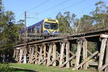
Photograph - Digital Photograph, Alan King, Eltham Railway Trestle Bridge, 28 December 2007
... 34 timber-beam spans and four steel-joist spans, supported by four-pile timber piers and timber abutments. It has almost 200m of timber deck. All of the timbers have been replaced over the years, but the only change to the bridge’s character was the addition of pylons and wiring for electric trains in 1923. A petition for a railway to the shire was first made in 1883. A large deputation of local citizens to the Commissioner of Railways proposed a route...34 timber-beam spans and four steel-joist spans, supported by four-pile timber piers and timber abutments. It has almost 200m of timber deck. All of the timbers have been replaced over the years, but the only change to the bridge’s character was the addition of pylons and wiring for electric trains in 1923. A petition for a railway to the shire was first made in 1883. A large deputation of local citizens to the Commissioner of Railways proposed a route ...Covered under National Trust of Australia (Victoria) State Significance and Heritage Overlay, Nillumbik Planning Scheme. Published: Nillumbik Now and Then / Marguerite Marshall 2008; photographs Alan King with Marguerite Marshall.; p103 The Eltham railway trestle bridge is the only one of its kind still regularly used in Melbourne’s metropolitan railway network. Opened in 1902, it is also one of Victoria’s very few timber rail bridges that still carries trains.1 The bridge is part of the railway line extension from Heidelberg - extended to Hurstbridge in 1912. This extension resulted in one of the greatest social changes experienced in Eltham Shire, as it considerably lessened its isolation attracting tourists, artists and suburban commuters particularly after World War Two.2 The bridge has been classified by the National Trust as historically, scientifically, aesthetically and socially significant at state level. But this has not always been recognised, and in 1977, locals fought to save it from destruction. The Victorian Railways proposed to replace the bridge with an earth embankment and large culverts to avoid maintenance problems and fire. This was rejected by the Eltham Council who protested that the bridge helped maintain the area’s rural character, historic link and beauty, as well as avoiding possible serious flooding on the flood plain if a culvert was blocked. The bridge stands as part of a National Trust classified landscape which includes the Alistair Knox Park, named after the local conservationist and architect who helped to make Eltham famous for its mud-brick houses. The landscape includes tall and spreading manna gums and candlebarks, and the historic Shillinglaw Cottage. Artist Walter Withers, one of the Heidelberg School of painters, painted the bridge early in the 20th century. The 38 span single-track railway bridge over creek and road has 34 timber-beam spans and four steel-joist spans, supported by four-pile timber piers and timber abutments. It has almost 200m of timber deck. All of the timbers have been replaced over the years, but the only change to the bridge’s character was the addition of pylons and wiring for electric trains in 1923. A petition for a railway to the shire was first made in 1883. A large deputation of local citizens to the Commissioner of Railways proposed a route passing through Alphington to midway between Greensborough and Eltham up the Diamond Creek valley towards Queenstown and Kinglake. As a result the Princes Bridge-Heidelberg Railway was opened in 1888. From 1888 locals demanded a railway extension. Kangaroo Ground farmers in particular, led by Shire Councillor and Member for Evelyn, Ewen Cameron, said it would assist local farmers and orchardists send their produce to the Melbourne market. In 1890, before the severe economic Depression, an extension of the line to Hurst’s Bridge (now Hurstbridge) was included in a new Railways Bill. The parliamentary delegations were regaled with a banquet at Hurst’s barn and entertained by the Diamond Creek Brass Band, but the extension was abandoned when the Depression struck in 1892-1893. The extension of the railway to Eltham, completed in 1902, was one of the few built in those hard times. That is why the Eltham timber-trestle railway bridge is a rare example of a broad-gauge rail bridge constructed between 1893 and 1910. At the opening, despite persistent drizzle, 300 children waving flags and banners were among the large crowd welcoming the first train, carrying official dignitaries, to Eltham. It had taken 24 years to bring the railway to Eltham. From then Eltham became a popular destination for outings. Mr Orford of Eltham recalled that after the railway came to Eltham ‘the craze for picnics on weekends and holidays began…. During the wattle season, wattle trains came to Eltham frequently. The visitors roamed the creek pulling great armfuls of wattle blossom to take back with them to Melbourne’.3 In 1926 the railway line was electrified as part of the metropolitan rail network. But the Victorian Railways decided not to complete the formerly planned Diamond Valley Railway to Queenstown (now St Andrews) and Kinglake.This collection of almost 130 photos about places and people within the Shire of Nillumbik, an urban and rural municipality in Melbourne's north, contributes to an understanding of the history of the Shire. Published in 2008 immediately prior to the Black Saturday bushfires of February 7, 2009, it documents sites that were impacted, and in some cases destroyed by the fires. It includes photographs taken especially for the publication, creating a unique time capsule representing the Shire in the early 21st century. It remains the most recent comprehenesive publication devoted to the Shire's history connecting local residents to the past. nillumbik now and then (marshall-king) collection, eltham railway trestle bridge, eltham trestle bridge -
 Bendigo Historical Society Inc.
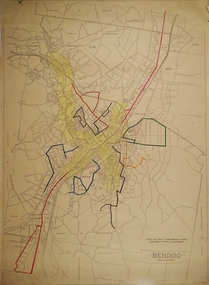
Map - BENDIGO BUS ROUTES, 1934 - 1958 ?
... Map: Bendigo bus Routes, State Electricity Commission of Victoria, Electricity Supply Department. Printed on the bottom right hand corner F.E.B 23-12-47 , R.L.A. 5-9-58, 19-9-34, 27-11-37. 4 Maps...MAP Bendigo transport State Electricity Commission Bendigo Bus Routes Map: Bendigo bus Routes, State Electricity Commission of Victoria, Electricity Supply Department. Printed on the bottom right hand corner F.E.B 23-12-47 , R.L.A. 5-9-58, 19-9-34, 27-11-37. 4 Maps Map BENDIGO BUS ROUTES ...Map: Bendigo bus Routes, State Electricity Commission of Victoria, Electricity Supply Department. Printed on the bottom right hand corner F.E.B 23-12-47 , R.L.A. 5-9-58, 19-9-34, 27-11-37. 4 Mapsmap, bendigo, transport, state electricity commission, bendigo bus routes -
 Bendigo Historical Society Inc.
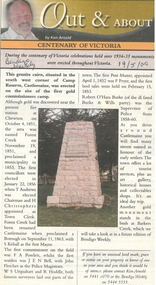
Newspaper - Newspaper articles by Ken Arnold, Out &About, 2000 - 2003
... Route 6.10.00 18. Volcanic Rock Cairn. Woodstock 13.10.00 19. Garfield Water Wheel 20.10.00 20. Anticline. Castlemaine 27.10.00 21. Lawson Bridge 10.11.00 22. Plaque. Sutton Grange area 17.11.00 23. Memorial Cairn. Maryborough 1.12.00 24. Lonely Grave 8.12.00 25. Moonlight Flat Church 5.1.01 26. Historic Church. Near Tullaroop reservoir 12.1.01 27. Granite Statue. Castlemaine 19.1.01 28. Marker. Near Tullaroop reservoir 25.1.01 29. Church Site. Mologa 2.2.01 30. Church Site. Mologa 9.2.01 31. Plaque. Mologa 16.2.01 32. Mincha School 23.2.01 33. Historic Marker. Mincha 2.3.01 34...Route 6.10.00 18. Volcanic Rock Cairn. Woodstock 13.10.00 19. Garfield Water Wheel 20.10.00 20. Anticline. Castlemaine 27.10.00 21. Lawson Bridge 10.11.00 22. Plaque. Sutton Grange area 17.11.00 23. Memorial Cairn. Maryborough 1.12.00 24. Lonely Grave 8.12.00 25. Moonlight Flat Church 5.1.01 26. Historic Church. Near Tullaroop reservoir 12.1.01 27. Granite Statue. Castlemaine 19.1.01 28. Marker. Near Tullaroop reservoir 25.1.01 29. Church Site. Mologa 2.2.01 30. Church Site. Mologa 9.2.01 31. Plaque. Mologa 16.2.01 32. Mincha School 23.2.01 33. Historic Marker. Mincha 2.3.01 34 ...Ken Arnold is a Bendigo author and publisher.A series of one hundred and thirty-five articles written by Ken Arnold and published in the Bendigo Weekly between 2000 and 2003. Each article has a topic or theme and includes historical information and details. Each article includes a photograph. The articles are stored in a red vinyl covered two ring A5 folder. Index below. Number Article Name Date 1. Centenary of Victoria 19.5.00 2. Storm Water Drain 26.5.00 3. Granite Rollers 2.6.00 4. Poverty Mine 9.6.00 5. Golden Monument. St Arnaud 16.6.00 6. Turner Statue 7.7.00 7. Gold Monument. High St Golden Square 30.6.00 8. Gold Monument. Howard Square Bendigo 14.7.00 9. Lansell Statue 21.7.00 10. Shelbourne West School 18.8.00 11. Mologa’s State Schools 25.8.00 12. Salinity Stone. Pyramid Hill 1.9.00 13. Cairn. Carisbrook 8.9.00 14. Commemorative Markers. Taradale 15.9.00 15. Burke Monument. Castlemaine 22.9.00 16. Cairn. Harcourt area 29.9.00 17. Cairn Marks Gold Route 6.10.00 18. Volcanic Rock Cairn. Woodstock 13.10.00 19. Garfield Water Wheel 20.10.00 20. Anticline. Castlemaine 27.10.00 21. Lawson Bridge 10.11.00 22. Plaque. Sutton Grange area 17.11.00 23. Memorial Cairn. Maryborough 1.12.00 24. Lonely Grave 8.12.00 25. Moonlight Flat Church 5.1.01 26. Historic Church. Near Tullaroop reservoir 12.1.01 27. Granite Statue. Castlemaine 19.1.01 28. Marker. Near Tullaroop reservoir 25.1.01 29. Church Site. Mologa 2.2.01 30. Church Site. Mologa 9.2.01 31. Plaque. Mologa 16.2.01 32. Mincha School 23.2.01 33. Historic Marker. Mincha 2.3.01 34. Expedition Marker. Pyramid Hill 9.3.01 35. Irrigation Marker. Tragowel 16.3.01 36. Mologa School Sites 23.3.01 37. Cairn. Pyramid Hill 30.3.01 38. Plaque. Pyramid Hill 6.4.01 39. Bristol Hill Lookout Tower. Maryborough 12.4.01 40. Eppalock Reservoir 20.4.01 41. Colbinabbin Cairn 27.4.01 42. Mount Macedon Cross 4.5.01 43. Memorial Gateway. Macedon 11.5.01 44. Cairn. Daylesford 18.5.01 45. Grave. Carlsruhe 25.5.01 46. Water Tower. Elmore 1.6.01 47. State School Site. Glenalbyn 8.6.01 48. Cairn. Kanya 15.6.01 49. Lonely Grave. Wedderburn 22.6.01 50. Church Cairn. Glenalbyn 29.6.01 51. Kamarooka School 6.7.01 52. Granite Marker. Moyston 13.7.01 53. Memorial Park. Kerang 20.7.01 54. Water Plaque. Bears Lagoon 27.7.01 55. Cemetery. Bears Lagoon 3.8.01 56. Race Monument 10.8.01 57. Cairn. Pyalong 17.8.01 58. Cairn. In memory of Edward Parker 24.8.01 59. Mt Macedon 31.8.01 60. Mt Macedon Cairn 7.9.01 61. Expedition Pass. Chewton 14.9.01 62. Granite Archway. St Arnaud 21.9.01 63. Stuart Mill School Site 28.9.01 64. School Site. Beazley’s Bridge 5.10.01 65. Fosterville 12.10.01 66. Barnadown 19.10.01 67. Salisbury School Site 26.10.01 68. Cricket History at Wattle Flat 2.11.01 69. School Site. Waterloo Plains 9.11.01 70. Carapooee School Site 11.01 71. Turkish Gun. Maldon 11.01 72. Kooreh 30.11.01 73. Marnoo East School 7.12.01 74. Bulgana Site 14.12.01 75. Emu School 21.12.01 76. Kooroocheang 4.1.02 77. Church Site. Gre Gre North 11.1.02 78. Carmens Tunnel. Maldon 18.1.02 79. Monument. Maldon 25.1.02 80. Woodfull Plaques. Maldon 1.2.02 81. Carapooee. St Peters Anglican Church 8.2.02 82. Cairn. Kingower 15.2.02 83. Cob & Co Stopover. Rheola 22.2.02 84. Flynn Monument 1.3.02 85. The Welcome Stranger. Moliagul 8.3.02 86. Campbell’s Creek Reserve 15.3.02 87. Mine. Fryerstown 22.3.02 88. Escott Grave. Near Chewton 28.3.02 89. School No 808. Kurting area 5.4.02 90. Graves. Bendigo Creek 10.5.02 91. School. Fish Point, Benjeroop North 17.5.02 92. Old Township. Diggora 24.5.02 93. Diggora West (1) 31.5.02 94. Diggora West (2) 7.6.02 95. School No 2735. Gower East 14.6.02 96. Pannoomilloo 21.6.02 97. Kamarooka Settlement 28.6.02 98. Mincha West State School No 1931 5.7.02 99. Bridges. Arnold 12.7.02 100. Woodvale 19.7.02 101. A Famous Son of Raywood. Jack Donaldson 26.7.02 102. Tandarra Area Schools 2.8.02 103. Dingee 9.8.02 104. Avonmore 30.8.02 105. Myola East School 6.9.02 106. Colbinabbin West 13.9.02 107. Colbinabbin West School 20.9.02 108. Runnymede area 27.9.02 109. Wanalta 4.10.02 110. School Sites. Between Wanalta and Carop 11.10.02 111. Burramboot 18.10.02 112. Kangaroo Chair. 25.10.02 113. Mincha South 1.11.02 114. Woodlands Church 8.11.02 115. School site. Sylvaterre 15.11.02 116. Terrick Terrick 22.11.02 117. Leitchville 29.11.02 118. Pennyweight Cemetery. Castlemaine 6.12.02 119. Mincha Area 13.12.02 120. Musk School 20.12.02 121. Dowie Park. Carisbrook 3.1.03 122. Neereman School Site 10.1.03 123. Bald Rock 17.1.03 124. Sylvaterre School Site 24.1.02 125. Carlsruhe 31.1.02 126. Athenaeum. Maldon 7.2.03 127. School. Mincha West 14.2.03 128. Yarraberb 21.2.03 129. Settlement Marker. Ravenswood Estate 28.2.03 130. Comini Reserve. Ravenswood 7.3.03 131. Ironbark and Gold Track. Whroo 14.3.03 132. Burke and Wills Obelisk. Castlemaine 21.3.03 133. James Cook Statue. Myers St Bendigo 28.3.03 134. St Marys Church. Axedale 4 .4.03 135. Butter Factory Site. Warragamba 11.4.03 events, monuments, historical sites, landmarks -
 Ballarat Tramway Museum
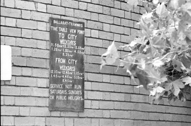
Photograph - Timetable board - View Point - Power station, Mal Rowe, 1/1/70
... Yields information about the timetable that applied for the View Point route, though by the end of the operations in 1971, View Point services did not operate. tramcars tramways signs timetables Ballarat A Power Station Ripon St View Point Mal Rowe copyright stamp with number "120,18" and "On Power station wall 1/1/70" and "No. 34 page 55" Black and white photograph notes on rear Photograph Timetable board - View Point - Power station Mal Rowe ...The photograph shows the View Point route timetable board that was on the Power station wall in Ripon St. Photo Mal Rowe 1/1/70. The photo, cropped was used on page 55 in Keith Kings 1971 book "Ballarat Tramways." This timetable board is one that is not in the Museum's collection.Yields information about the timetable that applied for the View Point route, though by the end of the operations in 1971, View Point services did not operate.Black and white photograph notes on rear Mal Rowe copyright stamp with number "120,18" and "On Power station wall 1/1/70" and "No. 34 page 55"tramcars, tramways, signs, timetables, ballarat a power station, ripon st, view point -
 Ballarat Tramway Museum
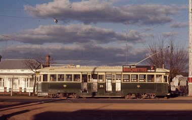
Slide - Ballarat trams - Sebastopol line - set of 9, Ron Hood, 9/1971
... Has a briquettes roof advert. 2 - tram 40 northbound at the Urquhart St loop 3 - tram 41, shortly before crossing Albert St. 4 - tram 34 crossing Albert St at Ophir St Anglican Trinity Church in the background. 5 - tram 40 southbound in Albert St shortly before Ophir St 6 - tram 40 northbound in Albert St 7 - ditto 8 - tram 35 northbound with a very empty tram - only the conductor and driver 9 - tram 34 to Sebastopol dropping off passengers at Rubicon St. with the Ford car dealer sign in the background. Yields information about tram operations on the Sebastopol line shortly before closure of the route. tramways trams Albert St Sebastopol Urquhart St tram 40 tram 34 tram 35 tram 41 In ink "Sebastopol line Sept. 1971" and slide numbers 19, 29, 30, 31, 32, 33, 34, 35, & 36 Set of 9 Colour slides in plain white cardboard mounts. ...Set of nine colour photographs by Ron Hood in early Sept. 1971 of trams on the Sebastopol line: 1 - side on view of tram 35, in bound in Albert St. Has a briquettes roof advert. 2 - tram 40 northbound at the Urquhart St loop 3 - tram 41, shortly before crossing Albert St. 4 - tram 34 crossing Albert St at Ophir St Anglican Trinity Church in the background. 5 - tram 40 southbound in Albert St shortly before Ophir St 6 - tram 40 northbound in Albert St 7 - ditto 8 - tram 35 northbound with a very empty tram - only the conductor and driver 9 - tram 34 to Sebastopol dropping off passengers at Rubicon St. with the Ford car dealer sign in the background.Yields information about tram operations on the Sebastopol line shortly before closure of the route.Set of 9 Colour slides in plain white cardboard mounts.In ink "Sebastopol line Sept. 1971" and slide numbers 19, 29, 30, 31, 32, 33, 34, 35, & 36tramways, trams, albert st, sebastopol, urquhart st, tram 40, tram 34, tram 35, tram 41 -
 Ballarat Tramway Museum
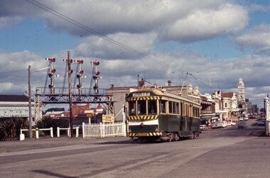
Slide - Ballarat trams - Railway station & Lydiard St - set of 3, Ron Hood, 9/1971
... Set of three colour photographs by Ron Hood in early Sept. 1971 of trams on the Lydiard St Nth line: 1 - tram 40, northbound crossing the level crossing in Lydiard St with the signal gantry in the view. 2 - tram 34, southbound ditto and the railway station building in the background. 3 - tram 35, northbound from the balcony of the Provincial Hotel with Reids Coffee palace, Macleod & Co, JJ Coller and 3BA buildings in the background. Yields information about tram operations at the Ballarat level crossing in Lydiard St Nth shortly before closure of the route ...Set of three colour photographs by Ron Hood in early Sept. 1971 of trams on the Lydiard St Nth line: 1 - tram 40, northbound crossing the level crossing in Lydiard St with the signal gantry in the view. 2 - tram 34, southbound ditto and the railway station building in the background. 3 - tram 35, northbound from the balcony of the Provincial Hotel with Reids Coffee palace, Macleod & Co, JJ Coller and 3BA buildings in the background.Yields information about tram operations at the Ballarat level crossing in Lydiard St Nth shortly before closure of the route.Set of 3 Colour slides in plain white cardboard mounts.In ink "Railway Station, Ballarat Sept. 1971" and slide numbers 21, 22, 23tramways, trams, tram 40, tram 34, tram 35, lydiard st north, level crossing, signals -
 Ballarat Tramway Museum
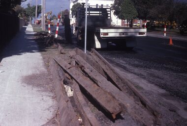
Slide - 35mm slide/s - set of 11, May 1979c
... All in Pakington St., Newtown, ex Newtown route. 2268.1 - slide 29 - look south from the north of Retreat Road. .2 - 30 - No. 276 in background, looking south .3 - 31 - City of Newtown Town Hall in background. .4 - 32 - opposite to that of No. 29. .5 - 33 - Looking south .6 - 34 - looking south with Aphrasia St. in the background. .7 - 35 - as for .2 .8 - 36 - Opposite No. 278, looking south .9 - 1 - opposite No. 276/278. .10 - 2 - ditto .11 - 3 - Outside No. 278, looking south. ...All in Pakington St., Newtown, ex Newtown route. 2268.1 - slide 29 - look south from the north of Retreat Road. .2 - 30 - No. 276 in background, looking south .3 - 31 - City of Newtown Town Hall in background. .4 - 32 - opposite to that of No. 29. .5 - 33 - Looking south .6 - 34 - looking south with Aphrasia St. in the background. .7 - 35 - as for .2 .8 - 36 - Opposite No. 278, looking south .9 - 1 - opposite No. 276/278. .10 - 2 - ditto .11 - 3 - Outside No. 278, looking south. ...Set of eleven colour slides (Kodak) showing the removal of tram track in Geelong, c May 1979. All in Pakington St., Newtown, ex Newtown route. 2268.1 - slide 29 - look south from the north of Retreat Road. .2 - 30 - No. 276 in background, looking south .3 - 31 - City of Newtown Town Hall in background. .4 - 32 - opposite to that of No. 29. .5 - 33 - Looking south .6 - 34 - looking south with Aphrasia St. in the background. .7 - 35 - as for .2 .8 - 36 - Opposite No. 278, looking south .9 - 1 - opposite No. 276/278. .10 - 2 - ditto .11 - 3 - Outside No. 278, looking south. Bus stop still in position. See Letter to Dave O'Neil and responses.tramways, trams, geelong, track removal, pakington st, newtown -
 Ballarat Tramway Museum
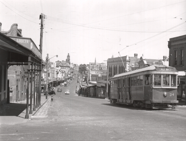
Photograph - Tram 34 - Bakery Hill, Ken Winney, 12/1949
... "Bogie No. 34 (ex MMTB C class) en route to Victoria St. Ballarat city area in background. 12/1949, I K Winney...Tramcars tram 34 Victoria St Bakery Hill "Bogie No. 34 (ex MMTB C class) en route to Victoria St. Ballarat city area in background. 12/1949, I K Winney Black and white photograph with photographers details on rear. ...Photograph shows SEC Ballarat tram No. 34 climbing Bakery Hill in Victoria St. The photo is taken at Humpffray St looking west. There is a Grocer on the left hand side of the photo. Photo by I K Winney of Sydney, 12/1949.Yields information about the view looking west along Victoria St from Humpffray St during 1949.Black and white photograph with photographers details on rear."Bogie No. 34 (ex MMTB C class) en route to Victoria St. Ballarat city area in background. 12/1949, I K Winneytramcars, tram 34, victoria st, bakery hill -
 Ballarat Tramway Museum
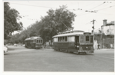
Photograph - Black & White Photograph/s, Lloyd Rogers, 21/03/1962 12:00:00 AM
... In ink "Ballarat Cars 30 and 34 entering Sturt St from Sebastopol route. 21/3/1962. and the number "4/43". ...Trams tramways Sturt St Drummond St Sth Hospital Corner Passengers tram 30 tram 34 In ink "Ballarat Cars 30 and 34 entering Sturt St from Sebastopol route. 21/3/1962. and the number "4/43". ...Yields information about the appearance of Hospital Corner in the early 1960's and trams that used the area.Black and white photograph of Ballarat tram No. 30 followed by No. 34 leaving Drummond St south and crossing Sturt St, Hospital corner. No. 30 has the destination of City and No. 34, Lydiard St North. In the background is the construction of the liquor store on the south west corner by J Wier. Dated 21/3/1962. Printed on Agfa Gevaert paper in a postcard format. In the front of No. 30 can be seen a child hanging onto the door and pillar. No. 34 has SEC Electricity cooking advertisement. Photo by Lloyd Rogers.In ink "Ballarat Cars 30 and 34 entering Sturt St from Sebastopol route. 21/3/1962. and the number "4/43". In the top left hand corner "30 ex M?"trams, tramways, sturt st, drummond st sth, hospital corner, passengers, tram 30, tram 34 -
 Ballarat Tramway Museum
Book, State Electricity Commission of Victoria (SECV), Instructions or Rules to Motormen, post 1945
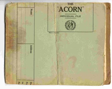
... 34 pages, with 104 rules or instructions, covering Tramcar Equipment (electrical), location of faults, tramcar braking, failure of the mechanical brakes, tramcar emergency braking, automatic braking, automatic electric signals and general instructions for Ballarat. The brown paper appears to have been placed on the outside, as it is cut and glued on the inside of the book. Individual sheets held into the book with a metal clip. On the rear of the book, a small piece of cardboard has been glued over the back of the metal strip. Notes mentions bogie trams, so therefore post 1945. Gives details of route...34 pages, with 104 rules or instructions, covering Tramcar Equipment (electrical), location of faults, tramcar braking, failure of the mechanical brakes, tramcar emergency braking, automatic braking, automatic electric signals and general instructions for Ballarat. The brown paper appears to have been placed on the outside, as it is cut and glued on the inside of the book. Individual sheets held into the book with a metal clip. On the rear of the book, a small piece of cardboard has been glued over the back of the metal strip. Notes mentions bogie trams, so therefore post 1945. Gives details of route ...Handmade book with light green covers made from a cut file holder with brown paper glued on the inside, containing 39 typed (original) sheets of paper giving Instructions or Rules to Motormen. Has five page index, then 34 pages, with 104 rules or instructions, covering Tramcar Equipment (electrical), location of faults, tramcar braking, failure of the mechanical brakes, tramcar emergency braking, automatic braking, automatic electric signals and general instructions for Ballarat. The brown paper appears to have been placed on the outside, as it is cut and glued on the inside of the book. Individual sheets held into the book with a metal clip. On the rear of the book, a small piece of cardboard has been glued over the back of the metal strip. Notes mentions bogie trams, so therefore post 1945. Gives details of route electric signals, use of doors on the trams relevant to the central median strip. On page 4, has hand drawn diagram showing the motors in series and parallel. On page 8 has a hand drawn diagram showing the car lighting circuit arrangements. Has been folded in the middle so as to store in pockets of a coat. Images show .1 - book, .2 - inside front cover and index sheet, .3 - hand made drawing - car lighting circuit. See Destination Eaglehawktrams, tramways, secv rules, rules, motormen, conductors -
 Ballarat Tramway Museum
Document - Table Cards (Sheets), State Electricity Commission of Victoria (SECV), Rosters, Mar. 1970
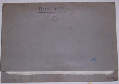
... All sheets imaged and are: Monday to Friday Runs 1- 3 4-6 7-9 10-12 13-15 16-18 19-21 22-24 25-28 29-30 31-33 34-36 37 and 38 Saturday Runs 1- 3 4-6 7-9 10-12 13-15 16-18 19-21 22-24 25-28 29-30 31-33 34 Sunday Runs 1- 3 4-6 7-9 10 Each run details where the driver/conductor would sign on, time, the trips, meal breaks, finish time and the total time of the shift. See also Reg Items 2984 - 2993 for table cards at the time of closure. 3293.2 - separate sheet in front of folder, was taped to folder, giving distance of the various routes within Ballarat - miles. ...Trams tramways Timetables Sec Ballarat Crews Routes On front of folder in black ink " BTPS 811" and on top of 3293.2 - "BTPS 611" 3293.1 - Grey folder, with a two prong clip, marked ""Rosters both sides, containing a set of 29 sheets, typed on foolscap paper, giving the Weekdays, Saturday and Sunday tables or runs for the SEC Ballarat trams on the SEC Ballarat Tramway system until the period before closure. Gives details of 38 tables or runs, numbered from 1 Run to 38 Run. Each sheet headed "Weekday", three runs per sheet. Saturdays - 1 to 34 ...3293.1 - Grey folder, with a two prong clip, marked ""Rosters both sides, containing a set of 29 sheets, typed on foolscap paper, giving the Weekdays, Saturday and Sunday tables or runs for the SEC Ballarat trams on the SEC Ballarat Tramway system until the period before closure. Gives details of 38 tables or runs, numbered from 1 Run to 38 Run. Each sheet headed "Weekday", three runs per sheet. Saturdays - 1 to 34, Sunday - 1 to 10. Each sheet has in the top right hand corner LJD/3/70. Time table operated until the commencement of closure of the system. All sheets imaged and are: Monday to Friday Runs 1- 3 4-6 7-9 10-12 13-15 16-18 19-21 22-24 25-28 29-30 31-33 34-36 37 and 38 Saturday Runs 1- 3 4-6 7-9 10-12 13-15 16-18 19-21 22-24 25-28 29-30 31-33 34 Sunday Runs 1- 3 4-6 7-9 10 Each run details where the driver/conductor would sign on, time, the trips, meal breaks, finish time and the total time of the shift. See also Reg Items 2984 - 2993 for table cards at the time of closure. 3293.2 - separate sheet in front of folder, was taped to folder, giving distance of the various routes within Ballarat - miles. Now loose within folder. Second copy of this sheet added 3-8-2006, BTPS Cat No. 611. - See image btm3293i31 for image file. Images of all sheets added 31/8/2012.On front of folder in black ink " BTPS 811" and on top of 3293.2 - "BTPS 611"trams, tramways, timetables, sec, ballarat, crews, routes -
 Sunshine and District Historical Society Incorporated
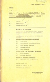
Administrative record - City of Sunshine - Commissioner Mr Alexander Alex George Gillon Collection 1976 - 1982 - Notice of ordinary meeting of the council of the City of Sunshine to be held on 5th October 1977, City of Sunshine, 28th September 1977
... Kilda Land Use Permit Application Service Premises Take Away Food Premise and Caretaker's Residence Addition to Existing Retail Nursery and Bird Aviary Corner Hampstead Road and Emu Street Contract Supply & Maintenance of Vehicles Contract Supply of Tractor & Gang Mower Plan of subdivision Hook Street and Vule Street Plan of Subdivision Stage 26 Albanvale Westerngate Estate Neale Road Bus Routes and Bus Stops Sunshine Bus Lines Suffolk Road Shops Bicycle Racks 407 Ballarat Road (Opposite McDonald) No Standing Anytime Use of Commonwealth Land for Garbage Disposal Purposes Eastern Side of Albion Explosive Factory Monsanto Outfall Drain Brooklyn Telecom Australia Public Telephones in the Maidstone Area Bon Thomas Reserve Development Report of the Building Surveyor Maintenance Organisation Australian Institute of Building Surveyors Annual Conference Fencing Council Contribution towards Shared Fences with Owner Fairbairn Pre-School Centre Fairbairn Road Sunshine West Sunshine Indoor Swimming Pool Sunshine Indoor Swimming Pool Facilities Fencing 34 Adelaide Street Flats Lot 30 Percy Street St. ...Kilda Land Use Permit Application Service Premises Take Away Food Premise and Caretaker's Residence Addition to Existing Retail Nursery and Bird Aviary Corner Hampstead Road and Emu Street Contract Supply & Maintenance of Vehicles Contract Supply of Tractor & Gang Mower Plan of subdivision Hook Street and Vule Street Plan of Subdivision Stage 26 Albanvale Westerngate Estate Neale Road Bus Routes and Bus Stops Sunshine Bus Lines Suffolk Road Shops Bicycle Racks 407 Ballarat Road (Opposite McDonald) No Standing Anytime Use of Commonwealth Land for Garbage Disposal Purposes Eastern Side of Albion Explosive Factory Monsanto Outfall Drain Brooklyn Telecom Australia Public Telephones in the Maidstone Area Bon Thomas Reserve Development Report of the Building Surveyor Maintenance Organisation Australian Institute of Building Surveyors Annual Conference Fencing Council Contribution towards Shared Fences with Owner Fairbairn Pre-School Centre Fairbairn Road Sunshine West Sunshine Indoor Swimming Pool Sunshine Indoor Swimming Pool Facilities Fencing 34 Adelaide Street Flats Lot 30 Percy Street St. ...Notice of Ordinary Meeting of the Council of the City of Sunshine to be held on 5th October 1977 Report of the Town Clerk's Department Report of the Town Clerk Private Street Construction Scheme Sheffield Estate and Cumberland Street Area United Grants From Commonwealth Government through State Government House 6 Corio Street Demolishment Alternative Premises for Citizens Advice Bureau Increases Charges at Sunshine Tip Cultural Centre for Western Region Henderson House Footscray Crossing over Railway Line at Ardeer Land Acquisition Maribyrnong Valley Zoning Officer's Committees Reports Method of Presentation Home Help Service Housekeepers Speaking Different Languages Sale of Land Derby Road and Anderson Road to Education Department Report of the Co-Ordinator of Welfare Services The Combined Pensioners Association Report of the Chief Health Inspector Training & Registration of Public Swimming Pool Operators Prosecutions Proceedings Sunshine Magistrate Court Application for Septic Tank Warranties Report of City Engineer Land Use Permit Application Poultry Farming Service Premises and Take Away Food Premise 159 - 161 Rosamond Road Maribyrnong Land Use Permit Application Extension to Existing Holy Eucharist Primary School, Holy Eucharist Church and Holy Eucharist Parish Centre Oleander Drive Land Use Permit Application Service Premises Mitchell Street Land Use Permit Application External Paging System 556 Ballarat Road Land Use Permit Application Car Sales Yard Lots 497 & 498 St. Albans Road Land Use Permit Application Two Illuminated signs 501 Ballarat Road Albion Land Use Permit Application Light Industry Loy 76 Lawton Street Braybrook Enforcement under the Town and Country Planning Act Massage Parlours Cities of Essendon & St. Kilda Land Use Permit Application Service Premises Take Away Food Premise and Caretaker's Residence Addition to Existing Retail Nursery and Bird Aviary Corner Hampstead Road and Emu Street Contract Supply & Maintenance of Vehicles Contract Supply of Tractor & Gang Mower Plan of subdivision Hook Street and Vule Street Plan of Subdivision Stage 26 Albanvale Westerngate Estate Neale Road Bus Routes and Bus Stops Sunshine Bus Lines Suffolk Road Shops Bicycle Racks 407 Ballarat Road (Opposite McDonald) No Standing Anytime Use of Commonwealth Land for Garbage Disposal Purposes Eastern Side of Albion Explosive Factory Monsanto Outfall Drain Brooklyn Telecom Australia Public Telephones in the Maidstone Area Bon Thomas Reserve Development Report of the Building Surveyor Maintenance Organisation Australian Institute of Building Surveyors Annual Conference Fencing Council Contribution towards Shared Fences with Owner Fairbairn Pre-School Centre Fairbairn Road Sunshine West Sunshine Indoor Swimming Pool Sunshine Indoor Swimming Pool Facilities Fencing 34 Adelaide Street Flats Lot 30 Percy Street St. Albans Extension to House 2 Kevin Street Sunshine Installation of Overhead Tank 44 Berkshire Road Sunshine North Report of Land Use Committee Orders of the Day Accounts Submitted for Payment as at 15th September 1977 Notice of Motion Commissioner Gillon to Move Rates Commissioner Gillon to Move Sanitary Commissioner Gillon to Move Valuation city of sunshine, alexander "alex" george gillon, cumberland street, sunshine north, corio street, sunshine, maribyrnong valley, derby road, anderson road, citizens advice bureau, sunshine tip, rosamond road, maribyrnong, holy eucharist primary school, holy eucharist church, holy eucharist parish centre, oleander drive, st. albans, mitchell street, maidstone, ballarat road, st. albans road, lawton street, braybrook, hampstead road, emu street, hook street, vule street, neale road, albanvale, deer park, suffolk road, albion explosive factory, monsanto, bon thomas reserve, quinn street, fairbairn pre-school centre, fairbairn road, sunshine indoor swimming pool, albion, percy street, kevin street, berkshire road, adelaide street -
 Sunshine and District Historical Society Incorporated
Administrative record - City of Sunshine - Commissioner Mr Alexander Alex George Gillon Collection 1976 - 1982 - Minutes of the ordinary meeting of council held on 5th October 1977, City of Sunshine, 5th October 1977
... Kilda Land Use Permit Application Service Premises Take Away Food Premise and Caretaker's Residence Addition to Existing Retail Nursery and Bird Aviary Corner Hampstead Road and Emu Street Contract Supply & Maintenance of Vehicles Contract Supply of Tractor & Gang Mower Plan of subdivision Hook Street and Vule Street Plan of Subdivision Stage 26 Albanvale Westerngate Estate Neale Road Bus Routes and Bus Stops Sunshine Bus Lines Suffolk Road Shops Bicycle Racks 407 Ballarat Road (Opposite McDonald) No Standing Anytime Use of Commonwealth Land for Garbage Disposal Purposes Eastern Side of Albion Explosive Factory Monsanto Outfall Drain Brooklyn Telecom Australia Public Telephones in the Maidstone Area Bon Thomas Reserve Development Report of the Building Surveyor Maintenance Organisation Australian Institute of Building Surveyors Annual Conference Fencing Council Contribution towards Shared Fences with Owner Fairbairn Pre-School Centre Fairbairn Road Sunshine West Sunshine Indoor Swimming Pool Sunshine Indoor Swimming Pool Facilities Fencing 34 Adelaide Street Flats Lot 30 Percy Street St. ...Kilda Land Use Permit Application Service Premises Take Away Food Premise and Caretaker's Residence Addition to Existing Retail Nursery and Bird Aviary Corner Hampstead Road and Emu Street Contract Supply & Maintenance of Vehicles Contract Supply of Tractor & Gang Mower Plan of subdivision Hook Street and Vule Street Plan of Subdivision Stage 26 Albanvale Westerngate Estate Neale Road Bus Routes and Bus Stops Sunshine Bus Lines Suffolk Road Shops Bicycle Racks 407 Ballarat Road (Opposite McDonald) No Standing Anytime Use of Commonwealth Land for Garbage Disposal Purposes Eastern Side of Albion Explosive Factory Monsanto Outfall Drain Brooklyn Telecom Australia Public Telephones in the Maidstone Area Bon Thomas Reserve Development Report of the Building Surveyor Maintenance Organisation Australian Institute of Building Surveyors Annual Conference Fencing Council Contribution towards Shared Fences with Owner Fairbairn Pre-School Centre Fairbairn Road Sunshine West Sunshine Indoor Swimming Pool Sunshine Indoor Swimming Pool Facilities Fencing 34 Adelaide Street Flats Lot 30 Percy Street St. ...Minutes of the Ordinary Meeting of Council held on 5th October 1977 Report of the Town Clerk's Department Report of the Town Clerk Private Street Construction Scheme Sheffield Estate and Cumberland Street Area United Grants From Commonwealth Government through State Government House 6 Corio Street Demolishment Alternative Premises for Citizens Advice Bureau Increases Charges at Sunshine Tip Cultural Centre for Western Region Henderson House Footscray Crossing over Railway Line at Ardeer Land Acquisition Maribyrnong Valley Zoning Officer's Committees Reports Method of Presentation Home Help Service Housekeepers Speaking Different Languages Sale of Land Derby Road and Anderson Road to Education Department Report of the Co-Ordinator of Welfare Services The Combined Pensioners Association Report of the Chief Health Inspector Training & Registration of Public Swimming Pool Operators Prosecutions Proceedings Sunshine Magistrate Court Application for Septic Tank Warranties Report of City Engineer Land Use Permit Application Poultry Farming Service Premises and Take Away Food Premise 159 - 161 Rosamond Road Maribyrnong Land Use Permit Application Extension to Existing Holy Eucharist Primary School, Holy Eucharist Church and Holy Eucharist Parish Centre Oleander Drive Land Use Permit Application Service Premises Mitchell Street Land Use Permit Application External Paging System 556 Ballarat Road Land Use Permit Application Car Sales Yard Lots 497 & 498 St. Albans Road Land Use Permit Application Two Illuminated signs 501 Ballarat Road Albion Land Use Permit Application Light Industry Loy 76 Lawton Street Braybrook Enforcement under the Town and Country Planning Act Massage Parlours Cities of Essendon & St. Kilda Land Use Permit Application Service Premises Take Away Food Premise and Caretaker's Residence Addition to Existing Retail Nursery and Bird Aviary Corner Hampstead Road and Emu Street Contract Supply & Maintenance of Vehicles Contract Supply of Tractor & Gang Mower Plan of subdivision Hook Street and Vule Street Plan of Subdivision Stage 26 Albanvale Westerngate Estate Neale Road Bus Routes and Bus Stops Sunshine Bus Lines Suffolk Road Shops Bicycle Racks 407 Ballarat Road (Opposite McDonald) No Standing Anytime Use of Commonwealth Land for Garbage Disposal Purposes Eastern Side of Albion Explosive Factory Monsanto Outfall Drain Brooklyn Telecom Australia Public Telephones in the Maidstone Area Bon Thomas Reserve Development Report of the Building Surveyor Maintenance Organisation Australian Institute of Building Surveyors Annual Conference Fencing Council Contribution towards Shared Fences with Owner Fairbairn Pre-School Centre Fairbairn Road Sunshine West Sunshine Indoor Swimming Pool Sunshine Indoor Swimming Pool Facilities Fencing 34 Adelaide Street Flats Lot 30 Percy Street St. Albans Extension to House 2 Kevin Street Sunshine Installation of Overhead Tank 44 Berkshire Road Sunshine North Report of Land Use Committee Orders of the Day Accounts Submitted for Payment as at 15th September 1977 Notice of Motion Commissioner Gillon to Move Rates Commissioner Gillon to Move Sanitary Commissioner Gillon to Move Valuation city of sunshine, alexander "alex" george gillon, cumberland street, sunshine north, corio street, sunshine, maribyrnong valley, derby road, anderson road, rosamond road, maribyrnong, holy eucharist primary school, holy eucharist church, holy eucharist parish centre, oleander drive, st. albans, mitchell street, maidstone, ballarat road, albion, st. albans road, lawton street, braybrook, hampstead road, emu street, hook street, vule street, albanvale, neale road, deer park, suffolk road, albion explosive factory, monsanto, brooklyn, bon thomas reserve, quinn street, fairbairn pre-school centre, fairbairn road, sunshine west, sunshine indoor swimming pool, adelaide street, percy street, kevin street, berkshire road -
 Ballarat Tramway Museum
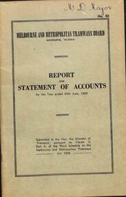
Document - Report, Melbourne and Metropolitan Tramways Board (MMTB), "Report and Statement of Accounts" for year ended 30 June 1958, 1959, 1960, 1958-1960
... 34 in pencil some notations re figures. 1215.2 - copy 2 - in ink on the front cover "Mr Major". 1215.3 - in light colour ink on front cover "Mr. B.F.Becher" 1215.1 - Annual report of the MMTB for the year end 30/6/1958 - No. 39 - buff heavy paper cover with 56 pages on inside giving details of the MMTB Board, Officers, Balance Sheet, Statement of funds, operation, schedule of debenture, investments, Auditors reports, record of Annual traffic receipts, passengers, miles etc, tram and bus routes operated, statistical information, graphs and photographs. ...1215.1 - Annual report of the MMTB for the year end 30/6/1958 - No. 39 - buff heavy paper cover with 56 pages on inside giving details of the MMTB Board, Officers, Balance Sheet, Statement of funds, operation, schedule of debenture, investments, Auditors reports, record of Annual traffic receipts, passengers, miles etc, tram and bus routes operated, statistical information, graphs and photographs. Photos include 2 of Influenza inoculations, traffic congestion in Collins St., new tram track in Malvern area, and new depot entrance at Camberwell. Has an insert inside front cover "With the Compliments of the Melbourne and Metropolitan Tramways Board." 1215.2 - 2 copies - Annual report of the MMTB for the year end 30/6/1959 - No. 40 - light green heavy paper cover with 60 pages on inside giving details of the MMTB Board, Officers, Balance Sheet, Statement of funds, operation, schedule of debenture, investments, Auditors reports, record of Annual traffic receipts, passengers, miles etc, tram and bus routes operated, statistical information, graphs and photographs. Photos include reconstruction of Batman Ave., laying special work at Kew Junction, pouring concrete in Johnston St., cable tramway abandonment, new thermit welding process, new dressing sheds at Wattle Park, illuminated tramcar for the City of Fitzroy centenary. Has an insert inside front cover "With the Compliments of the Melbourne and Metropolitan Tramways Board." 1215.3 - Annual report of the MMTB for the year end 30/6/1960 - No. 41 - light grey heavy paper cover with 60 pages on inside giving details of the MMTB Board, Officers, Balance Sheet, Statement of funds, operation, schedule of debenture, investments, Auditors reports, record of Annual traffic receipts, passengers, miles etc, tram and bus routes operated, statistical information, graphs and photographs. Photos include new St Kilda junction trackwork being assembled in Sth Melbourne yard, Flinders St. overpass under construction, - temporary trackwork, wheel welding machine at Preston, bus drivers school, new golf club house at Wattle Park, Q class tram decorated for Myers Christmas 1959. Has an insert inside front cover "With the Compliments of the Melbourne and Metropolitan Tramways Board." Printer not given on 1215.31215.1 - in ink on the front cover "Mr Major". On page 34 in pencil some notations re figures. 1215.2 - copy 2 - in ink on the front cover "Mr Major". 1215.3 - in light colour ink on front cover "Mr. B.F.Becher"trams, tramways, mmtb, melbourne, annual reports, operations, trackwork -
 Ballarat Tramway Museum
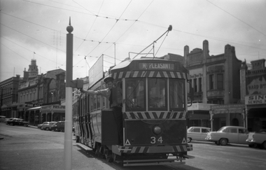
Negative - Black and white print from negative, Travis Jeffrey, c1961
... N391 and black and white print made by a laser printer (stored in folder) of Ballarat tram No. 34 about to cross Grenville St from Sturt St into Bridge St. Photo has the driver setting the route to control the tram signals for Mt. ...N391 and black and white print made by a laser printer (stored in folder) of Ballarat tram No. 34 about to cross Grenville St from Sturt St into Bridge St. Photo has the driver setting the route to control the tram signals for Mt. ...Negative No. N391 and black and white print made by a laser printer (stored in folder) of Ballarat tram No. 34 about to cross Grenville St from Sturt St into Bridge St. Photo has the driver setting the route to control the tram signals for Mt. Pleasant. Photo has the buildings along the north side of Sturt St in the photograph. Date of photo on folder - 5/9/1959, but this is incorrect, as the tram has been fitted with dash canopy lights and tiger stripes, post 1961. Folder and negative could have been mixed up. Original negative rescanned 24/5/2020 and image file updated. Paper folder that contained the negative had "NR8A" in red ink, "BA19" in pencil, date stamp of "5/9/1959" on front, and on rear date stamps "26 Sep 1962" and "26 Sep 1962".trams, tramways, sturt st, grenville st, signals, safeworking, tram 34 -
 Ballarat Tramway Museum
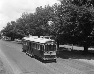
Photograph - SECV Ballarat - 34 outbound in bi-level Lydiard St near Macarthur St, Chris Wurr, 1/1971
... 34 travelling along Lydiard St. North, bound for the Lydiard St. North terminus. Photo shows the tree lined route and how the road surfaces was not fully sealed to the gutter, but with a crushed rock edge. ...34 travelling along Lydiard St. North, bound for the Lydiard St. North terminus. Photo shows the tree lined route and how the road surfaces was not fully sealed to the gutter, but with a crushed rock edge. ...Photograph of SEC tram 34 travelling along Lydiard St. North, bound for the Lydiard St. North terminus. Photo shows the tree lined route and how the road surfaces was not fully sealed to the gutter, but with a crushed rock edge. Photo taken by Chris Wurr Jan. 1971. Yields information about the tramway and the street scene in Lydiard St Nth during the last few years of tramway operation.Black and White photograph with photographer's notes on the rear.Copy 1 - On rear, in black stamp ink "Photo by Chris Wurr" Copy 2 - Additional words to above "Donated to BTPS by and"trams, tramways, lydiard st. nth, tram 34 -
 Melbourne Tram Museum
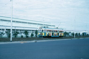
Slide - W7 1024 as the Lassie Kit-E-cat tram, Warren Doubleday, 3/72
... route 59. Yields information about the use of W7 1024 in all over advertising for a pet food company and Matthews Ave, Airport West. tramways Essendon airport Matthews Ave W7 class tram 1024 Has in pencil slide number "3/72/34" Colour slide - Kodak cardboard mount Slide W7 1024 as the Lassie Kit-E-cat tram Warren Doubleday ...Colour slide of W7 class tram 1024 in all over advertising for Lassie Kit-E-cat pet foods in Mathews Ave Essendon Airport, March 1971. Tram in bound to the city route 59.Yields information about the use of W7 1024 in all over advertising for a pet food company and Matthews Ave, Airport West.Colour slide - Kodak cardboard mountHas in pencil slide number "3/72/34"tramways, essendon airport, matthews ave, w7 class, tram 1024 -
 Melbourne Tram Museum
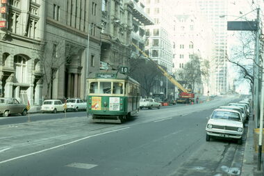
Slide - Collins St track work and single line running, Warren Doubleday, 8/73
... route 10) using the crossover near Elizabeth St. The Photographer's car is parked on the right side of the street. Yields information about tram operations in Collins St during track work and the method of keeping the service running on a Sunday. tramways track work bang road Collins St SW5 class sw6 class tram 848 tram 989 Has in pencil slide number "6/73/33 & 34" Colour slide - Kodak cardboard mount - set of 2 Slide Collins St track work and single line running Warren Doubleday ...Set of 2 colour slides taken during track reconstruction work in Collins St on a Sunday morning August 1973. Features Sw5 848 (route 42, Mont Albert) travelling on the wrong line or bang road between Spencer St and Elizabeth St and SW6 989 *West Preston/Northcote route 10) using the crossover near Elizabeth St. The Photographer's car is parked on the right side of the street.Yields information about tram operations in Collins St during track work and the method of keeping the service running on a Sunday.Colour slide - Kodak cardboard mount - set of 2Has in pencil slide number "6/73/33 & 34"tramways, track work, bang road, collins st, sw5 class, sw6 class, tram 848, tram 989 -
 Melbourne Tram Museum
Postcard - PMTT tram 34 at Malvern Burke Road terminus, c1916
... The postcard photograph shows PMTT No. 34 a Maximum Traction bogie, drop centre and drop ends at the Malvern Burke Road terminus. Has the driver and conductor standing by the front of the tram. There is a large "1" in the front window, indicating the route...The postcard photograph shows PMTT No. 34 a Maximum Traction bogie, drop centre and drop ends at the Malvern Burke Road terminus. Has the driver and conductor standing by the front of the tram. There is a large "1" in the front window, indicating the route ...The postcard photograph shows PMTT No. 34 a Maximum Traction bogie, drop centre and drop ends at the Malvern Burke Road terminus. Has the driver and conductor standing by the front of the tram. There is a large "1" in the front window, indicating the route number and the destination of Burke Road.Yields information the PMTT Tram No. 34 and the Malvern Burke Road terminus.Postcard - divided back with hand written note on the rear.In pencil "8 wheel maximum traction bogie, end saloon, drop centre loading, 48 pass, Duncan and Fraser builder 1912, to MMTB as C34, 1920"tramcars, tramways, pmtt, mavern burke road, tram 34 -
 Bacchus Marsh & District Historical Society
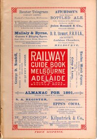
Book, Railway guide book and time table for Melbourne, Ballarat, Adelaide and all intermediate stations, also gazette for Bacchus Marsh, Ballan, Melton, &c., and almanac for 1891
... SUMMARY OF CONTENT: Includes detailed timetables and schedule of fares, descriptions of stations and refreshment facilities pp.6-26; overviews of Shires of Bacchus Marsh, Ballan and Melton, pp.27-30; historical, geographic, and economic background notes about places on the Melbourne to Adelaide route, pages 31-64, including descriptions of Bacchus Marsh, pp.34-42 and briefer notes on Ballan, pp.42-43 and Melton, pp.32-33. ...Publication details: 'Railway guide book and time table for Melbourne, Ballarat, Adelaide and all intermediate stations, also gazette for Bacchus Marsh, Ballan, Melton, &c., and almanac for 1891', compiled by Christopher Crisp. Printed and published by Crisp and Lane, Bacchus Marsh, Vic., 1891. SUMMARY OF CONTENT: Includes detailed timetables and schedule of fares, descriptions of stations and refreshment facilities pp.6-26; overviews of Shires of Bacchus Marsh, Ballan and Melton, pp.27-30; historical, geographic, and economic background notes about places on the Melbourne to Adelaide route, pages 31-64, including descriptions of Bacchus Marsh, pp.34-42 and briefer notes on Ballan, pp.42-43 and Melton, pp.32-33. Almanac section is pp.65-95 (not numbered), containing common information in nineteenth century almanacs such as a calendar of the days, weeks, and months of the year; a record of various astronomical phenomena, climate information and seasonal suggestions for farmers, the rising and setting times of the Sun and Moon, dates of eclipses, hours of high and low tides, and religious festivals. A brief history of Irrigation in Mildura is on pages 1 and 112 (first and last pages). Advertisements, mostly for Bacchus Marsh businesses are on pp.96-111. The Almanac section is illustrated with drawings of scenic views of various places in Australia, but none of the Bacchus Marsh region. Online access is available on Trove at: http://nla.gov.au/nla.obj-392504046Printed book. 112 pages in total. Pages 13 -64 numbered.non-fictionPublication details: 'Railway guide book and time table for Melbourne, Ballarat, Adelaide and all intermediate stations, also gazette for Bacchus Marsh, Ballan, Melton, &c., and almanac for 1891', compiled by Christopher Crisp. Printed and published by Crisp and Lane, Bacchus Marsh, Vic., 1891. SUMMARY OF CONTENT: Includes detailed timetables and schedule of fares, descriptions of stations and refreshment facilities pp.6-26; overviews of Shires of Bacchus Marsh, Ballan and Melton, pp.27-30; historical, geographic, and economic background notes about places on the Melbourne to Adelaide route, pages 31-64, including descriptions of Bacchus Marsh, pp.34-42 and briefer notes on Ballan, pp.42-43 and Melton, pp.32-33. Almanac section is pp.65-95 (not numbered), containing common information in nineteenth century almanacs such as a calendar of the days, weeks, and months of the year; a record of various astronomical phenomena, climate information and seasonal suggestions for farmers, the rising and setting times of the Sun and Moon, dates of eclipses, hours of high and low tides, and religious festivals. A brief history of Irrigation in Mildura is on pages 1 and 112 (first and last pages). Advertisements, mostly for Bacchus Marsh businesses are on pp.96-111. The Almanac section is illustrated with drawings of scenic views of various places in Australia, but none of the Bacchus Marsh region. Online access is available on Trove at: http://nla.gov.au/nla.obj-392504046railways, railway lines, almanacs, railway lines timetables -
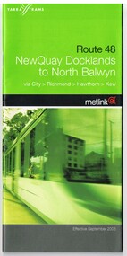 Melbourne Tram Museum
Ephemera - Timetable, Yarra Trams, Set of seven Yarra Trams timetables, 5/2003 to 9/2006
... All provide details about Yarra Trams, Metlink, Metcards and Frequency of Service. .1 - Printed 34 page book stapled timetable for "Route 48 - North Quay Docklands to North Balwyn" tram service, dated September 2006 with fold out covers. .2 - Printed 30 page book stapled timetable for "Route 59 - Airport West to City" tram service, dated Effective April 2004, gives details of route, check point and description of other Essendon Depot routes. .3 - Printed 40 page book stapled timetable for "Route 109 - Box Hill to Port Melbourne" tram service, dated September 2006 with fold out covers. .4 - Printed 44 page book stapled timetable for "Route 112 - South Melb....Trams tramways Tickets Yarra Trams Tram Services Timetables Route 48 Route 59 Route 109 Route 112 Route 19 Route 70 Route 75 Set of seven Yarra Trams timetables, green cover, centre stapled with contact details on rear. All provide details about Yarra Trams, Metlink, Metcards and Frequency of Service. .1 - Printed 34 page book stapled timetable for "Route 48 - North Quay Docklands to North Balwyn" tram service, dated September 2006 with fold out covers. .2 - Printed 30 page book stapled timetable for "Route 59 - Airport West to City" tram service, dated Effective April 2004, gives details of route, check point and description of other Essendon Depot routes. .3 - Printed 40 page book stapled timetable for "Route 109 - Box Hill to Port Melbourne" tram service, dated September 2006 with fold out covers. .4 - Printed 44 page book stapled timetable for "Route 112 - South Melb. ...Set of seven Yarra Trams timetables, green cover, centre stapled with contact details on rear. All provide details about Yarra Trams, Metlink, Metcards and Frequency of Service. .1 - Printed 34 page book stapled timetable for "Route 48 - North Quay Docklands to North Balwyn" tram service, dated September 2006 with fold out covers. .2 - Printed 30 page book stapled timetable for "Route 59 - Airport West to City" tram service, dated Effective April 2004, gives details of route, check point and description of other Essendon Depot routes. .3 - Printed 40 page book stapled timetable for "Route 109 - Box Hill to Port Melbourne" tram service, dated September 2006 with fold out covers. .4 - Printed 44 page book stapled timetable for "Route 112 - South Melb./St. Kilda Beach to West Preston" tram service, date May 2003. .5 - Printed 36 page book stapled timetable for "Route 19 - North Coburg to City" tram service, dated April 2004. .6 - Printed 24 pages book stapled timetable for "Route 70 - Wattle Park to City" tram service, dated May 2003 .7 - Printed 40 page book stapled timetable for "Route 75 Vermont South to City" tram service, dated July 2004 with fold out covers. Full Image of .5 added 9/4/17 following a query about route 19 timetables - see image i2trams, tramways, tickets, yarra trams, tram services, timetables, route 48, route 59, route 109, route 112, route 19, route 70, route 75 -
 Melbourne Tram Museum
Document - Folder of Track crossections drawings, Melbourne & Metropolitan Tramways Board (MMTB), c1928
... The folder is marked "H Bell" most likely the son of the later Chairman, Mr Hector Bell who was a civil engineer with the MMTB. 1 - P3948 - Camberwell Road - 1926 2 - P2789 - Camberwell Road reconstruction - 1920 3 - P3753 - Chapel St - 1926 4 - P60 - Expansion joints Church St bridge - 1924 5 - P3686 - Commercial Road reconstruction - 1926 6 - P4024 - Cotham Road reconstruction - 1927 7 - P4699 - Droop St duplication - 1927 8 - P2384 - Flemington Road conversion - 1925 9 - P1187 - Flemington Road tramway - undated c1920 10 - P4131 - Flinders St conversion - 1927 11 - P4132 - Flinders St conversion - special track drains where subject to flooding - 1927 12 - P3603 - Glenferrie Road east track - 1926 13 - P2608 - Glenferrie Road reconstruction - 1925 14 - P3577 - Glen Huntly Road extension - 1926 15 - P3745 - Glen Huntly Rd duplication - 1926 16 - P4655 - Gilbert Rd duplication - 1928 17 - P2472 - Hannah St at Crossings 1925 18 - P2459 - Hannah St in plantations - 1925 19 - P2582 - High St Prahran reconstruction - 1926 20 - P1594 - High St Prahran reconstruction - 1925 21 - P3611 - High St Malvern reconstruction - 1926 22 - P3900 - Lygon St - 1926 23 - P3689 - Malvern Road reconstruction - 1926 24 - P3951 - West Coburg Route - sleeper spacing - 1926 25 - P4703 - Nicholson St Coburg - duplication - 1928 26 - P4470 - Norwood Road duplication - 1927 27 - P2473 - Park St tramway - 1925 28 - P3707 - Riversdale Road reconstruction - 1926 29 - P4630 - Riversdale Road extension - 1927 30 - P4497- Riversdale Road duplication - 1927 31 - P1387 - South Melbourne Road - special boxed in Construction for Albert Road (parking loop) - 1924 32 - P4691 - Swan St reconstruction - 1927 33 - P3640 - Victoria St part - 1926 (2 copies) 34 - P4522 - Wallen Road reconstruction - 1927 35 - P3939 - Wallen Road reconstruction in front of depot - 1927 36 - P4702 - Trial types of track - 1928 37 - P4254 - Wattletree Road reconstruction - 1927 38 - P4531 - Wattletree Road connection to Glenferrie Road - 1927 39 - P4708 - Wellington Rd siding - 1928...The folder is marked "H Bell" most likely the son of the later Chairman, Mr Hector Bell who was a civil engineer with the MMTB. 1 - P3948 - Camberwell Road - 1926 2 - P2789 - Camberwell Road reconstruction - 1920 3 - P3753 - Chapel St - 1926 4 - P60 - Expansion joints Church St bridge - 1924 5 - P3686 - Commercial Road reconstruction - 1926 6 - P4024 - Cotham Road reconstruction - 1927 7 - P4699 - Droop St duplication - 1927 8 - P2384 - Flemington Road conversion - 1925 9 - P1187 - Flemington Road tramway - undated c1920 10 - P4131 - Flinders St conversion - 1927 11 - P4132 - Flinders St conversion - special track drains where subject to flooding - 1927 12 - P3603 - Glenferrie Road east track - 1926 13 - P2608 - Glenferrie Road reconstruction - 1925 14 - P3577 - Glen Huntly Road extension - 1926 15 - P3745 - Glen Huntly Rd duplication - 1926 16 - P4655 - Gilbert Rd duplication - 1928 17 - P2472 - Hannah St at Crossings 1925 18 - P2459 - Hannah St in plantations - 1925 19 - P2582 - High St Prahran reconstruction - 1926 20 - P1594 - High St Prahran reconstruction - 1925 21 - P3611 - High St Malvern reconstruction - 1926 22 - P3900 - Lygon St - 1926 23 - P3689 - Malvern Road reconstruction - 1926 24 - P3951 - West Coburg Route - sleeper spacing - 1926 25 - P4703 - Nicholson St Coburg - duplication - 1928 26 - P4470 - Norwood Road duplication - 1927 27 - P2473 - Park St tramway - 1925 28 - P3707 - Riversdale Road reconstruction - 1926 29 - P4630 - Riversdale Road extension - 1927 30 - P4497- Riversdale Road duplication - 1927 31 - P1387 - South Melbourne Road - special boxed in Construction for Albert Road (parking loop) - 1924 32 - P4691 - Swan St reconstruction - 1927 33 - P3640 - Victoria St part - 1926 (2 copies) 34 - P4522 - Wallen Road reconstruction - 1927 35 - P3939 - Wallen Road reconstruction in front of depot - 1927 36 - P4702 - Trial types of track - 1928 37 - P4254 - Wattletree Road reconstruction - 1927 38 - P4531 - Wattletree Road connection to Glenferrie Road - 1927 39 - P4708 - Wellington Rd siding - 1928 Yields information about the various tramway track cross sections used by the MMTB including cable tram conversions. tramways MMTB Tram tracks rails civil engineering cable conversion new tramways Has "H Bell" in ink on rear cover. ...The document provides cross sections of track used from c1920 to 1928. The folder is marked "H Bell" most likely the son of the later Chairman, Mr Hector Bell who was a civil engineer with the MMTB. 1 - P3948 - Camberwell Road - 1926 2 - P2789 - Camberwell Road reconstruction - 1920 3 - P3753 - Chapel St - 1926 4 - P60 - Expansion joints Church St bridge - 1924 5 - P3686 - Commercial Road reconstruction - 1926 6 - P4024 - Cotham Road reconstruction - 1927 7 - P4699 - Droop St duplication - 1927 8 - P2384 - Flemington Road conversion - 1925 9 - P1187 - Flemington Road tramway - undated c1920 10 - P4131 - Flinders St conversion - 1927 11 - P4132 - Flinders St conversion - special track drains where subject to flooding - 1927 12 - P3603 - Glenferrie Road east track - 1926 13 - P2608 - Glenferrie Road reconstruction - 1925 14 - P3577 - Glen Huntly Road extension - 1926 15 - P3745 - Glen Huntly Rd duplication - 1926 16 - P4655 - Gilbert Rd duplication - 1928 17 - P2472 - Hannah St at Crossings 1925 18 - P2459 - Hannah St in plantations - 1925 19 - P2582 - High St Prahran reconstruction - 1926 20 - P1594 - High St Prahran reconstruction - 1925 21 - P3611 - High St Malvern reconstruction - 1926 22 - P3900 - Lygon St - 1926 23 - P3689 - Malvern Road reconstruction - 1926 24 - P3951 - West Coburg Route - sleeper spacing - 1926 25 - P4703 - Nicholson St Coburg - duplication - 1928 26 - P4470 - Norwood Road duplication - 1927 27 - P2473 - Park St tramway - 1925 28 - P3707 - Riversdale Road reconstruction - 1926 29 - P4630 - Riversdale Road extension - 1927 30 - P4497- Riversdale Road duplication - 1927 31 - P1387 - South Melbourne Road - special boxed in Construction for Albert Road (parking loop) - 1924 32 - P4691 - Swan St reconstruction - 1927 33 - P3640 - Victoria St part - 1926 (2 copies) 34 - P4522 - Wallen Road reconstruction - 1927 35 - P3939 - Wallen Road reconstruction in front of depot - 1927 36 - P4702 - Trial types of track - 1928 37 - P4254 - Wattletree Road reconstruction - 1927 38 - P4531 - Wattletree Road connection to Glenferrie Road - 1927 39 - P4708 - Wellington Rd siding - 1928Yields information about the various tramway track cross sections used by the MMTB including cable tram conversions.Folder - heavy card cloth covers fitted with two interscrews containing some 39 plus one duplicate folded blue prints. Covers made by Swinnerton Bros of Melbourne - see image 6 for their logo/trademark.Has "H Bell" in ink on rear cover.tramways, mmtb, tram tracks, rails, civil engineering, cable conversion, new tramways -
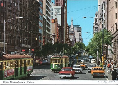 Melbourne Tram Museum
Postcard - Collins St at Elizabeth St - John Hinde Studios - W2 class trams, John Hinde Studios, early 1970's
... Route 11) and three other W2 class trams. Appears to be an Inspector standing at the west end of the Safety Zone. Yields information about Collins Street early 1970s and the motor car traffic. trams tramways safety zones traffic W2 class trams tram 224 tram 253 Victour Kodak Block Court Collins St Postcard - Collins St at Elizabeth St - John Hinde Studios 2 AUS 34 Postcard Collins St at Elizabeth St - John Hinde Studios - W2 class trams John Hinde Studios E Ludwig ...Postcard looking east along tree lined Collins St from Elizabeth Street with many now demolished buildings in the view. Buildings at the time include Block Court, Victour, Kodak, Souther Cross, Howey Court. Trams in the view are W2 224, W2 253 (Spencer Street Route 11) and three other W2 class trams. Appears to be an Inspector standing at the west end of the Safety Zone.Yields information about Collins Street early 1970s and the motor car traffic.Postcard - Collins St at Elizabeth St - John Hinde Studios 2 AUS 34trams, tramways, safety zones, traffic, w2 class trams, tram 224, tram 253, victour, kodak, block court, collins st -
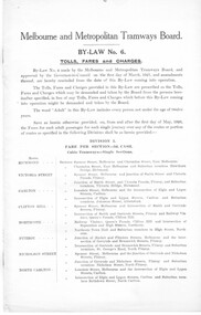 Melbourne Tram Museum
Legal record, Melbourne & Metropolitan Tramways Board (MMTB), MMTB By-Laws, 1922
... Original documents or generally extracts from the Government Gazette. .1 - 16 page foolscap document - side stapled - 30-4-1926 - front page scanned. .2 - 1 page foolscap - 1-9-1926 - scanned .3 - small sheet - 13-10-1926 .4 - 9-12-1926 .5 - 11-1-1927 .6 - 25-1-1927 .7 - 4-5-1927 .8 - 27-7-1927 .9 - 21-9-1927 .10 - 2-2-1928 .11 - 17-4-1928 .12 - 1-5-1928 .13 - 6-6-1928 .14 - 4-7-1928 .15 - 12-2-1929 .16 - 8-4-1929 .17 - 11-6-1929 .18 - 3-7-1929 - includes tourist trips by Motor Omnibuses and the various route details. .19 - not allocated .20 - 12-8-1929 .21 - 7-10-1929 .22 - 11-12-1929 .23 - 28-4-1930 .24 - 24-6-1930 .25 - 27-8-1930 .26 - 8-10-1930 .27 - 5-11-1930 .28 - 12-11-1930 .29 - 1-9-1931 .30 - 1-12-1931 .31 - 15-12-1931 .32 - 1-3-1933 .33 - 15-8-1934 .34 - 22-7-1935 .35 - 9-9-1935 .36 - 24-12-1935 .37 - 7-4-1936 .38 - 13-5-1936 .39 - 19-5-1936 .40 - 9-6-1936 .41 - 19-10-1936 .42 - 21-10-1936 .43 - 2-12-1936 .44 - 12-1-1937 .45 - 8-2-1937 .46 - 26-7-1936 .47 - 29-9-1937 .48 - 7-11-1938 .49 - 23-11-1938 .50 - 22-12-1938 .51 - 18-4-1939 .52 - 14-8-1939 .53 - 13-11-1939 .54 - 9-12-1940 .55 - 7-1-1941 Second copy of the original document By-Law 6 - added 20/7/2019 - from the collection of Robert Green, see htd3096doc.pdf and in good condition....Original documents or generally extracts from the Government Gazette. .1 - 16 page foolscap document - side stapled - 30-4-1926 - front page scanned. .2 - 1 page foolscap - 1-9-1926 - scanned .3 - small sheet - 13-10-1926 .4 - 9-12-1926 .5 - 11-1-1927 .6 - 25-1-1927 .7 - 4-5-1927 .8 - 27-7-1927 .9 - 21-9-1927 .10 - 2-2-1928 .11 - 17-4-1928 .12 - 1-5-1928 .13 - 6-6-1928 .14 - 4-7-1928 .15 - 12-2-1929 .16 - 8-4-1929 .17 - 11-6-1929 .18 - 3-7-1929 - includes tourist trips by Motor Omnibuses and the various route details. .19 - not allocated .20 - 12-8-1929 .21 - 7-10-1929 .22 - 11-12-1929 .23 - 28-4-1930 .24 - 24-6-1930 .25 - 27-8-1930 .26 - 8-10-1930 .27 - 5-11-1930 .28 - 12-11-1930 .29 - 1-9-1931 .30 - 1-12-1931 .31 - 15-12-1931 .32 - 1-3-1933 .33 - 15-8-1934 .34 - 22-7-1935 .35 - 9-9-1935 .36 - 24-12-1935 .37 - 7-4-1936 .38 - 13-5-1936 .39 - 19-5-1936 .40 - 9-6-1936 .41 - 19-10-1936 .42 - 21-10-1936 .43 - 2-12-1936 .44 - 12-1-1937 .45 - 8-2-1937 .46 - 26-7-1936 .47 - 29-9-1937 .48 - 7-11-1938 .49 - 23-11-1938 .50 - 22-12-1938 .51 - 18-4-1939 .52 - 14-8-1939 .53 - 13-11-1939 .54 - 9-12-1940 .55 - 7-1-1941 Second copy of the original document By-Law 6 - added 20/7/2019 - from the collection of Robert Green, see htd3096doc.pdf and in good condition. ...Set of 54 Printed documents - MMTB By-Law No. 6 - detailing Tolls, Fares and Charges and associated amendments - date given is that date shown as the application of the Common seal or approved by the Governor in Council. Printed on various sized sheets. Original documents or generally extracts from the Government Gazette. .1 - 16 page foolscap document - side stapled - 30-4-1926 - front page scanned. .2 - 1 page foolscap - 1-9-1926 - scanned .3 - small sheet - 13-10-1926 .4 - 9-12-1926 .5 - 11-1-1927 .6 - 25-1-1927 .7 - 4-5-1927 .8 - 27-7-1927 .9 - 21-9-1927 .10 - 2-2-1928 .11 - 17-4-1928 .12 - 1-5-1928 .13 - 6-6-1928 .14 - 4-7-1928 .15 - 12-2-1929 .16 - 8-4-1929 .17 - 11-6-1929 .18 - 3-7-1929 - includes tourist trips by Motor Omnibuses and the various route details. .19 - not allocated .20 - 12-8-1929 .21 - 7-10-1929 .22 - 11-12-1929 .23 - 28-4-1930 .24 - 24-6-1930 .25 - 27-8-1930 .26 - 8-10-1930 .27 - 5-11-1930 .28 - 12-11-1930 .29 - 1-9-1931 .30 - 1-12-1931 .31 - 15-12-1931 .32 - 1-3-1933 .33 - 15-8-1934 .34 - 22-7-1935 .35 - 9-9-1935 .36 - 24-12-1935 .37 - 7-4-1936 .38 - 13-5-1936 .39 - 19-5-1936 .40 - 9-6-1936 .41 - 19-10-1936 .42 - 21-10-1936 .43 - 2-12-1936 .44 - 12-1-1937 .45 - 8-2-1937 .46 - 26-7-1936 .47 - 29-9-1937 .48 - 7-11-1938 .49 - 23-11-1938 .50 - 22-12-1938 .51 - 18-4-1939 .52 - 14-8-1939 .53 - 13-11-1939 .54 - 9-12-1940 .55 - 7-1-1941 Second copy of the original document By-Law 6 - added 20/7/2019 - from the collection of Robert Green, see htd3096doc.pdf and in good condition.trams, tramways, mmtb, by laws, appeals, fares, tourist trips, tourist bus -
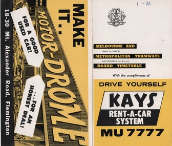 Melbourne Tram Museum
Ephemera - Timetable/s, Melbourne & Metropolitan Tramways Board (MMTB), "MMTB Timetables set of 39", 1960
... Not dated, based on fares - 1960 and possibly after Point Ormond had closed. .1 - Route 1, 21 - East Coburg - City .2 - Route 4, 4A, 4B - Carnegie - City .3 - Route 4D, 14 - East Malvern - City .4 - Route 5, 5A - Malvern Burke Road - City .5 - Route 6, 6A, 6B - Glen Iris - City .6 - Route 7, 7A, 7B, 7D - Camberwell - City .7 - Route 8, 8A - Toorak - City .8 - Route 9, 9A - Northcote via St Georges Road - City .9 - Route 9, 9B, 10, 12 - Sth Melbourne Beach, St Kilda Beach - City .10 - Route 10,11 - West Preston - City .11 - Route 15, 16 - St Kilda Beach - City .12 - Route 15, 22 - Moreland - City .13 - Route 18, 19, 20 - North Coburg - City .14 - Route 27, 28 - Hawthorn - Spencer St .15 - Route 42, 44, 45 - Mont Albert - City .16 - Route 48, 40, 41 - North Balwyn - Spencer St .17 - Route 49 - Essendon (Matthews Ave) - City .18 - Route 50, 54, 57, 58, 60 - West Maribyrnong - City .19 - Route 55, 56 - West Coburg - City .20 - Route 59 - Essendon Aerodrome - City .21 - Route 61, 62, 64, 65 - East Brighton - City .22 - Route 69 - Kew Cotham Road - St Kilda Beach .23 - Route 70, 71, 76 - Wattle Park - City .24 - Route 74, 75, 76 - Burwood - City .25 - Route 77, 80 - Prahran - City .26 - Route 78, 79 - North Richmond - Prahran .27 - Route 82 - Moonee Ponds - Footscray .28 - Williamstown Road - Footscray - Tram and bus .29 - Ballarat Road - Footscray - Tram and bus .30 - Russell St - - Footscray - Tram and bus .31 - East Brunswick - City .32 - Domain Road - City .33 - West Heidelberg - City .34 - Sunshine - City via Ballarat and Footscray Roads .35 - Sunshine - City via South and Dynon Roads .36 - Sunshine Park - City .37 - Garden City - City (Victoria St) .38 - Queens Bridge - Fisherman's Bend via Ingles St .39 - Queens Bridge - Fisherman's Bend via Lorimer St and Princes Bridge - Fisherman's Bend via Williamstown Rd....Not dated, based on fares - 1960 and possibly after Point Ormond had closed. .1 - Route 1, 21 - East Coburg - City .2 - Route 4, 4A, 4B - Carnegie - City .3 - Route 4D, 14 - East Malvern - City .4 - Route 5, 5A - Malvern Burke Road - City .5 - Route 6, 6A, 6B - Glen Iris - City .6 - Route 7, 7A, 7B, 7D - Camberwell - City .7 - Route 8, 8A - Toorak - City .8 - Route 9, 9A - Northcote via St Georges Road - City .9 - Route 9, 9B, 10, 12 - Sth Melbourne Beach, St Kilda Beach - City .10 - Route 10,11 - West Preston - City .11 - Route 15, 16 - St Kilda Beach - City .12 - Route 15, 22 - Moreland - City .13 - Route 18, 19, 20 - North Coburg - City .14 - Route 27, 28 - Hawthorn - Spencer St .15 - Route 42, 44, 45 - Mont Albert - City .16 - Route 48, 40, 41 - North Balwyn - Spencer St .17 - Route 49 - Essendon (Matthews Ave) - City .18 - Route 50, 54, 57, 58, 60 - West Maribyrnong - City .19 - Route 55, 56 - West Coburg - City .20 - Route 59 - Essendon Aerodrome - City .21 - Route 61, 62, 64, 65 - East Brighton - City .22 - Route 69 - Kew Cotham Road - St Kilda Beach .23 - Route 70, 71, 76 - Wattle Park - City .24 - Route 74, 75, 76 - Burwood - City .25 - Route 77, 80 - Prahran - City .26 - Route 78, 79 - North Richmond - Prahran .27 - Route 82 - Moonee Ponds - Footscray .28 - Williamstown Road - Footscray - Tram and bus .29 - Ballarat Road - Footscray - Tram and bus .30 - Russell St - - Footscray - Tram and bus .31 - East Brunswick - City .32 - Domain Road - City .33 - West Heidelberg - City .34 - Sunshine - City via Ballarat and Footscray Roads .35 - Sunshine - City via South and Dynon Roads .36 - Sunshine Park - City .37 - Garden City - City (Victoria St) .38 - Queens Bridge - Fisherman's Bend via Ingles St .39 - Queens Bridge - Fisherman's Bend via Lorimer St and Princes Bridge - Fisherman's Bend via Williamstown Rd. ...Set of 39 MMTB Tram timetables, 2 fold sheets, , providing timetables for specific routes, route numbers, day of week giving information on tram times at departure time points, sections and fares, where applicable all night bus services. All signed by B. H. Misson, Traffic Manager. All sponsored by Kays Rent a Car and Motor Drome, 18-30 Mount Alexander Road, Flemington. The only one missing is Point Ormond. Not dated, based on fares - 1960 and possibly after Point Ormond had closed. .1 - Route 1, 21 - East Coburg - City .2 - Route 4, 4A, 4B - Carnegie - City .3 - Route 4D, 14 - East Malvern - City .4 - Route 5, 5A - Malvern Burke Road - City .5 - Route 6, 6A, 6B - Glen Iris - City .6 - Route 7, 7A, 7B, 7D - Camberwell - City .7 - Route 8, 8A - Toorak - City .8 - Route 9, 9A - Northcote via St Georges Road - City .9 - Route 9, 9B, 10, 12 - Sth Melbourne Beach, St Kilda Beach - City .10 - Route 10,11 - West Preston - City .11 - Route 15, 16 - St Kilda Beach - City .12 - Route 15, 22 - Moreland - City .13 - Route 18, 19, 20 - North Coburg - City .14 - Route 27, 28 - Hawthorn - Spencer St .15 - Route 42, 44, 45 - Mont Albert - City .16 - Route 48, 40, 41 - North Balwyn - Spencer St .17 - Route 49 - Essendon (Matthews Ave) - City .18 - Route 50, 54, 57, 58, 60 - West Maribyrnong - City .19 - Route 55, 56 - West Coburg - City .20 - Route 59 - Essendon Aerodrome - City .21 - Route 61, 62, 64, 65 - East Brighton - City .22 - Route 69 - Kew Cotham Road - St Kilda Beach .23 - Route 70, 71, 76 - Wattle Park - City .24 - Route 74, 75, 76 - Burwood - City .25 - Route 77, 80 - Prahran - City .26 - Route 78, 79 - North Richmond - Prahran .27 - Route 82 - Moonee Ponds - Footscray .28 - Williamstown Road - Footscray - Tram and bus .29 - Ballarat Road - Footscray - Tram and bus .30 - Russell St - - Footscray - Tram and bus .31 - East Brunswick - City .32 - Domain Road - City .33 - West Heidelberg - City .34 - Sunshine - City via Ballarat and Footscray Roads .35 - Sunshine - City via South and Dynon Roads .36 - Sunshine Park - City .37 - Garden City - City (Victoria St) .38 - Queens Bridge - Fisherman's Bend via Ingles St .39 - Queens Bridge - Fisherman's Bend via Lorimer St and Princes Bridge - Fisherman's Bend via Williamstown Rd.All have the route number in ink on the front cover - see image 5691i.jpg for standard cover.trams, tramways, mmtb, timetables, melbourne, fares, route 1, route 22, route 4, route 4a, route 4b, route 4d, route 14, route 5, route 5a, route 6, route 6a, route 6b, route 7, route 7a, route 7b, route 7d, route 8, route 8a, route 9, route 9a, route 9b, route 10, route 11, route 12, route 15, route 16, route 22, route 18, route 19, route 20, route 27, route 28, route 42, route 45, route 44, route 48, route 40, route 41, route 49, route 50, route 54, route 57, route 58, route 60, route 52, route 56, route 59, route 61, route 62, route 64, route 65, route 69, route 70, route 71, route 76, route 74, route 75, route 76, route 77, route 80, route 78, route 79, route 82, williamstown rd, ballarat rd, russell st, route 96, domain rd, west heidelberg, sunshine, garden city, queens bridge, fishermen's bend
