Showing 133 items matching "rowland street"
-
 Kew Historical Society Inc
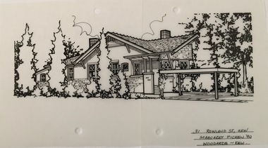
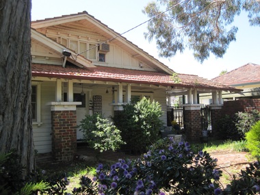
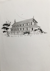
Drawing - Property Illustration, Margaret Picken, 31 Rowland Street, Kew, 1990
... 31 Rowland Street, Kew......31 rowland street -- kew (vic.)...Pen and ink architectural drawing on drafting film of 31 Rowland Street, Kew by Margaret Picken....The year in which the drawing was created is also a valuable record for house historians, as a number of the properties depicted have either been altered since that date or demolished. artist -- margaret picken 1950- architectural drawings -- houses -- kew (vic.) 31 rowland street -- kew (vic.) 31 ROWLAND ST., KEW / MARGARET PICKEN '90 / WOODARDS ~ KEW Pen and ink architectural drawing on drafting film of 31 Rowland Street, Kew by Margaret Picken. 31 Rowland Street, Kew Drawing Property Illustration Margaret Picken Woodards (Kew) ...After training as a Cartographic Draftsman within the mining industry, I worked as a property illustrator for real estate firms in the eastern suburbs of Melbourne for 22 years from 1983. I initially photographed houses with a Polaroid camera and made a 'thumbnail' sketch while there. The photos were used to scale off a sketch in pencil and then that sketch was overlaid with drafting film and the 'pen and ink' completed. The pens I used were the Rotring ‘Rapidigraph’ drafting pens. The ink was also made by Rotring (German).The film was ‘Rapidraw’, polyester drafting film, double matte. It takes a very fine line and doesn’t bleed. As well as house sketches, there were often floor plans and site plans ordered. Aerial sketches were ordered when the property needed an overall view. (Margaret Picken, 2020)This drawing is one of a series created by Margaret Picken for a number of real estate agents in Melbourne between 1983 and 2005. Each work is signed and dated by the artist.Gift of Margaret Picken, 2020Pen and ink architectural drawing on drafting film of 31 Rowland Street, Kew by Margaret Picken.31 ROWLAND ST., KEW / MARGARET PICKEN '90 / WOODARDS ~ KEWartist -- margaret picken 1950-, architectural drawings -- houses -- kew (vic.), 31 rowland street -- kew (vic.) -
 Kew Historical Society Inc
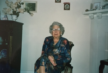
Photograph, Miss Lillias Jerram, aged 89, 1989
... ...37 rowland street (kew)...Miss Jerram who lived at 37 Rowland Street, Kew was, during the Second World War, a member of the Kew Voluntary Aid Detachment (V.A.D.).... / Miss Lillias Jerram / 37 Rowland Street Kew 31 / (Taken on her 89th birthday)."...[Courtesy: John Torpey representing the Kew RSL] lillias jerram voluntary aid detachment (kew branch) 37 rowland street (kew) Inscription on reverse in ink: "27.12.89. / Miss Lillias Jerram / 37 Rowland Street Kew 31 / (Taken on her 89th birthday)." ...In the collection of the Kew RSL (Cotham Road) there is a framed original certificate with information about Lillias Jerram. It includes the following information: Miss Lillias May JERRAM Commandant No. 323 Detachment, Victoria [Citation] Loyal and able leadership and service during World War II Service: Joined No.323 (Kew) Detachment in 1937. Commandant in 1944. Miss Jerram did voluntary duty in casualty and wards at St Vincent's Hospital regularly for 6 years. Also duty at the Eye and Ear Hospital and A.R.P. Duty. Helped No.323 Detachment to raise funds amounting to 400 pounds for St. John Theatre at 115th A.G.H., Heidelberg. Blood donor. [Courtesy: John Torpey representing the Kew RSL]Miss Lillias Jerram in 1989, taken on her 89th birthday. Miss Jerram who lived at 37 Rowland Street, Kew was, during the Second World War, a member of the Kew Voluntary Aid Detachment (V.A.D.)Inscription on reverse in ink: "27.12.89. / Miss Lillias Jerram / 37 Rowland Street Kew 31 / (Taken on her 89th birthday)."lillias jerram, voluntary aid detachment (kew branch), 37 rowland street (kew) -
 Surrey Hills Historical Society Collection
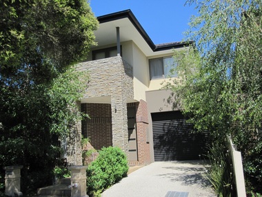
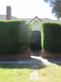
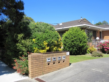
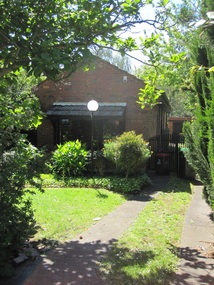
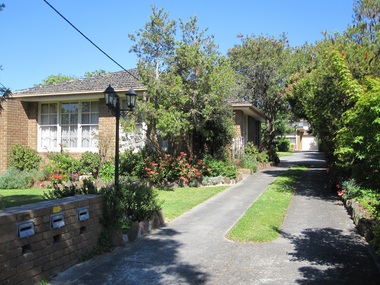
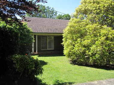
Photograph - 1A Rowland Street, Mont Albert, The Street Where You Live Project
... 1A Rowland Street, Mont Albert...The Street Where You Live Project Photograph 1A Rowland Street, Mont Albert ...Photos documenting this address as part of a photographic series undertaken by volunteer photographers during 2013 and 2014 for The Street Where You Live Project. This was organised through the Surrey Hills Neighbourhood Centre and covered the postcode 3127 in the cities of Boroondara and Whitehorse.These photos provide a snapshot of real estate in the suburbs of Mont Albert and Surrey Hills during a period of rapid change with many properties on large blocks demolished to create higher density residential development or renewal of single dwellings. At particular risk were properties not covered by heritage overlays, especially interwar housing and post 1950's housing. -
 Surrey Hills Historical Society Collection
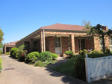
Photograph - 1B Rowland Street, Mont Albert, The Street Where You Live Project
... 1B Rowland Street, Mont Albert...The Street Where You Live Project Photograph 1B Rowland Street, Mont Albert ...Photos documenting this address as part of a photographic series undertaken by volunteer photographers during 2013 and 2014 for The Street Where You Live Project. This was organised through the Surrey Hills Neighbourhood Centre and covered the postcode 3127 in the cities of Boroondara and Whitehorse.These photos provide a snapshot of real estate in the suburbs of Mont Albert and Surrey Hills during a period of rapid change with many properties on large blocks demolished to create higher density residential development or renewal of single dwellings. At particular risk were properties not covered by heritage overlays, especially interwar housing and post 1950's housing. -
 Surrey Hills Historical Society Collection
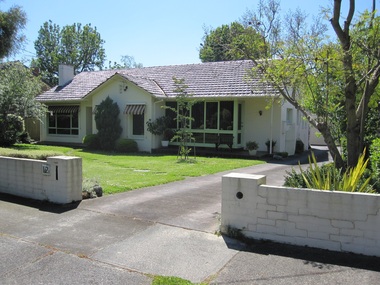
Photograph - 1C Rowland Street, Mont Albert, The Street Where You Live Project
... 1C Rowland Street, Mont Albert...The Street Where You Live Project Photograph 1C Rowland Street, Mont Albert ...Photos documenting this address as part of a photographic series undertaken by volunteer photographers during 2013 and 2014 for The Street Where You Live Project. This was organised through the Surrey Hills Neighbourhood Centre and covered the postcode 3127 in the cities of Boroondara and Whitehorse.These photos provide a snapshot of real estate in the suburbs of Mont Albert and Surrey Hills during a period of rapid change with many properties on large blocks demolished to create higher density residential development or renewal of single dwellings. At particular risk were properties not covered by heritage overlays, especially interwar housing and post 1950's housing. -
 Surrey Hills Historical Society Collection
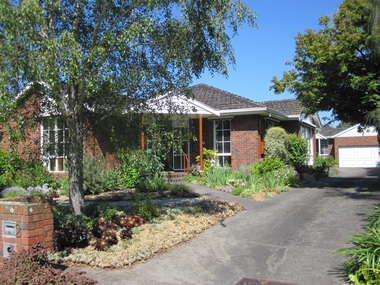
Photograph - 2 Rowland Street, Mont Albert, The Street Where You Live Project
... 2 Rowland Street, Mont Albert...The Street Where You Live Project Photograph 2 Rowland Street, Mont Albert ...Photos documenting this address as part of a photographic series undertaken by volunteer photographers during 2013 and 2014 for The Street Where You Live Project. This was organised through the Surrey Hills Neighbourhood Centre and covered the postcode 3127 in the cities of Boroondara and Whitehorse.These photos provide a snapshot of real estate in the suburbs of Mont Albert and Surrey Hills during a period of rapid change with many properties on large blocks demolished to create higher density residential development or renewal of single dwellings. At particular risk were properties not covered by heritage overlays, especially interwar housing and post 1950's housing. -
 Surrey Hills Historical Society Collection
Photograph - 3 Rowland Street, Mont Albert, The Street Where You Live Project
... 3 Rowland Street, Mont Albert...The Street Where You Live Project Photograph 3 Rowland Street, Mont Albert ...Photos documenting this address as part of a photographic series undertaken by volunteer photographers during 2013 and 2014 for The Street Where You Live Project. This was organised through the Surrey Hills Neighbourhood Centre and covered the postcode 3127 in the cities of Boroondara and Whitehorse.These photos provide a snapshot of real estate in the suburbs of Mont Albert and Surrey Hills during a period of rapid change with many properties on large blocks demolished to create higher density residential development or renewal of single dwellings. At particular risk were properties not covered by heritage overlays, especially interwar housing and post 1950's housing. -
 Surrey Hills Historical Society Collection
Photograph - 4 Rowland Street, Mont Albert, The Street Where You Live Project
... 4 Rowland Street, Mont Albert...The Street Where You Live Project Photograph 4 Rowland Street, Mont Albert ...Photos documenting this address as part of a photographic series undertaken by volunteer photographers during 2013 and 2014 for The Street Where You Live Project. This was organised through the Surrey Hills Neighbourhood Centre and covered the postcode 3127 in the cities of Boroondara and Whitehorse.These photos provide a snapshot of real estate in the suburbs of Mont Albert and Surrey Hills during a period of rapid change with many properties on large blocks demolished to create higher density residential development or renewal of single dwellings. At particular risk were properties not covered by heritage overlays, especially interwar housing and post 1950's housing. -
 Surrey Hills Historical Society Collection
Photograph - 5 Rowland Street, Mont Albert, The Street Where You Live Project
... 5 Rowland Street, Mont Albert...The Street Where You Live Project Photograph 5 Rowland Street, Mont Albert ...Photos documenting this address as part of a photographic series undertaken by volunteer photographers during 2013 and 2014 for The Street Where You Live Project. This was organised through the Surrey Hills Neighbourhood Centre and covered the postcode 3127 in the cities of Boroondara and Whitehorse.These photos provide a snapshot of real estate in the suburbs of Mont Albert and Surrey Hills during a period of rapid change with many properties on large blocks demolished to create higher density residential development or renewal of single dwellings. At particular risk were properties not covered by heritage overlays, especially interwar housing and post 1950's housing. -
 Surrey Hills Historical Society Collection
Photograph - 6 Rowland Street, Mont Albert, The Street Where You Live Project
... 6 Rowland Street, Mont Albert...The Street Where You Live Project Photograph 6 Rowland Street, Mont Albert ...Photos documenting this address as part of a photographic series undertaken by volunteer photographers during 2013 and 2014 for The Street Where You Live Project. This was organised through the Surrey Hills Neighbourhood Centre and covered the postcode 3127 in the cities of Boroondara and Whitehorse.These photos provide a snapshot of real estate in the suburbs of Mont Albert and Surrey Hills during a period of rapid change with many properties on large blocks demolished to create higher density residential development or renewal of single dwellings. At particular risk were properties not covered by heritage overlays, especially interwar housing and post 1950's housing. -
 Surrey Hills Historical Society Collection
Photograph - 7 Rowland Street, Mont Albert, The Street Where You Live Project
... 7 Rowland Street, Mont Albert...The Street Where You Live Project Photograph 7 Rowland Street, Mont Albert ...Photos documenting this address as part of a photographic series undertaken by volunteer photographers during 2013 and 2014 for The Street Where You Live Project. This was organised through the Surrey Hills Neighbourhood Centre and covered the postcode 3127 in the cities of Boroondara and Whitehorse.These photos provide a snapshot of real estate in the suburbs of Mont Albert and Surrey Hills during a period of rapid change with many properties on large blocks demolished to create higher density residential development or renewal of single dwellings. At particular risk were properties not covered by heritage overlays, especially interwar housing and post 1950's housing. -
 Surrey Hills Historical Society Collection
Photograph - 8 Rowland Street, Mont Albert, The Street Where You Live Project
... 8 Rowland Street, Mont Albert...The Street Where You Live Project Photograph 8 Rowland Street, Mont Albert ...Photos documenting this address as part of a photographic series undertaken by volunteer photographers during 2013 and 2014 for The Street Where You Live Project. This was organised through the Surrey Hills Neighbourhood Centre and covered the postcode 3127 in the cities of Boroondara and Whitehorse.These photos provide a snapshot of real estate in the suburbs of Mont Albert and Surrey Hills during a period of rapid change with many properties on large blocks demolished to create higher density residential development or renewal of single dwellings. At particular risk were properties not covered by heritage overlays, especially interwar housing and post 1950's housing. -
 Surrey Hills Historical Society Collection
Photograph - 9 Rowland Street, Mont Albert, The Street Where You Live Project
... 9 Rowland Street, Mont Albert...The Street Where You Live Project Photograph 9 Rowland Street, Mont Albert ...Photos documenting this address as part of a photographic series undertaken by volunteer photographers during 2013 and 2014 for The Street Where You Live Project. This was organised through the Surrey Hills Neighbourhood Centre and covered the postcode 3127 in the cities of Boroondara and Whitehorse.These photos provide a snapshot of real estate in the suburbs of Mont Albert and Surrey Hills during a period of rapid change with many properties on large blocks demolished to create higher density residential development or renewal of single dwellings. At particular risk were properties not covered by heritage overlays, especially interwar housing and post 1950's housing. -
 Surrey Hills Historical Society Collection
Photograph - 11 Rowland Street, Mont Albert, The Street Where You Live Project
... 11 Rowland Street, Mont Albert...The Street Where You Live Project Photograph 11 Rowland Street, Mont Albert ...Photos documenting this address as part of a photographic series undertaken by volunteer photographers during 2013 and 2014 for The Street Where You Live Project. This was organised through the Surrey Hills Neighbourhood Centre and covered the postcode 3127 in the cities of Boroondara and Whitehorse.These photos provide a snapshot of real estate in the suburbs of Mont Albert and Surrey Hills during a period of rapid change with many properties on large blocks demolished to create higher density residential development or renewal of single dwellings. At particular risk were properties not covered by heritage overlays, especially interwar housing and post 1950's housing. -
 Surrey Hills Historical Society Collection
Photograph - 12 Rowland Street, Mont Albert, The Street Where You Live Project
... 12 Rowland Street, Mont Albert...The Street Where You Live Project Photograph 12 Rowland Street, Mont Albert ...Photos documenting this address as part of a photographic series undertaken by volunteer photographers during 2013 and 2014 for The Street Where You Live Project. This was organised through the Surrey Hills Neighbourhood Centre and covered the postcode 3127 in the cities of Boroondara and Whitehorse.These photos provide a snapshot of real estate in the suburbs of Mont Albert and Surrey Hills during a period of rapid change with many properties on large blocks demolished to create higher density residential development or renewal of single dwellings. At particular risk were properties not covered by heritage overlays, especially interwar housing and post 1950's housing. -
 Surrey Hills Historical Society Collection
Photograph - 13 Rowland Street, Mont Albert, The Street Where You Live Project
... 13 Rowland Street, Mont Albert...The Street Where You Live Project Photograph 13 Rowland Street, Mont Albert ...Photos documenting this address as part of a photographic series undertaken by volunteer photographers during 2013 and 2014 for The Street Where You Live Project. This was organised through the Surrey Hills Neighbourhood Centre and covered the postcode 3127 in the cities of Boroondara and Whitehorse.These photos provide a snapshot of real estate in the suburbs of Mont Albert and Surrey Hills during a period of rapid change with many properties on large blocks demolished to create higher density residential development or renewal of single dwellings. At particular risk were properties not covered by heritage overlays, especially interwar housing and post 1950's housing. -
 Surrey Hills Historical Society Collection
Photograph - 14 Rowland Street, Mont Albert, The Street Where You Live Project
... 14 Rowland Street, Mont Albert...The Street Where You Live Project Photograph 14 Rowland Street, Mont Albert ...Photos documenting this address as part of a photographic series undertaken by volunteer photographers during 2013 and 2014 for The Street Where You Live Project. This was organised through the Surrey Hills Neighbourhood Centre and covered the postcode 3127 in the cities of Boroondara and Whitehorse.These photos provide a snapshot of real estate in the suburbs of Mont Albert and Surrey Hills during a period of rapid change with many properties on large blocks demolished to create higher density residential development or renewal of single dwellings. At particular risk were properties not covered by heritage overlays, especially interwar housing and post 1950's housing. -
 Surrey Hills Historical Society Collection
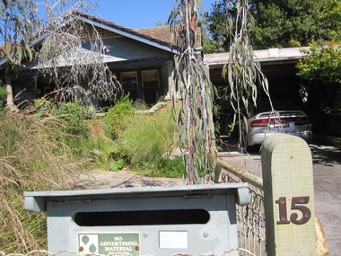
Photograph - 15 Rowland Street, Mont Albert, The Street Where You Live Project
... 15 Rowland Street, Mont Albert...The Street Where You Live Project Photograph 15 Rowland Street, Mont Albert ...Photos documenting this address as part of a photographic series undertaken by volunteer photographers during 2013 and 2014 for The Street Where You Live Project. This was organised through the Surrey Hills Neighbourhood Centre and covered the postcode 3127 in the cities of Boroondara and Whitehorse.These photos provide a snapshot of real estate in the suburbs of Mont Albert and Surrey Hills during a period of rapid change with many properties on large blocks demolished to create higher density residential development or renewal of single dwellings. At particular risk were properties not covered by heritage overlays, especially interwar housing and post 1950's housing. -
 Surrey Hills Historical Society Collection
Photograph - 16 Rowland Street, Mont Albert, The Street Where You Live Project
... 16 Rowland Street, Mont Albert...The Street Where You Live Project Photograph 16 Rowland Street, Mont Albert ...Photos documenting this address as part of a photographic series undertaken by volunteer photographers during 2013 and 2014 for The Street Where You Live Project. This was organised through the Surrey Hills Neighbourhood Centre and covered the postcode 3127 in the cities of Boroondara and Whitehorse.These photos provide a snapshot of real estate in the suburbs of Mont Albert and Surrey Hills during a period of rapid change with many properties on large blocks demolished to create higher density residential development or renewal of single dwellings. At particular risk were properties not covered by heritage overlays, especially interwar housing and post 1950's housing. -
 Surrey Hills Historical Society Collection
Photograph - 17 Rowland Street, Mont Albert, The Street Where You Live Project
... 17 Rowland Street, Mont Albert...The Street Where You Live Project Photograph 17 Rowland Street, Mont Albert ...Photos documenting this address as part of a photographic series undertaken by volunteer photographers during 2013 and 2014 for The Street Where You Live Project. This was organised through the Surrey Hills Neighbourhood Centre and covered the postcode 3127 in the cities of Boroondara and Whitehorse.These photos provide a snapshot of real estate in the suburbs of Mont Albert and Surrey Hills during a period of rapid change with many properties on large blocks demolished to create higher density residential development or renewal of single dwellings. At particular risk were properties not covered by heritage overlays, especially interwar housing and post 1950's housing. -
 Surrey Hills Historical Society Collection
Photograph - 18 Rowland Street, Mont Albert, The Street Where You Live Project
... 18 Rowland Street, Mont Albert...The Street Where You Live Project Photograph 18 Rowland Street, Mont Albert ...Photos documenting this address as part of a photographic series undertaken by volunteer photographers during 2013 and 2014 for The Street Where You Live Project. This was organised through the Surrey Hills Neighbourhood Centre and covered the postcode 3127 in the cities of Boroondara and Whitehorse.These photos provide a snapshot of real estate in the suburbs of Mont Albert and Surrey Hills during a period of rapid change with many properties on large blocks demolished to create higher density residential development or renewal of single dwellings. At particular risk were properties not covered by heritage overlays, especially interwar housing and post 1950's housing. -
 Kew Historical Society Inc
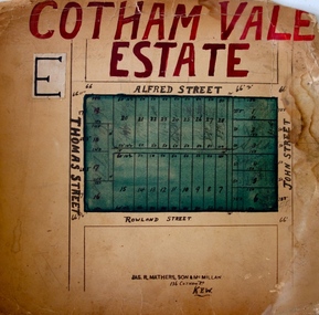
Plan - Subdivision Plan, Cotham Vale Estate, 1919
... ...rowland street -- Kew (Vic.)...The Cotham Vale Estate was a subdivision of land between Alfred, Thomas, Rowland and John Streets. It was promoted in the same time as the nearby Normanby Heights Estate. ...Barnes. subdivision plans - kew cotham vale estate rowland street -- Kew (Vic.) Thomas Street -- Kew (Vic.) ...Pru Sanderson, in her groundbreaking ‘City of Kew Urban Conservation Study : Volume 2 - Development History’ (1988), summarised the periods of urban development and subdivisions of land in Kew. The periods that she identified included 1845-1880, 1880-1893, 1893-1921, 1921-1933, 1933-1943, and Post-War Development. These periods were selected as they represented periods of rapid growth or decline in urban development. An obvious starting point for Sanderson’s groupings involved population growth and the associated economic cycles. These cycles also highlighted urban expansion onto land that was predominantly rural, although in other cases it represented the decline and breakup of large estates. A number of the plans in the Kew Historical Society’s collection can also be found in other collections, such as those of the State Library of Victoria and the Boroondara Library Service. A number are however unique to the collection.The Kew Historical Society collection includes almost 100 subdivision plans pertaining to suburbs of the City of Melbourne. Most of these are of Kew, Kew East or Studley Park, although a smaller number are plans of Camberwell, Deepdene, Balwyn and Hawthorn. It is believed that the majority of the plans were gifted to the Society by persons connected with the real estate firm - J. R. Mathers and McMillan, 136 Cotham Road, Kew. The Plans in the collection are rarely in pristine form, being working plans on which the agent would write notes and record lots sold and the prices of these. The subdivision plans are historically significant examples of the growth of urban Melbourne from the beginning of the 20th Century up until the 1980s. A number of the plans are double-sided and often include a photograph on the reverse. A number of the latter are by noted photographers such as J.E. Barnes.The Cotham Vale Estate was a subdivision of land between Alfred, Thomas, Rowland and John Streets. It was promoted in the same time as the nearby Normanby Heights Estate. Cotham Vale included 28 allotments. Contemporary newspaper advertisements noted that the Estate ‘is most conveniently situated in a well elevated position, only 2 minutes from Cotham rd. Electric Cars, penny section to Kew station’.subdivision plans - kew, cotham vale estate, rowland street -- kew (vic.), thomas street -- kew (vic.), john street -- kew (vic.) -
 Surrey Hills Historical Society Collection
Folder of real estate advertisements, Folders of real estate advertisements (Streets beginning with Q-R), Various
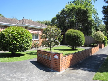
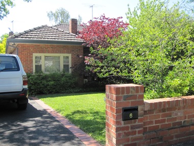
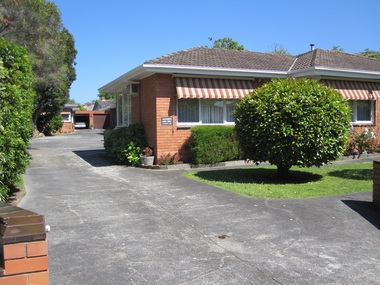
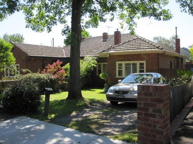
... ...rowland street...Surrey Hills Historical Society Collection 190A Canterbury Road Canterbury melbourne queen street redvers street riversdale road robinson road rose avenue ross street rostrevor parade rowland street royal lane russell street A4 folders with individual pockets for each property in streets beginning with Q-R located in Surrey Hills and Mont Albert. ...A4 folders with individual pockets for each property in streets beginning with Q-R located in Surrey Hills and Mont Albert. Folders are ordered by street name and then chronologically by property number. Each property has its own pocket. This may include multiple real estate advertisements collected from sales over time. It may also include copies of any research undertaken by Alan Holt and / or members of the SHNCHC team. These are augmented by cards in the Alan Holt index file and by his property registers of Surrey Hills and Mont Albert.queen street, redvers street, riversdale road, robinson road, rose avenue, ross street, rostrevor parade, rowland street, royal lane, russell street -
 Kew Historical Society Inc
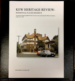
Archive (Sub-series) - Subject File, Kew Heritage Review, Residential Places Graded B, Volume 1, 1999, 1999
... ...34 rowland street...The Butler papers provide an important, and increasingly significant body of heritage research relating to Kew. graeme butler, heritage reviews - kew 20 yarra street 8 yarra street 33 wills street 25 wellington street 11 wellington street 118 walpole street 84 walpole street 83 walpole street 63 walpole street 52 walpole street 51 walpole street 14 vista avenue 12 tara avenue 89 studley park road 75 studley park road 44 studley park road 25 studley park road 13 studley avenue 21 stoke avenue 71 stevenson street 34 stevenson street 12 stevenson street 36 stawell street 11 second avenue 3 second avenue 2 second avenue 34 rowland street 21 redmond street 11 redmond street 16 queen street 27 princess street 82 molesworth street 28 miller grove 26 miller grove 24 miller grove 24 milfay avenue 8 milfay avenue 4 merrion grove 25 mary street 24 lister avenue 2 john street 9 hume street 7 hume street 24 howard street 20 howard street 19 howard street 10 howard street 2 howard street 26 holroyd street 12 holroyd street 73 high street 69 high street 35 high street 6 high street 53 harp road 6 gellibrand street 48 foley street 9 eglinton street 25-27 edgecombe street 21-23 edgecombe street 5-7 edgecombe street 23 dunlop avenue 167 derby street 8 denmark street 1 denmark street 2 daracomb avenue 2 danielle place 340 cotham road 294 cotham road 241 cotham road 221-229 cotham road 208 cotham road 193 cotham road 180 cotham road 171 cotham road 167 cotham road 161 cotham road 135-137 cotham road 46 clyde street 4 cameron court 1291 burke road 1223 burke road 1205 burke road 5 bowen street 35-37 belford road 389 barkers road 387 barkers road 311 barkers road 231 barkers road 83-85 barkers road 15 adeney avenue 6 a'beckett street Black 4-Ring binder that includes research about, and an assessment of buildings previously graded B in the City of Kew Urban Conservation Study 1988 by Pru Sanderson Design Pty Ltd. ...Graeme Butler & AssociatesProject FilesProvenance OrderBlack 4-Ring binder that includes research about, and an assessment of buildings previously graded B in the City of Kew Urban Conservation Study 1988 by Pru Sanderson Design Pty Ltd. The files were created by the heritage architect Graeme Butler and the paper files include maps, correspondence, title searches, readings, reviews of prior classifications, newspaper and journal articles, directories etc for each property assessed.graeme butler, heritage reviews - kew, 20 yarra street, 8 yarra street, 33 wills street, 25 wellington street, 11 wellington street, 118 walpole street, 84 walpole street, 83 walpole street, 63 walpole street, 52 walpole street, 51 walpole street, 14 vista avenue, 12 tara avenue, 89 studley park road, 75 studley park road, 44 studley park road, 25 studley park road, 13 studley avenue, 21 stoke avenue, 71 stevenson street, 34 stevenson street, 12 stevenson street, 36 stawell street, 11 second avenue, 3 second avenue, 2 second avenue, 34 rowland street, 21 redmond street, 11 redmond street, 16 queen street, 27 princess street, 82 molesworth street, 28 miller grove, 26 miller grove, 24 miller grove, 24 milfay avenue, 8 milfay avenue, 4 merrion grove, 25 mary street, 24 lister avenue, 2 john street, 9 hume street, 7 hume street, 24 howard street, 20 howard street, 19 howard street, 10 howard street, 2 howard street, 26 holroyd street, 12 holroyd street, 73 high street, 69 high street, 35 high street, 6 high street, 53 harp road, 6 gellibrand street, 48 foley street, 9 eglinton street, 25-27 edgecombe street, 21-23 edgecombe street, 5-7 edgecombe street, 23 dunlop avenue, 167 derby street, 8 denmark street, 1 denmark street, 2 daracomb avenue, 2 danielle place, 340 cotham road, 294 cotham road, 241 cotham road, 221-229 cotham road, 208 cotham road, 193 cotham road, 180 cotham road, 171 cotham road, 167 cotham road, 161 cotham road, 135-137 cotham road, 46 clyde street, 4 cameron court, 1291 burke road, 1223 burke road, 1205 burke road, 5 bowen street, 35-37 belford road, 389 barkers road, 387 barkers road, 311 barkers road, 231 barkers road, 83-85 barkers road, 15 adeney avenue, 6 a'beckett streetgraeme butler, heritage reviews - kew, 20 yarra street, 8 yarra street, 33 wills street, 25 wellington street, 11 wellington street, 118 walpole street, 84 walpole street, 83 walpole street, 63 walpole street, 52 walpole street, 51 walpole street, 14 vista avenue, 12 tara avenue, 89 studley park road, 75 studley park road, 44 studley park road, 25 studley park road, 13 studley avenue, 21 stoke avenue, 71 stevenson street, 34 stevenson street, 12 stevenson street, 36 stawell street, 11 second avenue, 3 second avenue, 2 second avenue, 34 rowland street, 21 redmond street, 11 redmond street, 16 queen street, 27 princess street, 82 molesworth street, 28 miller grove, 26 miller grove, 24 miller grove, 24 milfay avenue, 8 milfay avenue, 4 merrion grove, 25 mary street, 24 lister avenue, 2 john street, 9 hume street, 7 hume street, 24 howard street, 20 howard street, 19 howard street, 10 howard street, 2 howard street, 26 holroyd street, 12 holroyd street, 73 high street, 69 high street, 35 high street, 6 high street, 53 harp road, 6 gellibrand street, 48 foley street, 9 eglinton street, 25-27 edgecombe street, 21-23 edgecombe street, 5-7 edgecombe street, 23 dunlop avenue, 167 derby street, 8 denmark street, 1 denmark street, 2 daracomb avenue, 2 danielle place, 340 cotham road, 294 cotham road, 241 cotham road, 221-229 cotham road, 208 cotham road, 193 cotham road, 180 cotham road, 171 cotham road, 167 cotham road, 161 cotham road, 135-137 cotham road, 46 clyde street, 4 cameron court, 1291 burke road, 1223 burke road, 1205 burke road, 5 bowen street, 35-37 belford road, 389 barkers road, 387 barkers road, 311 barkers road, 231 barkers road, 83-85 barkers road, 15 adeney avenue, 6 a'beckett street -
 Kew Historical Society Inc
Archive (Sub-series) - Subject File, Kew Heritage Review, Residential Places Graded B, Volume 2, 1999, 1999
... ...34 rowland street...The Butler papers provide an important, and increasingly significant body of heritage research relating to Kew. graeme butler, heritage reviews - kew 25 mary street 4 merrion grove 24 milfay avenue 24 miller grove 26 miller grove 28 miller grove 82 molesworth street 27 princess street 16 queen street 20 yarra street 84 walpole street 118 walpole street 11 wellington street 83 walpole street 25 wellington street 8 yarra street 33 wills street 63 walpole street 14 vista avenue 89 studley park road 12 tara avenue 75 studley park road 21 redmond street 52 walpole street 51 walpole street 71 stevenson street 34 rowland street 21 stoke avenue 34 stevenson street 44 studley park road 25 studley park road 13 studley avenue 2 second avenue 11 second avenue 3 second avenue 36 stawell street 12 stevenson street Black 4-Ring binder that includes research about, and an assessment of buildings previously graded B in the City of Kew Urban Conservation Study 1988 by Pru Sanderson Design Pty Ltd. ...Graeme Butler & AssociatesProject FilesProvenance OrderBlack 4-Ring binder that includes research about, and an assessment of buildings previously graded B in the City of Kew Urban Conservation Study 1988 by Pru Sanderson Design Pty Ltd. The files were created by the heritage architect Graeme Butler and the paper files include maps, correspondence, title searches, readings, reviews of prior classifications, newspaper and journal articles, directories etc for each property assessed. graeme butler, heritage reviews - kew, 25 mary street, 4 merrion grove, 24 milfay avenue, 24 miller grove, 26 miller grove, 28 miller grove, 82 molesworth street, 27 princess street, 16 queen street, 20 yarra street, 84 walpole street, 118 walpole street, 11 wellington street, 83 walpole street, 25 wellington street, 8 yarra street, 33 wills street, 63 walpole street, 14 vista avenue, 89 studley park road, 12 tara avenue, 75 studley park road, 21 redmond street, 52 walpole street, 51 walpole street, 71 stevenson street, 34 rowland street, 21 stoke avenue, 34 stevenson street, 44 studley park road, 25 studley park road, 13 studley avenue, 2 second avenue, 11 second avenue, 3 second avenue, 36 stawell street, 12 stevenson streetgraeme butler, heritage reviews - kew, 25 mary street, 4 merrion grove, 24 milfay avenue, 24 miller grove, 26 miller grove, 28 miller grove, 82 molesworth street, 27 princess street, 16 queen street, 20 yarra street, 84 walpole street, 118 walpole street, 11 wellington street, 83 walpole street, 25 wellington street, 8 yarra street, 33 wills street, 63 walpole street, 14 vista avenue, 89 studley park road, 12 tara avenue, 75 studley park road, 21 redmond street, 52 walpole street, 51 walpole street, 71 stevenson street, 34 rowland street, 21 stoke avenue, 34 stevenson street, 44 studley park road, 25 studley park road, 13 studley avenue, 2 second avenue, 11 second avenue, 3 second avenue, 36 stawell street, 12 stevenson street -
Glen Eira Historical Society
Ephemera - Carnegie Cricket Club
... Street... Rowland S....Grange Road Sutherland M. Bent Street Rowland S. Chestnut Street Ariadne Avenue Rankin Ian Caulfield City Carnegie R. ...This file contains nineteen Carnegie Cricket Club season match cards owned by the club’s Honorary Secretary for 1930-1931, and life member, Mr. T. E. S. Ash. The cards encompass the years from 1930-1931, 1936-1938, 1940-1941, 1943-1951 and 1952-1960. Each of the match cards list the office bearers for the year as well as the club’s fixtures. Some contain handwritten annotations by Mr. Ash as to the outcomes of the matches.ash mr., shelton j. n., reid s. h., price c., harratt f., stevenson h., donaldson t., walker a., cakebread e., gregg r., tebbs j., tempany t., quinn p., price f., lonch w., newing s., henderson e., reader a., larter f. t., harwood h., ash t. e. s., neerim road, bone j., jenner t., paul j., richards u., diamond c., mckee w., reid s. h., robertson g., sherwood j., tyers s. w., allaway j. e., clarke t. b., goldman a., jukes a., spencer w., beaumont c., carnegie, wishart g., bone r., boxshall k., cameron h., johnson a., hubbard l., larter f., price c. l., moore d., allaway e., ash t., louch w. h., goodall m., reid g., graham j., reid m., wilde w., willison p., murrumbeena, henty street, crussell j. a., williams h., allan p., pooley p. c., greig g., pierce l., caples r. w., newbury c. j., chamberlain a., cusack r., driver w. j., mau r., moore d. c., wishart m., pummeroy k., bailey f. i., brown r. w., whelan j. g., parker c., rofe r., wilkins d., dann e., tebbs j. (junior), yenden road, loush w., neville street, williams r. h., greenway a., lewis j., rolfe d., saunders r., wishart d., st. anthony, glenhuntly, stocks w., christie a., greenway a. e., caulfield south, ireland p., mcdougall c. j., burke s., pert r. g. a., mimosa road, carn. soc., carnegie socials, caulfield sth, ormond a, sweetnam r. w., price f. n., bone r. n., burke s. r., mcintosh a., ormond, caulfield east, ormond park, murrumbeena c, murrumbeena d, elsternwick, murrumbeena e, carnegie soldiers, mccarron a., newbury c. r., middleton j., o’connor j., cakebread j., morton l., lyons street, mckinnon, carnegie traders, bone r. j., north road, caul. f’balls, caulfield north, clarke t., whitelaw w., sweetman r. w., jury j., macfarlan i., daniells j. (senior), price r., bull a. j., tranmere avenue, wakeman o. w., coorigil road, bailey i., james p. c., ormond b, james p., pert r., green w., knox h., reid street, caulfield, heib j., price v. j., elliot a., phillips n., wilde w. j., cusack s., tyers n. s., hender b., george d., ford j., castles p., rolfe d. h., cusack r. s., gamble h., louch w. h., pearce e., koornang road, koornan road, harrington a., somerville h. j., grange road, sutherland m., bent street, rowland s., chestnut street, ariadne avenue, rankin ian, caulfield city, carnegie r. s. l., caulfield foot, murrumbeena foot, whitelaw m., chilvers r., kennedy d., mclatchie h., murrumbeena z, ormond c. of c., murrumbeena b, bentleigh, crussell j., mckee g., andrews e. j., andrews n., somerville h., moonya road, murrumbeena park, sweetnan r. w., hubbard l. c., harwood h. j., wilkins d. (senior), sporting clubs, cricket, clubs and associations, volunteers -
 Kew Historical Society Inc
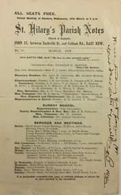
Pamphlet - Document, St Hilary's Anglican Church, St Hilary's Parish Notes, No.70., March 1919, 1919
... St Hilary's Anglican Church in Rowland Street, Kew was established in 1888 on land granted to the congregation by the Dumaresq family....Kew Historical Society Inc Kew Court House 188 High Street Kew melbourne St Hilary's Anglican Church in Rowland Street, Kew was established in 1888 on land granted to the congregation by the Dumaresq family. ...St Hilary's Anglican Church in Rowland Street, Kew was established in 1888 on land granted to the congregation by the Dumaresq family.The Parish Notes are historically interesting as they outline the various ways in which the Influenza Epidemic of 1919 had an impact on local communities. St Hilary's Church of England Parish Notes from 1919, which includes among other items of interest states that because of the risks of contagion during the influenza epidemic, parishioners are required to worship outside. Written note on front page signed by the Rev Charles H Barnes and dated 16/3/19.st hilary's church of england - kew (vic), churches - kew (vic), influenza epidemic 1919 - kew (vic) -
 Kew Historical Society Inc
Drawing, Dione McIntyre, Rear view of 'old' St Hilary's, 2013
... Hilary’s Church of England (Kew) was a timber building on the corner of John and Rowland Streets, designed in 1888 by Albert Purchas. ...Hilary’s Church of England (Kew) was a timber building on the corner of John and Rowland Streets, designed in 1888 by Albert Purchas. ...The first St. Hilary’s Church of England (Kew) was a timber building on the corner of John and Rowland Streets, designed in 1888 by Albert Purchas. This timber building was demolished in the 1940s to make way for a new church and tennis courts. The drawing was made to accompany a newsletter article by Dione McIntyre.Pen and ink drawing of the rear view of ‘old’ St Hilary’s, drawn by Dione McIntyre, 2013. "Rear view of 'old' St Hilary's"st hilary's church (kew), dione mcintyre, churches -- kew (vic) -
 Kew Historical Society Inc
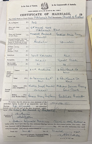
Legal record - Marriage Certificate: Maxwell Howard Martin and Gertrude Daisy Perry, 1943
... Wife: Gertrude Daisy Perry, Spinster, [born] Kew, Typiste Clerk, 32, 2 Rowland Street, Kew. [Wife's father] William James Perry, Law Clerk / [Wife's mother] Gertrude Bisset Location: St Hilary's Church, Kew Date: 9th March 1943...Wife: Gertrude Daisy Perry, Spinster, [born] Kew, Typiste Clerk, 32, 2 Rowland Street, Kew. [Wife's father] William James Perry, Law Clerk / [Wife's mother] Gertrude Bisset Location: St Hilary's Church, Kew Date: 9th March 1943 Legal record Marriage Certificate: Maxwell Howard Martin and Gertrude Daisy Perry ...The Martin Family records include photographs and documents pertaining to three families - the Bissetts, Perrys, and Martins - connected across five generations by marriage. The collection records life events such as marriage, images of members of the families, as well as snapshots of daily life Marriage Certificate: Maxwell Howard Martin and Gertrude Daisy Perry. Recorded information includes: No. in Register 343. Husband: Maxwell Howard Martin, Bachelor, [born] North Adelaide, Soldier, 30, A.I.F. Australia. 60 Normanby Road, Kew. [Husband's] Father: Walter Joseph Martin, deceased / [Husband's] Mother: Bessie May Ingham. Wife: Gertrude Daisy Perry, Spinster, [born] Kew, Typiste Clerk, 32, 2 Rowland Street, Kew. [Wife's father] William James Perry, Law Clerk / [Wife's mother] Gertrude Bisset Location: St Hilary's Church, Kew Date: 9th March 1943martin family collection, maxwell howard martin, gertrude daisy perry., walter joseph martin, bessie may ingham, william james perry, gertrude bisset, st hilary's church - kew (vic), marriage certificates -
 Kew Historical Society Inc
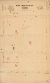
Plan, Melbourne & Metropolitan Board of Works : Borough of Kew : Detail Plan No.1568, 1905
... Alfred Street and Rowland Street are in shown in the middle of the plan. ...Alfred Street and Rowland Street are in shown in the middle of the plan. ...The Melbourne and Metropolitan Board of Works (MMBW) plans were produced from the 1890s to the 1950s. They were crucial to the design and development of Melbourne's sewerage and drainage system. The plans, at a scale of 40 feet to 1 inch (1:480), provide a detailed historical record of Melbourne streetscapes and environmental features. Each plan covers one or two street blocks (roughly six streets), showing details of buildings, including garden layouts and ownership boundaries, and features such as laneways, drains, bridges, parks, municipal boundaries and other prominent landmarks as they existed at the time each plan was produced. (Source: State Library of Victoria)This plan forms part of a large group of MMBW plans and maps that was donated to the Society by the Mr Poulter, City Engineer of the City of Kew in 1989. Within this collection, thirty-five hand-coloured plans, backed with linen, are of statewide significance as they include annotations that provide details of construction materials used in buildings in the first decade of the 20th century as well as additional information about land ownership and usage. The copies in the Public Record Office Victoria and the State Library of Victoria are monochrome versions which do not denote building materials so that the maps in this collection are invaluable and unique tools for researchers and heritage consultants. A number of the plans are not held in the collection of the State Library of Victoria so they have the additional attribute of rarity.Original survey plan, issued by the MMBW to a contractor with responsibility for constructing sewers in the area identified on the plan within the Borough of Kew. The plan was at some stage hand-coloured, possibly by the contractor, but more likely by officers working in the Engineering Department of the Borough and later Town, then City of Kew. The hand-coloured sections of buildings on the plan were used to denote masonry or brick constructions (pink), weatherboard constructions (yellow), and public buildings (grey). Plan No.1568 covers the area bounded by Cotham Road, John Street, Sackville Street, and Edward Street. Alfred Street and Rowland Street are in shown in the middle of the plan. The two most notable buildings shown are ‘St Helliers’, the home of the Dumaresq family, and St Hilary’s Church and school. While the colours used to indicate St Hilary’s are grey as in other civic/public buildings, the first St Hilary’s Anglican Church was at this stage constructed in weatherboard. At the left of the plan, facing Sackville Street is a house named ‘Glencara’. The 1988 ‘Kew Conservation Study’ recorded that “The first documentary evidence of this house comes from Rate Books which record that in 1893 a Mrs Treadway was the owner of this building with an N.A.V. of £81? At that date the occupier of the house was Charles B. Kelly, a clerk, while by 1910 Kelly had become the owner of the property described in that year ‘as a six-roomed stone, brick and wood house with stables and outbuildings’”. Contrary to this description, the 1905 plan indicates that the house was entirely constructed of masonry.melbourne and metropolitan board of works, detail plans, mmbw 1568