Showing 9 items matching "shire of berwick map"
-
 Narre Warren and District Family History Group
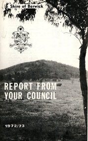
Booklet, Shire of Berwick, Shire of Berwick Report from your council for 1971/1972, 1972/73 and 1973/1974
... Shire of Berwick...Shire of Berwick map...A snapshot of the Shire of Berwick in 1972/73. Shire of Berwick Shire of Berwick map George Rae Havelock Park Berwick Vic Mt Cannibal Garfield North Vic Cr. ...A report from the Shire of Berwick on the local council. There is an individual report on each service provided by the council for the financial years 1971/72, 1972/73 and 1973/74. Lists the principal officers and councillors of the municipality, and a message from the Shire President.Three brochures for the financial years 1971/72, 1972/73 amd 1973/74 from the City of Berwicknon-fictionA report from the Shire of Berwick on the local council. There is an individual report on each service provided by the council for the financial years 1971/72, 1972/73 and 1973/74. Lists the principal officers and councillors of the municipality, and a message from the Shire President. shire of berwick, shire of berwick map, george rae, havelock park berwick vic, mt cannibal garfield north vic, cr. j. g hoskings, cr. i. m. baillieu, cr. e. a owen, cr. g. p. t. sweeney, cr. b. d. simon, cr. m. k. anderson, cr. i. g. farrell, cr. m. s. bishop, cr. h. marson, cr. c. m. huyskens, cr. j. matthews, cr. k. r. wishart, cr. j. g. bateman, cr. s. h. pargeter, trevor kilvington, beaconsfield kindergarten, cr. a. j funston, cr. p. b ronald, cr. g. h richardson, cr. d. c. m sanna, city of berwick proclaimation, dandenong valley regional library service, pakenham sports complex, b. j wallis, r. j chambers -
 Emerald Museum & Nobelius Heritage Park
Map - Municipality Road Classification - Beaconsfield-Emerald Rd., Shire of Gembrook 1973, Title Survey Division, Crown Description - Part of Crown Allotment 44, Parish of Gembrook, County of Mornington, c1973
... Shire of Berwick, Beaconsfeld-Emerald Rd. (MR)/Francis J Webber of Kirkpatrick & Webber, 285 Maroondah Hwy., Ringwood/(Signed) - Principal Title Survey Office 16.1.73/SP13461 Image of Crown Survey Map for crown allotment 44 (Beaconsfield-Emerald Rd.) parish of Gembrook, County of Mornington Title Survey Division, Crown Description - Part of Crown Allotment 44, Parish of Gembrook, County of Mornington Map Municipality Road Classification - Beaconsfield-Emerald Rd., Shire of Gembrook 1973 ...Image of Crown Survey Map for crown allotment 44 (Beaconsfield-Emerald Rd.) parish of Gembrook, County of MorningtonTitle Survey Division/Crown Description/Part of Crown Allotment 44, Parish of Gembrook, County of Mornington/Municipality Road Classification, Shire of Berwick, Beaconsfeld-Emerald Rd. (MR)/Francis J Webber of Kirkpatrick & Webber, 285 Maroondah Hwy., Ringwood/(Signed) - Principal Title Survey Office 16.1.73/SP13461 -
 Emerald Museum & Nobelius Heritage Park
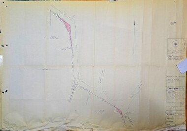
Map - Survey Map - Municipality Road Classification - Beaconsfield-Emerald Rd. (near Downey Rd.) 1972, Title Survey Division, Crown Description - part of Crown Allotments 39A and 39D, Parish of Gembrook, County of Mornington, c1972
... Emerald Museum & Nobelius Heritage Park 5 Crichton Rd Emerald yarra-valley-and-the-dandenong-ranges Title Survey Division/Crown Description/Part of Crown Allotments 39A and 39D, Parish of Gembrook,County of Mornington/Municipality Road Classification - Shire of Berwick, Beaconsfield - Emerald Rd, Upper Beaconsfield - Upper Pakenham Road/John L Dwyer of Fisher Cleeland Turner & Dwyer Pty. Ltd., 213 King Street, Melbourne - 14 April, 1972/S.R. CLARKE - Principal Title Survey Officer 5.9.72/SP 13072 Image of Crown survey map ...Image of Crown survey map - changes to allotments bordering Beaconsfield-Emerald Rd. near Downey Rd. in 1972Title Survey Division/Crown Description/Part of Crown Allotments 39A and 39D, Parish of Gembrook,County of Mornington/Municipality Road Classification - Shire of Berwick, Beaconsfield - Emerald Rd, Upper Beaconsfield - Upper Pakenham Road/John L Dwyer of Fisher Cleeland Turner & Dwyer Pty. Ltd., 213 King Street, Melbourne - 14 April, 1972/S.R. CLARKE - Principal Title Survey Officer 5.9.72/SP 13072 -
 Emerald Museum & Nobelius Heritage Park
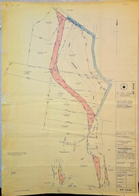
Map - Municipality Road Classification - Beaconsfield - Emerald Rd., Shire of Berwick Alteration 1973, c1973
... Image of map indicating Municipality Road Classification - Beaconsfield - Emerald Rd., Shire of Berwick Alteration 1973...Emerald Museum & Nobelius Heritage Park 5 Crichton Rd Emerald yarra-valley-and-the-dandenong-ranges Title Survey Division/Crown description/Crown allotment 47A and Part of Crown allotments1,46,47, 48A and former Government Rd., Parish of Gembrook, County of Mornington/Municipality Road Classification/Shire of Berwick, Beaconsfield-Emerald Road/Signed (Unreadable) Principal Title Survey Officer and Proper Officer 13.8.1973/SP13349 Image of map indicating Municipality Road Classification - Beaconsfield - Emerald Rd., Shire of Berwick Alteration 1973 Municipality Road Classification - Beaconsfield - Emerald Rd., Shire of Berwick Alteration 1973 Map Municipality Road Classification - Beaconsfield - Emerald Rd., Shire of Berwick Alteration 1973 ...Image of map indicating Municipality Road Classification - Beaconsfield - Emerald Rd., Shire of Berwick Alteration 1973Title Survey Division/Crown description/Crown allotment 47A and Part of Crown allotments1,46,47, 48A and former Government Rd., Parish of Gembrook, County of Mornington/Municipality Road Classification/Shire of Berwick, Beaconsfield-Emerald Road/Signed (Unreadable) Principal Title Survey Officer and Proper Officer 13.8.1973/SP13349 -
 Emerald Museum & Nobelius Heritage Park
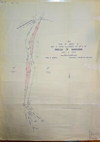
Map - Plan of Survey of Crown Allotments, Healesville - Koo Wee Rup Road, Shire of Berwick, c1969
... /Plan of Survey of part of Crown Allotments 61A, 61B and 61E/Parish of Nangana, County of Evelyn/Shire of Berwick/Healesville0KooWeeRup Road Image of Survey of Crown Allotments 61A, 61B & 81E, Parish of Nangana Plan of Survey of Crown Allotments, Healesville - Koo Wee Rup Road, Shire of Berwick Map Plan of Survey of Crown Allotments, Healesville - Koo Wee Rup Road, Shire of Berwick ...Image of Survey of Crown Allotments 61A, 61B & 81E, Parish of NanganaC.R.B./Plan of Survey of part of Crown Allotments 61A, 61B and 61E/Parish of Nangana, County of Evelyn/Shire of Berwick/Healesville0KooWeeRup Road -
 City of Moorabbin Historical Society (Operating the Box Cottage Museum)
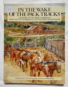
Book, Berwick-Pakenham Historical Society, In the wake of the pack tracks : a history of the Shire of Berwick, now the City of Berwick and the Shire of Pakenham, 1982
... City of Moorabbin Historical Society (Operating the Box Cottage Museum) Joyce Park Jasper Road Ormond melbourne Berwick pakenham A history of the Shire of Berwick, now the City of Berwick and the Shire of Pakenham. xvi, 175 p. : ill., maps (some col.), ports. ; Includes index. eCol. maps on lining papers. ...A history of the Shire of Berwick, now the City of Berwick and the Shire of Pakenham.xvi, 175 p. : ill., maps (some col.), ports. ; Includes index. eCol. maps on lining papers.non-fictionA history of the Shire of Berwick, now the City of Berwick and the Shire of Pakenham.berwick, pakenham -
 Narre Warren and District Family History Group
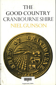
Book, Niel Gunson, The Good Country : Cranbourne Shire, 1968
... Berwick melbourne Cranbourne (Vic.) Shire of Cranbourne This book provides a detailed history of the Cranbourne Shire, including information about early settlers, Aboriginal heritage, soldier settlements, and the development of towns and rail tracks. The book also features photographs, maps ...This book provides a detailed history of the Cranbourne Shire, including information about early settlers, Aboriginal heritage, soldier settlements, and the development of towns and rail tracks. The book also features photographs, maps, and appendices with shire statistics and historical records.non-fictionThis book provides a detailed history of the Cranbourne Shire, including information about early settlers, Aboriginal heritage, soldier settlements, and the development of towns and rail tracks. The book also features photographs, maps, and appendices with shire statistics and historical records.cranbourne (vic.), shire of cranbourne -
 Narre Warren and District Family History Group
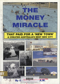
Book, Syd Pargeter, The money miracle : that paid for a "new town" & created Australia's best new city, 2005
... GMH Heinz Dairy industry Details the successful movement to separate parts of the Berwick Shire to form the new, fast-growing City of Berwick, focusing on community development in areas like Doveton and Eumemmerring, with industries like GMH and Heinz driving early growth and a strong local identity. 136 p. : ill., maps, ports. ...Details the successful movement to separate parts of the Berwick Shire to form the new, fast-growing City of Berwick, focusing on community development in areas like Doveton and Eumemmerring, with industries like GMH and Heinz driving early growth and a strong local identity.136 p. : ill., maps, ports. (some col.) ; 30 cmnon-fictionDetails the successful movement to separate parts of the Berwick Shire to form the new, fast-growing City of Berwick, focusing on community development in areas like Doveton and Eumemmerring, with industries like GMH and Heinz driving early growth and a strong local identity. berwick (vic.), doveton (vic.), gmh, heinz, dairy industry -
 Southern Sherbrooke Historical Society Inc.
Information folder - Local Government Amalgamations 1986, 1985 & 1986
... maps -memo, dated 21 November 1985 from K. E. Matson, General Manager, Shire of Sherbrooke, to all councillors, re. local government commission and municipal restructure, 12 pages including map -letter, Warwick Heine, CEO, Shire of Lilydale to K. E. Matson, General Manager, Shire of Sherbrooke, dated 16 April 1986, re. local government restructure (2 copies) -booklet, "The Restructure of Local Government in Victoria: Options Paper Eastern Melbourne Segment", Local Government Commission June 1986, 24 pages -article "Residents to fight land deal", Knox-Sherbrooke News, 17 June1986, re. proposed annexation of part of Lysterfield by Berwick Council -article "Knox and Sherbooke align for the future", The Trader, 30 April 1986, re. alignment of common boundary -article "Boundary changes 'just a joke'", by Cheryl Critchley, Knox-Sherbrooke News, 6 May 1986 , re. ...Southern Sherbrooke Historical Society Inc. 127 Colby Drive Belgrave Heights 3160 yarra-valley-and-the-dandenong-ranges shire of sherbrooke shire of lilydale knox city council berwick shire council Folder containing information pertaining to the Local Government amalgamations in Victoria in 1986. Contents: -copy of "Local Government Act 1958, appointment of a division of the local government commission and referral of proposals to the division", 8 pages and 6 explanatory maps -memo, dated 21 November 1985 from K. ...Folder containing information pertaining to the Local Government amalgamations in Victoria in 1986. Contents: -copy of "Local Government Act 1958, appointment of a division of the local government commission and referral of proposals to the division", 8 pages and 6 explanatory maps -memo, dated 21 November 1985 from K. E. Matson, General Manager, Shire of Sherbrooke, to all councillors, re. local government commission and municipal restructure, 12 pages including map -letter, Warwick Heine, CEO, Shire of Lilydale to K. E. Matson, General Manager, Shire of Sherbrooke, dated 16 April 1986, re. local government restructure (2 copies) -booklet, "The Restructure of Local Government in Victoria: Options Paper Eastern Melbourne Segment", Local Government Commission June 1986, 24 pages -article "Residents to fight land deal", Knox-Sherbrooke News, 17 June1986, re. proposed annexation of part of Lysterfield by Berwick Council -article "Knox and Sherbooke align for the future", The Trader, 30 April 1986, re. alignment of common boundary -article "Boundary changes 'just a joke'", by Cheryl Critchley, Knox-Sherbrooke News, 6 May 1986 , re. Knox-Sherbrooke boundary alignment -article "Border clash worsens", by Peter Janky, Mountain District Free Press, 7 May 1986, re. Sherbrooke-Lilydale boundary changes -article "Ranges future is still clouded", The Free Press 30 April 1986, re. proposal to form a shire covering Dandenong Ranges -article "Sherbrooke wins first battle in restructuring", by Peter Janky, Free Press, 30 April 1986, re. ceding of forest areas by Knox to Sherbrooke.shire of sherbrooke, shire of lilydale, knox city council, berwick shire council