
Showing 31 items matching "south coast phillip island"
-
 Phillip Island and District Historical Society Inc.
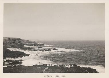
Photograph, South Coast Phillip Island, Feb 1939
... South Coast Phillip Island...One of a collection of 18 photographs and postcards donated by Jill Yeoman southcoast phillip island phillip island coastline coastline phillip island jill yeoman Cowes Feb 1939 Black & White photograph of the Southcoast Phillip Island - near Summerland South Coast Phillip Island Photograph Photograph Photo Shop Series ...One of a collection of 18 photographs and postcards donated by Jill YeomanBlack & White photograph of the Southcoast Phillip Island - near SummerlandCowes Feb 1939southcoast phillip island, phillip island coastline, coastline phillip island, jill yeoman -
 Phillip Island and District Historical Society Inc.
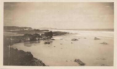
Photograph, Unknown
... phillip island coastline...south coast...Black & White photograph of the South Coast of Phillip Island....Batty phillip island coastline south coast phillip island phillip island m batty Black & White photograph of the South Coast of Phillip Island. ...One of 6 photographs donated by M. BattyBlack & White photograph of the South Coast of Phillip Island.phillip island coastline, south coast phillip island, phillip island, m batty -
 Phillip Island and District Historical Society Inc.
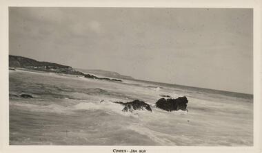
Photograph, 01/1938
... phillip island coastline...south coast...Black & White photograph of the South Coast of Phillip Island...One of 8 photographs donated by Joseph White phillip island coastline south coast phillip island shoreline phillip island joseph white "Cowes - Jan 1938" Black & White photograph of the South Coast of Phillip Island Photograph Photograph Photo Shop ...One of 8 photographs donated by Joseph WhiteBlack & White photograph of the South Coast of Phillip Island"Cowes - Jan 1938"phillip island coastline, south coast phillip island, shoreline phillip island, joseph white -
 Phillip Island and District Historical Society Inc.
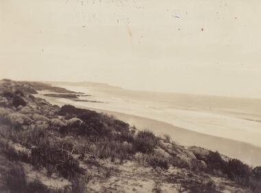
Photograph, Early 20th Century
... phillip island coastline...south coast...Black & White photograph of the South Coast of Phillip Island...One of a collection of 6 photographs donated by Mary Karney phillip island coastline south coast phillip island mary karney Black & White photograph of the South Coast of Phillip Island Photograph Photograph ...One of a collection of 6 photographs donated by Mary KarneyBlack & White photograph of the South Coast of Phillip Islandphillip island coastline, south coast phillip island, mary karney -
 Phillip Island and District Historical Society Inc.
Photograph - Post Card, Early 1900's
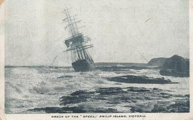
... ...south coast phillip island...Black & White postcard of the Speke wrecked off the South Coast of Phillip Island with the loss of one life. 22/2/1906....One of a collection of photographs purchased by the Society from Jack Day of Mornington. the speke wreck of the speke south coast phillip island phillip island ship wrecks phillip island jack day collection "Wrck of the "Speke", Philip Island, Victoria" Black & White postcard of the Speke wrecked off the South Coast of Phillip Island with the loss of one life. 22/2/1906. ...One of a collection of photographs purchased by the Society from Jack Day of Mornington.Black & White postcard of the Speke wrecked off the South Coast of Phillip Island with the loss of one life. 22/2/1906."Wrck of the "Speke", Philip Island, Victoria"the speke, wreck of the speke, south coast phillip island, phillip island, ship wrecks phillip island, jack day collection -
 Phillip Island and District Historical Society Inc.
Photograph, Unknown
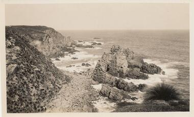
... phillip island coastline...coastline - south coast...Black & White photograph of South Coast of Phillip Island with rocky outcrop....Batty phillip island coastline coastline - south coast rocky outcrock phillip island phillip island m batty Black & White photograph of South Coast of Phillip Island with rocky outcrop. ...One of 6 photograph donated by M. BattyBlack & White photograph of South Coast of Phillip Island with rocky outcrop.phillip island coastline, coastline - south coast, rocky outcrock phillip island, phillip island, m batty -
 Phillip Island and District Historical Society Inc.
Photograph, Bryant West
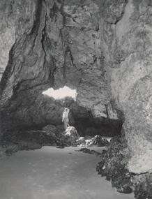
... Photograph inside Forrest Caves South Coast Phillip Island. Man inside looking out. ...One of a collection of over 400 photographs in an album commenced in 1960 and presented to the Phillip Island & Westernport Historical Society by the Shire of Phillip Island local history photography photographs coastline caves phillip island forrest caves phillip island john jenner bryant west Photograph inside Forrest Caves South Coast Phillip Island. ...One of a collection of over 400 photographs in an album commenced in 1960 and presented to the Phillip Island & Westernport Historical Society by the Shire of Phillip IslandPhotograph inside Forrest Caves South Coast Phillip Island. Man inside looking out. local history, photography, photographs, coastline, caves, phillip island, forrest caves phillip island, john jenner, bryant west -
 Phillip Island and District Historical Society Inc.
Photograph - Post Card, 1906
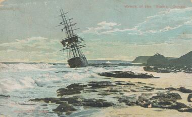
... Colour postcard of the wreck of the :Speke" on the south coast of Phillip Island in 1906....One of a collection of photographs donated by Shirley Peterson. wreck of the sailing ship "speke" phillip island coastline phillip island shirley peterson "Wreck of the "Speke", Cowes" "Robb Bros. Cowes" Colour postcard of the wreck of the :Speke" on the south coast of Phillip Island in 1906. ...One of a collection of photographs donated by Shirley Peterson.Colour postcard of the wreck of the :Speke" on the south coast of Phillip Island in 1906."Wreck of the "Speke", Cowes" "Robb Bros. Cowes"wreck of the sailing ship "speke", phillip island coastline, phillip island, shirley peterson -
 Phillip Island and District Historical Society Inc.
Photograph, The Speke, 22/02/1906
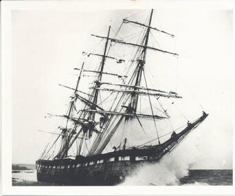
... Black & White photograph of The Speke running aground on the south coast of Phillip Island....Life boats were immediately lowered and the ship’s crew all made it to shore except Seaman Frank Henderson, who lost his life. wreck of the speke the speke jack loney Black & White photograph of The Speke running aground on the south coast of Phillip Island. The Speke Photograph ...The Speke was an all steel ship of 310 feet, beam of 35 feet and weight of 2,712 tons and triple masted. She was built in 1891 at Carnarvon in Wales for a cost of 22,000 pounds. The wreck of the Speke was purchased for a mere 12 pounds after it went aground in 1906. The Speke had come from Peru to Sydney. She was then on her way to load wheat in Geelong when she ran aground on the 22 February 1906. Captain Tiltson confused a bushfire, near Cowes, for navigation lights. The ship drifted close to shore in Kitty Miller Bay and was eventually holed at 3 pm on the rocks. Life boats were immediately lowered and the ship’s crew all made it to shore except Seaman Frank Henderson, who lost his life.Black & White photograph of The Speke running aground on the south coast of Phillip Island.wreck of the speke, the speke, jack loney -
 Phillip Island and District Historical Society Inc.
Photographs, 1998
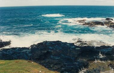
... the nobbies phillip island...south coast...A group of photographs donated by Henrietta Da Costa, Telopa, NSW - in order to retain local history of Phillip Island. the nobbies phillip island south coast phillip island the blowhole phillip island farmland ventnor phillip island henrietta da costa Eleven coloured photographs of The Nobbies area and coastline and Ventnor farmland. ...A group of photographs donated by Henrietta Da Costa, Telopa, NSW - in order to retain local history of Phillip Island.Eleven coloured photographs of The Nobbies area and coastline and Ventnor farmland.the nobbies phillip island, south coast phillip island, the blowhole phillip island, farmland ventnor phillip island, henrietta da costa -
 Phillip Island and District Historical Society Inc.
Photograph, Early 20th Century
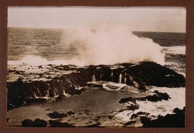
... ...south coast phillip island...One of a collection of 13 photographs donated by Ralph Correy. rock formations south coast phillip island breaking waves phillip island coastline ralph correy Black & White photograph of waves breaking over a rock platform near The Nobbies. ...One of a collection of 13 photographs donated by Ralph Correy.Black & White photograph of waves breaking over a rock platform near The Nobbies.rock formations, south coast phillip island, breaking waves, phillip island coastline, ralph correy -
 Phillip Island and District Historical Society Inc.
Photograph, Early 20th Century
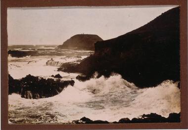
... phillip island...breaking waves...south coast...One of a collection of 13 photographs donated by Ralph Correy. the nobbies phillip island breaking waves south coast phillip island ralph correy Black & White photograph of breaking waves over rocks looking towards The Nobbies. ...One of a collection of 13 photographs donated by Ralph Correy.Black & White photograph of breaking waves over rocks looking towards The Nobbies. Two little specks on top of The Nobbies are the Lighthouse and Beacon.the nobbies phillip island, breaking waves, south coast phillip island, ralph correy -
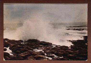 Phillip Island and District Historical Society Inc.
Photograph, Early 20th Century
... ...south coast phillip island...One of a collection of 13 photographs donated by Ralph Correy. breaking waves south coast phillip island phillip island coastline ralph correy Black & White photograph of waves breaking over the rocks - probably near The Nobbies. ...One of a collection of 13 photographs donated by Ralph Correy.Black & White photograph of waves breaking over the rocks - probably near The Nobbies.breaking waves, south coast phillip island, phillip island coastline, ralph correy -
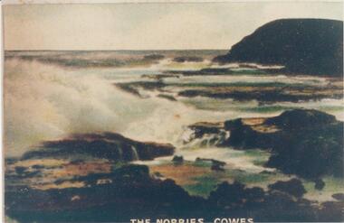 Phillip Island and District Historical Society Inc.
Photograph, Early 20th Century
... phillip island...rock formation phillip island...south coast...One of a collection of photographs donated by Bruce Bennett the nobbies phillip island rock formation phillip island south coast phillip island coastline phillip island bruce bennett "The Nobbies - Cowes" Coloured copy of a postcard. ...One of a collection of photographs donated by Bruce BennettColoured copy of a postcard. Rock platform with breakers and Nobbies at top right."The Nobbies - Cowes"the nobbies phillip island, rock formation phillip island, south coast phillip island, coastline phillip island, bruce bennett -
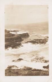 Phillip Island and District Historical Society Inc.
Photograph, Early 20th Century
... phillip island coastline...south coast...Winn phillip island coastline south coast phillip island coastal f winn Sepia photograph of the South Coastline of Phillip Island with waves crashing on the rocks. ...One of a collection of 9 photographs donated by F. WinnSepia photograph of the South Coastline of Phillip Island with waves crashing on the rocks.phillip island coastline, south coast phillip island, coastal, f winn -
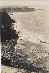 Phillip Island and District Historical Society Inc.
Photograph, Bryant West
... south coast...south coast...cliffs...south coast phillip island...One of a collection of over 400 photographs in an album commenced in 1960 and presented to the Phillip Island & Westernport Historical Society by the Shire of Phillip Island local history photography photographs coastline - south coast south coast cliffs south coast phillip island john jenner bryant west Photograph from cliff top of rocky south coastline looking easterly Photograph Bryant West ...One of a collection of over 400 photographs in an album commenced in 1960 and presented to the Phillip Island & Westernport Historical Society by the Shire of Phillip IslandPhotograph from cliff top of rocky south coastline looking easterlylocal history, photography, photographs, coastline - south coast, south coast, cliffs, south coast phillip island, john jenner, bryant west -
 Phillip Island and District Historical Society Inc.
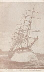
Photograph - Post Card, Early 1900's
... Sepia postcard of the "Speke" wrecked on rocks off south coast of Phillip Island on 22nd February 1906 with the lost of one life....One of a collection of photographs purchased by the Society from Jack Day of Mornington. the speke wreck of the speke phillip island ship wrecks phillip island jack day collection "The "Speke" on the rocks, Phillip Island, Victoria." Sepia postcard of the "Speke" wrecked on rocks off south coast of Phillip Island on 22nd February 1906 with the lost of one life. ...One of a collection of photographs purchased by the Society from Jack Day of Mornington.Sepia postcard of the "Speke" wrecked on rocks off south coast of Phillip Island on 22nd February 1906 with the lost of one life."The "Speke" on the rocks, Phillip Island, Victoria."the speke, wreck of the speke, phillip island, ship wrecks phillip island, jack day collection -
 Phillip Island and District Historical Society Inc.
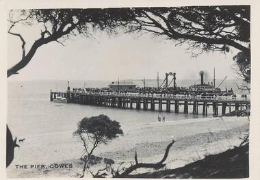
Photographs, Photo Shop Series, 1940
... Ferry at centre left and crowd of people on end of pier. 217-02 Photograph taken from the end of the Cowes Pier with Isle of Wight Hotel in the background. 217-03 Photograph of the Killara Ferry leaving Cowes with a crowd of people on board. 217-04 Photograph of waves surging over Bridal Veil rock platform in foreground. 217-05 Photograph of wave breaking over rock platform on the South Coast of Phillip Island. 217-06 Photograph of the Suspension Bridge from San Remo. 217-07 Photograph of a Guesthouse Dining Room. ...phillip island seals on seal rocks phillip island seal rocks phillip island mrs haines 217-01 Photograph of the Cowes Pier taken from foreshore. Ferry at centre left and crowd of people on end of pier. 217-02 Photograph taken from the end of the Cowes Pier with Isle of Wight Hotel in the background. 217-03 Photograph of the Killara Ferry leaving Cowes with a crowd of people on board. 217-04 Photograph of waves surging over Bridal Veil rock platform in foreground. 217-05 Photograph of wave breaking over rock platform on the South Coast of Phillip Island. 217-06 Photograph of the Suspension Bridge from San Remo. 217-07 Photograph of a Guesthouse Dining Room. ...A collection of 18 photographs taken by Mrs Haines' sister whilst on an excursion to Phillip Island from Mt Barker High School in South Australia. 217-01 Photograph of the Cowes Pier taken from foreshore. Ferry at centre left and crowd of people on end of pier. 217-02 Photograph taken from the end of the Cowes Pier with Isle of Wight Hotel in the background. 217-03 Photograph of the Killara Ferry leaving Cowes with a crowd of people on board. 217-04 Photograph of waves surging over Bridal Veil rock platform in foreground. 217-05 Photograph of wave breaking over rock platform on the South Coast of Phillip Island. 217-06 Photograph of the Suspension Bridge from San Remo. 217-07 Photograph of a Guesthouse Dining Room. Tables covered with white cloth and fully laid, including floral arrangements. 217-08 Photograph of the War Memorial at Cowes with the pier in background. 217-09 Photograph of seals on Seal Rocks Phillip Island. 217-10 Photograph of a koala on the trunk of a Gum Tree. Handwritten on the back of the photo - "Roberta, a pet koala". 217-11 Photograph of children rolling down dune onto the beach. Children and adults standing at water's edge. 217-12 Photograph of the Killara at San Remo taken from the Suspension Bridge. 217-13 Photograph of a group of school children with teachers, young girl in the foreground, on rocks at Smith's Beach. 217-14 Photograph looking along the Suspension bridge from Newhaven end. Group of people walking toward San Remo. 217-15 Photograph of Suspension bridge from Newhaven beach. 217-16 Photograph of Mrs Melbourne and Mrs Haines sister. 217-17 Photograph of Seal Rocks taken from a boat. 217-18 Photograph of Theni Beddams - Headmistress of Shelford and Ila Tattersall (Mrs Haines) Sybil Robinson's sister together with four sailors.cowes pier phillip island, the killara ferry, ferries, wildlife - seals, wildlife - koala, suspension bridge phillip island, phillip island coastline, smith's beach, lover's walk cowes, lover's walk cowes phillip island, war memorial cowes phillip island, seals on seal rocks phillip island, seal rocks phillip island, mrs haines -
 Flagstaff Hill Maritime Museum and Village
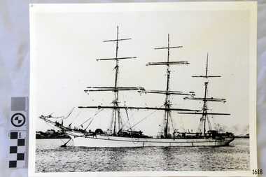
Photograph, 1907-1914
... south west coast of Victoria, and is the only wreck that took the lives of all people on board. She is listed on the Victorian Heritage Register VHS S34. The Antares is significant as a sail trader carrying an international inbound cargo. It is part of the Great Ocean Road Historic Shipwreck Trail. flagstaff hill warrnambool shipwrecked-coast flagstaff-hill flagstaff-hill-maritime-museum maritime-museum shipwreck-coast flagstaff-hill-maritime-village antares tall ship peterborough 1914 shipwreck phillip le couteur peter mathieson constable stainsbury sutlej antares rock. bay of islands Photograph of the three masted fully rigged Antares at anchor. ...This photograph is of the sailing ship ANTARES at full sail, taken between 1907, when she was named ANTARES, and 1914, when she was wrecked.. THE ANTARES In mid-November 1914, after the beginning of the First World War, a young local man went one evening to fish near the Bay of Islands, west of Peterborough. He later arrived home hurriedly and in an agitated state declaring: "The Germans are coming!" His family laughed and disbelieved him, as this young fellow was prone to telling fictional tales. About a month later, on December 13th 1914, local farmers Phillip Le Couteur and Peter Mathieson were riding in the vicinity, checking on cattle. Phillip Le Couteur saw what he “thought was the hull of a ship below the cliffs.” He rode to Allansford and contacted police. The next day, two Constables and Phillip Le Couteur returned to the site, where they dug a trench near the top of the cliff and sank a log in it. To this they attached a rope, which they threw down the cliff face. Constable Stainsbury and Phillip Le Couteur then made the dangerous descent down the rope on the sheer cliff face. They found wreckage strewn around a small cove and a portion of a man's body under the cliffs. The hull of the ship could be seen about 300 metres out to sea. Some of the wreckage revealed the name Antares and the remains of the ship's dinghy bore the name Sutlej. During the next two weeks and with the help of the Warrnambool lifeboat and crew, two more bodies were found. Later investigations proved that the tragic wreck was indeed that of the Antares, reported overdue on the 207th day of her voyage from Marseilles, France, to Melbourne. She was a three masted, 1749 ton iron clipper, built in Glasgow in 1888 and originally named and launched as the Sutlej. Bought in 1907 by Semider Bros. from Genoa, Italy, she was refitted and renamed Antares. It was later realised that the local lad who a month earlier had declared he had seen German guns being fired, had probably seen distress flares fired from the deck of the Antares the night she was wrecked. She was last sailed under Captain Gazedo and wrecked at what is now known as Antares Rock, near the Bay of Islands. She had been carrying a large cargo of roofing tiles from France to Melbourne, consigned to Mullaly & Byrne. Many of them are now to be seen amongst the battered and scattered remains of the wreck. Some of the timbers were found to be blackened by fire. An Information Board has been erected on the cliff top near to the site of the Antares wreck, at the end of Radfords Rd, west of Peterborough. (Ref: Flagstaff Hill Maritime Village’s “Antares” fact sheet, Victorian Heritage Database, Information Board at Peterborough, Flagstaff Hill Significance Assessment 2010) The Antares was one of the last of the 'tall ships' to be lost along the south west coast of Victoria, and is the only wreck that took the lives of all people on board. She is listed on the Victorian Heritage Register VHS S34. The Antares is significant as a sail trader carrying an international inbound cargo. It is part of the Great Ocean Road Historic Shipwreck Trail. Photograph of the three masted fully rigged Antares at anchor. (ref: Ships A-B SH016.)flagstaff hill, warrnambool, shipwrecked-coast, flagstaff-hill, flagstaff-hill-maritime-museum, maritime-museum, shipwreck-coast, flagstaff-hill-maritime-village, antares, tall ship, peterborough, 1914 shipwreck, phillip le couteur, peter mathieson, constable stainsbury, sutlej, antares rock., bay of islands -
 Flagstaff Hill Maritime Museum and Village
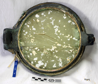
Functional object - Porthole, c 1888
... south west coast of Victoria, and is the only wreck that took the lives of all people on board. She is listed on the Victorian Heritage Register VHS S34. The Antares is significant as a sail trader carrying an international inbound cargo. It is part of the Great Ocean Road Historic Shipwreck Trail. flagstaff hill warrnambool shipwrecked-coast flagstaff-hill flagstaff-hill-maritime-museum maritime-museum shipwreck-coast flagstaff-hill-maritime-village porthole antares. tall ship peterborough 1914 shipwreck phillip le couteur peter mathieson constable stainsbury sutlej antares rock. bay of islands ship's fitting Porthole with glass, brass, screw dog broken off, glass has cracks through it, some encrustation. ...This porthole was part of the ship's fittings when the Antares was constructed. THE ANTARES In mid-November 1914, after the beginning of the First World War, a young local man went one evening to fish near the Bay of Islands, west of Peterborough. He later arrived home hurriedly and in an agitated state declaring: "The Germans are coming!" His family laughed and disbelieved him, as this young fellow was prone to telling fictional tales. About a month later, on December 13th 1914, local farmers Phillip Le Couteur and Peter Mathieson were riding in the vicinity, checking on cattle. Phillip Le Couteur saw what he “thought was the hull of a ship below the cliffs.” He rode to Allansford and contacted police. The next day, two Constables and Phillip Le Couteur returned to the site, where they dug a trench near the top of the cliff and sank a log in it. To this they attached a rope, which they threw down the cliff face. Constable Stainsbury and Phillip Le Couteur then made the dangerous descent down the rope on the sheer cliff face. They found wreckage strewn around a small cove and a portion of a man's body under the cliffs. The hull of the ship could be seen about 300 metres out to sea. Some of the wreckage revealed the name Antares and the remains of the ship's dinghy bore the name Sutlej. During the next two weeks and with the help of the Warrnambool lifeboat and crew, two more bodies were found. Later investigations proved that the tragic wreck was indeed that of the Antares, reported overdue on the 207th day of her voyage from Marseilles, France, to Melbourne. She was a three masted, 1749 ton iron clipper, built in Glasgow in 1888 and originally named and launched as the Sutlej. Bought in 1907 by Semider Bros. from Genoa, Italy, she was refitted and renamed Antares. It was later realised that the local lad who a month earlier had declared he had seen German guns being fired, had probably seen distress flares fired from the deck of the Antares the night she was wrecked. She was last sailed under Captain Gazedo and wrecked at what is now known as Antares Rock, near the Bay of Islands. She had been carrying a large cargo of roofing tiles from France to Melbourne, consigned to Mullaly & Byrne. Many of them are now to be seen amongst the battered and scattered remains of the wreck. Some of the timbers were found to be blackened by fire. An Information Board has been erected on the cliff top near to the site of the Antares wreck, at the end of Radfords Rd, west of Peterborough. (Ref: Flagstaff Hill Maritime Village’s “Antares” fact sheet, Victorian Heritage Database, Information Board at Peterborough, Flagstaff Hill Significance Assessment 2010)The Antares was one of the last of the 'tall ships' to be lost along the south west coast of Victoria, and is the only wreck that took the lives of all people on board. She is listed on the Victorian Heritage Register VHS S34. The Antares is significant as a sail trader carrying an international inbound cargo. It is part of the Great Ocean Road Historic Shipwreck Trail. Porthole with glass, brass, screw dog broken off, glass has cracks through it, some encrustation. Artefact Reg No A/5, recovered from the wreck of the Antares.flagstaff hill, warrnambool, shipwrecked-coast, flagstaff-hill, flagstaff-hill-maritime-museum, maritime-museum, shipwreck-coast, flagstaff-hill-maritime-village, porthole, antares., tall ship, peterborough, 1914 shipwreck, phillip le couteur, peter mathieson, constable stainsbury, sutlej, antares rock., bay of islands, ship's fitting -
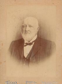 Phillip Island and District Historical Society Inc.
Photograph - Photograph, black + white, c. 1900
... South Sea Islands and the west coast of South America. In 1859 he took the well known Albion Hotel, Bourke-street east, Melbourne, the starting place for all Cobb and Co's lines of up-country coaches, and kept it for 22 years, marrying whilst there Miss Blake, of Mornington. Shortly before leaving the hotel he purchased 7000 acres of land at Phillip...South Sea Islands and the west coast of South America. In 1859 he took the well known Albion Hotel, Bourke-street east, Melbourne, the starting place for all Cobb and Co's lines of up-country coaches, and kept it for 22 years, marrying whilst there Miss Blake, of Mornington. Shortly before leaving the hotel he purchased 7000 acres of land at Phillip ...John Cleeland JP of Newhaven, 1826-1914, a native of County Down, Ireland, came to Victoria in 1840 with his parents and settled at Darebin Creek. After a few years spent there he went to sea in his schooner yacht of 200 tons, the Harriet, visiting the South Sea Islands and the west coast of South America. In 1859 he took the well known Albion Hotel, Bourke-street east, Melbourne, the starting place for all Cobb and Co's lines of up-country coaches, and kept it for 22 years, marrying whilst there Miss Blake, of Mornington. Shortly before leaving the hotel he purchased 7000 acres of land at Phillip Island for breeding purposes, and there bred Wollomai, who won the Melbourne Cup in 1875. In 1881 he retired to his magnificent estate, besides which he has another 1000 acres at Bass and other properties. He also once owned racing stables at Brighton, where he had Barwon (which won the Champion race) and other valuable horses. Mr Cleeland is a member of the Phillip Island Council and is a justice of the peace for the central bailiwick. Taken from Victoria and its Metropolis: past and present, 1888. Donated by Ivy Cleeland, John Cleeland's grand-daughter.Portrait of John Cleeland of Wollomai House, Phillip Island.On front: Paris, 119 Swanston Street, Melbourne On back: John Cleeland of Wollomai House.john cleeland, ivy cleeland -
 Phillip Island and District Historical Society Inc.
Book, ?BOWDEN, Keith, Matthew Flinders' narrative of Tom Thumb's cruise to Canoe Rivulet, 1985
... matthew flinders travel new south wales tom thumb boat coasts discovery exploration Stamped 'Phillip Island & District Historical Society'. ...Stamped 'Phillip Island & District Historical Society'.matthew flinders, travel, new south wales, tom thumb, boat, coasts, discovery, exploration -
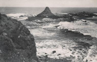 Phillip Island and District Historical Society Inc.
Photograph, Bryant West
... One of a collection of over 400 photographs in an album commenced in 1960 and presented to the Phillip Island & Westernport Historical Society by the Shire of Phillip Island local history photography photographs coastline - rock formation - pyramid rock coastline south coast pyramid rock john jenner bryant west Photograph of Pyramid Rock looking south from cliff top Photograph Bryant West ...One of a collection of over 400 photographs in an album commenced in 1960 and presented to the Phillip Island & Westernport Historical Society by the Shire of Phillip IslandPhotograph of Pyramid Rock looking south from cliff toplocal history, photography, photographs, coastline - rock formation - pyramid rock, coastline, south coast, pyramid rock, john jenner, bryant west -
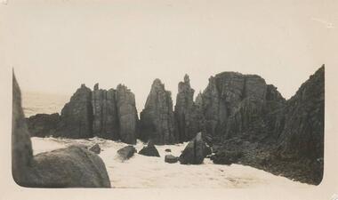 Phillip Island and District Historical Society Inc.
Photograph, The Pinnacles, Cape Woolamai
... south side of Philip Island, Cape Woolamai. Part of the Jessie Smith Collection. local history photographs the pinnacles cape woolamai phillip island coastal geography jessie smith collection stan mcfee Coastal view of The Pinnacles, Cape Woolamai - rocks at coast edge. ...Pinnacles south side of Philip Island, Cape Woolamai. Part of the Jessie Smith Collection.Coastal view of The Pinnacles, Cape Woolamai - rocks at coast edge.local history, photographs, the pinnacles, cape woolamai, phillip island, coastal geography, jessie smith collection, stan mcfee -
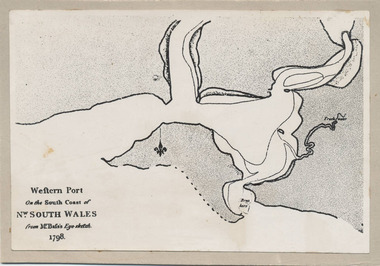 Phillip Island and District Historical Society Inc.
Photograph, Bryant West, 1798
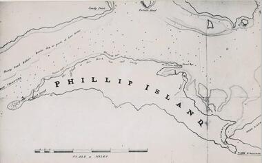
... One of a collection of over 400 photographs in an album commenced in 1960 and presented to the Phillip Island & Westernport Historical Society by the Shire of Phillip Island local history photography photographs exploration maritime documents maps george bass phillip island bryant west john jenner As written on front of map - "Western Port on the South Coast of Nw. ...One of a collection of over 400 photographs in an album commenced in 1960 and presented to the Phillip Island & Westernport Historical Society by the Shire of Phillip IslandPhotograph of the First Map of Phillip Island ever drawn. An eye sketch by Bass.As written on front of map - "Western Port on the South Coast of Nw. South Wales from GE Bass's Eye-sketch 1798"local history, photography, photographs, exploration, maritime, documents, maps, george bass, phillip island, bryant west, john jenner -
 Phillip Island and District Historical Society Inc.
Photograph, Bryant West
... Phillip Island. The first to show Fort Dumaresq, track to beach and beginning of road to South coast. ...One of a collection of over 400 photographs in an album commenced in 1960 and presented to the Phillip Island & Westernport Historical Society by the Shire of Phillip Island local history photography photographs exploration maritime documents maps phillip island john jenner bryant west Photograph of a Map of Phillip Island. The first to show Fort Dumaresq, track to beach and beginning of road to South coast ...One of a collection of over 400 photographs in an album commenced in 1960 and presented to the Phillip Island & Westernport Historical Society by the Shire of Phillip IslandPhotograph of a Map of Phillip Island. The first to show Fort Dumaresq, track to beach and beginning of road to South coast. local history, photography, photographs, exploration, maritime, documents, maps, phillip island, john jenner, bryant west -
 Phillip Island and District Historical Society Inc.
Photograph, Bryant West
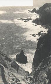
... One of a collection of over 400 photographs in an album commenced in 1960 and presented to the Phillip Island & Westernport Historical Society by the Shire of Phillip Island local history photography photographs coastline phillip island southern coastline phillip island john jenner bryant west Photograph of Rocky south coast shoreline. ...One of a collection of over 400 photographs in an album commenced in 1960 and presented to the Phillip Island & Westernport Historical Society by the Shire of Phillip IslandPhotograph of Rocky south coast shoreline.local history, photography, photographs, coastline, phillip island, southern coastline phillip island, john jenner, bryant west -
 Flagstaff Hill Maritime Museum and Village
Ceramic - Roof Tile, c 1914
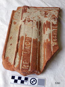
... south west coast of Victoria, and is the only wreck that took the lives of all people on board. She is listed on the Victorian Heritage Register VHS S34. The Antares is significant as a sail trader carrying an international inbound cargo. It is part of the Great Ocean Road Historic Shipwreck Trail. flagstaff hill warrnambool shipwrecked-coast flagstaff-hill flagstaff-hill-maritime-museum maritime-museum shipwreck-coast flagstaff-hill-maritime-village antares tall ship peterborough 1914 shipwreck phillip le couteur peter mathieson constable stainsbury sutlej antares rock. bay of islands terracotta tile roof tile clay tile roofing material building material Part of a terracotta roof tile from the wreck of the Antares Has sand encrusted to bottom of tile. ...This terracotta clay roof tile was part of a consignment of tiles in the cargo of ANTARES. THE ANTARES In mid-November 1914, after the beginning of the First World War, a young local man went one evening to fish near the Bay of Islands, west of Peterborough. He later arrived home hurriedly and in an agitated state declaring: "The Germans are coming!" His family laughed and disbelieved him, as this young fellow was prone to telling fictional tales. About a month later, on December 13th 1914, local farmers Phillip Le Couteur and Peter Mathieson were riding in the vicinity, checking on cattle. Phillip Le Couteur saw what he “thought was the hull of a ship below the cliffs.” He rode to Allansford and contacted police. The next day, two Constables and Phillip Le Couteur returned to the site, where they dug a trench near the top of the cliff and sank a log in it. To this they attached a rope, which they threw down the cliff face. Constable Stainsbury and Phillip Le Couteur then made the dangerous descent down the rope on the sheer cliff face. They found wreckage strewn around a small cove and a portion of a man's body under the cliffs. The hull of the ship could be seen about 300 metres out to sea. Some of the wreckage revealed the name Antares and the remains of the ship's dinghy bore the name Sutlej. During the next two weeks and with the help of the Warrnambool lifeboat and crew, two more bodies were found. Later investigations proved that the tragic wreck was indeed that of the Antares, reported overdue on the 207th day of her voyage from Marseilles, France, to Melbourne. She was a three masted, 1749 ton iron clipper, built in Glasgow in 1888 and originally named and launched as the Sutlej. Bought in 1907 by Semider Bros. from Genoa, Italy, she was refitted and renamed Antares. It was later realised that the local lad who a month earlier had declared he had seen German guns being fired, had probably seen distress flares fired from the deck of the Antares the night she was wrecked. She was last sailed under Captain Gazedo and wrecked at what is now known as Antares Rock, near the Bay of Islands. She had been carrying a large cargo of roof tiles from France to Melbourne, consigned to Mullaly & Byrne. Many of them are now to be seen amongst the battered and scattered remains of the wreck. Some of the timbers were found to be blackened by fire. An Information Board has been erected on the cliff top near to the site of the Antares wreck, at the end of Radfords Rd, west of Peterborough. (Ref: Flagstaff Hill Maritime Village’s “Antares” fact sheet, Victorian Heritage Database, Information Board at Peterborough, Flagstaff Hill Significance Assessment 2010) The Antares was one of the last of the 'tall ships' to be lost along the south west coast of Victoria, and is the only wreck that took the lives of all people on board. She is listed on the Victorian Heritage Register VHS S34. The Antares is significant as a sail trader carrying an international inbound cargo. It is part of the Great Ocean Road Historic Shipwreck Trail.Part of a terracotta roof tile from the wreck of the Antares Has sand encrusted to bottom of tile. Artefact Reg No A/6.flagstaff hill, warrnambool, shipwrecked-coast, flagstaff-hill, flagstaff-hill-maritime-museum, maritime-museum, shipwreck-coast, flagstaff-hill-maritime-village, antares, tall ship, peterborough, 1914 shipwreck, phillip le couteur, peter mathieson, constable stainsbury, sutlej, antares rock., bay of islands, terracotta tile, roof tile, clay tile, roofing material, building material -
 Flagstaff Hill Maritime Museum and Village
Tile, c 1914
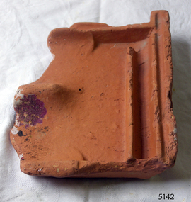
... south west coast of Victoria, and is the only wreck that took the lives of all people on board. She is listed on the Victorian Heritage Register VHS S34. The Antares is significant as a sail trader carrying an international inbound cargo. It is part of the Great Ocean Road Historic Shipwreck Trail. flagstaff hill warrnambool shipwrecked-coast flagstaff-hill flagstaff-hill-maritime-museum maritime-museum shipwreck-coast flagstaff-hill-maritime-village antares tall ship peterborough 1914 shipwreck phillip le couteur peter mathieson constable stainsbury sutlej antares rock. bay of islands clay tile roofing tile roof tile Piece of a clay roof tile recovered from the wreck of the Antares. ...This clay roof tile was part of the ANTARES cargo, a large consignment of tiles on its way to Melbourne. THE ANTARES In mid-November 1914, after the beginning of the First World War, a young local man went one evening to fish near the Bay of Islands, west of Peterborough. He later arrived home hurriedly and in an agitated state declaring: "The Germans are coming!" His family laughed and disbelieved him, as this young fellow was prone to telling fictional tales. About a month later, on December 13th 1914, local farmers Phillip Le Couteur and Peter Mathieson were riding in the vicinity, checking on cattle. Phillip Le Couteur saw what he “thought was the hull of a ship below the cliffs.” He rode to Allansford and contacted police. The next day, two Constables and Phillip Le Couteur returned to the site, where they dug a trench near the top of the cliff and sank a log in it. To this they attached a rope, which they threw down the cliff face. Constable Stainsbury and Phillip Le Couteur then made the dangerous descent down the rope on the sheer cliff face. They found wreckage strewn around a small cove and a portion of a man's body under the cliffs. The hull of the ship could be seen about 300 metres out to sea. Some of the wreckage revealed the name Antares and the remains of the ship's dinghy bore the name Sutlej. During the next two weeks and with the help of the Warrnambool lifeboat and crew, two more bodies were found. Later investigations proved that the tragic wreck was indeed that of the Antares, reported overdue on the 207th day of her voyage from Marseilles, France, to Melbourne. She was a three masted, 1749 ton iron clipper, built in Glasgow in 1888 and originally named and launched as the Sutlej. Bought in 1907 by Semider Bros. from Genoa, Italy, she was refitted and renamed Antares. It was later realised that the local lad who a month earlier had declared he had seen German guns being fired, had probably seen distress flares fired from the deck of the Antares the night she was wrecked. She was last sailed under Captain Gazedo and wrecked at what is now known as Antares Rock, near the Bay of Islands. She had been carrying a large cargo of roof tiles from France to Melbourne, consigned to Mullaly & Byrne. Many of them are now to be seen amongst the battered and scattered remains of the wreck. Some of the timbers were found to be blackened by fire. An Information Board has been erected on the cliff top near to the site of the Antares wreck, at the end of Radfords Rd, west of Peterborough. (Ref: Flagstaff Hill Maritime Village’s “Antares” fact sheet, Victorian Heritage Database, Information Board at Peterborough, Flagstaff Hill Significance Assessment 2010) The Antares was one of the last of the 'tall ships' to be lost along the south west coast of Victoria, and is the only wreck that took the lives of all people on board. She is listed on the Victorian Heritage Register VHS S34. The Antares is significant as a sail trader carrying an international inbound cargo. It is part of the Great Ocean Road Historic Shipwreck Trail. Piece of a clay roof tile recovered from the wreck of the Antares. Has a relief of a horse on back. Artefact Reg No A/7.flagstaff hill, warrnambool, shipwrecked-coast, flagstaff-hill, flagstaff-hill-maritime-museum, maritime-museum, shipwreck-coast, flagstaff-hill-maritime-village, antares, tall ship, peterborough, 1914 shipwreck, phillip le couteur, peter mathieson, constable stainsbury, sutlej, antares rock., bay of islands, clay tile, roofing tile, roof tile -
 Phillip Island Conservation Society Inc.
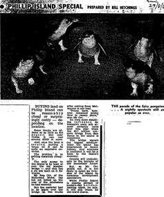
Work on paper - Photocopy of newspaper cutting, Melbourne Sun newspaper, "PHILLIP ISLAND SPECIAL PREPARED BY BILL HITCHINGS", 29.08.1969
... Phillip Island, late 1960s. At that stage a number of outlying residential estates had been created, especially on Phillip Island South Coast and at Cowes West. ...Phillip Island, late 1960s. At that stage a number of outlying residential estates had been created, especially on Phillip Island South Coast and at Cowes West. ...This article by journalist Bill Hitchings describes the state of the land market and cost of transporting building materials, Phillip Island, late 1960s. At that stage a number of outlying residential estates had been created, especially on Phillip Island South Coast and at Cowes West. While blocks of land on the outlier estates were very cheap and poorly serviced, the Cowes blocks were selling at $3000 per residential block. Hitchings quotes the owner of the Hollydene motel, Reg Orr, as saying that when the new bridge opens shortly he did not expect it to create a rush of visitors or residents.Bill Hitching was a well-known Melbourne journalist. This article gives an idea of land values on Phillip Island in the late 1960s, the fact that business owners were prepared to upgrade and expand their businesses to cater for extra potential demand on accommodation, and the strong identification of Phillip Island with the Phillip Island Penguin Parade in the minds of the general public in Melbourne. The significance of the new Phillip Island bridge to Phillip Islanders and visitors, and the cost of the bridge, are also outlined. Reg Orr was highly active in the business community of that era on Phillip Island. The Hollydene motel was a well-known Phillip Island accommodation venue.T-shaped article cutting with large image at top of article, dark due to poor photcopy. Double collumn text under photo clearly readable. Black and white.Sun/29/8/6 (?) Probably: Melbourne Sun newspaper, 29 August, 1969phillip island, phillip island tourism, development, hollydene motel, reg orr, phillip island penguin parade, land values, phillip island first bridge, phillip island 2nd bridge, transportation costs
