Showing 13 items matching "southern golf club"
-
 Heidelberg Golf Club
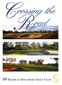
Book, Southern Golf Club, Crossing the road: 50 years at Southern Golf Club, 1997
... Crossing the road: 50 years at Southern Golf Club...Southern Golf Club...Southern Golf Club...Heidelberg Golf Club 8 Main Road Lower Plenty 3093 Southern Golf Club Golf Clubs - History Golf Clubs - Keysborough A history of Southern Golf Club, Keysborough, founded 1947. 112 p., illus. ...A history of Southern Golf Club, Keysborough, founded 1947.112 p., illus. (some col,)non-fictionA history of Southern Golf Club, Keysborough, founded 1947.southern golf club, golf clubs - history, golf clubs - keysborough -
 Federation University Historical Collection
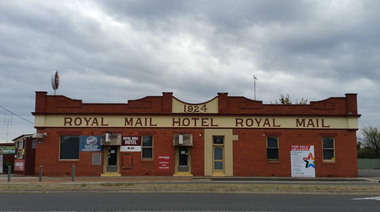
Photograph, Marilyn Jeffs, Hotels of Ballarat, 2019
... club hotel...grapes hotel...munster arms hotel...golden city hotel...golf house hotel...irish murphy's...camp hotel...lake view hotel...la porchetta...southern...Barker Library (top floor) Mount Helen goldfields hotels ballarat royal mail hotel peter lalor hotel the george hotel x on albert hotel cattleyards inn market hotel bunch of grapes hotel argyle hotel atlantic hotel ballarat hotel black hill hotel blue bell hotel bluebell hotel brown hill hotel canberra hotel carboni carboni's italian kitchen eureka stockade hotel carriers arms hotel eastern station hotel centenary hotel craig's hotel eastern railway hotel freight bar athletic club hotel grapes hotel munster arms hotel golden city hotel golf house hotel irish murphy's camp hotel lake view hotel la porchetta southern cross hotel the mallow hotel meaghers hotel millers arms miners tavern hotel miner's tavern hotel provincial hotel north britain hotel north star hotel oscar's hotel criterian hotel park hotel prince regent house prince regent hotel sport globe sporting globe jacksons hotel railway hotel pwtn pater lalor hotel royal highlander hotel queen's head hotel red lion hotel robin hood hotel military arms hotel royal oak hotel western hotel imperial hotel unicorn hotel union hotel Numerous photographs take by Marilyn Jeffs for use on the Ballarat and District Industrial Heritage Wiki Hotels of Ballarat Photograph Marilyn Jeffs ...Numerous photographs take by Marilyn Jeffs for use on the Ballarat and District Industrial Heritage Wikihotels, ballarat, royal mail hotel, peter lalor hotel, the george hotel, x on albert hotel, cattleyards inn, market hotel, bunch of grapes hotel, argyle hotel, atlantic hotel, ballarat hotel, black hill hotel, blue bell hotel, bluebell hotel, brown hill hotel, canberra hotel, carboni, carboni's italian kitchen, eureka stockade hotel, carriers arms hotel, eastern station hotel, centenary hotel, craig's hotel, eastern railway hotel, freight bar, athletic club hotel, grapes hotel, munster arms hotel, golden city hotel, golf house hotel, irish murphy's, camp hotel, lake view hotel, la porchetta, southern cross hotel, the mallow hotel, meaghers hotel, millers arms, miners tavern hotel, miner's tavern hotel, provincial hotel, north britain hotel, north star hotel, oscar's hotel, criterian hotel, park hotel, prince regent house, prince regent hotel, sport globe, sporting globe, jacksons hotel, railway hotel, pwtn, pater lalor hotel, royal highlander hotel, queen's head hotel, red lion hotel, robin hood hotel, military arms hotel, royal oak hotel, western hotel, imperial hotel, unicorn hotel, union hotel -
 Heidelberg Golf Club
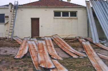
Photograph, Heidelberg Golf Club: Clubhouse renovations 1997-98 - Demolition - Southern end, 1997
... Heidelberg Golf Club: Clubhouse renovations 1997-98 - Demolition - Southern end...Heidelberg Golf Club: Clubhouse renovations 1997-98 - Demolition - Southern end...Heidelberg Golf Club 8 Main Road Lower Plenty 3093 Heidelberg Golf Club: Clubhouse renovations 1997-98 - Demolition - Southern end Clubhouse redevelopment 1998 HGC Clubhouse 1997 HGC old clubhouse Demolition of old clubhouse Colour photograph and caption in album Heidelberg Golf Club: Clubhouse renovations 1997-98 - Demolition - Southern end Photograph Photograph ...Heidelberg Golf Club: Clubhouse renovations 1997-98 - Demolition - Southern endColour photograph and caption in albumclubhouse redevelopment 1998, hgc clubhouse 1997, hgc old clubhouse, demolition of old clubhouse -
 Heidelberg Golf Club
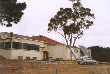
Photograph, Heidelberg Golf Club: Clubhouse renovations 1997-98 - Demolition - Southern end, 1997
... Heidelberg Golf Club: Clubhouse renovations 1997-98 - Demolition - Southern end...Heidelberg Golf Club 8 Main Road Lower Plenty 3093 Heidelberg Golf Club: Clubhouse renovations 1997-98 - old pro shop Clubhouse redevelopment 1998 HGC Clubhouse 1997 HGC old clubhouse Demolition of old clubhouse Colour photograph and caption in album Heidelberg Golf Club: Clubhouse renovations 1997-98 - Demolition - Southern end Photograph Photograph ...Heidelberg Golf Club: Clubhouse renovations 1997-98 - old pro shopColour photograph and caption in albumclubhouse redevelopment 1998, hgc clubhouse 1997, hgc old clubhouse, demolition of old clubhouse -
 Southern Sherbrooke Historical Society Inc.
Photograph - 9 hole golf course-Belgrave Heights 1930-1943 map
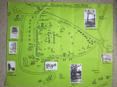
... Southern Sherbrooke Historical Society Inc. 127 Colby Drive Belgrave Heights 3160 yarra-valley-and-the-dandenong-ranges Hand drawn map of Belgrave Heights and its 9 hole golf course, between 1930 and 1943 created by Betty de Coite nee Woods, who holidayed in the area with her family. Map drawn in marker. Photographs attached, including a view of the golf course, Fern Glade Tracks, Lockwood Rd, the dam at Marama Rd corner, The Crescent, the path near the club ...Hand drawn map of Belgrave Heights and its 9 hole golf course, between 1930 and 1943 created by Betty de Coite nee Woods, who holidayed in the area with her family. Map drawn in marker. Photographs attached, including a view of the golf course, Fern Glade Tracks, Lockwood Rd, the dam at Marama Rd corner, The Crescent, the path near the club house, and a wagon near golf course. These photos were taken by members of the Woods family. Map highlights Lockwood House at the corner of Lockwood Rd, the 9 hole golf course, and Sunnyside guesthouse. Club house at Lockwood Rd is later the site of the Convention Centre. Above club house is Fred and Ruby Cook's House. -
 Kew Historical Society Inc
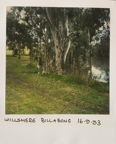
Photograph - Willsmere [Kew] Billabong, 1993
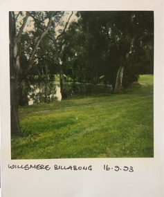
... Golf Club, Willow Grove and the Eastern Freeway. The land on which the park is now situated was bought by Thomas Wills at the Crown Land Sales of 1846 (Section 56). From the 1840s to the 1940s it was intensively farmed. The park is dominated by very large playing fields, while planting to the southern...Golf Club, Willow Grove and the Eastern Freeway. The land on which the park is now situated was bought by Thomas Wills at the Crown Land Sales of 1846 (Section 56). From the 1840s to the 1940s it was intensively farmed. The park is dominated by very large playing fields, while planting to the southern ...Willsmere Park is bounded by the the Yarra River, Green Acres Golf Club, Willow Grove and the Eastern Freeway. The land on which the park is now situated was bought by Thomas Wills at the Crown Land Sales of 1846 (Section 56). From the 1840s to the 1940s it was intensively farmed. The park is dominated by very large playing fields, while planting to the southern boundary was undertaken when the Eastern Freeway was built. It is only along the banks of the Yarra that there is any remnant native vegetation. Willsmere Park is of significance as an area of open land that remains from the flood plain that once dominated northern Kew. (Source: Kew Conservation Study, 1988)Original colour small format polaroid photograph of the 'Kew Billabong' in the Willsmere Park, taken on 16 September 1993."Willsmere Billabong 16.9.93"kew billabong, willsmere park, yarra river -- billabongs -
 Kew Historical Society Inc
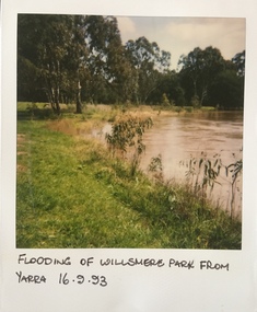
Photograph - Yarra River in flood at the Willsmere Park, 1993
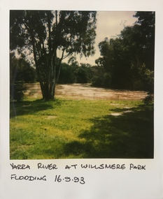
... Golf Club, Willow Grove and the Eastern Freeway. The land on which the park is now situated was bought by Thomas Wills at the Crown Land Sales of 1846 (Section 56). From the 1840s to the 1940s it was intensively farmed. The park is dominated by very large playing fields, while planting to the southern...Golf Club, Willow Grove and the Eastern Freeway. The land on which the park is now situated was bought by Thomas Wills at the Crown Land Sales of 1846 (Section 56). From the 1840s to the 1940s it was intensively farmed. The park is dominated by very large playing fields, while planting to the southern ...Willsmere Park is bounded by the the Yarra River, Green Acres Golf Club, Willow Grove and the Eastern Freeway. The land on which the park is now situated was bought by Thomas Wills at the Crown Land Sales of 1846 (Section 56). From the 1840s to the 1940s it was intensively farmed. The park is dominated by very large playing fields, while planting to the southern boundary was undertaken when the Eastern Freeway was built. It is only along the banks of the Yarra that there is any remnant native vegetation. Willsmere Park is of significance as an area of open land that remains from the flood plain that once dominated northern Kew. (Source: Kew Conservation Study, 1988)Original colour small format polaroid photograph of the Yarra River in flood at the Willsmere Park, taken on 16 September 1993."Yarra River at Willsmere Park Flooding 16.9.93"willsmere park, yarra river -- floods -- kew (vic.) -
 Kew Historical Society Inc
Photograph - Flooding in the Willsmere Park, 1993
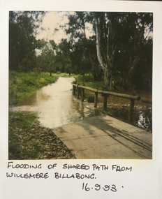
... Golf Club, Willow Grove and the Eastern Freeway. The land on which the park is now situated was bought by Thomas Wills at the Crown Land Sales of 1846 (Section 56). From the 1840s to the 1940s it was intensively farmed. The park is dominated by very large playing fields, while planting to the southern...Golf Club, Willow Grove and the Eastern Freeway. The land on which the park is now situated was bought by Thomas Wills at the Crown Land Sales of 1846 (Section 56). From the 1840s to the 1940s it was intensively farmed. The park is dominated by very large playing fields, while planting to the southern ...Willsmere Park is bounded by the the Yarra River, Green Acres Golf Club, Willow Grove and the Eastern Freeway. The land on which the park is now situated was bought by Thomas Wills at the Crown Land Sales of 1846 (Section 56). From the 1840s to the 1940s it was intensively farmed. The park is dominated by very large playing fields, while planting to the southern boundary was undertaken when the Eastern Freeway was built. It is only along the banks of the Yarra that there is any remnant native vegetation. Willsmere Park is of significance as an area of open land that remains from the flood plain that once dominated northern Kew. (Source: Kew Conservation Study, 1988)Original colour small format polaroid photograph of flooding in the Willsmere Park, taken on 16 September 1993."Flooding of shared path from Willsmere Billabong 16.9.93"willsmere park, yarra river -- floods -- kew (vic.), kew billabong -
 Kew Historical Society Inc
Photograph - Flooding in the Willsmere Park, 1993
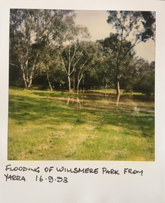
... Golf Club, Willow Grove and the Eastern Freeway. The land on which the park is now situated was bought by Thomas Wills at the Crown Land Sales of 1846 (Section 56). From the 1840s to the 1940s it was intensively farmed. The park is dominated by very large playing fields, while planting to the southern...Golf Club, Willow Grove and the Eastern Freeway. The land on which the park is now situated was bought by Thomas Wills at the Crown Land Sales of 1846 (Section 56). From the 1840s to the 1940s it was intensively farmed. The park is dominated by very large playing fields, while planting to the southern ...Willsmere Park is bounded by the the Yarra River, Green Acres Golf Club, Willow Grove and the Eastern Freeway. The land on which the park is now situated was bought by Thomas Wills at the Crown Land Sales of 1846 (Section 56). From the 1840s to the 1940s it was intensively farmed. The park is dominated by very large playing fields, while planting to the southern boundary was undertaken when the Eastern Freeway was built. It is only along the banks of the Yarra that there is any remnant native vegetation. Willsmere Park is of significance as an area of open land that remains from the flood plain that once dominated northern Kew. (Source: Kew Conservation Study, 1988)Original colour small format polaroid photograph of flooding in the Willsmere Park, taken on 16 September 1993."Flooding of Willsmere Park from Yarra 16.9.93"willsmere park, yarra river -- floods -- kew (vic.) -
 Kew Historical Society Inc
Photograph - Flooding of Willsmere Park from Yarra, 1993
... Golf Club, Willow Grove and the Eastern Freeway. The land on which the park is now situated was bought by Thomas Wills at the Crown Land Sales of 1846 (Section 56). From the 1840s to the 1940s it was intensively farmed. The park is dominated by very large playing fields, while planting to the southern...Golf Club, Willow Grove and the Eastern Freeway. The land on which the park is now situated was bought by Thomas Wills at the Crown Land Sales of 1846 (Section 56). From the 1840s to the 1940s it was intensively farmed. The park is dominated by very large playing fields, while planting to the southern ...Willsmere Park is bounded by the the Yarra River, Green Acres Golf Club, Willow Grove and the Eastern Freeway. The land on which the park is now situated was bought by Thomas Wills at the Crown Land Sales of 1846 (Section 56). From the 1840s to the 1940s it was intensively farmed. The park is dominated by very large playing fields, while planting to the southern boundary was undertaken when the Eastern Freeway was built. It is only along the banks of the Yarra that there is any remnant native vegetation. Willsmere Park is of significance as an area of open land that remains from the flood plain that once dominated northern Kew. (Source: Kew Conservation Study, 1988)Original colour small format polaroid photograph of flooding in Willsmere Park resulting from heavy rain on 15 September 1993."Flooding of Willsmere Park from Yarra 16.9.93"yarra river -- floods -- kew (vic.), willsmere park -
 Kew Historical Society Inc
Photograph - Willsmere [Kew] Billabong, 1993
... Golf Club, Willow Grove and the Eastern Freeway. The land on which the park is now situated was bought by Thomas Wills at the Crown Land Sales of 1846 (Section 56). From the 1840s to the 1940s it was intensively farmed. The park is dominated by very large playing fields, while planting to the southern...Golf Club, Willow Grove and the Eastern Freeway. The land on which the park is now situated was bought by Thomas Wills at the Crown Land Sales of 1846 (Section 56). From the 1840s to the 1940s it was intensively farmed. The park is dominated by very large playing fields, while planting to the southern ...Willsmere Park is bounded by the the Yarra River, Green Acres Golf Club, Willow Grove and the Eastern Freeway. The land on which the park is now situated was bought by Thomas Wills at the Crown Land Sales of 1846 (Section 56). From the 1840s to the 1940s it was intensively farmed. The park is dominated by very large playing fields, while planting to the southern boundary was undertaken when the Eastern Freeway was built. It is only along the banks of the Yarra that there is any remnant native vegetation. Willsmere Park is of significance as an area of open land that remains from the flood plain that once dominated northern Kew. (Source: Kew Conservation Study, 1988)Original colour small format polaroid photograph of Willsmere [Kew] Billabong on September 1993."Willsmere Billabong 16.9.93"yarra river -- floods -- kew (vic.), willsmere park -
 City of Kingston
Photograph - Colour, 29 January 1993
... southern section of neighbouring Chelsea within the City of Kingston. The extent of this 1993 aerial image includes: Top left - Maury Road at the south end of the Chelsea shopping Centre; Top right - Scotch Parade Chelsea Bottom left - Monica Avenue in Bonbeach; Bottom right - Patterson River Golf Club. ...southern section of neighbouring Chelsea within the City of Kingston. The extent of this 1993 aerial image includes: Top left - Maury Road at the south end of the Chelsea shopping Centre; Top right - Scotch Parade Chelsea Bottom left - Monica Avenue in Bonbeach; Bottom right - Patterson River Golf Club. ...Bonbeach is a small beachside suburb located between Chelsea and Carrum. The station was opened in 1926 and was the last to be established in the group from Aspendale to Carrum. Urban growth began after World War II. State primary and high schools were opened in 1958 on land in Breeze Street that was once occupied by The Australian Glass Manufacturers. Immediately east of the school sites is the Patterson River Golf Club. The Bonbeach sports reserve has five ovals and is home to the Bonbeach football and baseball clubs. The suburb borders the Edithvale-Seaford Wetlands which is the remnant site of the Carrum Carrum swamp, once the home of the Bunurong people.Bonbeach was originally a seaside destination for holidaymakers and the housing comprised of holiday homes and gradually more permanent residents. It was not until 1926 that Bonbeach had its own railway station. From 1906 until the late 1940s sand was quarried on the east side of the railway line and used in the manufacture of glass. The Australian Glass Manufacturers sold this land in residential blocks and Bonbeach's permanent population spread from the coastal strip across to the other side of the railway line. Laminated colour aerial photograph of the suburb of Bonbeach and also the southern section of neighbouring Chelsea within the City of Kingston. The extent of this 1993 aerial image includes: Top left - Maury Road at the south end of the Chelsea shopping Centre; Top right - Scotch Parade Chelsea Bottom left - Monica Avenue in Bonbeach; Bottom right - Patterson River Golf Club. Landmarks include St Joseph's Church and Primary School, Chelsea Primary School, Bonbeach Station, Bonbeach Fotball Club sports playing fields and Bonbeach Life Saving Club. The Edithvale Wetlands is featured prominently to the right-hand side of the image. Black typed writing on white adhesive label: No. 6662 Black typed writing on white adhesive label: 26E/6662, 29/1/93, 4.25 pm Black typed writing on white adhesive label: 29-1-93 Black typed writing on white adhesive label: P000109 Circular yellow adhesive sticker bonbeach, chelsea -
Bendigo Historical Society Inc.
Plan - United Ulster Gold Mining Company
... Club, in between the South Deborah Gold Mine and the Great Southern Mine. All situated near Honeybone Street. 'The Cosmopolitan, Garden Gully Railway Reserve, Ulster and South Ulster Company have decided to amalgamate as the United Ulster Company. The length of the United Ulster Company will be about 400 yards' (Bendigo Advertiser, 13 January, 1881, p3) gold mining gold Ulster United Gold Mine United Ulster G.M. Quarry Hill Golf ...United Ulster Gold Mining Company: located in Quarry Hill on the now existing Quarry Hill Gold Club, in between the South Deborah Gold Mine and the Great Southern Mine. All situated near Honeybone Street. 'The Cosmopolitan, Garden Gully Railway Reserve, Ulster and South Ulster Company have decided to amalgamate as the United Ulster Company. The length of the United Ulster Company will be about 400 yards' (Bendigo Advertiser, 13 January, 1881, p3)United Ulster Gold Mining Company Plan forms part of the Margaret Roberts Collection.gold mining, gold, ulster united gold mine, united ulster g.m., quarry hill golf club, quarry hill