
Showing 144 items matching "spring plains creek"
-
 Bendigo Historical Society Inc.
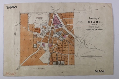
Map - MIAMI ( MIA MIA), 26/06/1906
... ...Spring Plains Creek...The name Miami on the is a misprint MAP Dalhousie township Mia Mia Spring Plains Creek Map: Township of Miami (Mia Mia), Parish of Spring Plains, County of Dalhousie Map MIAMI ( MIA MIA) ...The name Miami on the is a misprint Map: Township of Miami (Mia Mia), Parish of Spring Plains, County of Dalhousiemap, dalhousie, township, mia mia, spring plains creek -
 Federation University Historical Collection
Book, Stanley B. Hunter, Memoirs of the Geological Survey of Victoria No 7., The Deep Leads of Victoria, 1909
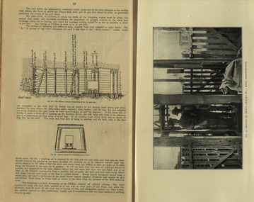
... Contents include tunnelling, deep sinking, the Chiltern Method, the Ballarat Method, Stawell, Ararat, Moyston, Raglan, Wimmera, Landsborough, Avoca, Ballarat West Leads, Berry-Moolort-Loddon Lead System, Clunes, Creswick, Bullarook Affluent, Corinella, Daylesford-Castlemaine Tributary, Majorca-Carisbrook tributary, Huntly, Coliban, Campaspe, Rutherglen., Smythesdale, Durham Lead, Tanjil, Evolution of Mining Machinery, size of claims, Definition of a Deep Lead, Discovery of Gold in Victoria, Geographical Position of Deep Leads, Water in Deep Leads, Methods of Deep Lead Mining, Cost of Deep Lead Mining, Stawell, Ararat, Moyston, Raglan, Wimmera, Landsborough, Avoca, Ballarat West, Berry, Springs Hill, Loddon Valley, Charlotte Plains, , Timor, Burn Creek, Huntly, Colinan, Goulburn, Ovens Valley, Chiltern, Indigo, Morrison's Lead, Plans include: geological Map of Stawell, ararat, Raglan and Landsborough; Kempson's Freehold Mine, Stawell; Geological Map of Beaufort, Avoca, Maryborough, Ballarat west, Berry-Moolort, Loddon, Creswick, Marong, &c; Cardigan Propriety Gold Mine; Working Miners United Gold Mine, Homebush; Hepburn Deep Lead Plan; Madame Berry West Mine; West Berry Consols Mine; Spring Hill and Central Leads; Berry Consols Extended Mine; Loddon Valley Goldfields; Chalk's No 3 Mine; Charlotte Plains Considated Mine; Duke United Mine; Geological Map of Bendigo, Huntley, Campaspe, Malmsbury, Kyneton, trentham, &c; Geological Map of Chiltern, Rutherglan, Eldorado, Beechworth, &c; Chiltern Valley Gold Mine; Wallace Chiltern Valley Consols Mine; great Southern and Chiltern Valley United Mine; great Northern extended Consols; Prentice and Southern deep Leads; Glenfine South Gold Mine; Geological map of Pitfield, Rokewood, Mt Mercer, Ballark, Meredith, &c.; McEvoy Mine; Dargo . . . . . . . . . . . . . . . . . . . . . . . ...Contents include tunnelling, deep sinking, the Chiltern Method, the Ballarat Method, Stawell, Ararat, Moyston, Raglan, Wimmera, Landsborough, Avoca, Ballarat West Leads, Berry-Moolort-Loddon Lead System, Clunes, Creswick, Bullarook Affluent, Corinella, Daylesford-Castlemaine Tributary, Majorca-Carisbrook tributary, Huntly, Coliban, Campaspe, Rutherglen., Smythesdale, Durham Lead, Tanjil, Evolution of Mining Machinery, size of claims, Definition of a Deep Lead, Discovery of Gold in Victoria, Geographical Position of Deep Leads, Water in Deep Leads, Methods of Deep Lead Mining, Cost of Deep Lead Mining, Stawell, Ararat, Moyston, Raglan, Wimmera, Landsborough, Avoca, Ballarat West, Berry, Springs Hill, Loddon Valley, Charlotte Plains, , Timor, Burn Creek, Huntly, Colinan, Goulburn, Ovens Valley, Chiltern, Indigo, Morrison's Lead, Plans include: geological Map of Stawell, ararat, Raglan and Landsborough; Kempson's Freehold Mine, Stawell; Geological Map of Beaufort, Avoca, Maryborough, Ballarat west, Berry-Moolort, Loddon, Creswick, Marong, &c; Cardigan Propriety Gold Mine; Working Miners United Gold Mine, Homebush; Hepburn Deep Lead Plan; Madame Berry West Mine; West Berry Consols Mine; Spring Hill and Central Leads; Berry Consols Extended Mine; Loddon Valley Goldfields; Chalk's No 3 Mine; Charlotte Plains Considated Mine; Duke United Mine; Geological Map of Bendigo, Huntley, Campaspe, Malmsbury, Kyneton, trentham, &c; Geological Map of Chiltern, Rutherglan, Eldorado, Beechworth, &c; Chiltern Valley Gold Mine; Wallace Chiltern Valley Consols Mine; great Southern and Chiltern Valley United Mine; great Northern extended Consols; Prentice and Southern deep Leads; Glenfine South Gold Mine; Geological map of Pitfield, Rokewood, Mt Mercer, Ballark, Meredith, &c.; McEvoy Mine; Dargo . . . . . . . . . . . . . . . . . . . . . . . ...Pink paper covered book by Stanley Hunter, Engineer in Charge of Boring Operations. Contents include tunnelling, deep sinking, the Chiltern Method, the Ballarat Method, Stawell, Ararat, Moyston, Raglan, Wimmera, Landsborough, Avoca, Ballarat West Leads, Berry-Moolort-Loddon Lead System, Clunes, Creswick, Bullarook Affluent, Corinella, Daylesford-Castlemaine Tributary, Majorca-Carisbrook tributary, Huntly, Coliban, Campaspe, Rutherglen., Smythesdale, Durham Lead, Tanjil, Evolution of Mining Machinery, size of claims, Definition of a Deep Lead, Discovery of Gold in Victoria, Geographical Position of Deep Leads, Water in Deep Leads, Methods of Deep Lead Mining, Cost of Deep Lead Mining, Stawell, Ararat, Moyston, Raglan, Wimmera, Landsborough, Avoca, Ballarat West, Berry, Springs Hill, Loddon Valley, Charlotte Plains, , Timor, Burn Creek, Huntly, Colinan, Goulburn, Ovens Valley, Chiltern, Indigo, Morrison's Lead, Plans include: geological Map of Stawell, ararat, Raglan and Landsborough; Kempson's Freehold Mine, Stawell; Geological Map of Beaufort, Avoca, Maryborough, Ballarat west, Berry-Moolort, Loddon, Creswick, Marong, &c; Cardigan Propriety Gold Mine; Working Miners United Gold Mine, Homebush; Hepburn Deep Lead Plan; Madame Berry West Mine; West Berry Consols Mine; Spring Hill and Central Leads; Berry Consols Extended Mine; Loddon Valley Goldfields; Chalk's No 3 Mine; Charlotte Plains Considated Mine; Duke United Mine; Geological Map of Bendigo, Huntley, Campaspe, Malmsbury, Kyneton, trentham, &c; Geological Map of Chiltern, Rutherglan, Eldorado, Beechworth, &c; Chiltern Valley Gold Mine; Wallace Chiltern Valley Consols Mine; great Southern and Chiltern Valley United Mine; great Northern extended Consols; Prentice and Southern deep Leads; Glenfine South Gold Mine; Geological map of Pitfield, Rokewood, Mt Mercer, Ballark, Meredith, &c.; McEvoy Mine; Dargo . . . . . . . . . . . . . . . . . . . . . . . mining, deep leads, squire, tools, gold panning, gold cradle, cradling, puddling, tubbing, mining shaft, shaft sinking, whip, horse whip, whim, horse whim, chalk's no. 1 mine, maryborough, mining cage, shaft, mining trucks, maryborough, washdirt, puddler, tunnelling, deep sinking, chiltern method of working, ballarat method of working, sampling washdirt. gravels, balmoral, mt william, stawell, moyston, great western, ararat, raglan, wimmera valley, landsborough, cardigan, haddon, beaufort, waterloo, avoca, lamplough, caralulup, ballarat west, ballarat, smythesdale, glenfine, illabarook, durham lead, morrison's lead, bullengarook, berry-moolort-loddon system, clunes, creswick, spring hill, bullarook, castlemaine - daylesford, majorca, carisbrook, timor, burnt creek tributary, tarnagulla, marong, rheola, inglewood, huntly, coliban, campaspe, goulburn lead system, ovens valley system, mitta mitta, kiewa valley, tarago, tanjil, moondarra, bogong, dargo high plains -
 Federation University Historical Collection
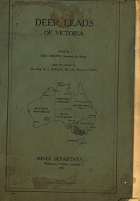
Book, Mines Department, Victoria, Deep Leads of Victoria, 1937, 1937
... Contents include Ballarat, berry Consols, Canadian Lead, Castlemaine-Daylesford System, Chiltern, Duke of Cornwall Mine, Dyke's Freehold, Frenchman's Lead, Garibaldi Shaft, Glenfine, Guidlford, Hepburn Estate Co., Hepburn Home Paddock, Italian Gully, Henderson's Lead, Langi Logan, Leigh Consols, Sebastopol Plateau; Talbot, Woady Yalloak, A definition of a deep lead, formation of deep leads, water in deep leads, methods of deep lead mining (Tunnelling, Deep sinking, Chiltern method of working, Ballarat method of working), sampling washdirt and gravels, Balmoral, Mt William, Stawell, Moyston, Great Western, Ararat, Raglan, Wimmera Valley, Landsborough, Cardigan, Haddon, Beaufort, Waterloo, Avoca, Lamplough, Caralulup, Ballarat West, Ballarat, Smythesdale, Glenfine, Illabarook, Durham Lead, Morrison's Lead, Bullengarook, Berry-Moolort-Loddon System, Clunes, Creswick, Spring Hill, Bullarook, Castlemaine - Daylesford, Majorca, Carisbrook, Timor, Burnt Creek Tributary, Tarnagulla, Marong, Rheola, Inglewood, Huntly, Coliban, Campaspe, Goulburn Lead System, Ovens Valley System, Mitta Mitts, Kiewa Valley, Tarago, Tanjil, Moondarra, Bogong, Dargo High Plains, glossary...mining deep leads mines department squire leigh consols chiltern duke of cornwall mine dyke's freehold frenchman's lead garibaldi shaft glenfine guidlford hepburn estate co. hepburn home paddock italian gully henderson's lead langi logan sebastopol plateau talbot woady yalloak tunnelling deep sinking chiltern method of working ballarat method of working sampling washdirt. gravels balmoral mt william stawell moyston great western ararat raglan wimmera valley landsborough cardigan haddon beaufort waterloo avoca lamplough caralulup ballarat west ballarat smythesdale illabarook durham lead morrison's lead bullengarook berry-moolort-loddon system clunes creswick spring hill bullarook castlemaine - daylesford majorca carisbrook timor burnt creek tributary tarnagulla marong rheola inglewood huntly coliban campaspe goulburn lead system ovens valley system mitta mitta kiewa valley tarago tanjil moondarra bogong dargo high plains Charcoal green soft covered book of 64 pages. ...Charcoal green soft covered book of 64 pages. Contents include Ballarat, berry Consols, Canadian Lead, Castlemaine-Daylesford System, Chiltern, Duke of Cornwall Mine, Dyke's Freehold, Frenchman's Lead, Garibaldi Shaft, Glenfine, Guidlford, Hepburn Estate Co., Hepburn Home Paddock, Italian Gully, Henderson's Lead, Langi Logan, Leigh Consols, Sebastopol Plateau; Talbot, Woady Yalloak, A definition of a deep lead, formation of deep leads, water in deep leads, methods of deep lead mining (Tunnelling, Deep sinking, Chiltern method of working, Ballarat method of working), sampling washdirt and gravels, Balmoral, Mt William, Stawell, Moyston, Great Western, Ararat, Raglan, Wimmera Valley, Landsborough, Cardigan, Haddon, Beaufort, Waterloo, Avoca, Lamplough, Caralulup, Ballarat West, Ballarat, Smythesdale, Glenfine, Illabarook, Durham Lead, Morrison's Lead, Bullengarook, Berry-Moolort-Loddon System, Clunes, Creswick, Spring Hill, Bullarook, Castlemaine - Daylesford, Majorca, Carisbrook, Timor, Burnt Creek Tributary, Tarnagulla, Marong, Rheola, Inglewood, Huntly, Coliban, Campaspe, Goulburn Lead System, Ovens Valley System, Mitta Mitts, Kiewa Valley, Tarago, Tanjil, Moondarra, Bogong, Dargo High Plains, glossarymining, deep leads, mines department, squire, leigh consols, chiltern, duke of cornwall mine, dyke's freehold, frenchman's lead, garibaldi shaft, glenfine, guidlford, hepburn estate co., hepburn home paddock, italian gully, henderson's lead, langi logan, sebastopol plateau, talbot, woady yalloak, tunnelling, deep sinking, chiltern method of working, ballarat method of working, sampling washdirt. gravels, balmoral, mt william, stawell, moyston, great western, ararat, raglan, wimmera valley, landsborough, cardigan, haddon, beaufort, waterloo, avoca, lamplough, caralulup, ballarat west, ballarat, smythesdale, illabarook, durham lead, morrison's lead, bullengarook, berry-moolort-loddon system, clunes, creswick, spring hill, bullarook, castlemaine - daylesford, majorca, carisbrook, timor, burnt creek tributary, tarnagulla, marong, rheola, inglewood, huntly, coliban, campaspe, goulburn lead system, ovens valley system, mitta mitta, kiewa valley, tarago, tanjil, moondarra, bogong, dargo high plains -
 Federation University Historical Collection
Reports, Big Cats Sightings and Stock Kills 2000-2011, 2000-2011
... The folder was collected for research being conducted by David Waldron. australian mythical animals collection david waldron Department of Primary Industries rangers peter walsh Warragul creek Binginwarri Coongulla Straford Licola Blanket Hill Darramin Blanket Hill Woodside BEach heyfield puma panther cowwarr glenmaggie bolands bluff darrimen bolands bluff binginnwarri dawson the springs mt taylor black range driffield west Snowy plains airstrip glenmaggie north jack smith lake munro briagaling dutson downs connors plain giffard west darriment Joyces Road Junction Giffard West wallaby creek south Gippsland Highway avon river orbost four mile creek Folder of reports of Big Cat by rangers. ...The folder or correspondence is the result of a Freedom of Informaition request made to the Department of Primary Industries in 2011. The folder was collected for research being conducted by David Waldron.Folder of reports of Big Cat by rangers. australian mythical animals collection, david waldron, department of primary industries, rangers, peter walsh, warragul creek, binginwarri, coongulla, straford, licola, blanket hill, darramin, blanket hill, woodside beach, heyfield, puma, panther, cowwarr, glenmaggie, bolands bluff, darrimen, bolands bluff, binginnwarri, dawson, the springs, mt taylor, black range, driffield west, snowy plains airstrip, glenmaggie north, jack smith lake, munro, briagaling, dutson downs, connors plain, giffard west, darriment, joyces road junction, giffard west, wallaby creek, south gippsland highway, avon river, orbost, four mile creek -
 Eltham District Historical Society Inc
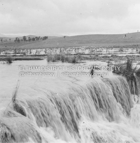
Album - Photograph, J.A. McDonald, Eltham-Yarra Glen Road, 19 Oct. 1956
... Creek Road floods Black and white photo print (location of negative unknown) Adhered to a page in an album of 78 foolscap pages containing a sequence of photos, adhered via glue or sticky tape, with typed or handwritten headings and captions in pencil. Originally contained in a green foolscap binder with spring clasp spine for retaining loose pages. Also inserted loose within the binder a number of photo negative/print processing folders containing various loose prints and medium format Kodak 620 6x6 cm black and white negatives as well as plain ...Dixons Creek Road 19th October, 1956 Scour developing back onto road from Smedley’s property near Blease RoadRecord of various Shire of Eltham infrastructure works undertaken during the period of 1952-1962 involving bridge and road reconstruction projects, sometimes with Eltham Shire Council Project Reference numbers quoted. It was during this period that a number of significant improvements were made to roads and new bridges constructed within the shire that remain in place as of present day (2022). In many situations, the photos provide a tangible visible record of infrastructure that existed throughout the early days of the Shire. The album was put together by or under the direction of the Shire Engineer, J.A. McDonald.infrastructure, road construction, shire of eltham, bridge construction, eltham-yarra glen road, 1956-10-19, dixons creek bridge, dixon's creek road, floods -
 Eltham District Historical Society Inc
Album - Photograph, J.A. McDonald, General; Albion Street and Eltham-Yarra Glen Road, Oct. 1955
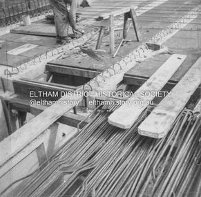
... Creek Black and white photo print (location of negative unknown) Adhered to a page in an album of 78 foolscap pages containing a sequence of photos, adhered via glue or sticky tape, with typed or handwritten headings and captions in pencil. Originally contained in a green foolscap binder with spring clasp spine for retaining loose pages. Also inserted loose within the binder a number of photo negative/print processing folders containing various loose prints and medium format Kodak 620 6x6 cm black and white negatives as well as plain ...General – Country Roads Board Albion Street bridge over Moonee Ponds Creek, Brunswick West Deck Forms October 1955Record of various Shire of Eltham infrastructure works undertaken during the period of 1952-1962 involving bridge and road reconstruction projects, sometimes with Eltham Shire Council Project Reference numbers quoted. It was during this period that a number of significant improvements were made to roads and new bridges constructed within the shire that remain in place as of present day (2022). In many situations, the photos provide a tangible visible record of infrastructure that existed throughout the early days of the Shire. The album was put together by or under the direction of the Shire Engineer, J.A. McDonald.infrastructure, road construction, shire of eltham, 1955-10, albion street, bridge construction, country roads board, benchmark studies, brunswick west, moonee ponds creek -
 Eltham District Historical Society Inc
Album - Photograph, J.A. McDonald, General; Albion Street and Eltham-Yarra Glen Road, Oct. 1955
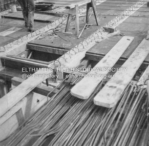
... Creek Black and white photo print (location of negative unknown) Adhered to a page in an album of 78 foolscap pages containing a sequence of photos, adhered via glue or sticky tape, with typed or handwritten headings and captions in pencil. Originally contained in a green foolscap binder with spring clasp spine for retaining loose pages. Also inserted loose within the binder a number of photo negative/print processing folders containing various loose prints and medium format Kodak 620 6x6 cm black and white negatives as well as plain ...General – Country Roads Board Albion Street bridge over Moonee Ponds Creek, Brunswick West Deck Forms October 1955Record of various Shire of Eltham infrastructure works undertaken during the period of 1952-1962 involving bridge and road reconstruction projects, sometimes with Eltham Shire Council Project Reference numbers quoted. It was during this period that a number of significant improvements were made to roads and new bridges constructed within the shire that remain in place as of present day (2022). In many situations, the photos provide a tangible visible record of infrastructure that existed throughout the early days of the Shire. The album was put together by or under the direction of the Shire Engineer, J.A. McDonald.infrastructure, road construction, shire of eltham, 1955-10, albion street, bridge construction, country roads board, benchmark studies, brunswick west, moonee ponds creek -
 Eltham District Historical Society Inc
Album - Photograph, J.A. McDonald, General; Albion Street and Eltham-Yarra Glen Road, Oct. 1955
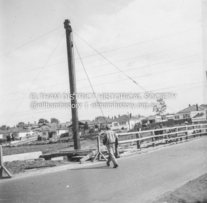
... Creek Black and white photo print (location of negative unknown) Adhered to a page in an album of 78 foolscap pages containing a sequence of photos, adhered via glue or sticky tape, with typed or handwritten headings and captions in pencil. Originally contained in a green foolscap binder with spring clasp spine for retaining loose pages. Also inserted loose within the binder a number of photo negative/print processing folders containing various loose prints and medium format Kodak 620 6x6 cm black and white negatives as well as plain ...General – Country Roads Board Albion Street bridge over Moonee Ponds Creek, Brunswick West Derrick for launching beams October 1955Record of various Shire of Eltham infrastructure works undertaken during the period of 1952-1962 involving bridge and road reconstruction projects, sometimes with Eltham Shire Council Project Reference numbers quoted. It was during this period that a number of significant improvements were made to roads and new bridges constructed within the shire that remain in place as of present day (2022). In many situations, the photos provide a tangible visible record of infrastructure that existed throughout the early days of the Shire. The album was put together by or under the direction of the Shire Engineer, J.A. McDonald.infrastructure, road construction, shire of eltham, 1955-10, albion street, bridge construction, country roads board, benchmark studies, brunswick west, moonee ponds creek -
 Eltham District Historical Society Inc
Album - Photograph, J.A. McDonald, Heidelberg-Kinglake Road, 18 Oct. 1956
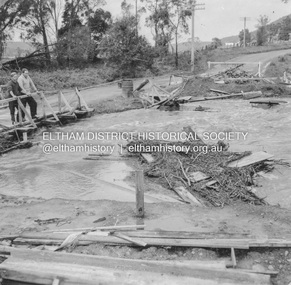
... Infrastructure shire of eltham bridge construction Heidelberg-Kinglake Road Road construction 1956-10-18 Flood damage floods Floodwater Jehosophat Creek Yarra Glen-Glenburn Road Black and white photo print (location of negative unknown) Adhered to a page in an album of 78 foolscap pages containing a sequence of photos, adhered via glue or sticky tape, with typed or handwritten headings and captions in pencil. Originally contained in a green foolscap binder with spring clasp spine for retaining loose pages. Also inserted loose within the binder a number of photo negative/print processing folders containing various loose prints and medium format Kodak 620 6x6 cm black and white negatives as well as plain ...Yarra Glen-Glenburn Road Jehosophat Creek 18th October 1956Record of various Shire of Eltham infrastructure works undertaken during the period of 1952-1962 involving bridge and road reconstruction projects, sometimes with Eltham Shire Council Project Reference numbers quoted. It was during this period that a number of significant improvements were made to roads and new bridges constructed within the shire that remain in place as of present day (2022). In many situations, the photos provide a tangible visible record of infrastructure that existed throughout the early days of the Shire. The album was put together by or under the direction of the Shire Engineer, J.A. McDonald.infrastructure, shire of eltham, bridge construction, heidelberg-kinglake road, road construction, 1956-10-18, flood damage, floods, floodwater, jehosophat creek, yarra glen-glenburn road -
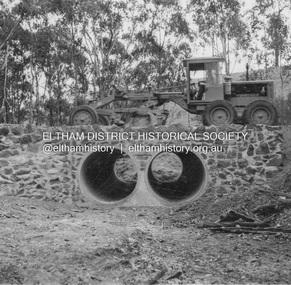 Eltham District Historical Society Inc
Album - Photograph, J.A. McDonald, Heidelberg-Kinglake Road, May 1957
... creek Black and white photo print (location of negative unknown) Adhered to a page in an album of 78 foolscap pages containing a sequence of photos, adhered via glue or sticky tape, with typed or handwritten headings and captions in pencil. Originally contained in a green foolscap binder with spring clasp spine for retaining loose pages. Also inserted loose within the binder a number of photo negative/print processing folders containing various loose prints and medium format Kodak 620 6x6 cm black and white negatives as well as plain ...Wild Dog Creek (Day Labour) 56M346 Two rows 6’0” pipe May 1957 Showing culvert and stone wallsRecord of various Shire of Eltham infrastructure works undertaken during the period of 1952-1962 involving bridge and road reconstruction projects, sometimes with Eltham Shire Council Project Reference numbers quoted. It was during this period that a number of significant improvements were made to roads and new bridges constructed within the shire that remain in place as of present day (2022). In many situations, the photos provide a tangible visible record of infrastructure that existed throughout the early days of the Shire. The album was put together by or under the direction of the Shire Engineer, J.A. McDonald.infrastructure, shire of eltham, bridge construction, heidelberg-kinglake road, road construction, 1957-05, wild dog creek -
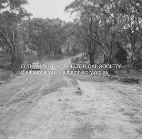 Eltham District Historical Society Inc
Album - Photograph, J.A. McDonald, Heidelberg-Kinglake Road, May 1957
... creek Black and white photo print (location of negative unknown) Adhered to a page in an album of 78 foolscap pages containing a sequence of photos, adhered via glue or sticky tape, with typed or handwritten headings and captions in pencil. Originally contained in a green foolscap binder with spring clasp spine for retaining loose pages. Also inserted loose within the binder a number of photo negative/print processing folders containing various loose prints and medium format Kodak 620 6x6 cm black and white negatives as well as plain ...Wild Dog Creek (Day Labour) 56M346 Two rows 6’0” pipe May 1957 Showing culvert and stone wallsRecord of various Shire of Eltham infrastructure works undertaken during the period of 1952-1962 involving bridge and road reconstruction projects, sometimes with Eltham Shire Council Project Reference numbers quoted. It was during this period that a number of significant improvements were made to roads and new bridges constructed within the shire that remain in place as of present day (2022). In many situations, the photos provide a tangible visible record of infrastructure that existed throughout the early days of the Shire. The album was put together by or under the direction of the Shire Engineer, J.A. McDonald.infrastructure, shire of eltham, bridge construction, heidelberg-kinglake road, road construction, 1957-05, wild dog creek -
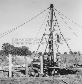 Eltham District Historical Society Inc
Album - Photograph, J.A. McDonald, Old Healesville Road, Sep. 1958
... Creek Road 1958-09 Black and white photo print (location of negative unknown) Adhered to a page in an album of 78 foolscap pages containing a sequence of photos, adhered via glue or sticky tape, with typed or handwritten headings and captions in pencil. Originally contained in a green foolscap binder with spring clasp spine for retaining loose pages. Also inserted loose within the binder a number of photo negative/print processing folders containing various loose prints and medium format Kodak 620 6x6 cm black and white negatives as well as plain ...Paul Creek Road September 1958 Showing west abutmentRecord of various Shire of Eltham infrastructure works undertaken during the period of 1952-1962 involving bridge and road reconstruction projects, sometimes with Eltham Shire Council Project Reference numbers quoted. It was during this period that a number of significant improvements were made to roads and new bridges constructed within the shire that remain in place as of present day (2022). In many situations, the photos provide a tangible visible record of infrastructure that existed throughout the early days of the Shire. The album was put together by or under the direction of the Shire Engineer, J.A. McDonald.infrastructure, shire of eltham, bridge construction, road construction, old healesville road, paul creek road, 1958-09 -
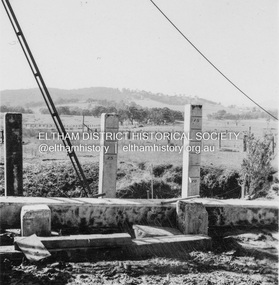 Eltham District Historical Society Inc
Album - Photograph, J.A. McDonald, Old Healesville Road, Sep. 1958
... Creek Road 1958-09 Black and white photo print (location of negative unknown) Adhered to a page in an album of 78 foolscap pages containing a sequence of photos, adhered via glue or sticky tape, with typed or handwritten headings and captions in pencil. Originally contained in a green foolscap binder with spring clasp spine for retaining loose pages. Also inserted loose within the binder a number of photo negative/print processing folders containing various loose prints and medium format Kodak 620 6x6 cm black and white negatives as well as plain ...Paul Creek Road September 1958 Looking eastRecord of various Shire of Eltham infrastructure works undertaken during the period of 1952-1962 involving bridge and road reconstruction projects, sometimes with Eltham Shire Council Project Reference numbers quoted. It was during this period that a number of significant improvements were made to roads and new bridges constructed within the shire that remain in place as of present day (2022). In many situations, the photos provide a tangible visible record of infrastructure that existed throughout the early days of the Shire. The album was put together by or under the direction of the Shire Engineer, J.A. McDonald.infrastructure, shire of eltham, bridge construction, road construction, old healesville road, paul creek road, 1958-09 -
 Eltham District Historical Society Inc
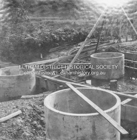
Album - Photograph, J.A. McDonald, Yarra Glen-Glenburn Road, Nov. 1956
... Infrastructure shire of eltham 1956-03 bridge construction Jehosophat Creek Road construction Yarra Glen-Glenburn Road Black and white photo print (location of negative unknown) Adhered to a page in an album of 78 foolscap pages containing a sequence of photos, adhered via glue or sticky tape, with typed or handwritten headings and captions in pencil. Originally contained in a green foolscap binder with spring clasp spine for retaining loose pages. Also inserted loose within the binder a number of photo negative/print processing folders containing various loose prints and medium format Kodak 620 6x6 cm black and white negatives as well as plain ...Cylinder foundation – Jehosophat Creek Showing flume – March 1956Record of various Shire of Eltham infrastructure works undertaken during the period of 1952-1962 involving bridge and road reconstruction projects, sometimes with Eltham Shire Council Project Reference numbers quoted. It was during this period that a number of significant improvements were made to roads and new bridges constructed within the shire that remain in place as of present day (2022). In many situations, the photos provide a tangible visible record of infrastructure that existed throughout the early days of the Shire. The album was put together by or under the direction of the Shire Engineer, J.A. McDonald.infrastructure, shire of eltham, 1956-03, bridge construction, jehosophat creek, road construction, yarra glen-glenburn road -
 Eltham District Historical Society Inc
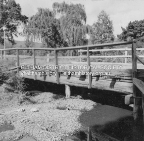
Album - Photograph, J.A. McDonald, Yarra Glen-Glenburn Road, Jan. 1956
... Infrastructure shire of eltham bridge construction Jehosophat Creek Road construction Yarra Glen-Glenburn Road 1956-01 Black and white photo print (location of negative unknown) Adhered to a page in an album of 78 foolscap pages containing a sequence of photos, adhered via glue or sticky tape, with typed or handwritten headings and captions in pencil. Originally contained in a green foolscap binder with spring clasp spine for retaining loose pages. Also inserted loose within the binder a number of photo negative/print processing folders containing various loose prints and medium format Kodak 620 6x6 cm black and white negatives as well as plain ...Jehosphat Creek old bridge January 1956Record of various Shire of Eltham infrastructure works undertaken during the period of 1952-1962 involving bridge and road reconstruction projects, sometimes with Eltham Shire Council Project Reference numbers quoted. It was during this period that a number of significant improvements were made to roads and new bridges constructed within the shire that remain in place as of present day (2022). In many situations, the photos provide a tangible visible record of infrastructure that existed throughout the early days of the Shire. The album was put together by or under the direction of the Shire Engineer, J.A. McDonald.infrastructure, shire of eltham, bridge construction, jehosophat creek, road construction, yarra glen-glenburn road, 1956-01 -
 Eltham District Historical Society Inc
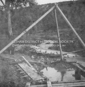
Album - Photograph, J.A. McDonald, Yarra Glen-Glenburn Road, Apr. 1956
... Infrastructure shire of eltham bridge construction Jehosophat Creek Road construction Yarra Glen-Glenburn Road 1956-04 Black and white photo print (location of negative unknown) Adhered to a page in an album of 78 foolscap pages containing a sequence of photos, adhered via glue or sticky tape, with typed or handwritten headings and captions in pencil. Originally contained in a green foolscap binder with spring clasp spine for retaining loose pages. Also inserted loose within the binder a number of photo negative/print processing folders containing various loose prints and medium format Kodak 620 6x6 cm black and white negatives as well as plain ...Showing first flood debris April 1956Record of various Shire of Eltham infrastructure works undertaken during the period of 1952-1962 involving bridge and road reconstruction projects, sometimes with Eltham Shire Council Project Reference numbers quoted. It was during this period that a number of significant improvements were made to roads and new bridges constructed within the shire that remain in place as of present day (2022). In many situations, the photos provide a tangible visible record of infrastructure that existed throughout the early days of the Shire. The album was put together by or under the direction of the Shire Engineer, J.A. McDonald.infrastructure, shire of eltham, bridge construction, jehosophat creek, road construction, yarra glen-glenburn road, 1956-04 -
 Eltham District Historical Society Inc
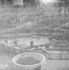
Album - Photograph, J.A. McDonald, Yarra Glen-Glenburn Road, Apr. 1956
... Infrastructure shire of eltham bridge construction Jehosophat Creek Road construction Yarra Glen-Glenburn Road 1956-04 Black and white photo print (location of negative unknown) Adhered to a page in an album of 78 foolscap pages containing a sequence of photos, adhered via glue or sticky tape, with typed or handwritten headings and captions in pencil. Originally contained in a green foolscap binder with spring clasp spine for retaining loose pages. Also inserted loose within the binder a number of photo negative/print processing folders containing various loose prints and medium format Kodak 620 6x6 cm black and white negatives as well as plain ...Showing first flood debris April 1956Record of various Shire of Eltham infrastructure works undertaken during the period of 1952-1962 involving bridge and road reconstruction projects, sometimes with Eltham Shire Council Project Reference numbers quoted. It was during this period that a number of significant improvements were made to roads and new bridges constructed within the shire that remain in place as of present day (2022). In many situations, the photos provide a tangible visible record of infrastructure that existed throughout the early days of the Shire. The album was put together by or under the direction of the Shire Engineer, J.A. McDonald.infrastructure, shire of eltham, bridge construction, jehosophat creek, road construction, yarra glen-glenburn road, 1956-04 -
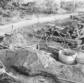 Eltham District Historical Society Inc
Album - Photograph, J.A. McDonald, Yarra Glen-Glenburn Road, 1957
... Infrastructure shire of eltham bridge construction Jehosophat Creek Road construction Yarra Glen-Glenburn Road 1957 Black and white photo print (location of negative unknown) Adhered to a page in an album of 78 foolscap pages containing a sequence of photos, adhered via glue or sticky tape, with typed or handwritten headings and captions in pencil. Originally contained in a green foolscap binder with spring clasp spine for retaining loose pages. Also inserted loose within the binder a number of photo negative/print processing folders containing various loose prints and medium format Kodak 620 6x6 cm black and white negatives as well as plain ...Jehosophat Creek Foundation work – 1957Record of various Shire of Eltham infrastructure works undertaken during the period of 1952-1962 involving bridge and road reconstruction projects, sometimes with Eltham Shire Council Project Reference numbers quoted. It was during this period that a number of significant improvements were made to roads and new bridges constructed within the shire that remain in place as of present day (2022). In many situations, the photos provide a tangible visible record of infrastructure that existed throughout the early days of the Shire. The album was put together by or under the direction of the Shire Engineer, J.A. McDonald.infrastructure, shire of eltham, bridge construction, jehosophat creek, road construction, yarra glen-glenburn road, 1957 -
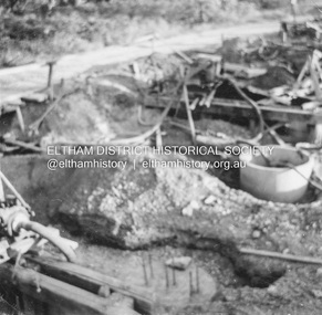 Eltham District Historical Society Inc
Album - Photograph, J.A. McDonald, Yarra Glen-Glenburn Road, 1957
... Infrastructure shire of eltham bridge construction Jehosophat Creek Road construction Yarra Glen-Glenburn Road 1957 Black and white photo print (location of negative unknown) Adhered to a page in an album of 78 foolscap pages containing a sequence of photos, adhered via glue or sticky tape, with typed or handwritten headings and captions in pencil. Originally contained in a green foolscap binder with spring clasp spine for retaining loose pages. Also inserted loose within the binder a number of photo negative/print processing folders containing various loose prints and medium format Kodak 620 6x6 cm black and white negatives as well as plain ...Jehosophat Creek Foundation work – 1957Record of various Shire of Eltham infrastructure works undertaken during the period of 1952-1962 involving bridge and road reconstruction projects, sometimes with Eltham Shire Council Project Reference numbers quoted. It was during this period that a number of significant improvements were made to roads and new bridges constructed within the shire that remain in place as of present day (2022). In many situations, the photos provide a tangible visible record of infrastructure that existed throughout the early days of the Shire. The album was put together by or under the direction of the Shire Engineer, J.A. McDonald.infrastructure, shire of eltham, bridge construction, jehosophat creek, road construction, yarra glen-glenburn road, 1957 -
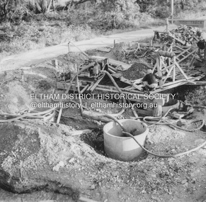 Eltham District Historical Society Inc
Album - Photograph, J.A. McDonald, Yarra Glen-Glenburn Road, 1957
... Infrastructure shire of eltham bridge construction Jehosophat Creek Road construction Yarra Glen-Glenburn Road 1957 Black and white photo print (location of negative unknown) Adhered to a page in an album of 78 foolscap pages containing a sequence of photos, adhered via glue or sticky tape, with typed or handwritten headings and captions in pencil. Originally contained in a green foolscap binder with spring clasp spine for retaining loose pages. Also inserted loose within the binder a number of photo negative/print processing folders containing various loose prints and medium format Kodak 620 6x6 cm black and white negatives as well as plain ...Jehosophat Creek Foundation work – 1957Record of various Shire of Eltham infrastructure works undertaken during the period of 1952-1962 involving bridge and road reconstruction projects, sometimes with Eltham Shire Council Project Reference numbers quoted. It was during this period that a number of significant improvements were made to roads and new bridges constructed within the shire that remain in place as of present day (2022). In many situations, the photos provide a tangible visible record of infrastructure that existed throughout the early days of the Shire. The album was put together by or under the direction of the Shire Engineer, J.A. McDonald.infrastructure, shire of eltham, bridge construction, jehosophat creek, road construction, yarra glen-glenburn road, 1957 -
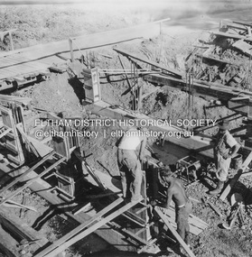 Eltham District Historical Society Inc
Album - Photograph, J.A. McDonald, Yarra Glen-Glenburn Road, 1957
... Infrastructure shire of eltham bridge construction Jehosophat Creek Road construction Yarra Glen-Glenburn Road 1957 Black and white photo print (location of negative unknown) Adhered to a page in an album of 78 foolscap pages containing a sequence of photos, adhered via glue or sticky tape, with typed or handwritten headings and captions in pencil. Originally contained in a green foolscap binder with spring clasp spine for retaining loose pages. Also inserted loose within the binder a number of photo negative/print processing folders containing various loose prints and medium format Kodak 620 6x6 cm black and white negatives as well as plain ...Jehosophat Creek (W. Wolf contractor) – 1957 Pier columns being placedRecord of various Shire of Eltham infrastructure works undertaken during the period of 1952-1962 involving bridge and road reconstruction projects, sometimes with Eltham Shire Council Project Reference numbers quoted. It was during this period that a number of significant improvements were made to roads and new bridges constructed within the shire that remain in place as of present day (2022). In many situations, the photos provide a tangible visible record of infrastructure that existed throughout the early days of the Shire. The album was put together by or under the direction of the Shire Engineer, J.A. McDonald.infrastructure, shire of eltham, bridge construction, jehosophat creek, road construction, yarra glen-glenburn road, 1957 -
 Eltham District Historical Society Inc
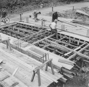
Album - Photograph, J.A. McDonald, Yarra Glen-Glenburn Road, May 1957
... Infrastructure shire of eltham bridge construction Jehosophat Creek Road construction Yarra Glen-Glenburn Road 1957-05 Black and white photo print (location of negative unknown) Adhered to a page in an album of 78 foolscap pages containing a sequence of photos, adhered via glue or sticky tape, with typed or handwritten headings and captions in pencil. Originally contained in a green foolscap binder with spring clasp spine for retaining loose pages. Also inserted loose within the binder a number of photo negative/print processing folders containing various loose prints and medium format Kodak 620 6x6 cm black and white negatives as well as plain ...Jehosophat Creek – 56M295 May 1957 Preparation for Deck pourRecord of various Shire of Eltham infrastructure works undertaken during the period of 1952-1962 involving bridge and road reconstruction projects, sometimes with Eltham Shire Council Project Reference numbers quoted. It was during this period that a number of significant improvements were made to roads and new bridges constructed within the shire that remain in place as of present day (2022). In many situations, the photos provide a tangible visible record of infrastructure that existed throughout the early days of the Shire. The album was put together by or under the direction of the Shire Engineer, J.A. McDonald.infrastructure, shire of eltham, bridge construction, jehosophat creek, road construction, yarra glen-glenburn road, 1957-05 -
 Eltham District Historical Society Inc
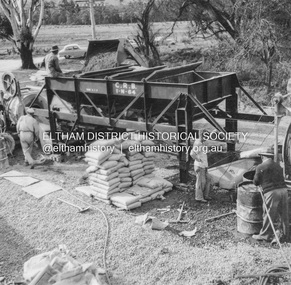
Album - Photograph, J.A. McDonald, Yarra Glen-Glenburn Road, June 1957
... Infrastructure shire of eltham bridge construction Jehosophat Creek Road construction Yarra Glen-Glenburn Road 1957-06 Black and white photo print (location of negative unknown) Adhered to a page in an album of 78 foolscap pages containing a sequence of photos, adhered via glue or sticky tape, with typed or handwritten headings and captions in pencil. Originally contained in a green foolscap binder with spring clasp spine for retaining loose pages. Also inserted loose within the binder a number of photo negative/print processing folders containing various loose prints and medium format Kodak 620 6x6 cm black and white negatives as well as plain ...Jehosophat Creek – 56M295 June 1957 Mixing procedure deck pourRecord of various Shire of Eltham infrastructure works undertaken during the period of 1952-1962 involving bridge and road reconstruction projects, sometimes with Eltham Shire Council Project Reference numbers quoted. It was during this period that a number of significant improvements were made to roads and new bridges constructed within the shire that remain in place as of present day (2022). In many situations, the photos provide a tangible visible record of infrastructure that existed throughout the early days of the Shire. The album was put together by or under the direction of the Shire Engineer, J.A. McDonald.infrastructure, shire of eltham, bridge construction, jehosophat creek, road construction, yarra glen-glenburn road, 1957-06 -
 Eltham District Historical Society Inc
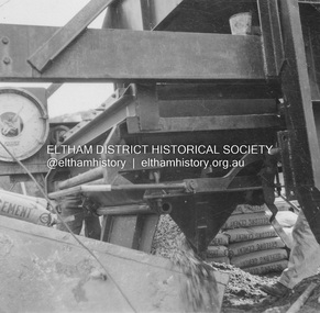
Album - Photograph, J.A. McDonald, Yarra Glen-Glenburn Road, June 1957
... Infrastructure shire of eltham bridge construction Jehosophat Creek Road construction Yarra Glen-Glenburn Road 1957-06 Black and white photo print (location of negative unknown) Adhered to a page in an album of 78 foolscap pages containing a sequence of photos, adhered via glue or sticky tape, with typed or handwritten headings and captions in pencil. Originally contained in a green foolscap binder with spring clasp spine for retaining loose pages. Also inserted loose within the binder a number of photo negative/print processing folders containing various loose prints and medium format Kodak 620 6x6 cm black and white negatives as well as plain ...Jehosophat Creek – 56M295 June 1957 Weigh batcher in operationRecord of various Shire of Eltham infrastructure works undertaken during the period of 1952-1962 involving bridge and road reconstruction projects, sometimes with Eltham Shire Council Project Reference numbers quoted. It was during this period that a number of significant improvements were made to roads and new bridges constructed within the shire that remain in place as of present day (2022). In many situations, the photos provide a tangible visible record of infrastructure that existed throughout the early days of the Shire. The album was put together by or under the direction of the Shire Engineer, J.A. McDonald.infrastructure, shire of eltham, bridge construction, jehosophat creek, road construction, yarra glen-glenburn road, 1957-06 -
 Eltham District Historical Society Inc
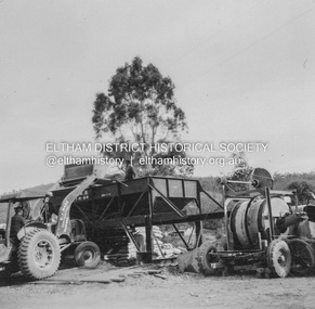
Album - Photograph, J.A. McDonald, Yarra Glen-Glenburn Road, June 1957
... Infrastructure shire of eltham bridge construction Jehosophat Creek Road construction Yarra Glen-Glenburn Road 1957-06 Black and white photo print (location of negative unknown) Adhered to a page in an album of 78 foolscap pages containing a sequence of photos, adhered via glue or sticky tape, with typed or handwritten headings and captions in pencil. Originally contained in a green foolscap binder with spring clasp spine for retaining loose pages. Also inserted loose within the binder a number of photo negative/print processing folders containing various loose prints and medium format Kodak 620 6x6 cm black and white negatives as well as plain ...Jehosophat Creek – 56M295 June 1957 Loading weigh batcher deck pourRecord of various Shire of Eltham infrastructure works undertaken during the period of 1952-1962 involving bridge and road reconstruction projects, sometimes with Eltham Shire Council Project Reference numbers quoted. It was during this period that a number of significant improvements were made to roads and new bridges constructed within the shire that remain in place as of present day (2022). In many situations, the photos provide a tangible visible record of infrastructure that existed throughout the early days of the Shire. The album was put together by or under the direction of the Shire Engineer, J.A. McDonald.infrastructure, shire of eltham, bridge construction, jehosophat creek, road construction, yarra glen-glenburn road, 1957-06 -
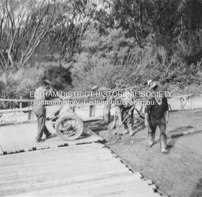 Eltham District Historical Society Inc
Album - Photograph, J.A. McDonald, Yarra Glen-Glenburn Road, June 1957
... Infrastructure shire of eltham bridge construction Jehosophat Creek Road construction Yarra Glen-Glenburn Road 1957-06 Black and white photo print (location of negative unknown) Adhered to a page in an album of 78 foolscap pages containing a sequence of photos, adhered via glue or sticky tape, with typed or handwritten headings and captions in pencil. Originally contained in a green foolscap binder with spring clasp spine for retaining loose pages. Also inserted loose within the binder a number of photo negative/print processing folders containing various loose prints and medium format Kodak 620 6x6 cm black and white negatives as well as plain ...Jehosophat Creek – 56M295 June 1957 Placing deck concreteRecord of various Shire of Eltham infrastructure works undertaken during the period of 1952-1962 involving bridge and road reconstruction projects, sometimes with Eltham Shire Council Project Reference numbers quoted. It was during this period that a number of significant improvements were made to roads and new bridges constructed within the shire that remain in place as of present day (2022). In many situations, the photos provide a tangible visible record of infrastructure that existed throughout the early days of the Shire. The album was put together by or under the direction of the Shire Engineer, J.A. McDonald.infrastructure, shire of eltham, bridge construction, jehosophat creek, road construction, yarra glen-glenburn road, 1957-06 -
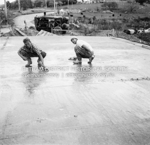 Eltham District Historical Society Inc
Album - Photograph, J.A. McDonald, Yarra Glen-Glenburn Road, June 1957
... Infrastructure shire of eltham bridge construction Jehosophat Creek Road construction Yarra Glen-Glenburn Road 1957-06 Black and white photo print (location of negative unknown) Adhered to a page in an album of 78 foolscap pages containing a sequence of photos, adhered via glue or sticky tape, with typed or handwritten headings and captions in pencil. Originally contained in a green foolscap binder with spring clasp spine for retaining loose pages. Also inserted loose within the binder a number of photo negative/print processing folders containing various loose prints and medium format Kodak 620 6x6 cm black and white negatives as well as plain ...Jehosophat Creek 56M295 June 1957 Floating off deck Paul and WallyRecord of various Shire of Eltham infrastructure works undertaken during the period of 1952-1962 involving bridge and road reconstruction projects, sometimes with Eltham Shire Council Project Reference numbers quoted. It was during this period that a number of significant improvements were made to roads and new bridges constructed within the shire that remain in place as of present day (2022). In many situations, the photos provide a tangible visible record of infrastructure that existed throughout the early days of the Shire. The album was put together by or under the direction of the Shire Engineer, J.A. McDonald.infrastructure, shire of eltham, bridge construction, jehosophat creek, road construction, yarra glen-glenburn road, 1957-06 -
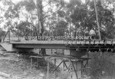 Eltham District Historical Society Inc
Album - Photograph, J.A. McDonald, Henley Road Bridge over Watsons Creek, Aug. 1962
... Infrastructure shire of eltham bridge construction Road construction bushfires 1962-08 Bend of Islands Henley Road Henley Road Bridge Kangaroo Ground Oxley Bridge Watsons Creek H941 stamped on reverse (film processing #) Black and white photo print (location of negative unknown) Loose print originally inserted in an album of 78 foolscap pages containing a sequence of photos, adhered via glue or sticky tape, with typed or handwritten headings and captions in pencil. Originally contained in a green foolscap binder with spring clasp spine for retaining loose pages. Also inserted loose within the binder a number of photo negative/print processing folders containing various loose prints and medium format Kodak 620 6x6 cm black and white negatives as well as plain ...Henley Road Bridge over Watsons Creek Eltham Abutment August 1962Record of various Shire of Eltham infrastructure works undertaken during the period of 1952-1962 involving bridge and road reconstruction projects, sometimes with Eltham Shire Council Project Reference numbers quoted. It was during this period that a number of significant improvements were made to roads and new bridges constructed within the shire that remain in place as of present day (2022). In many situations, the photos provide a tangible visible record of infrastructure that existed throughout the early days of the Shire. The album was put together by or under the direction of the Shire Engineer, J.A. McDonald.H941 stamped on reverse (film processing #)infrastructure, shire of eltham, bridge construction, road construction, bushfires, 1962-08, bend of islands, henley road, henley road bridge, kangaroo ground, oxley bridge, watsons creek -
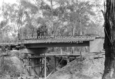 Eltham District Historical Society Inc
Album - Photograph, J.A. McDonald, Henley Road Bridge over Watsons Creek, Aug. 1962
... Infrastructure shire of eltham bridge construction Road construction bushfires 1962-08 Bend of Islands Henley Road Henley Road Bridge Kangaroo Ground Oxley Bridge Watsons Creek H941 stamped on reverse (film processing #) Black and white photo print (location of negative unknown) Loose print originally inserted in an album of 78 foolscap pages containing a sequence of photos, adhered via glue or sticky tape, with typed or handwritten headings and captions in pencil. Originally contained in a green foolscap binder with spring clasp spine for retaining loose pages. Also inserted loose within the binder a number of photo negative/print processing folders containing various loose prints and medium format Kodak 620 6x6 cm black and white negatives as well as plain ...Henley Road Bridge over Watsons Creek Yarra Glen Abutment August 1962Record of various Shire of Eltham infrastructure works undertaken during the period of 1952-1962 involving bridge and road reconstruction projects, sometimes with Eltham Shire Council Project Reference numbers quoted. It was during this period that a number of significant improvements were made to roads and new bridges constructed within the shire that remain in place as of present day (2022). In many situations, the photos provide a tangible visible record of infrastructure that existed throughout the early days of the Shire. The album was put together by or under the direction of the Shire Engineer, J.A. McDonald.H941 stamped on reverse (film processing #)infrastructure, shire of eltham, bridge construction, road construction, bushfires, 1962-08, bend of islands, henley road, henley road bridge, kangaroo ground, oxley bridge, watsons creek -
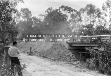 Eltham District Historical Society Inc
Album - Photograph, J.A. McDonald, Henley Road Bridge over Watsons Creek, Sep. 1962
... Infrastructure shire of eltham bridge construction Road construction bushfires Bend of Islands Henley Road Henley Road Bridge Kangaroo Ground Oxley Bridge Watsons Creek 1962-09 H941 stamped on reverse (film processing #) Black and white photo print (location of negative unknown) Loose print originally inserted in an album of 78 foolscap pages containing a sequence of photos, adhered via glue or sticky tape, with typed or handwritten headings and captions in pencil. Originally contained in a green foolscap binder with spring clasp spine for retaining loose pages. Also inserted loose within the binder a number of photo negative/print processing folders containing various loose prints and medium format Kodak 620 6x6 cm black and white negatives as well as plain ...Henley Road Bridge over Watsons Creek Eltham Abutment September 1962Record of various Shire of Eltham infrastructure works undertaken during the period of 1952-1962 involving bridge and road reconstruction projects, sometimes with Eltham Shire Council Project Reference numbers quoted. It was during this period that a number of significant improvements were made to roads and new bridges constructed within the shire that remain in place as of present day (2022). In many situations, the photos provide a tangible visible record of infrastructure that existed throughout the early days of the Shire. The album was put together by or under the direction of the Shire Engineer, J.A. McDonald.H941 stamped on reverse (film processing #)infrastructure, shire of eltham, bridge construction, road construction, bushfires, bend of islands, henley road, henley road bridge, kangaroo ground, oxley bridge, watsons creek, 1962-09
