


Physical description
Pink paper covered book by Stanley Hunter, Engineer in Charge of Boring Operations.
Contents include tunnelling, deep sinking, the Chiltern Method, the Ballarat Method, Stawell, Ararat, Moyston, Raglan, Wimmera, Landsborough, Avoca, Ballarat West Leads, Berry-Moolort-Loddon Lead System, Clunes, Creswick, Bullarook Affluent, Corinella, Daylesford-Castlemaine Tributary, Majorca-Carisbrook tributary, Huntly, Coliban, Campaspe, Rutherglen., Smythesdale, Durham Lead, Tanjil, Evolution of Mining Machinery, size of claims, Definition of a Deep Lead, Discovery of Gold in Victoria, Geographical Position of Deep Leads, Water in Deep Leads, Methods of Deep Lead Mining, Cost of Deep Lead Mining, Stawell, Ararat, Moyston, Raglan, Wimmera, Landsborough, Avoca, Ballarat West, Berry, Springs Hill, Loddon Valley, Charlotte Plains, , Timor, Burn Creek, Huntly, Colinan, Goulburn, Ovens Valley, Chiltern, Indigo, Morrison's Lead,
Plans include: geological Map of Stawell, ararat, Raglan and Landsborough; Kempson's Freehold Mine, Stawell; Geological Map of Beaufort, Avoca, Maryborough, Ballarat west, Berry-Moolort, Loddon, Creswick, Marong, &c; Cardigan Propriety Gold Mine; Working Miners United Gold Mine, Homebush; Hepburn Deep Lead Plan; Madame Berry West Mine; West Berry Consols Mine; Spring Hill and Central Leads; Berry Consols Extended Mine; Loddon Valley Goldfields; Chalk's No 3 Mine; Charlotte Plains Considated Mine; Duke United Mine; Geological Map of Bendigo, Huntley, Campaspe, Malmsbury, Kyneton, trentham, &c; Geological Map of Chiltern, Rutherglan, Eldorado, Beechworth, &c; Chiltern Valley Gold Mine; Wallace Chiltern Valley Consols Mine; great Southern and Chiltern Valley United Mine; great Northern extended Consols; Prentice and Southern deep Leads; Glenfine South Gold Mine; Geological map of Pitfield, Rokewood, Mt Mercer, Ballark, Meredith, &c.; McEvoy Mine; Dargo
.
.
.
.
.
.
.
.
.
.
.
.
.
.
.
.
.
.
.
.
.
.
.
Subjects
- mining,
- deep leads,
- squire,
- tools,
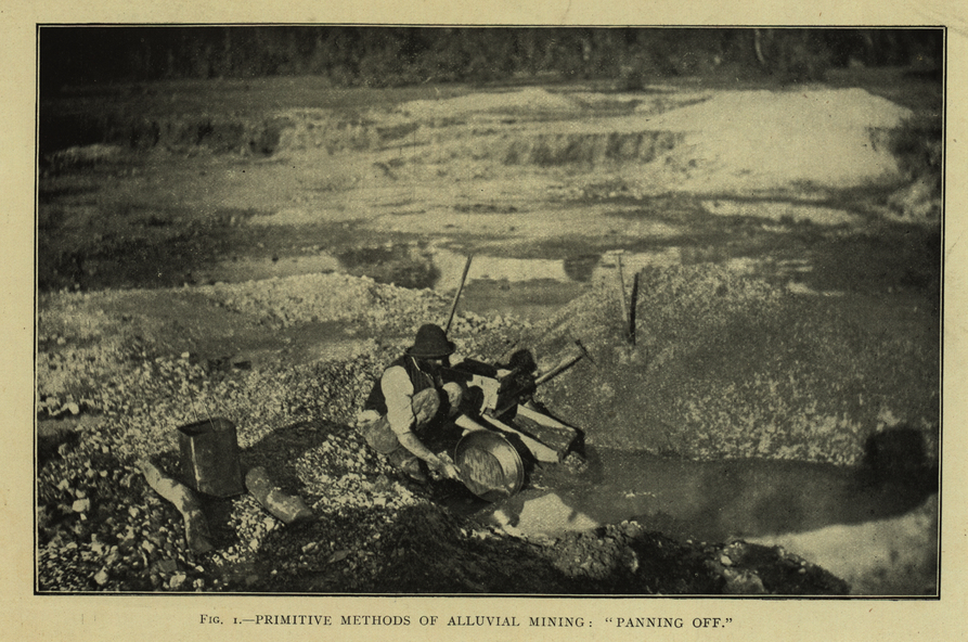
- gold panning,
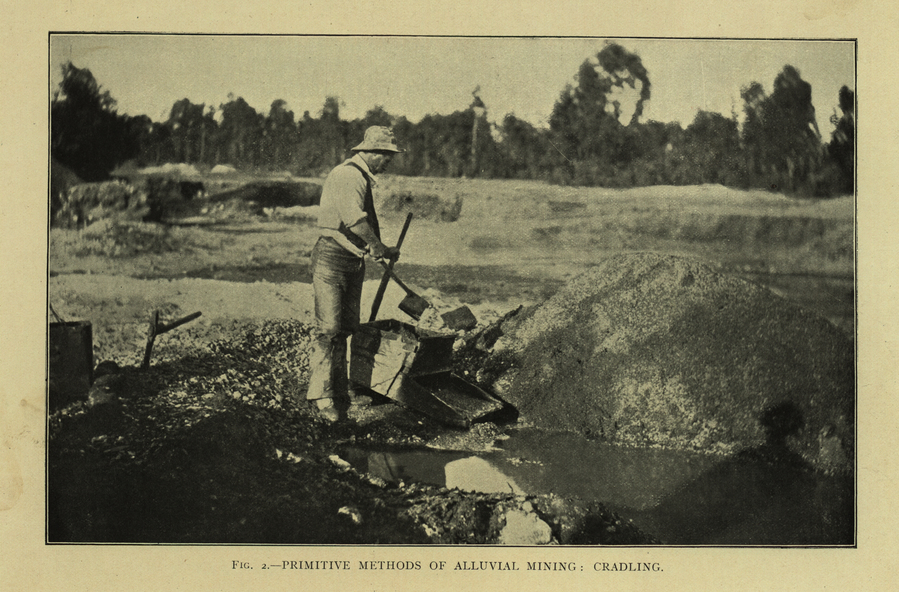
- gold cradle,
- cradling,
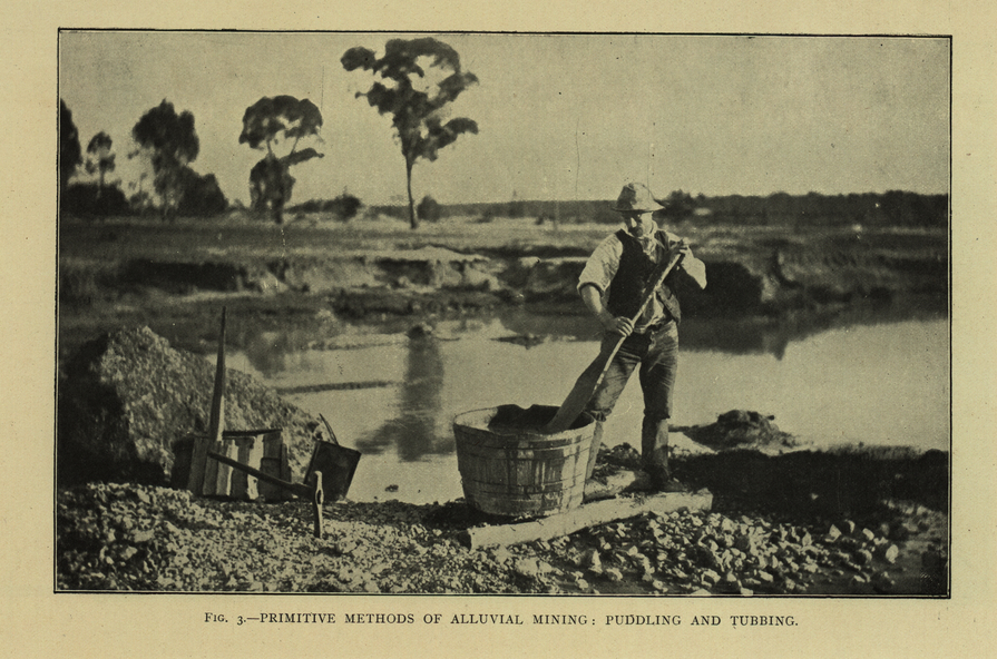
- puddling,
- tubbing,
- mining shaft,
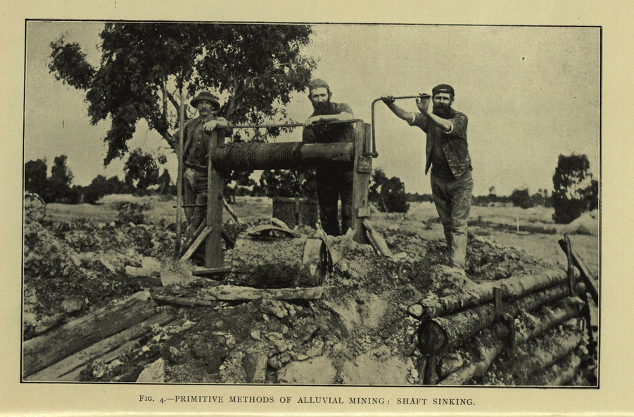
- shaft sinking,
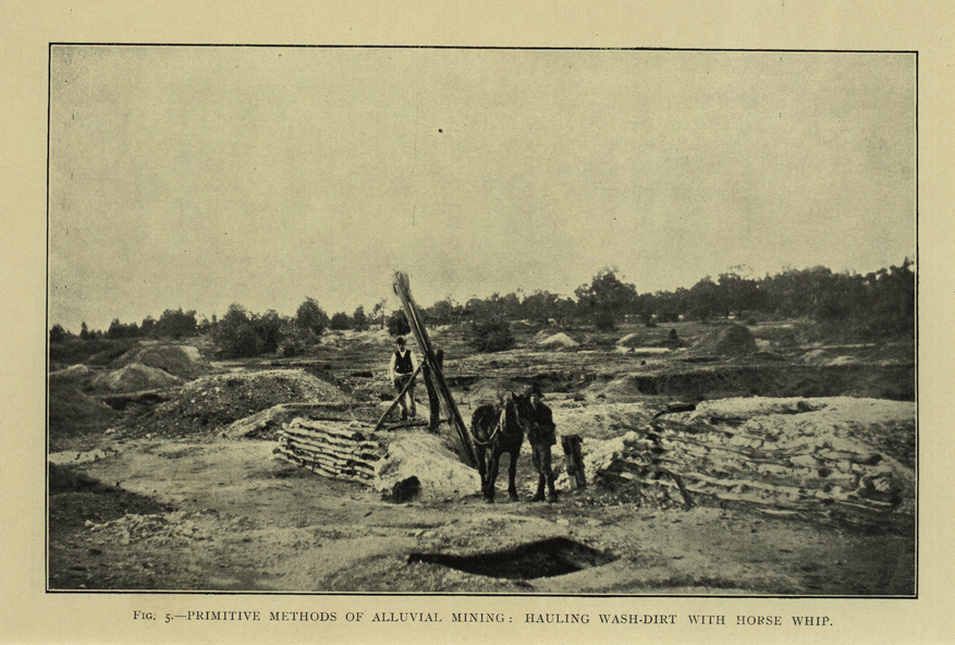
- whip,
- horse whip,
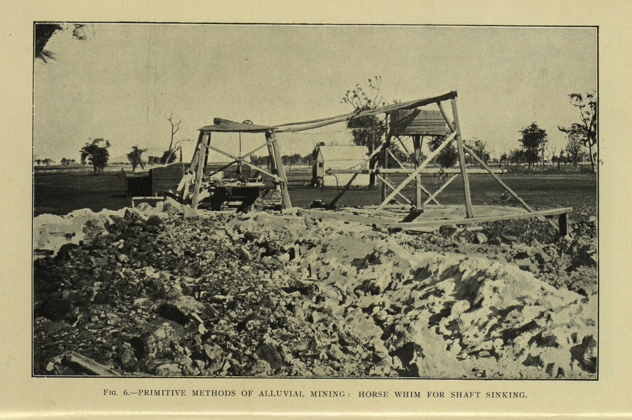
- whim,
- horse whim,
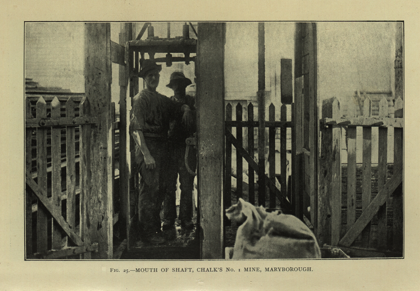
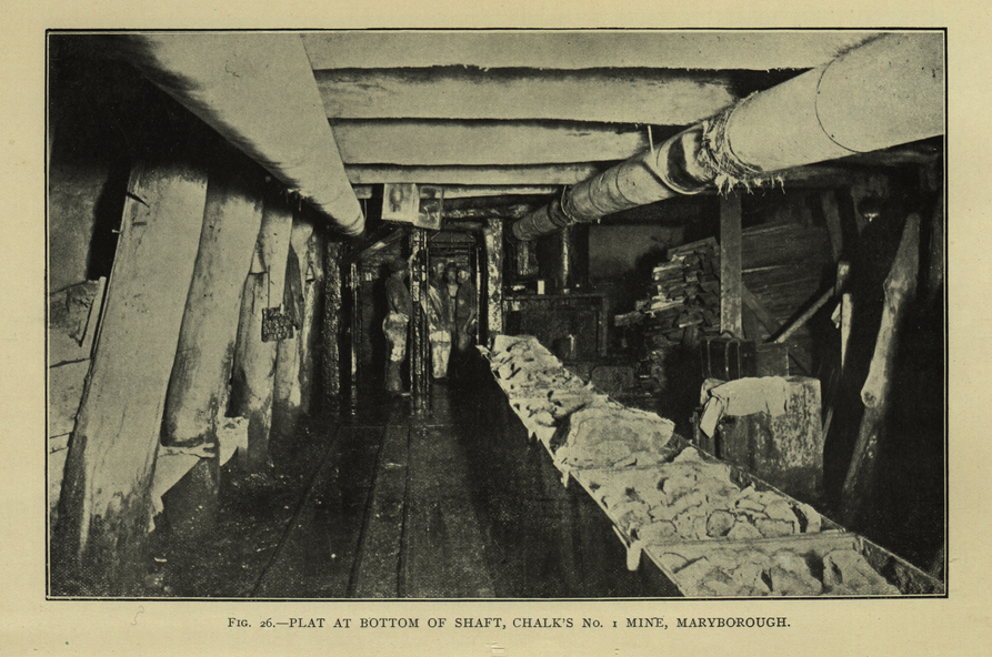
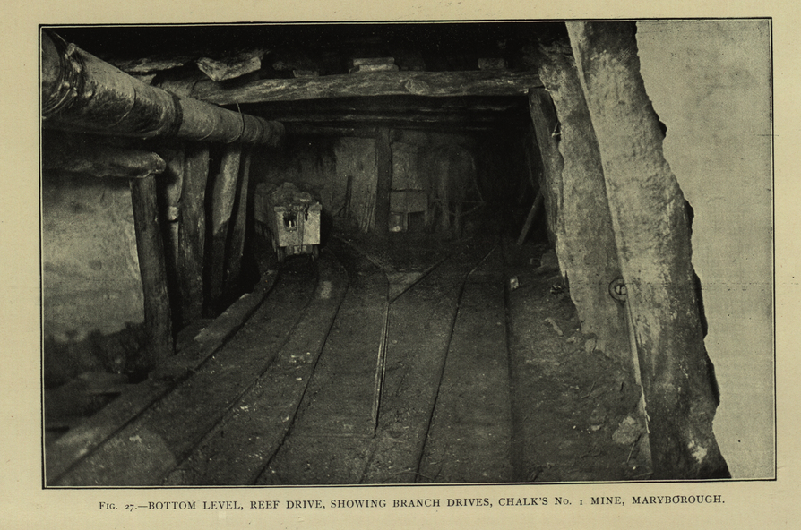
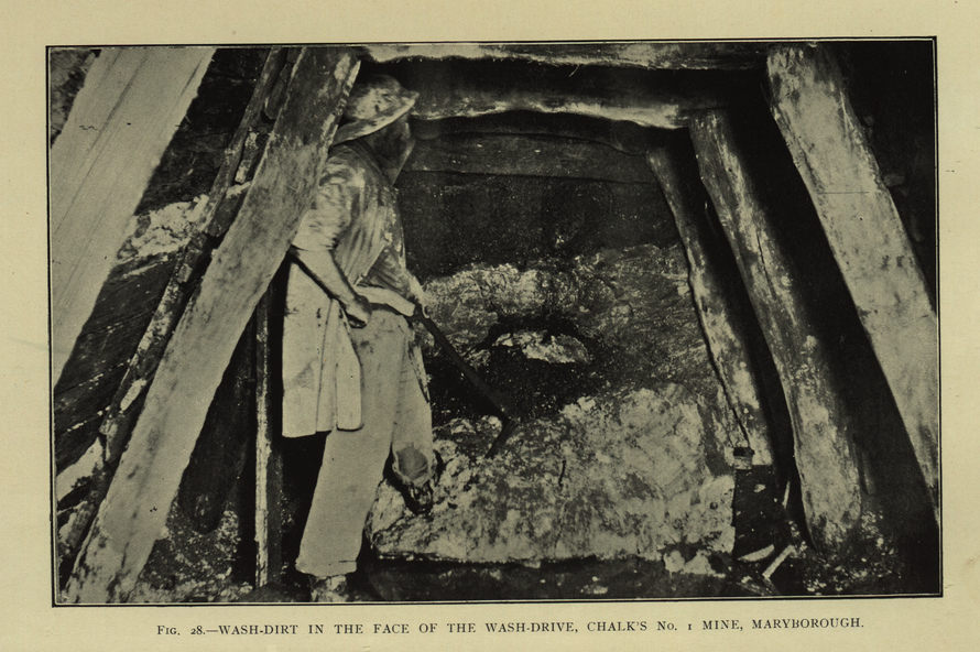
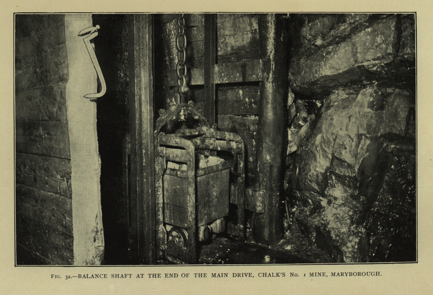
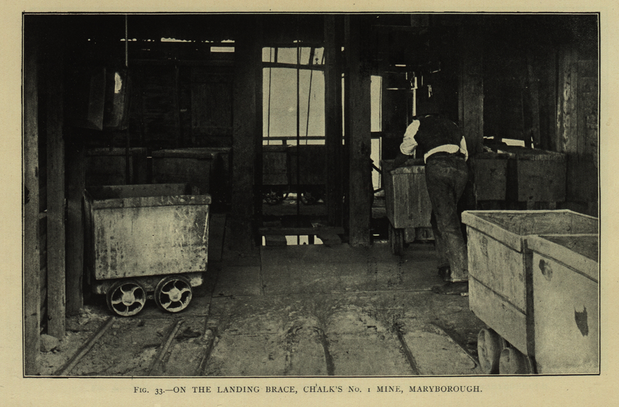
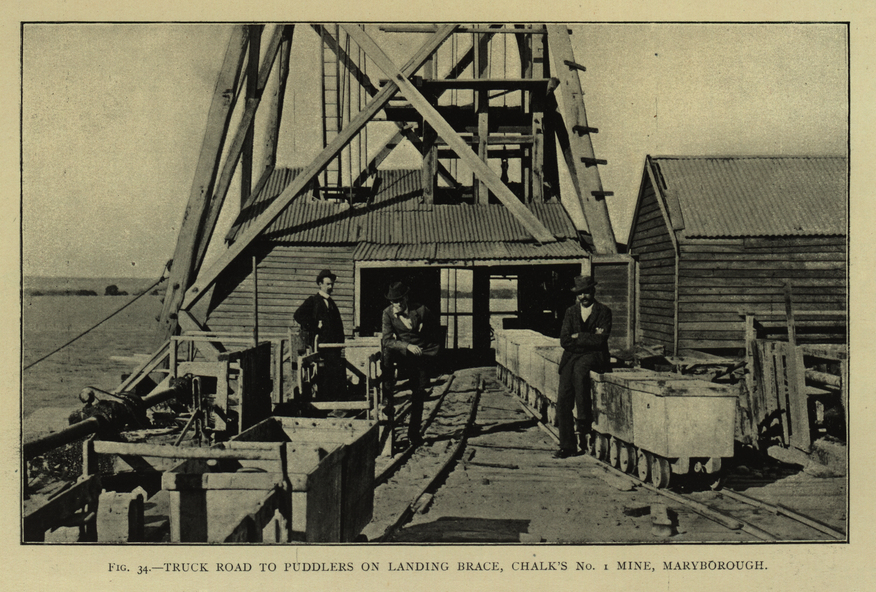
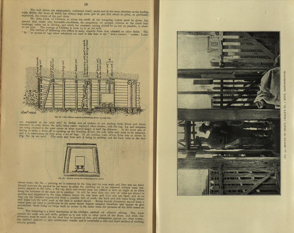
- chalk's no. 1 mine, maryborough,
- mining cage,
- shaft,
- mining trucks,
- maryborough,
- washdirt,
- puddler,
- tunnelling,
- deep sinking,
- chiltern method of working,
- ballarat method of working,
- sampling washdirt. gravels,
- balmoral,
- mt william,
- stawell,
- moyston,
- great western,
- ararat,
- raglan,
- wimmera valley,
- landsborough,
- cardigan,
- haddon,
- beaufort,
- waterloo,
- avoca,
- lamplough,
- caralulup,
- ballarat west,
- ballarat,
- smythesdale,
- glenfine,
- illabarook,
- durham lead,
- morrison's lead,
- bullengarook,
- berry-moolort-loddon system,
- clunes,
- creswick,
- spring hill,
- bullarook,
- castlemaine - daylesford,
- majorca,
- carisbrook,
- timor,
- burnt creek tributary,
- tarnagulla,
- marong,
- rheola,
- inglewood,
- huntly,
- coliban,
- campaspe,
- goulburn lead system,
- ovens valley system,
- mitta mitta,
- kiewa valley,
- tarago,
- tanjil,
- moondarra,
- bogong,
- dargo high plains