
Showing 14 items matching "squatters runs"
-
 Tatura Irrigation & Wartime Camps Museum
Folder, Squatters' Runs in the 1840's
... Squatters' Runs in the 1840's...squatters runs...Copies of Squatters' Runs 1840's, Goulburn Blacks Tribal Lands, History of Bangerang Tribe, Issues of Aboriginal Australia (Magazine), History of Cummeragunga...Copies of Squatters' Runs 1840's, Goulburn Blacks Tribal Lands, History of Bangerang Tribe, Issues of Aboriginal Australia (Magazine), History of Cummeragunga squatters runs aboriginal tribal lands cummeragunga aboriginal history Black plastic cover, plastic sleeves Squatters' Runs in the 1840's Folder ...Copies of Squatters' Runs 1840's, Goulburn Blacks Tribal Lands, History of Bangerang Tribe, Issues of Aboriginal Australia (Magazine), History of CummeragungaBlack plastic cover, plastic sleevessquatters runs, aboriginal tribal lands, cummeragunga, aboriginal history -
 Stawell Historical Society Inc
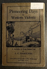
Book, Pioneering Days in Western Victoria
... Includes Aboriginal/First Nation Massacre Page 30 Early Station Life, Squatters Runs....Includes Aboriginal/First Nation Massacre Page 30 Early Station Life, Squatters Runs. Author J. C. Hamilton A Narrative of Early Station Life Brown/Grey Cover with Black Print Lide Drawing of Wool Carting Pioneering Days in Western Victoria Book ...Includes Aboriginal/First Nation Massacre Page 30 Early Station Life, Squatters Runs.Brown/Grey Cover with Black Print Lide Drawing of Wool CartingAuthor J. C. Hamilton A Narrative of Early Station Life -
 Bendigo Historical Society Inc.
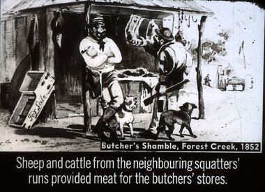
Slide - DIGGERS & MINING. STORES AT THE DIGGINGS, c1852
... Sheep and cattle from the neighbouring squatters' runs provided meat for the butchers' stores. ...Sheep and cattle from the neighbouring squatters' runs provided meat for the butchers' stores. ...Diggers & Mining. Stores at the diggings. Butcher's Shamble, Forest Creek, 1852. Sheep and cattle from the neighbouring squatters' runs provided meat for the butchers' stores. Slide shows miner checking out the meat for sale other items are also for sale. Markings: 23 994.LIF. 5. Used as a teaching aid.hanimounteducation, tertiary, goldfields -
 Bendigo Historical Society Inc.
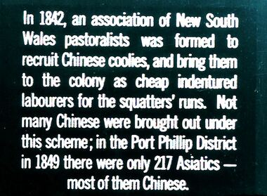
Slide - DIGGERS & MINING. GOLD, c1842
... In 1842, an association of New South Wales pastoralists was formed to recruit Chinese coolies, and bring them to the colony as cheap indentured labourers for the squatters' runs. Not many Chinese were brought out under this scheme; in the Port Phillip District in 1849 there were only 217 Asiatics - most of them Chinese. ...In 1842, an association of New South Wales pastoralists was formed to recruit Chinese coolies, and bring them to the colony as cheap indentured labourers for the squatters' runs. Not many Chinese were brought out under this scheme; in the Port Phillip District in 1849 there were only 217 Asiatics - most of them Chinese. ...Diggers & Mining. Gold. In 1842, an association of New South Wales pastoralists was formed to recruit Chinese coolies, and bring them to the colony as cheap indentured labourers for the squatters' runs. Not many Chinese were brought out under this scheme; in the Port Phillip District in 1849 there were only 217 Asiatics - most of them Chinese. Markings: 13 994.GOL. Used as a teaching aid.hanimounteducation, tertiary, goldfields -
 Victorian Aboriginal Corporation for Languages
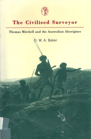
Book, D W A Baker, The civilised surveyor : Thomas Mitchell and the Australian Aborigines, 1997
... Thomas Mitchell, surveyor in Sydney from 1827 at the time when Squatters were extending their runs with huge detriment to the Aboriginal population. ...Thomas Mitchell New South Wales history race relations racism colonisation Maps, b&w illustrations Thomas Mitchell, surveyor in Sydney from 1827 at the time when Squatters were extending their runs with huge detriment to the Aboriginal population. ...Thomas Mitchell, surveyor in Sydney from 1827 at the time when Squatters were extending their runs with huge detriment to the Aboriginal population. Mitchell and his men were ambiguous in their treatment of the people. His conviction was in the superiority of the British civilisation.Maps, b&w illustrationsthomas mitchell, new south wales history, race relations, racism, colonisation -
 Bendigo Historical Society Inc.
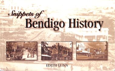
Book - "Snippets of Bendigo History", 2006
... European exploration began with Major Thomas Mitchell in 1836, followed by squatters establishing sheep runs in 1837. The arrival of settlers led to the displacement of the Dja Dja Wurrung people, with waves of settlement from the south in 1837 and from the north in 1845. ...European exploration began with Major Thomas Mitchell in 1836, followed by squatters establishing sheep runs in 1837. The arrival of settlers led to the displacement of the Dja Dja Wurrung people, with waves of settlement from the south in 1837 and from the north in 1845. ...Edith Lunn was born in Bendigo in July, 1907, and had lived all of her life in the city and its immediate environs. Edith was awarded the Order of Australia medal in 2002 for her services to, and interest in, Bendigo's history. This text records to history of Bendigo, as recalled and researched by Edith. Bendigo, formerly known as Sandhurst, grew from Indigenous lands to a major gold rush boomtown and is now a vibrant regional city with rich cultural heritage. The Bendigo region is the traditional land of the Dja Dja Wurrung (Djaara) people, who have lived in the area for thousands of years. They managed the land sustainably, utilizing the rich hunting grounds and waterways, and their cultural stories and knowledge remain deeply woven into the landscape today. European exploration began with Major Thomas Mitchell in 1836, followed by squatters establishing sheep runs in 1837. The arrival of settlers led to the displacement of the Dja Dja Wurrung people, with waves of settlement from the south in 1837 and from the north in 1845. Gold was discovered on Bendigo Creek in 1851 by Mrs. Margaret Kennedy and Mrs. Julia Farrell, sparking one of Australia’s largest gold rushes. By 1852, around 20,000 people had arrived from across the world, including Europe and China, transforming Bendigo into a booming gold-mining economy. The city was officially named Sandhurst from 1853 to 1891. The wealth generated during this period is reflected in Bendigo’s Victorian architecture, including the Town Hall and historic buildings. Gold mining continued into the early 20th century, but by 1954, mining had largely ceased. The city then shifted focus to manufacturing and regional services, experiencing renewed growth from the 1930s onward. Modern Bendigo has become a fast-growing regional centre, aided by infrastructure like the Calder Freeway linking it to Melbourne. Today, Bendigo preserves its history through museums, walking tours, and heritage sites. Key attractions include the Bendigo Art Gallery, Bendigo Joss House Temple, Central Deborah Gold Mine, and the Goldfields Track, which highlight both the gold rush era and the city’s cultural diversity. "Snippets of Bendigo History" written by Edith Lunn. Forward by Daryl McClure. Printed by Bendigo Modern Press. Soft cover book. Front and back covers are sepia with Bendigo street scene, and front cover has three inset sepia toned Bendigo scenes inserted. Title and author's name are in black text on front cover. Author's name and book title written in black on spine. Printed in Bendigo, Australia. 65 pp. This edition was 500 copies. Contents page on iv. Details about author on iii. Contains both text and black and white images. edith lunn, bendigo -
 Eltham District Historical Society Inc
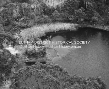
Photograph - Digital Photograph, Alan King, Blue Lake, Plenty Gorge Park, 2008
... By 1837 squatters had claimed large runs of land for their sheep and cattle. ...By 1837 squatters had claimed large runs of land for their sheep and cattle. ...A quarry was transformed into the Blue Lake. Published: Nillumbik Now and Then / Marguerite Marshall 2008; photographs Alan King with Marguerite Marshall.; p179 The dramatic steep-sided Plenty Gorge lies along the divide of two geological areas, and separates the Nillumbik Shire and the City of Whittlesea. On the Nillumbik side are undulating hills and sedimentary rock, and in Whittlesea, lies a basalt plain formed by volcanic action up to two million years ago. This provides the Plenty Gorge Park with diverse vegetation and habitats, making it one of Greater Melbourne’s most important refuges for threatened and significant species. The park, established in 1986, consists of around 1350 hectares, and extends 11 kilometres along the Plenty River, from Greensborough to Mernda. It provides a wildlife corridor for around 500 native plant and 280 animal species. The area’s plentiful food and water attracted the Wurundjeri Aboriginal people and then European settlers. By 1837 squatters had claimed large runs of land for their sheep and cattle. The Plenty Valley was among the first in the Port Phillip District to be settled - mainly in the less heavily timbered west - and was proclaimed a settled district in 1841.But by the late 1880s, the settlers’ extensive land clearing for animal grazing, then agriculture, depleted the Wurundjeri’s traditional food sources, which helped to drive them away. Many Wurundjeri artefacts remain (now government protected), and so far 57 sites have been identified in the park, including scarred trees, burial areas and stone artefacts. Pioneer life could be very hard because of isolation, flooding, bushfires and bushrangers. Following the Black Thursday bushfires of 1851, basalt was quarried to build more fire-resistant homes. Gold discoveries in the early 1850s swelled the population, particularly around Smugglers Gully; but food production made more of an impact. In the late 1850s wheat production supplanted grazing. In the 1860s the government made small holdings available to poorer settlers. These had the greatest effect on the district, particularly in Doreen and Yarrambat, where orchards were established from the 1880s to 1914. Links with a prominent early family are the remains of Stuchbery Farm, by the river’s edge bounded by Smugglers Gully to the north and La Trobe Road, Yarrambat, to the east. The Stuchberys moved to the valley in 1890, and the family still lives in the area. In 1890, Alfred and Ada first lived in a tent where four children were born, then Alfred built the house and outbuildings around 1896. They planted an orchard, then a market garden, and developed a dairy. The family belonged to the local Methodist and tennis communities. Their grandson Walter, opened the Flying Scotsman Model Railway Museum in Yarrambat, which his widow, Vi, continues to run. Wal was also the Yarrambat CFA Captain for 22 years until 1987. Walter sold 24 hectares in 1976 for development - now Vista Court - and in 1990, the remaining 22.6 hectares for the park. Remaining are an early stone dairy and remnants of a stone barn, a pig sty and a well. Until it was destroyed by fire in 2003, a slab hut stood on the Happy Hollow Farm site, at the southern end of the park. The hut is thought to have been built in the Depression around 1893. This was a rare and late example of a slab hut with a domestic orchard close to Melbourne. Emmet Watmough and his family first occupied the hut, followed by a succession of families, until the Bell family bought it around 1948. There they led a subsistence lifestyle for 50 years, despite encroaching Melbourne suburbia. The Yellow Gum Recreation Area includes the Blue Lake, coloured turquoise at certain times of the year. Following the 1957 bushfires, this area was quarried by Reid Quarries Pty Ltd for Melbourne’s first skyscrapers, then by Boral Australia. However in the early 1970s water began seeping into the quarry forming the Blue Lake and the quarry was closed. The State Government bought the site in 1997 and opened it as a park in 1999.This collection of almost 130 photos about places and people within the Shire of Nillumbik, an urban and rural municipality in Melbourne's north, contributes to an understanding of the history of the Shire. Published in 2008 immediately prior to the Black Saturday bushfires of February 7, 2009, it documents sites that were impacted, and in some cases destroyed by the fires. It includes photographs taken especially for the publication, creating a unique time capsule representing the Shire in the early 21st century. It remains the most recent comprehenesive publication devoted to the Shire's history connecting local residents to the past. nillumbik now and then (marshall-king) collection, blue lake, plenty gorge park -
 Eltham District Historical Society Inc
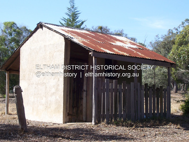
Photograph - Digital Photograph, Marguerite Marshall, Stuchbery Farm dairy, 14 March 2008
... By 1837 squatters had claimed large runs of land for their sheep and cattle. ...By 1837 squatters had claimed large runs of land for their sheep and cattle. ...Stuchbery Farm was situated on the Plenty River bounded by Smugglers Gully to the north and La trobe Road, Yarrambat, to the east. Alan and Ada Stutchbery moved to the valley in 1890, first living in a tent where four children were born. Alfred built a home and outbuildings around 1896. They planted an orchard, then a market garden and developed a dairy. Published: Nillumbik Now and Then / Marguerite Marshall 2008; photographs Alan King with Marguerite Marshall.; p179 The dramatic steep-sided Plenty Gorge lies along the divide of two geological areas, and separates the Nillumbik Shire and the City of Whittlesea. On the Nillumbik side are undulating hills and sedimentary rock, and in Whittlesea, lies a basalt plain formed by volcanic action up to two million years ago. This provides the Plenty Gorge Park with diverse vegetation and habitats, making it one of Greater Melbourne’s most important refuges for threatened and significant species. The park, established in 1986, consists of around 1350 hectares, and extends 11 kilometres along the Plenty River, from Greensborough to Mernda. It provides a wildlife corridor for around 500 native plant and 280 animal species. The area’s plentiful food and water attracted the Wurundjeri Aboriginal people and then European settlers. By 1837 squatters had claimed large runs of land for their sheep and cattle. The Plenty Valley was among the first in the Port Phillip District to be settled - mainly in the less heavily timbered west - and was proclaimed a settled district in 1841. But by the late 1880s, the settlers’ extensive land clearing for animal grazing, then agriculture, depleted the Wurundjeri’s traditional food sources, which helped to drive them away. Many Wurundjeri artefacts remain (now government protected), and so far 57 sites have been identified in the park, including scarred trees, burial areas and stone artefacts. Pioneer life could be very hard because of isolation, flooding, bushfires and bushrangers. Following the Black Thursday bushfires of 1851, basalt was quarried to build more fire-resistant homes. Gold discoveries in the early 1850s swelled the population, particularly around Smugglers Gully; but food production made more of an impact. In the late 1850s wheat production supplanted grazing. In the 1860s the government made small holdings available to poorer settlers. These had the greatest effect on the district, particularly in Doreen and Yarrambat, where orchards were established from the 1880s to 1914. Links with a prominent early family are the remains of Stuchbery Farm, by the river’s edge bounded by Smugglers Gully to the north and La Trobe Road, Yarrambat, to the east. The Stuchberys moved to the valley in 1890, and the family still lives in the area. In 1890, Alfred and Ada first lived in a tent where four children were born, then Alfred built the house and outbuildings around 1896. They planted an orchard, then a market garden, and developed a dairy. The family belonged to the local Methodist and tennis communities. Their grandson Walter, opened the Flying Scotsman Model Railway Museum in Yarrambat, which his widow, Vi, continues to run. Wal was also the Yarrambat CFA Captain for 22 years until 1987. Walter sold 24 hectares in 1976 for development - now Vista Court - and in 1990, the remaining 22.6 hectares for the park. Remaining are an early stone dairy and remnants of a stone barn, a pig sty and a well. Until it was destroyed by fire in 2003, a slab hut stood on the Happy Hollow Farm site, at the southern end of the park. The hut is thought to have been built in the Depression around 1893. This was a rare and late example of a slab hut with a domestic orchard close to Melbourne. Emmet Watmough and his family first occupied the hut, followed by a succession of families, until the Bell family bought it around 1948. There they led a subsistence lifestyle for 50 years, despite encroaching Melbourne suburbia. The Yellow Gum Recreation Area includes the Blue Lake, coloured turquoise at certain times of the year. Following the 1957 bushfires, this area was quarried by Reid Quarries Pty Ltd for Melbourne’s first skyscrapers, then by Boral Australia. However in the early 1970s water began seeping into the quarry forming the Blue Lake and the quarry was closed. The State Government bought the site in 1997 and opened it as a park in 1999.This collection of almost 130 photos about places and people within the Shire of Nillumbik, an urban and rural municipality in Melbourne's north, contributes to an understanding of the history of the Shire. Published in 2008 immediately prior to the Black Saturday bushfires of February 7, 2009, it documents sites that were impacted, and in some cases destroyed by the fires. It includes photographs taken especially for the publication, creating a unique time capsule representing the Shire in the early 21st century. It remains the most recent comprehenesive publication devoted to the Shire's history connecting local residents to the past. nillumbik now and then (marshall-king) collection, ada stuchbery, alan stuchbery, dairy, stuchbery farm, farm buildings, yarrambat, plenty gorge park -
 Federation University Historical Collection
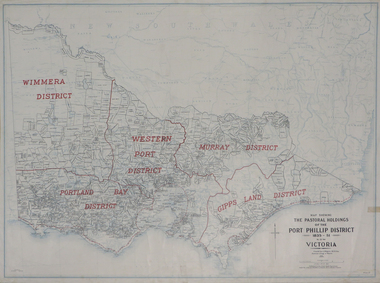
Plan, Map Showing the Pastoral Holdings of the Port Phillip District 1835-1851 Now Victoria, 1932, 1932
... runs. Information on Alfred Stephen Kenyon of the Historical Society of Victoria can be found at http://adb.anu.edu.au/biography/kenyon-alfred-stephen-6936/text12035 pastoral holdings squatters squatting victoria land crown lands a.s. kenyon alfred stephen kenyon Map of Victoria showing the boundaries of the Port Phillip District (Victoria) pastoral boundaries. ...Another name for Pastoral Holdings is squatting runs. Information on Alfred Stephen Kenyon of the Historical Society of Victoria can be found at http://adb.anu.edu.au/biography/kenyon-alfred-stephen-6936/text12035 Map of Victoria showing the boundaries of the Port Phillip District (Victoria) pastoral boundaries. pastoral holdings, squatters, squatting, victoria, land, crown lands, a.s. kenyon, alfred stephen kenyon -
 Flagstaff Hill Maritime Museum and Village
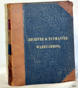
Book - Reference/Legal Statutes, John Ferres, Government Printer, The Victorian Legal Statutes Vol 3, Receiver Paymaster/Warrnambool, 1866
... . · Property and Land Transfer: Crucial laws managing land ownership, inheritance, and the foundational transfers of property as the colony shifted away from old squatter runs to permanent towns. · Wines, Beer, and Spirits: The colonial acts regulating the licensing of hotels and public houses, and managing the highly lucrative, tightly controlled alcohol trade. ...This volume is part of the first comprehensive consolidation of laws for the Colony of Victoria after it separated from New South Wales and established its own parliament. Specifically, Volume 3 is the final part of the core "Public and General" Victorian colonial laws. The first three volumes of the 1866 consolidation were organised alphabetically by legal topic. Volume 3 specifically contains all the major public acts running from P to W. Because it covers the tail end of the alphabet, it holds some of the most critical laws that built day-to-day society in 19th-century Victoria. These include: · Police Offences and Public Order: The legal frameworks for policing the goldfield boomtowns, managing public behaviour, and running early colonial prisons. · Public Works and Infrastructure: The acts authorising the construction of roads, bridges, and early municipal water supplies across the fast-growing colony. · Railways: The specific general legislation governing the expansion of Victoria's heavily subsidised, state-expanding railway networks. · Property and Land Transfer: Crucial laws managing land ownership, inheritance, and the foundational transfers of property as the colony shifted away from old squatter runs to permanent towns. · Wines, Beer, and Spirits: The colonial acts regulating the licensing of hotels and public houses, and managing the highly lucrative, tightly controlled alcohol trade.The Victorian Statutes Vol 3 Various Legal Statues /Warrnambool Publisher: John Ferres Government Printer Melbourne Date: 1866 Further Information: Three quarter leather. Corners worn lettering in gilt. non-fictionThis volume is part of the first comprehensive consolidation of laws for the Colony of Victoria after it separated from New South Wales and established its own parliament. Specifically, Volume 3 is the final part of the core "Public and General" Victorian colonial laws. The first three volumes of the 1866 consolidation were organised alphabetically by legal topic. Volume 3 specifically contains all the major public acts running from P to W. Because it covers the tail end of the alphabet, it holds some of the most critical laws that built day-to-day society in 19th-century Victoria. These include: · Police Offences and Public Order: The legal frameworks for policing the goldfield boomtowns, managing public behaviour, and running early colonial prisons. · Public Works and Infrastructure: The acts authorising the construction of roads, bridges, and early municipal water supplies across the fast-growing colony. · Railways: The specific general legislation governing the expansion of Victoria's heavily subsidised, state-expanding railway networks. · Property and Land Transfer: Crucial laws managing land ownership, inheritance, and the foundational transfers of property as the colony shifted away from old squatter runs to permanent towns. · Wines, Beer, and Spirits: The colonial acts regulating the licensing of hotels and public houses, and managing the highly lucrative, tightly controlled alcohol trade.flagstaff hill, warrnambool, shipwrecked coast, flagstaff hill maritime museum, maritime museum, shipwreck coast, flagstaff hill maritime village, great ocean road, book, pattison collection, warrnambool library, warrnambool mechanics’ institute, ralph eric pattison, corangamite regional library service, warrnambool city librarian, mechanics’ institute library, victorian library board, warrnambool books and records, warrnambool children’s library -
 Kiewa Valley Historical Society
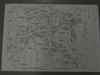
Maps - Squatting Runs of the Murray District 1848 x2, July 26,1848
... Runs of the Murray District 1848." The area is recorded (eg. Tawanga, Dederang, Gundowring, Kergunia, Merrimarenbung all along the Kiewa River) under which the names of the squatter is recorded, the number of acres and the licence number. ...Runs of the Murray District 1848." The area is recorded (eg. Tawanga, Dederang, Gundowring, Kergunia, Merrimarenbung all along the Kiewa River) under which the names of the squatter is recorded, the number of acres and the licence number. ...The Port Phillip Gazette was the second newspaper published in Melbourne, in the then Port Phillip district, now Victoria. In 1948 it was published bi-weekly.The map shows the original names of squatters along the Kiewa River. The names of the district are mostly current today although some are spelt differently.2 copies - 1 laminated & 1 paper of the map of "Squatting Runs of the Murray District 1848." The area is recorded (eg. Tawanga, Dederang, Gundowring, Kergunia, Merrimarenbung all along the Kiewa River) under which the names of the squatter is recorded, the number of acres and the licence number. Scale is 8 miles to the inch.squatting runs; kiewa valley; port phillip district; -
 Kiewa Valley Historical Society
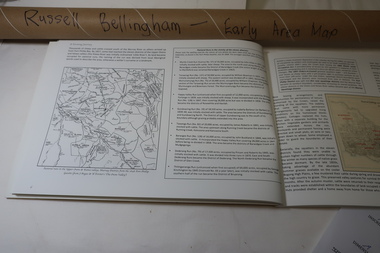
Map - Early Area Map in 1848 with Squatters Page 6 of "A Farming Journey", Early 1848 Area Map from A Farming Journey Page 6
... A map showing the squatting runs in 1848 including the names of the squatters , the licenxe numberand the area in acres. ...This map shows the following: The name as spelt in 1848; the licence number as found in Port Phillip Gazette for July 26, 1848; name of licensee; estimated area in acres. The scale is 8 miles to the inch.A map showing the squatting runs in 1848 including the names of the squatters , the licenxe numberand the area in acres. Roll of hand drawn map depicting 'Squatting Runs of the Murray District 1848 in Victoria. Created by squatting runs map 1848, dederang, tawanga, gundowring, kergunyah -
Koorie Heritage Trust
Book, Baker, D.W.A, The civilised surveyor : Thomas Mitchell and the Australian Aborigines, 1997
... By the 1830's the squatters were poised to extend theri runs over eastern Australia and so dispossess untold thousands of Aboriginal families of their land. ...By the 1830's the squatters were poised to extend theri runs over eastern Australia and so dispossess untold thousands of Aboriginal families of their land. Mitchell witnessed at first hand some of the worst years of a monstrous and incomprehensible disaster. More than that, his work directly assisted in this destruction.xv, 213 pages : illustrations, maps ; 22 cm.By the 1830's the squatters were poised to extend theri runs over eastern Australia and so dispossess untold thousands of Aboriginal families of their land. Mitchell witnessed at first hand some of the worst years of a monstrous and incomprehensible disaster. More than that, his work directly assisted in this destruction.mitchell, thomas, sir, 1792-1855 -- relations with aborigines, australian -- new south wales. | mitchell, thomas, sir, 1792-1855 -- journeys -- new south wales. | aboriginal australians -- new south wales -- first contact with europeans. | aboriginal australians -- first contact with europeans. -
 Bacchus Marsh & District Historical Society
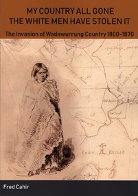
Book, "My country all gone the white men have stolen it" : the invasion of Wadawurrung Country 1800-1870
... Divided into chronological and thematic sections, the book chronicles three waves of invasion: the early invasion period incorporating trespassers predominately from the sea, the sheepherders or squatters who followed in their wake and usurped the Wadawurrung of all their Country for sheep runs, and the third wave of invadors – the gold seekers. ...Description from publication blurb The Wadawurrung are the Aboriginal people whose Country includes the cities now known as Ballarat and Geelong. Fred Cahir examines the contact history in the period 1800 – 1870 of the Wadawurrung and the ngamadjidj (generally translated as white stranger belonging to the sea). Divided into chronological and thematic sections, the book chronicles three waves of invasion: the early invasion period incorporating trespassers predominately from the sea, the sheepherders or squatters who followed in their wake and usurped the Wadawurrung of all their Country for sheep runs, and the third wave of invadors – the gold seekers. This historical study is transformative as it presents a compelling argument of how the Wadawurrung were active agents of change and sought cultural enrichment in the midst of the frontier war on the Country." Significant sections of this book look at the interactions between the Wadawurrung people in locations within the Bacchus Marsh district. The private diary and published works of prominent pastoralist Charles Griffith of Glenmore Station are among the records used to examine this history.Printed book. Softcover. 348 pages, with illustrations. Citation: My country all gone the white men have stolen it" : the invasion of Wadawurrung Country 1800-1870 by Fred Cahir. Published by Australian History Matters, Ballarat, Vic., 2019. BMDHS Location: AR/SU4non-fictionDescription from publication blurb The Wadawurrung are the Aboriginal people whose Country includes the cities now known as Ballarat and Geelong. Fred Cahir examines the contact history in the period 1800 – 1870 of the Wadawurrung and the ngamadjidj (generally translated as white stranger belonging to the sea). Divided into chronological and thematic sections, the book chronicles three waves of invasion: the early invasion period incorporating trespassers predominately from the sea, the sheepherders or squatters who followed in their wake and usurped the Wadawurrung of all their Country for sheep runs, and the third wave of invadors – the gold seekers. This historical study is transformative as it presents a compelling argument of how the Wadawurrung were active agents of change and sought cultural enrichment in the midst of the frontier war on the Country." Significant sections of this book look at the interactions between the Wadawurrung people in locations within the Bacchus Marsh district. The private diary and published works of prominent pastoralist Charles Griffith of Glenmore Station are among the records used to examine this history. aboriginal australians bacchus marsh region history, wadawurrung people, charles james griffith 1808-1863, aboriginal australians colonisation
