

Historical information
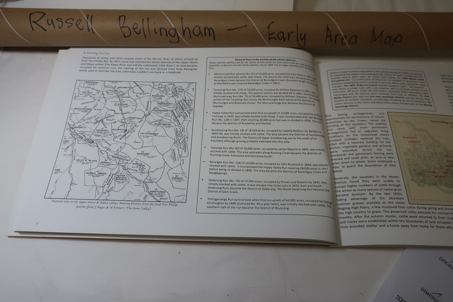
This map shows the following: The name as spelt in 1848; the licence number as found in Port Phillip Gazette for July 26, 1848; name of licensee; estimated area in acres. The scale is 8 miles to the inch.
Significance
A map showing the squatting runs in 1848 including the names of the squatters , the licenxe numberand the area in acres.
Physical description
Roll of hand drawn map depicting 'Squatting Runs of the Murray District 1848 in Victoria. Created by