
Showing 26 items matching "storm creek"
-
 Marysville & District Historical Society
Photograph (item) - Colour photograph, Unknown
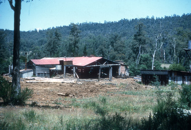
... ...storm creek...In 1938, timber workers established the Cathedral Mill near the junction of Little River and Storm Creek. The mill was later renamed Cooks Mill and supported local milling operations through the 1940s and 1950s, supplying sawn timber to the Healesville railway station and Melbourne builders. ...In 1938, timber workers established the Cathedral Mill near the junction of Little River and Storm Creek. The mill was later renamed Cooks Mill and supported local milling operations through the 1940s and 1950s, supplying sawn timber to the Healesville railway station and Melbourne builders. ...A digital copy of a colour photograph of Cooks Mill in Victoria. Located in the Cathedral Range State Park near Marysville, Cooks Mill was established as Cathedral Mill in 1938. Processing Mountain Ash and Manna Gum, it was a major local employer before ceasing operations in 1955. Early settlers initially used the harsh, rocky country of the Cathedral Range for grazing. However, wild dogs and difficult terrain eventually ended this. In 1938, timber workers established the Cathedral Mill near the junction of Little River and Storm Creek. The mill was later renamed Cooks Mill and supported local milling operations through the 1940s and 1950s, supplying sawn timber to the Healesville railway station and Melbourne builders. The mill itself stopped operating in 1955, though logging continued in the surrounding forests until late 1971.A digital copy of a colour photograph of Cooks Mill in Victoria.marysville, victoria, australia, taggerty, cathedral range state park, cathedral mill, mountain ash, manna gum, little river, storm creek, cooks mill, healesville railway station, melbourne -
 Marysville & District Historical Society
Photograph (item) - Colour photograph, Unknown
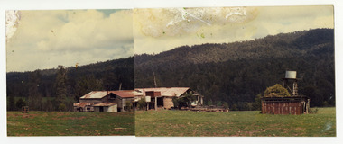
... ...storm creek...In 1938, timber workers established the Cathedral Mill near the junction of Little River and Storm Creek. The mill was later renamed Cooks Mill and supported local milling operations through the 1940s and 1950s, supplying sawn timber to the Healesville railway station and Melbourne builders. ...In 1938, timber workers established the Cathedral Mill near the junction of Little River and Storm Creek. The mill was later renamed Cooks Mill and supported local milling operations through the 1940s and 1950s, supplying sawn timber to the Healesville railway station and Melbourne builders. ...A colour photograph of Cooks Mill in Victoria. Located in the Cathedral Range State Park near Marysville, Cooks Mill was established as Cathedral Mill in 1938. Processing Mountain Ash and Manna Gum, it was a major local employer before ceasing operations in 1955. Early settlers initially used the harsh, rocky country of the Cathedral Range for grazing. However, wild dogs and difficult terrain eventually ended this. In 1938, timber workers established the Cathedral Mill near the junction of Little River and Storm Creek. The mill was later renamed Cooks Mill and supported local milling operations through the 1940s and 1950s, supplying sawn timber to the Healesville railway station and Melbourne builders. The mill itself stopped operating in 1955, though logging continued in the surrounding forests until late 1971.A colour photograph of Cooks Mill in Victoria.marysville, victoria, australia, taggerty, cathedral range state park, cathedral mill, mountain ash, manna gum, little river, storm creek, cooks mill, healesville railway station, melbourne, photograph -
 Marysville & District Historical Society
Photograph (item) - Colour photograph, Unknown
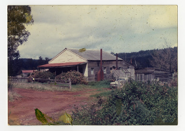
... ...storm creek...In 1938, timber workers established the Cathedral Mill near the junction of Little River and Storm Creek. The mill was later renamed Cooks Mill and supported local milling operations through the 1940s and 1950s, supplying sawn timber to the Healesville railway station and Melbourne builders. ...In 1938, timber workers established the Cathedral Mill near the junction of Little River and Storm Creek. The mill was later renamed Cooks Mill and supported local milling operations through the 1940s and 1950s, supplying sawn timber to the Healesville railway station and Melbourne builders. ...A colour photograph of a house that was located at Cooks Mill in Victoria. Located in the Cathedral Range State Park near Marysville, Cooks Mill was established as Cathedral Mill in 1938. Processing Mountain Ash and Manna Gum, it was a major local employer before ceasing operations in 1955. Early settlers initially used the harsh, rocky country of the Cathedral Range for grazing. However, wild dogs and difficult terrain eventually ended this. In 1938, timber workers established the Cathedral Mill near the junction of Little River and Storm Creek. The mill was later renamed Cooks Mill and supported local milling operations through the 1940s and 1950s, supplying sawn timber to the Healesville railway station and Melbourne builders. The mill itself stopped operating in 1955, though logging continued in the surrounding forests until late 1971.A colour photograph of a house that was located at Cooks Mill in Victoria.Cook's Mill House/ (Tom Lewis lived there) 1970'smarysville, victoria, australia, taggerty, cathedral range state park, cathedral mill, mountain ash, manna gum, little river, storm creek, cooks mill, healesville railway station, melbourne, photograph, tom lewis -
 Marysville & District Historical Society
Document (item) - Memories document, Janet Allen, MARYSVILLE MEMORIES, 15-10-2009
... ...storm creek...A document outlining Janet Allen's (nee Hannan) memories of living in a mill house at Cooks Mill in Victoria. marysville victoria australia taggerty cathedral range state park cathedral mill mountain ash manna gum little river storm creek cooks mill healesville railway station melbourne janet hannan robin hannan A document outlining Janet Allen's (nee Hannan) memories of living in a mill house at Cooks Mill in Victoria. ...A document outlining Janet Allen's (nee Hannan) memories of living in a mill house at Cooks Mill in Victoria.A document outlining Janet Allen's (nee Hannan) memories of living in a mill house at Cooks Mill in Victoria.marysville, victoria, australia, taggerty, cathedral range state park, cathedral mill, mountain ash, manna gum, little river, storm creek, cooks mill, healesville railway station, melbourne, janet hannan, robin hannan -
 Marysville & District Historical Society
Photograph (item) - Black and white photographs, Unknown
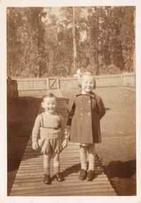
... ...storm creek...A series of seven black and white photographs of Janet and Robin Hannan who lived in Marysville and had an association with Cooks Mill in Victoria. marysville victoria australia taggerty cathedral range state park cathedral mill mountain ash manna gum little river storm creek cooks mill healesville railway station melbourne A series of seven black and white photographs of Janet and Robin Hannan who lived in Marysville and had an association with Cooks Mill in Victoria. ...A series of seven black and white photographs of Janet and Robin Hannan who lived in Marysville and had an association with Cooks Mill in Victoria.A series of seven black and white photographs of Janet and Robin Hannan who lived in Marysville and had an association with Cooks Mill in Victoria.marysville, victoria, australia, taggerty, cathedral range state park, cathedral mill, mountain ash, manna gum, little river, storm creek, cooks mill, healesville railway station, melbourne -
 Greensborough Historical Society
Newspaper Clipping, Diamond Valley Leader, Perk hour traffic, 30/08/2017
... A storm in a coffee cup is brewing on busy Diamond Creek Road. Every time a motorist stops for a morning caffeine fix, six lanes of traffic grind to a standstill. ...A storm in a coffee cup is brewing on busy Diamond Creek Road. Every time a motorist stops for a morning caffeine fix, six lanes of traffic grind to a standstill. ...A storm in a coffee cup is brewing on busy Diamond Creek Road. Every time a motorist stops for a morning caffeine fix, six lanes of traffic grind to a standstill. Sensors installed at St Sava Serbian Church trigger traffic lights which allow the car in the carpark to enter traffic.News article 1 page, black text.greensborough, coffee stop, diamond creek road, nillumbik council, st sava serbian orthodox church -
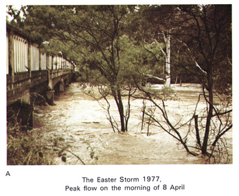 Eltham District Historical Society Inc
Work on paper (Sub-Item) - Photograph, Main Road Bridge, Eltham peak flow of flood 8 April, 1977
... Flooding of Diamond Creek at Main Road Bridge, Eltham peak flow of flood. Easter storm, 8 April, 1977...Flooding of Diamond Creek at Main Road Bridge, Eltham peak flow of flood. Easter storm, 8 April, 1977 flood diamond creek flooding eltham bridge main road Image printed on A4 page from 04997 Diamond Creek Basin Study, 1980 Main Road Bridge, Eltham peak flow of flood 8 April, 1977 Work on paper Photograph ...Colour photograph. Flooding of Diamond Creek at Main Road Bridge, Eltham peak flow of flood. Easter storm, 8 April, 1977flood, diamond creek, flooding, eltham, bridge, main road -
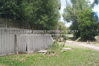 Eltham District Historical Society Inc
Photograph, Fay Bridge, Flood damage at Nillumbik Medical Centre, 1078 Main Road, Eltham, 26 December 2011
... storm on Christmas Day 2011. A flash flood occurred from significant rain fall and hail, which accumulated along an old waterway with floodwater submerging cars along Valonia Drive then down Grove Street flooding houses, through the Bible Street Reserve where it then submerged Main Road washing away the small railway trestle bridge opposite the reserve then flooding the Judge Book Village before finally entering the Diamond Creek.....storm on Christmas Day 2011. A flash flood occurred from significant rain fall and hail, which accumulated along an old waterway with floodwater submerging cars along Valonia Drive then down Grove Street flooding houses, through the Bible Street Reserve where it then submerged Main Road washing away the small railway trestle bridge opposite the reserve then flooding the Judge Book Village before finally entering the Diamond Creek.. ...Flood damage resulting from a late afternoon storm on Christmas Day 2011. A flash flood occurred from significant rain fall and hail, which accumulated along an old waterway with floodwater submerging cars along Valonia Drive then down Grove Street flooding houses, through the Bible Street Reserve where it then submerged Main Road washing away the small railway trestle bridge opposite the reserve then flooding the Judge Book Village before finally entering the Diamond Creek..fay bridge collection, 2011-12-26, bible street reserve, flood damage, floods, floodwater, main road, nillumbik medical centre -
 Eltham District Historical Society Inc
Newsclipping, Vince Chadwick, Violent storms shatter the peace of Christmas, The Age, Monday, December 26, p3, 2011
... storm on Christmas Day 2011. A flash flood occurred from significant rain fall and hail, which accumulated along an old waterway with floodwater submerging cars along Valonia Drive then down Grove Street flooding houses, through the Bible Street Reserve where it then submerged Main Road washing away the small railway trestle bridge opposite the reserve then flooding the Judge Book Village before finally entering the Diamond Creek. ...storm on Christmas Day 2011. A flash flood occurred from significant rain fall and hail, which accumulated along an old waterway with floodwater submerging cars along Valonia Drive then down Grove Street flooding houses, through the Bible Street Reserve where it then submerged Main Road washing away the small railway trestle bridge opposite the reserve then flooding the Judge Book Village before finally entering the Diamond Creek. ...A late afternoon storm on Christmas Day 2011. A flash flood occurred from significant rain fall and hail, which accumulated along an old waterway with floodwater submerging cars along Valonia Drive then down Grove Street flooding houses, through the Bible Street Reserve where it then submerged Main Road washing away the small railway trestle bridge opposite the reserve then flooding the Judge Book Village before finally entering the Diamond Creek. Widespread damage occured from hail and flash flooding.fay bridge collection, 2011-12-26, eltham, flood damage, floods, grove street, main road, valonia drive -
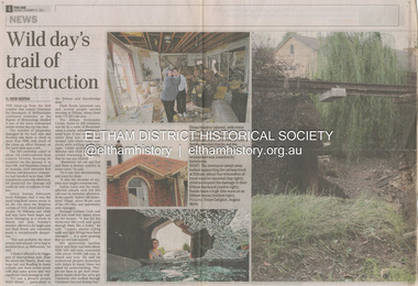 Eltham District Historical Society Inc
Newsclipping, Reid Sexton, Wild day's trail of destruction, The Age, Tuesday, December 27, pp4-5, 2011
... storm on Christmas Day 2011. A flash flood occurred from significant rain fall and hail, which accumulated along an old waterway with floodwater submerging cars along Valonia Drive then down Grove Street flooding houses, through the Bible Street Reserve where it then submerged Main Road washing away the small railway trestle bridge opposite the reserve then flooding the Judge Book Village before finally entering the Diamond Creek. ...storm on Christmas Day 2011. A flash flood occurred from significant rain fall and hail, which accumulated along an old waterway with floodwater submerging cars along Valonia Drive then down Grove Street flooding houses, through the Bible Street Reserve where it then submerged Main Road washing away the small railway trestle bridge opposite the reserve then flooding the Judge Book Village before finally entering the Diamond Creek. ...A late afternoon storm on Christmas Day 2011. A flash flood occurred from significant rain fall and hail, which accumulated along an old waterway with floodwater submerging cars along Valonia Drive then down Grove Street flooding houses, through the Bible Street Reserve where it then submerged Main Road washing away the small railway trestle bridge opposite the reserve then flooding the Judge Book Village before finally entering the Diamond Creek. Widespread damage occured from hail and flash flooding.fay bridge collection, eltham, 2011-12-27, flood damage, floods, floodwater -
 Eltham District Historical Society Inc
Newsclipping, Angus Thompson et al, Another insurance storm brews, Herald Sun, Tuesday, December 27, pp4-5, 2011
... storm on Christmas Day 2011. A flash flood occurred from significant rain fall and hail, which accumulated along an old waterway with floodwater submerging cars along Valonia Drive then down Grove Street flooding houses, through the Bible Street Reserve where it then submerged Main Road washing away the small railway trestle bridge opposite the reserve then flooding the Judge Book Village before finally entering the Diamond Creek. ...storm on Christmas Day 2011. A flash flood occurred from significant rain fall and hail, which accumulated along an old waterway with floodwater submerging cars along Valonia Drive then down Grove Street flooding houses, through the Bible Street Reserve where it then submerged Main Road washing away the small railway trestle bridge opposite the reserve then flooding the Judge Book Village before finally entering the Diamond Creek. ...A late afternoon storm on Christmas Day 2011. A flash flood occurred from significant rain fall and hail, which accumulated along an old waterway with floodwater submerging cars along Valonia Drive then down Grove Street flooding houses, through the Bible Street Reserve where it then submerged Main Road washing away the small railway trestle bridge opposite the reserve then flooding the Judge Book Village before finally entering the Diamond Creek. Widespread damage occured from hail and flash flooding.fay bridge collection, eltham, 2011-12-27, flood damage, floods, floodwater -
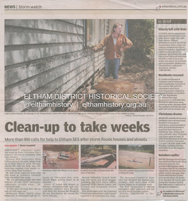 Eltham District Historical Society Inc
Newsclipping, Shaun Campbell, Clean-up to take weeks, Diamond Valley Leader, December 2011
... storm on Christmas Day 2011. A flash flood occurred from significant rain fall and hail, which accumulated along an old waterway with floodwater submerging cars along Valonia Drive then down Grove Street flooding houses, through the Bible Street Reserve where it then submerged Main Road washing away the small railway trestle bridge opposite the reserve then flooding the Judge Book Village before finally entering the Diamond Creek. ...storm on Christmas Day 2011. A flash flood occurred from significant rain fall and hail, which accumulated along an old waterway with floodwater submerging cars along Valonia Drive then down Grove Street flooding houses, through the Bible Street Reserve where it then submerged Main Road washing away the small railway trestle bridge opposite the reserve then flooding the Judge Book Village before finally entering the Diamond Creek. ...A late afternoon storm on Christmas Day 2011. A flash flood occurred from significant rain fall and hail, which accumulated along an old waterway with floodwater submerging cars along Valonia Drive then down Grove Street flooding houses, through the Bible Street Reserve where it then submerged Main Road washing away the small railway trestle bridge opposite the reserve then flooding the Judge Book Village before finally entering the Diamond Creek. Widespread damage occured from hail and flash flooding.fay bridge collection, eltham, flood damage, floods, floodwater -
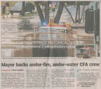 Eltham District Historical Society Inc
Newsclipping, Shaun Campbell, Mayor backs under-fire, under-water CFA crew, Diamond Valley Leader, December 2011
... storm on Christmas Day 2011. A flash flood occurred from significant rain fall and hail, which accumulated along an old waterway with floodwater submerging cars along Valonia Drive then down Grove Street flooding houses, through the Bible Street Reserve where it then submerged Main Road washing away the small railway trestle bridge opposite the reserve then flooding the Judge Book Village before finally entering the Diamond Creek. ...storm on Christmas Day 2011. A flash flood occurred from significant rain fall and hail, which accumulated along an old waterway with floodwater submerging cars along Valonia Drive then down Grove Street flooding houses, through the Bible Street Reserve where it then submerged Main Road washing away the small railway trestle bridge opposite the reserve then flooding the Judge Book Village before finally entering the Diamond Creek. ...A late afternoon storm on Christmas Day 2011. A flash flood occurred from significant rain fall and hail, which accumulated along an old waterway with floodwater submerging cars along Valonia Drive then down Grove Street flooding houses, through the Bible Street Reserve where it then submerged Main Road washing away the small railway trestle bridge opposite the reserve then flooding the Judge Book Village before finally entering the Diamond Creek. Widespread damage occured from hail and flash flooding.fay bridge collection, eltham, flood damage, floods, floodwater, main road, research fire brigade -
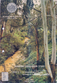 Eltham District Historical Society Inc
Book, Diamond Creek Basin Study. Part 1, A Compendium of Factors Relevant to Stormwater Flows, 1980
... creek...st helena east drain...st helena road...st helena...storm...Basin Studies are studies to evaluate water supply and demand and help ensure reliable water supplies by identifying strategies to address imbalances in water supply and demand. aerial photographs allendale road arthurs creek mine arthurs creek road bridge arthurs creek bald spur look-out bank protection bolton steet bridge street bridge bridge street bridges challenger street chute street construction coolaroo drive culvert deep creek diamond creek basin diamond creek region diamond creek diamond street bridge drainage works eltham lower park eltham town park eltham trestle bridge eltham west drains eltham erosion flood management floods footbridge glen katherine estate gold mining gum glade hurstbridge kangaroo ground kinglake escarpment kinglake national park latiners hat factory main road bridge main road masons falls melbourne metropolitan board of works, monash bridge mount sugarloaf nillumbik park orchards railway culvert railway line ramptons road real estate advertisement research creek st helena east drain st helena road st helena storm sewers stormwater sugarloaf-preston transfer main crossing susan street union mine village pond water flow watkins street wattletree road weidlich road wingrove park yarra river zig zag road water supply basin study Spiral Bound. 157 leaves in various foliations (some folded) : illustrated. ...Basin Studies are studies to evaluate water supply and demand and help ensure reliable water supplies by identifying strategies to address imbalances in water supply and demand.Spiral Bound. 157 leaves in various foliations (some folded) : illustrated. (some colour.), maps (some colour.)aerial photographs, allendale road, arthurs creek mine, arthurs creek road bridge, arthurs creek, bald spur look-out, bank protection, bolton steet, bridge street bridge, bridge street, bridges, challenger street, chute street, construction, coolaroo drive, culvert, deep creek, diamond creek basin, diamond creek region, diamond creek, diamond street bridge, drainage works, eltham lower park, eltham town park, eltham trestle bridge, eltham west drains, eltham, erosion, flood management, floods, footbridge, glen katherine estate, gold mining, gum glade, hurstbridge, kangaroo ground, kinglake escarpment, kinglake national park, latiners hat factory, main road bridge, main road, masons falls, melbourne metropolitan board of works, monash bridge, mount sugarloaf, nillumbik park, orchards, railway culvert, railway line, ramptons road, real estate advertisement, research creek, st helena east drain, st helena road, st helena, storm sewers, stormwater, sugarloaf-preston transfer main crossing, susan street, union mine, village pond, water flow, watkins street, wattletree road, weidlich road, wingrove park, yarra river, zig zag road, water supply, basin study -
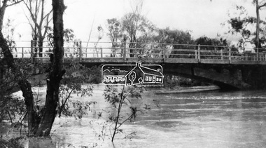 Eltham District Historical Society Inc
Negative - Photograph, Diamond Creek floodwater at Monash Bridge, Hurstbridge, Dec. 1934
... The historic 1934 flood of the Diamond Creek and Yarra River following the storms of 29-30 November set the levels for future planning with respect to flood water rise....The historic 1934 flood of the Diamond Creek and Yarra River following the storms of 29-30 November set the levels for future planning with respect to flood water rise. ...The historic 1934 flood of the Diamond Creek and Yarra River following the storms of 29-30 November set the levels for future planning with respect to flood water rise.This photo forms part of a collection of photographs gathered by the Shire of Eltham for their centenary project book,"Pioneers and Painters: 100 years of the Shire of Eltham" by Alan Marshall (1971). The collection of over 500 images is held in partnership between Eltham District Historical Society and Yarra Plenty Regional Library (Eltham Library) and is now formally known as the 'The Shire of Eltham Pioneers Photograph Collection.' It is significant in being the first community sourced collection representing the places and people of the Shire's first one hundred years.Digital image 4 x 5 inch B&W Negshire of eltham pioneers photograph collection, hurstbridge, 1934 flood, floods, monash bridge, diamond creek (creek) -
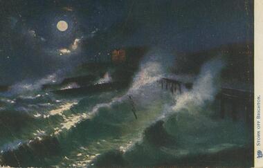 Bendigo Historical Society Inc.
Postcard - Alice McGregor Postcard Collection, 1900 - 1920
... Shatford, Watson's Creek, via Kangaroo Grounds, Melbourne Sender J Y D Dated Jan 31, 1906 Postcard Album of Alice McGregor containing 86 postcards. See 1400 Coloured image entitled 'Storm ...Alice McGREGOR Born: 1908; unknown parents. Possibly adopted by the Salter family? Electoral Roll 1936: Highland Terrace Kangaroo Flat. Alice Mary Salter and William Robert Salter living together; presumed to be sister and brother. William Robert Salter was killed in a MVA in Bendigo in 1937 aged 26. In Victoria in 1938, Alice Mary Salter married James Thomas McGregor (born Victoria 1917, died Victoria 1983, buried Fawkner Cemetery) Lived: 1968; 22 Wade Street Golden Square Alice McGregor Died: 1999 aged 91 at Anne Caudle Centre, Bendigo Buried: Kangaroo Flat Cemetery See additional research. Postcard Album of Alice McGregor contained 86 post cards.Postcard Album of Alice McGregor containing 86 postcards. See 1400 Coloured image entitled 'Storm off Brighton'. Dark moonlit night with rough seas. Just visible is a pier on the right. Lights of a house in background. Hull of a ship in centre? Addressee - Miss H.Y. Shatford, Watson's Creek, via Kangaroo Grounds, Melbourne Sender J Y D Dated Jan 31, 1906 postcard, collector, alice mcgregor -
 Bendigo Historical Society Inc.
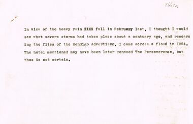
Document - EXTRACT FROM BENDIGO ADVERTISER, JANUARY 4TH 1864: (SEVERE STORM), 04/01/1864
... Extract from Bendigo Advertiser, January 4th, 1864 (Severe Storm) with attached typed note stating that this extract found in relation to the ''heavy rain fall in February last'' (no date! - but about ''a century ago'). Mention in this note that the hotel mentioned - Costello's Axe Creek...Creeks. Document EXTRACT FROM BENDIGO ADVERTISER, JANUARY 4TH 1864: (SEVERE STORM) ...Extract from Bendigo Advertiser, January 4th, 1864 (Severe Storm) with attached typed note stating that this extract found in relation to the ''heavy rain fall in February last'' (no date! - but about ''a century ago'). Mention in this note that the hotel mentioned - Costello's Axe Creek Bridge Hotel may have been later renamed The Perseverence (sic). The 1864 article describes the water and ice/hail damage in the neighborhood of the Sheepwash, Emu and Axe Creeks.Bendigo Advertisernewspaper, bendigo advertiser, weather event, emu and axe creeks, axe creek bridge hotel -
 Bendigo Historical Society Inc.
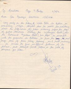
Document - ARTICLES FOR ROYAL HISTORICAL SOCIETY (BENDIGO BRANCH) NEWSLETTER APRIL 1973
... Article from Bendigo Advertiser 4th Jan 1864 re storm of 31/1/1864 (sic) December? Mention of Axe Creek Bridge Hotel of Mr Costelloe. ...Article from Bendigo Advertiser 4th Jan 1864 re storm of 31/1/1864 (sic) December? Mention of Axe Creek Bridge Hotel of Mr Costelloe. ...Articles for Royal Historical Society (Bendigo Branch) Newsletter - April 1973. 1. From Bendigo Advertiser 15/10/1950 re Bendigo's first unofficial postman, Mr Collier, White Hills. 2.''Inaugurating the New Lock Up'' from Bendigo Advertiser 20/9/1861; mention of Detective Thompson and first inhabitant of Market Square lockup (man named Diamond). 3. Chinese Testimonial (Bendigo Advertiser 27/11/1856) re ring presented to Mr Lysaght as their ''first lawyer''. 4. Bendigo City Coat of Arms - description of this in detail and the representations of the Coat of Arms that are incorrect (eg on three sides of the City Hall) Suggestion - '' see the old Council Chambers'' for ''portraits'' of the (full and correct?) Bendigo Coat of Arms.5. Article from Bendigo Advertiser 4th Jan 1864 re storm of 31/1/1864 (sic) December? Mention of Axe Creek Bridge Hotel of Mr Costelloe. A note from 1973 from author that this hotel might later have been renamed 'The Perseverance' hotel; details of severed storm and flash flood of the day. [Two copies].document, names of bendigo pioneers, bendigo -
 Eltham District Historical Society Inc
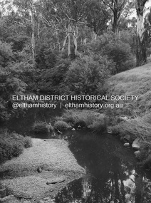
Photograph - Digital Photograph, Alan King, Diamond Creek, Barak Bushlands, Eltham, 2008
... Storm water is filtered through plants in the wetland ponds then is released slowly into the billabong, before flowing into the Diamond Creek. ...Storm water is filtered through plants in the wetland ponds then is released slowly into the billabong, before flowing into the Diamond Creek. ...A habitat corridor and it strengthens the community. Published: Nillumbik Now and Then / Marguerite Marshall 2008; photographs Alan King with Marguerite Marshall.; p185 Barak Bushlands lie west of the Diamond Creek on the corner of Falkiner Street and busy, noisy Main Road. They form part of an important habitat corridor linking the Yarra River to the Kinglake National Park.1 Manna Gums, tawny frogmouths and platypuses are some of the indigenous plants and animals that have made their home there. The bushlands are the result of more than nine years of hard work by the local community with the Nillumbik Council, to transform a degraded flood plain into this refuge of natural beauty. In 1997, shortly after moving into the new Riverside Estate on Falkiner Street, Eltham, several residents noticed the sorry state of the Diamond Creek and surrounding area. Part of it was used as a cow paddock and although small patches of vegetation survived, the area was infested with weeds, rabbits, rubbish and drainage from the housing estate. At various times the 4.4 hectares had been used as a market garden and for shire stock piles. The residents began to restore the area by revegetating land along the Diamond Creek. In 1998 they established the Friends of the Diamond Creek Falkiner Street Reserve2 and 35 families joined from the 90-house Estate. Carolyn Mellor, as the Friends’ Land Manager, undertook a four-year horticulture course to guide this massive project for a volunteer organisation. Since 1999, she has been the Friends’ President. In 1999 the Friends urged the Nillumbik Council to undertake a feasibility study into establishing a wetland system and urban forest. Work began in 2002 with Nillumbik Council funding the project, supplemented by government grants. The Friends also received grants from Melbourne Water and Parks Victoria. Aided by the Friends and other community members, the Council created the Barak Bushlands consisting of a forest, a wetland, a bridge, a path and open space. The beautiful wetland treats most of the estate’s stormwater runoff. Storm water is filtered through plants in the wetland ponds then is released slowly into the billabong, before flowing into the Diamond Creek. The wetland also helps to minimise flooding and the improved water quality provides a flora and fauna habitat. The Friends and other volunteers planted more than 27,000 plants, more than one third of which they grew from seeds they collected at Lower Eltham and Wingrove Parks. Eltham High School students planted thousands of these through a Year Eight program introduced for this purpose. Other groups who assisted were: Green Corps, local Scouts and Guides – 2nd Montmorency, 1st Diamond Creek and 1st Eltham Cub Packs, Eltham College students, Eltham East Primary School, Landcare members, Eltham Lions Club and the Eltham Baptist Church. To maintain enthusiasm for the mammoth task, the Friends and other volunteers ‘adopted’ trees to water and wrote their names on the stakes. In 2004, to recognise the area’s original occupiers, the reserve was named Barak Bushlands. William Barak, who lived from 1824 to 1903, was the last chief of the Yarra Yarra tribe of the Wurundjeri-willam people. Traces of these original inhabitants remain in scar trees (bark sections removed to make a shield or canoe). That same year the Friends’ group was a finalist in the prestigious Federal Government, Banksia Environmental Awards. The Friends have also participated in Clean Up Australia, removing tonnes of rubbish and regularly testing the billabong, wetland and creek, for pollutants. For years the Friends, together with the Australian Platypus Conservancy, have tagged, measured and checked the health of platypuses from the Diamond and Mullum Mullum Creeks. With Latrobe University the Friends have conducted night walks to view owls, possums, bats and sugar gliders. Challenges for the council and the Friends continue with a large rabbit population, some vandalism, weed eradication and maintenance. However, thanks to this community effort, locals can now escape confined urban living on small blocks of land and enjoy the beauty of indigenous plants and animals. Working together has also strengthened the local community,This collection of almost 130 photos about places and people within the Shire of Nillumbik, an urban and rural municipality in Melbourne's north, contributes to an understanding of the history of the Shire. Published in 2008 immediately prior to the Black Saturday bushfires of February 7, 2009, it documents sites that were impacted, and in some cases destroyed by the fires. It includes photographs taken especially for the publication, creating a unique time capsule representing the Shire in the early 21st century. It remains the most recent comprehenesive publication devoted to the Shire's history connecting local residents to the past. nillumbik now and then (marshall-king) collection, barak bushlands, diamond creek (creek), eltham -
 Darebin Parklands Association
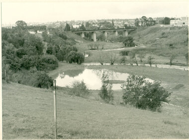
Rockbeare Park and Darebin Creek, August 1974, 1974
... Darebin Parklands Association stormed the meeting to get this decision reversed, and the wetlands were never filled in. B&W photograph. Shows wetlands and Darebin Creek. ...In 1972 Ivanhoe Progress Association planned to fill in the wetlands because they felt it bred mosquitos, and they obtained a grant for this work to take place. Darebin Parklands Association stormed the meeting to get this decision reversed, and the wetlands were never filled in.B&W photograph. Shows wetlands and Darebin Creek. Albion Reid land on fore bank. View from the north with panorama of Kew in the distance This item and all other Darebin Parklands Association archival material is now held by State Library Victoria (Accession No: YMS 13746). Please contact State Library Victoria if access is required. -
 Southern Sherbrooke Historical Society Inc.
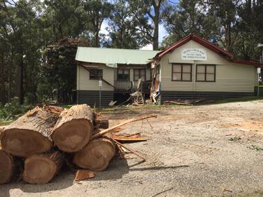
Photograph - Menzies Creek Hall damaged by storm, 2016
... Menzies Creek Hall damaged by storm, 2016....Colour photographs of Menzies Creek Hall damaged by a falling tree during a wind storm, 10th October 2016. ...Colour photographs of Menzies Creek Hall damaged by a falling tree during a wind storm, 10th October 2016. ...Colour photographs of Menzies Creek Hall damaged by a falling tree during a wind storm, 10th October 2016. In the first photo several cut logs in the foreground. The second photo shows a room bisected by the tree. Photos taken by Marian Matta. -
 Federation University Art Collection
Painting, Norman Hofmaier, 'Promethius 1 from the Mallee Mysteries Series', by Norman Hofmaier
... Creek. Both he and his father had an intimate knowledge of the flora and fauna of the Mallee. The Wyperfeld National Park, home to the Big Desert, was a favourite place for Norman’s uncle who planted acres of native trees at the family property. Dr Di Bresciani explains: “The colours and vastness of the Mallee are represented in many works which reflect, variously, the relentless quiet and swirling energies found in the ‘dust storm might’ of the Mallee area. ...Creek. Both he and his father had an intimate knowledge of the flora and fauna of the Mallee. The Wyperfeld National Park, home to the Big Desert, was a favourite place for Norman’s uncle who planted acres of native trees at the family property. Dr Di Bresciani explains: “The colours and vastness of the Mallee are represented in many works which reflect, variously, the relentless quiet and swirling energies found in the ‘dust storm might’ of the Mallee area. ...Norman Keith HOFMAIER (12.08.1951- ) Born Beulah, Wimmera, Victoria Norman Hofmaier was a scion of a well-known family, he completed his secondary education at Hopetoun High School and Ballarat College. Later he studied Visual Art at University of Ballarat, including painting, design and sculpture. Hofmaier’s childhood in Beulah was spent on the family property running beside the Yarriambiack Creek. Both he and his father had an intimate knowledge of the flora and fauna of the Mallee. The Wyperfeld National Park, home to the Big Desert, was a favourite place for Norman’s uncle who planted acres of native trees at the family property. Dr Di Bresciani explains: “The colours and vastness of the Mallee are represented in many works which reflect, variously, the relentless quiet and swirling energies found in the ‘dust storm might’ of the Mallee area. Most works may be described as abstract, lyrical abstract or abstract expressionist." From the 1970s until the 1990s he began an outpouring of work, using oil-based paints overlaid manually on large, specially-prepared boards using brushes, cloths, sponges, sprays or rollers. Petrol solvents were used to soften, blur and enhance shapes and edges. His work reflected his exploration of his inner state, sometimes flowing and placid, sometimes tempestuous. After a brief sojourn into city-life Norman returned to working in the country, until finally submitting to mental illness and permanent care in the mid 1990s. Norman Hofmaier's works are represented in major collections including that of the well- known artist Mitch Pearson ( an important influence and lifelong friend). The work 'Pastel of a Nude' was shown in a widely distributed magazine and two works owned by Mark Shannon were planned to be published as record covers in 1993. He won an award during the bicentennial recognising his skill as a Wimmera artist. From the 1970s until the 1990s he began an outpouring of work, using oil-based paints overlaid manually on large, specially-prepared boards using brushes, cloths, sponges, sprays or rollers. Petrol solvents were used to soften, blur and enhance shapes and edges. This work was purchased from the exhibition 'Norman Hofmaier: Mallee Mysteries' at the Lost Ones Gallery in Camp Street, Ballarat. The exhibition explored the legacy of Hofmaier’s work as well as raising money for the Ballarat Art Foundation. The Hofmaier family donated 16 works of the artist to be sold to raise funds for the foundation, to support emerging artists.Original painting in square format, featuring abstract swirls of blue, white, red, yellow and green.On back of work: 1. pools of diluted oil paint covering approximately 8 cm from each edge, 2. in right hand corner in permanent marker "N Hofmaier" 3. middle right hand side, torn exhibition label, with the words, "Belauh", "Local Art", "Prome", "Local Art", "$350", "Collect A", "oin" 4. Bottom right corner, two exhibition labels on card. Cards read: The flowing of movement before any known bodies are formed. Matter and gases bubble forming kaleidoscopic colours and shapes. Promethius 1 Oil based pigment with petrol on prepared board 1320 x 1210 mm On front of work, bottom right hand corner, in white lettering, N Hofmaier. Bottom right hand olive green frame damaged on front of work.painter, mallee, beluah, norman hofmaier, wimmera, abstract, alumni -
 Sunbury Family History and Heritage Society Inc.
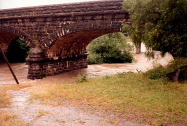
Photograph, Marilyn Bray, 17th December 1985
... On 17th December 1985, Sunbury and surrounding districts experienced heavy rainfall resulting in the local rivers and waterways flooding.The floodwaters flowing under the Macedon Street bridge at Jackson Creek, almost reached the arches before the waters receded. Some of the low-lying areas in Sunbury had water flowing over the roads as a result of storm water drains overflowing. ...On 17th December 1985, Sunbury and surrounding districts experienced heavy rainfall resulting in the local rivers and waterways flooding.The floodwaters flowing under the Macedon Street bridge at Jackson Creek, almost reached the arches before the waters receded. Some of the low-lying areas in Sunbury had water flowing over the roads as a result of storm water drains overflowing. ...On 17th December 1985, Sunbury and surrounding districts experienced heavy rainfall resulting in the local rivers and waterways flooding.The floodwaters flowing under the Macedon Street bridge at Jackson Creek, almost reached the arches before the waters receded. Some of the low-lying areas in Sunbury had water flowing over the roads as a result of storm water drains overflowing. A non-digital coloured photograph of flood waters rushing under a bluestone bridge. floods, macedon street bridge, jacksons creek, sunbury -
 Linton and District Historical Society Inc
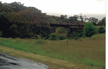
Photograph, Dilapidated bridge over Springdallah Creek, Happy Valley/Piggoreet, 2010
... The old bridge was further damaged by storms and flooding in November 2010 and January 2011. (The newer bridge was completely washed away when the Springdallah Creek flooded in January 2011.) ...The old bridge was further damaged by storms and flooding in November 2010 and January 2011. (The newer bridge was completely washed away when the Springdallah Creek flooded in January 2011.) ...This bridge was built in the 1880s. By the 1980s it was in a dilapidated condition and was replaced. The old bridge was further damaged by storms and flooding in November 2010 and January 2011. (The newer bridge was completely washed away when the Springdallah Creek flooded in January 2011.) In 2025, little remains of the old bridge.Colour photograph of a trestle bridge spanning Springdallah Creek, Linton-Piggoreet Road.trestle bridges, old springdallah bridge -
 Linton and District Historical Society Inc
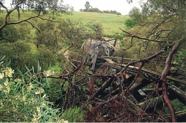
Photograph, Dilapidated bridge over Springdallah Creek, Happy Valley/Piggoreet, 2010
... storms and floodwaters in 2010 and 2011. In 2025, little remains of the old bridge. Trestle Bridges Old Springdallah Bridge Colour photograph showing damage to the Old Springdallah Bridge - a trestle bridge spanning Springdallah Creek, on Linton-Piggoreet Road. ...Already in a dilapidated condition, the bridge was further damaged by storms and floodwaters in 2010 and 2011. In 2025, little remains of the old bridge.Colour photograph showing damage to the Old Springdallah Bridge - a trestle bridge spanning Springdallah Creek, on Linton-Piggoreet Road. trestle bridges, old springdallah bridge -
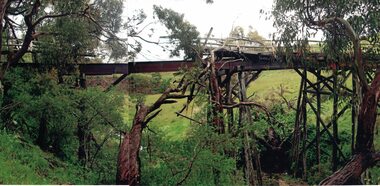 Linton and District Historical Society Inc
Photograph, Dilapidated bridge over Springdallah Creek, Happy Valley/Piggoreet, 2010
... The old bridge was further damaged by storms and flooding in November 2010 and January 2011. (The newer bridge was completely washed away when the Springdallah Creek flooded in January 2011.) ...The old bridge was further damaged by storms and flooding in November 2010 and January 2011. (The newer bridge was completely washed away when the Springdallah Creek flooded in January 2011.) ...This bridge was built in the 1880s. By the 1980s it was in a dilapidated condition and was replaced. The old bridge was further damaged by storms and flooding in November 2010 and January 2011. (The newer bridge was completely washed away when the Springdallah Creek flooded in January 2011.) In 2025, little remains of the old bridge.Two colour photographs of a trestle bridge spanning Springdallah Creek, Linton-Piggoreet Road. The two photographs have been sticky-taped together to form one panoramic image.trestle bridges, old springdallah bridge
