
Showing 514 items matching "streets, parks and gardens"
-
 Federation University Historical Collection
Plan, Ballaarat East Town Allotments, 1891, 18/09/1891
... The streets developed along gold leads and early tracks. The Public Park Botanic Gardens and Recreation Reserve is now Mount Xavier Golf Course, and Ballarat Secondary College Eastern Campus. ...It shows Victoria Street, Clifford Street, Finlay Street, Ryan Street, Bradbury Street, Elford Street, Fussell Street, Jones Street, Park Parade, Ballarat -Geelong Railway, Eureka Street, Ballarat East Public Park Botanic Garden and Recreation Reserve. ...It shows Victoria Street, Clifford Street, Finlay Street, Ryan Street, Bradbury Street, Elford Street, Fussell Street, Jones Street, Park Parade, Ballarat -Geelong Railway, Eureka Street, Ballarat East Public Park Botanic Garden and Recreation Reserve. ...Ballarat East was historically a separate municipality than Ballaarat. The streets developed along gold leads and early tracks. The Public Park Botanic Gardens and Recreation Reserve is now Mount Xavier Golf Course, and Ballarat Secondary College Eastern Campus. The section with Bettle's Private Property is now Saint Francis Xavier Primary School. Elford Street now appears to be the continuation of Eureka Street.Plan of Town Allotments for a portion of Ballarat East in the County of Grant. It shows Victoria Street, Clifford Street, Finlay Street, Ryan Street, Bradbury Street, Elford Street, Fussell Street, Jones Street, Park Parade, Ballarat -Geelong Railway, Eureka Street, Ballarat East Public Park Botanic Garden and Recreation Reserve. The only allotment names is Bettle's Private Property. Gift of the Squire Family, 2014ballarat east, ballaarat east, victoria street, ballarat east botanical gardens, richard squire, squire, ryan street, jones street, bradbury street, humffray steet, fussell street, elford street -
 Old Colonists' Association of Ballarat Inc.
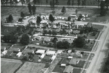
Photograph, Thornton Richards, Cottages at the Ballarat Old Colonists' Association Retirement Village, c1960
... Thirteen black and white cottages at the Ballarat Old Colonists' Association Retirement Village in Charles Anderson Grove, off Gillies Street. The Caravan Park and Garden Court is also evident in the photograph....The Old Colonists' Association of Ballarat Inc Retirement Village is located at Charles Anderson Grove. old colonists' association ballarat charles anderson grove retirement village Thirteen black and white cottages at the Ballarat Old Colonists' Association Retirement Village in Charles Anderson Grove, off Gillies Street. The Caravan Park and Garden Court is also evident in the photograph. ...The Old Colonists' Association of Ballarat Inc Retirement Village is located at Charles Anderson Grove.Thirteen black and white cottages at the Ballarat Old Colonists' Association Retirement Village in Charles Anderson Grove, off Gillies Street. The Caravan Park and Garden Court is also evident in the photograph.old colonists' association ballarat, charles anderson grove, retirement village -
 Ballarat Heritage Services
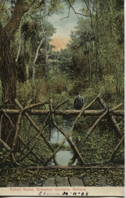
Postcard, Ballarat Botanical Gardens, c1908
... The major works that projected the Garden City image were the street plantings, parks and botanical gardens ..." ...The major works that projected the Garden City image were the street plantings, parks and botanical gardens ..." ..."Within six years of its first land sales in 1852, founder members had challenged council over horticultural decisions and Ballarat's main thoroughfare contained fences squares, trees and flower beds. The major works that projected the Garden City image were the street plantings, parks and botanical gardens ..." Reference: Michael Taffe, Growing a garden City: Ballarat Horticultural Society 1859-2009, BHS Publishing, 2014, p. 10.This postcard shows how the botanical gardens in Ballarat, famous for being a Garden City.Coloured postcard Forest Scene, Botanical Gardens, Ballarat printed in red at bottom of card. Elaine 30-11-08 handwritten in black ink underneath.botanical gardens, ballarat, forest scene, gardens, botanical, -
 Bendigo Historical Society Inc.
Souvenir - Bendigo the Golden City Booklet, 1940
... Carol Holsworth Collection: Bendigo the Golden City Booklet, 14 pages which feature text and sketches of 'Bendigo The Golden City of Tree-lined streets and parks and gardens.' Published by Frank J. ...BHS Collection history bendigo Carol Holsworth Collection Bendigo the Golden City Booklet Carol Holsworth Collection: Bendigo the Golden City Booklet, 14 pages which feature text and sketches of 'Bendigo The Golden City of Tree-lined streets and parks and gardens.' Published by Frank J. ...BHS CollectionCarol Holsworth Collection: Bendigo the Golden City Booklet, 14 pages which feature text and sketches of 'Bendigo The Golden City of Tree-lined streets and parks and gardens.' Published by Frank J. Every's Bok and Stationary Centre Bendigo, printed by John Sands Pty Ltd, Druitt Street, Sydney NSW.history, bendigo, carol holsworth collection, bendigo the golden city booklet -
 Federation University Historical Collection
Document - Documents, Golden Point - Mount Pleasant Progress Association Establishment
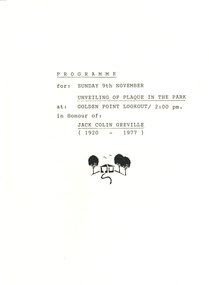
... Topics include: Pearce's Park; removal of elms, names and addresses of members, Sovereign Hill realignment; Sovereign Hill Lookout; membership form; Golden Point Historic Mines Direction Indicator; Ballarat Observatory; Nerrina Tip; Yarrowee Creek; Mine Capping (Sovereign Mine); tree planting (Sovereign Hill Lookout); Magpie Street Park; Hill Street; Yarrowee Flora Park; Barkly Street; South Street Bluestone Gutter; Ballarat Goldfields; Eastern baths site; Grant Street; Flooding; Aboriginal Advancement League; Sunnyside Woollen Mill; Chinese Garden; Golden Point Primary School closure; Ballarat West Goldfields; Sovereign Hill Land Title and Management Revision; Wainwright; Street; Llanberris; Yuille's Station Park...Topics include: Pearce's Park; removal of elms, names and addresses of members, Sovereign Hill realignment; Sovereign Hill Lookout; membership form; Golden Point Historic Mines Direction Indicator; Ballarat Observatory; Nerrina Tip; Yarrowee Creek; Mine Capping (Sovereign Mine); tree planting (Sovereign Hill Lookout); Magpie Street Park; Hill Street; Yarrowee Flora Park; Barkly Street; South Street Bluestone Gutter; Ballarat Goldfields; Eastern baths site; Grant Street; Flooding; Aboriginal Advancement League; Sunnyside Woollen Mill; Chinese Garden; Golden Point Primary School closure; Ballarat West Goldfields; Sovereign Hill Land Title and Management Revision; Wainwright; Street; Llanberris; Yuille's Station Park Golden Point - Mount Pleasant Progress Association Establishment Document Documents ...The Golden Point - Mt Pleasant Progress Association was established on Wednesday 6 April 1983. Membership was open to any person or organisation in the area generally bounded by Bridge mall and Skipton Street, Elsworth Street and main Road. annual family or organisation membership was $2.00. Mara Gluyas served as secretary of the Golden Point - Mt Pleasant Progress Association from 1983 to 1994. Ian McKinnon was the President from 1983 to 1992. Kerry Daniels was the President in 1994.A small white cardboard box with purple lid of A4 documents relating to the establishment of the Golden Point - Mt Pleasant Progress Association. The documents include the original constitution and minutes. Topics include: Pearce's Park; removal of elms, names and addresses of members, Sovereign Hill realignment; Sovereign Hill Lookout; membership form; Golden Point Historic Mines Direction Indicator; Ballarat Observatory; Nerrina Tip; Yarrowee Creek; Mine Capping (Sovereign Mine); tree planting (Sovereign Hill Lookout); Magpie Street Park; Hill Street; Yarrowee Flora Park; Barkly Street; South Street Bluestone Gutter; Ballarat Goldfields; Eastern baths site; Grant Street; Flooding; Aboriginal Advancement League; Sunnyside Woollen Mill; Chinese Garden; Golden Point Primary School closure; Ballarat West Goldfields; Sovereign Hill Land Title and Management Revision; Wainwright; Street; Llanberris; Yuille's Station Parkgolden point, mount pleasant, mt pleasant, ian mckinnno, mara gluyas, peter hiscock, frank williams, geoff howard, leigh gillett, sovereign hill, kerry daniels, norm strange; graeme kent; george netherway; keith rash; ian mckinnon, albert graham, bryan crebbin, jim humphreys. wid radbourn, heath martin, janet dore, alex mills park -
University of Melbourne, Burnley Campus Archives
Newspaper - Newspaper Cutting, The Age, Victorian Horticultural Society, 1862
... Extension of Swan Street through Richmond Park, past Pic Nic Station to the Gardens and River Yarra....Extension of Swan Street through Richmond Park, past Pic Nic Station to the Gardens and River Yarra. ...(1) Photocopy of article in "The Age" 30 January, 1862 p7. (2) Similar article from "the Argus" 30 January, 1962 p4. Description of the annual general meeting of the Victorian Horticultural Society. Description of a competition for a design and that the decorative part of the garden was nearly complete and open to the public. Donors of plants named including Rule (Californian Redwood?) Extension of Swan Street through Richmond Park, past Pic Nic Station to the Gardens and River Yarra.the age, the argus, victorian horticultural society, horticultural society of victoria, monthly meeting, competition for design of experimental gardens, burnley gardens, rule, californian redwood, donations of plants, pic nic station -
 Chelsea & District Historical Society Inc
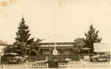
Photograph - Thames Promenade, Chelsea, Mr Baxter's house, 1916-1920
... In front of the house, on the street, there are three parked cars....In front of the house, on the street, there are three parked cars. Mr Baxter's house Photograph Thames Promenade, Chelsea ...Black and white photo of a house in Thames Avenue, Chelsea. The weatherboard house, with a picket fence, has a flagpole with a sign advertising for "Fred. W. Baxter New Zealand Insurance Company" in the front garden. A large billboard is on the right advertising the various business that Mr Baxter ran. In front of the house, on the street, there are three parked cars.Fred. W. Baxter Agent NEW ZEALAND INSURANCE COMPANY Co. OXYMEL OIL AND PAINT COMPANY HIGH GRADE PAINTS CYCLONE PTY LTD METAL GATES AND FENCES COLORO PTY LTD ALEX. STURROCK & SONS TIMBER MERCHANTS AND IMPORTERS RENOWN CARSthames promenade, chelsea, mr fred. w. baxter, businesses, housing, cars -
 St Kilda Historical Society
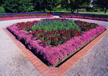
Ephemera - Postcard, City of Port Phillip, St Vincent Gardens annual bedding display 1995, c. 1995
... St Vincent Gardens is of national significance for its English style. ...St Vincent Gardens is of national significance for its English style. ...One of a series of postcards celebrating the launch of 'Flora for Victoria 1996', a project to celebrate the Royal Botanic Gardens of Melbourne`s 150th anniversary and the centenary of the death of its first director Baron Ferdinand von Mueller (1825 -1896). St Vincent Gardens is of national significance for its English style. Designed by Clement Hodgkinson in 1868 the garden reflects the Georgian era. Image description: Tree plantings are arranged in symmetrical patterns with themed plantings throughout the gardens timescale, four of which are registered with the National Trust. Message to residents on two of the postcards reads: "Dear Resident. NATURE STRIPS MOWING: The nature strips are a vital part of the streetscapes and the assistance you provide by maintaining the grassed nature strip is appreciated. The Parks team has mown your nature strip today as it was becoming quite long, however, Council encourages residents to mow their nature strip as it has limited resources. Pensioners or others unable to mow the nature strip are encouraged to advise the Parks team. Council also operates a 'Free lawn mower borrowing service' from the Albert Park Nursery, at 42 Mills Street, Albert Park. Lawn mowers are available daily 9.00am to 4.00pm except Christmas Day, Good Friday, and Anzac Day. For further information contact Parks on 9209 6672."Colour postcard (3 identical photos on each)St Vincent Gardens annual bedding display 1995 Historic gardens in the City of Port Phillip postcard series celebrating the launch of the Royal Botanic Garden's [sic] Melbourne, 'Flora for Victoria 1996' Produced by the City of Port Phillip, Melbourne Victoria Australia 9209 6209 City of Port Phillip logoalbert park, st vincent gardens, clement hodgkinson, city of port phillip, parks, gardens -
 Melbourne Tram Museum
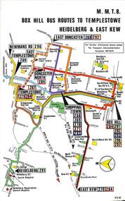
Map, Melbourne & Metropolitan Tramways Board (MMTB), Set of 8 bus route maps, 1977 to 1979
... Show the major cross streets, parks, schools, other tram routes, major stop numbers and railway lines. .1 - Box Hill bus routes to Templestowe - R38/82, Heidelberg and East Kew, includes Doncaster, Shoppingtown and Newmans Road. .2 - Clifton Hill - R2/79 - Elsternwick, Point Ormond and St Kilda Junction .3 - Footscray, Sunshine, Deer Park, Nth Altona, Fishermen's Bend, Highpoint and Williamstown Road - R2/79. .4 - Bulleen - City - Port Melbourne - Garden City Bus Route, including Kew, Collingwood - R6/78 .5 - City - Warrandyte and East Doncaster including Newmans Road, Templestowe, East Doncaster, Donvale, Shopping town, and Kew. ...Show the major cross streets, parks, schools, other tram routes, major stop numbers and railway lines. .1 - Box Hill bus routes to Templestowe - R38/82, Heidelberg and East Kew, includes Doncaster, Shoppingtown and Newmans Road. .2 - Clifton Hill - R2/79 - Elsternwick, Point Ormond and St Kilda Junction .3 - Footscray, Sunshine, Deer Park, Nth Altona, Fishermen's Bend, Highpoint and Williamstown Road - R2/79. .4 - Bulleen - City - Port Melbourne - Garden City Bus Route, including Kew, Collingwood - R6/78 .5 - City - Warrandyte and East Doncaster including Newmans Road, Templestowe, East Doncaster, Donvale, Shopping town, and Kew. ...Series of colour route maps for various bus or groups of tram lines for the MMTB. Some have the Transport Information Centre telephone printed on them, others have a label stuck on. Some are finished with a plastic laminate finish on either one or both sides. Show the major cross streets, parks, schools, other tram routes, major stop numbers and railway lines. .1 - Box Hill bus routes to Templestowe - R38/82, Heidelberg and East Kew, includes Doncaster, Shoppingtown and Newmans Road. .2 - Clifton Hill - R2/79 - Elsternwick, Point Ormond and St Kilda Junction .3 - Footscray, Sunshine, Deer Park, Nth Altona, Fishermen's Bend, Highpoint and Williamstown Road - R2/79. .4 - Bulleen - City - Port Melbourne - Garden City Bus Route, including Kew, Collingwood - R6/78 .5 - City - Warrandyte and East Doncaster including Newmans Road, Templestowe, East Doncaster, Donvale, Shopping town, and Kew. R3/82. .6 - West Heidelberg, La Trobe University, Northland - R3/81 .7 - Box Hill, Ringwood to East Doncaster and Warrandyte, Park Orchards, North Blackburn R3/82. .8 - Geelong - Herne Hill, Rollins Road, Donnybrook Rd, North Shore and Corio Villagetrams, tramways, maps, route guide, route numbers, routes, buses, box hill, templestowe, doncaster, east kew, heidelberg, clifton hill, point ormond, elsternwick, footscray, sunshine, deer park, north altona, fishermen's bend, highpoint, williamstown rd, bulleen, kew, collingwood, port melbourne, garden city, warrandyte, donvale, la trobe university, northland, ringwood, park orchards, mitcham, blackburn, geelong -
 Kew Historical Society Inc
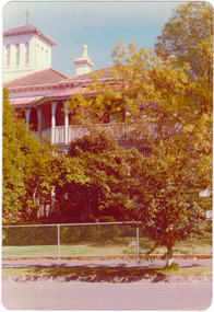
Photograph - 'Fernhurst', 13 Fernhurst Grove, 1978
... Originally accessed from near the corner of Princess Street and Studley Park Road, its gardens had been subdivided in the 1900s and its footprint restricted to 13 Fernhurst Grove. ...Originally accessed from near the corner of Princess Street and Studley Park Road, its gardens had been subdivided in the 1900s and its footprint restricted to 13 Fernhurst Grove. ...George Wharton arrived in Melbourne in 1844. An architect and surveyor, he was appointed to lay out the 'Village of Kew' by N.A. Fenwick following the land sales of 1851. A protagonist for Kew's separation from the Boroondara District Road Board, he was elected chairman when Kew achieved municipal status in December 1860. His home, 'Fernhurst', was built in 1866 on eight acres in Studley Park, with a four-storey tower and pyramidal roof. The Italianate home was a prominent Kew landmark. It was demolished in 1979 and replaced by St Paul's College in 1980.Rare colour photograph of what was once a significant mansion in Kew.Original colour positive photograph (Kodak print) of 'Fernhurst' in 1978. Photographed by Stewart West in May 1978, one year before it was demolished, the photograph gives little idea of the large landholding once surrounding the house. Originally accessed from near the corner of Princess Street and Studley Park Road, its gardens had been subdivided in the 1900s and its footprint restricted to 13 Fernhurst Grove. Like many other grand houses, by the 1970s it had been converted into apartments. From the photograph, one can see that the house had retained many of its original features such as the distinctive tower and the wide bow-fronted verandah. The slates on the roof (apart from those on the tower) had been replaced by tiles and the cement render of the exterior painted white. Annotated reverse: "View of Fernhurst Home Taken from Street / 10"fernhurst, 13 fernhurst grove -- kew (vic.), george wharton, italianate architecture, vila maria society, st paul's school for the blind -
 Kew Historical Society Inc
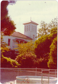
Photograph - 'Fernhurst', 13 Fernhurst Grove, 1978
... Originally accessed from near the corner of Princess Street and Studley Park Road, its gardens had been subdivided in the 1900s and its footprint restricted to 13 Fernhurst Grove. ...Originally accessed from near the corner of Princess Street and Studley Park Road, its gardens had been subdivided in the 1900s and its footprint restricted to 13 Fernhurst Grove. ...George Wharton arrived in Melbourne in 1844. An architect and surveyor, he was appointed to lay out the 'Village of Kew' by N.A. Fenwick following the land sales of 1851. A protagonist for Kew's separation from the Boroondara District Road Board, he was elected chairman when Kew achieved municipal status in December 1860. His home, 'Fernhurst', was built in 1866 on eight acres in Studley Park, with a four-storey tower and pyramidal roof. The Italianate home was a prominent Kew landmark. It was demolished in 1979 and replaced by St Paul's College in 1980.Rare colour photograph of what was once a significant mansion in Kew.Original colour positive photograph (Kodak print) of 'Fernhurst' in 1978. Photographed by Stewart West in May 1978, one year before it was demolished, the photograph gives little idea of the large landholding once surrounding the house. Originally accessed from near the corner of Princess Street and Studley Park Road, its gardens had been subdivided in the 1900s and its footprint restricted to 13 Fernhurst Grove. Like many other grand houses, by the 1970s it had been converted into apartments. From the photograph, one can see that the house had retained many of its original features such as the distinctive tower and the wide bow-fronted verandah. The slates on the roof (apart from those on the tower) had been replaced by tiles and the cement render of the exterior painted white. Annotated reverse: "Fernhurst from higher ground level side shot / 7"fernhurst, 13 fernhurst grove -- kew (vic.), george wharton, italianate architecture, vila maria society, st paul's school for the blind -
 Kew Historical Society Inc
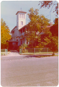
Photograph - 'Fernhurst', 13 Fernhurst Grove, 1978
... Originally accessed from near the corner of Princess Street and Studley Park Road, its gardens had been subdivided in the 1900s and its footprint restricted to 13 Fernhurst Grove. ...Originally accessed from near the corner of Princess Street and Studley Park Road, its gardens had been subdivided in the 1900s and its footprint restricted to 13 Fernhurst Grove. ...George Wharton arrived in Melbourne in 1844. An architect and surveyor, he was appointed to lay out the 'Village of Kew' by N.A. Fenwick following the land sales of 1851. A protagonist for Kew's separation from the Boroondara District Road Board, he was elected chairman when Kew achieved municipal status in December 1860. His home, 'Fernhurst', was built in 1866 on eight acres in Studley Park, with a four-storey tower and pyramidal roof. The Italianate home was a prominent Kew landmark. It was demolished in 1979 and replaced by St Paul's College in 1980.Rare colour photograph of what was once a significant mansion in Kew.Original colour positive photograph (Kodak print) of 'Fernhurst' in 1978. Photographed by Stewart West in May 1978, one year before it was demolished, the photograph gives little idea of the large landholding once surrounding the house. Originally accessed from near the corner of Princess Street and Studley Park Road, its gardens had been subdivided in the 1900s and its footprint restricted to 13 Fernhurst Grove. Like many other grand houses, by the 1970s it had been converted into apartments. From the photograph, one can see that the house had retained many of its original features such as the distinctive tower and the wide bow-fronted verandah. The slates on the roof (apart from those on the tower) had been replaced by tiles and the cement render of the exterior painted white. Annotated reverse: "Back view of Fernhurst / 8"fernhurst, 13 fernhurst grove -- kew (vic.), george wharton, italianate architecture, vila maria society, st paul's school for the blind -
 Kew Historical Society Inc
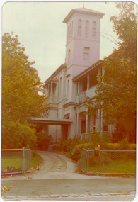
Photograph - 'Fernhurst', 13 Fernhurst Grove, 1978
... Originally accessed from near the corner of Princess Street and Studley Park Road, its gardens had been subdivided in the 1900s and its footprint restricted to 13 Fernhurst Grove. ...Originally accessed from near the corner of Princess Street and Studley Park Road, its gardens had been subdivided in the 1900s and its footprint restricted to 13 Fernhurst Grove. ...George Wharton arrived in Melbourne in 1844. An architect and surveyor, he was appointed to lay out the 'Village of Kew' by N.A. Fenwick following the land sales of 1851. A protagonist for Kew's separation from the Boroondara District Road Board, he was elected chairman when Kew achieved municipal status in December 1860. His home, 'Fernhurst', was built in 1866 on eight acres in Studley Park, with a four-storey tower and pyramidal roof. The Italianate home was a prominent Kew landmark. It was demolished in 1979 and replaced by St Paul's College in 1980.Rare colour photograph of what was once a significant mansion in Kew.Original colour positive photograph (Kodak print) of 'Fernhurst' in 1978. Photographed by Stewart West in May 1978, one year before it was demolished, the photograph gives little idea of the large landholding once surrounding the house. Originally accessed from near the corner of Princess Street and Studley Park Road, its gardens had been subdivided in the 1900s and its footprint restricted to 13 Fernhurst Grove. Like many other grand houses, by the 1970s it had been converted into apartments. From the photograph, one can see that the house had retained many of its original features such as the distinctive tower and the wide bow-fronted verandah. The slates on the roof (apart from those on the tower) had been replaced by tiles and the cement render of the exterior painted white. Annotated reverse: "Fernhurst front view taken from across Fernhurst Grove / 6"fernhurst, 13 fernhurst grove -- kew (vic.), george wharton, italianate architecture, vila maria society, st paul's school for the blind -
 Kew Historical Society Inc
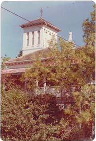
Photograph - 'Fernhurst', 13 Fernhurst Grove, 1978
... Originally accessed from near the corner of Princess Street and Studley Park Road, its gardens had been subdivided in the 1900s and its footprint restricted to 13 Fernhurst Grove. ...Originally accessed from near the corner of Princess Street and Studley Park Road, its gardens had been subdivided in the 1900s and its footprint restricted to 13 Fernhurst Grove. ...George Wharton arrived in Melbourne in 1844. An architect and surveyor, he was appointed to lay out the 'Village of Kew' by N.A. Fenwick following the land sales of 1851. A protagonist for Kew's separation from the Boroondara District Road Board, he was elected chairman when Kew achieved municipal status in December 1860. His home, 'Fernhurst', was built in 1866 on eight acres in Studley Park, with a four-storey tower and pyramidal roof. The Italianate home was a prominent Kew landmark. It was demolished in 1979 and replaced by St Paul's College in 1980.Rare colour photograph of what was once a significant mansion in Kew.Original colour positive photograph (Kodak print) of 'Fernhurst' in 1978. Photographed by Stewart West in May 1978, one year before it was demolished, the photograph gives little idea of the large landholding once surrounding the house. Originally accessed from near the corner of Princess Street and Studley Park Road, its gardens had been subdivided in the 1900s and its footprint restricted to 13 Fernhurst Grove. Like many other grand houses, by the 1970s it had been converted into apartments. From the photograph, one can see that the house had retained many of its original features such as the distinctive tower and the wide bow-fronted verandah. The slates on the roof (apart from those on the tower) had been replaced by tiles and the cement render of the exterior painted white. Annotated reverse: "Front view of Fernhurst showing tower to advantage / 9"fernhurst, 13 fernhurst grove -- kew (vic.), george wharton, italianate architecture, vila maria society, st paul's school for the blind -
 Kew Historical Society Inc
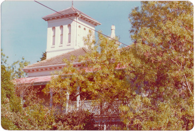
Photograph - 'Fernhurst', 13 Fernhurst Grove, 1978
... Originally accessed from near the corner of Princess Street and Studley Park Road, its gardens had been subdivided in the 1900s and its footprint restricted to 13 Fernhurst Grove. ...Originally accessed from near the corner of Princess Street and Studley Park Road, its gardens had been subdivided in the 1900s and its footprint restricted to 13 Fernhurst Grove. ...George Wharton arrived in Melbourne in 1844. An architect and surveyor, he was appointed to lay out the 'Village of Kew' by N.A. Fenwick following the land sales of 1851. A protagonist for Kew's separation from the Boroondara District Road Board, he was elected chairman when Kew achieved municipal status in December 1860. His home, 'Fernhurst', was built in 1866 on eight acres in Studley Park, with a four-storey tower and pyramidal roof. The Italianate home was a prominent Kew landmark. It was demolished in 1979 and replaced by St Paul's College in 1980.Rare colour photograph of what was once a significant mansion in Kew.Original colour positive photograph (Kodak print) of 'Fernhurst' in 1978. Photographed by Stewart West in May 1978, one year before it was demolished, the photograph gives little idea of the large landholding once surrounding the house. Originally accessed from near the corner of Princess Street and Studley Park Road, its gardens had been subdivided in the 1900s and its footprint restricted to 13 Fernhurst Grove. Like many other grand houses, by the 1970s it had been converted into apartments. From the photograph, one can see that the house had retained many of its original features such as the distinctive tower and the wide bow-fronted verandah. The slates on the roof (apart from those on the tower) had been replaced by tiles and the cement render of the exterior painted white. Annotated reverse: "Fernhurst corner shot through trees / 12-22"fernhurst, 13 fernhurst grove -- kew (vic.), george wharton, italianate architecture, vila maria society, st paul's school for the blind -
 Kew Historical Society Inc
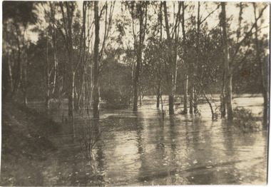
Photograph, Marnie McLeod, Floods of the River Yarra at Kew, 1916
... Street, Kew, so would be near there. Retain (or discard) as you see fit." [Donor's name and address withheld from public view]. To gain an insight into the flood levels at Kew, it is worth reading newspaper accounts of the event. The Age published an article - Valuable Gardens Destroyed at Kew - on 25 September 1916: "VALUABLE GARDENS DESTROYED AT KEW. From the heights of Studley Park...Street, Kew, so would be near there. Retain (or discard) as you see fit." [Donor's name and address withheld from public view]. To gain an insight into the flood levels at Kew, it is worth reading newspaper accounts of the event. The Age published an article - Valuable Gardens Destroyed at Kew - on 25 September 1916: "VALUABLE GARDENS DESTROYED AT KEW. From the heights of Studley Park ...The donation was accompanied by the following letter from the donor: "Hi. I found these in with family photos. Taken by family as Mamie McLeod was living in Fellows Street, Kew, so would be near there. Retain (or discard) as you see fit." [Donor's name and address withheld from public view]. To gain an insight into the flood levels at Kew, it is worth reading newspaper accounts of the event. The Age published an article - Valuable Gardens Destroyed at Kew - on 25 September 1916: "VALUABLE GARDENS DESTROYED AT KEW. From the heights of Studley Park, Kew, a splendid view of the flood waters can be obtained, and yesterday afternoon, despite continuous rain, crowds of citizens assembled there to witness the spectacle. There is a vast stretch of water some 300 or 400 yards broad, above the foot bridge connecting Gipps-street, Collingwood, and Studley Park. The river is only about 3 feet from the top of the embankment connecting with the ramp of the bridge on the Studiey Park side. When the upper llood waters come down it is almost a certainty that tne embankment will be submerged and the bridge rendered impassible. Below the bridge the waters again stretch out, and have submerged all the low-lying land on the Collingwood side and invaded the back premises ot the Kodak Co., Phoenix Biscuit Factory, a tannery adjoining thereto, the Shamrock Brewery, and Chinese gardens in the vicinity. At Walmer-street-bridge, at the end of Studley Park, the low-lying land on the Kew side is covered with water to the depth of many feet. Tlie land in question is owned in a great part by Mr Frank Lavers who haa gone in for intense culture on a pretty liberal scale on both the slopes of the hill and on the river flat. On the latter he is cultivating many acres of asparagus, and has at a considerable cost spent three years in preparing the ground and installing an irrigation system, reticulated from the Yan Yean water supply. This year the asparagus was put down, and the plants were in a promising condition. Tlie flood waters are now flowing fast over the land. The crop is ruined, and three years' work and expenditure destroyed. Mr. Laver's private residence fortunately is high above flood level, but two houses he owns off Young-street have been flooded out. Having been warned in time, the tenants removed their furniture hefore the water came down to Mr. Laver's residence, where they themselves have been given accommodation in the meantime. All the river flats in East Kew are under water. One or two low-lying houses have been flooded. Chipperfield's boat shed at Willsmere is nearly covered, and some Chinese gardens in the vicinity are several feet under water."This, and the other three photographs donated of floods in Kew are believed to be the earliest in the collection. Together with our original MMBW River Yarra map showing flood levels, these items, when compared allow researchers to gain a visual perspective of the extent of the flood in 1916. Black and white photograph of flooded trees in Kew with rising dry ground in distance.Inscription on reverse in pencil: "Flood River Yarra Kew Vic"river yarra, kew, floods 1916 -
 Kew Historical Society Inc
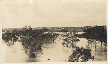
Photograph, Marnie McLeod, Floods on the River Yarra at Kew, 1916
... Street, Kew, so would be near there. Retain (or discard) as you see fit." [Donor's name and address withheld from public view]. To gain an insight into the flood levels at Kew, it is worth reading newspaper accounts of the event. The Age published an article - Valuable Gardens Destroyed at Kew - on 25 September 1916: "VALUABLE GARDENS DESTROYED AT KEW. From the heights of Studley Park...Street, Kew, so would be near there. Retain (or discard) as you see fit." [Donor's name and address withheld from public view]. To gain an insight into the flood levels at Kew, it is worth reading newspaper accounts of the event. The Age published an article - Valuable Gardens Destroyed at Kew - on 25 September 1916: "VALUABLE GARDENS DESTROYED AT KEW. From the heights of Studley Park ...The donation was accompanied by the following letter from the donor: "Hi. I found these in with family photos. Taken by family as Mamie McLeod was living in Fellows Street, Kew, so would be near there. Retain (or discard) as you see fit." [Donor's name and address withheld from public view]. To gain an insight into the flood levels at Kew, it is worth reading newspaper accounts of the event. The Age published an article - Valuable Gardens Destroyed at Kew - on 25 September 1916: "VALUABLE GARDENS DESTROYED AT KEW. From the heights of Studley Park, Kew, a splendid view of the flood waters can be obtained, and yesterday afternoon, despite continuous rain, crowds of citizens assembled there to witness the spectacle. There is a vast stretch of water some 300 or 400 yards broad, above the foot bridge connecting Gipps-street, Collingwood, and Studley Park. The river is only about 3 feet from the top of the embankment connecting with the ramp of the bridge on the Studiey Park side. When the upper llood waters come down it is almost a certainty that tne embankment will be submerged and the bridge rendered impassible. Below the bridge the waters again stretch out, and have submerged all the low-lying land on the Collingwood side and invaded the back premises ot the Kodak Co., Phoenix Biscuit Factory, a tannery adjoining thereto, the Shamrock Brewery, and Chinese gardens in the vicinity. At Walmer-street-bridge, at the end of Studley Park, the low-lying land on the Kew side is covered with water to the depth of many feet. Tlie land in question is owned in a great part by Mr Frank Lavers who haa gone in for intense culture on a pretty liberal scale on both the slopes of the hill and on the river flat. On the latter he is cultivating many acres of asparagus, and has at a considerable cost spent three years in preparing the ground and installing an irrigation system, reticulated from the Yan Yean water supply. This year the asparagus was put down, and the plants were in a promising condition. Tlie flood waters are now flowing fast over the land. The crop is ruined, and three years' work and expenditure destroyed. Mr. Laver's private residence fortunately is high above flood level, but two houses he owns off Young-street have been flooded out. Having been warned in time, the tenants removed their furniture hefore the water came down to Mr. Laver's residence, where they themselves have been given accommodation in the meantime. All the river flats in East Kew are under water. One or two low-lying houses have been flooded. Chipperfield's boat shed at Willsmere is nearly covered, and some Chinese gardens in the vicinity are several feet under water."This, and the other three photographs donated of floods in Kew are believed to be the earliest in the collection. Together with our original MMBW River Yarra map showing flood levels, these items, when compared allow researchers to gain a visual perspective of the extent of the flood in 1916. Panoramic view, believed to be looking north towards Fairfield from the Zig-Zag Bridge on the River Yarra. The inscription on the reverese identifies it as taken before 1920.Inscription on reverse in ink "(pre 1920) Flood from Zig-zag bridge Yarra River, Kew Vic."river yarra, kew, floods 1916, zig-zag bridge -
 Kew Historical Society Inc
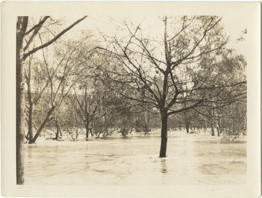
Photograph, Marnie McLeod, Flood, River Yarra, Kew, 1916
... Street, Kew, so would be near there. Retain (or discard) as you see fit." [Donor's name and address withheld from public view]. To gain an insight into the flood levels at Kew, it is worth reading newspaper accounts of the event. The Age published an article - Valuable Gardens Destroyed at Kew - on 25 September 1916: "VALUABLE GARDENS DESTROYED AT KEW. From the heights of Studley Park...Street, Kew, so would be near there. Retain (or discard) as you see fit." [Donor's name and address withheld from public view]. To gain an insight into the flood levels at Kew, it is worth reading newspaper accounts of the event. The Age published an article - Valuable Gardens Destroyed at Kew - on 25 September 1916: "VALUABLE GARDENS DESTROYED AT KEW. From the heights of Studley Park ...The donation was accompanied by the following letter from the donor: "Hi. I found these in with family photos. Taken by family as Mamie McLeod was living in Fellows Street, Kew, so would be near there. Retain (or discard) as you see fit." [Donor's name and address withheld from public view]. To gain an insight into the flood levels at Kew, it is worth reading newspaper accounts of the event. The Age published an article - Valuable Gardens Destroyed at Kew - on 25 September 1916: "VALUABLE GARDENS DESTROYED AT KEW. From the heights of Studley Park, Kew, a splendid view of the flood waters can be obtained, and yesterday afternoon, despite continuous rain, crowds of citizens assembled there to witness the spectacle. There is a vast stretch of water some 300 or 400 yards broad, above the foot bridge connecting Gipps-street, Collingwood, and Studley Park. The river is only about 3 feet from the top of the embankment connecting with the ramp of the bridge on the Studiey Park side. When the upper llood waters come down it is almost a certainty that tne embankment will be submerged and the bridge rendered impassible. Below the bridge the waters again stretch out, and have submerged all the low-lying land on the Collingwood side and invaded the back premises ot the Kodak Co., Phoenix Biscuit Factory, a tannery adjoining thereto, the Shamrock Brewery, and Chinese gardens in the vicinity. At Walmer-street-bridge, at the end of Studley Park, the low-lying land on the Kew side is covered with water to the depth of many feet. Tlie land in question is owned in a great part by Mr Frank Lavers who haa gone in for intense culture on a pretty liberal scale on both the slopes of the hill and on the river flat. On the latter he is cultivating many acres of asparagus, and has at a considerable cost spent three years in preparing the ground and installing an irrigation system, reticulated from the Yan Yean water supply. This year the asparagus was put down, and the plants were in a promising condition. Tlie flood waters are now flowing fast over the land. The crop is ruined, and three years' work and expenditure destroyed. Mr. Laver's private residence fortunately is high above flood level, but two houses he owns off Young-street have been flooded out. Having been warned in time, the tenants removed their furniture hefore the water came down to Mr. Laver's residence, where they themselves have been given accommodation in the meantime. All the river flats in East Kew are under water. One or two low-lying houses have been flooded. Chipperfield's boat shed at Willsmere is nearly covered, and some Chinese gardens in the vicinity are several feet under water."This, and the other three photographs donated of floods in Kew are believed to be the earliest in the collection. Together with our original MMBW River Yarra map showing flood levels, these items, when compared allow researchers to gain a visual perspective of the extent of the flood in 1916. Small black and white photograph of flooded trees in Kew.Inscription on reverse in ink "Flood R. Yarra Kew Vicriver yarra, kew, floods 1916 -
 Surrey Hills Historical Society Collection
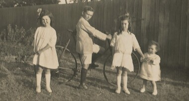
Photograph, Four Mair children in the backyard, c1922
... Dave walked across the gardens to work at the MCG. He never drove or owned a car. ...Dave walked across the gardens to work at the MCG. He never drove or owned a car. ...David Miller (Dave) Mair (1879-1938) married Lily Vipond Deakin (1890-1945) in 1910. They had 5 children: Geoffrey David (1913-1970), Beryl (1916-1976), Gwynneth (1917-1997), Isabel Lillian (1921-1997) and Shirley Inez (1928-1968). Personal communication from Laurie Newton, Beryl's daughter: Dave and Lily initially lived in East Melbourne after they married. Dave walked across the gardens to work at the MCG. He never drove or owned a car. Geoffrey, Beryl and Gwynneth were born in East Melbourne. They subsequently moved to Louise Avenue, Mont Albert and Isabel may have been born while they were there. Later they purchased 20 Barton Street, Mont Albert. Shirley was born after they moved to Barton Street. Electoral roll details: 1919 68 Park Street, Hawthorn 1922 24 Louise Avenue, Mont Albert 1924 20 Barton Street, Mont Albert Dave Mair was a very keen sportsman. This is part of a large donation of material from the Deakin, Mair and Young families. The Deakin, Mair and Young families had many connections with Mont Albert and Surrey Hills.A sepia photo of 4 well-dressed children, a boy and 3 girls, one a toddler, in a back yard. The boy is astride a bicycle and the girls stand either side. Behind them is a high paling fence.On rear: "Gwen Geoff Beryl Isabel" in blue biro. Thought to be Beryl Mair's handwriting. Photographic processing stamp in blue "54".david miller mair, dave mair, lily vipond deakin, lily vipond mair, geoffrey mair, beryl mair, isabel mair gwynneth mair, children, back yards, bicycles -
 Surrey Hills Historical Society Collection
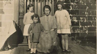
Photograph, Lily Mair and 3 daughters, c1924
... Dave walked across the gardens to work at the MCG. He never drove or owned a car. ...Dave walked across the gardens to work at the MCG. He never drove or owned a car. ...David Miller (Dave) Mair (1879-1938) married Lily Vipond Deakin (1890-1945) in 1910. They had 5 children: Geoffrey David (1913-1970), Beryl (1916-1976), Gwynneth (1917-1997), Isabel Lillian (1921-1997) and Shirley Inez (1928-1968). Personal communication from Laurie Newton, Beryl's daughter: Dave and Lily initially lived in East Melbourne after they married. Dave walked across the gardens to work at the MCG. He never drove or owned a car. Geoffrey, Beryl and Gwynneth were born in East Melbourne. They subsequently moved to Louise Avenue, Mont Albert and Isabel may have been born while they were there. Later they purchased 20 Barton Street, Mont Albert. Shirley was born after they moved to Barton Street. Electoral roll details: 1919 68 Park Street, Hawthorn 1922 24 Louise Avenue, Mont Albert 1924 20 Barton Street, Mont Albert Dave Mair was a very keen sportsman. This is part of a large donation of material from the Deakin, Mair and Young families. The Deakin, Mair and Young families had many connections with Mont Albert and Surrey Hills.A sepia photo of a woman seated on a veranda with 3 girls. Part of the facade of the house can be seen behind them. The veranda is timber. The door has acid-etched feature windows either side of it. The front is block-fronted and looks to be picked out in 2 paint colours. There are shadows of foliage and from lacework detail on the veranda cast over one side and the top pf the photo. The shadow of the photographer's hat can be seen on the bottom edge.On rear: "L-R" (in lead pencil) Beryl Isabel Mum / Gwen at Barton St" in blue biro. Thought to be Beryl Mair's handwriting. Number 39 in lead pencil.barton street, children, lily vipond deakin, lily vipond mair, beryl mair, isabel mair,, gwynneth mair -
 Surrey Hills Historical Society Collection
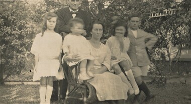
Photograph, Dave and Lily Mair and children, c1923, c1923
... Dave walked across the gardens to work at the MCG. He never drove or owned a car. ...Dave walked across the gardens to work at the MCG. He never drove or owned a car. ...David Miller (Dave) Mair (1879-1938) married Lily Vipond Deakin (1890-1945) in 1910. They had 5 children: Geoffrey David (1913-1970), Beryl (1916-1976), Gwynneth (1917-1997), Isabel Lillian (1921-1997) and Shirley Inez (1928-1968). Personal communication from Laurie Newton, Beryl's daughter: Dave and Lily initially lived in East Melbourne after they married. Dave walked across the gardens to work at the MCG. He never drove or owned a car. Geoffrey, Beryl and Gwynneth were born in East Melbourne. They subsequently moved to Louise Avenue, Mont Albert and Isabel may have been born while they were there. Later they purchased 20 Barton Street, Mont Albert. Shirley was born after they moved to Barton Street. Electoral roll details: 1919 68 Park Street, Hawthorn 1922 24 Louise Avenue, Mont Albert 1924 20 Barton Street, Mont Albert Dave Mair was a very keen sportsman. This is part of a large donation of material from the Deakin, Mair and Young families. The Deakin, Mair and Young families had many connections with Mont Albert and Surrey Hills.A sepia photo of a family posed informally in a garden. The woman is seated on a cane chair holding the youngest child with one girl standing to her left and a girl and boy standing to her right. The man is standing behind her with only his face captured in the photo. The infant and the girl to the right have moved and their faces are blurred. The house in the background is of block-front construction with simple fretwork to the veranda.On rear: "Beryl Dad Isabel Mum / Gwen Geoff / at Louise Avenue / Mont Abert" in blue biro. Thought to be Beryl Mair's handwriting. Photographic processing stamp in blue ink "54 P"barton street, children, lily vipond deakin, lily vipond mair, beryl mair, isabel mair,, gwynneth mair -
 Surrey Hills Historical Society Collection
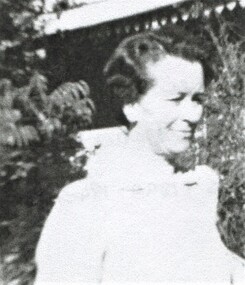
Photograph, Lily Vipond Mair, c1940, c1940
... Dave walked across the gardens to work at the MCG. He never drove or owned a car. ...Dave walked across the gardens to work at the MCG. He never drove or owned a car. ...David Miller (Dave) Mair (1879-1938) married Lily Vipond Deakin (1890-1945) in 1910. They had 5 children: Geoffrey David (1913-1970), Beryl (1916-1976), Gwynneth (1917-1997), Isabel Lillian (1921-1997) and Shirley Inez (1928-1968). Personal communication from Laurie Newton, Beryl's daughter: Dave and Lily initially lived in East Melbourne after they married. Dave walked across the gardens to work at the MCG. He never drove or owned a car. Geoffrey, Beryl and Gwynneth were born in East Melbourne. They subsequently moved to Louise Avenue, Mont Albert and Isabel may have been born while they were there. Later they purchased 20 Barton Street, Mont Albert. Shirley was born after they moved to Barton Street. Electoral roll details: 1919 68 Park Street, Hawthorn 1922 24 Louise Avenue, Mont Albert 1924 20 Barton Street, Mont Albert Dave Mair was a very keen sportsman. This is part of a large donation of material from the Deakin, Mair and Young families. A black & white photocopy image of Lily Vipond Mair (nee Deakin) taken from a photo.On rear in grey lead pencil: "Lily Vipond Mair / (nee Deakin) / aged about 50 / (5.7.1890-1943)" lily vipond deakin, lily vipond mair -
 Surrey Hills Historical Society Collection
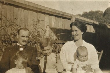
Work on paper - Photograph, David Miller (Dave) Mair and wife Lily Vipond Deakin with children: Geoffrey, Beryl and Isabel, c1921
... Dave walked across the gardens to work at the MCG. He never drove or owned a car. ...Dave walked across the gardens to work at the MCG. He never drove or owned a car. ...David Miller (Dave) Mair (1879-1938) married Lily Vipond Deakin (1890-1945) in 1910. They had 5 children: Geoffrey David (1913-1970), Beryl (1916-1976), Gwynneth (1917-1997), Isabel Lillian (1921-1997) and Shirley Inez (1928-1968). Personal communication from Laurie Newton, Beryl's daughter: Dave and Lily initially lived in East Melbourne after they married. Dave walked across the gardens to work at the MCG. He never drove or owned a car. Geoffrey, Beryl and Gwynneth were born in East Melbourne. They subsequently moved to Louise Avenue, Mont Albert and Isabel may have been born while they were there. Later they purchased 20 Barton Street, Mont Albert. Shirley was born after they moved to Barton Street. Electoral roll details: 1919 68 Park Street, Hawthorn 1922 24 Louise Avenue, Mont Albert 1924 20 Barton Street, Mont Albert Dave Mair was a very keen sportsman. This is part of a large donation of material from the Deakin, Mair and Young families. The Mair family were long term residents in the area with strong social and business connections to the Surrey Hills community.A sepia photo of a man, a women, 2 children and a baby seated in front of a paling fence. The man is balding with a moustache. Children's faces are lowered as if avoiding looking at the sun.On rear: "Dad Beryl Geoff / Mum Isabel" in blue biro. Thought to be Beryl Mair's handwriting.david miller mair, dave mair, lily vipond deakin, lily vipond mair, geoffrey mair, beryl mair, isabel mair gwynneth mair, toddlers, family portraits, 1920s -
 Ballarat Tramway Museum
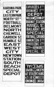
Sign - Sign - Destination Blinds, Tram Destination Blinds for various areas - Geelong and Melbourne
... ...garden street...Geelong blind starts with Kardinia Park going to the City, Eastern Park, Shannon Street, Belmont, Chilwell, Garden and Humble Streets, City, Newtown, Station, South Beach, Depot. ...Geelong blind starts with Kardinia Park going to the City, Eastern Park, Shannon Street, Belmont, Chilwell, Garden and Humble Streets, City, Newtown, Station, South Beach, Depot. ...Ron Bridger was an avid collector of items related to transport, predominately Trams. These items include newspaper cuttings, pamphlets, reports, timetables, fares prices plus special items relating to events. Items from Melbourne and regional Victoria, interstate - Adelaide and Sydney, plus overseas, make up this collection. Sheet showing examples of tram destination blinds in miniature. Geelong example is white with black print. Footscray/Melbourne examples are black with white print. Geelong blind starts with Kardinia Park going to the City, Eastern Park, Shannon Street, Belmont, Chilwell, Garden and Humble Streets, City, Newtown, Station, South Beach, Depot. This is one of the routes that provided tram travel for people in Geelong. The Maribyrnong blind shown was on the tram route that stopped at Explosives Factory, Ordnance Factory, Ammunition Factory and Pyrotechnic Factory. These trams carried local people and workers at the different factories. The last item listed SPECIAL.E was not to carry general passengers - workers only. Small example shows Caulfield area.Miniature blinds for Geelong area - white with black print and Melbourne area of Maribyrnong - black with white print.Names of stopping places listed for each routeas box 48a, destination blinds, geelong area, kardinia park, eastern park, football, belmont, chilwell, humble street, garden street, newtown, south beach, explosives factory, ordnance factory, williamstown road, russell street, football ground, ammunition factory, pyrotechnic factory, haymarket, special e, point ormond, south caulfield, elsternwick railway station, glenhuntly depot, special, ron bridger collection -
 Surrey Hills Historical Society Collection
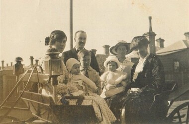
Photograph, David Miller and Lily Vipond Mair and family, c1921
... Dave walked across the gardens to work at the MCG. He never drove or owned a car. ...Dave walked across the gardens to work at the MCG. He never drove or owned a car. ...David Miller (Dave) Mair (1879-1938) married Lily Vipond Deakin (1890-1945) in 1910. They had 5 children: Geoffrey David (1913-1970), Beryl (1916-1976), Gwynneth (1917-1997), Isabel Lillian (1921-1997) and Shirley Inez (1928-1968). Personal communication from Laurie Newton, Beryl's daughter: Dave and Lily initially lived in East Melbourne after they married. Dave walked across the gardens to work at the MCG. He never drove or owned a car. Geoffrey, Beryl and Gwynneth were born in East Melbourne. They subsequently moved to Louise Avenue, Mont Albert and Isabel may have been born while they were there. Later they purchased 20 Barton Street, Mont Albert. Electoral roll details: 1919 68 Park Street, Hawthorn 1922 24 Louise Avenue, Mont Albert 1924 20 Barton Street, Mont Albert So, Shirley would have been born while they were at Barton Street. On the basis of these dates, this may have been taken in Hawthorn. Identification of 'Grannie': If this is Lily's mother her name is Janet Deakin (nee Longmore - 1851-1939). If it is Dave's mother her name is Isabel Brown (1855-1944). The other woman is identified as May Little, who helped in the house. Dave Mair was a very keen sportsman. A sepia photo of a well-dressed family in and beside a buggy. The group is comprised of a man, 3 women and 3 children. The chimneys of Victorian or perhaps Edwardian houses are in the background.On rear: "Grannie Dad Mum / Beryl Geoff Isabel" (in hand 1 and blue biro) "on left Isabel on knee" (in a different hand in black biro) "May Little (Helped in / House" (in hand 1 in blue biro). On the basis of inscriptions in family autograph books, the first and third inscriptions look to have been written by Beryl Mair.david miller mair, dave mair, lily vipond mair, lily vipond deakin, geoffrey david mair, beryl mair, gwynneth mair, isabel lillian mair, janet deakin, janet longmore, isabel brown, isabel mair, horse-drawn vehicles, children, may little -
 Surrey Hills Historical Society Collection
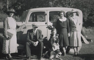
Photograph, David Miller and Lily Vipond Mair and family and friends on outing, c1932
... Dave walked across the gardens to work at the MCG. He never drove or owned a car. ...Dave walked across the gardens to work at the MCG. He never drove or owned a car. ...David Miller (Dave) Mair (1879-1938) married Lily Vipond Deakin (1890-1945) in 1910. They had 5 children: Geoffrey David (1913-1970), Beryl (1916-1976), Gwynneth (1917-1997), Isabel Lillian (1921-1997) and Shirley Inez (1928-1968). Personal communication from Laurie Newton, Beryl's daughter: Dave and Lily initially lived in East Melbourne after they married. Dave walked across the gardens to work at the MCG. He never drove or owned a car. Geoffrey, Beryl and Gwynneth were born in East Melbourne. They subsequently moved to Louise Avenue, Mont Albert and Isabel may have been born while they were there. Later they purchased 20 Barton Street, Mont Albert. Shirley was born after they moved to Barton Street. Electoral roll details: 1919 68 Park Street, Hawthorn 1922 24 Louise Avenue, Mont Albert 1924 20 Barton Street, Mont Albert Dave Mair was a very keen sportsman. The woman named as Mattie was Martha Dunham Brooks b1892, Camberwell. She was the daughter of Arthur 'Empire' Brooks and his wife Mary Jane Wilson who lived at 21 York Street. They also had twin boys: Thomas Moffat Brooks – b. 1899, Surrey Hills; d. 1906 and Edwin Dunham Wilson Brooks – b. 1899, Surrey Hills; d. 1971 Heidelberg. The donor remembered the later as a builder of 11 York Street. Martha m. Clifford Ernest Cairns in 1935. Mattie Cairns was the donor's godmother. This is part of a large donation of material from the Deakin, Mair and Young families. This is part of a large donation of material from the Deakin, Mair and Young families all of which had connections with Surrey Hills / Mont Albert.A black & white photo of a man, a women, 2 women, a girl and a young lady beside a car in a country setting. The girl is bending to pat a dog.On rear: "Mum Dad Mair / Shirl Isabel Mattie / Digger - Cliff Cairns / Dog" in blue biro. Thought to be Beryl Mair's handwriting. "LILY" and "DAVE" in lead pencil above Mum and Dad. Photographer's stamp "653" in blue ink.dave mair, david miller mair, lilly vipond deakin, lily vipond mair, shirley inez mair, isabel lillian mair, mattie brooks, martha dunham brooks, cars -
 Surrey Hills Historical Society Collection
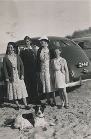
Photograph, Lily Vipond Mair with family and friends at the beach, c1936
... Dave walked across the gardens to work at the MCG. He never drove or owned a car. ...Dave walked across the gardens to work at the MCG. He never drove or owned a car. ...David Miller (Dave) Mair (1879-1938) married Lily Vipond Deakin (1890-1945) in 1910. They had 5 children: Geoffrey David (1913-1970), Beryl (1916-1976), Gwynneth (1917-1997), Isabel Lillian (1921-1997) and Shirley Inez (1928-1968). Personal communication from Laurie Newton, Beryl's daughter: Dave and Beryl initially lived in East Melbourne after they married. Dave walked across the gardens to work at the MCG. He never drove or owned a car. Geoffrey, Beryl and Gwynneth were born in East Melbourne. They subsequently moved to Louise Avenue, Mont Albert and Isabel may have been born while they were there. Later they purchased 20 Barton Street, Mont Albert. Shirley was born after they moved to Barton Street. Electoral roll details: 1919 68 Park Street, Hawthorn 1922 24 Louise Avenue, Mont Albert 1924 20 Barton Street, Mont Albert Dave Mair was a very keen sportsman. The woman named as Mattie was Martha Dunham Brooks b1892, Camberwell. She was the daughter of Arthur 'Empire' Brooks and his wife Mary Jane Wilson who lived at 21 York Street. They also had twin boys: Thomas Moffat Brooks – b. 1899, Surrey Hills; d. 1906 and Edwin Dunham Wilson Brooks – b. 1899, Surrey Hills; d. 1971 Heidelberg. The donor remembered the later as a builder of 11 York Street. Martha m. Clifford Ernest Cairns in 1935. Mattie Cairns was the donor's godmother. This is part of a large donation of material from the Deakin, Mair and Young families. This is part of a large donation of material from the Deakin, Mair and Young families all of which had connections with Surrey Hills / Mont Albert. Mattie Brooks' father was a significant figure in early Surrey Hills.A black & white photo of 2 women, a girl and a lad beside a car on the sand at the beach.On rear: "Mum Mattie / Shirl / Digger (Cliff Cairns / Dog" in blue biro. "MATTIE BROOKS / LAD UNKNOWN" Thought to be Beryl Mair's handwriting. Photographer's stamp "653" in blue ink.beach, lily vipond mair, lilly vipond deakin, mattie brooks, martha dunham brooks, mattie cairns, martha dunham carins -
 Eltham District Historical Society Inc
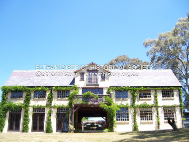
Photograph - Digital Photograph, Marguerite Marshall, Jelbart Barn, 93 Arthur Street, Eltham, 11 November 2006
... The Jelbarts had moved to Eltham in the early 1940s when they purchased a poultry farm in New Street, now Lavendar Park Road. (The local Black Friday bushire of January 13, 1939 had started at C.A. ...The Jelbarts had moved to Eltham in the early 1940s when they purchased a poultry farm in New Street, now Lavendar Park Road. (The local Black Friday bushire of January 13, 1939 had started at C.A. ...Situated at the top of the hill in Arthur Street, the former Jelbart residence and barn were part of a major change that transformed Eltham's character in the late 1960s. Built from the mid 1940s through mid 1950s when Eltham was a rural community, the Jelbart residence and barn are all that remain of a family property of some 250 acres (100 ha). With growing population pressures, in the late 1960s, owners Ron and Yvonne Jelbart decided to subdivide their property creating the Woodridge Estate in the early 1970s, a major factor towards the transformation of Eltham to the suburb it is today. The Jelbarts had moved to Eltham in the early 1940s when they purchased a poultry farm in New Street, now Lavendar Park Road. (The local Black Friday bushire of January 13, 1939 had started at C.A. (Clarrie) Hurst’s Eltham Poultry Farm and Hatchery in New Street.) Jelbart was primarily a businessman importing office machinery but desired farm beef and dairy cattle so the couple purchased the virgin bushland at what was then at the end of a dirt road, Arthur Street. With post war shortages of most building materials, they followed the example of the Eltham Artists' Colony (later called Montsalvat) and built their home from mud-bricks and recycled materials. The barn was first to be completed in 1945 which they made their home whilst building the main residence. It took eight years to complete the two buildings. Both the main residence and the barn are now separate homes, and along with the remaining property being sub-divided further in 1998 are now part of the Kinloch Gardens Estate at 93 Arthur Street. Covered under Heritage Overlay, Nillumbik Planning Scheme. Published: Nillumbik Now and Then / Marguerite Marshall 2008; photographs Alan King with Marguerite Marshall.; p139This collection of almost 130 photos about places and people within the Shire of Nillumbik, an urban and rural municipality in Melbourne's north, contributes to an understanding of the history of the Shire. Published in 2008 immediately prior to the Black Saturday bushfires of February 7, 2009, it documents sites that were impacted, and in some cases destroyed by the fires. It includes photographs taken especially for the publication, creating a unique time capsule representing the Shire in the early 21st century. It remains the most recent comprehenesive publication devoted to the Shire's history connecting local residents to the past. nillumbik now and then (marshall-king) collection, eltham, arthur street, jelbart barn, jelbart home, kinloch gardens -
 Eltham District Historical Society Inc
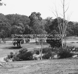
Photograph - Digital Photograph, Alan King, Alistair Knox Park, Eltham, 2008
... Parks and Gardens Department for the Eltham Shire Council. First plantings occurred in Arbour Week in 1973, then the lake and botanic area were completed in 1975, with Federal Government funding, and the toilet block in 1978. Bounded by the Eltham railway line, Panther Place, Main Road, Bridge and Susan Streets...Parks and Gardens Department for the Eltham Shire Council. First plantings occurred in Arbour Week in 1973, then the lake and botanic area were completed in 1975, with Federal Government funding, and the toilet block in 1978. Bounded by the Eltham railway line, Panther Place, Main Road, Bridge and Susan Streets ...Alistair Knox Park, an oasis of peace and beauty. Covered under National Trust of Australia (Victoria) Landscape Significance and Heritage Overlay, Nillumbik Planning Scheme. Published: Nillumbik Now and Then / Marguerite Marshall 2008; photographs Alan King with Marguerite Marshall.; p173 It is hard to imagine that the Alistair Knox Park, an oasis of peace and beauty beside busy Main Road, Eltham, was once the township’s rubbish dump. It was only in the 1970s that the tip was transformed into this beautiful six hectare space, which later earned it a National Trust Landscape classification. Before its life as a dump, the area was used for small farms. Thanks largely to the foresight and efforts of local environmental builder Alistair Knox, the park was designed sympathetically with the character of the wider Eltham landscape. Then, appropriately, the park was named after Knox, who was an Eltham Shire Councillor from 1971 to 1975 and Shire President in 1975. The park designers were four major forces in the urban bush landscape garden –Knox, landscape designer Gordon Ford, artist Peter Glass and landscaper Ivan Stranger. The National Trust citation for the park, originally called Eltham Town Park, includes the Eltham railway trestle bridge and the Shillinglaw Cottage. The citation states ‘the semi-natural setting of the parkland provides a landscape which is evocative of the history of the area’. Manna Gums (Eucalyptus viminalis) and Candlebarks (Eucalyptus rubida) are significant features. Most of the park’s construction was directed by Bob Grant, Superintendent of the Parks and Gardens Department for the Eltham Shire Council. First plantings occurred in Arbour Week in 1973, then the lake and botanic area were completed in 1975, with Federal Government funding, and the toilet block in 1978. Bounded by the Eltham railway line, Panther Place, Main Road, Bridge and Susan Streets, the park is in a valley about a kilometre wide overlooked by steep hills at the east and west. The Diamond Creek flows through it and the picturesque historic timber trestle railway bridge edges the north. Informal plantings of Australian indigenous and native species in open and undulating grassed settings blend with the natural landscape of the Diamond Creek to the west. The bush-style plants, particularly around the creek, balance with open lawns, paths and a cascade flowing from a small lake to another below. A footbridge over the creek leads to the park’s west. The park includes an adventure playground and barbecue areas. The park stands on part of the land bought from the Crown in 1851 by Josiah Holloway, who subdivided it into allotments and which he called Little Eltham. Most of the land was subdivided into residential lots, but the creek valley, on which the park stands, was subdivided into farm-size lots, used mainly for orchards and grazing. One of the earliest owners was John Hicks Petty, who in 1874 bought a plot from Holloway. Other families who owned properties in that area, included Rees, Clark, Waterfall, Graham, Hill and Morant. In 1901 the railway was built through the area. Jock Read, an Eltham resident since around 1920, remembers several farms in the 1920s and ’30s that occupied the site of today’s park. A poultry farm, which extended from present day Panther Place, was owned by the Gahan family. Next to that farm was another for grazing cattle owned by Jack Carrucan. Beside this was land owned by John Lyon. A doctor lived beside this, and at the north-west corner of Bridge Street and Main Road stood a memorial to the soldiers who died in World War One, which was later moved to the RSL site. Mr Read also remembers other farms and orchards west of the creek In the early 1960s the Eltham Council began buying these farms and in the late 1960s turned the areas east of the Diamond Creek into a garbage tip. When this was filled above the creek’s flood plain, the tip was moved to the west of the creek.This collection of almost 130 photos about places and people within the Shire of Nillumbik, an urban and rural municipality in Melbourne's north, contributes to an understanding of the history of the Shire. Published in 2008 immediately prior to the Black Saturday bushfires of February 7, 2009, it documents sites that were impacted, and in some cases destroyed by the fires. It includes photographs taken especially for the publication, creating a unique time capsule representing the Shire in the early 21st century. It remains the most recent comprehenesive publication devoted to the Shire's history connecting local residents to the past. nillumbik now and then (marshall-king) collection, alistair knox park, eltham -
 Melbourne Tram Museum
Map, Melbourne & Metropolitan Tramways Board (MMTB), MMTB Route Maps, 1979
... Show the major cross streets, parks, schools, other tram routes, major stop numbers, and railway lines. ...Show the major cross streets, parks, schools, other tram routes, major stop numbers, and railway lines. ...Series of colour maps for various tram and bus routes, dated 1979. Also contained, not scanned are letters, reports, and specifications for printing these maps for use in shelters etc. Some have the Transport Information Centre telephone printed on them. Some are finished with a plastic laminate finish on either one or both sides. Show the major cross streets, parks, schools, other tram routes, major stop numbers, and railway lines. See also item 3909 for another example of these. Trams 1 - City route guide - R9/77 - showing all route numbers and destinations that passed through the CBD. 2 - Bourke St tram routes - R4/77 - East Brunswick Blyth St and East Preston Tyler St and intermediate routes, routes 95, 96, 97, 90, 89 and 88. 3 - Malvern, East Malvern, Carnegie, and East Brighton Tram Routes (from St Kilda Junction) - R1/79 - shows routes 5, 3, 67, 66, 61, 62, and 64. 4 - Elizabeth St tram routes - R12/77 - Essendon Airport, West Maribyrnong, North Coburg lines, routes 50, 58, 60, 54, 57, 52. 49, 59, 18, 20 and 19 5 - Flinders St tram routes - R5/78 - North Balwyn, East Burwood, routes 48, 40, 41, Hartwell, 28, 74 and 75 6 - Kew - St Kilda Beach - R1/79 - Route 69. 7 - Mont - Albert City - R11/77, shows routes 43. 47. 45. 44 8 - St Kilda Rd Tram Routes R12/77 - details South Melbourne Beach, route 1 and route 2 and St Kilda Beach routes 15, 16, and 55 otherwise shows where the various routes branch off St Kilda Road 9 - Batman Ave tram routes - R9/77 - Wattle Park, North Richmond and Prahran - routes 70, 71, 78 and 79. 10 - Footscray - Moonee Ponds - R3/81 - Route 82 11 - Swanston St tram guide - R1/79 - lists all routes and route numbers that branch or cross Swanston St between Grattan St and St Kilda Junction. 12 - Toorak Camberwell and Glen Iris tram route with Camberwell Junction and Malvern Town Hall, R1/79, routes 8, 7, 6, 72, and 73 shown. 13 - West Preston - Beach tram routes - R12/77 - routes 10, 11, 9 and 12, 14 - William St tram routes - R12/77 - Route 55, 56, and 63 - South Melbourne Depot and Domain. Buses 1 - Footscray, Sunshine, Deer Park, Nth Altona & Fishermans Bend - R2/79 2 - Box Hill bus routes to Templestowe, Heidelberg & East Kew - R6/78 - notes superseded by R3/82 3 - Plan of Russell St Melbourne bus departure bays. 4 - Box Hill, Mitcham & Ringwood bus routes to East Doncaster & Warrandyte - R3/82 5 - City - Warrandyte & East Doncaster bus routes - R3/82 & R6/78 6 - Bulleen - City - Port Melbourne - Garden City Bus route - R6/78 7 - North Altona - City bus route - 11/78 8 - Clifton Hill - Elsternwick - R2/79 9 - La Trobe - Northland - West Heidelberg - City Bus Service via East Freeway - 11/79 and R3/81 10 - Box Hill, Mitcham & Ringwood Bus Routes to East Doncaster & Warrandyte - R10/84 - with the Metropolitan Transit logo.Yields information about tram and bus routes in late 1970s early 1980s.Book - brown comb binding, card and clear plastic covers containing both bound and unbound maps and documents.K C Painter on front cover in ink.tramways, mmtb, tram routes, maps, bus routes, route numbers, routes, route guide
