Sunshine and District Historical Society Incorporated
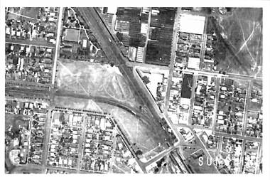
Photograph - Sunshine CBD Aerial Photograph C1945, Adastra Airways, 1945
... Sunshine CBD Aerial Photograph C1945...Black & white photograph of the Sunshine CBD C1945...The image was cropped out of aerial photo-map 8488b1d produced by the Victorian Department of Lands and Survey from aerial photography taken by Adastra Airways in 1945 The photo-map was downloaded from the University of Melbourne map collection site http://www.lib.unimellb.edu.au/collections/maps/historicall/1945melb/ Sunshine Business District Aerial Photograph 1945 view of Part of Sunshine showing the Avenue of Honour in Sun Crescent Black & white photograph of the Sunshine CBD C1945 Photograph Sunshine CBD Aerial Photograph C1945 Adastra Airways ...
The image was cropped out of aerial photo-map 8488b1d produced by the Victorian Department of Lands and Survey from aerial photography taken by Adastra Airways in 1945 The photo-map was downloaded from the University of Melbourne map collection site http://www.lib.unimellb.edu.au/collections/maps/historicall/1945melb/1945 view of Part of Sunshine showing the Avenue of Honour in Sun Crescentsunshine business district, aerial photograph
 Sunshine and District Historical Society Incorporated
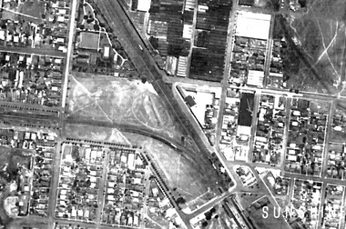 Sunshine and District Historical Society Incorporated