
Showing 233 items matching "surveyors reports"
-
 Victorian Aboriginal Corporation for Languages
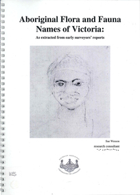
Book, Sue Wesson et al, Aboriginal flora and fauna names of Victoria : as extracted from early surveyors' reports, 2001
... Aboriginal flora and fauna names of Victoria : as extracted from early surveyors' reports...Aboriginal flora and fauna names of Victoria : as extracted from early surveyors' reports Book Sue Wesson Victorian Aboriginal Corporation for Languages ...The Flora and Fauna Names Project is an initiative of the Victorian Aboriginal Corporation for Languages and the Victorian Biodiversity Strategy. The researcher has examined material from the archives of the Department of Natural Resources and Environment (NRE), the State Library of Victoria, the Victorian Public Records Office and the Australian Archives Office. This first stage of the project focussed on the NRE archives, in particular the field notebooks of the earliest surveyors and their maps although other NRE resources, libraries and public records were accessed. A total of 3028 words were found of which a significant proportion have previously been unknown to linguists. It appears that the place names and word lists in early surveyors notebooks, the 1858 surveyors responses to the Surveyor General and an extensive Wiradjuri wordlist by James Baylis have not yet been widely used or published. Fifteen percent of these 3028 words describe flora and fauna and six percent describe habitat. Of particular interest is the evidence provided by these lists of the existence of fauna in the mid nineteenth century in regions where it is now extinct. For example, magpie geese, eastern quolls, bustards and pademelons were assigned names in the Jardwadjali language area of the upper Glenelg and Wimmera Rivers. The outcomes of this project may help to assist in ascertaining the distribution of flora and fauna assets in Victoria.maps, b&w photographs, colour photographs, illustrations, word listswiradjuri, jardwadjali, glenelg river, wimmera river -
 Bendigo Historical Society Inc.
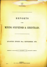
Book - REPORT OF THE MINING REGISTRARS AND SURVEYORS REPORT - SEPT. 1878, 1878
... REPORT OF THE MINING REGISTRARS AND SURVEYORS REPORT - SEPT. 1878...GOLD MINING Miners' Safety Cage mining registrar and surveyors repo gold gold mining mining registrar surveyors REPORT OF THE MINING REGISTRARS AND SURVEYORS REPORT - SEPT. 1878 Book REPORT OF THE MINING REGISTRARS AND SURVEYORS REPORT - SEPT. 1878 ...REPORT OF THE MINING REGISTRARS AND SURVEYORS REPORT - SEPT. 1878gold mining, miners' safety cage, mining registrar and surveyors repo, gold, gold mining, mining registrar, surveyors -
 Bendigo Military Museum
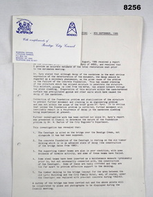
Document - SURVEYORS RESTORATION REPORT BENDIGO, Bendigo City Council, c.1986
... Surveyors report 1986 regarding the restoration of the Bendigo Cenotaph continued on from Cat No 8255. ...Main points, "Building Surveyors report - 8th September 1986 - B.18/86 - restoration of Cenotaph (32.7.1)"...Document SURVEYORS RESTORATION REPORT BENDIGO Bendigo City Council ...Surveyors report 1986 regarding the restoration of the Bendigo Cenotaph continued on from Cat No 8255. The document starts with a report to a Council meeting held on August 18th 1986. This is a more detailed report of the first by Dr. A.H. Spry (AMDEL) followed by Mr W. Barton City Engineers Department. The state of the Cenotaph was also compounded by it's situation re the Bendigo Creek. Main points where. The Cenotaph is sited on the Bridge over the Creek not alongside it as was supposed. The Cenotaph concrete foundation was resting on the old timber decking which is in an advanced state of decay among 5 main points. Report goes on with points. Conclusion; "It would of course be necessary to demolish the Cenotaph to carry out this work". Estimate of costs in brief. 1. Bridge repairs $72,000.00. 2. Cenotaph repairs. - Demolish & rebuild $110,000.00. Options - There are only two options (as per estimate) or demolish and relocate to another location under 3 sections (a) (b) (c). Recommendations; Motions referred to Estimates 1986/87 and RSL for comments - 1 carried, 1 lost.Document, paper 3 pages foolscap size, all print in black, copy of original, stapled with the pages is a Bendigo City Compliments Card in blue text.Main points, "Building Surveyors report - 8th September 1986 - B.18/86 - restoration of Cenotaph (32.7.1)"document, surveyor, cenotaph, brsl, smirsl -
 Bendigo Military Museum
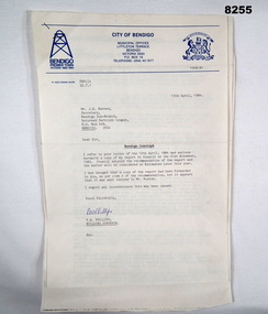
Document - CENOTAPH RESTORATION BENDIGO, City of Bendigo, C.1984
... The Surveyors Report pages 2/3 gives a background report back to 1976 re its condition by the Building Surveyor at the time Mr R.H. ...Page 2/3, “Building Surveyors Report - 21st November 1983 - B42/83 - (32.7.1)”...The Surveyors Report pages 2/3 gives a background report back to 1976 re its condition by the Building Surveyor at the time Mr R.H. ...This Document is the first in several plus photos and an article following the restoration of the Bendigo Cenotaph (Replica of the Cenotaph in Whitehall London). The letter is from the City of Bendigo Municipal Offices Lyttleton Terrace Bendigo is dated 13th April 1984 from the Building Surveyor Mr P.W. Phillips to Mr J.K. Barnes Secretary Bendigo RSL Sub Branch P.O.Box 449 Bendigo. Letter states that the Surveyors Report was adopted by Council on 21st November 1983 and would then be considered at Estimates later in the year. The Surveyors Report pages 2/3 gives a background report back to 1976 re its condition by the Building Surveyor at the time Mr R.H. Chellow and that an offer to fund at no cost was offered. Unfortunately this did not proceed. Council had approved funds for Stone work etc in the 1976/77 Estimates. The report is under several headings “Restoration of Cenotaph” being the history to this point. “Nature of Repairs Neccessary” - in brief, Extensive repairs, Granite structure is good, Sandstone needs 90% replacement, brick core in good order. “Estimate of Cost” A price of $30,000 for Budget purposes but could be as low as $25,000. “Recommendation” That Restoration be referred to the 1984/85 Estimates for consideration, copies to Bendigo RSL and State President RSL.Document 3 pages stapled together, front page is A4 and the pages 2/3 is Foolscap.Front page has a top section in blue, on the left is a depiction of a Mine Poppet Head, on the right is a Coat of Arms. The letter section is in black type, signed at the bottom in blue pen. Pages 2/3 are all black print.Page 1 points, Coat of Arms, “City of Bendigo - Progress”. “1968/84” - PWP:LT 32.7.1”. Page 2/3, “Building Surveyors Report - 21st November 1983 - B42/83 - (32.7.1)”brsl, smirsl, cenotaph, restoration -
 Port Melbourne Historical & Preservation Society
Book - Town of Port Melbourne Surveyor's reports, A V Heath, Arthur Victor Heath, Town Surveyor, 1911- 1917
... Heath's book of Town of Port Melbourne Surveyor's Reports 1911 to 1917...Heath's book of Town of Port Melbourne Surveyor's Reports 1911 to 1917 Book Town of Port Melbourne Surveyor's reports, A V Heath Arthur Victor Heath, Town Surveyor ...A.V. Heath's book of Town of Port Melbourne Surveyor's Reports 1911 to 1917local government - town of port melbourne, arthur victor heath -
 Bendigo Historical Society Inc.
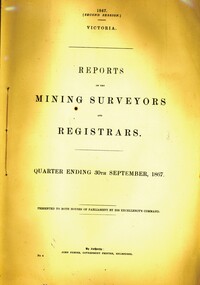
Book - REPORTS OF THE MINING SURVEYORS AND REGISTRARS 30TH. SEPT. 1867, 1867
... ...surveyors reports...REPORTS OF THE MINING SURVEYORS AND REGISTRARS 30TH. SEPT. 1867...GOLD MINING Miners' Safety Cage surveyors reports gold gold mining mining registrars report mining surveyor REPORTS OF THE MINING SURVEYORS AND REGISTRARS 30TH. ...REPORTS OF THE MINING SURVEYORS AND REGISTRARS 30TH. SEPT. 1867gold mining, miners' safety cage, surveyors reports, gold, gold mining, mining registrars report, mining surveyor -
Port Melbourne Historical & Preservation Society
Book - Borough of Sandridge, Charles Clay, Borough Surveyor, Surveyor's Reports, 1877
... Surveyor Charles CLAY's reports to Council March 1877 to June 1882, handwritten. 176pp volume bound in maroon linen with red spine; sticker on front: MINUTE BOOK; 'Surveyor's Reports' hand printed...Two printed Agendas 1881 and 1882 pasted in front. Surveyor Charles CLAY's reports to Council March 1877 to June 1882, handwritten. 176pp volume bound in maroon linen with red spine; sticker on front: MINUTE BOOK; 'Surveyor's Reports' hand printed Surveyor's Reports Book Borough of Sandridge Charles Clay, Borough Surveyor ...Surveyor Charles CLAY's reports to Council March 1877 to June 1882, handwritten. 176pp volume bound in maroon linen with red spine; sticker on front: MINUTE BOOK; 'Surveyor's Reports' hand printedThree names/addresses noted on first page. Two printed Agendas 1881 and 1882 pasted in front.local government - borough of sandridge, engineering - roads streets lanes and footpaths, port melbourne town hall, transport - tramways, engineering - canals and drainage, celebrations fetes and exhibitions, business and traders, fishermans bend, fire and fire services, flood, engineering - bridges, utilities, health - general health, built environment - domestic, industry - manufacturing, livestock, transport - railways, charles clay, sandridge lagoon, business and traders - hotels -
 Whitehorse Historical Society Inc.
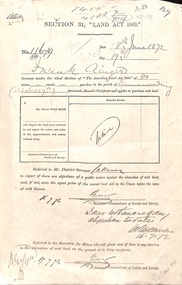
Document - Report, Section 31 Land Act 1869, 01/06/1872
... Land application by Frank Ainger, referred to District Surveyor. Report by Mounted Constable Douglas with description of proposed use of land. ...ainger frank douglas (mounted constable) assistant commissioner of lands and survey whitehorse road mitcham doncaster east road land settlement Land application by Frank Ainger, referred to District Surveyor. Report by Mounted Constable Douglas with description of proposed use of land. ...Land application by Frank Ainger, referred to District Surveyor. Report by Mounted Constable Douglas with description of proposed use of land. Map of area. The area is on the corner of Whitehorse Road and Doncaster East Road.ainger, frank, douglas (mounted constable), assistant commissioner of lands and survey, whitehorse road, mitcham, doncaster east road, land settlement -
Clunes Museum
Document
... STAPLED REPORT BY CONSULTING ENGINEERS ,SURVEYORS STRUCTURAL REPORT - CLUNES MUSEUM 7 SEPTEMBER 1998...local history document structual appraisal structual appraisel STAPLED REPORT BY CONSULTING ENGINEERS ,SURVEYORS STRUCTURAL REPORT - CLUNES MUSEUM 7 SEPTEMBER 1998 Document DOCUMENT ...STAPLED REPORT BY CONSULTING ENGINEERS ,SURVEYORS STRUCTURAL REPORT - CLUNES MUSEUM 7 SEPTEMBER 1998local history, document, structual appraisal, structual appraisel -
Port Melbourne Historical & Preservation Society
Book - Town of Port Melbourne, Arthur Victor Heath, Town Surveyor et al, Surveyors Report Book, 1901
... Reports to Council hand entered by Town Surveyor and ATS, with marginal notes on actions taken by Council....Gold stamped on spine 'Minute Book' but added leather label below reads 'Surveyors Report Book'. Some inserts (glued in)...Gold stamped on spine 'Minute Book' but added leather label below reads 'Surveyors Report Book'. Some inserts (glued in) Surveyors Report Book Book Town of Port Melbourne Arthur Victor Heath, Town Surveyor H V Champion, Acting Town Surveyor ...Reports to Council hand entered by Town Surveyor and ATS, with marginal notes on actions taken by Council.Book of reports of Port Melbourne Town Surveyor 1901-1911: 475 pp volume bound in dark green with maroon spine and corners. Gold stamped on spine 'Minute Book' but added leather label below reads 'Surveyors Report Book'. Some inserts (glued in)Stamped inside cover and on some pages, 'Town of Port Melbourne Surveyors Office'sandridge lagoon, local government - town of port melbourne, fishermans bend, flood, fire and fire services, port melbourne town hall, transport - horse, transport - tramways, parks and gardens, engineering - roads streets lanes and footpaths, excelsior hall, societies clubs unions and other organisations, built environment, industry - manufacturing, engineering - canals and drainage, crimes and misdemeanours, transport - ferries, south melbourne, arthur victor heath, george beazley, h v champion, business and traders - hotels -
 Sunshine and District Historical Society Incorporated
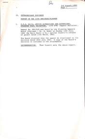
Administrative record - City of Sunshine - Commissioner Mr Alexander Alex George Gillon Collection 1976 - 1982 - Extraordinary Business Report Office Alterations Rosamond Road 3rd August 1982, City of Sunshine, 3rd August 1982
... Extraordinary Business Report of the City Engineer / Planner Planning Permit Application Office Alterations and Extensions Rosamond Road Maidstone Robert Bruce Reserve Tin Shed removal quotations Robert Barrett Reserve Sewerage Building Surveyor Report Infringement of the Uniform Building Regulations Mawson Street Deer Park...City of Sunshine Alexander "Alex" George Gillon Rosamond Road Maidstone Robet Bruce Reserve Gould Street Deer Park Robert Barrett Reserve Maribyrnong Mawson Street Extraordinary Business Report of the City Engineer / Planner Planning Permit Application Office Alterations and Extensions Rosamond Road Maidstone Robert Bruce Reserve Tin Shed removal quotations Robert Barrett Reserve Sewerage Building Surveyor Report Infringement of the Uniform Building Regulations Mawson Street Deer Park Foolscap sized document. ...Extraordinary Business Report of the City Engineer / Planner Planning Permit Application Office Alterations and Extensions Rosamond Road Maidstone Robert Bruce Reserve Tin Shed removal quotations Robert Barrett Reserve Sewerage Building Surveyor Report Infringement of the Uniform Building Regulations Mawson Street Deer Park city of sunshine, alexander "alex" george gillon, rosamond road, maidstone, robet bruce reserve, gould street, deer park, robert barrett reserve, maribyrnong, mawson street -
 Sunshine and District Historical Society Incorporated
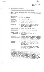
Administrative record - City of Sunshine - Commissioner Mr Alexander Alex George Gillon Collection 1976 - 1982 - Extraordinary Business Report Transport Depot 20th July 1982, City of Sunshine, 20th July 1982
... Extraordinary Business Report of the Acting City Engineer / Planner Planning Permit Application Clean Away Pty Ltd Transport Depot 11 Wright Street Sunshine Planning Permit Application Take Away Food Premise 419 Somerville Road Footscray West Report of the Building Surveyor Building Surveyor Report Building Control Act 1981 Underground Tanks 33 Raleigh Road Maribyrnong...City of Sunshine Alexander "Alex" George Gillon Wright Street Sunshine Somerville Road Footscray West Raleigh Road Maribyrnong Extraordinary Business Report of the Acting City Engineer / Planner Planning Permit Application Clean Away Pty Ltd Transport Depot 11 Wright Street Sunshine Planning Permit Application Take Away Food Premise 419 Somerville Road Footscray West Report of the Building Surveyor Building Surveyor Report Building Control Act 1981 Underground Tanks 33 Raleigh Road Maribyrnong Foolscap sized document. ...Extraordinary Business Report of the Acting City Engineer / Planner Planning Permit Application Clean Away Pty Ltd Transport Depot 11 Wright Street Sunshine Planning Permit Application Take Away Food Premise 419 Somerville Road Footscray West Report of the Building Surveyor Building Surveyor Report Building Control Act 1981 Underground Tanks 33 Raleigh Road Maribyrnong city of sunshine, alexander "alex" george gillon, wright street, sunshine, somerville road, footscray west, raleigh road, maribyrnong -
 Kew Historical Society Inc
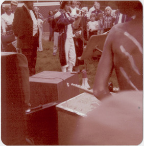
Photograph - Historic re-enactment during the Festival of Kew, 1978
... Original colour photographic positive of the [unhistoric] report by a Trinity Grammar School student, dressed in costume as the surveyor Charles Grimes, reporting to the then Mayor of Kew, Cr Noel Whiting. ...The photographs, taken by amateur and professional photographers, represent a period in time when the dominant values were those shared by the descendants of European settlers in Victoria. kew historical society trinity grammar school kew girl guides city of kew yarra river charles grimes collins expedition wurundjeri people yarra bend park colonial surveys historic re-enactments festival of kew kew festival Annotated on reverse: "GRIMES REPORTING TO MAYOR" Original colour photographic positive of the [unhistoric] report by a Trinity Grammar School student, dressed in costume as the surveyor Charles Grimes, reporting to the then Mayor of Kew, Cr Noel Whiting. ...At the 1978 Festival of Kew, a number of organisations, including the City of Kew, the Kew Historical Society, Trinity Boys Grammar School and local Girl Guides participated in a re-enactment of the expedition of the party of Charles Grimes in surveying the Yarra River as far as Kew in February 1803. The location for the event was Yarra Bend Park near the Studley Park Boat House. The event was organised by the Kew Historical Society. The re-enactment was captured by a number of amateur photographers as well as by a photographer from the local Progress Press.Local communities select events to commemorate according to their shared history and values. Commemorations of colonial exploration were popular with local historical groups such as the Kew Historical Society in the twentieth century. In re-enacting events such as the Grimes survey of the Yarra, students from a local school were encouraged to take on specific roles, including play-acting individuals involved in the survey party as well as members of the local Wurundjeri People. The photographs, taken by amateur and professional photographers, represent a period in time when the dominant values were those shared by the descendants of European settlers in Victoria. Original colour photographic positive of the [unhistoric] report by a Trinity Grammar School student, dressed in costume as the surveyor Charles Grimes, reporting to the then Mayor of Kew, Cr Noel Whiting. Wurundjeri warriors are in the foreground. .Annotated on reverse: "GRIMES REPORTING TO MAYOR"kew historical society, trinity grammar school, kew girl guides, city of kew, yarra river, charles grimes, collins expedition, wurundjeri people, yarra bend park, colonial surveys, historic re-enactments, festival of kew, kew festival -
 Victorian Aboriginal Corporation for Languages
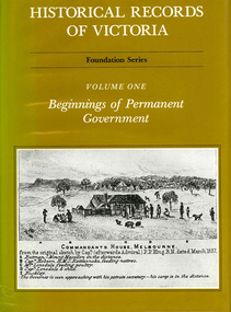
Book, Pauline Jones, Historical records of Victoria : volume 1 : beginnings of permanent government, 1981
... Reproductions of various transactions and reports dealing with the early government of Port Phillip, including laws, surveyors? ...Victorian history Port Phillip Governor Bourke Geelong John Batman treaty William Lonsdale William Buckley Werribee Reproductions of various transactions and reports dealing with the early government of Port Phillip, including laws, surveyors? ...Reproductions of various transactions and reports dealing with the early government of Port Phillip, including laws, surveyors? and administrators? reports, bills, requisitions, prices, police reports, and miscellaneous other documents dealing with the early administration of Port Phillip.victorian history, port phillip, governor bourke, geelong, john batman, treaty, william lonsdale, william buckley, werribee -
 Eltham District Historical Society Inc
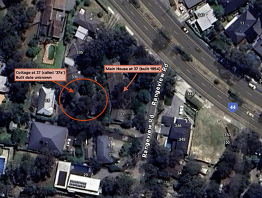
Document - Property Binder, 338 Main Road, Lower Plenty (also 37 Rangeview Road), March 2025
... Goodison, Licensed Surveyor, and attached Surveyor's Report dated 6 June 1990 (Withdrawn) 9. ...Goodison, Licensed Surveyor, and attached Surveyor's Report dated 6 June 1990 (Withdrawn) 9. ...EDHS_03095-338 | EDHS_08635-37 338 Main Road Lower Plenty | 37 Rangeview Road, Lower Plenty Original Mudbrick cottage and studio designed and built by Eltham artist, David Alan Newbury See also EDHS_06090 David Newbury (Artist) David Newbury was married to Clare Margaret Newbury. According to the 1954 Electoral Roll they were living at 36A Murphy Street, South Yarra however around 1953 they purchased Lots 3 and 4 of Main Road Lot Plan LP 23911 in Lower Plenty. A building permit, No. 71, was issued 8 December 1953 for a 5-room house of Vertical Board construction, cost £2,840, builder L. Williams, owner D. Newbury of 36 Murphy Cl., South Yarra. The large house was in fact mostly built of mudbrick, the construction method was only just becoming recognised as an acceptable form in the late 1940s for issuance of a building permit. The house was commenced in 1954, designed by David Newbury and built by David Newbury, Horrie Judd and others. Information from Newbury family friends suggests that a second mudbrick building was constructed in the late 1950s, early 1960s for use as an artist studio by Newbury. The building was connected directly to the water mains at the time and was made suitable for living accommodation during the period Newbury was teaching at Bendigo. Apparently he and Claire rented out the main house during their time in Bendigo and would reside in the studio when visiting Melbourne. No permit for this studio was found in the Building Permit Register, Shire of Eltham, 1949-1960. The last recorded entries in the register are dated May 1960. This would suggest that the studio was constructed post May 1960. It is believed the studio was constructed during the latter period of Newbury’s teaching post in Bendigo so possibly late 1960/1961. In 1963 the Newbury’s address in the Electoral Roll has the property recorded as 220 Main Road, Lower Plenty. Between 1967 to 1980 the Electoral Rolls record the property as 338 Main Road. Today the address is 37 Rangeview Road, Lower Plenty. Contents: 1. Extract from 1942 Shire of Eltham Rate Book. Muriel Gladys Reitsma listed as owner 2. Extract from 1984-85 Shire of Eltham Rate Book for Rangeview Road. (No mention of No. 37 so was probably still listed as 338 Main Road.) 3. Certificate of Title, Vol. 5601 Fol. 1120089 - Issued to David James Graham of Lower Plenty, Builder, Heidelberg for Lot 32 Block B on Plan of Subdivision No. 7606, part of Crown Portion Two, Parish of Nillumbik, County of Evelyn, 29 October 1929 4. Certificate of Title, Vol. 8008 Fol. 076 - Issued to David Alan Newbury of 36 Murphy Street, South Yarra, School Teacher for Lot 3 on Plan of Subdivision No. 23911, part of Crown Portion Two, Parish of Nillumbik, County of Evelyn, 29 October 1953. Amended 24 June 1963 to transfer portion for road widening scheme per Country Roads Board Plan 6889 - Cancelled 24 September 1984 5. Certificate of Title, Vol. 9581 Fol. 583 - Issued to Paul Robert Biber and Althea Constance Biber of 139 Lower Heidelberg Road, Ivanhoe for Lot 3 on Plan of Subdivision No. 23911, part of Crown Portion Two, Parish of Nillumbik, County of Evelyn, 24 September 1984. Derived from Vol. 8008 Fol. 076 L276994V - Cancelled 20 Nov 1992 when subdivided from one to two lots in Vol 10092 Fol. 192 and Vol. 10092 Fol. 193; LP222467B 6. Certificate of Title, Vol. 10092 Fol. 192 - Transfer to Lawrie Mein of 20 Dewar Drive, Hurstbridge of Lot 1 on Plan of Subdivision No. 222467B, lodged 17 Feb 1993, Registered 29 March 1996. Parent Titles Vol 08008 Fol 077, Vol 09581 Fol 583 7. Survey Field Notes of Part of Crown Portion 2, Parish of Nillumbik, County of Evelyn - Portion of land bounded by New Eltham Road. Application 23911 dated 8 Sep 1952 with appended Surveyor Field notes per Application 7098; R.D. Steele, Licensed Surveyor, 18 August 1950 8. Survey Field Notes of Part of Crown Portion 2, Parish of Nillumbik, County of Evelyn - Portion of land bounded by Main Road and Rangeview Road; 2 Lot subdivisions, Vol. 9581 Fol. 583 Part Lot 3 on LP 23911 and Vol. 8008 Fol, 077 Lot 4 on LP 23911; Application 221805 dated 27 November 1989; W.J. Goodison, Licensed Surveyor, and attached Surveyor's Report dated 6 June 1990 (Withdrawn) 9. Survey Field Notes of Part of Crown Portion 2, Parish of Nillumbik, County of Evelyn - Portion of land bounded by Main Road and Rangeview Road; 2 Lot subdivisions, Vol. 9581 Fol. 583 Part Lot 3 on LP 23911 and Vol. 8008 Fol, 077 Lot 4 on LP 23911; Application 222467 dated 20 November 1992 (221805 resubmitted); W.J. Goodison, Licensed Surveyor, and attached Surveyor's Report dated 6 June 1990 Notes: Items 1 to 6 donated electronically Items 7 to 9 sourced from LASSI - SPEAR, Department of Transport and Planning, Victoria State Government, https://maps.land.vic.gov.au/lassi/SpearUI.jsp main road, property, mudbrick, david newbury, phoebe mason collection, rate books, shire of eltham, certificate of title, survey plan, 37 rangeview road, 338 main road, application 23911, lower plenty, map, surveyor field notes, application 221805, application 222467 -
 Sunshine and District Historical Society Incorporated
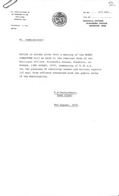
Administrative record - City of Sunshine - Commissioner Mr Alexander Alex George Gillon Collection 1976 - 1982 - Notice of committee meetings of the council 13th August 1979, City of Sunshine, 8th August 1979
... Notice of Committee Meetings of the Council 13th August 1979 Notice of Works Committee Meeting Notice of Agenda and Forward Planning Committee Meeting Notice of Finance Committee Meeting Report of Town Clerk Printing of Sunshine and District Historical Society Book Called Sunshine and District to 1901 Financial Report for the Period Ended 30th July 1979 The Hub Statement of Receipts and Payment for the Period Ended 30th July 1979 The Municipal Sunshine Tip Statement of Receipts and Payment for the Period Ended 30th July 1979 Award Matters Leases Multilith Printer & U-Bix Photocopying Machine Report of the Senior Health Surveyor Sanitary Contract Report of the Municipal Recreation Officer Holiday Programme Finance 1979 Report of the City Engineer & Planner Ourdoor Staff Request for Travelling Allowance for use of private vehicles Capital Works Programme 1979/80 and 1980/81 Ridgeway Parade Infant Welfare and Pre-School Centre Sunshine West Epalock Crescent Infant Welfare and Pre-School Centre St. ...Albans Buckingham Crescent Community Centre Buckingham Crescent Deer Park Community Centre Deer Park Sunshine West Community Centre Notice of Committee Meetings of the Council 13th August 1979 Notice of Works Committee Meeting Notice of Agenda and Forward Planning Committee Meeting Notice of Finance Committee Meeting Report of Town Clerk Printing of Sunshine and District Historical Society Book Called Sunshine and District to 1901 Financial Report for the Period Ended 30th July 1979 The Hub Statement of Receipts and Payment for the Period Ended 30th July 1979 The Municipal Sunshine Tip Statement of Receipts and Payment for the Period Ended 30th July 1979 Award Matters Leases Multilith Printer & U-Bix Photocopying Machine Report of the Senior Health Surveyor Sanitary Contract Report of the Municipal Recreation Officer Holiday Programme Finance 1979 Report of the City Engineer & Planner Ourdoor Staff Request for Travelling Allowance for use of private vehicles Capital Works Programme 1979/80 and 1980/81 Ridgeway Parade Infant Welfare and Pre-School Centre Sunshine West Epalock Crescent Infant Welfare and Pre-School Centre St. ...Notice of Committee Meetings of the Council 13th August 1979 Notice of Works Committee Meeting Notice of Agenda and Forward Planning Committee Meeting Notice of Finance Committee Meeting Report of Town Clerk Printing of Sunshine and District Historical Society Book Called Sunshine and District to 1901 Financial Report for the Period Ended 30th July 1979 The Hub Statement of Receipts and Payment for the Period Ended 30th July 1979 The Municipal Sunshine Tip Statement of Receipts and Payment for the Period Ended 30th July 1979 Award Matters Leases Multilith Printer & U-Bix Photocopying Machine Report of the Senior Health Surveyor Sanitary Contract Report of the Municipal Recreation Officer Holiday Programme Finance 1979 Report of the City Engineer & Planner Ourdoor Staff Request for Travelling Allowance for use of private vehicles Capital Works Programme 1979/80 and 1980/81 Ridgeway Parade Infant Welfare and Pre-School Centre Sunshine West Epalock Crescent Infant Welfare and Pre-School Centre St. Albans Southwold Street Infant Welfare and Pre-School Centre St. Albans Buckingham Crescent Community Centre Sunshine West Deer Park Community Centre Sunshine West Community Centre sunshine tip, the hub, sun crescent, sunshine, ridgeway parade infant welfare and pre-school centre, ridgeway parade, sunshine west, epalock crescent infant welfare and pre-school centre, epalock crescent, southwold street infant welfare and pre-school centre, southwold street, st. albans, buckingham crescent community centre, buckingham crescent, deer park community centre, deer park, sunshine west community centre -
 Sunshine and District Historical Society Incorporated
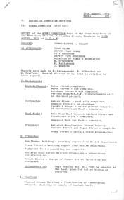
Administrative record - City of Sunshine - Commissioner Mr Alexander Alex George Gillon Collection 1976 - 1982 - Report of committee meetings 14th August 1979, City of Sunshine, 14th August 1979
... West Ward Progressing Tree Maintenance 50% Complete Dempster Park Practice Wickets Being Prepared for Laying of Synthetic Surface Report of Finance Committee Meeting Report of the Town Clerk Printing of Sunshine and District Historical Society Book Award Matters Leases Report of the Senior Health Surveyor Sanitary Contract Report of the Municipal Recreation Officer Holiday Programmes Finance 1979 Report of the City Engineer Outdoor Staff Request for Travelling Allowance for Use of Private Vehicles Capital Works Programme 1979/80 & 1980/81...West Ward Progressing Tree Maintenance 50% Complete Dempster Park Practice Wickets Being Prepared for Laying of Synthetic Surface Report of Finance Committee Meeting Report of the Town Clerk Printing of Sunshine and District Historical Society Book Award Matters Leases Report of the Senior Health Surveyor Sanitary Contract Report of the Municipal Recreation Officer Holiday Programmes Finance 1979 Report of the City Engineer Outdoor Staff Request for Travelling Allowance for Use of Private Vehicles Capital Works Programme 1979/80 & 1980/81 Foolscap sized document. ...Report of Committee Meetings 14th August 1979 Report of the Works Committee Kerb & Channel Melon Street Completed Kerb & Channel Burns Street 75% Completed Kerb & Channel Brisbane Street 85% Completed Kerb & Channel Furlong Road M.M.B.W, Reinstatements will be next project Footpath Ashley Strteet Partially Completed Footpath Adamson Street In Progress Footpath Cornhill Street Reinstatement Completed Footpath 24 Northumberland Road Completed Road Works Main Road East between Watford Street and Stradbroke Drive Completed Road Works Dempster Park Car Park Completed Drainage Ballarat Road Service Road between Vincent Street and Hogan Street Completed Orama Street Outfall Drain Progressing Bon Thomas Reserve Building Awaiting Report from Health Department Orama Street Awaiting Report from Health Department Highpoint West Panelling Now Completed Ballarat Road Infant Welfare Centre Extensions Progressing Toilet Blocks Design of Future Toilet Facilities was Discussed Diamond Avenue Building Finalisation of Landscaping Delayed due to Supply of Instant Turf Bon Thomas Reserve Landscaping Drainage, Sand Pits and Concrete Edging Completed Street Treets Bult Planting in Southern, River and Central Wards Completed. West Ward Progressing Tree Maintenance 50% Complete Dempster Park Practice Wickets Being Prepared for Laying of Synthetic Surface Report of Finance Committee Meeting Report of the Town Clerk Printing of Sunshine and District Historical Society Book Award Matters Leases Report of the Senior Health Surveyor Sanitary Contract Report of the Municipal Recreation Officer Holiday Programmes Finance 1979 Report of the City Engineer Outdoor Staff Request for Travelling Allowance for Use of Private Vehicles Capital Works Programme 1979/80 & 1980/81melon street, braybrook, burns street, maidstone, brisbane street, albion, furlong road, sunshine north, ashley strteet, adamson street, cornhill street, northumberland road, main road east, watford street, stradbroke drive, dempster park, phoenix street, ballarat road, vincent street, hogan street, deer park, orama street, bon thomas reserve, quinn street, ballarat road infant welfare centre, diamond avenue, albanvale -
 Sunshine and District Historical Society Incorporated
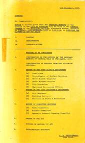
Administrative record - City of Sunshine - Commissioner Mr Alexander Alex George Gillon Collection 1976 - 1982 - Notice of ordinary meeting of the council 12th December 1978, City of Sunshine, 6th December 1978
... Notice of Ordinary Meeting of the Council 12th December 1978 Report of the Town Clerk's Department Report of the Town Clerk Sinking Fund Investments Land Transfer from Council Right of Way Discontinued of Stradbroke Drive Land Transfer Lot 58 Derrimut Street and Lot 89 Wyalong Street to create Walkway from Derrimut Street to Wyalong Street (Beside Albion State School) Creation of Easement Lot 382 Newbury Street Senior Management Training Program Dates for Meetings Amendment to Housing Act Lease 2 - 4 Burton Street Right of Way Rear of Shops Main Road West at Cornhill Street Translation Secretariat for the Western region Request for Financial Assistance Funds & Projects Housing Commission Area Proposed Subdivision of Land Fairbairn Road Report of the Co-Ordinator of Welfare Services Chiropody Subsidies Handicapped Persons' Parking Domiciliary Chiropody Resource Toy Library Community Youth Support Scheme Subsidies for Welfare Officers Residential Tenancies Bill Maribyrnong Senior Citizens' Club Possible of Land Sale Randall Street Maribyrnong by Administrative Services to Council Report of the Chief Health Inspector Fifth National Conference Australian Institute of health Surveyors Report Removal of Dwelling Outside the Municipality 23 Boreham Street Sunshine to Lot 46 Greenwich Grange Coronet Bay Victoria Prosecutions Proceedings Sunshine Magistrates Court Application for Transfer of Proprietorship of Premises under the Health Act Statistics on Head Lice from Commencement of Campaign to 25th October Request of the use of Braybrook Infant Welfare Centre Infant Welfare Herbicides 2-4-D & 2-45-T Typhoid Fever Incident St. ...Albans South Special School Mulhall Drive Canterbury Street Ralph Street Sunshine Indoor Heated Swimming Pool Service Street Laurel Street Raleigh Road Ballarat Road Hampshire Road McIntyre Road Sunshine North Cromer Avenue The Esplanade Disraeli Street Andrea Street Mitchell Street Maidstone Navigator Street Mernda Street Sydney Street Geelong Road King Edward Avenue Kororoit Creek Berkshire Road Hutchinson Street Neale Road Fairfax Circuit Antioch Court Islington Street Clacton Street Justin Road Tottenham Denton Avenue Percy Street Sunshine Tip Corio Street Whitesides Avenue Allison Street Mark Street Charlotte Street Glengala Road Ashley Street Cranwell Street Braybrook Edward Street Ridley Street Nortumberland Road Child Care Centre Northumberland Road Orama Street Child Care Centre Orama Street Highpoint West Child Care Centre Rosamond Road Bon Thomas Reserve Pre-School Centre Quinn Street Plantation Street Omega Street Notice of Ordinary Meeting of the Council 12th December 1978 Report of the Town Clerk's Department Report of the Town Clerk Sinking Fund Investments Land Transfer from Council Right of Way Discontinued of Stradbroke Drive Land Transfer Lot 58 Derrimut Street and Lot 89 Wyalong Street to create Walkway from Derrimut Street to Wyalong Street (Beside Albion State School) Creation of Easement Lot 382 Newbury Street Senior Management Training Program Dates for Meetings Amendment to Housing Act Lease 2 - 4 Burton Street Right of Way Rear of Shops Main Road West at Cornhill Street Translation Secretariat for the Western region Request for Financial Assistance Funds & Projects Housing Commission Area Proposed Subdivision of Land Fairbairn Road Report of the Co-Ordinator of Welfare Services Chiropody Subsidies Handicapped Persons' Parking Domiciliary Chiropody Resource Toy Library Community Youth Support Scheme Subsidies for Welfare Officers Residential Tenancies Bill Maribyrnong Senior Citizens' Club Possible of Land Sale Randall Street Maribyrnong by Administrative Services to Council Report of the Chief Health Inspector Fifth National Conference Australian Institute of health Surveyors Report Removal of Dwelling Outside the Municipality 23 Boreham Street Sunshine to Lot 46 Greenwich Grange Coronet Bay Victoria Prosecutions Proceedings Sunshine Magistrates Court Application for Transfer of Proprietorship of Premises under the Health Act Statistics on Head Lice from Commencement of Campaign to 25th October Request of the use of Braybrook Infant Welfare Centre Infant Welfare Herbicides 2-4-D & 2-45-T Typhoid Fever Incident St. ...Notice of Ordinary Meeting of the Council 12th December 1978 Report of the Town Clerk's Department Report of the Town Clerk Sinking Fund Investments Land Transfer from Council Right of Way Discontinued of Stradbroke Drive Land Transfer Lot 58 Derrimut Street and Lot 89 Wyalong Street to create Walkway from Derrimut Street to Wyalong Street (Beside Albion State School) Creation of Easement Lot 382 Newbury Street Senior Management Training Program Dates for Meetings Amendment to Housing Act Lease 2 - 4 Burton Street Right of Way Rear of Shops Main Road West at Cornhill Street Translation Secretariat for the Western region Request for Financial Assistance Funds & Projects Housing Commission Area Proposed Subdivision of Land Fairbairn Road Report of the Co-Ordinator of Welfare Services Chiropody Subsidies Handicapped Persons' Parking Domiciliary Chiropody Resource Toy Library Community Youth Support Scheme Subsidies for Welfare Officers Residential Tenancies Bill Maribyrnong Senior Citizens' Club Possible of Land Sale Randall Street Maribyrnong by Administrative Services to Council Report of the Chief Health Inspector Fifth National Conference Australian Institute of health Surveyors Report Removal of Dwelling Outside the Municipality 23 Boreham Street Sunshine to Lot 46 Greenwich Grange Coronet Bay Victoria Prosecutions Proceedings Sunshine Magistrates Court Application for Transfer of Proprietorship of Premises under the Health Act Statistics on Head Lice from Commencement of Campaign to 25th October Request of the use of Braybrook Infant Welfare Centre Infant Welfare Herbicides 2-4-D & 2-45-T Typhoid Fever Incident St. Albans South Special School Report of the Chief By-Laws Officer Court Proceedings Parking Infringements Proposed Prohibited Parking Canterbury Street Deer Park Proposed Prohibited Parking Ralph Street Sunshine West Dog Act Amendment to the Dog Act Report of the City Librarian Library Statistics 1st October 1977 to 40th September 1978 Melton Library Report of the Municipal Recreation Officer Adventure Playground Seminar Burnley College Holiday Programme funding Department of Youth, Sport & Recreation Sunshine Indoor Heated Swimming Pool Report of the City Engineer Proposed Rezoning of Land Laurel Street St. Albans Residential Building Lots City of Sunshine M.M.B.W. Planning Permit Application Sky Sign Lots 3, 4 & 5 Raleigh Road Planning Permit Application Access to Ballarat Road from Lot 59 Ballarat Road Deer Park Planning Permit Application National Bank of Australia Extension 248 Hampshire Road Planning Permit Application Hairdressing Salon Lot 66 Hampshire Road Planning Permit Application Office Lots 61 & 62 McIntyre Road Planning Permit Application Factory Lot 22 Cromer Avenue Planning Permit Application 2 Lot Subdivision Lot 1 The Esplanade Maribyrnong Planning Permit Application Cafe & Amusement Parlour Lot 2 Disraeli Street St. Albans Planning Permit Application Community Health Centre Andrea Street (Temporary Child-Minding Centre) Planning Permit Application Factory Lot 208 Cromer Avenue Planning Permit Application Service Premises 140B Mitchell Street Maidstone Planning Permit Application Educational Establishment Lot 9 Navigator Street Planning Permit Application Flats Lot 9 Mernda Street Planning Permit Application Advertising Signs 36 Sydney Street Planning Permit Loy 59 Ballarat Road Deer Park Presbytery and Church Additional to Existing Church and School Planning Permit Entertainment Complex Malibu Grand Prix Ballarat Road and Geelong Road Planning Permit Flats 17 King Edward Avenue Planning Permit Application Filling Within 30 metre of Kororoit Creek Mernda Street Planning Permit Application Pylon Sky Sign Lot 24 Berkshire Road Planning Permit Application Place of Assembly Lot 110 Hutchinson Street Planning Permit Application Subdivision and Detached Houses Neale Road Plan of Subdivision Neale Road, Fairfax Circuit and Antioch Court Strata Subdivision 3 - 5 Islington Street Plan of Subdivision 1 Clacton Street Robinsons Road Subdivision Construction of Justin Road Plan of Subdivision Denton Avenue Strata Subdivision 10 Percy Street Contract Fire Service Sunshine Tip Site Tender for Garbage Compactor Replacement of Holman Compressor Plant No 205 Purchase of Mini Bus for Community Groups Use Clearing Vacant Land 8 Corio Street Foundation for the Technical Advancement of local Government Engineering in Victoria Sewerage Facilities Sunshine West Bounded by Whitesides Avenue, Allison Street, Mark Street & Charlotte Street and Bounded by Mark Street, Lorna Crescent, Glengala Road & Alllison Street and Lots 1471 to 1473 Glengala Road and Lots 1493 to 1496 Mark Street Ashley Autos Half Cost Footpath West Side of Ashley Street between Ballarat Road and Cranwell Street Load Limit Various Road Sewerage Reticulation Area No 4037 Edward Street Deer Park Construction of Laneway Rear of Sydney Street Between King Edward Avenue and Ridley Street to 33 King Edward Avenue Tenders for Child Care Centre 24 Northumberland Road Sunshine North Tenders for Mechanical Services Orama Street Child Care Centre and Highpoint West Child Care Centre Tenders for Bon Thomas Reserve Pre-School Centre Retirement of City Engineer Henry Laskowski Report of the Building Surveyor Building Over Easement 50 Denton Avenue St. Albans Building Over Easement 189 McIntyre Road Sunshine North Building on Flood Prone Land Lot 4 Plantation Street Maribyrnong Report of the Director of Parks & Recreation Employment of Additional Staff Orders of the Day Accounts Submitted for Payment as at 30th November 1978 Proposal to Construct Right of way Main Road West at Cornhill Street Under the Provisions of Division 10 of Part XIX of the Local Government Act 1958 Proposal to Discontinue Part of Omega Street Under the Provisions of Section 528 of the Local Government Act 1958 city of sunshine, alexander "alex" george gillon, stradbroke drive, st. albans, wyalong street, derrimut street, albion, albion state school, newbury street, deer park, burton crescent, maribyrnong, main road west, cornhill street, fairbairn road, sunshine west, maribyrnong senior citizens' club, randall street, boreham street, sunshine, braybrook infant welfare centre, st. albans south special school, mulhall drive, canterbury street, ralph street, sunshine indoor heated swimming pool, service street, laurel street, raleigh road, ballarat road, hampshire road, mcintyre road, sunshine north, cromer avenue, the esplanade, disraeli street, andrea street, mitchell street, maidstone, navigator street, mernda street, sydney street, geelong road, king edward avenue, kororoit creek, berkshire road, hutchinson street, neale road, fairfax circuit, antioch court, islington street, clacton street, justin road, tottenham, denton avenue, percy street, sunshine tip, corio street, whitesides avenue, allison street, mark street, charlotte street, glengala road, ashley street, cranwell street, braybrook, edward street, ridley street, nortumberland road child care centre, northumberland road, orama street child care centre, orama street, highpoint west child care centre, rosamond road, bon thomas reserve pre-school centre, quinn street, plantation street, omega street -
 Sunshine and District Historical Society Incorporated
Administrative record - City of Sunshine - Commissioner Mr Alexander Alex George Gillon Collection 1976 - 1982 - Minutes of the ordinary meeting of council held on 12th Dec 1978, City of Sunshine, 12th December 1978
... Minutes of the Ordinary Meeting of Council held on 12th December 1978 Report of the Town Clerk's Department Report of the Town Clerk Sinking Fund Investments Land Transfer from Council Right of Way Discontinued of Stradbroke Drive Land Transfer Lot 58 Derrimut Street and Lot 89 Wyalong Street to create Walkway from Derrimut Street to Wyalong Street (Beside Albion State School) Creation of Easement Lot 382 Newbury Street Senior Management Training Program Dates for Meetings Amendment to Housing Act Lease 2 - 4 Burton Street Right of Way Rear of Shops Main Road West at Cornhill Street Translation Secretariat for the Western region Request for Financial Assistance Funds & Projects Housing Commission Area Proposed Subdivision of Land Fairbairn Road Report of the Co-Ordinator of Welfare Services Chiropody Subsidies Handicapped Persons' Parking Domiciliary Chiropody Resource Toy Library Community Youth Support Scheme Subsidies for Welfare Officers Residential Tenancies Bill Maribyrnong Senior Citizens' Club Possible of Land Sale Randall Street Maribyrnong by Administrative Services to Council Report of the Chief Health Inspector Fifth National Conference Australian Institute of health Surveyors Report Removal of Dwelling Outside the Municipality 23 Boreham Street Sunshine to Lot 46 Greenwich Grange Coronet Bay Victoria Prosecutions Proceedings Sunshine Magistrates Court Application for Transfer of Proprietorship of Premises under the Health Act Statistics on Head Lice from Commencement of Campaign to 25th October Request of the use of Braybrook Infant Welfare Centre Infant Welfare Herbicides 2-4-D & 2-45-T Typhoid Fever Incident St. ...Bernadette's Primary School Suffolk Road Westmoreland Road Rufford Street Willey Street Dempster Park Phoenix Street Greogry Street Simmie Street Ralph Street Reserve Robert Bruce Reserve Station Road Tallintyre Road Reserve Kermeen Street Heaton Close Ardeer Minutes of the Ordinary Meeting of Council held on 12th December 1978 Report of the Town Clerk's Department Report of the Town Clerk Sinking Fund Investments Land Transfer from Council Right of Way Discontinued of Stradbroke Drive Land Transfer Lot 58 Derrimut Street and Lot 89 Wyalong Street to create Walkway from Derrimut Street to Wyalong Street (Beside Albion State School) Creation of Easement Lot 382 Newbury Street Senior Management Training Program Dates for Meetings Amendment to Housing Act Lease 2 - 4 Burton Street Right of Way Rear of Shops Main Road West at Cornhill Street Translation Secretariat for the Western region Request for Financial Assistance Funds & Projects Housing Commission Area Proposed Subdivision of Land Fairbairn Road Report of the Co-Ordinator of Welfare Services Chiropody Subsidies Handicapped Persons' Parking Domiciliary Chiropody Resource Toy Library Community Youth Support Scheme Subsidies for Welfare Officers Residential Tenancies Bill Maribyrnong Senior Citizens' Club Possible of Land Sale Randall Street Maribyrnong by Administrative Services to Council Report of the Chief Health Inspector Fifth National Conference Australian Institute of health Surveyors Report Removal of Dwelling Outside the Municipality 23 Boreham Street Sunshine to Lot 46 Greenwich Grange Coronet Bay Victoria Prosecutions Proceedings Sunshine Magistrates Court Application for Transfer of Proprietorship of Premises under the Health Act Statistics on Head Lice from Commencement of Campaign to 25th October Request of the use of Braybrook Infant Welfare Centre Infant Welfare Herbicides 2-4-D & 2-45-T Typhoid Fever Incident St. ...Minutes of the Ordinary Meeting of Council held on 12th December 1978 Report of the Town Clerk's Department Report of the Town Clerk Sinking Fund Investments Land Transfer from Council Right of Way Discontinued of Stradbroke Drive Land Transfer Lot 58 Derrimut Street and Lot 89 Wyalong Street to create Walkway from Derrimut Street to Wyalong Street (Beside Albion State School) Creation of Easement Lot 382 Newbury Street Senior Management Training Program Dates for Meetings Amendment to Housing Act Lease 2 - 4 Burton Street Right of Way Rear of Shops Main Road West at Cornhill Street Translation Secretariat for the Western region Request for Financial Assistance Funds & Projects Housing Commission Area Proposed Subdivision of Land Fairbairn Road Report of the Co-Ordinator of Welfare Services Chiropody Subsidies Handicapped Persons' Parking Domiciliary Chiropody Resource Toy Library Community Youth Support Scheme Subsidies for Welfare Officers Residential Tenancies Bill Maribyrnong Senior Citizens' Club Possible of Land Sale Randall Street Maribyrnong by Administrative Services to Council Report of the Chief Health Inspector Fifth National Conference Australian Institute of health Surveyors Report Removal of Dwelling Outside the Municipality 23 Boreham Street Sunshine to Lot 46 Greenwich Grange Coronet Bay Victoria Prosecutions Proceedings Sunshine Magistrates Court Application for Transfer of Proprietorship of Premises under the Health Act Statistics on Head Lice from Commencement of Campaign to 25th October Request of the use of Braybrook Infant Welfare Centre Infant Welfare Herbicides 2-4-D & 2-45-T Typhoid Fever Incident St. Albans South Special School Report of the Chief By-Laws Officer Court Proceedings Parking Infringements Proposed Prohibited Parking Canterbury Street Deer Park Proposed Prohibited Parking Ralph Street Sunshine West Dog Act Amendment to the Dog Act Report of the City Librarian Library Statistics 1st October 1977 to 40th September 1978 Melton Library Report of the Municipal Recreation Officer Adventure Playground Seminar Burnley College Holiday Programme funding Department of Youth, Sport & Recreation Sunshine Indoor Heated Swimming Pool Report of the City Engineer Proposed Rezoning of Land Laurel Street St. Albans Residential Building Lots City of Sunshine M.M.B.W. Planning Permit Application Sky Sign Lots 3, 4 & 5 Raleigh Road Planning Permit Application Access to Ballarat Road from Lot 59 Ballarat Road Deer Park Planning Permit Application National Bank of Australia Extension 248 Hampshire Road Planning Permit Application Hairdressing Salon Lot 66 Hampshire Road Planning Permit Application Office Lots 61 & 62 McIntyre Road Planning Permit Application Factory Lot 22 Cromer Avenue Planning Permit Application 2 Lot Subdivision Lot 1 The Esplanade Maribyrnong Planning Permit Application Cafe & Amusement Parlour Lot 2 Disraeli Street St. Albans Planning Permit Application Community Health Centre Andrea Street (Temporary Child-Minding Centre) Planning Permit Application Factory Lot 208 Cromer Avenue Planning Permit Application Service Premises 140B Mitchell Street Maidstone Planning Permit Application Educational Establishment Lot 9 Navigator Street Planning Permit Application Flats Lot 9 Mernda Street Planning Permit Application Advertising Signs 36 Sydney Street Planning Permit Loy 59 Ballarat Road Deer Park Presbytery and Church Additional to Existing Church and School Planning Permit Entertainment Complex Malibu Grand Prix Ballarat Road and Geelong Road Planning Permit Flats 17 King Edward Avenue Planning Permit Application Filling Within 30 metre of Kororoit Creek Mernda Street Planning Permit Application Pylon Sky Sign Lot 24 Berkshire Road Planning Permit Application Place of Assembly Lot 110 Hutchinson Street Planning Permit Application Subdivision and Detached Houses Neale Road Plan of Subdivision Neale Road, Fairfax Circuit and Antioch Court Strata Subdivision 3 - 5 Islington Street Plan of Subdivision 1 Clacton Street Robinsons Road Subdivision Construction of Justin Road Plan of Subdivision Denton Avenue Strata Subdivision 10 Percy Street Contract Fire Service Sunshine Tip Site Tender for Garbage Compactor Replacement of Holman Compressor Plant No 205 Purchase of Mini Bus for Community Groups Use Clearing Vacant Land 8 Corio Street Foundation for the Technical Advancement of local Government Engineering in Victoria Sewerage Facilities Sunshine West Bounded by Whitesides Avenue, Allison Street, Mark Street & Charlotte Street and Bounded by Mark Street, Lorna Crescent, Glengala Road & Alllison Street and Lots 1471 to 1473 Glengala Road and Lots 1493 to 1496 Mark Street Ashley Autos Half Cost Footpath West Side of Ashley Street between Ballarat Road and Cranwell Street Load Limit Various Road Sewerage Reticulation Area No 4037 Edward Street Deer Park Construction of Laneway Rear of Sydney Street Between King Edward Avenue and Ridley Street to 33 King Edward Avenue Tenders for Child Care Centre 24 Northumberland Road Sunshine North Tenders for Mechanical Services Orama Street Child Care Centre and Highpoint West Child Care Centre Tenders for Bon Thomas Reserve Pre-School Centre Retirement of City Engineer Henry Laskowski Report of the Building Surveyor Building Over Easement 50 Denton Avenue St. Albans Building Over Easement 189 McIntyre Road Sunshine North Building on Flood Prone Land Lot 4 Plantation Street Maribyrnong Report of the Director of Parks & Recreation Employment of Additional Staff Orders of the Day Accounts Submitted for Payment as at 30th November 1978 Proposal to Construct Right of way Main Road West at Cornhill Street Under the Provisions of Division 10 of Part XIX of the Local Government Act 1958 Proposal to Discontinue Part of Omega Street Under the Provisions of Section 528 of the Local Government Act 1958 Extraordinary Business Report of the City Engineer Proposed Amendment No 90 to the Melbounre Metropolitan Planning scheme Planning Permit Application 21 Factory Burke Street and Mullenger Road Planning Permit Application Extensions to the Existing Office and Truck Sales and Service Centre Lot 2 Geelong Road North East Corner McDonald Road Planning Permit Application 65 Bed Nursing Home and Matrons Residence Killara Street and Mernda Street Sunshine West Outer Ring Freeway St. Albans Road Sunshine to Webber Parade Planning Permit Application Factory 40 - 42 McIntyre Road Planning Permit Application Flats Lots 1 - 7 Warrs Road and Lots 18 - 22 Fabian Court Stages 2 & 3 Only Planning Permit Application Flats Lots 1 - 7 Warrs Road and Lots 18 - 22 Fabian Court Stages 1 & 4 Only Planning Permit Presbytery Addition to Existing Church and St. Bernadette's Primary School Land Bounded by Suffolk Road, Westmoreland Road, Rufford Street & Willey Street Lease of Highpoint West Child Care Centre Contract Tennis Courts Dempster Park Neale Road Construction Stage 2 Greogry Street and Simmie Street One Way Proposal Toilet Blocks Ralph Street Reserve, Robert Bruce Reserve & Tallintyre Road Reserve Report of the Building Surveyor Fence 2 Heaton Close Ardeer city of sunshine, alexander "alex" george gillon, stradbroke drive, st. albans, wyalong street, derrimut street, albion, albion state school, newbury street, deer park, maribyrnong, main road west, cornhill street, fairbairn road, sunshine west, maribyrnong senior citizens' club, randall street, burton street, boreham street, sunshine, braybrook infant welfare centre, st. albans south special school, mulhall road, canterbury street, ralph street, sunshine indoor heated swimming pool, service street, laurel street, raleigh road, ballarat road, hampshire road, mcintyre road, cromer avenue, the esplanade, disraeli street, andrea street, mitchell street, maidstone, mernda street, sydney street, geelong road, brooklyn, king edward avenue, kororoit creek, berkshire road, hutchinson street, neale road, fairfax circuit, antioch court, islington street, clacton street, robinsons road, justin road, tottenham, denton avenue, percy street, sunshine tip, corio street, whitesides avenue, allison street, mark street, charlotte street, lorna crescent, glengala road, ashley street, cranwell street, braybrook, ridley street, northumberland child care centre, northumberland road, orama street child care centre, orama street, highpoint west child care centre, rosamond road, bon thomas reserve pre-school centre, bon thomas reserve, quinn street, plantation street, omega street, burke street, mullenger road, mcdonald road, killara street, webber parade, keilor east, warrs road, fabian court, st. bernadette's primary school, suffolk road, westmoreland road, rufford street, willey street, dempster park, phoenix street, greogry street, simmie street, ralph street reserve, robert bruce reserve, station road, tallintyre road reserve, kermeen street, heaton close, ardeer -
 Federation University Historical Collection
Photograph - Photograph (black & white), Ferdinand Moritz Krause
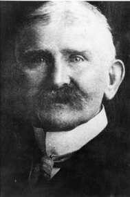
... Whilst at Ballarat in 1887-90 he had completed geological maps and reports on the parishes of Haddon, Carngham, Scarsdale, Lillerie, Smythesdale and Comeralghip; these were published in 1898. The Institute of Surveyors...Whilst at Ballarat in 1887-90 he had completed geological maps and reports on the parishes of Haddon, Carngham, Scarsdale, Lillerie, Smythesdale and Comeralghip; these were published in 1898. The Institute of Surveyors ...Civil engineer and geologist Ferdinand Moritz Krause lecturered at the Ballarat School of Mines from 1880 to 1895. He was born at Kassel, Germany on 24 February 1841, the youngest son of Frederich Wilhelm Krause. Ferdinand Krause married Amy Augusta Dimock. He died in South Africa 16 June 1918. In June 1880 Krausé was appointed to the Ballarat School of Mines as lecturer in 'geology, palaeontology, mineralogy, electricity, magnetism, scientific mining, geological and topographical surveying' and as museum curator. In 1881 he was appointed Professor of Geology and in 1892 was elected president of the Staff Association. He was held in high repute by his students and also known as a keen musician. He resigned from the School of Mines to be lecturer in mining at the University of Melbourne from June 1895 to January 1897. Whilst at Ballarat in 1887-90 he had completed geological maps and reports on the parishes of Haddon, Carngham, Scarsdale, Lillerie, Smythesdale and Comeralghip; these were published in 1898. The Institute of Surveyors elected him a member in 1891. His Introduction to the study of Mineralogy for Australian readers was published in Melbourne in 1896. In January 1897 he became manager of the General Gordon mine near Kalgoorlie. In 1900 he contributed an article to the Ballarat School of Mines Students' Magazine on the mining geology of Kalgoorlie. Invited by a former student, George Denny, Krausé left for South Africa in 1901. His last work was a geological map of the Barberton area, Transvaal, published in March 1918. He died on 16 June, survived by his wife, three sons and a daughter. (http://adb.anu.edu.au/biography/krause-ferdinand-moritz-3971, accessed 20 November 2018) Black and White photograph of the head and shoulders of Professor Ferdinand Krause of the Ballarat School of Mines.ballarat school of mines, ferdinand krause, geology, fm krause, krause, ballarat school of mines museum -
 Flagstaff Hill Maritime Museum and Village
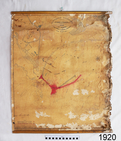
Document - Plan, Victorian Harbours Warrnambool, Victorian Harbours, Warrnambool, Plan to Accompany Sir John Coode's Report, 28-02-1879
... Surveyor and Sir John Coode. Plan has gold coloured quarter-dowel rods top and bottom and a metal ring at the top. Stamped with title. Signed by Sir John Coode. Victorian Harbours, Warrnambool, Plan to Accompany Sir John Coode's Report ...This plan is of great significance to the local history of Warrnambool, in particular the Breakwater and its impact on Warrnambool's maritime and trade history. The plan shows the existing jetties at the Port of Warrnambool, plus the partially erected Breakwater and proposed works to the Breakwater by both the Borough of Warrnambool Surveyor and Sir John Coode. The plan was signed 28th February 1879 by Sir John Coode. The legend at the bottom left describes the existing works and the proposed works. The Warrnambool Breakwater Sir John Coode was a British harbour engineer. He was brought to Melbourne by the Melbourne Harbour Trust to advise on works to improve the Port of Melbourne. The Victorian Government commissioned him to present a plan to complete the Warrnambool Breakwater. His original plan was too expensive so he prepared a revised plan for a shorter structure. The work was completed in 1890. The construction proved to be too short to protect adequately from the weather and didn't allow enough depth for larger vessels to come into port. The decreasing trade was further affected by siltation in the bay due to the breakwater, and the completion of the railway line. The situation of the harbour became a real problem that, by 1910, required continuous dredging. In 1914 the Breakwater was extended but proved to be a failure because the work began to subside and by 1920 about two thirds of the harbour was silted up. Alterations made in the 1920's increased the silting problem and by the 1940's the harbour was no longer used. More alterations were made in the 1950's and 1960's. The Warrnambool Breakwater is registered as a place of significance on the Victorian Heritage Database. This plan of the proposed works for the existing Warrnambool Breakwater is of great significance to the local history of Warrnambool, in particular the Breakwater and its impact on Warrnambool's maritime and trade history. The Warrnambool Breakwater is registered as a place of significance on the Victorian Heritage Database (VHR H2024). It is historically significant to Victoria as one of the most important maritime engineering projects in Victoria in the late 19th century. The Warrnambool Breakwater is of historical significance as one of the most important maritime engineering projects in Victoria in the late nineteenth century. It is evidence of Victoria's nineteenth century investment in regional port infrastructure and the development of Victorian coastal shipping. It is of significance for its association with the English civil engineer Sir John Coode, the most distinguished harbour engineer of the nineteenth century, who was brought to Victoria to advise on works to improve the Port of Melbourne, but was retained by the Government to advise on improvements to the harbours at Portland, Geelong, Port Fairy, and Lakes Entrance, as well as Warrnambool. His projects for Melbourne, Lakes Entrance and Warrnambool were major engineering projects of the nineteenth century. The breakwater is historically significant as a reminder of Warrnambool's early maritime history as a Western District port, and as one of Victoria's major 'outer ports'. While the Warrnambool Breakwater is a demonstration of the engineering skills of the nineteenth century, it also demonstrates the limitations of knowledge relating to sedimentology at the time and the confidence apparent in a number of nineteenth century plans which assumed that natural forces could be overcome or contained by engineering.Plan of Warrnambool Harbour, Port of Warrnambool, dated 28 Feb 1879. Plan shows existing Breakwater and work proposed by both Warrnambool Borough Surveyor and Sir John Coode. Plan has gold coloured quarter-dowel rods top and bottom and a metal ring at the top. Stamped with title. Signed by Sir John Coode.Stamped "VICTORIAN HARBOURS / WARRNAMBOOL / PLAN / to accompany / SIR JOHN GOODE'S REPORT / DATED 28 FEB 1879" Signature "John Coode"flagstaff hill, warrnambool, maritime museum, shipwreck coast, great ocean road, sir john coode, borough of warrnambool surveyor, plan of warrnambool, victorian harbours, warrnambool harbour, warrnambool breakwater, port of warrnambool, vhd vhr h2024, flagstaff hill maritime museum & village, maritime village, map, chart, plan, lady bay, breakwater, jetty, pier, vhr h2024, proposed works, 1879 -
 Federation University Historical Collection
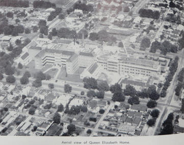
Booklet, City of Ballarat Mayor's Report, 1957-1958, 1958
... Ballarat was created a municipality on 17 December 1855, declared a Borough on October 1863, Proclaimed a City on 09 September 1970. city of ballarat mayor's report annual report jack chisholm city of ballarat coat of arms arms of ballarat john a. chisholm arthur nicholson alan pittard gordon scott arthur mason frederick oliver oscar curnow frank woodward william roff francis cutts nathaniel callow kenneth webb mrs john a. chisholm queen mother raaf school of radio city engineer's department public health report finance mr k. h. mitchell mr f. j. rogers building surveyor's department mr j. b. menhennet mr r. g. campbell city health inspector mr. r. g. biggs weights and measures inspector mr. w. mccormack libraries mr r. a. mccallum streets, parks and gardens water supply and sewerage ballaarat's voluntary community committees service clubs city traffic mr. j. h. sorrell sturt street gardens ballarat base hospital st john of god hospital queen elizabeth centre black hill black hill reclaimation Ballarat Benenevolent Asylum Green covered book City of Ballarat Mayor's Report, 1957-1958 Booklet Booklet John Fraser & Son Printers ...Ballarat was created a municipality on 17 December 1855, declared a Borough on October 1863, Proclaimed a City on 09 September 1970.Green covered bookcity of ballarat, mayor's report, annual report, jack chisholm, city of ballarat coat of arms, arms of ballarat, john a. chisholm, arthur nicholson, alan pittard, gordon scott, arthur mason, frederick oliver, oscar curnow, frank woodward, william roff, francis cutts, nathaniel callow, kenneth webb, mrs john a. chisholm, queen mother, raaf school of radio, city engineer's department, public health report, finance, mr k. h. mitchell, mr f. j. rogers, building surveyor's department, mr j. b. menhennet, mr r. g. campbell, city health inspector, mr. r. g. biggs, weights and measures inspector, mr. w. mccormack, libraries, mr r. a. mccallum, streets, parks and gardens, water supply and sewerage, ballaarat's voluntary community committees, service clubs, city traffic, mr. j. h. sorrell, sturt street gardens, ballarat base hospital, st john of god hospital, queen elizabeth centre, black hill, black hill reclaimation, ballarat benenevolent asylum -
 The Beechworth Burke Museum
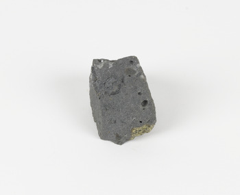
Geological specimen - Basalt (igneous-volcanic) containing Olivine, unknown
... Alfred Selwyn was appointed geological surveyor in Australia in 1852 which began the Geological Survey of Victoria. In 1853-69 the Geological Survey issued under Selwyn's direction sixty-one geological maps and numerous reports; they were of such high standard that a writer in the Quarterly Journal of the Geological Society of London bracketed the survey with that of the United States of America as the best in the world. ...Alfred Selwyn was appointed geological surveyor in Australia in 1852 which began the Geological Survey of Victoria. In 1853-69 the Geological Survey issued under Selwyn's direction sixty-one geological maps and numerous reports; they were of such high standard that a writer in the Quarterly Journal of the Geological Society of London bracketed the survey with that of the United States of America as the best in the world. ...This particular geological specimen was found in Mount Franklin or Lalgambook in Djadjawurrung, located between Daylesford and Newstead, approximately ninety minutes drive from Melbourne. The mountain is an example of a breached scoria cone (a steep conical hill of loose pyroclastic fragments) which was created by a volcanic eruption about 470,000 years ago, a date which may indicate the age of this geological specimen. The volcanic eruptions of Mount Franklin were most likely witnessed by members of the Dja Dja Wurrung Aboriginal tribe, who referred to this country as the 'smoking grounds'. Mount Franklin and the surrounding area appears to have been a place of considerable religious significance to Aboriginal people, there is evidence which indicates that frequent large ceremonial gatherings took place in the area. Basalt is the most common rock on Earth’s surface, more than 90% of all volcanic rock on Earth is basalt. Basalt is an aphanitic extrusive igneous rock formed from the rapid cooling of low-viscosity lava exposed at or very near the surface of a rocky planet or moon. Specimens are black in colour and weather to dark green or brown. Basalt is rich in iron and magnesium and is mainly composed of olivine, pyroxene, and plagioclase. Olivine is the name of a group of rock-forming silicate minerals with compositions ranging between Mg2SiO4 and Fe2SiO4. Unlike other minerals, Olivine has a very high crystallisation temperature which makes it the first of the minerals to crystallise from magma. As magma cools, the crystals begin to form and settle on the bottom of the lava and form basalts that are abnormally enriched in olivine in the lower part of lava flows. According to H. M. King (on geology.com) "Olivine is thought to be an important mineral in Earth's mantle. Its presence as a mantle mineral has been inferred by a change in the behaviour of seismic waves as they cross the boundary between Earth's crust and mantle". Lava from Mount Franklin and other volcanoes in the area filled valleys and buried the gold bearing streams that became the renowned ‘deep leads’ of the gold mining era. In 1852, as part of the Victorian gold rush, gold was discovered in the immediate area, this gold was created by lava flows during the Newer Volcanic period, which were mined intensively during the nineteenth century. Around 1865 the presence of a deep lead in Mount Franklin was established. Deep lead mining was initially unsuccessful, and it was not until the late 1870s that the Franklinford Gold Mining Company mined at Mount Franklin on a significant scale. A few years later the Mount Franklin Estate Gold Mining Company also struck gold, followed by the Shakespeare and Great Western companies in the mid-1880s. By the late 1880s, however, deep lead mining had ceased in the area. Soon after gold was discovered in 1851, Victoria’s Governor La Trobe wrote to the Colonial Office in London, urging ‘the propriety of selecting and appointing as Mineral Surveyor for this Colony a gentleman possessed of the requisite qualifications and acquaintance with geological science and phenomena’. Alfred Selwyn was appointed geological surveyor in Australia in 1852 which began the Geological Survey of Victoria. In 1853-69 the Geological Survey issued under Selwyn's direction sixty-one geological maps and numerous reports; they were of such high standard that a writer in the Quarterly Journal of the Geological Society of London bracketed the survey with that of the United States of America as the best in the world. During his years spent in Australia, Selwyn collected numerous significant geological specimens, examples of which are held in collections such as the Burke Museum.This geological specimen is an example of basalt and olivine which shows the volcanic lava activity and geographical specific nature of Mt Franklin as a significant volcanic site. According to Agriculture Victoria 'The crater is one of the deepest in the Central Highlands area. It is a major megacryst site with some of the largest known Victorian examples of megacrysts of augite and an orthoclase. The small parasitic mound of Lady Franklin on the western flanks adds to the geological interest of the site'. This specimen also highlights the locality as a significant place for both indigenous activity and Victorian gold rush era mining practices. This specimen is part of a larger collection of geological and mineral specimens collected from around Australia (and some parts of the world) and donated to the Burke Museum between 1868-1880. A large percentage of these specimens were collected in Victoria as part of the Geological Survey of Victoria that begun in 1852 (in response to the Gold Rush) to study and map the geology of Victoria. Collecting geological specimens was an important part of mapping and understanding the scientific makeup of the earth. Many of these specimens were sent to research and collecting organisations across Australia, including the Burke Museum, to educate and encourage further study.An angular, solid hand-sized piece of grey volcanic Basalt with green/brown Olivine phenocrysts along one flat edge.Olivine in basalt / - label is probably / correct. / C. Willman / 15/4/21burke museum, beechworth, indigo shire, beechworth museum, geological, geological specimen, mineralogy, basalt, igneous rock, igneous-volcanic, volcanic geology, volcanic, olivine, olivine specimen, basaltoid -
 The Beechworth Burke Museum
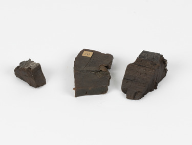
Geological specimen - Coorongite
... surveyor in Australia in 1852 which began the Geological Survey of Victoria. Selwyn went on to collect geological samples and catalogue thousands of specimens around Australia. In 1853-69 the Geological Survey issued under Selwyn's direction sixty-one geological maps and numerous reports; they were of such high standard that a writer in the Quarterly Journal of the Geological Society of London bracketed the survey with that of the United States of America as the best in the world. ...surveyor in Australia in 1852 which began the Geological Survey of Victoria. Selwyn went on to collect geological samples and catalogue thousands of specimens around Australia. In 1853-69 the Geological Survey issued under Selwyn's direction sixty-one geological maps and numerous reports; they were of such high standard that a writer in the Quarterly Journal of the Geological Society of London bracketed the survey with that of the United States of America as the best in the world. ...Coorongite is a dark, rubber-like, highly resilient structureless algal deposit. In the Coorong district of South Australia it occurs in moderate quantities associated with the coastal swamps and sand dunes which extend for a considerable distance east of the mouth of the Murray. This particular specimen was recovered from the south of the Coorong River, South Australia. A type of sediment rich in organic matter, Coorongite is the unlithified end-member of the sapropelic coal series. The members of the sapropelic coal series can be ranked in order as sapropel (the unlithified form), sapropelic-lignite, and sapropelic-coal (the lithified forms) based on increasing carbon content and decreasing volatile content. Sapropel (Coorongite) is an unlithified dark, pulpy, fine organic mud containing concentrations of algae and miospores that are more or less identifiable. Coorongite is typically found as an algae like substance, that can be found in irregular size pieces. Coorongite was believed to be dried up oil due to its rubber-like texture. The Coorongite is also soft to the point where it can be cut into with a knife or it can be broken and torn by hand. Otherwise known as 'Kurangk', the Coorong River is home to the Ngarrindjeri people, which acts as both a place for gathering food and a spiritual place. In 1852 the first sight of Coorongite was found along the Coorong River. The finders mistook the Coorongite for dried up oil, which lead to the belief that there were oil reserves under the Coorong River. Between the 1860s and the 1930s the Coorong River became a place where mining oil and Coorongite became precedent. Nowadays, the local council and the South Australian Government are working together with the Ngarrindjeri people to sustain and preserve the Coorong River and the culture that is with it. Soon after gold was discovered in 1851, Victoria’s Governor La Trobe wrote to the Colonial Office in London, urging ‘the propriety of selecting and appointing as Mineral Surveyor for this Colony a gentleman possessed of the requisite qualifications and acquaintance with geological science and phenomena’. Alfred Selwyn was appointed geological surveyor in Australia in 1852 which began the Geological Survey of Victoria. Selwyn went on to collect geological samples and catalogue thousands of specimens around Australia. In 1853-69 the Geological Survey issued under Selwyn's direction sixty-one geological maps and numerous reports; they were of such high standard that a writer in the Quarterly Journal of the Geological Society of London bracketed the survey with that of the United States of America as the best in the world. During his years spent in Australia, Selwyn collected numerous significant geological specimens, examples of which are held in collections such as the Burke Museum.Coorongite is considered to be a mineral with a unique texture, where it can be both hard and soft. Coorongite can also be considered to be a rare mineral, as it is only located along the Coorong River and due to the mining of it, has left very few sources. It was believed at one point that Coorongite could be used to replace oil. This specimen is part of a larger collection of geological and mineral specimens collected from around Australia (and some parts of the world) and donated to the Burke Museum between 1868-1880. A large percentage of these specimens were collected in Victoria as part of the Geological Survey of Victoria that begun in 1852 (in response to the Gold Rush) to study and map the geology of Victoria. Collecting geological specimens was an important part of mapping and understanding the scientific makeup of the earth. Many of these specimens were sent to research and collecting organisations across Australia, including the Burke Museum, to educate and encourage further study.Three solid varyingly hand-sized pieces of wooden appearing organic matter derived from the river in the Coorong District in South Australia. A rubber-like, highly resilient structureless algal deposit.Specimen 245 page 69 / in Descriptive Register / "Elcestic Bitumen, / Coorangite" South of / Coorung River, South Australia . / C. WIllman / 15/4/21burke museum, beechwoth, indigo shire, beechworth museum, geological, geological specimen, mineraology, coorong, coorong river, kurangk, ngarrindjeri, south australia, coorongite, coorongite specimen -
 The Beechworth Burke Museum
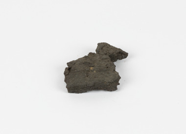
Geological specimen - Brown Coal
... Alfred Selwyn was appointed geological surveyor in Australia in 1852 which began the Geological Survey of Victoria. In 1853-69 the Geological Survey issued under Selwyn's direction sixty-one geological maps and numerous reports; they were of such high standard that a writer in the Quarterly Journal of the Geological Society of London bracketed the survey with that of the United States of America as the best in the world. ...Alfred Selwyn was appointed geological surveyor in Australia in 1852 which began the Geological Survey of Victoria. In 1853-69 the Geological Survey issued under Selwyn's direction sixty-one geological maps and numerous reports; they were of such high standard that a writer in the Quarterly Journal of the Geological Society of London bracketed the survey with that of the United States of America as the best in the world. ...Brown Coal is typically found as rocks. During formation the Brown Coal starts as peats, which is an acidic brown deposit resembling soil, and over time when subjected to pressure and heat these peats form the Coal. Brown Coal is the lowest rank of coal as it has a low carbon (energy) content, and a high moisture content. This high moisture content makes Brown Coal unsuitable for overseas exports. This particular specimen was recovered from the Yallourn Mine in Latrobe Valley, Victoria as part of the geological survey of Victoria being carried out by Alfred Selwyn. Otherwise known as the 'Yallourn Power Station', the Yallourn Mine is Australia's second largest mine. Yallourn Mine was first built in 1920, and since then it has been providing over 1 billion tonnes of Brown Coal to Australia every year. The Yallourn Mine is responsible for 22% of Victoria's electricity and 8% of Australia's electricity. As of 2021 the mine employs around 500 people. Due to ongoing maintenance issues and Australia's move to cleaner energy, the Yallourn Mine intends to shut down permanently as of 2028. Soon after gold was discovered in 1851, Victoria’s Governor La Trobe wrote to the Colonial Office in London, urging ‘the propriety of selecting and appointing as Mineral Surveyor for this Colony a gentleman possessed of the requisite qualifications and acquaintance with geological science and phenomena’. Alfred Selwyn was appointed geological surveyor in Australia in 1852 which began the Geological Survey of Victoria. In 1853-69 the Geological Survey issued under Selwyn's direction sixty-one geological maps and numerous reports; they were of such high standard that a writer in the Quarterly Journal of the Geological Society of London bracketed the survey with that of the United States of America as the best in the world. During his years spent in Australia, Selwyn collected numerous significant geological specimens, examples of which are held in collections such as the Burke Museum.Brown coal is considered to be an essential rock to Australia's energy consumption. Although plentiful in sources, Brown Coal is not able to be exported overseas due to its high moisture content. As Australia moves towards cleaner energy, Brown Coal is going become less used. This specimen is part of a larger collection of geological and mineral specimens collected from around Australia (and some parts of the world) and donated to the Burke Museum between 1868-1880. A large percentage of these specimens were collected in Victoria as part of the Geological Survey of Victoria that begun in 1852 (in response to the Gold Rush) to study and map the geology of Victoria. Collecting geological specimens was an important part of mapping and understanding the scientific makeup of the earth. Many of these specimens were sent to research and collecting organisations across Australia, including the Burke Museum, to educate and encourage further study.A solid hand-sized sedimentary rock that is a dark shade of brown.13 / BROWN COAL / Showing Woody structure / Locality: Yallourn, Vic. | Label probably / correct but / can't find reference / no. 13 to match in / registers. / C Willman / 15/4/21burke museum, beechworth, indigo shire, beechworth museum, geological, geological specimen, mineralogy, yallourn, yallourn mine, victoria, coal, brown coal, brown coal specimen, alfred selwyn, geological survey of victoria, geological survey, yallourn power station -
Federation University Historical Collection
Document, Zelda Martin, Central Victorian Goldmining towns - Boom Towns or Ghost Towns?, c1996
... Surveyor General's Department 1851and Commissioner of Crown Lands and Survey. * Newspaper articles from The Argus, 1849, re the discovery of gold in the Pyrenees region. * Excerpt - a report...Surveyor General's Department 1851and Commissioner of Crown Lands and Survey. * Newspaper articles from The Argus, 1849, re the discovery of gold in the Pyrenees region. * Excerpt - a report ...Zelda Martin was a PhD candidate at the University of Melbourne.[.1] 4th item in light blue display book titled Research Approach/Overview of Chapters/Confirmation of Canditure/Chapters1,2,3&4 of proposed thesis. *Twenty-seven page article on Victorian goldfields towns titled: Central Victorian Goldmining Towns - Boom Towns or Ghost Towns. The article was written during the author's PhD study. It outlines the context methodology, and resources and the chapters of the proposed thesis: (1) Central Victorian Goldmining Towns - The Context (2) Contemporary Views of the Factors Necessary for Town Growth (3) Outward Manifestations of Town Growth (4) The Trappings of Government (5-9) The Main Towns and Their Hinterland. [.2] 5th item in Light Blue display book as above item. *Chapter 1 of proposed thesis titled 'Pick, Shovel and Tin Dish Mining.' Covers in Section A: Central Victoria - Pre 1851: Aborigines in Central Victoria, Squatters, and Government. Section B: The years 1851-1854: The Early Gold Rushes, Government Reaction, Township Surveys, Legislation, Town Development, Local Government and Early Settlement. [.3] 6th item in Light Blue display book as above item. *2A of proposed thesis titled 'Contemporary Views of the Factors Necessary for Town Growth'. Similar information to Chapter 1 plus extra re towns and maps. Sections: Introduction, Context of Place - Geographical Towns Listed, The Context of Time - Pre1851 Aborigines, Governance of Port Phillip, The Squatters, The Villages of Central Victorian Highlands, Conclusion, Condensed Version of Chapter2B. [.4] 7th item in Light Blue display book as above item. *Chapter2B of proposed thesis. Sections: Area of Research, Schools, Banks, Newspapers, Progress Association, Town Development - Sandhurst (Bendigo), Ballarat, Castlemaine,, Maryborough, Ararat and Stawell. [.5] 8th item in Light Blue display book as above item. *Chapter 3 of proposed thesis titled 'Outward Manifestations of Town Growth'. Sections: Introduction, Contemporary Writing, Educationalists, The Bankers, The Townsfolk, Current Theory, General Theories of Urban Development, and Conclusion. [.6] 9th item in Light Blue display book as above item. *Chapter 4 of proposed thesis titled 'Trappings of Government' Sections: Introduction, Early Government Attitudes to Mining and Town Development, Law and Order, Township Surveys, Legislation, Local Government, Transport and Communication, The People and Lobbyists. [.7] 10th item in Light Blue display book as above item. *'The Rise and Fall of Central Victorian Goldmining Towns'. Includes a map showing main Goldfields, a table showing towns and villages at two points in time - 1857 and 1871; a Bibliography of Primary and Secondary Sources. [.8] Resource No1. Black display book titled Local Towns 1 : Alma: *Brief history *Directory *Maps Amphitheatre / Mountain Hut: *Brief History Post Office Directory Ararat: *Brief History *Post Office Directory 1869 - Alphabetical Listing by Occupation *Ararat - Prominent Citizens of 1858 *Langi-Morgala Museum Avoca: *Brief History *Excerpts from 'Avoca The Early Years', Margery and Betty Beavis; pg1 - Beginnings; pg11 - The Midas Touch; pg25 - Local Gold Escorts; pg27 - A Town is Born; pg51- The Administration of Justice; pg53 - The Ways of the Law; pg61 - News of the Day; pg65 - A Time to Play; pg72 - Land Ownership *Post Office Directory (Bailliere's) 1869 *Tourism Map and Information of area *Historic Avoca - A 5.5km Tour *Avoca & the Pyrenees Region - information pamphlet Ballarat: *Early History of Ballarat - Ballarat Historical Society, Publication No.1: origin of the name; Ballaarat - the Beginning; Fabulous Yields from the Ballaarat Goldfield; *Streetscape Lydiard Street. *Hand drawn map showing Leigh River, Old Portland Bay Road, plaque on road to Colac; etc. *Newspaper article re 'The Theatre Royal' ( which stood in the vicinity of the current Owen Williams store) - 'The News'15/04/1998 *Article - 'Ballarat's Mechanics' Institute Lives On' Ballarat Courier, 14/09/1985 *Article - Standing the Test of Time' The News 17/11/1993 re The Mechanics Institute & picture of the Reading Room *'Ballarat a Study of a City, Phyllis Reichl, pub. Nelson, 1968; no.3 place, time and people field studies series *Investigator Vol.33 No.2, 1998 Geelong Historical Society. Article on pg75 describes Ballarat in 1861 *Folded poster - 'Ballarat 100' a history of telegraph communication, pub. Telecom. Beaufort (Fiery Creek): *Brief history *Post Office Directory [.9] Resource No.2 Black Folder Titled Towns cont.No2 Bendigo (Sandhurst): *'Family & Local History at the Bendigo Library - 1851-2001 150 years of gold'. *Bendigo Government Camp in 1853 illustration; key to sketch and names of Government officers stationed there *Excerpts from 'Bendigo and Vicinity' Adolph Haman *The Bendigo Goldfield Registry - pgs 1-7 Introduction *Excerpt: 'Breaking the Grip' *Excerpt: The Most Go-Ahead Place *Excerpts from 'History of Bendigo' - anti license agitation; laying out of town; proposed railway; gold calls and dividends; the Sandhurst Municipality; journalism *Bibliography Blackwood: *Excerpts from 'Aspects of Early Blackwood - The Goldfield, the Landmarks, the Pioneers' Alan J Buckingham and Margaret F Hitchcock, JG Publishing,1980 Buninyong: *A Brief History *Investigator Vol1 No.2 Feb 1966 Geelong Historical Society. Pg3 - Article re gold escort route - Mt Alexander to Adelaide - (see a simple monument on the Western Highway a few miles out of Horsham. Pg 15 - Ballarat Excursion - re the finding of gold. *Three articles published by Buninyong and District Historical Society Inc: (Magpie Exploration; Finding Gold In The Green Hills; Magpie Exploration; Burnt Bridge to Cargarie to Mt Mercer) *Copies of newspaper articles/items *Buninyong Street Directory Carisbrook: *In the Beginning There Was Carisbrook *The History of the Carisbrook Racecourse Carngham / Snake Valley: *Brief History *Directory Castlemaine: *Directory 1865-1866 - Alphabetical and Street *Poster - Castlemaine A Contemporary Guide "The Great Centre" 1866 - A Contemporary Guide to the Fascinating Past *Pamphlet - Castlemaine District Community Hospital *Map - Castlemaine, Maldon & Surrounding Districts *Map and Information - The Dry Diggings Track - a 55kl walk among historic goldfields relics ( Castlemaine Fryerstown Vaughan Mt Franklin Hepburn Daylesford) *Postcard - Former Court House *Directory 1867 - Alphabetical, Trade [.10] Resource No.3 Grey folder Titled Towns 3 Creswick to Maryborough Creswick: *Brief History *Booklet - "Creswick Cemetery Walk" *Booklet - The Buried Rivers of Gold Heritage Trail Creswick *Creswick Historical Museum Information Sheet *Chronological History of Creswick *Alphabetical Directory of the Borough of Creswick *Creswick's Creek Directory 1856 *Historic Creswick Walking Tour *A Brief Account of the Schools of Creswick - Past and Present *100 Years of Railway Travel in Creswick *The Berry Deep Leads *The Spence Home at Jackass Gully in the Creswick State Forest ( William Guthrie Spence - Pioneer) *The New Australian Mine and the 1882 Disaster *Creswick District News, Issue 7, July August 1999 *The Creswick Miners Walk - Information and Map *Maps Chewton: *Brief History *Directory Clunes: *Brief History *Clunes Street Directory Daylesford: *Brief History *Notable Bushfires in Daylesford District Over More Than a Century - "Black Thursday" 1851; 1862; 1899; the Disastrous Hepburn Fire of 1906; 1939; 1944; 1969. *Post Office Directory -Daylesford and Hepburn Dunolly / Inkerman: *Brief History *Directory *Pamphlet - Goldfields Historical Museum *Pamphlet - Historic Dunolly - Victoria's Best Kept Secret *Map of Gold Workings at Dunolly Area - showing where the main gold rushes occurred *Brief History - Inglewood *Directory - Inglewood - Name Occupation, Dwelling Kingower: *Brief History *Directory - Name / Ocupation / Dwelling Linton / Happy Valley / Piggoreet: *Brief History *Directory - Lintons McIvor: *"A History of the Shire and the Township of Heathcote" by J.O. Randell Majorca: *Brief History *Official Post Office Directory 1869 - Name / Occupation/ Address Maldon (Tarrangower): *Brief History Part 1 *Brief History Part 2 *Post Office Directory *List - Alphabetical Order by Names plus Business and Trade (Tarrangower Times Oct/1858) *List - Alphabetical Order by Trade plus Name and Business *Directory - Name / Occupation / Dwelling Maryborough: *Worsley Cottage - built by Arthur Worsley, a contractor in stonework in 1894 [.11] Resource No. 4 Blue Display Book titled Towns 4 Moliagul to Stawell Moliagul: *Brief History *Moligul Legislative Assembly (Voting?) List - Names and Occupations *Moliagul Victorian Post Office Directory 1868 - Name / Ocupation / Address / Comments *"The Welcome Stranger" gold nugget *The Sunday School *The Welcome Stranger Discovery Walk - information and map Moonambel (Mountain Creek) Redbank *Brief History *List of names extracted from advertisments of the Pioneer and Mountain Creek Advertiser 16/02/1861. *Bailliere's Directory 1869 - Alphabetical List of Name / Occupation / Place St Arnaud: *Brief History Sebastapol: *Brief History *Directory 1869 - Alphabetical by Name; plus occupation and address. Browns and Scarsdale: *Brief History *Browns Street Directory - Name and Occupation Smythesdale: *Brief Description *Smythesdale Street Directory -Name and Occupation Stawell (Pleasant Creek) *Brief History *Victorian Official Post Office Directory - Name /Occupation / Dwelling *Chronology - 1841-1920 *Production of gold statistics - 1879 - 1900 *Big Hill *Extracts from "The Golden Years of Stawell". Chapt 1 - Stawell's Coming Out. Capt. 2 - The Gold Rush. Caapt.3 - Cradle of Democracy. Chapt.4 - The Reefs Becomes Stawell. Chapt. 5 - Rushing In. Chapt.6 - The Pioneers. Chapt 7 - The Decade of Optimism. [.12] Resource No. 5: Blue Display Book titled 'Towns Steiglitz to the The Golden Triangle. Steiglitz: Brief History Victorian Post Office Directory 1869 *Map of Steiglitz *List of maps relevant to Steiglitz history *Information 6 tables of data from "Reports of Mining Surveyors Talbot (Back Creek) Brief History Taradale: Post office Directory 1869 - Name/Occupation/Street. Also list in alphabetical order by Occupation Taradale *Chronological Reference to Taradale Mines *Water - The Coliban System of Waterworks *Joseph Brady *The Syphon Tarnagulla (Sandy Creek) *Brief History *Tarnagulla Businessmen Cameos to give depth to advertisments in 'The Tarnagulla Courier' various issues 1864-1871 *Directory - Name/Occupation /Address *List - Name/Business/Trade Wedderburn (Koorong) *Brief History *List - Name/Occupation The Golden Triangle: *The Early Rushes - Wedderburn / Moliagul / Sandy Creek - Tarnagulla / Jones Creek - Waanyarra / Kingower / Dunolly - Goldsborough / Inglweood *Census of 1857 - Population / Occupations *1858-1871 - A Time of Consolidation- Wedderburn / Moliagul / Sandy Creek- Tarnagulla / Arnold *Census 1871 - Population *Information gleaned from the census data - Demographics / Population / Occupations / marital / Birthplace / Religion / Literacy/ Occupation and Housing Cameos *Graphs - Birthplace of settlers /Male-Female Ratio / Married males / Children under 15 as Percentage of Population / Religion *Census 1857 - Statistical data *Maps *Bibliography [.13] Resource No. 6 - Black Display Book Information and Research in Central Victoria including: *Banking - Research from ANZ Bank Archives *Institutions - also includes articles listed from the Ballarat Times Newspaper *Australian mining History Association - A.M.H.A. Bibliography *Australia's Mining History * Bibliography - Land Surveys Victoria - *1853 Administration (Statistics and Other) includes: schools / ministers of religion / police / military / local administration / licences for sale of spirits / distances between various Victorian gold fields. * Victoria Government Gazette (Copy) - N0. 116, 12/12/1854 includes: Gold Felds Commission of Enquiry & No. 85, 15/09/1854 - Addresses presented to the Lieutenant Governor (Sir Charles Hotham) during his tour through the Gold Fields of Victoria,1854. Addresses on behalf of : the people of Bendigo; Members of the Church of England, Bendigo; Members of the Wesleyan Church on the Bendigo Gold Fields; Bendigo Gold District General Hospital; the Bendigo Prospecting Association; Committee of the Bendigo Local Exhibition; Bendigo District Medical Association; Coloured Americans Resident at Bendigo; German Inhabitants of Bendigo; Landowners, Inhabitants, and Miners of Castlemaine; Inhabitants of Forest Creek; Inhabitants of Heathcote and Gold Miners of McIvor; Residents and landholders of the District of Bacchus Marsh; Inhabitants of Kilmore and Vicinity. *Gold Fields Correspondence 1853: letter from Lieutenant Colonel Valiant, (Officer commanding the Troops in Victoria) to the Lieutenant Governor re threatened disturbance at Sandhurst (Bendigo) regarding the Gold License Fee. * Extracts from a book "Victoria" re Gold Fields Commission of Enquiry involving mainly Ballarat and Castlemaine and a chapter titled 'A Tour to the Victorian Gold-Fields' *Lists of central Victorian newspapers - listed by date published 1851to 1874; by first date available to State Library. *A list of cities and towns showing County, population in 1861 &1871, and municipal status. [.14] Resource no.7. Black display book. *Reference: Papers presented to Parliament Victoria - 1859-1860 4 volumes - relevant sections copied. Contains information on Branches of Government. General / Finance / Gold / Gazette / Commission and Warrant / Statistic. *Gold Fields Act. In accordance with the Act the gold fields are divided into six districts - Ballaarat, Castlemaine , Sandhurst, Avoca, Ararat, and Beechworth.. Official staff in each gold district consists of a Resident Warden, Wardens, Wardens' Clerks, Bailiffs, Chinese Protectors, Chinese Interpreters, and Mining Surveyors. *Gold Receiver *Gaols *Police magistrates and Clerks of Petty Sessions, etc. *Field Branch *Immigration and Emigration Overland - Chinese - 1859 *Population on the Goldfields *The Geological Survey - The Government Geologist is assisited by staff from four branches - the office Branch; the Publishing Branch; the Field Branch and the Museum Branch. *Commission to Enquire Into Sludge dated 10/02/1859 (Some sections copied) - Report to the Honorable Chief Commissioner of Public Works, Melbourne re the mode of carrying the sludge from the puddling mills in Sandhurst without interfering with the drainage of the town and the roads in the neighbourhood. [.15] Resource No.8: Camel display book titled Resource No. 8. Aborigines *Lists of book titles - +"Readings in Victorian prehistory" +"The Aborigines of Port Phillip" +Aboriginal languages and clans" +"A History of the Port Phillip District" +"Langi Ghiran 1: Aboriginal Rock...." +"Koorie History: sources for aboriginal studies in the State Library of Victoria", ed. Tom Griffiths, Melb. Friends of the State Library, 1989 +"The Public Lands of Australia Felix"; settlement and land appraisal in Victoria1834-91 with special reference to the Western Plains", J.M.Powell, Melb. Oxford University Press 1970 +*Bibliography of the Victorian Aborigines' from the earliest manuscripts to 31st December 1970, Massoa, Aldo, Melb. Hawthorn Press, 1971 +"Aborigines in Colonial Victoria, 1836-1886", M.F. Christie, Sydney University Press, 1979 +"Urban and Industrial Australia: readings in Human Geography" ed J.M. Powell, Melb. Sorrett Pub. 1974 *Extracts: -Processes of Pioneer Settlement - The Squatting Occupation of Victoria, 1834-60. J.M. Powell -Areal Variations in the Class Structure of the Central-Place Hierarchy. P. Scott - Volume1 and Volume 2: Notes Relating to the Habits of the Natives of Other Parts of Australia and Tasmania. Compiled from various sources for the Government of Victoria by R Brough Smyth. John Curry, O'Neil, Melb. 1st pub. Melb. 1876. p31-45 - Numbers and Distribution of the Aborigines in Victoria -Victorian Aborigines 1835-1901 - A Resource Guide to the Holdings of the Public Record Office, Victoria; published by the Government Information Centre 1984. *History of the Aboriginal Artefacts Displayed in the Daylesford Museum. F. G. Powell (4 page pamphlet) *Letter to Zelda Martin from Peter Lovett, Cultural Officer, Ballarat & District Aboriginal Co- Operative, 05/02/1997 *Map: Ian Clarke Victorian Tribunal Boundary Map - Clans of Central Victoria. *Victorian Rock Art and Mythology - Article about Mount Langhi Ghiran and myths of the Tjapwarong people. *Two Aboriginal myths relating to the Grampians - 'The Monster Emu' / 'The Aquisition of Fire', by the Aborigines in the Grampians Areas *Article titled (chapter 8) Ballarat - information re camping sites in the region. Lake Wendouree / Lake Burrumbeet (includes a myth) / Mt Bunninyong / Lal Lal / Pitfield / Mount Elephant / Mount Egerton / Meredith / Lake Goldsmith / Lake Learmonth / Ercildoune *Notes on the Aborigines of the Wider Ballarat Region plus European names=Aboriginal names. John Morris 26/07/1995 *Role of Aborigines in Town Development in Central Victoria. Mentions Native Police Force est. in Port Phillip 1842 and Central Board for Aborigines est. 1860 *The Grave of King Billy. (Frank Wilson) Pamphlet. *Camping Places in Central and Northern Victoria. Article re Lake Burrumbeet site. *Programme for the Unveiling of Memorial Cairn for Edward Stone Parker 1802-1865. Note portrait not accurate. Accurate portrait is available in the book "A Successful Failure A Trilogy The Aborigines and Early Settlers", Edgar Morrison, Graffiti Publications, 2002. * Large envelope addressed to Mr G Netherway containing newspaper cuttings regarding the life of Edward Stone Parker, the unveiling of the Memorial Cairn as mentioned above, articles titled 'Episodes from Our Early Days' (Edgar Morrison, Yandoit)- The Black's School, A School At Last and The Final years. Also a typed page titled 'Historical Background to E.S.Parker's Career. Includes an interesting tale titled 'When the cat lay doggo' re laying power leads for the unveiling ceremony at the memorial site. [.16] green display folder titled 'Research Aids' *List of references to Commissioners' & W'ardens' Reports (formerly held at La Trobe Library Archives, now at Public Records Office [PRO]). Indicates town referred to / date of report / name of camp if different to town. * Archive information re Anglican Records *Movement around the Goldfields - Miners and Storekeepers - usefulness of newspapers in providing information - areas covered - Castlemaine, Maldon, Ararat, Stawell, Tarnagulla, Dunolly. *Port Phillip /Victoria Directories 1839/1867 - Chronological list of Directories included in this series. *"Notes on the History of Local Government in Victoria" A.W. Greig Melb. University Press 1925 - Photo-copied extract p5-p40. (Source - Deakin University Library) - Introduction by W.Harrison Moore. Section 1 - Development in New South Wales Before Separation. Section 2 - Development in Victoria After Its Separation from New South Wales. Hand written notations: 'roads, markets, and local government 1855 on' ;'opportunity of squatters in parliament' and 'opportunities of matters in parliament p33' * Notes on the Establishment of Surveyor General's Department 1851and Commissioner of Crown Lands and Survey. * Newspaper articles from The Argus, 1849, re the discovery of gold in the Pyrenees region. * Excerpt - a report on schools - A.B.Orlebar, Inspector; re the need for permanent school buildings rather than tents. *Excerpt from - 'Approaches to Urban History', Sean Glynn: The Case for Caution * Except from - 'The Urban Sprinkle', Weston Bate: Country Towns and Australian Regional History *Reference- 'The History of Land Tenure in the Colony of Victoria', John Quick. References the Haines Land Bill, land tenure and Land Leagues. [.17] Light blue envelope folder titled 'Birtchnell's Ballarat, etc. Directory 1862 *Contains various directories for Smythesdale, Buninyong, Clunes, Brown's and Creswick. [.18] Red envelope folder no.2 titled Victorian Gazetteer *Selected pages from 1869 Victorian Gazetteer on A4 paper (with a handwritten note questioning if some pages are from 1868 Victorian Gazetteer as appears to be different sizes - A3 pages.) Information includes locations and descriptions of towns, hotels, banks, communications and populations. (Does not include names, residences and occupations) [.19] Red Envelope folder titled Bailliere's Official Post Office Directory 1868 (or1869 or a mixture of both?) *Preface *Contains a selection of pages of towns highlighted in yellow in the the index *Work on this directory was commenced in 1867. *Information includes: Municipalities - mayors and councilors; lists of towns naming male inhabitants and their occupations. [.20]Yellow manila folder titled Post Grad Seminar Presentation 1996 *Gives some background to Zelda Martin's proposed thesis and why she chose the topic Gold Mining Towns Boom or Bust [.21] A3 display book - No. 1A * A list of 'Relevant Newspapers collected: The Tarrangower Times and Maldon Advertiser (first published 1858) Includes dates 1858-1867. The Mount Alexander Mail. Includes dates 1854-1866 The Tarnagulla Courier. Includes dates from1864-1871 Dunolly and Burnt Creek Express. Includes dates from 1862-1871 * Selection of newspaper pages from The Mount Alexander Mail 1854 to 1856, mostly showing advertisements for businesses and services provided to that community. [.22] A3 display book - No. 1B * Selection of newspaper pages from The Mount Alexander Mail 1857 to 1866, mostly showing advertisements for businesses and services provided to that community. [.23] A3 display book -No. 2 * Selection of newspaper pages from The Tarnagulla Courier 1864 to 1871, mostly showing advertisements for businesses and services provided to that community. [.24] A3 display book - No. 3 *Selection of newspaper pages from The Tarrangower Times (and Maldon and Newstead) Advertiser 1858 to1867, mostly showing advertisements for businesses and services provided to that community. [.25] A3 display book - No.4 * Selection of newspaper pages from The Dunolly and Burnt Creek Express; and The Dunolly and Betbetshire Express 1862 to 1871, mostly showing advertisements for businesses and services provided for that community. [.26] A3 display book - No.5 Includes: * Bryce Ross's Diggings Directory. Includes instructions for using this directory. This directory was used by "all persons having connexion or desiring to communicate with 'working parties, private friends, or Stores at the Diggings." As a directory for each area wwas completed it was published in each month's issue of Bonwick's "Digger's Magazine." Years c1852/1853. This Directory commences first at the head of Forest Creek. Includes a directory for Bendigo and Ballarat. Of interest at the end of the Bendigo and Ballarat directory is a list of the number of storekeepers, butchers, doctors, smiths, eating houses, lemonade sellers and chapels. * The Castlemaine Directory and Book of General Information Comprehending Glass's Model Calendar for the Two Years 1862 and1863. "zelda martin, victorian goldfield towns, bendigo, castlemaine, ballarat, maldon, stawell, ararat, maryborough, creswick, avoca, heathcote, banks, bank of australasia, union bank of australia, government camp, sandhurst, water supply, tarnagulla, talbot, back creek, mountain creek, police court, carisbrook, dunolly, thompson's foundry, charles clacy, anthony trollope, robert cecil, mount alexander, urbanisation, national schools, education, govenrment, industry, railway, transport, settlement, land settlement in central victoria, steiglitz, joseph brady, the new australian mine, berry deep leads, william guthrie spence, creswick state forest, arthur worsley, worsley cottage, the welcome stranger, moliagul, moonambel, redbank, st arnaud, sebastapol, brown's, scarsdale, clunes, chewton, daylesford, bushfires, inkerman, inglewood, kingower, lintons, happy valley, piggoreet, mcivor, majorca, tarrangower, taradale, the coliban system, the syphon, sandy creek, wedderburn, koorong, arnold, jones creek, waanyarra, the golden triangle, census 1857, blackwood, buninyong, durham lead, magpie, carngham, snake valley, alma, amherst, daisy hill, amphitheatre, mountain hut, beaufort, fiery creek, counties, population, gold fields commission of enquiry1854, william westgarth, gold license fee, lieutenant colonel valiant, administration of the victorian gold fields, commission to enquire into sludge 1859, e.s. parker, edward stone parker, edgar morrison, mount franklin protectorate, dja dja wurrung, memorial cairn, franklinford, mt franklin memorial cairn, jajowurrong, dja dja wurung, tjaowarong, wothowurong, assistant protectors, daylesford museum, buluk, rock art - grampians, aboriginal mythology - grampians, aborigines, first nations people, mount franklin, aboriginal artifacts, lake burrumbeet, native police force, central board of aborigines, yandoit, commissioners' reports, wardens' reports, port phillip/victoria directories 1839-1867, local government - victoria 1853/1854, surveyor general's department - 1850's, victorian schools 1850's, a.b.orlebar, haines land bill, william charles haines, wilson gray, land tenure, land leagues, victorian gazetteer, the tarrangower times and maldon advertiser - 1858-1867, the mount alexander mail 1854-1866, the tarnagulla courier 1864, dunolly and burnt creek express 1862-1871, bryce rose's diggings directory, the castlemaine directory 1862-1863 -
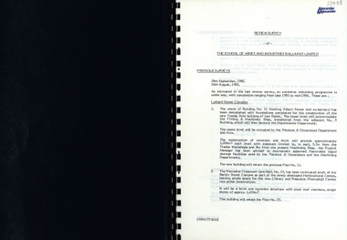 Federation University Historical Collection
Report, SMB: Review Survey of Buildings and Grounds, July 1985, 1985
... Report contains written evaluation, maps/diagrams and photographs. ballarat school of mines and industries survey alexander and alexander j w elliott maps photographs Gold lettering on from cover "Alexander & Alexander" Signature "J W Elliott" on page 10 (Loss Control Surveyor Spiral bound book - dark blue cover. 15 pages of written information plus 3 pages of photographs. ...Report of the detailed review of The School of Mines and Industries Ballarat Limited undertaken by Alexander & Alexander in 1985. Previous reports were done in 1982 and 1983. The report covers all areas of the school - buildings and grounds. Some sections/buildings are still being completed. Report contains written evaluation, maps/diagrams and photographs.Spiral bound book - dark blue cover. 15 pages of written information plus 3 pages of photographs.Gold lettering on from cover "Alexander & Alexander" Signature "J W Elliott" on page 10 (Loss Control Surveyorballarat school of mines and industries, survey, alexander and alexander, j w elliott, maps, photographs -
Federation University Historical Collection
Report, James Stirling, Assistant Geological Surveyor, Report on Rapid Surveys of the Gold-Fields, 1898, 1898
... Report on Rapid Surveys of the Gold-Fields, 1898 Report James Stirling, Assistant Geological Surveyor ...Foolscap report by Ferdinand Krause, issued by James Travis, Acting Secretary for Mines. department of mines, james stirling, a.w. howitt, warrandyte, nillumbik, greensborough, queenstown, a.o.e. whitelaw -
Federation University Historical Collection
Report, James Stirling, Assistant Geological Surveyor, Report on Rapid Surveys of the Gold-Fields, 1895, 1895
... Report on Rapid Surveys of the Gold-Fields, 1895 Report James Stirling, Assistant Geological Surveyor ...Foolscap report by Ernest Lidget, issued by James Travis, Acting Secretary for Mines. department of mines, j. travis, ernest lidgey, mannidar -
Federation University Historical Collection
Book - Report, Reports of the Mining Surveyors and Registrars, 1867, 30/06/1969 - 31/12/1881
... gold statistics mining survey .1) 39 page report dated 30 September 1867 .2) 40 page report dated 31 December 1871 .3) 46 page report dated 30 June 1872 .4) 42 page report dated 31 December 1873 .5) 45 page report dated 30 September 1872 .6) 44 page report dated 31 December 1881 Reports of the Mining Surveyors and Registrars, 1867 Book Report ....1) 39 page report dated 30 September 1867 .2) 40 page report dated 31 December 1871 .3) 46 page report dated 30 June 1872 .4) 42 page report dated 31 December 1873 .5) 45 page report dated 30 September 1872 .6) 44 page report dated 31 December 1881gold statistics, mining survey
