
Showing 54 items matching "tourist information guides"
-
 Warrnambool and District Historical Society Inc.
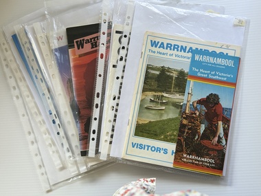
Booklet - Warrnambool Visitor's Handbooks 1979-2024, Collett, Bain and Gaspar, Printers, 1979-2014
... ...tourist information guides...Tourist Information Centre. They contain maps of Warrnambool, lists of services, accommodation and tourist attractions as well as many advertisements for local businesses. These handbooks give a useful snapshot of businesses and tourist attractions in Warrnambool for each of the years covered. (1979, 1980, 1986, 1990, 1993, 1994, 1995, 2014) warrnambool visitor handbooks tourist information guides warrnambool maps [.1a] Warrnambool The Heart of Victoria's Great Southwest Visitor's Handbook [.1b] Warrnambool City for all seasons; The Heart of Victoria's Great Southwest [.2] Warrnambool visitor's handbook Warrnambool Premier Town 1979-1982 [.3] Warrnambool Handbook Victoria [.4] Warrnambool The Shipwreck Coast [.5] Welcome to Warrnambool Warrnambool Visitors Handbook 1993-1994 [.6] Welcome to Warrnambool Visitors Handbook 1994-95 Rear cover: Warrnambool Centre of Victoria's Shipwreck Coast on Australia's Great Ocean Road [.7] Warrnambool Shipwreck Coast - Great Ocean Road; You'll love every piece of Victoria; Visitors Handbook [.8] Warrnambool Great Ocean Road Official Visitor Guide; It's a wonderful Warrnambool; You'll love every piece of Victoria visitvictoria.com. ...This is a collection of eight Warrnambool Visitor handbooks produced between 1979 and 2014 by the City of Warrnambool Tourist Information Centre. They contain maps of Warrnambool, lists of services, accommodation and tourist attractions as well as many advertisements for local businesses.These handbooks give a useful snapshot of businesses and tourist attractions in Warrnambool for each of the years covered. (1979, 1980, 1986, 1990, 1993, 1994, 1995, 2014)[.1a] A 48 page booklet with white pages and blue printing. The front cover has a coloured photograph of Flagstaff Hill with boats on a man made lake in the foreground looking across Lake Pertobe toward South Warrnambool. [.1b] A coloured bifold brochure. The front cover has a fisherman on a cray-boat holding a crayfish in the lower section. The top quarter has a blue back ground with white printing. The rear cover is red and has small photos of the Hopkins River and the Framlingham Forest. [.2] A 48 page booklet with white pages and black printing. The front cover is white with black writing on the left hand side and a colour photograph of the Loch Ard peacock. The Warrnambool Premier Town stylised logo of seven Norfollk pines above blue waves is in the top right hand corner. There is a blank ink Warrnambool Library stamp underneath the logo. The rear cover has photographs of The Twelve Apostles and the Hopkins Falls and the Premier Town Logo [.3] A 40 page booklet with mainly black printing on white paper. There are three fold out maps of Warrnambool and the surrounding district. The glossy cover has a black background with a colour photograph of the Twelve Apostles taken at sunset. The rear cover has three small of Proudfoot's boathouse on the Hopkins River, Flagstaff Hill, and the main beach area. The front cover has black writing inside to peach coloured rectangles. The inside rear cover has a fold out coloured tour map of Western Victoria. [.4] A 40 page booklet printed on glossy white paper with coloured photographs and black and red printing. The front cover has a photograph of The Twelve Apostles surrounded by a white border. There is red writing in the upper border. There is a sandy coloured writing superimposed across the bottom of the photograph and a Victoria's Shipwreck Coast logo in the bottom right hand corner. [.5] A 44 page booklet printed on white paper with black printing. The cream coloured cover has a pale red rectangle with blue writing on the right hand facing edge and includes two stylised Norfolk pines and with waves underneath. There is is an intersecting blue rectangle with cream printing. [.6] A 48 page booklet printed on white paper with black printing. The cover is brown with a cream vertical strip containing black writing on the right hand side. There is a stylised map from Geelong to Mount Gambier showing the Great Ocean Road across the cover. [.7] A 48 page booklet printed on white paper with black print. The glossy colour cover has a photograph of a Southern Right whale fluke. There is white printing on a the blue background of the sky and sea. The bottom left hand side of the front cover has a Tourism Victoria logo made of jigsaw puzzle pieces. The back cover has a stylised coloured map of The Great Ocean Road located in a white rectangle at the top of the page. Within the rectangle is a small map of Australia locating Victoria and the part of Victoria covered by the map. [.8] A 64 page A5 coloured booklet printed on white pages with black print. The white front cover has black and grey print with a colour photograph of two people holding coffee cups watching four race horses being exercised on the beach and in the water of Lady Bay in the early morning. The bottom right hand corner has a Tourism Victoria logo. The rear cover has a mainly blue back ground with a pink orange and green colour splats contains words advertising the 2015 Fun 4 Kids Festival [.1a] Warrnambool The Heart of Victoria's Great Southwest Visitor's Handbook [.1b] Warrnambool City for all seasons; The Heart of Victoria's Great Southwest [.2] Warrnambool visitor's handbook Warrnambool Premier Town 1979-1982 [.3] Warrnambool Handbook Victoria [.4] Warrnambool The Shipwreck Coast [.5] Welcome to Warrnambool Warrnambool Visitors Handbook 1993-1994 [.6] Welcome to Warrnambool Visitors Handbook 1994-95 Rear cover: Warrnambool Centre of Victoria's Shipwreck Coast on Australia's Great Ocean Road [.7] Warrnambool Shipwreck Coast - Great Ocean Road; You'll love every piece of Victoria; Visitors Handbook [.8] Warrnambool Great Ocean Road Official Visitor Guide; It's a wonderful Warrnambool; You'll love every piece of Victoria visitvictoria.com. Rear Cover Live entertainment.Workshops.Creativity.Action 28 June - 5 July 2015 Australia's Best Children's Festival F4K The ultimate winter school holiday adventure Fun 4 kids festival Warrnambool For more information visit Fun4kids.com.au Warrnambool great Ocean Road Victoriawarrnambool, visitor handbooks, tourist information guides, warrnambool maps -
 Bendigo Historical Society Inc.
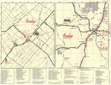
Document - TED BEATIE COLLECTION: MAP, Pre 1980s
... Bendigo tourist map and information guide - printed by the Bendigo and District tourist Association...Ted Beattie Map Bendigo Bendigo tourist map and information guide - printed by the Bendigo and District tourist Association Document TED BEATIE COLLECTION: MAP ...Bendigo tourist map and information guide - printed by the Bendigo and District tourist Associationted beattie, map, bendigo -
 Marysville & District Historical Society
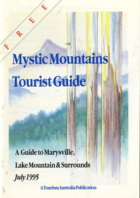
Ephemera (Item) - Tourist Guide, Graeme Haycraft, Mystic Mountains Tourist Guide July 1995, 07-1995
... tourist guide...mystic mountains...lake mountain...tourism australia...graeme haycraft...magic creek nursery...missing links miniature golf...phelps bakery...blackwood cottages...marysville hotel motel...tower motel...kerami house...marylands guest house...lomatia lodge...willowbank at taggerty...barree mud brick cottages...scenic motel...somerled mountain retreat...dalrymples guest cottages...nanda binya lodge...mathilde's of marysville country guest house...the birches resort...mystic mountains tourist information...A tourist guide outlining services, accommodation, activities and places of interest to visit in and around Marysville, Lake Mountain and the local district. marysville victoria australia tourist guide mystic mountains lake mountain tourism australia graeme haycraft magic creek nursery missing links miniature golf phelps bakery blackwood cottages marysville hotel motel tower motel kerami house marylands guest house lomatia lodge willowbank at taggerty barree mud brick cottages scenic motel somerled mountain retreat dalrymples guest cottages nanda binya lodge mathilde's of marysville country guest house the birches resort mystic mountains tourist information marysville caravan park the cumberland igloo roadhouse top shop pancake parlour the silver birch restaurant steavenson's restaurant olde yarra track shoppe danish coffee gardens oscars take-away country touch pottery studio & gallery cumberland memorial scenic reserve cathedral range state park lady talbot forest drive wishing well taggerty river picnic area taggerty river phantom falls keppels falls the beeches walking track mount sugarloaf maryton park holiday cottages snowviews esa camping & conference centre wirreanda festival marysville post shop hidden talent craft gallery marysville automotive repairs geoffrey pope & associates beauty spot walk tree fern gully walk michaeldene track marysville riding school gerraty's ski centre marysville holiday cottages marysville triangle taxi service fruit salad farm lake mountain alpine resort marysville ski hire lake mountain ski school cross country ski hire lake mountain ski hire marysville country club Acknowledgements/ Mystic Mountains Tourism Association, Marysville Office of the Dept. of Conser/ vation & Natural Resources, Mrs Elaine Postlethwaite, Ms Sue Henry & every/ advertiser without whose support this Guide would not have been possible. ...A tourist guide outlining services, accommodation, activities and places of interest to visit in and around Marysville, Lake Mountain and the local district.A tourist guide outlining services, accommodation, activities and places of interest to visit in and around Marysville, Lake Mountain and the local district.Acknowledgements/ Mystic Mountains Tourism Association, Marysville Office of the Dept. of Conser/ vation & Natural Resources, Mrs Elaine Postlethwaite, Ms Sue Henry & every/ advertiser without whose support this Guide would not have been possible.marysville, victoria, australia, tourist guide, mystic mountains, lake mountain, tourism australia, graeme haycraft, magic creek nursery, missing links miniature golf, phelps bakery, blackwood cottages, marysville hotel motel, tower motel, kerami house, marylands guest house, lomatia lodge, willowbank at taggerty, barree mud brick cottages, scenic motel, somerled mountain retreat, dalrymples guest cottages, nanda binya lodge, mathilde's of marysville country guest house, the birches resort, mystic mountains tourist information, marysville caravan park, the cumberland, igloo roadhouse, top shop pancake parlour, the silver birch restaurant, steavenson's restaurant, olde yarra track shoppe, danish coffee gardens, oscars take-away, country touch pottery studio & gallery, cumberland memorial scenic reserve, cathedral range state park, lady talbot forest drive, wishing well, taggerty river picnic area, taggerty river, phantom falls, keppels falls, the beeches walking track, mount sugarloaf, maryton park holiday cottages, snowviews, esa camping & conference centre, wirreanda festival, marysville post shop, hidden talent craft gallery, marysville automotive repairs, geoffrey pope & associates, beauty spot walk, tree fern gully walk, michaeldene track, marysville riding school, gerraty's ski centre, marysville holiday cottages, marysville triangle taxi service, fruit salad farm, lake mountain alpine resort, marysville ski hire, lake mountain ski school, cross country ski hire, lake mountain ski hire, marysville country club -
 Marysville & District Historical Society
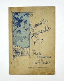
Booklet, Marysville Tourist Association, Magestic Marysville-The Mystic Mountains of the Great Divide, 1920's
... information guide of day trips to attractions in an around Marysville in Victoria. An information guide of day trips to attractions in an around Marysville in Victoria. marysville victoria marysville tourise association steavenson falls keppel falls cameron cascades cumberland mt cathedral eildon snob's creek falls wolfram mine mt strickland keppel's lookout mt kitchener mt edgar mt gordon nichol's lookout michael dene beauty spot gilbert's gully taggerty river wood's point An information guide of day trips to attractions in and around Marysville in Victoria. This booklet was produced by the Marysville Tourist ...An information guide of day trips to attractions in and around Marysville in Victoria. This booklet was produced by the Marysville Tourist Association.Paperback. Cover is beige with a drawing of two people standing next to a car looking at the view. The title is in dark blue across the front.non-fictionAn information guide of day trips to attractions in and around Marysville in Victoria. This booklet was produced by the Marysville Tourist Association.marysville, victoria, marysville tourise association, steavenson falls, keppel falls, cameron cascades, cumberland, mt cathedral, eildon, snob's creek falls, wolfram mine, mt strickland, keppel's lookout, mt kitchener, mt edgar, mt gordon, nichol's lookout, michael dene, beauty spot, gilbert's gully, taggerty river, wood's point -
 Marysville & District Historical Society
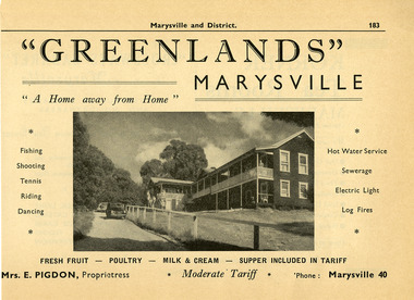
Ephemera (Item) - Information booklet advertisement, Broadbent's Official Road Guides Company, "GREENLANDS" MARYSVILLE, Unknown
... guide of the Government Tourist Bureau. An advertisement for Greenlands guest house in Marysville taken from a Broadbent's accommodation guide. marysville victoria australia greenlands the spot green lanes sarah mclean murdock mclean geoffrey cobb cath m anderson mr and mrs a.g. clarke e pigdon bert patterson guest house advertisement broadbent's accommodation guide An advertisement for Greenlands guest house in Marysville taken from a Broadbent's accommodation guide. "GREENLANDS" MARYSVILLE Ephemera Information ...An advertisement for Greenlands guest house in Marysville taken from a Broadbent's accommodation guide. Broadbent's was the official guide of the Government Tourist Bureau.An advertisement for Greenlands guest house in Marysville taken from a Broadbent's accommodation guide.marysville, victoria, australia, greenlands, the spot, green lanes, sarah mclean, murdock mclean, geoffrey cobb, cath m anderson, mr and mrs a.g. clarke, e pigdon, bert patterson, guest house, advertisement, broadbent's accommodation guide -
 Marysville & District Historical Society
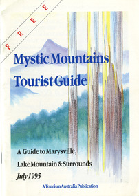
Ephemera (Item) - Tourist Guide, Graeme Haycraft, Mystic Mountains Tourist Guide July 1995, 07-1995
... tourist guide...mystic mountains...lake mountain...tourism australia...graeme haycraft...magic creek nursery...missing links miniature golf...phelps bakery...blackwood cottages...marysville hotel motel...tower motel...kerami house...marylands guest house...lomatia lodge...willowbank at taggerty...barree mud brick cottages...scenic motel...somerled mountain retreat...dalrymples guest cottages...nanda binya lodge...mathilde's of marysville country guest house...the birches resort...mystic mountains tourist information...A tourist guide outlining services, accommodation, activities and places of interest to visit in and around Marysville, Lake Mountain and the local district. marysville victoria australia tourist guide mystic mountains lake mountain tourism australia graeme haycraft magic creek nursery missing links miniature golf phelps bakery blackwood cottages marysville hotel motel tower motel kerami house marylands guest house lomatia lodge willowbank at taggerty barree mud brick cottages scenic motel somerled mountain retreat dalrymples guest cottages nanda binya lodge mathilde's of marysville country guest house the birches resort mystic mountains tourist information marysville caravan park the cumberland igloo roadhouse top shop pancake parlour the silver birch restaurant steavenson's restaurant olde yarra track shoppe danish coffee gardens oscars take-away country touch pottery studio & gallery cumberland memorial scenic reserve cathedral range state park lady talbot forest drive wishing well taggerty river picnic area taggerty river phantom falls keppels falls the beeches walking track mount sugarloaf maryton park holiday cottages snowviews esa camping & conference centre wirreanda festival marysville post shop hidden talent craft gallery marysville automotive repairs geoffrey pope & associates beauty spot walk tree fern gully walk michaeldene track marysville riding school gerraty's ski centre marysville holiday cottages marysville triangle taxi service fruit salad farm lake mountain alpine resort marysville ski hire lake mountain ski school cross country ski hire lake mountain ski hire marysville country club Acknowledgements/ Mystic Mountains Tourism Association, Marysville Office of the Dept. of Conser/ vation & Natural Resources, Mrs Elaine Postlethwaite, Ms Sue Henry & every/ advertiser without whose support this Guide would not have been possible. ...A tourist guide outlining services, accommodation, activities and places of interest to visit in and around Marysville, Lake Mountain and the local district.A tourist guide outlining services, accommodation, activities and places of interest to visit in and around Marysville, Lake Mountain and the local district.Acknowledgements/ Mystic Mountains Tourism Association, Marysville Office of the Dept. of Conser/ vation & Natural Resources, Mrs Elaine Postlethwaite, Ms Sue Henry & every/ advertiser without whose support this Guide would not have been possible.marysville, victoria, australia, tourist guide, mystic mountains, lake mountain, tourism australia, graeme haycraft, magic creek nursery, missing links miniature golf, phelps bakery, blackwood cottages, marysville hotel motel, tower motel, kerami house, marylands guest house, lomatia lodge, willowbank at taggerty, barree mud brick cottages, scenic motel, somerled mountain retreat, dalrymples guest cottages, nanda binya lodge, mathilde's of marysville country guest house, the birches resort, mystic mountains tourist information, marysville caravan park, the cumberland, igloo roadhouse, top shop pancake parlour, the silver birch restaurant, steavenson's restaurant, olde yarra track shoppe, danish coffee gardens, oscars take-away, country touch pottery studio & gallery, cumberland memorial scenic reserve, cathedral range state park, lady talbot forest drive, wishing well, taggerty river picnic area, taggerty river, phantom falls, keppels falls, the beeches walking track, mount sugarloaf, maryton park holiday cottages, snowviews, esa camping & conference centre, wirreanda festival, marysville post shop, hidden talent craft gallery, marysville automotive repairs, geoffrey pope & associates, beauty spot walk, tree fern gully walk, michaeldene track, marysville riding school, gerraty's ski centre, marysville holiday cottages, marysville triangle taxi service, fruit salad farm, lake mountain alpine resort, marysville ski hire, lake mountain ski school, cross country ski hire, lake mountain ski hire, marysville country club -
 Marysville & District Historical Society
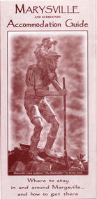
Ephemera (item) - Accommodation brochure, Project Art & Photo, MARYSVILLE AND SURROUNDS Accommodation Guide, Unknown
... An information brochure regarding the accommodation and facilities available for guests in and around Marysville. marysville victoria australia accommodation mystic mountains tourist information centre brochure An information brochure regarding the accommodation and facilities available for guests in and around Marysville. MARYSVILLE AND SURROUNDS Accommodation Guide ...An information brochure regarding the accommodation and facilities available for guests in and around Marysville.An information brochure regarding the accommodation and facilities available for guests in and around Marysville.marysville, victoria, australia, accommodation, mystic mountains tourist information centre, brochure -
 Marysville & District Historical Society
Ephemera (item) - Accommodation brochure, Project Art & Photo, MARYSVILLE AND SURROUNDS Accommodation Guide, Unknown
... An information brochure regarding the accommodation and facilities available for guests in and around Marysville. marysville victoria australia accommodation mystic mountains tourist information centre brochure An information brochure regarding the accommodation and facilities available for guests in and around Marysville. MARYSVILLE AND SURROUNDS Accommodation Guide ...An information brochure regarding the accommodation and facilities available for guests in and around Marysville.An information brochure regarding the accommodation and facilities available for guests in and around Marysville.marysville, victoria, australia, accommodation, mystic mountains tourist information centre, brochure -
 Marysville & District Historical Society
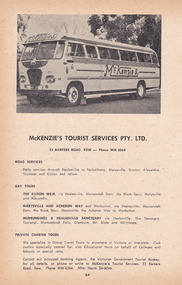
Ephemera (item) - Information booklet advertisement, Broadbent's Official Road Guides Company, McKENZIE'S TOURIST SERVICES PTY. LTD, Unknown
... Tourist Services Pty. Ltd. that was taken from a Broadbent's accommodation guide. An advertisement for McKenzie's Tourist Services Pty. Ltd. that was taken from a Broadbent's accommodation guide. marysville victoria australia mckenzie's tourist services pty. ltd. broadbent's accommodation guide broadbent's official road guides company advertisement An advertisement for McKenzie's Tourist Services Pty. Ltd. that was taken from a Broadbent's accommodation guide. McKENZIE'S TOURIST SERVICES PTY. LTD. Ephemera Information ...An advertisement for McKenzie's Tourist Services Pty. Ltd. that was taken from a Broadbent's accommodation guide.An advertisement for McKenzie's Tourist Services Pty. Ltd. that was taken from a Broadbent's accommodation guide.marysville, victoria, australia, mckenzie's tourist services pty. ltd., broadbent's accommodation guide, broadbent's official road guides company, advertisement -
 Glenelg Shire Council Cultural Collection
Document - Portland Tourist Guide, E. DAVIS & SONS Pty Ltd, n.d
... Sixteen page tourist guide to Portland, similar set-up to 8199, but image of Tourist Information Centre on front cover....Sixteen page tourist guide to Portland, similar set-up to 8199, but image of Tourist Information Centre on front cover. ...Sixteen page tourist guide to Portland, similar set-up to 8199, but image of Tourist Information Centre on front cover. -
Glenelg Shire Council Cultural Collection
Booklet - Booklet - Tourist guide Portland Victoria, n.d
... Twelve page tourist guide to Portland and district, produced by Tourist Information Centre. ...Twelve page tourist guide to Portland and district, produced by Tourist Information Centre. ...Twelve page tourist guide to Portland and district, produced by Tourist Information Centre. Contains tourist information and local business advertisements. Black and white. -
Glenelg Shire Council Cultural Collection
Document - Portland and South West Tourist Guide, E. Davis & Sons, Pty Ltd Portland, n.d
... White, black print, tourist guide to Portland and the far South West. Illustrations of Portland and district, maps of Portland, Heywood and Nelson, information about places to see....White, black print, tourist guide to Portland and the far South West. Illustrations of Portland and district, maps of Portland, Heywood and Nelson, information about places to see. ...Single page flyer, folded 3 times, printed both sides. White, black print, tourist guide to Portland and the far South West. Illustrations of Portland and district, maps of Portland, Heywood and Nelson, information about places to see. -
Glenelg Shire Council Cultural Collection
Pamphlet, Tourist Guide to the South West Region, n.d
... tourism walking tourist information south west map Pamphlet, Tourist Guide to the South West Region. ...Pamphlet, Tourist Guide to the South West Region. Map of Victoria on one side, with areas of interest numbered. Reverse has details for each number.tourism, walking, tourist information, south west, map -
 Orbost & District Historical Society
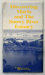
map/brochure, Discovering Marlo & The Snowy River Estuary, December 1988
... tourist information in Orbost. This item is a useful research tool. map brochure snowy-river marlo A folded map/brochure titled "DISCOVERING MARLO & THE SNOWY RIVER ESTUARY". On the front is a photograph of Marlo and the title in yellow print. There is a locality map for access to Corringle beach and the brochure Includes a key to fishing sites and various tourist locations. On the back of the brochure are notes on fishing, wildlife and a boating guide ...In 1983 the Department of Conservation, Forests and Lands replaced the Department of Crown Lands and Survey, the Department of State Forests and the Ministry for Conservation. This brochure/map was used as tourist information in Orbost.This item is a useful research tool.A folded map/brochure titled "DISCOVERING MARLO & THE SNOWY RIVER ESTUARY". On the front is a photograph of Marlo and the title in yellow print. There is a locality map for access to Corringle beach and the brochure Includes a key to fishing sites and various tourist locations. On the back of the brochure are notes on fishing, wildlife and a boating guide, map brochure snowy-river marlo -
 Orbost & District Historical Society
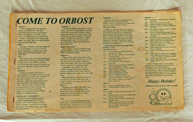
brochure, Come To Orbost, c 1980's
... tourist guide to Orbost. This item is a useful research tool. tourism-orbost A magazine/brochure for use as tourist information. ...This brochure was produced as a tourist guide to Orbost.This item is a useful research tool.A magazine/brochure for use as tourist information. It contains the history, maps and touring routes of the Orbost district.tourism-orbost -
 Orbost & District Historical Society
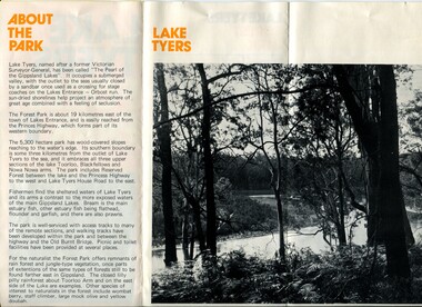
pamphlet, Lake Tyers Forest Park, 1960's
... tourist guide to East Gippsland. This item is a useful reference tool. pamphlet lake tyers-forest-park A three fold glossy, pamphlet titled"Lake Tyers Forest Park". It contains information ...This pamphlet would have been produced as a tourist guide to East Gippsland.This item is a useful reference tool.A three fold glossy, pamphlet titled"Lake Tyers Forest Park". It contains information, a map and black / white photographs of Lake Tyers Park. Print colours are brown, white, yellow and black.pamphlet lake tyers-forest-park -
 Flagstaff Hill Maritime Museum and Village
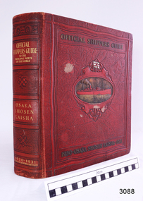
Book - Reference, M. Franklin Kline, Official Shippers Guide, 1930
... information about shipping companies and the world's ports. It was a handy guide for travellers of the time and included how and where to board ships going to various countries in 1930 & 1931. In effect, it was a reference work like a timetable for shippers and travellers alike. The book has maps depicting N.Y.K. shipping lines all over the world, indexes (including advertisers), and is thumb-indexed. This book is an official guide that supplies vast information for ships and shipping lines but also for tourists ...This book has information about shipping companies and the world's ports. It was a handy guide for travellers of the time and included how and where to board ships going to various countries in 1930 & 1931. In effect, it was a reference work like a timetable for shippers and travellers alike.The book has maps depicting N.Y.K. shipping lines all over the world, indexes (including advertisers), and is thumb-indexed. This book is an official guide that supplies vast information for ships and shipping lines but also for tourists of the time. These types of reference works are keenly collected today.Official Shippers Guide reference book to the Principal Ports of the World, OSAKA SHOSEN KAISHA, 1930 – 1931, Seventeenth Edition, edited, compiled and designed by M. Franklin Kline. Large, hard covered, bound book with margin thumb tabs. Covers are dark red with gold lettering and embossed pattern. Centre of front cover has an oval image of a red steam ship on a gold sea. Above the ship is a white flag with a red emblem.flagstaff hill, warrnambool, flagstaff hill maritime museum, maritime museum, shipwreck coast, flagstaff hill maritime village, great ocean road, traveller's guide, shippers guide, osaka shosen kaishaguide, guide to world ports, m. franklin kline -
 Phillip Island and District Historical Society Inc.
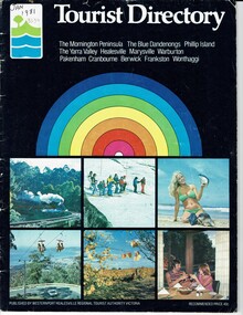
Booklet, Tourist Directory 1981 and Guide to Phillip Island & surrounds 1995
... tourist photos. Inside is black type with descriptions, maps, advertisements and photos. Guide is smaller with white and red writing and maps. Inside it has red writing on history, climate and information...Tourist Authority Victoria. Printed by Standard Newspapers, Cheltenham. Guide to Phillip Island & surrounds.Phillip Island Information Centre RMB 1305 Newhaven....Tourist Authority Victoria. Printed by Standard Newspapers, Cheltenham. Guide to Phillip Island & surrounds.Phillip Island Information Centre RMB 1305 Newhaven. ...HistoricalLarge black booklet with brightly coloured cover with tourist photos. Inside is black type with descriptions, maps, advertisements and photos. Guide is smaller with white and red writing and maps. Inside it has red writing on history, climate and information on Phillip Island and small advertisements of attractions.Tourist Directory, Published by Westernport Healesville Regional Tourist Authority Victoria. Printed by Standard Newspapers, Cheltenham. Guide to Phillip Island & surrounds.Phillip Island Information Centre RMB 1305 Newhaven.tourism, tourist brochure, accomodation, restaurants, map of phillip island -
 Phillip Island and District Historical Society Inc.
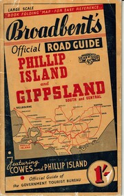
Booklet, Broadbent's Official Roadguide Phillip Island and Gippsland 45, c. 1945
... guide of the Government Tourist Bureau. Mr Roy Bain owned a secondhand shop on corner of Thompson Ave and Chapel Street, Cowes, currently a Japanese restaurant. Historical Guesthouses Broadbent's Guides Hislop newsagency Underdown strawberry farm Osterlund fishing trips Parry's Butcher Athenia Cafe Roy Bain Broadway Bakery Cowes Camping ground Cowes Main Garage Beach Park Camp Broadbent's Official Road Guide Phillip Island and Gippsland South and Central. Broadbent's Year of Issue 45. Small orange, black and red booklet with black type containing maps and information ...Broadbent's was the official guide of the Government Tourist Bureau. Mr Roy Bain owned a secondhand shop on corner of Thompson Ave and Chapel Street, Cowes, currently a Japanese restaurant.HistoricalSmall orange, black and red booklet with black type containing maps and information of accommodation, businesses and tourist venues.Broadbent's Official Road Guide Phillip Island and Gippsland South and Central. Broadbent's Year of Issue 45.guesthouses, broadbent's guides, hislop newsagency, underdown strawberry farm, osterlund fishing trips, parry's butcher, athenia cafe, roy bain, broadway bakery, cowes camping ground, cowes main garage, beach park camp -
 Phillip Island and District Historical Society Inc.
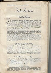
Book, Broadbent's Road Guide- Central Victoria Jubilee Edition, 1946
... Historical Broadbent's Guides Guesthouses tourism Shops San remo koala cafe cowes Phillip Island A5 bound book, missing cover, broken binding, contains maps, photos, advertisements and information on tourist areas. ...Broadbents began in 1935 and produced many travel guides. The Jubilee edition [ 50th] was probably printed in 1946.HistoricalA5 bound book, missing cover, broken binding, contains maps, photos, advertisements and information on tourist areas.broadbent's guides, guesthouses, tourism, shops, san remo, koala cafe cowes, phillip island -
 Phillip Island and District Historical Society Inc.
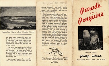
Pamphlet, 'Parade of Penguins' & Phillip Island Visitors guide', Unknown
... Promotional tourist brochures on penguins and visitors information Historical Penguin Parade Tourism As Above Two sepia brochures with hand drawings 'Parade of Penguins' & Phillip Island Visitors guide' Pamphlet ...Promotional tourist brochures on penguins and visitors informationHistoricalTwo sepia brochures with hand drawings As Abovepenguin parade, tourism -
 Halls Gap & Grampians Historical Society
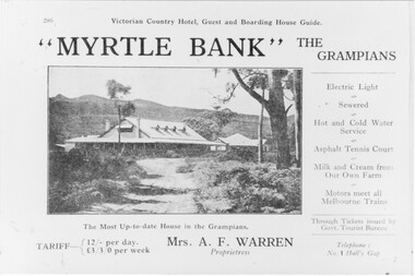
Photograph - B/W, C 1918
... Information supplied with accommodation details Victorian Country Hotel, Guest and Boarding House Guide "Myrtle Bank" The Grampians Electric Light, Sewered, Hot and Cold Water Service, Asphalt, Tennis Court, Milk and Cream from our own farm, Motors meet all melbounre Trains, The Most Up-to-date house in the Grampians, Through Tickets issued by Govt. Tourist...Information supplied with accommodation details Victorian Country Hotel, Guest and Boarding House Guide "Myrtle Bank" The Grampians Electric Light, Sewered, Hot and Cold Water Service, Asphalt, Tennis Court, Milk and Cream from our own farm, Motors meet all melbounre Trains, The Most Up-to-date house in the Grampians, Through Tickets issued by Govt. Tourist ...Information supplied with accommodation details Victorian Country Hotel, Guest and Boarding House Guide "Myrtle Bank" The Grampians Electric Light, Sewered, Hot and Cold Water Service, Asphalt, Tennis Court, Milk and Cream from our own farm, Motors meet all melbounre Trains, The Most Up-to-date house in the Grampians, Through Tickets issued by Govt. Tourist Bureau, Telephone : No. 1 Halls Gap Tariff: 12/ per day L 3/3/0 per week. Proprietress Mrs A. F WarrenGuest House and grounds with Tariff information and servicesQuality paper made in Germanyaccommodation, guesthouses, myrtlebank -
 Cheese World Museum
Book, Queen City Printers Pty Ltd, Collins Street Directoryand Publice Guide: 8th Edition
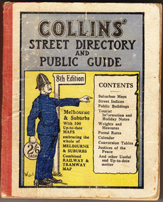
... guide...Collins...Melbourne...maps...tourist information...COLLINS' STREET DIRECTORY/AND/PUBLIC GUIDE/8th Edition/2/6 each/CONTENTS/ Suburban Maps/Street Indices/Public Buildings/Tourist Information and Holiday Notes/Weights and Measures/Postal Rates/Calendar/Conversion Tables/Justices of the Peace/And other useful and up-to-date matter...-not listed Allansford Uebergang street directory public guide Collins Melbourne maps tourist information Queen City Printers Pty Ltd almanacs local history COLLINS' STREET DIRECTORY/AND/PUBLIC GUIDE/8th Edition/2/6 each/CONTENTS/ Suburban Maps/Street Indices/Public Buildings/Tourist Information and Holiday Notes/Weights and Measures/Postal Rates/Calendar/Conversion Tables/Justices of the Peace/And other useful and up-to-date matter White hard cover pocket-sized street directory book with red cloth spine. ...The Percy Uebergang family lived at Tooram Park, Allansford from 1912 until 1992. This booklet was part of the collection of items given into the care of the Cheese World Museum. Uebergang catalogue No. -not listed White hard cover pocket-sized street directory book with red cloth spine. The front cover has a blue and yellow background with title, contents, edition listed and a policeman in a blue uniform. The back cover has information in black print. Melbourne and suburbs maps throughout. 439 pages.COLLINS' STREET DIRECTORY/AND/PUBLIC GUIDE/8th Edition/2/6 each/CONTENTS/ Suburban Maps/Street Indices/Public Buildings/Tourist Information and Holiday Notes/Weights and Measures/Postal Rates/Calendar/Conversion Tables/Justices of the Peace/And other useful and up-to-date matterallansford, uebergang, street directory, public guide, collins, melbourne, maps, tourist information, queen city printers pty ltd, almanacs, local history -
 Warrnambool and District Historical Society Inc.
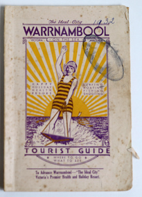
Booklet - Warrnambool Tourist Booklet, Warrnambool Progress Association, Warrnambool On the Sea, Victoria, Australia, Tourist Guide, 1932
... tourist attractions. This booklet is of considerable interest because of the number of 1930s photographs of Warrnambool and the extensive historical information it contains. Warrnambool Tourism Warrnambool Progress Association Warrnambool Tourist Guide ...Warrnambool Tourist GuideThis is a booklet with a cream cover featuring a sketch of a woman waterskiing and blue printing. The pages contain black and white photographs, advertisements, two maps and printed text. There is one fold-out page. The booklet is stapled and bound with glue.non-fictionWarrnambool Tourist Guidewarrnambool tourism, warrnambool progress association -
 Warrnambool and District Historical Society Inc.
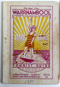
Booklet - Warrnambool Tourist Guide, Warrnambool Progress Association, Warrnambool On The Sea Tourist Guide, The Ideal City, Where to Go and What to See, 1936
... tourist attractions. This booklet is of historical interest because of its 1930s photographs and extensive information on Warrnambool at that time. Tourism in Warrnambool Warrnambool Progress Association Warrnambool Tourist Guide 1936 This is a booklet with a buff-coloured cover featuring an illustration of a woman water skiing. ...Warrnambool Tourist Guide 1936This is a booklet with a buff-coloured cover featuring an illustration of a woman water skiing. The back cover has blue printing. The pages contain a fold-out map, advertisements, printed text and black and white photographs. The pages have been stapled and then glued.non-fictionWarrnambool Tourist Guide 1936tourism in warrnambool, warrnambool progress association -
 Warrnambool and District Historical Society Inc.
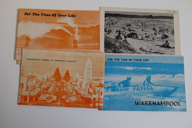
Booklet - Warrnambool Tourist Guides (5), Warrnambool Chamber of Commerce and Industry, Warrnambool - For the Time of Your Life, 1970-1975
... tourist attractions. These booklets are of historical interest because of the many 1970s photographs and information about Warrnambool at that time. Warrnambool Tourism Tourism in Warrnambool in the 1970s Warrnambool Tourist Guides 1970-1975 .1,.2,.3 - These are booklets of 36 pages with an orange cover with an illustration of two people on surf boards on the front cover and an image of a main street on the back cover. ...Warrnambool Tourist Guides 1970-1975.1,.2,.3 - These are booklets of 36 pages with an orange cover with an illustration of two people on surf boards on the front cover and an image of a main street on the back cover. The cover has blue printing. The pages contain a map, advertisements, black and white photographs and printed text. One booklet is stapled and two have the staples removed. .4,.5 -These are booklets of 40 pages with a front cover with a photograph in blue tones of a surf patrol boat and two lifesavers and a back cover with a black and white photograph (beach scene). The pages contain a map, advertisements, black and white photographs and printed text. One booklet is stapled and one has the staples removed. non-fictionWarrnambool Tourist Guides 1970-1975warrnambool tourism, tourism in warrnambool in the 1970s -
 Warrnambool and District Historical Society Inc.
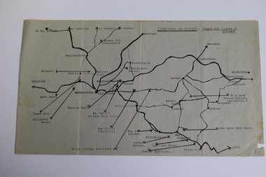
Map - Tourist Map Collection: Warrnambool & District Tourist Maps, Philprint, Warrnambool
... This is a diverse collection of Tourist Maps for the Warrnambool & District area. [.1] From information on this guide it dates from the mid 1970's. ...This is a diverse collection of Tourist Maps for the Warrnambool & District area. [.1] From information on this guide it dates from the mid 1970's. ...This is a diverse collection of Tourist Maps for the Warrnambool & District area. [.1] From information on this guide it dates from the mid 1970's. It appears to not have been commercially printed and includes details of attractions no longer operating in Warrnambool such as Warrnambool Aquarium and the Oasis Reptile Park and Zoo. [.2] Commercially printed Warrnambool tourist map (c mid 1980's) surrounded by advertisements for local businesses. [.3] Commercial printed December 1991 tourist map of Warrnambool and District includes a competition entry form [.4] Commercially printed tourist map aimed at children [.5] Walking map of Warrnambool and District [.6] Commercially printed Warrnambool tourist map (c mid 1980's) surrounded by advertisements for local businesses. This collection of maps from the mid 1970's to early 1990's gives an insight into what was available to assist tourists find their way around Warrnambool and District. They include advertisements for business operating during this period and include lists of available accommodation, eateries, and tourist attractions.[.1] Tourist Attractions In and Around Warrnambool two foolscap pages with two sides of type written information of local and district attractions. There is a Warrnambool City map with points of interest marked and a hand drawn district map; [.2]Commercially printed grid map of Warrnambool City surrounded by advertisements from local businesses. Reverse side has a district map and a map of the Warrnambool CBD surrounded by advertising. [.3] Brochure including small grid maps of Warrnambool and district listing accommodation providers and places of interest. Stylised blue & bright green design of Norfolk pines and sea. [.4] Children's treasure hunt map to Warrnambool There are two examples, one with blue edging (Jan 1986) and one with red edging (Aug 1993) Both have a circular logo with a stylised whale and lighthouse [.5] Walking maps of Warrnambool blue printed photo of four tourists walking coastline on the front cover. [.6] Commercially printed grid map of Warrnambool with a bright yellow inset of Warrnambool CBD main shopping centre. The map is surrounded by advertising for local businesses.warrnambool, tourist maps, warrnambool businesses, warrnambool accommodation -
Warrnambool and District Historical Society Inc.
Booklet - Regional Tourist Guide, W. Payne, Western Districts Illustrated Guide, c. 1914
... tourist guide to the Western District. It dates from about 1914 and includes advertisements, text and black and white photographs of the towns of Warrnambool, Camperdown, Port Fairy, Koroit, Colac and Lorne. The advertisements are of local businesses and these no doubt contributed to the cost of publishing the booklet. Tourism in the region became important in the late 19th century with efforts, especially in Warrnambool, to promote the benefits of the bracing climate, coastal scenery and agricultural advancements. This booklet is of considerable interest because of the historical value of the information ...Regional Tourist Guide with photographs and textThis is a small booklet of 32 pages. The cream-coloured cover contains an ornamental border, four black and white photographs and black printing. The pages contain advertisements, black and white photographs and printed text. The booklet has been stapled but the staples have been removed. non-fictionRegional Tourist Guide with photographs and textwestern district of victoria, warrnambool tourism, early 20th century tourist guides -
 Warrnambool and District Historical Society Inc.
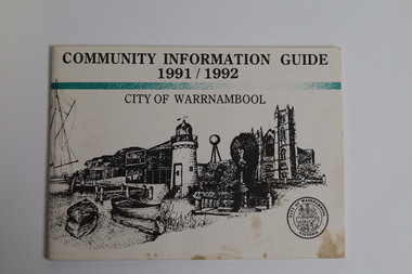
Booklet - Booklet Collection: City of Warrnambool Tourist Guides, Collett, Bain and Gaspar, Warrnambool
... tourist guides dating from the mid 1970's to 2013. These contain listings of businesses, accommodation, eateries and events in Warrnambool and district. They also include maps of Warrnambool and surrounds, advertising and photographs of various attractions. While mainly covering Warrnambool a small number of the guides cover the South West Region. These directories have mainly been published by the Warrnambool City Council and are a selection of the types of information...tourist guides dating from the mid 1970's to 2013. These contain listings of businesses, accommodation, eateries and events in Warrnambool and district. They also include maps of Warrnambool and surrounds, advertising and photographs of various attractions. While mainly covering Warrnambool a small number of the guides cover the South West Region. These directories have mainly been published by the Warrnambool City Council and are a selection of the types of information ...This is a collection of sixteen tourist guides dating from the mid 1970's to 2013. These contain listings of businesses, accommodation, eateries and events in Warrnambool and district. They also include maps of Warrnambool and surrounds, advertising and photographs of various attractions. While mainly covering Warrnambool a small number of the guides cover the South West Region. These directories have mainly been published by the Warrnambool City Council and are a selection of the types of information provided to visitors at the Tourist information centre during this time period.These tourist guides give snapshots of the City of Warrnambool for the years covered and will be useful for research.[.1] An 8 page paper booklet with black printing and a black & white photo of the pond at the Botanical Gardens on the front cover. [.2] two photocopied A4 black and white pages from the book "On the Trail" K Winser 1956 (Main Roads of Australia) [.3] A trifold colour brochure with a stylised map of the coast on the yellow and blue front cover. The inside has stylised colour drawings on Warrnambool attractions. The rear cover has coloured photographs of bush, Liebig Street and Fletcher Jones gardens [.4] A trifold black and white brochure with a black line drawing of a whale on the front cover. [.5] A trifold white card with mauve printing. The front cover has a line drawing of the former Timor Street post office and a map of businesses and landmarks in Timor Street. The reverse side contains a brief history of Warrnambool. [.6] A 98 page stapled booklet with a foreword by Vanda Savill. There are 4 pages of coloured photographs. The remainder are black and white photographs. The front cover is purple with white writing in the lower third. There is an outline of the coast and five colour photographs of district attractions. The inside middle page has a map of the Western wonderland region. The content covers towns in this area. Content relating to Warrnambool is in the last six pages. [.7] Twelve loose photocopied black and white pages. The front cover has the Warrnambool Premier Town 1988-1991 logo and a photo of a Southern Right Whale and calf. The bottom right hand corner has a Standard Warrnambool logo. [.8] 44 page booklet printed with blue ink. The staples have been removed. The glossy front cover has blue printing with a coloured photo of Flagstaff Hill Maritime Village pond. The centre pages has a fold out map of the City of Warrnambool. The rear cover has photos of The Twelve Apostles and Hopkins Falls. [.9] 4 loose photocopied pages with Warrnambool Library and Corangamite Regional Library Service Warrnambool City Library black ink stamps. The front page line drawing illustrations of Warrnambool attractions [.10] A single sheet of glossy white paper folded in half to make four pages. The front page has a Warrnambool premier town logo 1979-1982 and blue printing and a visitor survey. [.11] A conference pack of light card folded to make a pocket containing three brochures, a shipwreck coast tourist directory and a Australian Heritage Parks Association conference program dated 24 to 27 May 1992. The front cover of the pack has green writing over a stylised upward arrow. There is a City of Warrnambool logo in the top right hand corner and two film strips diagonally across the cover containing photographs of Warrnambool. The rear cover has a coloured Warrnambool Premier Town logo. [.12] A 63 page stapled booklet with coloured photographs of Warrnambool. The front cover has black writing on white background. There is a coloured photograph of Flagstaff Hill in the middle of the cover and a Warrnambool City and Visit Victoria logos on the lower edge. The middle pages has a coloured of the city of Warrnambool with an inset map of Allansford. [.13] A single large sheet of white paper folded in ten to make a brochure. The front cover has black printing. The rear cover has a purple ink stamp for the City of Warrnambool Tourist Information Centre. When folded out the reverse side has a green, grey and white map of the South West Region of Victoria. [.14] A 48 page colour booklet on glossy paper. The front cover has white writing on a blue background and includes photographs of the Twelve Apostles, the Promenade walk, Flagstaff Hill and a southern right whale's tail. The rear cover has photographs of The Twelve apostles, a passenger train from Melbourne passing the Lake Pertobe playground, and a rural scene. There is white writing and a white Warrnambool City logo on a blue background. The centre pages have a stylised green and blue map of the city of Warrnambool. [.15] A 48 page colour booklet on glossy paper. The front cover has white writing over colour photographs of two people at a lookout, Flagstaff Hill, three southern right whales and a child at the Lake Pertobe playground. The lower edge has blue upper case writing on a white background. The rear cover has a colour photograph of the Twelve Apostles. The lower white border on the rear covers has a a blue and green City of Warrnambool logo and blue writing. The centre pages have a stylised green and blue map of the city of Warrnambool. [.16] A 64 page colour booklet on glossy paper. The front cover has black writing on a black background and there is a photograph of a southern right whale's tail. The lower edge has the Warrnambool City and Visit Victoria Logos. The centre pages have maps of Warrnambool and surrounds. [.1] This week in Warrnambool Vol 2 No. 5 Thurs 1st Feb. For the time of your life [.2] Warrnambool Way [.3] Warrnambool The Holiday Host on the South West Coast with compliments City of Warrnambool and Warrnambool Chamber of Commerce [.4] MMI Insurance presents Whales Giants of the Deep Whale Watcher's Logbook Warrnambool [.5] Warrnambool History began in Timor Street [.6] Western Wonderland Tourist Association [.7] A Premier Arrow Tour of Warrnambool Victoria's Premier Town Australia's Southern Right Whale Nursery [.8] Warrnambool The Heart of Victoria's Great Southwest Visitor's Handbook [.9] What to see in Warrnambool Victoria's Premier City 1979-1982 [.10] Win a Free Holiday & $200 Cash in Victoria's Premier Town [.11] Advancing Warrnambool together! [.12] Great Ocean Road Warrnambool Official Visitor Guide [.13] Tourist guide to the South West Region Victoria All it needs is you [.14] Warrnambool visitor guide 2005 the great ocean road experience attractions accommodation entertainment dining [.15] Warrnambool Visitor Guide 2006 the great ocean road experience Attractions Accommodation Entertainment Dining [.16] Official Visitors' Guide Warrnambool Victoria Australia Discover the Great Ocean Road warrnambool, warrnambool tourist guides -
 Warrnambool and District Historical Society Inc.
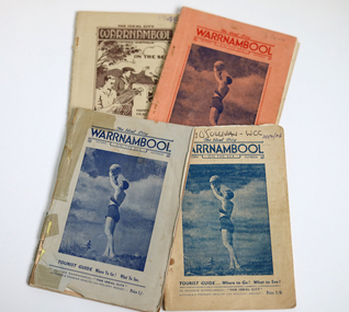
Booklet - The Ideal City Warrnambool On the Sea, 1944-1948
... Tourist Associations in Warrnambool prior to 1927 and all of them promoted Warrnambool as a health resort and an ideal holiday destination with the Sea Baths in Gilles Street and the beach close by. These guides were produced during and immediately post World War Two with rationing of petrol and other goods and most people in Victoria would not have been contemplating long and expensive holidays so Warrnambool with its rail service and beach facilities would have been seen as a possible holiday destination. The booklets contain information...Tourist Associations in Warrnambool prior to 1927 and all of them promoted Warrnambool as a health resort and an ideal holiday destination with the Sea Baths in Gilles Street and the beach close by. These guides were produced during and immediately post World War Two with rationing of petrol and other goods and most people in Victoria would not have been contemplating long and expensive holidays so Warrnambool with its rail service and beach facilities would have been seen as a possible holiday destination. The booklets contain information ...These booklets were issued in 1944 to 1948 by the Warrnambool Progress and Tourist Association(established in 1927). Warrnambool was the winner of the Sun News Pictorial Quest in 1928, the ‘Ideal City’ and used this title to promote the city. There had been several Tourist Associations in Warrnambool prior to 1927 and all of them promoted Warrnambool as a health resort and an ideal holiday destination with the Sea Baths in Gilles Street and the beach close by. These guides were produced during and immediately post World War Two with rationing of petrol and other goods and most people in Victoria would not have been contemplating long and expensive holidays so Warrnambool with its rail service and beach facilities would have been seen as a possible holiday destination. The booklets contain information on the tourist attractions of Warrnambool and district, black and white photographs of buildings, events and scenic spots and advertisements for local businesses. Many of the advertisements also contain photographs of business premises.These booklets are of interest as they contain photographs of Warrnambool in the mid to late 1940's and advertisements for many business operating at that time.[.1] 56 page booklet. The apricot cover has red printing and a picture of a young woman holding a beach ball aloft on the front. The white pages have black printing & blue coloured photographs. The last page is pink. [.2] 54 page stapled booklet. The pale blue cover has dark blue printing and a picture of a young woman holding a beach ball aloft on the front. There are three pink pages at the front. The remainder are white with black printing. This booklet contains a handwritten letter to the Warrnambool City Council and a yellow page typed reply acknowledging the donation. [.3] 48 page originally stapled booklet now held together with white cotton. The beige cover has dark blue printing and a picture of a young woman holding a beach ball aloft on the front. Name written in biro on front cover. There are blue and pink pages which contain photographs and an apricot coloured fold out map. [.4] 50 page booklet with rounded corners. The beige cover has brown printing and a drawing of a tennis player and golfer waving to two ladies in bathing costumes on the beach. There are sail boats, a mountain, clouds and a gum tree in the background. There are some coloured pages. [.1] The Ideal City WARRNAMBOOL ON THE SEA Victoria Australia Tourist Guide Where to Go! What to See! To Advance Warrnambool - "THE IDEAL CITY" Victoria's Premier Health and Holiday Resort - Price 6d. [.2] The Ideal City WARRNAMBOOL ON THE SEA Victoria Australia Tourist Guide Where to Go! What to See! To Advance Warrnambool - "THE IDEAL CITY" Victoria's Premier Health and Holiday Resort - Price 1/- [.3] The Ideal City WARRNAMBOOL ON THE SEA Victoria Australia Tourist Guide Where to Go! What to See! To Advance Warrnambool - "THE IDEAL CITY" Victoria's Premier Health and Holiday Resort - Price 1/6 Handwritten in biro Terry O'Sullivan - WCC 20/2/06 [.4] The Ideal City WARRNAMBOOL Victoria Australia ON THE SEA Happy Holiday Health Resort Surfing Boating Shooting Tourist Guide Where to Go! What to See! To Advance Warrnambool - "THE IDEAL CITY" Victoria's Premier Health and Holiday Resort - Price 1/6 Handwritten in biro 1948 warrnambool, ideal city, warrnambool tourist guide, warrnambool progress and tourist association, warrnambool tourism, warrnambool business advertisements
