Showing 21 items matching "upper yarra track"
-
 Marysville & District Historical Society
Document (item) - Gold Mine Prospectus, H.D. McKie, Prospectus of the New Golden Bower & Star Gold M.Co, 1896
... yarra track...marysville...victoria...share prospectus...upper...William Edward Chester discovered the Golden Secret gold vein which became part of the Golden Bower Mine at Chesterville near Donovans Creek on the Cumberland goldfield which he mined with George Locke until the late 1930s. new golden bower & star gold m.co. donovan's creek nuggety gully creek yarra track marysville victoria share prospectus upper yarra track wood's point victoria mount morgan gold mining co. british mount morgan mine mr white reefton turnoff santa claus reef bear's creek mr r ely bear's creek reef big river mr feely new star reef golden bower reef a1 mining co mr r m lee locke's no.1 extended gold mining company mr q dick A copy of the Prospectus of the New Golden Bower & Star Gold M.Co. near Marysville in Victoria. ...A copy of the Prospectus of the New Golden Bower & Star Gold M.Co. near Marysville in Victoria.A copy of the Prospectus of the New Golden Bower & Star Gold M.Co. near Marysville in Victoria. The Golden Bower gold mine was a quartz reef mine. William Edward Chester discovered the Golden Secret gold vein which became part of the Golden Bower Mine at Chesterville near Donovans Creek on the Cumberland goldfield which he mined with George Locke until the late 1930s. new golden bower & star gold m.co., donovan's creek, nuggety gully creek, yarra track, marysville, victoria, share prospectus, upper yarra track, wood's point, victoria mount morgan gold mining co., british mount morgan mine, mr white, reefton turnoff, santa claus reef, bear's creek, mr r ely, bear's creek reef, big river, mr feely, new star reef, golden bower reef, a1 mining co, mr r m lee, locke's no.1 extended gold mining company, mr q dick -
 Upper Yarra Museum
Negative Photographic Reproduction, Building of tramway track
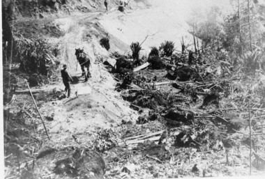
... 03027 Photograph Building of tramway track Upper Yarra Shire 1888-1988 Centenary collection. ...Upper Yarra Museum Old Railway Station 2415C Warburton Highway Yarra Junction yarra-valley-and-dandenong-ranges building tramway track horse scraperscoop 03027 Photograph Building of tramway track Upper Yarra Shire 1888-1988 Centenary collection. ...03027 Photograph Building of tramway track Upper Yarra Shire 1888-1988 Centenary collection. Negative, Black & white.Two men with horses digging earth with scoops and then tipping it over the side of the new embankment to make it wide enough for timber traffic to pass by.building tramway track horse scraperscoop -
 Upper Yarra Museum
Sepia Photograph, Mt Donna Buang, Warburton, 1912 (exact)
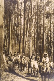
... Upper Yarra Museum Old Railway Station 2415C Warburton Highway Yarra Junction yarra-valley-and-dandenong-ranges A large original print of the opening of the track to the summit of Mt Donna Buang. ...A large original print of the opening of the track to the summit of Mt Donna Buang. The party consists of horses with riders along with walkers.An original photo with the makers name at the bottom.The orgingal photograph of people on horses climbing the track to the summit of Mt Donna Buang for its opening. Unmounted photo by SearsInscription at bottom of photo "Mt Donna Buang, Warburton / Mr W.H.Edgar, Mrs Edgar, Mr Catani and Party / on the track to the Summit / 1912"original print, horses, mt donna buang, warburton, sears photo, mr w h edgar, mrs edgar, mr catani, track to mt donna buang, mr e a storey, damman, storey, catani, edgar, trees, track opening, mountain ash, eucalpytus regnans, 1912, hats -
 Upper Yarra Museum
Negative Photographic Reproduction, Building tramway track 1895, 13/4/1983
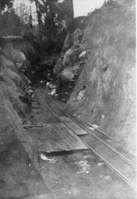
... 03026 Building tramway track 1895 Upper Yarra Shire 1888-1988 Centenary collection. ...Upper Yarra Museum Old Railway Station 2415C Warburton Highway Yarra Junction yarra-valley-and-dandenong-ranges building tramway track 1895 deep cutting 03026 Building tramway track 1895 Upper Yarra Shire 1888-1988 Centenary collection. ...03026 Building tramway track 1895 Upper Yarra Shire 1888-1988 Centenary collection. Negative, Black & white. Scanned at 600 dpi building tramway track 1895 deep cutting -
 Upper Yarra Museum
Negative Photographic Reproduction, Laying the tram track to Clover Dell Mill with E. Smith , W Towers …. Hoddles Creek
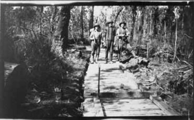
... Upper Yarra Museum Old Railway Station 2415C Warburton Highway Yarra Junction yarra-valley-and-dandenong-ranges laying tram track clover dell mill e smith w towers hoddle creek Laying the tram track to Clover Dell Mill with E. ...Laying the tram track to Clover Dell Mill with E. Smith , W Towers & ? Hoddles Creek Negative Black white Scanned at 600 dpi.laying tram track clover dell mill e smith w towers hoddle creek -
 Eltham District Historical Society Inc
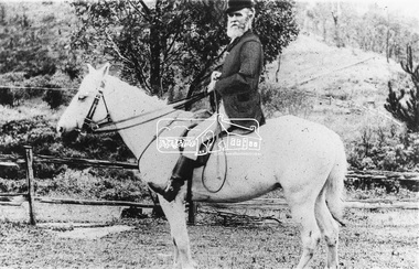
Photograph, Mr Yates, Clerk of the Course for the Diamond Creek Racing Club, c.1880
... "Mr Yates of Pine Grove, Upper Diamond Creek was the local postmaster, and Clerk of the Course for the Diamond Creek Racing Club in the 1880s. He is dressed for a meeting - the coat was scarlet. When racing ended at Diamond Creek in the 1890s he became Clerk of the Course at the Yarra Glen track."..."Mr Yates of Pine Grove, Upper Diamond Creek was the local postmaster, and Clerk of the Course for the Diamond Creek Racing Club in the 1880s. He is dressed for a meeting - the coat was scarlet. When racing ended at Diamond Creek in the 1890s he became Clerk of the Course at the Yarra Glen track." ...Photo from J. Sinclair reproduced on p92 of The Diamond Valley Story by Dianne H. Edwards, Shire of Diamond Valley 1979. "Mr Yates of Pine Grove, Upper Diamond Creek was the local postmaster, and Clerk of the Course for the Diamond Creek Racing Club in the 1880s. He is dressed for a meeting - the coat was scarlet. When racing ended at Diamond Creek in the 1890s he became Clerk of the Course at the Yarra Glen track."Black and white copy of photo printed on glossy photographic paper 30.5 x 40.5 cm (12 x 16 inch); image size approx. 18.5 x 28 cmclerk of the course, diamond creek racing club, diamond valley story, horse, mr yates, pine grove, postmaster, upper diamond creek -
 Ringwood and District Historical Society
Map - Public Land Sale by Thomas Ham, 2000 Acres for Sale - Crown Sections 20, 23, 24 - Ringwood, Victoria - 1855
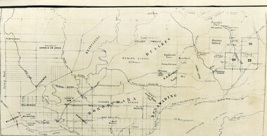
... When at the "Woodman Inn", take the Cotham Road to the right, bearing due east, keep this Road, passing Trainor's "White Horse" Inn, and before you leave the fences, you will see calico bills (see margin) nailed to the Trees on the bush track leading to the Upper Yarra country, follow the Bills till you come to the SOUTH boundary line of the Property, which bears East and West (see Plan) where you will see Bills nailed up "THIS PROPERTY FOR SALE, etc." ...When at the "Woodman Inn", take the Cotham Road to the right, bearing due east, keep this Road, passing Trainor's "White Horse" Inn, and before you leave the fences, you will see calico bills (see margin) nailed to the Trees on the bush track leading to the Upper Yarra country, follow the Bills till you come to the SOUTH boundary line of the Property, which bears East and West (see Plan) where you will see Bills nailed up "THIS PROPERTY FOR SALE, etc." ...Two 1850s surveyor's maps on cardboard backing showing area from Melbourne extending East beyond Bulleen and Nunawading. Detailed description of lots for sale and navigational directions to the property from Richmond by Thomas Ham, Victorian public servant, map maker, publisher, lithographer and original Ringwood land owner. Inset map enlarging area between Yarra River and Dandenong Creek, with southern boundary of allotments later forming part of Oban Road, North Ringwood.TRANSCRIPT: "This really valuable Property is now offered to the public for sale, in lots to suit purchasers at the Iow rate of £1 per Acre for 80 acres and upwards, and £1.10s per Acre for any smaller portion. Terms of payment Half Cash, Balance in 6 and 12 months, bearing 8 per cent interest. The Estate is well wooded with Gum, Cherry Tree and Stringy Bark, with Wattle in the valleys of the several creeks. Every lot is Staked and Trenched at the corners marked on the Plan thus - The Surveyor has carefully sub-divided the Property, in order to give every Farm a Creek for Water, Valley for Cultivation, and Hills for House and Grass Paddock. The ROADS have been very carefully laid out so as to give a firm, well drained, and nearly level road to each Homestead. Intending purchasers can readily find the property by the following directions, viz: Start from Richmond Bridge, at Hawthorne, then take the left-hand road to KEW. When at the "Woodman Inn", take the Cotham Road to the right, bearing due east, keep this Road, passing Trainor's "White Horse" Inn, and before you leave the fences, you will see calico bills (see margin) nailed to the Trees on the bush track leading to the Upper Yarra country, follow the Bills till you come to the SOUTH boundary line of the Property, which bears East and West (see Plan) where you will see Bills nailed up "THIS PROPERTY FOR SALE, etc." The Bills from Town lead direct to where Mr. Jull is erecting his Store, and arrangements have been made with him to show the lots to intending purchasers free of charge. At the respective corners of the lots the Bills are nailed up double, with numbers to denote the lot, and that the corner stake is adjacent. Any parties wishing to proceed to the property by way of BULLEEN will find Bills nailed on the Trees, commencing at the NEW INN, at "Wilson's Slip Rail." Keep this Track till you come to the Log Bridge, over the Deep Creek at Bloxhome's Paddock; go through the land now being cleared; keep the track over the hill till you come to an Iron House, you will then be on the property, which Iies to the North and East as per Plan. Follow the Bills till you come to Mr. Jull's Store, etc. etc. Further particulars can be had from the Agent for the Property. THOMAS HAM. " -
 Ringwood and District Historical Society
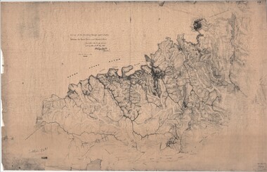
Map, Survey of Dividing Range between Yarra Yarra and Western Port - William Wedge Darke, 1843
... Descriptive remarks include upstream area of Yarra River - "impassable, appears to have been formerly a lake", and to the south - "barren and scrubby swamps of the Western Port Country". Marked tracks include "best line of road from Melbourne", "track to Dandenong", "Road to Port Albert may probably be found on this range", "Best line to Upper Yarra". ...Descriptive remarks include upstream area of Yarra River - "impassable, appears to have been formerly a lake", and to the south - "barren and scrubby swamps of the Western Port Country". Marked tracks include "best line of road from Melbourne", "track to Dandenong", "Road to Port Albert may probably be found on this range", "Best line to Upper Yarra". ...Extract - Ringwood, Place of Many Eagles - Hugh Anderson (1974): William Wedge Darke, from Hereford, England, was a nephew of John Helder Wedge of the Port Phillip Association, who was also a surveyor. William's most important work was probably his survey of the Dividing Range and the country between the Yarra River and Western Port, completed in May 1843, and during which he made a traverse between the Mullum and Dandenong creeks along the higher ground that he labelled the "best line of road from Melbourne". This road was for many years the major route to Gippsland and to the higher country about Alexandra and Mansfield, sometimes known as White Horse Road, and now Maroondah Highway.Surveyor's relief map of features to the east of Melbourne including Yarra Yarra River, Mullum Mullum Creek, Anderson's Creek, Dandenong Creek.Transmitted to the Surveyor General with my letter of 10th May 1843 (signed) Wm Wedge Drake, Assistant Surveyor. Scale: two inches to a mile. Descriptive remarks include upstream area of Yarra River - "impassable, appears to have been formerly a lake", and to the south - "barren and scrubby swamps of the Western Port Country". Marked tracks include "best line of road from Melbourne", "track to Dandenong", "Road to Port Albert may probably be found on this range", "Best line to Upper Yarra". Several huts also marked. -
 Marysville & District Historical Society
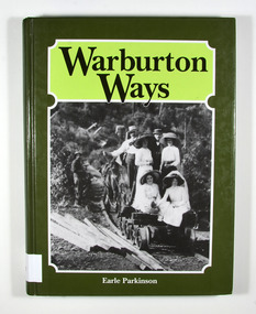
Book, Warburton Ways, 1993
... Upper Yarra Valley/ -an inheritance/ so well worth/ preserving Stamp of Marysville & District / Historical Society Inc / P.O. Box 22 / Marysville 3779 Hardcover. Front cover has a photograph of a group of people sitting on a small railway cart which is being drawn by horse along a railway track. ...A history of Warburton and its pioneersHardcover. Front cover has a photograph of a group of people sitting on a small railway cart which is being drawn by horse along a railway track. There is also a man standing to the left of the railway track. The photograph appears to have been taken in the late 1800's.With best wishes / Earle Parkinson Dedicated/ to the pioneer men/ and women who/ gave to us the/ Upper Yarra Valley/ -an inheritance/ so well worth/ preserving Stamp of Marysville & District / Historical Society Inc / P.O. Box 22 / Marysville 3779warburton, yarra ranges, victoria, australia, history, pioneers -
 Marysville & District Historical Society
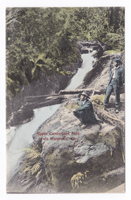
Postcard (item) - Colour tinted postcard, Victorian Stamp Market, Upper Cumberland Falls, via Marysville, Vic, 1908
... yarra-valley-and-the-dandenong-ranges An early colour tinted photograph of the Upper Cumberland Falls near Cambarville in Victoria. This postcard was published by Victorian Stamp Market as a souvenir of Marysville. An early colour tinted photograph of the Upper Cumberland Falls near Cambarville in Victoria. These falls are located on the Marysville-Wood's Point Road. Cambarville is notable for its giant mountain ash (Eucalyptus regnans) trees within the Cumberland Memorial Scenic Reserve, and relics from former sawmills and gold mining. The Big Culvert is located nearby on the Marysville - Woods Point Road, which was historically part of the Yarra Track ...An early colour tinted photograph of the Upper Cumberland Falls near Cambarville in Victoria. This postcard was published by Victorian Stamp Market as a souvenir of Marysville. An early colour tinted photograph of the Upper Cumberland Falls near Cambarville in Victoria. These falls are located on the Marysville-Wood's Point Road. Cambarville is notable for its giant mountain ash (Eucalyptus regnans) trees within the Cumberland Memorial Scenic Reserve, and relics from former sawmills and gold mining. The Big Culvert is located nearby on the Marysville - Woods Point Road, which was historically part of the Yarra Track. Cambarville was established as a timber mill town in the 1940s. Timber mill owners A Cameron and FJ Barton named Cambarville. They established the mill to salvage timber from trees destroyed in the 1939 bushfires. Cambarville was impacted by the 2009 Black Saturday bushfires and any remaining structures were destroyed.POST CARD This space may be used for Correspondence. FOR ADDRESS ONLY Printed in Germany V.S.M. Seriescumberland falls, cambarville, marysville, victoria, waterfalls, postcard, souvenir, mountain ash, mining, timber mills, big culvert, yarra track, a cameron, fj barton, black saturday bushfires, 1939 bushfires, eucalyptus regnans, victorian stamp market, victorian stamp market series -
 Marysville & District Historical Society
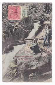
Postcard (item) - Colour tinted postcard, Victorian Stamp Market, Upper Cumberland Falls via Marysville, Vic, 1908
... yarra-valley-and-the-dandenong-ranges An early colour tinted photograph of the Upper Cumberland Falls near Cambarville in Victoria. This postcard was published by Victorian Stamp Market as a souvenir of Marysville. An early colour tinted photograph of the Upper Cumberland Falls near Cambarville in Victoria. These falls are located on the Marysville-Wood's Point Road. Cambarville is notable for its giant mountain ash (Eucalyptus regnans) trees within the Cumberland Memorial Scenic Reserve, and relics from former sawmills and gold mining. The Big Culvert is located nearby on the Marysville - Woods Point Road, which was historically part of the Yarra Track ...An early colour tinted photograph of the Upper Cumberland Falls near Cambarville in Victoria. This postcard was published by Victorian Stamp Market as a souvenir of Marysville. An early colour tinted photograph of the Upper Cumberland Falls near Cambarville in Victoria. These falls are located on the Marysville-Wood's Point Road. Cambarville is notable for its giant mountain ash (Eucalyptus regnans) trees within the Cumberland Memorial Scenic Reserve, and relics from former sawmills and gold mining. The Big Culvert is located nearby on the Marysville - Woods Point Road, which was historically part of the Yarra Track. Cambarville was established as a timber mill town in the 1940s. Timber mill owners A Cameron and FJ Barton named Cambarville. They established the mill to salvage timber from trees destroyed in the 1939 bushfires. Cambarville was impacted by the 2009 Black Saturday bushfires and any remaining structures were destroyed.POST CARD This space may be used for Correspondence. FOR ADDRESS ONLY Printed in Germany V.S.M. Series WOOD / VICT/ A/ 10 -4.S.10-3/ DISTRIBUZIONS JWO Gricardi/ Via Galletti/ V 16/ Loruis/ Italy Mary A????/ Australiacumberland falls, cambarville, marysville, victoria, waterfalls, postcard, souvenir, mountain ash, mining, timber mills, big culvert, yarra track, a cameron, fj barton, black saturday bushfires, 1939 bushfires, eucalyptus regnans, victorian stamp market, victorian stamp market series -
 Marysville & District Historical Society
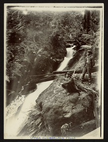
Photograph (item) - Black and white photograph, Unknown
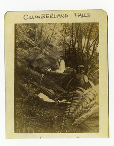
... yarra-valley-and-the-dandenong-ranges An early black and white photograph of the Upper Cumberland Falls in the Cumberland Valley in Victoria. An early black and white photograph of the Upper Cumberland Falls in the Cumberland Valley in Victoria. These falls are located on the Marysville-Wood's Point Road. Cambarville is notable for its giant mountain ash (Eucalyptus regnans) trees within the Cumberland Memorial Scenic Reserve, and relics from former sawmills and gold mining. The Big Culvert is located nearby on the Marysville - Woods Point Road, which was historically part of the Yarra Track ...An early black and white photograph of the Upper Cumberland Falls in the Cumberland Valley in Victoria.An early black and white photograph of the Upper Cumberland Falls in the Cumberland Valley in Victoria. These falls are located on the Marysville-Wood's Point Road. Cambarville is notable for its giant mountain ash (Eucalyptus regnans) trees within the Cumberland Memorial Scenic Reserve, and relics from former sawmills and gold mining. The Big Culvert is located nearby on the Marysville - Woods Point Road, which was historically part of the Yarra Track. Cambarville was established as a timber mill town in the 1940s. Timber mill owners A Cameron and FJ Barton named Cambarville. They established the mill to salvage timber from trees destroyed in the 1939 bushfires. Cambarville was impacted by the 2009 Black Saturday bushfires and any remaining structures were destroyed.UPPER CUMBERLAND FALLScumberland falls, cambarville, marysville, victoria, waterfalls, postcard, souvenir, mountain ash, mining, timber mills, big culvert, yarra track, a cameron, fj barton, black saturday bushfires, 1939 bushfires, eucalyptus regnans -
Marysville & District Historical Society
Document (item) - Gold Mine Prospectus, Messrs Bruce & Robinson, Prospectus-Chester & Locke's Golden Secret Gold Mining Company, 1899
... ...yarra track...upper...William Edward Chester discovered the Golden Secret gold vein which became part of the Golden Bower Mine at Chesterville near Donovans Creek on the Cumberland goldfield which he mined with George Locke until the late 1930s. share prospectus chester & locke's golden secret mining company marysville victoria yarra track upper yarra district david newell j.g. aikman w.j. mountain andrew barrie gold mining messrs w.p. jones and co. william chester george locke chesterville FOR PRIVATE CIRCULATION A copy of the prospectus for the Chester & Locke's Golden Secret Mining Company near Marysville in Victoria. ...A copy of the prospectus for the Chester & Locke's Golden Secret Mining Company near Marysville in Victoria.A copy of the prospectus for the Chester & Locke's Golden Secret Mining Company near Marysville in Victoria. The Golden Bower gold mine was a quartz reef mine. William Edward Chester discovered the Golden Secret gold vein which became part of the Golden Bower Mine at Chesterville near Donovans Creek on the Cumberland goldfield which he mined with George Locke until the late 1930s. FOR PRIVATE CIRCULATIONshare prospectus, chester & locke's golden secret mining company, marysville, victoria, yarra track, upper yarra district, david newell, j.g. aikman, w.j. mountain, andrew barrie, gold mining, messrs w.p. jones and co., william chester, george locke, chesterville -
 Marysville & District Historical Society
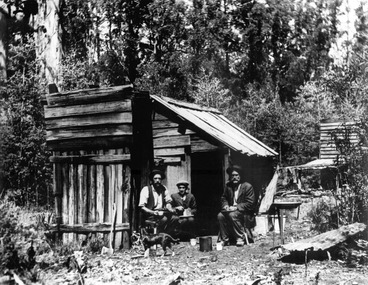
Photograph (item) - Black and white photograph, Unknown
... ...yarra track...upper...William Chester and George Locke opened Chester and Locke's Golden Secret Gold Mining Company (N.L.), which was situated on the Yarra Track, Wood's Point, in the Upper Yarra district of Victoria. george locke andrew kirwan william chester chester & locke's golden secret mining company yarra track upper yarra district gold mine A digital copy of an early black and white photograph of George Locke, Andrew Kirwan and William Chester who were local gold prospectors. ...A digital copy of an early black and white photograph of George Locke, Andrew Kirwan and William Chester who were local gold prospectors.A digital copy of an early black and white photograph of George Locke, Andrew Kirwan and William Chester who were local gold prospectors. William Chester and George Locke opened Chester and Locke's Golden Secret Gold Mining Company (N.L.), which was situated on the Yarra Track, Wood's Point, in the Upper Yarra district of Victoria.george locke, andrew kirwan, william chester, chester & locke's golden secret mining company, yarra track, upper yarra district, gold mine -
Marysville & District Historical Society
Document (Item) - Report, John F. Waghorn, Yarra Track, Unknown
... yarra track...john waghorn...victoria's postal services...wood's point...sydney road...longwood...merton...mansfield...postmasters...bonnie doon...melville merton mansfield...eltham...healesville...marysville...walhalla...melbourne-warburton-wood's point line...loose bags...heidelberg post office...eltham post office...kangaroo ground post office...yarra glen post office...marysville post office...healesville post office...mansfield post office...jamieson post office...gaffney's creek post office...wood's point post office...postal department...george rieck...stockman...jones...beecher...stockman's reward...big river...mary mcdonald...upper...If an ancestor was a postmaster in a Victorian town, he may have been able to reveal the person's occupation, income and working conditions. yarra track john waghorn victoria's postal services wood's point sydney road longwood merton mansfield postmasters bonnie doon melville merton mansfield eltham healesville marysville walhalla melbourne-warburton-wood's point line loose bags heidelberg post office eltham post office kangaroo ground post office yarra glen post office marysville post office healesville post office mansfield post office jamieson post office gaffney's creek post office wood's point post office postal department george rieck stockman jones beecher stockman's reward big river mary mcdonald upper yarra river donovan's creek cornelius donovan bridget buggy matlock alexandra william farrell jordan diggings new chum watts river black spur narbethong granton acheron river mount strickland paradise plains mount grant mount arnold jordan goldfields william robley robley's spur big river crossing great dividing range cumberland valley james mcguigan w elliot christopher harrison james marsh cobb and co box hill lilydale fehrings koehlers shaws bear creek cairnsville cumberland creek walkers golden bower mine collins' mountain home hotel walsh's creek post office rosa mcveigh frank barton hitchins matthew kennedy william morris e r nichols t woods tom burchell peter kerr henry kuyper william podlech george koehler henry brockmann henry petty thomas smith jacob butchart john perry slingsby davis royal mail hotel walter gray john summers travellers rest hotel lockington the oaks the springs st clair thomas crawford springvale hotel john sinclair saint clair hotel gould mathews willie we have missed you hotel germany johan fehring adelaide linton ballarat gunbower murray river anna katerina fehring 1890s depression land boom fehring place fred baker alf sparke fehring's hotel mcveigh's hotel wood's point mountaineer l cox victorian country directories letson cox coburg maria hayes setson fitzroy richmond john cox jordan river jericho e. norris le poidevin newell o'brien alhambra sinclair parker ellis tripp quin vernon thompson charsley james fahie george locke william chester chesterville kirwan cumberland reserve blue spruce e.s. and a bank selby joyce selby charles joy selby joseph joyce A report on the history of the Yarra Track by John Waghorn, a local amateur historian. ...A report on the history of the Yarra Track by John Waghorn, a local amateur historian.A report on the history of the Yarra Track by John Waghorn, a local amateur historian. John Waghorn was an amateur historian, an authority on the history of Victoria's postal services. He could tell you how mail was delivered in the high country in the 1880s, where the town of Gobur was, or when the overland Melbourne-Sydney mail service began. He admitted that his hobby has got a little out of hand. He had 30 filing cabinets, and indexes of more than 70,000 postal workers over the past 160 years crammed into three rooms at his home. If an ancestor was a postmaster in a Victorian town, he may have been able to reveal the person's occupation, income and working conditions.yarra track, john waghorn, victoria's postal services, wood's point, sydney road, longwood, merton, mansfield, postmasters, bonnie doon, melville merton mansfield, eltham, healesville, marysville, walhalla, melbourne-warburton-wood's point line, loose bags, heidelberg post office, eltham post office, kangaroo ground post office, yarra glen post office, marysville post office, healesville post office, mansfield post office, jamieson post office, gaffney's creek post office, wood's point post office, postal department, george rieck, stockman, jones, beecher, stockman's reward, big river, mary mcdonald, upper yarra river, donovan's creek, cornelius donovan, bridget buggy, matlock, alexandra, william farrell, jordan diggings, new chum, watts river, black spur, narbethong, granton, acheron river, mount strickland, paradise plains, mount grant, mount arnold, jordan goldfields, william robley, robley's spur, big river crossing, great dividing range, cumberland valley, james mcguigan, w elliot, christopher harrison, james marsh, cobb and co, box hill, lilydale, fehrings, koehlers, shaws, bear creek, cairnsville, cumberland creek, walkers, golden bower mine, collins' mountain home hotel, walsh's creek post office, rosa mcveigh, frank barton, hitchins, matthew kennedy, william morris, e r nichols, t woods, tom burchell, peter kerr, henry kuyper, william podlech, george koehler, henry brockmann, henry petty, thomas smith, jacob butchart, john perry, slingsby davis, royal mail hotel, walter gray, john summers, travellers rest hotel, lockington, the oaks, the springs, st clair, thomas crawford, springvale hotel, john sinclair, saint clair hotel, gould, mathews, willie we have missed you hotel, germany, johan fehring, adelaide, linton, ballarat, gunbower, murray river, anna katerina fehring, 1890s depression, land boom, fehring place, fred baker, alf sparke, fehring's hotel, mcveigh's hotel, wood's point mountaineer, l cox, victorian country directories, letson cox, coburg, maria hayes, setson, fitzroy, richmond, john cox, jordan river, jericho, e. norris, le poidevin, newell, o'brien, alhambra, sinclair, parker, ellis, tripp, quin, vernon, thompson, charsley, james fahie, george locke, william chester, chesterville, kirwan, cumberland reserve, blue spruce, e.s. and a bank, selby joyce, selby charles joy, selby joseph joyce -
 Marysville & District Historical Society
Photograph (Item) - Black and white photograph, Cumberland Falls, c1900
... Cambarville was impacted by the 2009 Black Saturday bushfires and any remaining structures were destroyed. cumberland falls cambarville marysville victoria waterfalls postcard souvenir mountain ash mining timber mills big culvert yarra track a cameron fj barton black saturday bushfires 1939 bushfires eucalyptus regnans ARMSTRONG COLLECTION 42 STATION STREET/ SANDRINGHAM 3191/ TEL. (03) 9521 5442/ IAN M.L. ARMSTRONG OAM An early black and white photograph of Cumberland Falls near Marysville in Victoria. The title of the photograph is along the upper ...An early black and white photograph of Cumberland Falls near Marysville in Victoria.An early black and white photograph of Cumberland Falls near Marysville in Victoria. These falls are located on the Marysville-Wood's Point Road. Cambarville is notable for its giant mountain ash (Eucalyptus regnans) trees within the Cumberland Memorial Scenic Reserve, and relics from former sawmills and gold mining. The Big Culvert is located nearby on the Marysville - Woods Point Road, which was historically part of the Yarra Track. Cambarville was established as a timber mill town in the 1940s. Timber mill owners A Cameron and FJ Barton named Cambarville. They established the mill to salvage timber from trees destroyed in the 1939 bushfires. Cambarville was impacted by the 2009 Black Saturday bushfires and any remaining structures were destroyed.ARMSTRONG COLLECTION 42 STATION STREET/ SANDRINGHAM 3191/ TEL. (03) 9521 5442/ IAN M.L. ARMSTRONG OAMcumberland falls, cambarville, marysville, victoria, waterfalls, postcard, souvenir, mountain ash, mining, timber mills, big culvert, yarra track, a cameron, fj barton, black saturday bushfires, 1939 bushfires, eucalyptus regnans -
 Marysville & District Historical Society
Booklet (Item) - Leisure guide, Michael Chesire & Associates Pty. Ltd, MARYSVILLE & DISTRICT LEISURE GUIDE-AUTUMN/WINTER, 1986, 1986
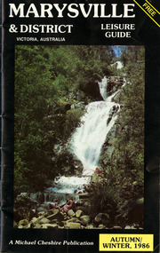
... yarra valley wineries...marysville coach tours...kooringa...marylands guest house...lady talbot forest drive...wishing well...taggerty river recreation area...athols abbey...phantom falls...keppel falls...the beeches walking track...marylyn guest house...kufstein inn motel...the cumberland...marysville tourist & progress association...marysville newsagency & general store...crossways restaurant & motel...beauty spot walk...tree fern gully walk...michaeldene track...keppel track...woods lookout track...marysville hotel motel...lake mountain ski hire...marysville recreation and fun park...mytanta horseback safaris...upper...A free leisure guide to Marysville and the surrounding district published for Autumn and Winter, 1986. marysville victoria australia leisure guide michael cheshire & associates pty ltd marysville golf club blackwood lodges sir colin mackenzie fauna park lake eildon fraser national park yarra valley wineries marysville coach tours kooringa marylands guest house lady talbot forest drive wishing well taggerty river recreation area athols abbey phantom falls keppel falls the beeches walking track marylyn guest house kufstein inn motel the cumberland marysville tourist & progress association marysville newsagency & general store crossways restaurant & motel beauty spot walk tree fern gully walk michaeldene track keppel track woods lookout track marysville hotel motel lake mountain ski hire marysville recreation and fun park mytanta horseback safaris upper big river valley the big culvert marysville mountain view horse hire maryton park amber view holiday lodges cathedral restaurant the top shop tower motel menzes garage beauty spot nursery marysville ski hire lake mountain ski school faraway forest scenic motel buxton trout farm marysville hardware timbertop steakhouse marysville trout farm healesville sanctuary buxton hotel motel nanda binya lodge buxton antique and furniture mart the black spur inn hotel alexandra lake mountain geoffrey pope & associates A free leisure guide to Marysville and the surrounding district published for Autumn and Winter, 1986. ...A free leisure guide to Marysville and the surrounding district published for Autumn and Winter, 1986. This was produced by Michael Cheshire as a free publication to promote tourism in Marysville and the surrounding district. It includes maps of the Big River Valley, Cumberland Valley, Lady Talbot Forest Drive, the Marysville area, and the township of Marysville. It was released in the autumn of 1986 and was sponsored by the Marysville Tourist & Progress Association. The Association was formed in November 1907 to promote tourism within the area. This included the physical creation of signage, parklands, roads, and walks to various attractions. A free leisure guide to Marysville and the surrounding district published for Autumn and Winter, 1986.marysville, victoria, australia, leisure guide, michael cheshire & associates pty ltd, marysville golf club, blackwood lodges, sir colin mackenzie fauna park, lake eildon, fraser national park, yarra valley wineries, marysville coach tours, kooringa, marylands guest house, lady talbot forest drive, wishing well, taggerty river recreation area, athols abbey, phantom falls, keppel falls, the beeches walking track, marylyn guest house, kufstein inn motel, the cumberland, marysville tourist & progress association, marysville newsagency & general store, crossways restaurant & motel, beauty spot walk, tree fern gully walk, michaeldene track, keppel track, woods lookout track, marysville hotel motel, lake mountain ski hire, marysville recreation and fun park, mytanta horseback safaris, upper big river valley, the big culvert, marysville mountain view horse hire, maryton park, amber view holiday lodges, cathedral restaurant, the top shop, tower motel, menzes garage, beauty spot nursery, marysville ski hire, lake mountain ski school, faraway forest, scenic motel, buxton trout farm, marysville hardware, timbertop steakhouse, marysville trout farm, healesville sanctuary, buxton hotel motel, nanda binya lodge, buxton antique and furniture mart, the black spur inn hotel, alexandra, lake mountain, geoffrey pope & associates -
 Marysville & District Historical Society
Booklet (Item) - Leisure guide, Michael Chesire & Associates Pty. Ltd, MARYSVILLE & DISTRICT LEISURE GUIDE-SPRING, 1986/SUMMBER, 1987, 1986
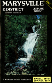
... yarra valley wineries...marysville coach tours...kooringa...marylands guest house...lady talbot forest drive...wishing well...taggerty river recreation area...athols abbey...phantom falls...keppel falls...the beeches walking track...marylyn guest house...kufstein inn motel...the cumberland...marysville tourist & progress association...marysville newsagency & general store...crossways restaurant & motel...beauty spot walk...tree fern gully walk...michaeldene track...keppel track...woods lookout track...marysville hotel motel...lake mountain ski hire...marysville recreation and fun park...mytanta horseback safaris...upper...A free leisure guide to Marysville and the surrounding district published for Spring 1986, and Summer 1987. marysville victoria australia leisure guide michael cheshire & associates pty ltd marysville golf club blackwood lodges sir colin mackenzie fauna park lake eildon fraser national park yarra valley wineries marysville coach tours kooringa marylands guest house lady talbot forest drive wishing well taggerty river recreation area athols abbey phantom falls keppel falls the beeches walking track marylyn guest house kufstein inn motel the cumberland marysville tourist & progress association marysville newsagency & general store crossways restaurant & motel beauty spot walk tree fern gully walk michaeldene track keppel track woods lookout track marysville hotel motel lake mountain ski hire marysville recreation and fun park mytanta horseback safaris upper big river valley the big culvert marysville mountain view horse hire maryton park amber view holiday lodges cathedral restaurant the top shop tower motel menzes garage beauty spot nursery marysville ski hire lake mountain ski school faraway forest scenic motel buxton trout farm marysville hardware timbertop steakhouse marysville trout farm healesville sanctuary buxton hotel motel nanda binya lodge buxton antique and furniture mart the black spur inn hotel alexandra lake mountain j l gould sawmills pty. ltd. geoffrey pope & associates marysville crafts & gifts olde yarra track shoppe cumberland scenic reserve tudor lodge road house fruit salad farm highwayman's retreat Kilmore Historical Society *10/183 *MDL.1. ...A free leisure guide to Marysville and the surrounding district published for Spring 1986, and Summer, 1987. This was produced by Michael Cheshire as a free publication to promote tourism in Marysville and the surrounding district. It includes maps of the Big River Valley, Cumberland Valley, Lady Talbot Forest Drive, the Marysville area, and the township of Marysville. It was released in the spring of 1986. A free leisure guide to Marysville and the surrounding district published for Spring 1986, and Summer 1987.Kilmore Historical Society *10/183 *MDL.1.marysville, victoria, australia, leisure guide, michael cheshire & associates pty ltd, marysville golf club, blackwood lodges, sir colin mackenzie fauna park, lake eildon, fraser national park, yarra valley wineries, marysville coach tours, kooringa, marylands guest house, lady talbot forest drive, wishing well, taggerty river recreation area, athols abbey, phantom falls, keppel falls, the beeches walking track, marylyn guest house, kufstein inn motel, the cumberland, marysville tourist & progress association, marysville newsagency & general store, crossways restaurant & motel, beauty spot walk, tree fern gully walk, michaeldene track, keppel track, woods lookout track, marysville hotel motel, lake mountain ski hire, marysville recreation and fun park, mytanta horseback safaris, upper big river valley, the big culvert, marysville mountain view horse hire, maryton park, amber view holiday lodges, cathedral restaurant, the top shop, tower motel, menzes garage, beauty spot nursery, marysville ski hire, lake mountain ski school, faraway forest, scenic motel, buxton trout farm, marysville hardware, timbertop steakhouse, marysville trout farm, healesville sanctuary, buxton hotel motel, nanda binya lodge, buxton antique and furniture mart, the black spur inn hotel, alexandra, lake mountain, j l gould sawmills pty. ltd., geoffrey pope & associates, marysville crafts & gifts, olde yarra track shoppe, cumberland scenic reserve, tudor lodge road house, fruit salad farm, highwayman's retreat -
 Marysville & District Historical Society
Booklet (Item) - Leisure guide, Michael Chesire & Associates Pty. Ltd, MARYSVILLE & DISTRICT LEISURE GUIDE-WINTER/SPRING 1987, 1987
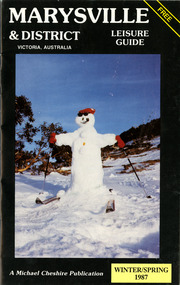
... yarra valley wineries...marysville coach tours...kooringa...marylands guest house...lady talbot forest drive...wishing well...taggerty river recreation area...athols abbey...phantom falls...keppel falls...the beeches walking track...marylyn guest house...kufstein inn motel...the cumberland...marysville tourist & progress association...marysville newsagency & general store...crossways restaurant & motel...beauty spot walk...tree fern gully walk...michaeldene track...keppel track...woods lookout track...marysville hotel motel...lake mountain ski hire...marysville recreation and fun park...mytanta horseback safaris...upper...A free leisure guide to Marysville and the surrounding district published for Winter and Spring, 1987. marysville victoria australia leisure guide michael cheshire & associates pty ltd marysville golf club blackwood lodges sir colin mackenzie fauna park lake eildon fraser national park yarra valley wineries marysville coach tours kooringa marylands guest house lady talbot forest drive wishing well taggerty river recreation area athols abbey phantom falls keppel falls the beeches walking track marylyn guest house kufstein inn motel the cumberland marysville tourist & progress association marysville newsagency & general store crossways restaurant & motel beauty spot walk tree fern gully walk michaeldene track keppel track woods lookout track marysville hotel motel lake mountain ski hire marysville recreation and fun park mytanta horseback safaris upper big river valley the big culvert marysville mountain view horse hire maryton park amber view holiday lodges cathedral restaurant the top shop tower motel menzes garage marysville ski hire lake mountain ski school faraway forest scenic motel buxton trout farm marysville hardware timbertop steakhouse marysville trout farm healesville sanctuary buxton hotel motel nanda binya lodge buxton antique and furniture mart the black spur inn hotel alexandra lake mountain j l gould sawmills pty. ltd. geoffrey pope & associates marysville crafts & gifts olde yarra track shoppe cumberland scenic reserve tudor lodge road house fruit salad farm highwayman's retreat beauty spot display gardens & nursery ski lake mountain cross country ski hire & kitchen buxton store valley view marysville acheron way mt donna buang road snow gum woodlands alpine ash forests mountain ash forests stringybark forests messmate forests manna gum forests A free leisure guide to Marysville and the surrounding district published for Winter/Spring 1987 MARYSVILLE & DISTRICT LEISURE GUIDE-WINTER/SPRING 1987 Booklet Leisure guide Michael Chesire & Associates Pty. ...A free leisure guide to Marysville and the surrounding district published for Winter and Spring, 1987. This was produced by Michael Cheshire as a free publication to promote tourism in Marysville and the surrounding district. It includes maps of the Big River Valley, Cumberland Valley, Lady Talbot Forest Drive, the Marysville area, and the township of Marysville. It was released in the winter of 1987. A free leisure guide to Marysville and the surrounding district published for Winter and Spring, 1987.marysville, victoria, australia, leisure guide, michael cheshire & associates pty ltd, marysville golf club, blackwood lodges, sir colin mackenzie fauna park, lake eildon, fraser national park, yarra valley wineries, marysville coach tours, kooringa, marylands guest house, lady talbot forest drive, wishing well, taggerty river recreation area, athols abbey, phantom falls, keppel falls, the beeches walking track, marylyn guest house, kufstein inn motel, the cumberland, marysville tourist & progress association, marysville newsagency & general store, crossways restaurant & motel, beauty spot walk, tree fern gully walk, michaeldene track, keppel track, woods lookout track, marysville hotel motel, lake mountain ski hire, marysville recreation and fun park, mytanta horseback safaris, upper big river valley, the big culvert, marysville mountain view horse hire, maryton park, amber view holiday lodges, cathedral restaurant, the top shop, tower motel, menzes garage, marysville ski hire, lake mountain ski school, faraway forest, scenic motel, buxton trout farm, marysville hardware, timbertop steakhouse, marysville trout farm, healesville sanctuary, buxton hotel motel, nanda binya lodge, buxton antique and furniture mart, the black spur inn hotel, alexandra, lake mountain, j l gould sawmills pty. ltd., geoffrey pope & associates, marysville crafts & gifts, olde yarra track shoppe, cumberland scenic reserve, tudor lodge road house, fruit salad farm, highwayman's retreat, beauty spot display gardens & nursery, ski lake mountain cross country ski hire & kitchen, buxton store, valley view marysville, acheron way, mt donna buang road, snow gum woodlands, alpine ash forests, mountain ash forests, stringybark forests, messmate forests, manna gum forests -
 Puffing Billy Railway
Station Sign - Upwey
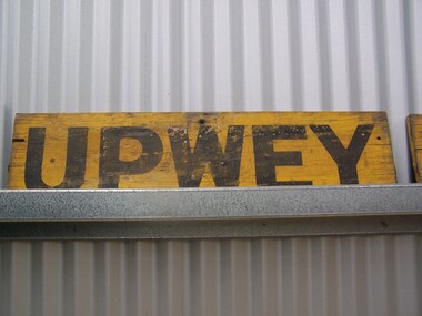
... yarra-valley-and-the-dandenong-ranges Upwey Station Sign; Upwey Railway Station is located on the Belgrave line in Victoria, Australia. This railway serves the Eastern region of Melbourne. Upwey Railway Station opened on the 3rd of June 1901. Upwey Railway Station has a crossing loop in the middle of a six kilometre section of single railway track between Ferntree Gully Railway Station and Belgrave Railway Station. The station was originally on the Upper ...Upwey Station Sign; Upwey Railway Station is located on the Belgrave line in Victoria, Australia. This railway serves the Eastern region of Melbourne. Upwey Railway Station opened on the 3rd of June 1901. Upwey Railway Station has a crossing loop in the middle of a six kilometre section of single railway track between Ferntree Gully Railway Station and Belgrave Railway Station. The station was originally on the Upper Ferntree Gully to Gembrook narrow gauge line. The Upper Ferntree Gully to Gembrook Narrow Gauge railway line officially closed on the 30th of April 1954. It saw further use between 1955 and early 1958, when trains were operated by the Puffing Billy Preservation Society in co-operation with the Victorian Railways. The Upper Ferntree Gully to Belgrave section was converted to Broad Guage and re-opened on the 19th of February 1962. This station sign shown here was one of a number used on the Upwey Railway Station while it was Narrow Gauge. Historic - Victorian Railways Station sign used at Upwey StationUpwey wooden rectangle Station name sign pained yellow background with black font.Upweypuffing billy, station sign, upwey station, victorian railways -
 Puffing Billy Railway
Puffing Billy Preservation Society 50th Anniversary Station Sign, 2005
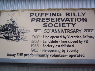
... Puffing Billy Railway 1 old monbulk road Belgrave yarra-valley-and-the-dandenong-ranges Puffing Billy Preservation Society 50th Anniversary sign This is the large poster board that was erected at Lakeside to celebrate the 50th Anniversary of the Puffing Billy Preservation Society in 2005. Established in 1955, the Puffing Billy Preservation Society was formed to operate the narrow gauge trains between Upper Fern Tree Gully and Belgrave following the successful Young Sun specials. With the conversion of the Upper Fern Tree Gully to Belgrave line to broad gauge track ...Puffing Billy Preservation Society 50th Anniversary sign This is the large poster board that was erected at Lakeside to celebrate the 50th Anniversary of the Puffing Billy Preservation Society in 2005. Established in 1955, the Puffing Billy Preservation Society was formed to operate the narrow gauge trains between Upper Fern Tree Gully and Belgrave following the successful Young Sun specials. With the conversion of the Upper Fern Tree Gully to Belgrave line to broad gauge track, the Puffing Billy Preservation Society was the instigator of restoring the Puffing Billy Railway from Belgrave to Menzies Creek in 1962, Menzies Creek to Emerald in 1965 and Emerald to Lakeside in 1975 and in association with the Emerald Tourist Railway Board, Lakeside to Gembrook in 1998. Historic - Puffing Billy Preservation Society - Station Sign - for the 50th Anniversary of the Preservation SocietyPuffing Billy Preservation Society 50th Anniversary sign Large rectangle metal sign - off white back ground with black lettering Puffing Billy Preservation Society 1955 - 50th Anniversary - 2005 1900 . Line opened by Victorian Railways 1953 . Landslide - Line closed by V.R 1955 . Society established 1962 . Re-opened by Society Today still predominantly volunteer - operated puffing billy, preservation society, station sign, 50th anniversary, lakeside station