
Showing 84 items matching "urban landscape"
-
 Federation University Historical Collection
Booklet, Ballarat and UNESCO Historic Urban Landscape Approach, 2013, 2013
... Ballarat and UNESCO Historic Urban Landscape Approach, 2013......historic urban landscape (hul)...Ballarat and UNESCO Historic Urban Landscape Approach, 2013 Booklet Booklet City of Ballarat ...Full colour booklet with a photograph of the Ballarat Botanical Gardens on the cover. Anne Beggs Sunter is in a red jumper on the first page, under the verandah of the Buninyong Cake Shop. unesco, historic urban landscape (hul), league of historical cities, urban heritage, ron van oers, burke and wills time capsule, ballarat heritage award, peel st story, landscape -
 RMIT Design Archives
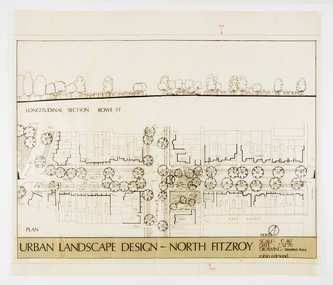
Architectural drawings, Urban Landscape Design - North Fitzroy
... Urban Landscape Design - North Fitzroy...Features the longitudinal section at Rowe St. Urban Landscape Design - North Fitzroy Architectural drawings Edmond, Robin Edmond, Robin ...Detailled Area plan of the Urban Renewal Project in North Fitzroy. Features the longitudinal section at Rowe St.ink, acetate -
Save the Dandenongs League Inc.
Archive (item), Save the Dandenongs League Incorporated, Upper Yarra Valley and Dandenong Ranges Authority - Technical Report Series - Report No. 18 - 1988 - Population and Housing in Urban, Landscape Living and Rural Residential Policy Areas of the Regional Strategy Plan at 1986 Census
... Upper Yarra Valley and Dandenong Ranges Authority - Technical Report Series - Report No. 18 - 1988 - Population and Housing in Urban, Landscape Living and Rural Residential Policy Areas of the Regional Strategy Plan at 1986 Census...Upper Yarra Valley and Dandenong Ranges Authority - Technical Report Series - Report No. 18 - 1988 - Population and Housing in Urban, Landscape Living and Rural Residential Policy Areas of the Regional Strategy Plan at 1986 Census Archive Save the Dandenongs League Incorporated ... -
 St Kilda Historical Society
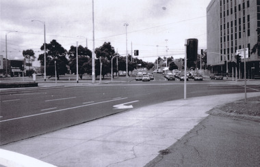
Photograph - Urban landscape, St Kilda Junction
... Urban landscape...St Kilda Junction black and white photograph St Kilda Junction Photograph Urban landscape ...black and white photographst kilda junction -
 Kew Historical Society Inc
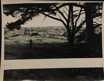
Photograph - Urban landscape, 1860
... Urban landscape...Similar locations in nos.41, 42, 43, 44. Photograph Urban landscape ...An item from an outstanding and diverse photographic collection, assembled by members of the Christian and Washfold families of Kew.Black and white photograph of man standing underneath large conifers looking across a valley to buildings in the distance. Similar locations in nos.41, 42, 43, 44.christian-washfold collection, landscape photography, subdivisions -- kew (vic.) -
 Kew Historical Society Inc
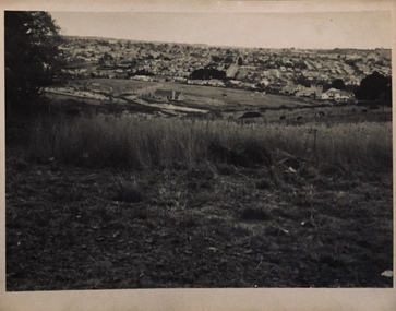
Photograph - Urban landscape, 1860
... Urban landscape...Similar locations in nos.41, 42, 43. 44. Photograph Urban landscape ...An item from an outstanding and diverse photographic collection, assembled by members of the Christian and Washfold families of Kew.Black and white photograph looking across a valley to buildings in the distance. Similar locations in nos.41, 42, 43. 44.subdivisions -- kew (vic.), christian-washfold collection, landscape photography -
 Kew Historical Society Inc
Photograph - Urban landscape, 1860
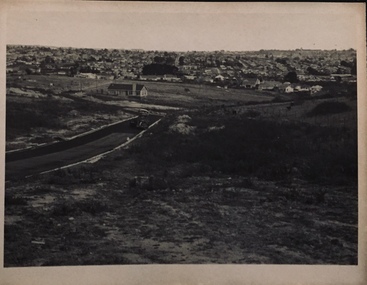
... Urban landscape...Identical but sharper photo than no.44. Photograph Urban landscape ...An item from an outstanding and diverse photographic collection, assembled by members of the Christian and Washfold families of Kew.Black and white photograph looking across a valley to buildings in the distance. Similar locations in nos.41, 42, 43, 44. Road-making in foreground. Identical but sharper photo than no.44.christian-washfold collection, landscape photography, subdivisions -- kew (vic.) -
 Kew Historical Society Inc
Photograph - Urban landscape, 1860
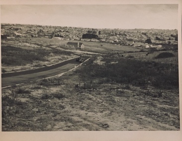
... Urban landscape...Identical but paler photo than no.43. Photograph Urban landscape ...An item from an outstanding and diverse photographic collection, assembled by members of the Christian and Washfold families of Kew.Black and white photograph looking across a valley to buildings in the distance. Similar locations in nos.41, 42, 43, 44. Road-making in foreground. Identical but paler photo than no.43.christian-washfold collection, landscape photography, subdivisions -- kew (vic.) -
 Kew Historical Society Inc
Photograph - Urban landscape, Henry Beater Christian, 1930s
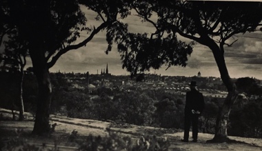
... Urban landscape...He may be standing on the edge of the Yarra Boulevard. Photograph Urban landscape Henry Beater Christian ...Henry Christian (c.1809-91), the grandfather of the photographer, was one of the first settlers in Kew. He arrived in Victoria with his wife Agnes and son Orlando in 1855 on the Gypsy Queen. He established a rope-making business in Bulleen Road by 1858 but was declared insolvent two years later. In his final years, he was celebrated as one of the oldest living settlers of the district. His son, Orlando Henry Beater Christian (c.1853-1930) became a member of the Hawthorn Band and a foundation member of the Willsmere Swimming Club. Orlando and his wife Elizabeth had four children of which Henry Beater Christian (1886-1962) was the eldest.An item from an outstanding and diverse photographic collection, assembled by members of the Christian family of Pakington Street, Kew, comprising professional and amateur photography, depicting individuals, natural and settled environments and the interactions between these worlds. Many of the photographs vividly capture the worlds of three generations of men - Henry Christian, his son Orlando Henry Beater Christian, and his grandson of Henry Christian. The most important photographer was the youngest, Henry Christian, who was a keen explorer, not just of his immediate environment but also of the Victorian wilderness. His major opus is contained in two albums in which he records, sometimes in majestic detail and on other occasions the intimate features of the natural world. His photographic travels during the 1920s, often in solitary ramblings but on other occasions with companions, recall the heroic landscape photography of an earlier era, pioneered by Nicholas Caire. In addition to their aesthetic value, the albums are historically significant records within the State of Victoria, of what is now a distant point in time, and of places that have become radically altered through human intervention.Black and white photo of the rear view of a man in a hat standing under a tree on a hill looking across the Yarra River (unseen) towards Melbourne. The exhibition building and the spires of St Patrick’s Cathedral can be seen on the skyline. The man may be Orlando Henry Beater Christian. If all the spires are intact it must postdate 1939 when work begun in the early 1930s on the spires began. He may be standing on the edge of the Yarra Boulevard.melbourne skyline - 1930s, yarra boulevard -- kew (vic.), christian-washfold collection -
Box Hill Historical Society
Book, Henshall Hansen Associates, Planners and Economists,Green and Dale Associates, Urban Designers and Landscape Architects, Box Hill District Centre Structure Plan - June 1991, 1991
... Henshall Hansen Associates, Planners and Economists,Green and Dale Associates, Urban Designers and Landscape Architects...Landscape Planning Box Hill Central This paper provides ideas for the plans for the Box Hill District Centre for the next decade. During the 1980s the Box Hill District Centre underwent substantial development. A new retail complex (Box Hill Central) combined with a transport interchange (rail/bus services) and a pedestrian mall added greater choice for the shopper as well as convenience and improved access. 292p Box Hill District Centre Structure Plan - June 1991. Book Henshall Hansen Associates, Planners and Economists,Green and Dale Associates, Urban ...This paper provides ideas for the plans for the Box Hill District Centre for the next decade. During the 1980s the Box Hill District Centre underwent substantial development. A new retail complex (Box Hill Central) combined with a transport interchange (rail/bus services) and a pedestrian mall added greater choice for the shopper as well as convenience and improved access.292pThis paper provides ideas for the plans for the Box Hill District Centre for the next decade. During the 1980s the Box Hill District Centre underwent substantial development. A new retail complex (Box Hill Central) combined with a transport interchange (rail/bus services) and a pedestrian mall added greater choice for the shopper as well as convenience and improved access.central business district, land use, car parks, transport, town planning, landscape planning, box hill central -
 Benalla Art Gallery
Painting, Clarice BECKETT, Spring morning, c. 1925
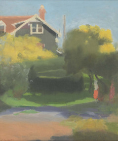
... Urban landscape with view of partial house, trees and figures. ...Tonalism Landscape House Figures Trees Australian art Recto: Signed "C.Beckett" in red paint l.l.c of composition; Not dated; Not titled Urban landscape with view of partial house, trees and figures. ...Born: Casterton, Victoria, Australia 1887; Died: 1935TonalismLedger Gift, 1988Urban landscape with view of partial house, trees and figures. Gold brushed wooden frame.Recto: Signed "C.Beckett" in red paint l.l.c of composition; Not dated; Not titledlandscape, house, figures, trees, australian art -
 Benalla Art Gallery
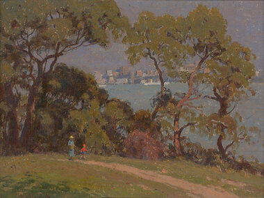
Painting, Percy LINDSAY, The harbour at Athol, Not dated
... Bush and urban landscape with figures, trees and water. Gold brushed and painted timber frame....Impressionism Painting Seascape Landscape Figures Trees Buildings Women Child Recto: Signed "Percy Lindsay" in red oil in l.l.c of composition; Not dated; Not titled Bush and urban landscape with figures, trees and water. Gold brushed and painted timber frame. ...Born: Creswick, Victoria, Australia 1870; Died: North Sydney, New South Wales, Australia 1952ImpressionismGift of Wooleen Pty. Ltd., 1980Bush and urban landscape with figures, trees and water. Gold brushed and painted timber frame.Recto: Signed "Percy Lindsay" in red oil in l.l.c of composition; Not dated; Not titledpainting, seascape, landscape, figures, trees, buildings, women, child -
 Benalla Art Gallery
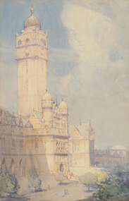
Watercolour, Arthur STREETON, The Imperial Institute, Kensington, London, c. 1900
... Sunny urban landscape with impressive building with large towers facing a street with figures and trees.Thin gold brushed timber frame....Edwardian Watercolour Building Sky Figures Trees Tower Recto: Signed "Arthur Streeton." in brown watercolour in l.l.c of composition; Not dated; Not titled Sunny urban landscape with impressive building with large towers facing a street with figures and trees.Thin gold brushed timber frame. ...Born: Mount Duneed, Victoria, Australia 1867; Lived and workd: England 1897-1919; Died: Olinda, Victoria, Australia 1943EdwardianGift of Mrs E.E. Ledger, 1982Sunny urban landscape with impressive building with large towers facing a street with figures and trees.Thin gold brushed timber frame.Recto: Signed "Arthur Streeton." in brown watercolour in l.l.c of composition; Not dated; Not titledwatercolour, building, sky, figures, trees, tower -
 Nillumbik Shire Council
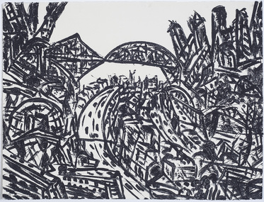
Print (sugarlift etching): Jan SENBERGS (b.1939 Lativia, arrived AUS 1950), Jan Sensbergs, 'New Jersey - rust belt' from the 'Baldessin & Friends' commemorative folio, 2016
... ...urban landscape...From lush landscapes to barren urban spaces, his body of work signifies an artist who has continually experimented with shape, form and motif, a fundamental humanist vision, a finely-honed sense of the absurd, and a rigorous studio practice spanning printmaking, drawing and painting. ...By following the movement of each line the viewer can witness the artist's eye travelling through, over and around each element of the urban landscape. The scale is deceptive with the image bled to the full-size of the sheet of paper like a microcosm of a much bigger whole. print sugarlift etching urban landscape ekphrasis2018 new jersey line rust belt In pencil (handwritten): top centre: left '14/25' (edition); centre 'New Jersey-Rustbelt' (title); right 'Jan Senbergs' (signature); sugar lift etching of an urban (cityscape - New Jersey) scene - bridges, roads, buildings, in thick black brushstrokes. ...Jan Senbergs was born in Riga, Latvia, in 1939 and came to Australia when he was ten. Senbergs’ work has been characterised by a simple and bold aesthetic. From lush landscapes to barren urban spaces, his body of work signifies an artist who has continually experimented with shape, form and motif, a fundamental humanist vision, a finely-honed sense of the absurd, and a rigorous studio practice spanning printmaking, drawing and painting. Senbergs is Baldessin's exact contemporary. He was also born in Europe and fled his homeland because of the war, arriving in Melbourne in 1950. Like George, Senbergs also worked at the RMIT and in 1973 represented Australia at the Bienal de Sao Paulo. Senbergs first met George when he was living in St. Kilda. George asked if he could screen print his 'Argus' catalogue for a show at the gallery in the Argus building. George Baldessin (1939-1978) was born in San Biagio di Callalta, in the Veneto in Northern Italy and arrived in Australia ten years later. A printmaker and sculptor he built his bluestone studio at St Andrews (Nillumbik) in 1971. The bluestone studio was hand built by George, his partner Tess and the three Hails brothers, Rob, Doug and Don. Made of recycled materials the studio today contains all of George’s equipment including the large press, which he modelled himself with the help of Neil Jeffrey (Enjay Presses). George won many prizes throughout his career and is represented in many of Australia's public art collections including his famous 'Pears' sculpture in front of the National Gallery of Australia, Canberra. In 1975 he represented Australia in the Sao Paulo Biennale, before living and working in Paris until his return to St Andrews in 1977. In 1978 George was killed in a car accident aged 39 years. In 2001 Tess returned to St Andrews to reclaim the run-down studio and reconstitute it as The Baldessin Press & Studio - a printmaking retreat. It operates in George’s memory, so that artists may continue to create, perpetuating the generous spirit of George.'New Jersey - rust belt' is one of eight prints in the 'Baldessin & Friends commemorative folio. The folio was conceived by Tess Edwards as a fundraising initiative in celebration of the The Baldessin Press & Studio's fifteen year anniversary, and as a way to honour George Baldessin's memory. The Baldessin Press & Studio is a not-for-profit organisation created in memory of the late George Baldessin (1939-1978), whose original studio is now open to the public for creative use and as a practical legacy to living artists. The Studio is located in St Andrews, Nillumbik. The folio is a unique coming together of seven very different and acclaimed artists who are connected by their friendship to the missing eighth member, George Baldessin. This print finds its' origins in the time Senbergs spent at Harvard in America in 1989-90. In the context of Baldessin it explores an industrial urban surreal vision that was common to both artist. The image captures the life force of the city revealing the keen and observant eye of Jan Senbergs. Similar in sensibility to his large scale charcoal drawings of the 1990s, the artwork is not only a record of what the artist sees, but of what interest him. By following the movement of each line the viewer can witness the artist's eye travelling through, over and around each element of the urban landscape. The scale is deceptive with the image bled to the full-size of the sheet of paper like a microcosm of a much bigger whole. sugar lift etching of an urban (cityscape - New Jersey) scene - bridges, roads, buildings, in thick black brushstrokes. The image is busy; full of energy and movement. A bleed print in which the paper barely contains the city scape. In pencil (handwritten): top centre: left '14/25' (edition); centre 'New Jersey-Rustbelt' (title); right 'Jan Senbergs' (signature); print, sugarlift etching, urban landscape, ekphrasis2018, new jersey, line, rust belt -
 Ringwood and District Historical Society
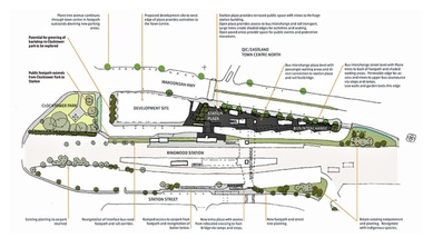
Document, Ringwood Transit City Public Domain and Landscape Guidelines (Railway Precinct, Ringwood, Victoria) 2012
... 4-page Urban Planning/Urban Design/Landscape Architecture guidelines for the design of street furniture, paving treatments and signage elements throughout the railway station precinct....Aurecon & Grimshaw Architects. 4-page Urban Planning/Urban Design/Landscape Architecture guidelines for the design of street furniture, paving treatments and signage elements throughout the railway station precinct. ...4-page Urban Planning/Urban Design/Landscape Architecture guidelines for the design of street furniture, paving treatments and signage elements throughout the railway station precinct.Department of Transport. Aurecon & Grimshaw Architects. -
 Federation University Art Collection
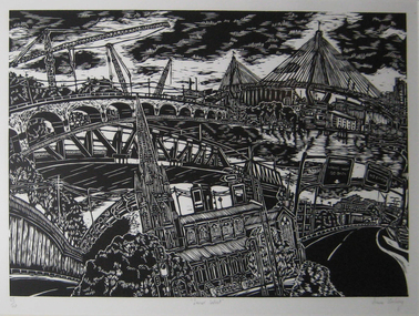
Work on paper - Printmaking - Relief Print, Starling, Anne, 'Innerwest' by Anne Starling, 2003
... Human interaction with the urban and industrial landscape is central to the work of Anne Starling. ...Human interaction with the urban and industrial landscape is central to the work of Anne Starling. ..."In my woodblock print I have focused on the architectrure, streetscape and layout of the city. I am itrigued with teh organisation of cities and in teh creation of my own image. In this work I have almalgamated site drawings of buildings, streets and various structures to create a fish eye viewof the inner west of Sydney. By creating such a cityscape I form an historical document and record of the specific place."Anne STARLING (1967 - ) Born Sydney, New South Wales A graduate of the City Art Institute/UNSW College of Fine Arts, Anne Starling completed a Master of Art in 1994 and Master of Fine Arts by Research in 2012. Human interaction with the urban and industrial landscape is central to the work of Anne Starling. She focuses on the neglect that has occurred due to misuse and exploitation by industrial manufacturers, and the social and ecological structures of areas surrounding of Rhodes in Sydney, Fremantle in Western Australia and Port Kembla in New South Wales.Through relief and drypoint prints she examine changes that occur in this environment, presenting a commentary on the degradation and pollution of land by industry and the surrounding urban landscape. This item is part of the Federation University Art Collection. The Art Collection features over 2000 works and was listed as a 'Ballarat Treasure' in 2007.Framed black and white relief print (woodblock) representing a collage of various Sydney architecture. art, artwork, anne starling, printmaking, woodblock, print council of australia, sydney, architecture, bridge, cityscape -
 City of Ballarat
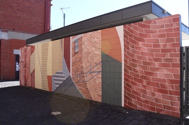
Artwork, other - Public Artwork - Temporary, George Goodnow, Mirror Maze by George Goodnow
... Recent work explores feelings of disorientation, binaries and queerness within suburban and urban landscapes. ...Recent work explores feelings of disorientation, binaries and queerness within suburban and urban landscapes. The artwork is of aesthetic significance to the people of Ballarat painted wall Mirror Maze by George Goodnow Artwork, other Public Artwork - Temporary George Goodnow ...“The artwork speaks to the historical architecture of this area, while exploring the idea of changing understanding of space. Space is bent, bulged and repeated, in this painting, like a mirror maze. In this way, it will inspire playfulness, curiosity and thought, by transforming the way we observe, move through and engage with public space”Artist George Goodnow has installed their artwork on the Annex Wall in Alfred Deakin Place from 30th November 2021 - 1 November 2022. George is a multidisciplinary artist and curator currently living in Naarm (Melbourne). Their work for the Annexe Wall will feature a fictional architectural arrangement of the Police Lane site. George utilises painting (designed through hand-drawn and digital processes) to adjust existing architecture, illuminating how spaces reflect, orientate and hold bodies. Recent work explores feelings of disorientation, binaries and queerness within suburban and urban landscapes. painted wall -
 Narre Warren and District Family History Group
Book, Narre Warren & District Family History Group Inc, Casey Cardinia Collection - Hampton Park Information File
... The date the articles were published, and title of articles are listed below. 10 Jun 2002 ‘Mr Hampton Park dies’ – Arthur Wren obituary 20 Nov 2002 Hampton Park Primary School celebrates 80th anniversary 12 Oct 2002 Golden Occasion for popular pair – Ken & Joy Reedy 20 Oct 2005 Unveiling for the ages – plaque honouring Ken Reedy 09 Apr 2008 Rural survivors in an urban landscape – Peter & Pam Davis 29 Feb 2012 Paul’s in Fine Trim - Paul Vogelaar UNKNOWN Special Couple Celebrates - Ken & Joy Reedy 8 Nov 2007 Fred’s Display a Ray of Sunshine - Fred Mynard...The date the articles were published, and title of articles are listed below. 10 Jun 2002 ‘Mr Hampton Park dies’ – Arthur Wren obituary 20 Nov 2002 Hampton Park Primary School celebrates 80th anniversary 12 Oct 2002 Golden Occasion for popular pair – Ken & Joy Reedy 20 Oct 2005 Unveiling for the ages – plaque honouring Ken Reedy 09 Apr 2008 Rural survivors in an urban landscape – Peter & Pam Davis 29 Feb 2012 Paul’s in Fine Trim - Paul Vogelaar UNKNOWN Special Couple Celebrates - Ken & Joy Reedy 8 Nov 2007 Fred’s Display a Ray of Sunshine - Fred Mynard Casey Cardinia Collection - Hampton Park Information File Book Narre Warren & District Family History Group Inc. ...Folder containing a table of contents and various newspaper clippings and other information pertaining to the Hampton Park area. The date the articles were published, and title of articles are listed below. 10 Jun 2002 ‘Mr Hampton Park dies’ – Arthur Wren obituary 20 Nov 2002 Hampton Park Primary School celebrates 80th anniversary 12 Oct 2002 Golden Occasion for popular pair – Ken & Joy Reedy 20 Oct 2005 Unveiling for the ages – plaque honouring Ken Reedy 09 Apr 2008 Rural survivors in an urban landscape – Peter & Pam Davis 29 Feb 2012 Paul’s in Fine Trim - Paul Vogelaar UNKNOWN Special Couple Celebrates - Ken & Joy Reedy 8 Nov 2007 Fred’s Display a Ray of Sunshine - Fred Mynardnon-fictionhampton park (vic.), arthur wren -
 Broadmeadows Historical Society & Museum
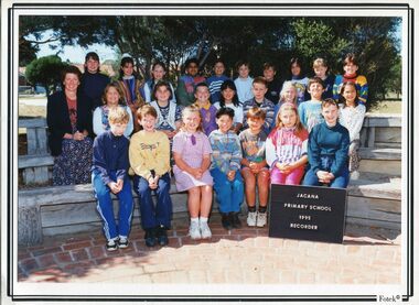
Photograph - Group Photograph, Fotek School Portraits, Jacana Primary School; Recorder Group, 1995, 1995
... Set against the backdrop of a changing urban landscape, the image also provides insight into the social atmosphere of the time, including fashion, hairstyles, and the informal culture of primary education. ...Set against the backdrop of a changing urban landscape, the image also provides insight into the social atmosphere of the time, including fashion, hairstyles, and the informal culture of primary education. ...Jacana Primary School, established in 1959 and closed in 2009, was a key educational institution in Melbourne’s northern suburbs, serving generations of families during a time of significant suburban development and demographic change. By the mid-1990s, the school had become a reflection of the area’s growing cultural diversity and community spirit. Music education played an important role in the school’s curriculum and extracurricular life, with programs like the Recorder Group offering students opportunities to explore creativity, develop discipline, and participate in shared performances. The 1995 Recorder Group photograph captures this aspect of school life, highlighting the value placed on artistic expression and student involvement beyond the classroom. Set against the backdrop of a changing urban landscape, the image also provides insight into the social atmosphere of the time, including fashion, hairstyles, and the informal culture of primary education. As part of Jacana Primary’s visual archive, it contributes to a broader understanding of how public schools supported holistic development and community cohesion during the late 20th century.The 1995 photograph of the Jacana Primary School Recorder Group is a valuable historical and emotional record that reflects the school’s dedication to fostering creativity and student engagement through music education. Captured within a now-closed institution, the image showcases the vibrant spirit, cultural diversity, and nurturing environment that defined Jacana Primary School during the mid-1990s. More than a group portrait, this photograph highlights the importance of extracurricular activities in shaping well-rounded educational experiences and building community among students. It also offers a charming glimpse into the fashion, hairstyles, and social atmosphere of the time, making it a treasured keepsake for former students, staff, and the wider Jacana community. As part of the school’s visual legacy, it preserves the memory of a place that played a formative role in the lives of generations of children.2 x Colour photographs on satin finish paper, 1 x mounted on white card backing, 1 x Laminated.(Front; Bottom right corner): Fotek © (Back Blue Label): Ph-5397 jacana primary school, students, staff, education, 1995, recorder -
 Sunshine and District Historical Society Incorporated
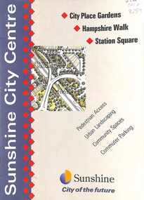
Document - Brimbank City Council Sunshine City Centre Improvement Projects, Brimbank City Council
... Sunshine City Centre Improvement Projects City Place Gardens, Hampshire Walk & Station Square, Pedestrian Access, Urban Landscaping, Community Spaces & Commuter Parking Project 1 - City Place Station Entry Project 2 - City Place Street Beautification Project 3 - Devonshire Road Reconstruction And Outfall Drain Project 4 - DSS Access Road Project 5 - Devonshire Road Streetscaping Project 6 - Withers Street Realignment Project 7 - Withers Street Roundabout Project 8 - Roundabout Hampshire Road & Sun Crescent Project 9 - Station Place Project Project 10 - Withers Street Reconstruction Project 11 & 12 - Commuter (North) Carpark Project 13 & 14 - Commuter (South) Carpark Project 15 - Extension Of Dawson Street Carpark Project 16 & 17 - Hampshire Road Reconstruction And Landscaping...City of Brimbank City of Sunshine Sunshine City Centre Improvement Projects City Place Gardens, Hampshire Walk & Station Square, Pedestrian Access, Urban Landscaping, Community Spaces & Commuter Parking Project 1 - City Place Station Entry Project 2 - City Place Street Beautification Project 3 - Devonshire Road Reconstruction And Outfall Drain Project 4 - DSS Access Road Project 5 - Devonshire Road Streetscaping Project 6 - Withers Street Realignment Project 7 - Withers Street Roundabout Project 8 - Roundabout Hampshire Road & Sun Crescent Project 9 - Station Place Project Project 10 - Withers Street Reconstruction Project 11 & 12 - Commuter (North) Carpark Project 13 & 14 - Commuter (South) Carpark Project 15 - Extension Of Dawson Street Carpark Project 16 & 17 - Hampshire Road Reconstruction And Landscaping Small soft covered information booklet Document Brimbank City Council Sunshine City Centre Improvement Projects Brimbank City Council ...Sunshine City Centre Improvement Projects City Place Gardens, Hampshire Walk & Station Square, Pedestrian Access, Urban Landscaping, Community Spaces & Commuter Parking Project 1 - City Place Station Entry Project 2 - City Place Street Beautification Project 3 - Devonshire Road Reconstruction And Outfall Drain Project 4 - DSS Access Road Project 5 - Devonshire Road Streetscaping Project 6 - Withers Street Realignment Project 7 - Withers Street Roundabout Project 8 - Roundabout Hampshire Road & Sun Crescent Project 9 - Station Place Project Project 10 - Withers Street Reconstruction Project 11 & 12 - Commuter (North) Carpark Project 13 & 14 - Commuter (South) Carpark Project 15 - Extension Of Dawson Street Carpark Project 16 & 17 - Hampshire Road Reconstruction And Landscapingcity of brimbank, city of sunshine -
 Yarra City Council
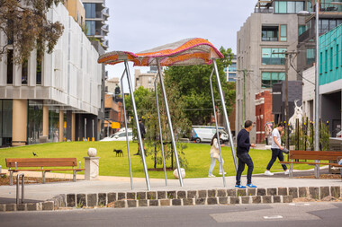
Artwork, other - Installation/Sculpture, William Eicholtz, Close Knit, 2023
... Yarra City Council has invested a further $731,130 towards the project. Urban Imitative Landscape Design worked with artist William Eicholtz at the beginning of the design process to consider the needs of a growing high-density population of the area. ...Yarra City Council has invested a further $731,130 towards the project. Urban Imitative Landscape Design worked with artist William Eicholtz at the beginning of the design process to consider the needs of a growing high-density population of the area. ...'Close Knit' was conceived based around providing the high density accommodation of the area with what many residents will never experience; the iconic ‘Aussie’ backyard, symbolised by washing on a Hills Hoist. This concept was transposed into several elements, including two large flying jumper sculptures. These stainless steel and fibreglass structures are supported on slanted poles, reminiscent of Hills Hoist arms. The jumpers appear to catch the breeze, and billow up, like washing on the clothesline on a sunny day, and cast lovely shadows across the paths and gardens. They are bright and joyful reminders of simple homespun joys. The handcraft theme is also featured in knitted concrete garden walls throughout the gardens. As if the wind is captured in the movement of the Hellenistic drapery, these panels echo the Lady of Justice, an earlier work of mine on the Victorian County Court. These feature walls bring a softness to the park and hark back to classic European garden design. There are 6 finial/balls of wool marking gateways and entrances to the park, as well as a couple randomly scattered throughout to be discovered. There is also a draped plinth at the Peel street entrance which has my signature. Again these elements echo traditional garden design and are a tactile and recognizable link to the hand knit themes of the park. Given the strong themes of domesticity and handcrafts, I have titled my work ‘Close Knit’, as it applies to the purpose of this public space as well as the works scattered throughout. Yarra City Council delivered Cambridge Street Reserve in partnership with the Victorian Government, who have supported the project with $1.3m funding. Yarra City Council has invested a further $731,130 towards the project. Urban Imitative Landscape Design worked with artist William Eicholtz at the beginning of the design process to consider the needs of a growing high-density population of the area. At double the size, with extensive park seating and a large lawn space which is shaded by native trees, Cambridge Street Reserve is now the largest park in Collingwood. 'Close Knit' by William EicholtzTwo knitted fibreglass 'jumpers' over stainless steel framework; six concrete balls of wool throughout the park; 25 metres of cast (drapery) concrete walls; concrete plinth at Peel street entry which is draped with a concrete knit and a ball of wool on top as finial; reverse rope reliefs on the front façade of eastern stairs. Artist name and date 'William Eicholtz 2023' inscribed on plinth with ball of wool on top as finial. handcrafts, domesticity, aussie icons, european garden design, public space, high density accomodation -
 Federation University Art Collection
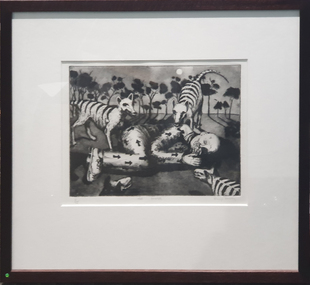
Work on paper, Phillip Davey, The Bolter, 1975
... Philip DAVEY (1949- ) Born Devon, United Kingdom Arrived Australia 1958 The broad artistic practice of Philip Davey incorporates images of urban and natural landscape, as well as figurative narrative works, often inspired by classic Australian texts. ...Philip DAVEY (1949- ) Born Devon, United Kingdom Arrived Australia 1958 The broad artistic practice of Philip Davey incorporates images of urban and natural landscape, as well as figurative narrative works, often inspired by classic Australian texts. ...Philip DAVEY (1949- ) Born Devon, United Kingdom Arrived Australia 1958 The broad artistic practice of Philip Davey incorporates images of urban and natural landscape, as well as figurative narrative works, often inspired by classic Australian texts. He has been artist in residence at several Victorian secondary institutions. Framed etching of a man in convict uniform surrounded by three thylacines.available, thylacene, convict -
 Eltham District Historical Society Inc
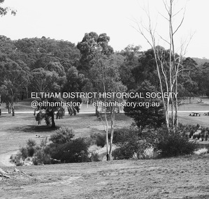
Photograph - Digital Photograph, Alan King, Alistair Knox Park, Eltham, 2008
... landscape. Then, appropriately, the park was named after Knox, who was an Eltham Shire Councillor from 1971 to 1975 and Shire President in 1975. The park designers were four major forces in the urban...landscape. Then, appropriately, the park was named after Knox, who was an Eltham Shire Councillor from 1971 to 1975 and Shire President in 1975. The park designers were four major forces in the urban ...Alistair Knox Park, an oasis of peace and beauty. Covered under National Trust of Australia (Victoria) Landscape Significance and Heritage Overlay, Nillumbik Planning Scheme. Published: Nillumbik Now and Then / Marguerite Marshall 2008; photographs Alan King with Marguerite Marshall.; p173 It is hard to imagine that the Alistair Knox Park, an oasis of peace and beauty beside busy Main Road, Eltham, was once the township’s rubbish dump. It was only in the 1970s that the tip was transformed into this beautiful six hectare space, which later earned it a National Trust Landscape classification. Before its life as a dump, the area was used for small farms. Thanks largely to the foresight and efforts of local environmental builder Alistair Knox, the park was designed sympathetically with the character of the wider Eltham landscape. Then, appropriately, the park was named after Knox, who was an Eltham Shire Councillor from 1971 to 1975 and Shire President in 1975. The park designers were four major forces in the urban bush landscape garden –Knox, landscape designer Gordon Ford, artist Peter Glass and landscaper Ivan Stranger. The National Trust citation for the park, originally called Eltham Town Park, includes the Eltham railway trestle bridge and the Shillinglaw Cottage. The citation states ‘the semi-natural setting of the parkland provides a landscape which is evocative of the history of the area’. Manna Gums (Eucalyptus viminalis) and Candlebarks (Eucalyptus rubida) are significant features. Most of the park’s construction was directed by Bob Grant, Superintendent of the Parks and Gardens Department for the Eltham Shire Council. First plantings occurred in Arbour Week in 1973, then the lake and botanic area were completed in 1975, with Federal Government funding, and the toilet block in 1978. Bounded by the Eltham railway line, Panther Place, Main Road, Bridge and Susan Streets, the park is in a valley about a kilometre wide overlooked by steep hills at the east and west. The Diamond Creek flows through it and the picturesque historic timber trestle railway bridge edges the north. Informal plantings of Australian indigenous and native species in open and undulating grassed settings blend with the natural landscape of the Diamond Creek to the west. The bush-style plants, particularly around the creek, balance with open lawns, paths and a cascade flowing from a small lake to another below. A footbridge over the creek leads to the park’s west. The park includes an adventure playground and barbecue areas. The park stands on part of the land bought from the Crown in 1851 by Josiah Holloway, who subdivided it into allotments and which he called Little Eltham. Most of the land was subdivided into residential lots, but the creek valley, on which the park stands, was subdivided into farm-size lots, used mainly for orchards and grazing. One of the earliest owners was John Hicks Petty, who in 1874 bought a plot from Holloway. Other families who owned properties in that area, included Rees, Clark, Waterfall, Graham, Hill and Morant. In 1901 the railway was built through the area. Jock Read, an Eltham resident since around 1920, remembers several farms in the 1920s and ’30s that occupied the site of today’s park. A poultry farm, which extended from present day Panther Place, was owned by the Gahan family. Next to that farm was another for grazing cattle owned by Jack Carrucan. Beside this was land owned by John Lyon. A doctor lived beside this, and at the north-west corner of Bridge Street and Main Road stood a memorial to the soldiers who died in World War One, which was later moved to the RSL site. Mr Read also remembers other farms and orchards west of the creek In the early 1960s the Eltham Council began buying these farms and in the late 1960s turned the areas east of the Diamond Creek into a garbage tip. When this was filled above the creek’s flood plain, the tip was moved to the west of the creek.This collection of almost 130 photos about places and people within the Shire of Nillumbik, an urban and rural municipality in Melbourne's north, contributes to an understanding of the history of the Shire. Published in 2008 immediately prior to the Black Saturday bushfires of February 7, 2009, it documents sites that were impacted, and in some cases destroyed by the fires. It includes photographs taken especially for the publication, creating a unique time capsule representing the Shire in the early 21st century. It remains the most recent comprehenesive publication devoted to the Shire's history connecting local residents to the past. nillumbik now and then (marshall-king) collection, alistair knox park, eltham -
 Flagstaff Hill Maritime Museum and Village
Theodolite, Troughton & Simms, Mid 19th Century
... Significance: With the rapid urban expansion, one of the most important needs of the new colony was to survey and map the landscape of the Australian Colony’s interior. ...The theodolite was sold by T. Gaunt & Co. of Melbourne, a manufacturer, importer and retailer of a wide variety of goods including jewellery, clocks and watches, navigational and measuring instruments, dinnerware, glassware and ornaments. Thomas Gaunt photograph was included in an album of security identity portraits of members of the Victorian Court, Centennial International Exhibition, Melbourne, 1888. (See further details below.) History for Troughton & Simms: Edward Troughton & William Simms established a scientific instrument making business in London in 1826. Edward Troughton (1756-1835) had previously had his own scientific instrument business, inherited from his father. His achievement's included a transit telescope for Greenwich Observatory (1816) and the precision surveying instruments for the Ordnance Survey of Britain, Ireland and India. William Simms (1793-1860) had trained as a goldsmith and began to gain work dividing circles on fine astronomical instruments. When William Simms died in 1860, the business was taken over by his son James and nephew William. Troughton & Simms shop in Fleet Street became the hub of the finest scientific instrument made in London, in a period in which there was an expanding demand for precision instruments, for astronomy, surveying and precision measurement. They made instruments for Greenwich Observatory, for imperial surveys and exploring expeditions. When fire destroyed the Houses of Parliament in 1834, the firm was commissioned to create new standard lengths, this required 10 years of testing against the remaining old measurements. Troughton and Simms made several of the main instruments for Melbourne Observatory, including an 18 inch azimuth used of the Geodetic Survey, portable transit instrument (circa 1850), zenith sector (1860), a 4.5 inch equatorial telescope (1862), an 8 inch equatorial telescope (1874) spectroscope (1877) and an 8 inch transit instrument in (1884). While the firm had an excellent reputation for quality the company exasperated many of its customers with delays of years in delivering some instruments. History for Thomas Gaunt: Thomas Ambrose Gaunt (1829 – 1890) was a jeweller, clock maker, and manufacturer of scientific instruments, whose head office and showroom were at 337–339 Bourke Street, Melbourne, Victoria, Australia. Thomas Gaunt established Melbourne's leading watchmaking, optical and jewellery business during the second half of the 19th century. Gaunt arrived in Melbourne in 1852, and by 1858 had established his own business at 14 Little Bourke Street. Around 1869 he moved to new premises in Bourke Street on the corner of Royal Arcade, Gaunt's shop quickly became a Melbourne institution. Gaunt proudly advertised that he was 'The only watch manufacturer in the Australian colonies'. While many watches and clocks may have had Gaunt's name on the dial, few would have been made locally. Gaunt did make some watches for exhibitions, and perhaps a few expensive watches for wealthy individuals. Gaunt's received a telegraph signal from Melbourne Observatory each day to correct his main clock and used this signal to rate and repair ship's chronometers and good quality watches. Thomas Gaunt also developed a department that focused on scientific instrumentation, making thermometers and barometers (from imported glass tubes), telescopes, surveying instruments and microscopes. Significance: With the rapid urban expansion, one of the most important needs of the new colony was to survey and map the landscape of the Australian Colony’s interior. Theodolites, such as this one, made by Troughton and Simms, who were significant scientific instrument makers of the 19th century were instrumental to the colony's surveyors and would have played an important part in their everyday work. This transit theodolite remains of national significance due to its pioneering role in Australian science and its association with Australia's earliest surveyors and astronomers. It is also significant for its association with nineteenth-century surveying instruments and instrument makers. Theodolite, Vernier repetition theodolite with enclosed horizontal circle (of about 130 mm diameter). Vertical circle exposed and somewhat corroded (diameter about 115 mm). Plate level 20" per division. Altitude bubble 20" per division. Horizontal and vertical circle intervals 20". Original (blue/grey) paint. Altitude bubble setting screw disabled. Tribrach allows movement of theodolite by 15 mm inside tribrach (for centering).Inscribed on the inner mounting plate,“Specially made in England for T Gaunt & Co Melbourne” and inscribed a little lower “Troughton & Simms London”flagstaff hill, warrnambool, shipwrecked-coast, flagstaff-hill, flagstaff-hill-maritime-museum, maritime-museum, shipwreck-coast, flagstaff-hill-maritime-village, theodolite, t. gaunt & co, troughton & simms, scientific instrument, measuring instrument, surveyor's instrument -
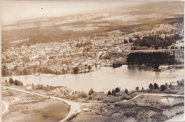 The Beechworth Burke Museum
Photograph, 1960
... urban park with a unique history. It was created in the mid-1800s by the Rocky Mountain Mining company during the gold rush era and used as a mining site until the early 1900s, which brought Europeans into the area. It was turned into a reserve for residents in 1920 and is considered an icon of Beechworth as it represents the development of the community, human endeavour, and the spirit of the landscape....urban park with a unique history. It was created in the mid-1800s by the Rocky Mountain Mining company during the gold rush era and used as a mining site until the early 1900s, which brought Europeans into the area. It was turned into a reserve for residents in 1920 and is considered an icon of Beechworth as it represents the development of the community, human endeavour, and the spirit of the landscape. ...Taken in 1960, depicted is an aerial view of Lake Sambell and the surrounding township. Lake Sambell is a beautiful Victorian recreation lake and urban park with a unique history. It was created in the mid-1800s by the Rocky Mountain Mining company during the gold rush era and used as a mining site until the early 1900s, which brought Europeans into the area. It was turned into a reserve for residents in 1920 and is considered an icon of Beechworth as it represents the development of the community, human endeavour, and the spirit of the landscape.This photograph represents what Lake Sambell looked like in 1960.Black and white reproduced rectangular photograph print on paper.lake sambell, #beechworth, beechworth 1960s, lake, victoria, australian landscape, mining, rocky mountain mining company -
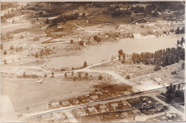 The Beechworth Burke Museum
Photograph, 1960
... urban park with a unique history. It was created in the mid-1800s by the Rocky Mountain Mining company during the gold rush era and used as a mining site until the early 1900s, which brought Europeans into the area. It was turned into a reserve for residents in 1920 and is considered an icon of Beechworth as it represents the development of the community, human endeavour, and the spirit of the landscape....urban park with a unique history. It was created in the mid-1800s by the Rocky Mountain Mining company during the gold rush era and used as a mining site until the early 1900s, which brought Europeans into the area. It was turned into a reserve for residents in 1920 and is considered an icon of Beechworth as it represents the development of the community, human endeavour, and the spirit of the landscape. ...Taken in 1960, depicted is the construction of Lake Sambell, looking west across the lake. Lake Sambell is a beautiful Victorian recreation lake and urban park with a unique history. It was created in the mid-1800s by the Rocky Mountain Mining company during the gold rush era and used as a mining site until the early 1900s, which brought Europeans into the area. It was turned into a reserve for residents in 1920 and is considered an icon of Beechworth as it represents the development of the community, human endeavour, and the spirit of the landscape.This photograph represents additional construction to Lake Sambell as a recreational reserve.Black and white reproduced rectangular photograph print on paper.beechworth lake, lake, lake sambell, construction, #beechworth, australian landscape, beechworth 1960s, victoria -
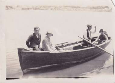 The Beechworth Burke Museum
Photograph, 1920
... urban park with a unique history. It was created in the mid-1800s by the Rocky Mountain Mining company during the gold rush era and used as a mining site until the early 1900s, which brought Europeans into the area. It was turned into a reserve for residents in 1920 and is considered an icon of Beechworth as it represents the development of the community, human endeavour, and the spirit of the landscape....urban park with a unique history. It was created in the mid-1800s by the Rocky Mountain Mining company during the gold rush era and used as a mining site until the early 1900s, which brought Europeans into the area. It was turned into a reserve for residents in 1920 and is considered an icon of Beechworth as it represents the development of the community, human endeavour, and the spirit of the landscape. ...Taken in 1920, depicted are four people in a rowing boat on Lake Sambell, Beechworth. From left to right, it is believed that the names of the people are Eric Beard, Mrs Doris Beard, and S/L to Bert Beard. The last two figures are unknown. Lake Sambell is a beautiful Victorian recreation lake and urban park with a unique history. It was created in the mid-1800s by the Rocky Mountain Mining company during the gold rush era and used as a mining site until the early 1900s, which brought Europeans into the area. It was turned into a reserve for residents in 1920 and is considered an icon of Beechworth as it represents the development of the community, human endeavour, and the spirit of the landscape.This photograph represents the community's social use of the lake in 1920.Black and white rectangular photograph print on paper.Reverse: LAKE SAMBELL/ c 1920/ from LTOR/ 1 ERIC? - BERT'S SON/ 2 MRS DORIS BEARD/ 3 S/L TO BERT BEARD/ 4 #beechworth, lake sambell, lake sambell boating, beechworth lake, social, 1920, victoria -
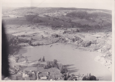 The Beechworth Burke Museum
Photograph, Unknown
... urban park with a unique history. It was created in the mid-1800s by the Rocky Mountain Mining company during the gold rush era and used as a mining site until the early 1900s, which brought Europeans into the area. It was turned into a reserve for residents in 1920 and is considered an icon of Beechworth as it represents the development of the community, human endeavour, and the spirit of the landscape....urban park with a unique history. It was created in the mid-1800s by the Rocky Mountain Mining company during the gold rush era and used as a mining site until the early 1900s, which brought Europeans into the area. It was turned into a reserve for residents in 1920 and is considered an icon of Beechworth as it represents the development of the community, human endeavour, and the spirit of the landscape. ...Aerial view of Lake Sambell, Beechworth with town views. Lake Sambell is a beautiful Victorian recreation lake and urban park with a unique history. It was created in the mid-1800s by the Rocky Mountain Mining company during the gold rush era and used as a mining site until the early 1900s, which brought Europeans into the area. It was turned into a reserve for residents in 1920 and is considered an icon of Beechworth as it represents the development of the community, human endeavour, and the spirit of the landscape.This photograph represents Lake Sambell with town views.Black and white reproduced rectangular photograph print on paper.Reverse: Stampbeechworth lake, lake sambell, aerial photo, construction, australian landscape, #beechworth, victoria -
 The Beechworth Burke Museum
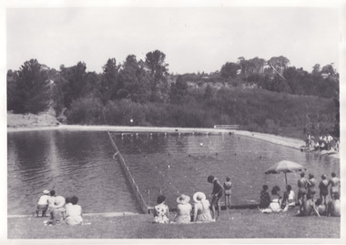
Photograph, 1960s
... urban park with a unique history. It was created in the mid-1800s by the Rocky Mountain Mining company during the gold rush era and used as a mining site until the early 1900s, which brought Europeans into the area. It was turned into a reserve for residents in 1920 and is considered an icon of Beechworth as it represents the development of the community, human endeavour, and the spirit of the landscape. ...urban park with a unique history. It was created in the mid-1800s by the Rocky Mountain Mining company during the gold rush era and used as a mining site until the early 1900s, which brought Europeans into the area. It was turned into a reserve for residents in 1920 and is considered an icon of Beechworth as it represents the development of the community, human endeavour, and the spirit of the landscape. ...Taken in the 1960s, depicted are approximately twenty-nine male and female spectators at a school swimming carnival on Lake Sambell near the caravan park. Lake Sambell is a beautiful Victorian recreation lake and urban park with a unique history. It was created in the mid-1800s by the Rocky Mountain Mining company during the gold rush era and used as a mining site until the early 1900s, which brought Europeans into the area. It was turned into a reserve for residents in 1920 and is considered an icon of Beechworth as it represents the development of the community, human endeavour, and the spirit of the landscape. This photograph represents the post-gold rush era use of Lake Sambell as a recreational reserve. Swimming carnivals were held at the lake and considered a social event for the Beechworth community.Black and white reproduced rectangular photograph print on paper.Reverse: Community/ Swimming pool 1960s/ near the caravan park/ Lakes?lake swimming pool, lake swimming, beechworth carnival processions, carnival, #beechworth, beechworth 1960s, victoria -
 The Beechworth Burke Museum
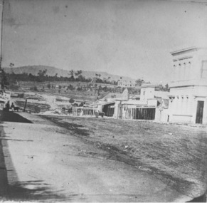
Photograph
... The Flemish gables remain as a dominant form of Beechworth's urban landscape. The Ovens and Murray Hospital for the Aged is of historical significance due to its association with the early development of Beechworth and its dominant siting within the town. ...Taken in Beechworth, this photograph depicts the business of Camp Street looking towards the Ovens and Murray Benevolent Asylum. In the foreground of right hand side; there are row of buildings, on the left hand side; there are a two standing figures. The Ovens Benevolent Asylum (or the Ovens and Murray Hospital for the Aged) was constructed in 1862 on an elevated site overlooking the township of Beechworth. This Asylum was built in response to boom in population due to the discovery of Gold in Beechworth in 1852. This period also saw the development of additional administration buildings such as; the Court house, the Town Hall, and offices. The original Benevolent Asylum building was designed in an unusual Flemish Gothic Revival style. The single storey building is of red brick on a dressed granite base, and the main facade is dominated by four curved, Flemish gable ends, those at the extremities being added to the original central section in 1867. This facade incorporates paired windows of pointed Gothic form and dark brick diaperwork patterning. The adjacent J. A. Wallace Wing of 1899 was designed by Donald Fiddes as a separate building. Also constructed of red brick, Fiddes adopted a conservative approach, designing a simple domestic scale building with central projecting gable porch and flanking bull nosed verandahs. The Benevolent Asylum was renamed the Ovens Benevolent Home in 1935 and The Ovens and Murray Home in 1954. Many buildings have been added to this site, particularly since the 1960s, including a poorly sited addition to the front of the original building. Extensive internal renovations have also been made to the original buildings. [https://vhd.heritagecouncil.vic.gov.au/places/118]The Ovens and Murray Hospital for the Aged is of architectural significance as an unusual example of Flemish influenced design from the 1860s. Although the facade has been partly obscured, it remains intact, and, together with the more simply designed Wallace wing, are important examples of early buildings designed for the specific purpose of aged care. The Flemish gables remain as a dominant form of Beechworth's urban landscape. The Ovens and Murray Hospital for the Aged is of historical significance due to its association with the early development of Beechworth and its dominant siting within the town. It is illustrative of the civic development that took place in the town after the peak of the gold rush, when Beechworth was develpoing as the administrative centre of the north east of Victoria. [https://vhd.heritagecouncil.vic.gov.au/places/118]Black and white rectangular photograph. Image is printed on matte photographic paper. Obverse: BOOT SHOE STORE Reverse: 7770.2 / 1997.3099beechworth, burke museum, diggings, camp street, the benevolent asylum, ovens benevolent hom, gold rush
