
Showing 236 items matching "vista"
-
 Kew Historical Society Inc
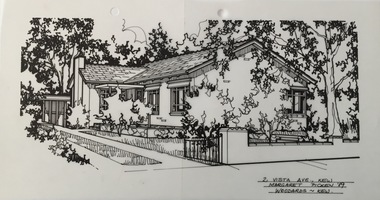
Drawing - Property Illustration, Margaret Picken, 2 Vista Avenue, Kew, 1989
... 2 Vista Avenue, Kew...Pen and ink architectural drawing on drafting film of 2 Vista Avenue, Kew by Margaret Picken....2 VISTA AVE., KEW / MARGARET PICKEN '89 / WOODARDS ~ KEW...The year in which the drawing was created is also a valuable record for house historians, as a number of the properties depicted have either been altered since that date or demolished. artist -- margaret picken 1950- architectural drawings -- houses -- kew (vic.) 2 vista avenue - kew (vic) 2 VISTA AVE., KEW / MARGARET PICKEN '89 / WOODARDS ~ KEW Pen and ink architectural drawing on drafting film of 2 Vista Avenue, Kew by Margaret Picken. 2 Vista Avenue, Kew Drawing Property Illustration Margaret Picken Woodards (Kew) ...After training as a Cartographic Draftsman within the mining industry, I worked as a property illustrator for real estate firms in the eastern suburbs of Melbourne for 22 years from 1983. I initially photographed houses with a Polaroid camera and made a 'thumbnail' sketch while there. The photos were used to scale off a sketch in pencil and then that sketch was overlaid with drafting film and the 'pen and ink' completed. The pens I used were the Rotring ‘Rapidigraph’ drafting pens. The ink was also made by Rotring (German).The film was ‘Rapidraw’, polyester drafting film, double matte. It takes a very fine line and doesn’t bleed. As well as house sketches, there were often floor plans and site plans ordered. Aerial sketches were ordered when the property needed an overall view. (Margaret Picken, 2020)This drawing is one of a series created by Margaret Picken for a number of real estate agents in Melbourne between 1983 and 2005. Each work is signed and dated by the artist.Gift of Margaret Picken, 2020Pen and ink architectural drawing on drafting film of 2 Vista Avenue, Kew by Margaret Picken.2 VISTA AVE., KEW / MARGARET PICKEN '89 / WOODARDS ~ KEWartist -- margaret picken 1950-, architectural drawings -- houses -- kew (vic.), 2 vista avenue - kew (vic) -
 Kew Historical Society Inc
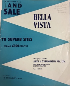
Plan - Subdivision Plan, Bella Vista, Doncaster East
... Bella Vista, Doncaster East ...The Bella Vista Subdivision included 101 lots in Murphy Road, Kerry Close, Keir Avenue, Norman Street, Daphne Street in Doncaster East,...An undated, four-page colour brochure for the sale of the Bella Vista Estate in Doncaster East. The item includes a separate price list of the home sites maintained by the agent. ...The Bella Vista Subdivision included 101 lots in Murphy Road, Kerry Close, Keir Avenue, Norman Street, Daphne Street in Doncaster East, subdivision plans - doncaster east (vic) bella vista subdivision - doncaster east (vic) An undated, four-page colour brochure for the sale of the Bella Vista Estate in Doncaster East. ...The Bella Vista Subdivision included 101 lots in Murphy Road, Kerry Close, Keir Avenue, Norman Street, Daphne Street in Doncaster East,An undated, four-page colour brochure for the sale of the Bella Vista Estate in Doncaster East. The item includes a separate price list of the home sites maintained by the agent. The latter includes the original and the discounted price. subdivision plans - doncaster east (vic), bella vista subdivision - doncaster east (vic) -
 Kew Historical Society Inc
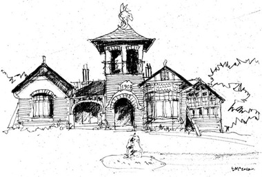
Drawing, Dione McIntyre, 'Bella Vista', Cotham Road, 2014
... 'Bella Vista', Cotham Road...Pen and ink drawing of Bella Vista in Cotham Road, Kew, originally the home of Abel Hoadley....'Bella Vista', Cotham Road Drawing Drawing Dione McIntyre ...The drawing was created by Dione McIntyre to illustrate an article on the house for a Kew Historical Society newsletter in 2014Pen and ink drawing of Bella Vista in Cotham Road, Kew, originally the home of Abel Hoadley.Signature of artist "D.McIntyre" lower rightbella vista - cotham road - kew, abel hoadley -
 Whitehorse Historical Society Inc.
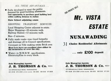
Document, Mt Vista Estate, n.d
... Mt Vista Estate...Brochure (2p) advertising sale of home sites in 'Mt Vista Estate'. Agent J.B. Thomson & Co....mount vista estate nunawading lorikeet street koala avenue dagola avenue land sales Brochure (2p) advertising sale of home sites in 'Mt Vista Estate'. ...Brochure (2p) advertising sale of home sites in 'Mt Vista Estate'.Brochure (2p) advertising sale of home sites in 'Mt Vista Estate'. Agent J.B. Thomson & Co.Brochure (2p) advertising sale of home sites in 'Mt Vista Estate'. mount vista estate, nunawading, lorikeet street, koala avenue, dagola avenue, land sales -
 Mt Dandenong & District Historical Society Inc.
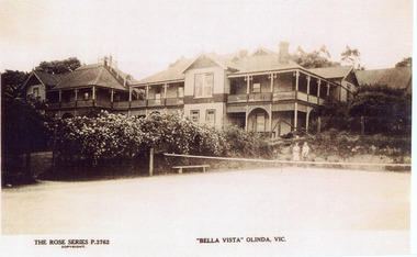
Photograph, "Bella Vista" Olinda, c1940
... "Bella Vista" Olinda...Bella Vista was built by Edmund Boulter in 1903. ...Copy of Rose Series Postcard number 3762 Bella Vista Guest House tennis Boulter Rose Series Copy of Rose Series Postcard #3762 showing Bella Vista Guest House at Olinda. ...Copy of Rose Series Postcard number 3762Copy of Rose Series Postcard #3762 showing Bella Vista Guest House at Olinda. This image is c1940s and shows the tennis court in the foreground. Bella Vista was built by Edmund Boulter in 1903. It comprised two large buildings with a walkway linking the balconies at second storey level. Views of Westernport and Port Phillip Bays could be seen from the rooftop lookout. Bella Vista was reputed to accommodate eighty guests. The Guest House operated until 1956, when it burned down.bella vista, guest house, tennis, boulter, rose series -
 Wangaratta Art Gallery
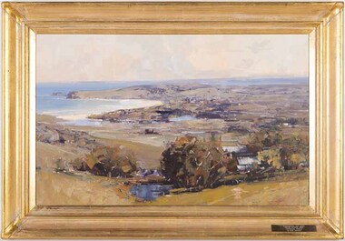
Painting, Ken Knight, Coastal Vista, c. 1992
... Coastal Vista...Obverse: KEN KNIGHT/ (bottom right corner) WANGARATTA ART SHOW/ GRAND WINNER 1992/ 'COASTAL VISTA'/ By KEN KNIGHT/ (plaque mounted on frame)...Coastal Vista Painting Ken Knight ...Knight’s art style is heavily influenced by the Australian Impressionist movement of the late 19th century and he paints his work in outdoor settings, which is known as plein-air painting. Rural City of Wangaratta Collection, Wangaratta Art Prize Grand Winner 1992.An aerial landscape of a costal view painted in oil using a tonal colour palette of browns, blues, greens, oranges, and whites.Obverse: KEN KNIGHT/ (bottom right corner) WANGARATTA ART SHOW/ GRAND WINNER 1992/ 'COASTAL VISTA'/ By KEN KNIGHT/ (plaque mounted on frame)wangaratta art gallery, ken knight, landscape, painting, costal, plein-air, plein air -
 Kew Historical Society Inc
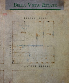
Plan - Subdivision Plan, Bella Vista Estate, 1929
... Bella Vista Estate...Bella Vista (later ‘Malinda’) was a large Federation house designed by the architect Robert Haddon for Abel Hoadley. ...Barnes. subdivision plans - kew bella vista estate Bella Vista (later ‘Malinda’) was a large Federation house designed by the architect Robert Haddon for Abel Hoadley. ...Pru Sanderson, in her groundbreaking ‘City of Kew Urban Conservation Study : Volume 2 - Development History’ (1988), summarised the periods of urban development and subdivisions of land in Kew. The periods that she identified included 1845-1880, 1880-1893, 1893-1921, 1921-1933, 1933-1943, and Post-War Development. These periods were selected as they represented periods of rapid growth or decline in urban development. An obvious starting point for Sanderson’s groupings involved population growth and the associated economic cycles. These cycles also highlighted urban expansion onto land that was predominantly rural, although in other cases it represented the decline and breakup of large estates. A number of the plans in the Kew Historical Society’s collection can also be found in other collections, such as those of the State Library of Victoria and the Boroondara Library Service. A number are however unique to the collection.The Kew Historical Society collection includes almost 100 subdivision plans pertaining to suburbs of the City of Melbourne. Most of these are of Kew, Kew East or Studley Park, although a smaller number are plans of Camberwell, Deepdene, Balwyn and Hawthorn. It is believed that the majority of the plans were gifted to the Society by persons connected with the real estate firm - J. R. Mathers and McMillan, 136 Cotham Road, Kew. The Plans in the collection are rarely in pristine form, being working plans on which the agent would write notes and record lots sold and the prices of these. The subdivision plans are historically significant examples of the growth of urban Melbourne from the beginning of the 20th Century up until the 1980s. A number of the plans are double-sided and often include a photograph on the reverse. A number of the latter are by noted photographers such as J.E. Barnes.Bella Vista (later ‘Malinda’) was a large Federation house designed by the architect Robert Haddon for Abel Hoadley. The house was built in 1902 and occupied the eastern corner of Thomas Street and Cotham Road. It was a single-storey, red brick house, set back from the road, featuring a central tower topped by a pagoda-like red terra cotta roof, on top of which was perched a very large terra cotta dragon. The Bella Vista subdivision of 1929 included Hoadley’s house as well as nine allotments facing Cotham Road and Alfred and Thomas Streets. In 1941, the land on which Hoadley’s house stood was to be further subdivided. Bella Vista is believed to have lasted until it was demolished in the 1980s.subdivision plans - kew, bella vista estate -
 Whitehorse Historical Society Inc.
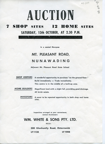
Document, Mt Vista Estate, 1950 ?
... Mt Vista Estate...Brochure advertising auction on 13 October 195? of 'Mt Vista Estate' comprising 7 shop sites and 12 home sites at Mount Pleasant Road, Nunawading. ...of 'Mt Vista Estate' Brochure advertising auction on 13 October 195? ...Brochure advertising auction on 13 October 195? of 'Mt Vista Estate'Brochure advertising auction on 13 October 195? of 'Mt Vista Estate' comprising 7 shop sites and 12 home sites at Mount Pleasant Road, Nunawading. Agent: Wm White & Sons Pty Ltd.Brochure advertising auction on 13 October 195? of 'Mt Vista Estate' mount vista estate, lorikeet street, nunawading, mount pleasant road, eugenia street, land sales -
 Moorabbin Air Museum
Machine - Flightmatic Vista Procedural Flight Simulator
... Flightmatic Vista Procedural Flight Simulator...Description: Flightmatic introduced its Vista series of Ground Trainers or Flight Simulators in 1973 with cockpit layouts to simulate the Cessna 150 or Piper 140 light aircraft. ...Level of Importance: Flightmatic Vista Procedural Flight Simulator Machine Flightmatic Vista Procedural Flight Simulator ...Historical Details: . Description: Flightmatic introduced its Vista series of Ground Trainers or Flight Simulators in 1973 with cockpit layouts to simulate the Cessna 150 or Piper 140 light aircraft. The Simulator included a projector that presents a horizontal display and responds to a. Level of Importance: -
Kew Historical Society Inc
Archive (series) - Subject File, 'Bella Vista', (aka 'Malinda')
... 'Bella Vista', (aka 'Malinda')...'Bella Vista' was a large Federation house built in 1902 which occupied the eastern corner of Thomas Street and Cotham Road. ...Typically files will contain primary and secondary sources. malinda Bella vista Cotham road fr maas Abel hoadley Anthony heinemann 'Bella Vista' was a large Federation house built in 1902 which occupied the eastern corner of Thomas Street and Cotham Road. ...Kew Historical SocietySince its foundation in 1958, members of the Kew Historical Society have been compiling and storing information about subjects relating to the history of Kew and its environs, of which this file is an example.Secondary values'Bella Vista' was a large Federation house built in 1902 which occupied the eastern corner of Thomas Street and Cotham Road. The house was built for Abel Hoadley who died in 1918. In 1937 Augustus Beker opened the property as a guest house named 'Malinda' Guest House. This closed in 1940. In 1941, the land was subdivided into four lots. During the 1940s, Fr. Maas opened a hostel for Dutch Catholic immigrants in the house. The house has now been demolished. The subject file contains an auction notice for the sale of Malinda in 1941 along with correspondence from 2016 detailing background information, a timeline of the demolition of th those, the name of the original owner, and other uses of the house's name.malinda, bella vista, cotham road, fr maas, abel hoadley, anthony heinemannmalinda, bella vista, cotham road, fr maas, abel hoadley, anthony heinemann -
Ringwood and District Historical Society
Document, Property Research Notes - The History of 18 Vista Avenue, Ringwood East, Victoria
... Property Research Notes - The History of 18 Vista Avenue, Ringwood East, Victoria...The History Of 18 Vista Avenue, Ringwood East The Land The current block located at 18 Vista Avenue was originally part of an 80 acre block granted to R Blood on 12 March 1872. ...The History Of 18 Vista Avenue, Ringwood East The Land The current block located at 18 Vista Avenue was originally part of an 80 acre block granted to R Blood on 12 March 1872. ...Single A4 page summary of the house and land prepared for real estate purposes by un-named author, undated, circa 1990s.The History Of 18 Vista Avenue, Ringwood East The Land The current block located at 18 Vista Avenue was originally part of an 80 acre block granted to R Blood on 12 March 1872. A Wallace Bruce subsequently sold off a portion of this land and on it the Davies family erected the house "Reaghill" shortly after 1909. A 35 acre parcel of this original block was subdivided into 22 lots in June 1955. The subdivision consisted of 15 lots from 1½ and 2½ acres and seven smaller blocks of about ½ acre fronting Bedford Road. The 18 Vista Avenue block, then just over 2 acres was purchased by Mr Campbell Boyd, a local pharmacist, in 1956. The purchase price was £1000. Mr Boyd became sick not long after acquiring the land and offered the property, then a bush block, to Dr Arthur G Stephens. Dr Stephens purchased the block for £2,500 in 1959. The block was not immediately built on. Dr and Mrs Stephens said they were not able to afford a new building on the Vista Avenue block at the time, so relocated their house from 302 Maroondah Highway, near the current site of the Maroondah City Council, to the current location on the block. The garden design was created by Gloria Parker from Park Orchards and included a variety of roses and unusual species of plants. The House The house which was built in 1959, was successfully moved in two pieces in 1972, from Maroondah Highway, under the railway crossing at Ringwood East and up Scenic Avenue. The route through the railway crossing on Dublin Road required the removal of the top four feet of roof from the building so it would fit under the overhead wires. The building was cut along the entrance hall and when put together the join was barely perceptible. The saw cuts on each side of the house when rejoined, were said to have matched exactly. There were originally two brick fireplaces in the house, one in the lounge (an Adams design) and the second in the library. The library fireplace was not reconstructed after the house was relocated. The bricks and bluestone slabs, which form a substantial part of the structure of the formal garden around the house, were salvaged from the demolition of the Burnt Bridge Hotel. Dr Stephens bought 32 truckloads of uncleaned bricks from the demolition contractor for $1 per load. Presumably the demolition contractor had already been paid to demolish, remove and dump the building rubble by the developer of the Burnt Bridge shopping centre and now was able to on-sell the bricks without the cost of disposal. These bricks make up the first three feet of the brick wall which encompasses the secret garden. This wall originally marked the start of a terraced area which extended back to the Vista Avenue road frontage. The large bluestone slabs making up most of the steps in the garden were the door steps on the old hotel and the large square roughmade bricks were originally the foundation stones for the stumps of the Burnt Bridge building. The terraced area and land to the south of the tennis court (the current 16A to 16E Vista Avenue) was sold off to Bovis Homes after the nine year covenant expried on the land. -
Phillip Island and District Historical Society Inc.
Book, LEEMING, Maisie, Moments of significance, 2007
... ...Vista Publications...maisie leeming embroidery australia To the Phillip Island Historical Society from Maisie Leeming Moments of significance Book LEEMING, Maisie Vista Publications ...To the Phillip Island Historical Society from Maisie Leemingmaisie, leeming, embroidery, australia -
 Robin Boyd Foundation
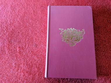
Book, Cyril Ray, The Compleat Imbiber, 1963
... ...Vista Books...Walsh St library From Mandie Christmas 1963 on front page Hardcover The Compleat Imbiber Book Cyril Ray Vista Books ...HardcoverFrom Mandie Christmas 1963 on front pagewalsh st library -
 Returned Nurses RSL Sub-branch
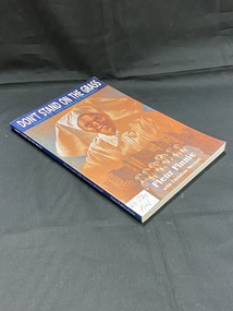
Book - Paperback book, Vista, Don't stand on the grass: memoirs of early nursing in Melbourne, 1996
... Vista...Don't stand on the grass: memoirs of early nursing in Melbourne Book Paperback book Vista Fleur Finnie ...This autobiography tells of the author's childhood in the 1920s and describes her subsequent work as a nurse at various hospitals in Melbourne, including the Austin and the Queen Victoria Memorial. Includes references and a bibliography. [Trove]Blue paperback book with the title printed in white across the top of the front cover and along spine. The remainder of the cover is covered by a blue and brown illustration of a nurse in white uniform, overlaid along the bottom is a drawing of 8 nurses in blue and white uniforms standing in front of a row of buildings. There is a white spine label sticker in the bottom left corner of the front cover.non-fictionThis autobiography tells of the author's childhood in the 1920s and describes her subsequent work as a nurse at various hospitals in Melbourne, including the Austin and the Queen Victoria Memorial. Includes references and a bibliography. [Trove]fleur finnie, nursing-australia-melbourne, nursing history-melbourne -
 Eltham District Historical Society Inc
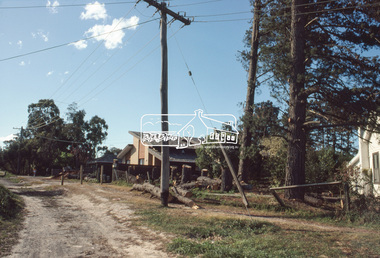
Slide, Looking towards 99 Buena Vista Drive, Montmorency, c.Oct. 1980
... Looking towards 99 Buena Vista Drive, Montmorency...They provide perspective of the changes in housing styles and road development that began sweeping in from the mid 1970s with increasing urbanisation of what was once more outlying suburbs and regions. houses infrastructure mccarthy grove montmorency roads Processed Oct 1980 35 mm colour positive transparency Mount - Kodak Kodachrome Card Looking towards 99 Buena Vista Drive, Montmorency Slide Slide ...One of a series of images of roads and infrastructure taken by Eltham Shire Council Planning and Engineering officers. They provide perspective of the changes in housing styles and road development that began sweeping in from the mid 1970s with increasing urbanisation of what was once more outlying suburbs and regions.35 mm colour positive transparency Mount - Kodak Kodachrome CardProcessed Oct 1980houses, infrastructure, mccarthy grove, montmorency, roads -
 Eltham District Historical Society Inc
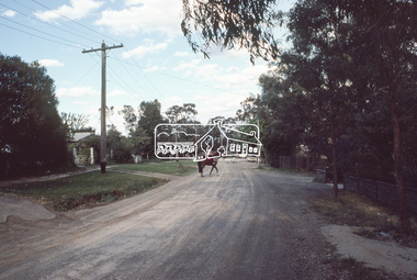
Slide, Looking east along Buena Vista Drive, Montmorency near no. 69, c.Oct. 1980
... Looking east along Buena Vista Drive, Montmorency near no. 69...They provide perspective of the changes in housing styles and road development that began sweeping in from the mid 1970s with increasing urbanisation of what was once more outlying suburbs and regions. Buena Vista Drive Horse Infrastructure Montmorency Roads Processed Oct 1980 35 mm colour positive transparency Mount - Kodak Kodachrome Card Looking east along Buena Vista Drive, Montmorency near no. 69 Slide Slide ...One of a series of images of roads and infrastructure focussed on the Quinn Estate in Montmorency taken by Eltham Shire Council Planning and Engineering officers. They provide perspective of the changes in housing styles and road development that began sweeping in from the mid 1970s with increasing urbanisation of what was once more outlying suburbs and regions.35 mm colour positive transparency Mount - Kodak Kodachrome CardProcessed Oct 1980buena vista drive, horse, infrastructure, montmorency, roads -
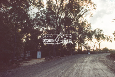 Eltham District Historical Society Inc
Slide, Quinn Estate, Buena Vista Drive, Montmorency near school looking northwest, c.Oct. 1980
... Quinn Estate, Buena Vista Drive, Montmorency near school looking northwest...They provide perspective of the changes in housing styles and road development that began sweeping in from the mid 1970s with increasing urbanisation of what was once more outlying suburbs and regions. housing estate infrastructure montmorency quinn estate roads Processed Oct 1980 35 mm colour positive transparency Mount - Kodak Kodachrome Card Quinn Estate, Buena Vista Drive, Montmorency near school looking northwest Slide Slide ...One of a series of images of roads and infrastructure focussed on the Quinn Estate in Montmorency taken by Eltham Shire Council Planning and Engineering officers. They provide perspective of the changes in housing styles and road development that began sweeping in from the mid 1970s with increasing urbanisation of what was once more outlying suburbs and regions.35 mm colour positive transparency Mount - Kodak Kodachrome CardProcessed Oct 1980housing estate, infrastructure, montmorency, quinn estate, roads -
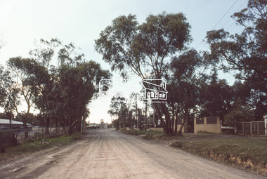 Eltham District Historical Society Inc
Slide, Looking north along Buena Vista Drive near Montmorency South Primary School, c.Oct. 1980
... Looking north along Buena Vista Drive near Montmorency South Primary School...They provide perspective of the changes in housing styles and road development that began sweeping in from the mid 1970s with increasing urbanisation of what was once more outlying suburbs and regions. Buena Vista Drive Infrastructure Montmorency Montmorency South Primary School Roads Processed Oct 1980 35 mm colour positive transparency Mount - Kodak Kodachrome Card Looking north along Buena Vista Drive near Montmorency South Primary School Slide Slide ...One of a series of images of roads and infrastructure focussed on the Quinn Estate in Montmorency taken by Eltham Shire Council Planning and Engineering officers. They provide perspective of the changes in housing styles and road development that began sweeping in from the mid 1970s with increasing urbanisation of what was once more outlying suburbs and regions.35 mm colour positive transparency Mount - Kodak Kodachrome CardProcessed Oct 1980buena vista drive, infrastructure, montmorency, montmorency south primary school, roads -
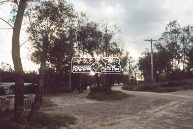 Eltham District Historical Society Inc
Slide, Quinn Estate, Buena Vista Drive, Montmorency near school looking northwest, c.Oct. 1980
... Quinn Estate, Buena Vista Drive, Montmorency near school looking northwest...Housing estate Infrastructure Montmorency Quinn Estate Roads Processed Oct 1980 35 mm colour positive transparency Mount - Kodak Kodachrome Card Quinn Estate, Buena Vista Drive, Montmorency near school looking northwest Slide Slide ...One of a series of images of roads and infrastructure focussed on the Quinn Estate in Montmorency taken by Eltham Shire Council Planning and Engineering officers. They provide perspective of the changes in housing styles and road development that began sweeping in from the mid 1970s with increasing urbanisation of what was once more outlying suburbs and regions.35 mm colour positive transparency Mount - Kodak Kodachrome CardProcessed Oct 1980housing estate, infrastructure, montmorency, quinn estate, roads -
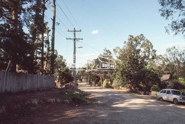 Eltham District Historical Society Inc
Slide, Reichelt Avenue/Buena Vista Drive closure towards Bolton Street, c.Oct. 1980
... Reichelt Avenue/Buena Vista Drive closure towards Bolton Street...They provide perspective of the changes in housing styles and road development that began sweeping in from the mid 1970s with increasing urbanisation of what was once more outlying suburbs and regions. Buena Vista Drive Infrastructure Montmorency Reichelt Avenue Roads Processed Oct 1980 35 mm colour positive transparency Mount - Kodak Kodachrome Card Reichelt Avenue/Buena Vista Drive closure towards Bolton Street Slide Slide ...One of a series of images of roads and infrastructure focussed on the Quinn Estate in Montmorency taken by Eltham Shire Council Planning and Engineering officers. They provide perspective of the changes in housing styles and road development that began sweeping in from the mid 1970s with increasing urbanisation of what was once more outlying suburbs and regions.35 mm colour positive transparency Mount - Kodak Kodachrome CardProcessed Oct 1980buena vista drive, infrastructure, montmorency, reichelt avenue, roads -
 Eltham District Historical Society Inc
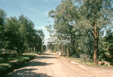
Slide, Quinn Estate, Buena Vista Drive, Montmorency, 15 Sep. 1982
... Quinn Estate, Buena Vista Drive, Montmorency...They provide perspective of the changes in housing styles and road development that began sweeping in from the mid 1970s with increasing urbanisation of what was once more outlying suburbs and regions. housing estate infrastructure montmorency quinn estate roads private street scheme Buena Vista Drive Processed 15 Sep1980 35 mm colour positive transparency (1 of15) Mount - Kodak Kodachrome Card Quinn Estate, Buena Vista Drive, Montmorency Slide Slide ...One of a series of images of roads and infrastructure taken by Eltham Shire Council Planning and Engineering officers of the Quinn Estate in Montmorency, Stage 1, Private Street Scheme during construction, September 1982. They provide perspective of the changes in housing styles and road development that began sweeping in from the mid 1970s with increasing urbanisation of what was once more outlying suburbs and regions.35 mm colour positive transparency (1 of15) Mount - Kodak Kodachrome CardProcessed 15 Sep1980housing estate, infrastructure, montmorency, quinn estate, roads, private street scheme, buena vista drive -
 Eltham District Historical Society Inc
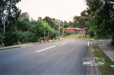
Photograph, Looking north along Looker Road at intersection with Buena Vista Drive, Montmorency
... Looking north along Looker Road at intersection with Buena Vista Drive, Montmorency...Buena Vista Drive Looker Road Montmorency streets Fuji 100 Roll of 35mm colour negative film, 4 strips Looking north along Looker Road at intersection with Buena Vista Drive, Montmorency Photograph ...Roll of 35mm colour negative film, 4 stripsFuji 100buena vista drive, looker road, montmorency, streets -
 Horsham Regional Art Gallery
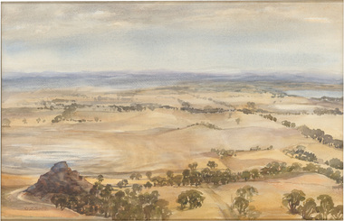
Painting, Gwendda SMITH, Drought - vista from Arapiles, 1983
... Drought - vista from Arapiles...watercolour on paper Drought - vista from Arapiles Painting Gwendda SMITH ...Gift of Judy Sheldon, 1998watercolour on paper -
Moorabbin Air Museum
Manual (item) - includes F206 and 207 operation and maintenance manual, VISTA flight trainer
... VISTA flight trainer...VISTA flight trainer Manual includes F206 and 207 operation and maintenance manual ... -
Moorabbin Air Museum
Manual - Flight trainers & simulators, Operation & Maintenance Manual VISTA series flight trainers
... Operation & Maintenance Manual VISTA series flight trainers ...Flight Trainers & Simulators General description Installation Operation Maintenance Parts list Overview of physical, electrical & performance characteristics of type F206/207 flight trainers, circa 1974 4 ring binder Operation & Maintenance Manual VISTA series flight trainers Manual Flight trainers & simulators ...Overview of physical, electrical & performance characteristics of type F206/207 flight trainers, circa 19744 ring bindernon-fictionOverview of physical, electrical & performance characteristics of type F206/207 flight trainers, circa 1974general description, installation, operation, maintenance, parts list -
 City of Greater Geelong
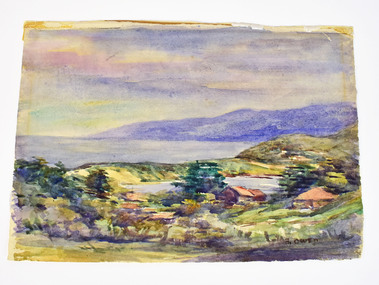
Watercolour, Mrs F Owen, Aireys Inlet Vista
... Aireys Inlet Vista...Hilly coastal view with ocean and hills in the background Aireys Inlet Vista Watercolour Mrs F Owen ...Hilly coastal view with ocean and hills in the background -
Tatura Irrigation & Wartime Camps Museum
Book, Looking To The River, 1991
... Written to celebrate the centenary of Rio Vista, home of W B Chaffey, now a Museum....Green and pink cover, sketch looking out through front door of Rio Vista, Mildura, when fountain was there....Written to celebrate the centenary of Rio Vista, home of W B Chaffey, now a Museum. chaffey families Rio Vista Mildura Victoria W B Chaffey Mildura Museum Green and pink cover, sketch looking out through front door of Rio Vista, Mildura, when fountain was there. ...Written to celebrate the centenary of Rio Vista, home of W B Chaffey, now a Museum.Green and pink cover, sketch looking out through front door of Rio Vista, Mildura, when fountain was there.chaffey families, rio vista mildura victoria, w b chaffey, mildura museum -
Ringwood and District Historical Society
Document, Property Research Notes - Reaghill, Ringwood East, Victoria
... Six-pages of historic notes tracing the property "Reaghill", originally located at 139 Bedford Road, Ringwood East, before being subdivided with frontage to Vista Avenue, Ringwood East....It is the story of those 60 acres, which now comprise Vista Avenue, Vista Court, Homebush Court, Rawson Court and Wombalano Park, which is the subject of these notes....It is the story of those 60 acres, which now comprise Vista Avenue, Vista Court, Homebush Court, Rawson Court and Wombalano Park, which is the subject of these notes. ...Six-pages of historic notes tracing the property "Reaghill", originally located at 139 Bedford Road, Ringwood East, before being subdivided with frontage to Vista Avenue, Ringwood East.The purpose of these notes is to trace the origins of the property from the year 1900 to the present day. Information in the notes is sourced from the archives of Carter Real Estate, from Land Titles Office records, and from the book of the history of Ringwood - "Ringwood, Place of Many Eagles" by Hugh Anderson. "Reaghill" is part of an older larger holding of sixty acres. It is the story of those 60 acres, which now comprise Vista Avenue, Vista Court, Homebush Court, Rawson Court and Wombalano Park, which is the subject of these notes. -
 Kew Historical Society Inc
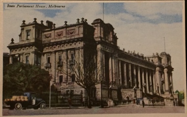
Postcard, Novelty Card Co, State Parliament House, Melbourne
... "Melbourne Vistas" Series...The postcards are part of a larger collection of photographs, postcards and publications donated to the collection in May 2021. parliament house -- melbourne postcards -- melbourne christian-washfold collection "Melbourne Vistas" Series Coloured matte postcard with oblique view of Parliament House looking south. ...One of a number of 'real photo' and commercial postcards created by or owned by members of the Christian and Washfold families of Kew. The postcards are part of a larger collection of photographs, postcards and publications donated to the collection in May 2021.Coloured matte postcard with oblique view of Parliament House looking south."Melbourne Vistas" Seriesparliament house -- melbourne, postcards -- melbourne, christian-washfold collection -
 Ringwood and District Historical Society
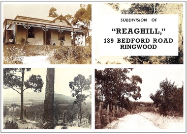
Archive, Richard Carter Collection - REAGHILL Subdivision Research (Parent Record)
... "Reaghill" is part of an older larger holding of sixty acres which came to comprise Vista Avenue, Vista Court, Homebush Court, Rawson Court and Wombalano Park...The first eleven lots came off Vista Avenue and formed an extension of Vista Avenue and a newly created Vista Court. ...The first eleven lots came off Vista Avenue and formed an extension of Vista Avenue and a newly created Vista Court. ...This record is the Parent Record for researching the subdivision of Reaghill, 139 Bedford Road, Ringwood, compiled by Richard Carter. "Reaghill" is part of an older larger holding of sixty acres which came to comprise Vista Avenue, Vista Court, Homebush Court, Rawson Court and Wombalano ParkTranscript: Researching “Reaghill" The property “Reaghill” originally stood at 139 Bedford Road, Ringwood East before the property was subdivided in the 1950s and took a new address and frontage to Vista Avenue, Ringwood East. The purpose of these notes is to trace the origins of the property from the year 1900 to the present day. Information in the notes is sourced from the archives of Carter Real Estate, from Land Titles Office records and from the book of the history of Ringwood, “Ringwood, Place of Many Eagles” by Hugh Anderson. “Reaghill” is part of an older larger holding of sixty acres. It Is the story of those 60 acres, which now comprise Vista Avenue, Vista Court, Homebush Court, Rawson Court and Wombalano Park, which Is the subject of these notes. Earlier Times A convenient starting point for these notes Is the year 1900. On 11th June 1900 Wallace Bruce of 68 High Street, Windsor became registered as the proprietor of “sixty acres or thereabouts” (24.28 hectares) being part of Crown Allotment 43 Parish of Ringwood County of Mornington. That title. Volume 2773 Folio 485 did not name the streets to which the property abutted but clearly they were Canterbury Road at its intersection with Bedford Road. Title records a lease of the property from Wallace Bruce to Thomas Oates, with the lease endorsed on title on 22 July 1903 and removed 16 June 1908. Wallace Bruce subsequently subdivided the land Into three parcels, two of which he sold to Dora Stanisforth Davies during 1909 and the balance he sold to Frank Leslie Walker in 1914. The Era of the Davies Wallace Bruce firstly sold the western portion of the property, containing twenty four acres three roods and 20 perches (24.875 acres or 10.0667 hectares) on 6 October 1909. The new title, Volume 3381 Folio 021, records the new proprietor as “Dora Stanisforth Davies, wife of Seymour George Pilkington Davies of Burwood Road, Hawthorn, Bank Manager”. Shortly thereafter, Wallace Bruce sold a further parcel of “ten acres or thereabouts” (4 hectares) being the north eastern portion of his original holding. That title, Volume 3384 Folio 795, showed the purchaser once again as “Dora Stanisforth Davies, wife of Seymour George Pilkington Davies of Burwood Road Hawthorn, Bank Manager”. It is noteable that the second, title which is dated 8 December 1909, had no abuttal to any road, nor was it at any time (even when subdivided in the 1950s) consolidated with Davies' adjoining title. Both titles then recorded that Dora Stanisforth Davies died on 19 February 1945 with probate of her will being granted to John Seymour Davies of 69 Grantham Street West Brunswick, Medical Practitioner, and Hugh Percival Hall of 339 Collins Street Melbourne, Solicitor. Almost two years later, on 6th December 1946, both parcels of land were transferred by the Executors to Geoffrey Francis Seymour Davies of 20 Albert Road Strathfield N.S.W, Medical Practitioner. From this chronology it could be surmised that one of Dora Davies’ executors, John Seymour Davies, was probably her son. Was Geoffrey Francis Seymour Davies another son, or was he her grandson? In any event Geoffrey Francis Seymour Davies set about subdividing what was then the property “Reaghill” and its 34.875 acres (14.11 hectares). The Subdivision of “Reaghill The subdivision of “Reaghill” was made more viable by the subdivision in 1931 of the property to the north and the creation of Scenic Avenue, Vista Avenue and Grandview Avenue, all of which abutted “Reaghill’s” northern boundary. In fact Geoffrey Francis Seymour Davies bought the freehold to Grandview Avenue, Scenic Avenue and Vista Avenue in July 1955 for £84-9-0 to give him legal rights over those roads. Title to those roads and the newly created Vista Avenue, Vista Court and Homebush Court remain in his name to this day. It is particularly interesting to note that whilst those streets had typical allotments of about 1000 square metres, the subdivision of Reaghill was into blocks of one to two acres or more (4000 square metres to about one hectare) except for the blocks fronting Bedford Road. That speaks volumes about Davies’ attitude to the land, its natural beauty, its topography and vegetation. “Reaghill” was subdivided into twenty two lots by Plan of Subdivision LP 41463. The first eleven lots came off Vista Avenue and formed an extension of Vista Avenue and a newly created Vista Court. Lot sizes ranged from 1 acre 1 rood 1½ perches (5097 square metres) to 2 acres 3 roods 21½ perches (1.167 hectares). A further four lots came off Homebush Court, a newly created court off Bedford Road. Those lots ranged from 1 acre 1 rood 29 perches (5792 square metres) to 2 acres 1 rood 39 ®/io perches (1.01 hectares). Seven further lots, parallelogram in configuration, fronted Bedford Road and had a typical area of 1518 square metres. The names of the streets (“Vista” Avenue/Court and “Homebush” Court) give an insight into the elevation of the land, the views it offered and the bushland it featured. The Covenant As evidence of Davies’ desire to maintain the bush setting of the property, covenants were imposed on the transfers of Lots 1 to 15 (the acreage lots). That covenant allowed for only one dwelling house to be erected on each of those lots for a period of 15 years from sale. Effectively it froze subdivision for 15 years. But 15 years came around quickly. The Sales “Reaghill” 139 Bedford Road, Ringwood was offered for Private Sale as “22 Excellent Residential Allotments” by estate agents Anderson & Hickling of 239 Collins Street Melbourne (telephone Central 25!), with a “protective covenant” of one dwelling house only on lots 1-15 for a period of 15 years. Solicitors for the vendor were Messrs Meares, Duigan & Hall of 139 Collins Street Melbourne. Sales commenced in 1955 and went through to 1967. Prices were typically from £1350, the price paid for Lot 13 in 1957. The Role of Frank Leslie Walker These notes have so far recorded that of the sixty acres originally owned by Wallace Bruce in 1900, some 34.875 acres were sold to Dora Davies in 1909 and subdivided and sold by her descendants. The balance of Wallace Bruce’s land was sold on 6th April 1914 to Frank Leslie Walker. This is the land at the south east corner of Bruce’s holding fronting Canterbury Road and which now comprises Rawson Court and Wombalano Park. Frank Leslie Walker “of Albany Chambers, Collins Street Melbourne” was described as an Art Decorator. In “Ringwood - Place of Many Eagles” he is shown as living on his land “in a house which was surrounded by a four foot high brick wall and the long drive of rough cream-coloured Lilydale gravel was entered through handsome wrought iron gates obtained from some building wrecker”. The “old rambling house" had been extended and renovated using secondhand doors, windows and timber. “Every inch of wall space seemed to be crammed from floor to ceiling with oils, watercolours, etchings and drawings of all sorts by well known artists”. On 13th August 1954 Frank Leslie Walker transferred an area of 12 acres 3 rood 21 perches (5.213 hectares) to The Mayor Councillors and Burgesses of the Borough of Ringwood for no consideration as a Gift “for the providing of pleasure grounds on places of public resort or public recreation”. That is now Wombalano Park. The balance of his property, containing 6 acres 1 rood 5 perches (2.54 hectares) and including the original homestead (named Wombalano?) was gifted by Frank Leslie Walker to his nephew on 25 November 1955. It was later subdivided as Rawson Court in 1956. The house no longer survives. The “Reaghill” Homestead The original homestead on Wallace Bruce’s holding, as has just been described fronted Canterbury Road in the area which is now Rawson Court. The age of the house is unknown but is described in 1914 as being “old and rambling”. The “Reaghill” homestead is likely to have been built by the Davies and was retained on Lot 11 of their subdivision. Its date of construction is not known but might have been soon after the Davies bought the land in 1909. Lot 11, with “Reaghill” was not sold in the 1950s as part of the land subdivision and sale. It remained as the family home of Dr. Davies until its sale in 1968 (without the 15 year covenant) to James Hamilton Kelly of New York, USA for $15,000. In time, Lot 11 was resubdivided. The house today remains on a reduced site of 7112 square metres, still on the highest point in the locality with fine views. Further Subdivisions Once the 15 year time frame of the covenant expired, the various owners of the lots, having built homes, proceeded to subdivide their surplus land. Lot 1 was first, followed by Lot 7. Only four of the original 15 acreage lots have not been subdivided. Some subdivisions were less respectful of their environment and neighbourhood than others. Maroondah City Council's planning scheme provides for a minimum lot size of 864 square metres in the locality. But the horse has already bolted. Summary “Reaghill” in its heyday, and the acreage properties which later surrounded it, contributed some of the finest and most exclusive properties in Ringwood East. Notably, the locality was home to a significant number of local medicos over the years. Its location dose to the newly relocated Tintern CEGGS gave it added exclusivity. Subdivision over the years has impinged on the beauty and the environment. However it is still a most important part of Ringwood East, with a rich history. R.A Carter January 2005
