
Showing 44 items matching "wheat silos"
-
 Sunshine and District Historical Society Incorporated
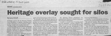
Article - Sunshine Wheat Silos Wright Street Sunshine
... Sunshine Wheat Silos Wright Street Sunshine...Sunshine Wheat Silos...Collection of documents relating to the Sunshine Wheat Silos Wright St Sunshine...Sunshine Wheat Silos Wright Street Sunshine Newspaper Article Star Weekly 12 July 2022 Heritage overlay sought of silos Collection of documents relating to the Sunshine Wheat Silos Wright St Sunshine Article Sunshine Wheat Silos Wright Street Sunshine ...Newspaper Article Star Weekly 12 July 2022 Heritage overlay sought of silossunshine wheat silos, wright street, sunshine -
 Sunbury Family History and Heritage Society Inc.
Photograph
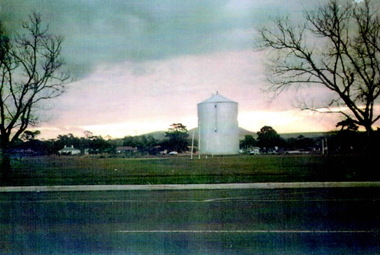
... Wheat silos...For a few years a wheat silo was erected on railway land on the west side of the Sunbury line. ...A scanned coloured photograph of a wheat silo erected in an open area with some cottages and a bare hillside visible in the background. ...For a few years a wheat silo was erected on railway land on the west side of the Sunbury line. ...For a few years a wheat silo was erected on railway land on the west side of the Sunbury line. The photograph was taken in Evans Street looking across to Horne Street and the hill in the distance is Mount Holden. Just beyond the two elm trees was the former sports ground, that was used before the Clarke Oval was built. Local farmers used the silo to store their grain before it was transported to other destinations either by rail or road. The silo was dismantled in the 1980s to make way for commercial development on the site. Cereal growing was one of the agricultural pursuits practised in the area around Sunbury until the land was sold and developed for housing. A scanned coloured photograph of a wheat silo erected in an open area with some cottages and a bare hillside visible in the background. Two bare elm trees are in the foreground.wheat silos, sunbury railway line, horne street, evans street -
 Sunbury Family History and Heritage Society Inc.
Photograph, Wheat silo
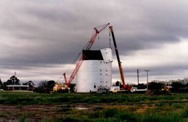
... Wheat silo....Wheat storage...Silos...The wheat silo was erected on railway land on the west side of the railway line at Sunbury from approx 1970s - 1980s. ...A non-digital photograph of two trucks and a crane dismantling a metal wheat silo, which has been standing in an open area. ...A CFA pavilion is visible in the distance. Wheat silo. Photograph ...The wheat silo was erected on railway land on the west side of the railway line at Sunbury from approx 1970s - 1980s. It served as a grain storage provision for the local cereal farmers. With the expansion of the shopping centre the silo was dismantled to provide commercial development on the west side of the railway line.The wheat silo is a reminder of past agricultural industries that were carried out in Sunbury.A non-digital photograph of two trucks and a crane dismantling a metal wheat silo, which has been standing in an open area. A CFA pavilion is visible in the distance.wheat storage, silos, sunbury railway station, evans street -
 Hume City Civic Collection
Photograph, 1/01/1971
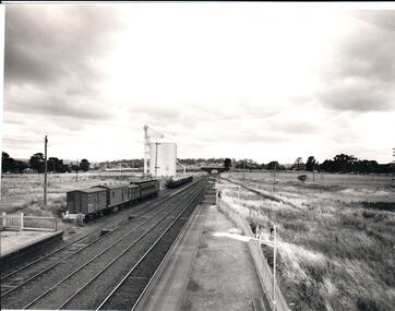
... ...wheat silos...Four rail carriages and eight goods trucks are on a railway siding near a wheat silo. There is open land on either side of the rail tracks....Four rail carriages and eight goods trucks are on a railway siding near a wheat silo. There is open land on either side of the rail tracks. ...The photograph was taken when railway land on either side of the tracks was used for recreational purposes and agricultural related activities. The local sports ground is on the RHS of the photograph and was used to stage a number of the town's events.A black and white photograph of a section of the two railway platforms and three sets of rail tracks with a stone bridge in the distance. Four rail carriages and eight goods trucks are on a railway siding near a wheat silo. There is open land on either side of the rail tracks.sunbury railway station, wheat silos, railways, macedon street rail bridge., george evans collection -
 Bendigo Historical Society Inc.
Slide - Mouat Crawford Collection: Farming Life in the Wimmera, 1960s
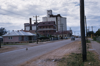
... ...wheat...silo...Wheat Silos at Horsham...BHS Collection farming wimmera wheat silo horsham mouat crawford collection Wheat Silos at Horsham Slide Mouat Crawford Collection: Farming Life in the Wimmera ...BHS CollectionWheat Silos at Horshamfarming, wimmera, wheat, silo, horsham, mouat crawford collection -
 Sunshine and District Historical Society Incorporated
Article - Sunshine Is No Longer A Dark Place, The Age, 14th October 2025
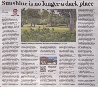
... ...Wheat Silos...Sunshine Parsons reserve Grand United Cricket Club Wheat Silos Derrimut Hotel Sunshine Is No Longer A Dark Place The Age newspaper article 14th October 2025 Page 3, written by Lee Crossley, depicting his personal story of living in Sunshine in 2025. ...Article in The Age Newspaper written by Lee Crossley, depicting his personal story of living in Sunshine in 2025.Sunshine Is No Longer A Dark Placesunshine, parsons reserve, grand united cricket club, wheat silos, derrimut hotel -
 Stawell Historical Society Inc
Photograph, Silos at Marnoo
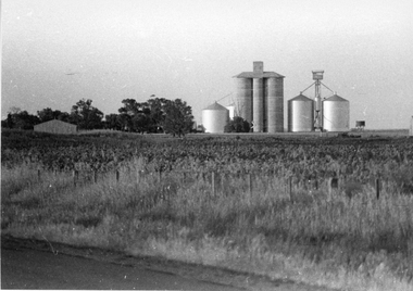
... Rural Scene - Wheat silos at Marnoo...Rural Scene - Wheat silos at Marnoo stawell Black and white photograph of a rural scene. main feature a group of silos. ...Rural Scene - Wheat silos at MarnooBlack and white photograph of a rural scene. main feature a group of silos.stawell -
 Greensborough Historical Society
Article - Newspaper Clipping (copy), Heidelberg Leader, Historical homestead uncovered, 09/07/2002
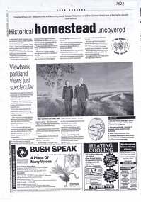
... Articles on discovery of the site of Viewbank homestead; wheat silos next to Banyule Road, and Viewbank parklands...Articles on discovery of the site of Viewbank homestead; wheat silos next to Banyule Road, and Viewbank parklands viewbank banyule road viewbank silos viewbank homestead Two photocopied pages of newspaper articles Historical homestead uncovered Article Newspaper Clipping (copy) Heidelberg Leader ...Articles on discovery of the site of Viewbank homestead; wheat silos next to Banyule Road, and Viewbank parklandsTwo photocopied pages of newspaper articlesviewbank, banyule road viewbank, silos, viewbank homestead -
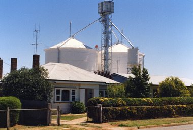 Charlton Golden Grains Museum Inc
Photograph, Storage Silos Charlton Victoria 3525
... ...Wheat Storage Silos...Basil & Esme Avery Wheat Storage Silos Storage Silos Charlton Victoria 3525 Photograph ...basil & esme avery, wheat storage silos -
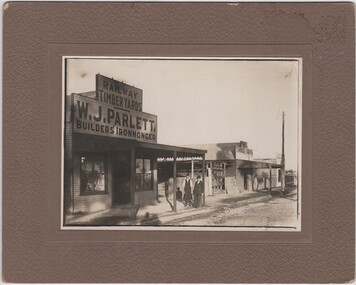 Rutherglen Historical Society
Photograph - Image, 1920 (Approximate)
... Parlett's store was situated in Audley Street opposite the wheat silos. Ada Parlett, W. T. Parlett's neice is a concert pianist...Parlett's store was situated in Audley Street opposite the wheat silos. Ada Parlett, W. T. Parlett's neice is a concert pianist parletts store w j parlett bob ready audley street brown plains road On reverse of mount: "Brown Plains Road / Rutherglen" Photograph of Parlett's Store, Rutherglen with Mr W.J. ...Parlett's store was situated in Audley Street opposite the wheat silos. Ada Parlett, W. T. Parlett's neice is a concert pianistPhotograph of Parlett's Store, Rutherglen with Mr W.J. Parlett and Mr Bob Ready standing outside store, black and white, mounted on a thick beige card.On reverse of mount: "Brown Plains Road / Rutherglen"parletts store, w j parlett, bob ready, audley street, brown plains road -
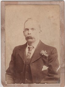 Rutherglen Historical Society
Image, c1900
... Parlett's store was situated in Audley Street opposite the wheat silos. Ada Parlett, W. J. Parlett's niece is a concert pianist....Parlett's store was situated in Audley Street opposite the wheat silos. Ada Parlett, W. J. Parlett's niece is a concert pianist. parlett family william james parlett On verso: "William James Parlett. ...Parletts owned and operated a timber yard near the railway station in the late 1800s to early 1900s. Parlett's store was situated in Audley Street opposite the wheat silos. Ada Parlett, W. J. Parlett's niece is a concert pianist.Black and white portrait photograph, mounted on cardboard, of William James ParlettOn verso: "William James Parlett. Rutherglen"parlett family, william james parlett -
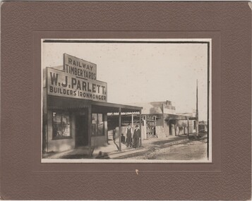 Rutherglen Historical Society
Image, c1920
... Parlett's store was situated in Audley Street opposite the wheat silos. Ada Parlett, W. J. Parlett's niece is a concert pianist....Parlett's store was situated in Audley Street opposite the wheat silos. Ada Parlett, W. J. Parlett's niece is a concert pianist. parlett parletts store w j parlett audley street bob ready william james parlett On verso: "Elderly man = W J (Bill) Parlett, Rutherglen - a prosperous man. ...Parletts owned and operated a timber yard near the railway station in the late 1800s to early 1900s. Parlett's store was situated in Audley Street opposite the wheat silos. Ada Parlett, W. J. Parlett's niece is a concert pianist.Photograph of Parlett's Store, Rutherglen with Mr W.J. Parlett and Mr Bob Ready standing outside store, black and white, mounted on thick beige card.On verso: "Elderly man = W J (Bill) Parlett, Rutherglen - a prosperous man. Father of Florie who also worked in her father's timber business and understood timber measurements. Florie remained single and died in Rutherglen."parlett, parletts store, w j parlett, audley street, bob ready, william james parlett -
 Dookie Historical Society
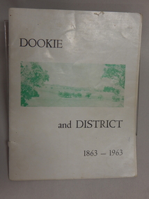
Soft Cover Dookie District History Book - Width 18.5cm x Height 24cm Consist of 33 pages (not numbered), The General Committee Organising the Dookie Back To, Dookie and District 1863 - 1963, Easter 1963 "WATERWHEEL PRESS,"
... Back Cover - An aerial view of Dookie as it is today, showing the Grain Elevators Board wheat silos under construction (lower right foreground). ...Back Cover - An aerial view of Dookie as it is today, showing the Grain Elevators Board wheat silos under construction (lower right foreground). ...Soft Cover Historical Book - White Background with 2 green and white soft aerial photographs of prominent landmarks at Dookie. Front Cover - Mount Major on the left and Saddleback on the right. Back Cover - An aerial view of Dookie as it is today, showing the Grain Elevators Board wheat silos under construction (lower right foreground). -
 Ballarat Tramway Museum
Negative - SECV Ballarat operations the last day - set of 9, Robert Green, 19/9/1971
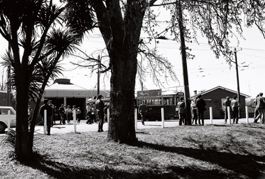
... Set of 9 photographs by Robert Green 19/9/1971, showing the tramcar operations of the SECV system on the last day of SECV Operations in Ballarat. 1 - General scene at depot on last day of operations 2 - Bogie tram running out from depot - across Lake View 3 -Tram 42 in Wendouree Parade is running a Special near the depot 4 - ditto 5 -Tram 34 ditto through the trees 6 -Tram 34 ditto 7 -Tram 34 ditto 8 -Tram 34 ditto 9 -Tram 34 ditto with the wheat silos in the background ...Set of 9 photographs by Robert Green 19/9/1971, showing the tramcar operations of the SECV system on the last day of SECV Operations in Ballarat. 1 - General scene at depot on last day of operations 2 - Bogie tram running out from depot - across Lake View 3 -Tram 42 in Wendouree Parade is running a Special near the depot 4 - ditto 5 -Tram 34 ditto through the trees 6 -Tram 34 ditto 7 -Tram 34 ditto 8 -Tram 34 ditto 9 -Tram 34 ditto with the wheat silos in the background Yields information about the SECV Ballarat tramways last day of operations on 19/9/1971. ...Set of 9 photographs by Robert Green 19/9/1971, showing the tramcar operations of the SECV system on the last day of SECV Operations in Ballarat. 1 - General scene at depot on last day of operations 2 - Bogie tram running out from depot - across Lake View 3 -Tram 42 in Wendouree Parade is running a Special near the depot 4 - ditto 5 -Tram 34 ditto through the trees 6 -Tram 34 ditto 7 -Tram 34 ditto 8 -Tram 34 ditto 9 -Tram 34 ditto with the wheat silos in the background Yields information about the SECV Ballarat tramways last day of operations on 19/9/1971.35mm negative in a film strip - set of 9tramways, wendouree parade, tram 34, sturt st, tram 42, depot, last day, closure -
 Ballarat Tramway Museum
Magazine, Association of Railway Enthusiasts (ARE), "Australian Railway Enthusiast - Vol 9, No. 4, December 1971", Dec. 1971
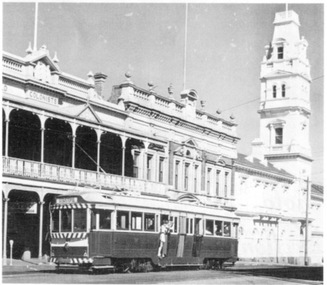
... Ballarat Photos 1 - 40 in Lydiard St. 2 - Bogie car in Wendouree Parade from the wheat silos 3 - Intersection of Sturt and Lydiard Street from the Town Hall 4 - Tram at City Centre with Boer War (?) ...Ballarat Photos 1 - 40 in Lydiard St. 2 - Bogie car in Wendouree Parade from the wheat silos 3 - Intersection of Sturt and Lydiard Street from the Town Hall 4 - Tram at City Centre with Boer War (?) ...Copy of the Australian Railway Enthusiast - Vol 9, No. 4, December 1971, which contains seven photographs of the closure of the Ballarat Tramway System on 19/9/1971 by Greg Triplett. Item 579 refers for centre page photograph. Magazine has articles on the Beech Forest Narrow Gauge, The Atjeh Tram (Indonesia), cable cars preserved in Melbourne and a derailment at Yering Vic. in 1900. Ballarat Photos 1 - 40 in Lydiard St. 2 - Bogie car in Wendouree Parade from the wheat silos 3 - Intersection of Sturt and Lydiard Street from the Town Hall 4 - Tram at City Centre with Boer War (?) statue in front of the tram - night photo 5 - 35 at Sebastopol Terminus - night photo 6 - 42 at the Lydiard Street terminus - night photo 7 - 40 leaving Sebastopol as the last tram - night photo (see item 579) Second copy added 31-8-2017. Second copy has a "Technical Book & Mag. Co." yellow label on the front cover.trams, tramways, ballarat, closure, lydiard st, sturt st, sebastopol -
 Glenelg Shire Council Cultural Collection
Postcard - Postcard - Portland Harbour, n.d
... 'The Harbour, showing bulk grain silo and wheat store', black print, bottom border PORTLAND HARBOUR - ROSE SERIES COLORVIEW NO. 1643...'The Harbour, showing bulk grain silo and wheat store', black print, bottom border PORTLAND HARBOUR - ROSE SERIES COLORVIEW NO. 1643 Postcard Postcard - Portland Harbour ...Coloured postcard, Portland Harbour, boats at swing moorings in foreground, marina, KS Anderson bulk grain silos. 'The Harbour, showing bulk grain silo and wheat store', black print, bottom border PORTLAND HARBOUR - ROSE SERIES COLORVIEW NO. 1643Back: Maker's details and logo PORTLAND HARBOUR - ROSE SERIES COLORVIEW NO. 1643postcard, portland, k s anderson -
 Wycheproof & District Historical Society Inc.
Railway Booklet, Steaming Up Broadway, 31/10/2010
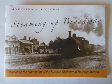
... Chapters include: The Early Days, The Arrival of Rail, The New Century, Bulk Wheat and Million Bushell Silos, Railway Families and Workers, The Last Chapter , A new Era Begins. ...Chapters include: The Early Days, The Arrival of Rail, The New Century, Bulk Wheat and Million Bushell Silos, Railway Families and Workers, The Last Chapter , A new Era Begins. ...Celebrating 125 years of Railway in WycheproofThe 28-09-1883 was a memorable date for Wycheproof for on that day the long-awaited official opening of the railway took place. It has been serving the district since then. In this booklet individual rail workers are acknowledged in a listing.Booklet of 14 pages - size A5. Sepia front cover photo depicts steam train hauling rail trucks up Broadway, Wycheproof, with early buildings and horse- drawn carriages showing. Back cover: Wycheproof Railway Station in its early beginnings - undated. Booklet celebrates the renovation of the historic Wycheproof Railway Station and 125 Years of Rail in Wycheproof. Chapters include: The Early Days, The Arrival of Rail, The New Century, Bulk Wheat and Million Bushell Silos, Railway Families and Workers, The Last Chapter , A new Era Begins. rail-wycheproof, bulk-wheat, railway-workers, station-renovation, steam-train -
 Sunshine and District Historical Society Incorporated
Photograph - Aerial Photographs Of Melbourne Metropolitan Area 1989, Qascophoto, 17th November 1989 & 28th November 1989
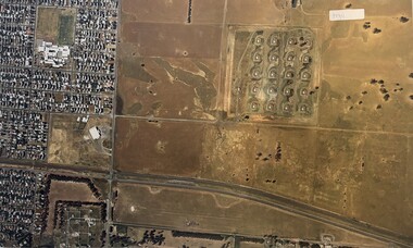
... Little Boundary Road (West) Points of Interest: Jones Road and Old Geelong Road Quarries, Brooklyn Go Kart Track, Sims Metal Foundry, Ralphs, Guiding Star Hotel, Gas & Fuel Substation 953.13 - Aerial Photographs Of Melbourne Metropolitan Area 1989.JPG Suburb(s): Sunshine, Sunshine West Area bounded by: Parsons Street (North), South of Fourth Avenue (South), Alfred Street (East), West of Kororoit Creek (West) Points of Interest: Parsons Reserve, Wheat Silos, H.V. McKay Trade Wing, Tottenham Hotel, Sunshine Carvan Park 953.14 - Aerial Photographs Of Melbourne Metropolitan Area 1989.JPG Suburb(s): Derrimut, Mt. ...Little Boundary Road (West) Points of Interest: Jones Road and Old Geelong Road Quarries, Brooklyn Go Kart Track, Sims Metal Foundry, Ralphs, Guiding Star Hotel, Gas & Fuel Substation 953.13 - Aerial Photographs Of Melbourne Metropolitan Area 1989.JPG Suburb(s): Sunshine, Sunshine West Area bounded by: Parsons Street (North), South of Fourth Avenue (South), Alfred Street (East), West of Kororoit Creek (West) Points of Interest: Parsons Reserve, Wheat Silos, H.V. McKay Trade Wing, Tottenham Hotel, Sunshine Carvan Park 953.14 - Aerial Photographs Of Melbourne Metropolitan Area 1989.JPG Suburb(s): Derrimut, Mt. ...953.01 - Aerial Photographs Of Melbourne Metropolitan Area 1989.JPG Suburb(s): Ardeer, Deer Park (Now Derrimut), Sunshine West Area bounded by: Railway Parade (North), Paramount Bouvard (South), Allison Street (East), Approx Station Road (West) Points of Interest: IVI Explosive Bunkers, Railway Siding into ICI off Forrest Street, Former Railway Station Tilburn Road, Sunshine Technical School Annex, Croatian Catholic Centre Sunshine Fitzgerald Road 953.02 - Aerial Photographs Of Melbourne Metropolitan Area 1989.JPG Suburb(s): Brooklyn, Yarraville Area bounded by: South of Somerville Road (North), Westgate Freeway (South), Urwin Street (East). West of McDonald Road (West) Points of Interest: State Electricity Commission of Victoria (SECV) Stores, Brooklyn Wool Stores, Brooklyn Primary School, Half Moon Caravan Park, Footscray Cemetery, Rheems, James Hardy 953.03 - Aerial Photographs Of Melbourne Metropolitan Area 1989.JPG Suburb(s): Ascot Vale, Maribyrnong Area bounded by: Raleigh Road (North), River Street and James Street (South), Holdsworth Street (East), West of Van Ness Avenue (West) Points of Interest: Highpoint City, Fairbairn Park, Hume Pipes, Riverside Golf Course, ICI Laboratories 953.04 - Aerial Photographs Of Melbourne Metropolitan Area 1989.JPG Suburb(s): Albion, Ardeer, Sunshine, Sunshine West Area bounded by: Dubbo Street (North), South of Glengala Road (South), West of Sydney Street (East), Vernon Crescent (West) Points of Interest: Ainsworth Reserve, Selwyn Park, St. Paul Church, Marian College, Ardeer Primary School, Glengala Road Shopping Centre, 953.05 - Aerial Photographs Of Melbourne Metropolitan Area 1989.JPG Suburb(s): Deer Park Area bounded by: Station Road (East), Marcellin Court (West), Irvine Street (North), Deer Street (South) Points of Interest: Deer Park Primary School, Deer Park Play Kindergaten, Deer Park Shopping Centre, St. Peter Chanel Church & School 953.06 - Aerial Photographs Of Melbourne Metropolitan Area 1989.JPG Suburb(s): Derrimut Area bounded by: Future Ring Road (North), South of Boundary Road (South), East of Andersons Swamp (East), West of Fitzgerald Road (West) Points of Interest: Andersons Swamp 953.07 - Aerial Photographs Of Melbourne Metropolitan Area 1989.JPG Suburb(s): Sunshine West Area bounded by: East of Fairbairn Road (East), East of Fitzgerald Road (West), North of Mailey Street (North), South of Talintyre Road (South) Points of Interest: Sunshine West High School, Sunshine Heights Primary School, Castley Reserve, Talintyre Reserve, Talintyre Road Shops, St. Peters School, Sunshine Golf Course, Ralph Reserve, Glengala Primary School 953.08 - Aerial Photographs Of Melbourne Metropolitan Area 1989.JPG Suburb(s): Derrimut, Ravenhall Area bounded by: East of Station Road, now Derrimut Road (East), West of Robinsons Road (West), South of Railway Line (North), North of Future Deer Park Bypass Points of Interest: Old Farms and Quarries 953.09 - Aerial Photographs Of Melbourne Metropolitan Area 1989.JPG Suburb(s): Sydenham, Taylors Lakes, Taylors Hill Area bounded by: Taylors Creek (North), Future Hume Drive (South), West of Future Parmelia Drive (East), Future Hawthorn Grove (West) Points of Interest: Sydenham Reservoir, Sydenham Railway Station, Sydenham Memorial Hall, Sydenham Primary School, Sydenham Recreation Reserve, Catholic Regional College Sydenham, Kingdom Hall of Jehovah's Witnesses 953.10 - Aerial Photographs Of Melbourne Metropolitan Area 1989.JPG Suburb(s): Brooklyn, Tottenham Area bounded by: Stony Creek (North), South of Somerville Road (South), Holmwood Road (East), West of McDonald Road (West) Points of Interest: Monsanto, Dalgety's, Wool Stores, Sims Metals, Farmer & Graziers, Olex Cables, Redbrook Carpets, May & Baker, Cargil Oil, Smorgans 953.11 - Aerial Photographs Of Melbourne Metropolitan Area 1989.JPG Suburb(s): Brooklyn Area bounded by: South of Fourth Avenue (North), South of Bunting Road (South), West of McDonald Road, East of Fitzgerald Road (West) Points of Interest: Market Road, Bunting & Jones Road Quarries, Monsanto, ANI, Market Timber 953.12 - Aerial Photographs Of Melbourne Metropolitan Area 1989.JPG Suburb(s): Brooklyn, Laverton North Area bounded by: South of Bunting Road (North), Buchanan Road (South), Cypress Avenue (East). Little Boundary Road (West) Points of Interest: Jones Road and Old Geelong Road Quarries, Brooklyn Go Kart Track, Sims Metal Foundry, Ralphs, Guiding Star Hotel, Gas & Fuel Substation 953.13 - Aerial Photographs Of Melbourne Metropolitan Area 1989.JPG Suburb(s): Sunshine, Sunshine West Area bounded by: Parsons Street (North), South of Fourth Avenue (South), Alfred Street (East), West of Kororoit Creek (West) Points of Interest: Parsons Reserve, Wheat Silos, H.V. McKay Trade Wing, Tottenham Hotel, Sunshine Carvan Park 953.14 - Aerial Photographs Of Melbourne Metropolitan Area 1989.JPG Suburb(s): Derrimut, Mt. Derrimut, Sunshine West, Area bounded by: East of Allison Street (East), Mt. Derrimut (West), Hilma Street (North), South of old Sunshine Golf Course (South) Points of Interest: Mt. Derrimut, Sunshine Golf Course 953.15 - Aerial Photographs Of Melbourne Metropolitan Area 1989.jpeg Suburb(s): Avondale Height, Braybrook, Sunshine North Area bounded by: Canning Street (North), North of Cranwell Street (South), Medway Golf Course (East), Nottingham Street (West) Points of Interest: Duke Street Quarries, Cranwell Park, Pennell Reserve 953.16 - Aerial Photographs Of Melbourne Metropolitan Area 1989.jpeg Suburb(s): All of City of Sunshine Area bounded by: Maribyrnong River (North), Westgate Freeway (South), Nicholson Street (East), Robinsons Road (West) Points of Interest: General overall of the City of Sunshine 953.17 - Aerial Photographs Of Melbourne Metropolitan Area 1989.jpeg Map is missing 953.18 - Aerial Photographs Of Melbourne Metropolitan Area 1989.jpeg Suburb(s): Braybrook, Maidstone, Sunshine Area bounded by: Ballarat Road (North), North of South Road (South), East of Ashley Street (East), West of Duke Street (West) Points of Interest: Skinner Reserve, Kinder Smith Reserve, Churchill Avenue Shops, St. John College, Industrial Engineering, Invita Carpets, Tottenham Technical School, Carolone Chisholm College, Christ The King Primary School, Sunshine East Primary School, Dyecraft 953.19 - Aerial Photographs Of Melbourne Metropolitan Area 1989.JPG Suburb(s): Laverton North, Sunshine West Area bounded by: North of Boundary Road (North), Sewer Out Fall (South), East of Little Boundary Road (East), East of Future Ring Road (West). Points of Interest: Factories in Laverton Northmelbourne, aerial photograph -
Marysville & District Historical Society
THE TRIANGLE NEWS-VOL 4 NO 42-DECEMBER 20 1979
... silo committee...red cross...walpeup primary school concert...church wheat...marysville victoria australia revue 1979 success letter to editor welders warning school & kinder photos narbethong mothers' club walpy news community care centre thanks carols by candlelight church transport wanted situation vacant swimming lessons fire brigade marysville golf club summer workshop buxton found glasses greetings brownies guides cubs & scouts swimming pool nye special crossways new owners lost watch maroondah county pumpernickel wirrianda stud for sale wanted marysville hotel nye supper dance narbethong hotel cricket wirreanda tshirts marysville hotel revue wirrianda appaloosa stallion happy hour 12 12 1979 host silo committee red cross walpeup primary school concert church wheat t.t.c. & t.c.c. cabaret fire roster donations exchange or buy donation mothers' club ladies' guild ladies' social club THE TRIANGLE NEWS-VOL 4 NO 42-DECEMBER 20 1979 ...marysville, victoria, australia, revue 1979 success, letter to editor, welders warning, school & kinder photos, narbethong mothers' club, walpy news, community care centre, thanks, carols by candlelight, church, transport wanted, situation vacant, swimming lessons, fire brigade, marysville golf club, summer workshop buxton, found glasses, greetings, brownies guides cubs & scouts, swimming pool, nye special, crossways new owners, lost watch, maroondah county, pumpernickel, wirrianda stud, for sale, wanted, marysville hotel, nye supper dance, narbethong hotel, cricket, wirreanda tshirts, marysville hotel revue, wirrianda appaloosa stallion, happy hour 12 12 1979 host, silo committee, red cross, walpeup primary school concert, church wheat, t.t.c. & t.c.c. cabaret, fire roster, donations, exchange or buy, donation mothers' club, ladies' guild, ladies' social club -
Glenelg Shire Council Cultural Collection
Photograph - Photograph - wharf construction, Portland, n.d
... Port of Portland Authority Archieves Port of Portland Archives construction wheat storage Black & white photo showing wharf construction. Large crane on left 2 workmen on right, constructing formwork for concrete slab. Silos ...Port of Portland Authority Archievesport of portland archives, construction, wheat storage -
 Glenelg Shire Council Cultural Collection
Photograph - Photograph - wheat storage construction, c. 1970
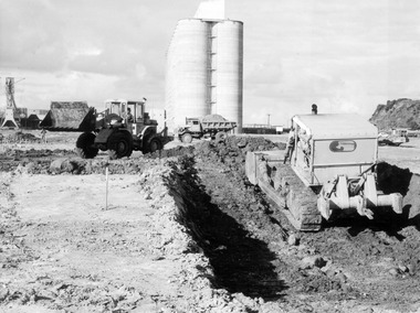
... Black and white photograph of construction of silo, with two trucks in foreground. Preliminary earthworks, wheat storage site....Port of Portland Authority archives Port of Portland Archives wheat storage Portland Harbour construction Front: (no inscriptions) Back: Preliminary earthworks, wheat storage site/ June 4th (pencil, upper left) Black and white photograph of construction of silo, with two trucks in foreground. ...Port of Portland Authority archivesFront: (no inscriptions) Back: Preliminary earthworks, wheat storage site/ June 4th (pencil, upper left)port of portland archives, wheat storage, portland harbour, construction -
 Glenelg Shire Council Cultural Collection
Photograph - Photograph - wheat storage construction, Portland, c. 1970
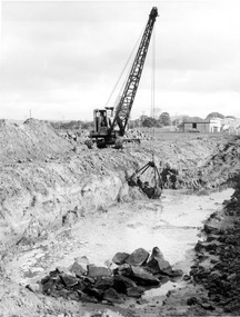
... Black and white photograph of construction of silo, with crane and dragline. Dragline on southern trench, wheat site....Port of Portland Authority archives Port of Portland Archives Front: (no inscriptions) Back: Dragline on southern trench, wheat site/ June 11th (pencil, upper left) Black and white photograph of construction of silo, with crane and dragline. ...Port of Portland Authority archivesFront: (no inscriptions) Back: Dragline on southern trench, wheat site/ June 11th (pencil, upper left)port of portland archives -
 Victorian Interpretive Projects Inc.
Photograph - digital, LJ Gervasoni, Murtoa Stick Shed 00031, 13/08/2011
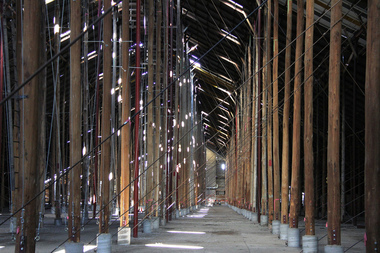
... Following its establishment in 1935 the Victorian Grain Elevators Board (GEB) planned a network of 160 concrete silos in country locations, connected by rail to the shipping terminal at Geelong. By the outbreak of the Second World War there was a worldwide glut of wheat, and Australia soon had a massive surplus which it was unable to export. ...Following its establishment in 1935 the Victorian Grain Elevators Board (GEB) planned a network of 160 concrete silos in country locations, connected by rail to the shipping terminal at Geelong. By the outbreak of the Second World War there was a worldwide glut of wheat, and Australia soon had a massive surplus which it was unable to export. ...From the Victorian Heritage Register statement of significance H0791 The Marmalake/Murtoa Grain Store, originally the No.1 Murtoa Shed, is located within the Murtoa Grain Terminal, adjacent to the grain elevator tower and railway line. The shed is 280m long, 60m wide and 19m high at the ridge with a capacity of 3.4 million bushels. The hipped corrugated iron roof of the shed is supported on approximately 600 unmilled hardwood poles set in a concrete slab floor and braced with iron tie rods. These poles are the reason for use of the term "stick shed". With its vast gabled interior and the long rows of poles the space has been likened to the nave of a cathedral. An elevator at one end took wheat from railway trucks to ridge level where it was distributed by conveyor along the length of the shed, creating a huge single mound of grain. Braced internal timber bulkheads on either side took the lateral thrust of the wheat, and conveyors at ground level outside the bulkheads took wheat back to the elevator for transport elsewhere. Wheat had been handled in jute bags from the start of the Victorian wheat industry in the mid nineteenth century. Bulk storage had been developed in North America from the early 1900s. NSW began building substantial concrete silos from 1920-21. In Western Australia, farmers' co-operatives, who had to supply their own bulk storage from 1934-5, pioneered the use of low-cost horizontal sheds of timber and corrugated iron for bulk storage. Following its establishment in 1935 the Victorian Grain Elevators Board (GEB) planned a network of 160 concrete silos in country locations, connected by rail to the shipping terminal at Geelong. By the outbreak of the Second World War there was a worldwide glut of wheat, and Australia soon had a massive surplus which it was unable to export. Only 48 silos had been established under the Victorian Silo Scheme so far, and wartime material and labour restrictions prevented progress with this scheme. The storage deficit had become an emergency by 1941 as Britain obtained its imports from North America, rather than over the lengthy and difficult shipping route from Australia. In 1941 the GEB, under chairman and general manager Harold Glowrey, proposed large temporary versions of the horizontal bulk storage sheds already in use in Western Australia. The proposal was approved by the Victorian Wheat and Woolgrowers Association, who considered the use of shed storages as a longer term proposition. After initial resistance from the Australian Wheat Board, some of whose members represented wheat bagging interests, the Commonwealth and Victorian governments agreed to split the costs, and Murtoa was chosen as a suitable site for the first emergency storage. The main contractor, Green Bros, commenced work on the No.1 Murtoa Shed in September 1941, deliveries of bulk wheat began in January 1942, and the store was full by June of the same year. In the following years the Council for Scientific and Industrial Research (later CSIRO) conducted valuable research and experiment on the impacts and control of insect pests at the Murtoa No.1 shed. With these discoveries, and the development of more effective pesticides, use of the No.1 shed and the larger No.2 shed, erected in 1942/43, continued for many years. The No.2 shed was demolished in 1975. By the 1990s, pest resistance to pesticides and requirements for both pest free and insecticide free grain rendered open storage of this type unviable. The No. 1 store was also becoming increasingly expensive to maintain, and its use was phased out from 1989.Image of the Marmalake/Murtoa Grain Store which is of historical, architectural, scientific (technical) and social significance to the State of VictoriaDigital colour image of the interior of the Marmaduke . Murtoa grain storage facility better known as the Stick Shed. The shed was constructed in World War Two to store grain. The supporting columns are trees.marmalake, murtoa grain store, wheat store, stick shed, murtoa -
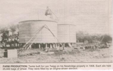 Bendigo Historical Society Inc.
Newspaper - JENNY FOLEY COLLECTION: FARM PRODUCTION
... Each silo held 25,000 bags of wheat. They were filled by an engine-driven elevator. ...Each silo held 25,000 bags of wheat. They were filled by an engine-driven elevator. ...Leopold Walter Twigg (1870-1935) married Mary Ann Lily (Lily) Douglas (1874-1952) in 1900. Bendigo Advertiser '' The way we were'' from 2003. Farm production: tanks built for Leo Twigg on his Newbridge property in 1908. Each silo held 25,000 bags of wheat. They were filled by an engine-driven elevator. The clip is in a folder.newspaper, bendigo advertiser, the way we were -
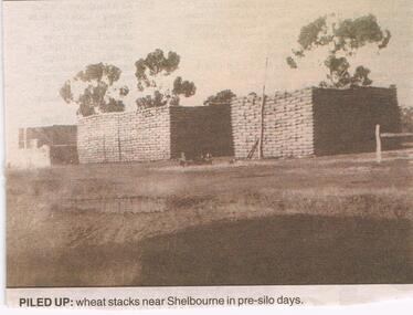 Bendigo Historical Society Inc.
Newspaper - JENNY FOLEY COLLECTION: PILED UP
... Piled up: wheat stacks near Shelbourne in pre-silo days. The clip is in a folder....Piled up: wheat stacks near Shelbourne in pre-silo days. The clip is in a folder. ...BHS CollectionBendigo Advertiser ''The way we were'' from 2002. Piled up: wheat stacks near Shelbourne in pre-silo days. The clip is in a folder.newspaper, bendigo advertiser, the way we were -
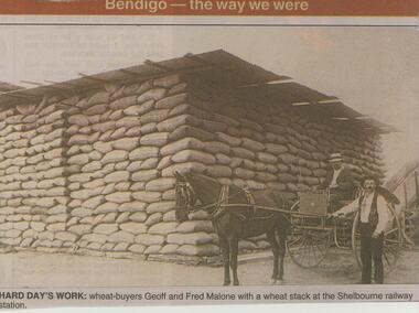 Bendigo Historical Society Inc.
Newspaper - JENNY FOLEY COLLECTION: HARD DAY'S WORK
... silos and part of the platform remain. Geoff Malone (1868-1946) NEWSPAPER Bendigo advertiser the way we were Bendigo Advertiser ''The way we were'' from 2002. Hard day's work: wheat ...The Shelbourne railway station was on a spur line that was intended to terminate at Laanacoorie but instead Shelbourne became the end of the line.. It operated from 1891 until 1970. Two grain silos and part of the platform remain. Geoff Malone (1868-1946)Bendigo Advertiser ''The way we were'' from 2002. Hard day's work: wheat buyers Geoff and Fred Malone with a wheat stack at the Shelbourne railway station. The clip is in a folder.newspaper, bendigo advertiser, the way we were -
 Bendigo Historical Society Inc.
Slide - Mouat Crawford Collection: Farming Life in the Wimmera, c1962
... View between the silos showing how they are attached to each other to give them strength and stability. Markings: Murtoa Bulk wheat Terminal. ...wimmera murtoa bulk wheat terminal mouat crawford collection Perutz View between the silos showing how they are attached to each other to give them strength and stability. ...View between the silos showing how they are attached to each other to give them strength and stability. Markings: Murtoa Bulk wheat Terminal. Used as a teaching aid.Perutzwimmera, murtoa bulk wheat terminal, mouat crawford collection -
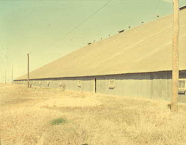 Bendigo Historical Society Inc.
Slide - Mouat Crawford Collection: Farming Life in the Wimmera
... ...wheat silo...AGRICULTURE Farm Crop Storage wimmera wheat silo stick shed murtoa mouat crawford collection PERUTZ Wheat terminal at Murtoa, known as the stick shed Markings: Murtoa(SIC) Bulk Wheat Terminal. ...Wheat terminal at Murtoa, known as the stick shed Markings: Murtoa(SIC) Bulk Wheat Terminal. The Stick Shed. Used as a teaching aid.PERUTZagriculture, farm, crop storage, wimmera, wheat silo, stick shed, murtoa, mouat crawford collection -
Bendigo Historical Society Inc.
Document - BROADCASTING STATION 3CV, MARYBOROUGH, 2 March, 1956
... ... build silos for wheat storage capacity is 100...In 1939 the firm began to build silos for the storage of bulk wheat and the present storage capacity is 100,000 bushels. 1944 power was changed from steam to electricity. ...Willersdorf and Forbes build silos for wheat storage capacity is 100 000 bushels. 1944 power was changed from steam to electricity. 20 sacks an hour. 1938 a chaff mill was built best in Victoria. ...Broadcasting Station 3CV, Maryborough. A souvenir of the opening of the New Studios and Offices of Central Victoria Broadcasters Pty Ltd. March 2nd, 1956. Established 1956, offices in Burke Street, opening coincides with the stations 21st birthday, March 2 for the former celebration, October 26 for the latter. Coverage included Bendigo, Ballarat, Daylesford, Castlemaine and Maryborough. 3CV plays active part in assisting charities and hospitals at Maryborough, Daylesford, Maldon and Dunolly. Active Women's Radio Club with branches in country centres adds strength to station's charitable efforts. Opening 3CV's new premises will widen the scope of the station's charitable efforts, and stronger link with Australian Commercial Broadcasting stations. Writer Harold V Nunn writes history of district of Mayborough. Manager Ken J Parker, Central Victoria Broadcasters Pty. Ltd. The Souvenir brochure also covers topics such as: deep lead mining. WWI. Houses being pulled down. New settlements of Mildura. Secondary Industries. Bowenvale, Alma, Majorca, Craigie, Amherst, Adelaide Lead, Havelock, Bet Bet, Bently. Primary production and a railway staff of approximately 150. Maryborough a little town without a future. Coal fields at Wonthaggi. 1917 a public meeting was convened in an effort to stem the tide of adversity. Mayor George Frost, M.L.A., decision to form a Progress Association, a policy of secondary industry was decided upon and committees were appointed, James L Drew much credit is due. Maryborough's move for rejuvenation was revolutionary, because apart from Ballarat, Bendigo and Geelong, it was regarded as so much presumption that industry could be expected to function with success in a country town. Governments were unsympathetic. Maryborough & district people showed determination to succeed and their faith in their town. Employment and economic security provided by the industries outweighed the debt. Maryborough's general position is that it is no longer dependent upon one particular phase of activity. The first of the industries to be formed in 1918 was the Butter Factory. The nearer dairy companies did not take kindly to the prospect of another opposition company taking supplies from their districts, and in the first few years of establishment completion made the going hard for the management. But adopting a conservative policy and placing all profits to reserve I the first six years of operation headway was gradually made. Thus it was a red letter day for the company in 1925 when the first dividend of 5 percent was paid.1955 dividend of 10 per cent. Operating it's own trucks the dairy serviced local dairymen up to 40 miles. Maryborough Knitting mills est. 1923, having transferred from Clunes. Out bid Ballarat and Bendigo to the industry. The mill has what is probably the largest circular underwear plant in the Commonwealth, which is conservatively valued at 198,913 pounds. It produces between four and five million garments each year, worth over one million pounds. The company has established subsidiary mills at Dunolly, Talbot and Avoca. The company also assisted in the establishment of the Interknit Hosiery Co. Ltd., Clunes. The Maryborough Flour Mills is the second oldest of Mayborough's industries. It was built by Mr Cadwallader over 70 years ago. It was later sold to Mr. A Land and then to Jas. Minifie & Co. It had a somewhat 'in-and -out' existence until purchased in 1923 by Messrs. Willersdorf and Forbes, of Eddington. In 1939 the firm began to build silos for the storage of bulk wheat and the present storage capacity is 100,000 bushels. 1944 power was changed from steam to electricity. The mill has an out put of 20 sacks an hour. 1938 a chaff mill was built, and now is regarded as one of the best in Victoria. Its output in one year of approximately 6,800 tons is a State record for a single cutter. During this 30 year period Patience and Nicholson Limited has grown with Maryborough and is now one of the major key industries of Australia. The P&N brand covers precision tools - taps, dies and twist drills - indispensable to the country's economy, and quality is acknowledged equally by an air craft factory in Canada, a dockyard in Thailand, a railway workshop in New Zealand, no less than by our own Australian industries. Maryborough can be proud of the part played by P&N in war when, geared to the needs of the times, it poured countless millions of tools into defence factories and to the armed forces of the Allies, and now in peace when it is providing, hydro-electric undertakings and the manufacture of cars and tractors. From 1858, W Phelan & Sons Pty Ltd has made phenomenal and spectacular growth, becoming incorporated as a private company in 1929. It is without doubt the greatest private development in the history of Maryborough. 1940 joinery manufacture was commenced. The company entered the Ready Built Housing field in `950 - and in 1951 established a factory at Cairns, Northern Queensland to overcome the manufacturing difficulties being experienced due to the shortage of plywood in Victoria. Present activities include: Ready Built Housing Factory, on-site building, a modern joinery, timber yard, drying kilns, etc., and plumbing & electrical & engineering services, a door and panel factory at Cairns, retail hardware store, Melbourne Sales Depot. Hedges & Bell Pty Ltd were est 1945, with a staff of 40 employees are the largest printing firm outside the metropolitan area. The branch of Premier Wireworks is a contribution made by the decentralisation policy of the State.event, official, celebration, broadcasting station 3cv, maryborough. a souvenir of the opening of the new studios and offices of central victoria broadcasters pty ltd. march 2nd, 1956. established 1956, offices in burke street, 21st birthday. coverage bendigo, ballarat, daylesford, castlemaine maryborough. assisting charities and hospitals maldon and dunolly. women's radio club opening 3cv's new premises australian commercial broadcasting stations. writer harold v nunn writes history of district of mayborough. manager ken j parker, central victoria broadcasters pty. ltd. souvenir brochure: deep lead mining. wwi. houses pulled down. new settlements. primary production railway staff. coal fields wonthaggi. 1917 a public meeting was convened in an effort to stem the tide of adversity. mayor george frost, m.l.a., form a progress association, policy of secondary industry, james l drew rejuvenation was revolutionary, employment and economic security. the first of the industries to be formed in 1918 was the butter factory. thus it was a red letter day for the company in 1925 when the first dividend of 5 percent was paid.1955 dividend of 10 per cent. operating it's own trucks serviced local dairymen. maryborough knitting mills est. 1923 largest circular underwear plant in the commonwealth. established subsidiary mills at dunolly, talbot, avoca. interknit hosiery co. ltd., clunes. the maryborough flour mills it was built by mr cadwallader. mr. a land jas. minifie & co. messrs. willersdorf and forbes, build silos for wheat storage capacity is 100, 000 bushels. 1944 power was changed from steam to electricity. 20 sacks an hour. 1938 a chaff mill was built, best in victoria. patience and nicholson limited the p&n precision tools - taps, dies and twist drills. war, geared to the needs of the times, countless millions of tools into defence factories the armed forces of the allies, hydro-electric undertakings and the manufacture of cars and tractors. from 1858, w phelan & sons pty ltd, incorporated 1929. 1940 joinery manufacture. ready built housing field in 1950 - 1951 established a factory at cairns, northern queensland to overcome the manufacturing difficulties being experienced due to the shortage of plywood in victoria. present activities: ready built housing factory, on-site building, a modern joinery, timber yard, drying kilns, etc., and plumbing & electrical & engineering services, a door and panel factory at cairns, retail hardware store, melbourne sales depot. hedges & bell pty ltd were est. 1945, with a staff of 40 employees are the largest printing firm outside the metropolitan area. the branch of premier wireworks is a contribution made by the decentralisation policy of the state. -
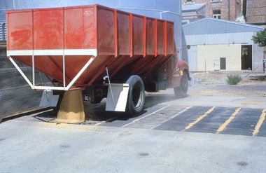 Bendigo Historical Society Inc.
Slide - Slide - Mouat Crawford Collection: Farming Life in the Wimmera, 1960s
... ...wheat...silo...Bulk Wheat being unloaded into a silo...BHS Collection farming wimmera wheat silo mouat crawford collection Bulk Wheat being unloaded into a silo Slide Slide - Mouat Crawford Collection: Farming Life in the Wimmera ...BHS CollectionBulk Wheat being unloaded into a silofarming, wimmera, wheat, silo, mouat crawford collection
