
Showing 90 items matching "woodlands park"
-
 Hume City Civic Collection
Photograph, September 1994
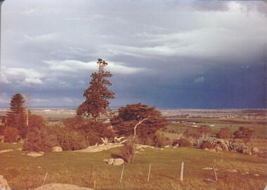
... woodlands park...Woodlands Park complex which includes 'Cumberland' and 'Dundonald' ruins and the Gellibrand Hill Quarries was acquired by the Victorian State Government in 1978 and is managed by Parks Victoria....Woodlands Park complex which includes 'Cumberland' and 'Dundonald' ruins and the Gellibrand Hill Quarries was acquired by the Victorian State Government in 1978 and is managed by Parks Victoria. woodlands park gellibrand hill greene william pomeroy anne george evans collection A view taken from Gellibrand Hill looking east towards the developing suburb of Greenvale. ...Woodlands Park complex which includes 'Cumberland' and 'Dundonald' ruins and the Gellibrand Hill Quarries was acquired by the Victorian State Government in 1978 and is managed by Parks Victoria.A view taken from Gellibrand Hill looking east towards the developing suburb of Greenvale. There are small rocky outcrops in the foreground and a clump of conifers and cypress trees in the middle. The sky is very overcast and a range of mountains can be seen across the skyline. Coloured photograph with rounded corners and matt finish.woodlands park, gellibrand hill, greene, william pomeroy, anne, george evans collection -
 Hume City Civic Collection
Photograph, September 1994
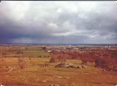
... woodlands park...Woodlands Park complex which includes 'Cumberland' and 'Dundonald' ruins and the Gellibrand Hill Quarries was acquired by the Victorian State Government in 1978 and is managed by Parks Victoria....Woodlands Park complex which includes 'Cumberland' and 'Dundonald' ruins and the Gellibrand Hill Quarries was acquired by the Victorian State Government in 1978 and is managed by Parks Victoria. woodlands park gellibrand hill greene william pomeroy anne george evans collection A view looking west towards the outer limits of the Tullamarine Airport taken from Gellibrand Hill. ...Woodlands Park complex which includes 'Cumberland' and 'Dundonald' ruins and the Gellibrand Hill Quarries was acquired by the Victorian State Government in 1978 and is managed by Parks Victoria.A view looking west towards the outer limits of the Tullamarine Airport taken from Gellibrand Hill. There is a small rocky outcrop in the middle of the photograph and trees are on the RHS of the image. Coloured photograph with rounded corners and matt finish.woodlands park, gellibrand hill, greene, william pomeroy, anne, george evans collection -
 Hume City Civic Collection
Photograph, September 1994
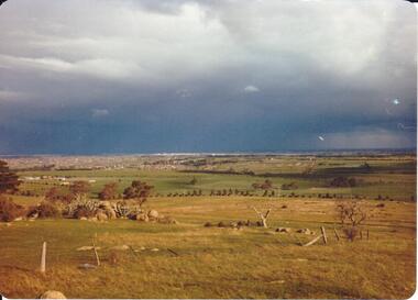
... woodlands park...Woodlands Park complex which includes 'Cumberland' and 'Dundonald' ruins and the Gellibrand Hill Quarries was acquired by the Victorian State Government in 1978 and is managed by Parks Victoria....Woodlands Park complex which includes 'Cumberland' and 'Dundonald' ruins and the Gellibrand Hill Quarries was acquired by the Victorian State Government in 1978 and is managed by Parks Victoria. woodlands park gellibrand hill greene william pomeroy anne george evans collection A view taken from Gellibrand Hill looking east towards the expanding suburb of Broadmeadows. ...Woodlands Park complex which includes 'Cumberland' and 'Dundonald' ruins and the Gellibrand Hill Quarries was acquired by the Victorian State Government in 1978 and is managed by Parks Victoria.A view taken from Gellibrand Hill looking east towards the expanding suburb of Broadmeadows. Apart from a few rocky outcrops and small trees the open grassland slopes away to a small line of conifers. Coloured photograph with rounded corners and matt finish.woodlands park, gellibrand hill, greene, william pomeroy, anne, george evans collection -
 Hume City Civic Collection
Photograph, Sep-94
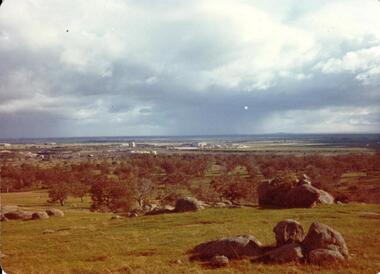
... woodlands park...Woodlands Park complex which includes 'Cumberland' and 'Dundonald' ruins and the Gellibrand Hill Quarries was acquired by the Victorian State Government in 1978 and is managed by Parks Victoria....Woodlands Park complex which includes 'Cumberland' and 'Dundonald' ruins and the Gellibrand Hill Quarries was acquired by the Victorian State Government in 1978 and is managed by Parks Victoria. woodlands park gellibrand hill greene william pomeroy anne george evans collection A view taken from Gellibrand Hill looking towards the recently constructed Tullamarine (Melbourne) Airport. ...Woodlands Park complex which includes 'Cumberland' and 'Dundonald' ruins and the Gellibrand Hill Quarries was acquired by the Victorian State Government in 1978 and is managed by Parks Victoria.A view taken from Gellibrand Hill looking towards the recently constructed Tullamarine (Melbourne) Airport. The airport buildings are just beyond an outcrop of trees. Four rocky outcrops are spread around the foreground. Coloured photograph with rounded corners and matt finish.woodlands park, gellibrand hill, greene, william pomeroy, anne, george evans collection -
 Hume City Civic Collection
Photograph, Sep-94
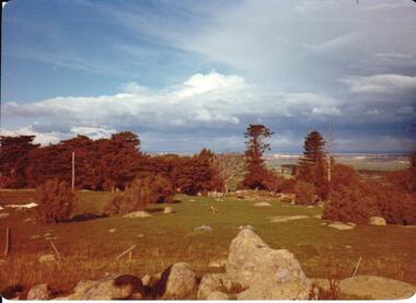
... woodlands park...Woodlands Park complex which includes 'Cumberland' and 'Dundonald' ruins and the Gellibrand Hill Quarries was acquired by the Victorian State Government in 1978 and is managed by Parks Victoria....Woodlands Park complex which includes 'Cumberland' and 'Dundonald' ruins and the Gellibrand Hill Quarries was acquired by the Victorian State Government in 1978 and is managed by Parks Victoria. woodlands park gellibrand hill greene william pomeroy anne george evans collection A view taken from Gellibrand Hill looking northwest. ...Woodlands Park complex which includes 'Cumberland' and 'Dundonald' ruins and the Gellibrand Hill Quarries was acquired by the Victorian State Government in 1978 and is managed by Parks Victoria.A view taken from Gellibrand Hill looking northwest. The open grassed area in the foreground is dotted with a number of rocky outcrops with conifers and cypress trees in the background. There are a few buildings in the distance.Coloured photograph with rounded corners and matt finish.woodlands park, gellibrand hill, greene, william pomeroy, anne, george evans collection -
 Sunbury Family History and Heritage Society Inc.
Photograph, Tree planting, 1987
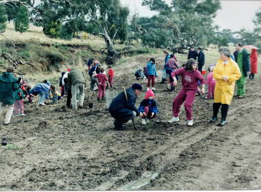
... ...Woodlands Park...The students from Bulla Primary School were taken on a school excursion to nearby Woodlands Park where they took part in a tree planting activity. ...The students from Bulla Primary School were taken on a school excursion to nearby Woodlands Park where they took part in a tree planting activity. ...The students from Bulla Primary School were taken on a school excursion to nearby Woodlands Park where they took part in a tree planting activity. They were planting trees that were native to the area in a bid to replenish the parkland with natural vegetation.The excursion aimed to give the students an awareness of the native vegetation in the area and the importance of conserving natural growth areas. A non-digital photograph of a group of children planting young trees in a prepared area in parkland while being supervised by a number of adults tree planting, woodlands park, bulla primary school, native vegetation -
 Sunbury Family History and Heritage Society Inc.
Photograph, Painting with lime wash, 1992
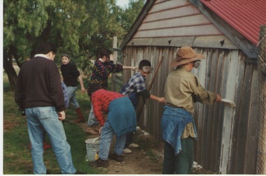
... ...woodlands park...In 1992 the children from the Bulla Primary School had an excursion to Woodlands Park for a Colonial Day where they were introduced to old crafts and skills. ...In 1992 the children from the Bulla Primary School had an excursion to Woodlands Park for a Colonial Day where they were introduced to old crafts and skills. ...In 1992 the children from the Bulla Primary School had an excursion to Woodlands Park for a Colonial Day where they were introduced to old crafts and skills. In this photograph the children were painting a shed using lime wash instead of commercially produced paint.The purpose of this school excursion was to introduce the children to day to day living in colonial times in Australia by giving them a hands on experience in a number of crafts and leisure time pursuits.A coloured photograph of five children painting a shed wall under the supervision of an adult. One person is mixing the paint while three others are doing the painting.bulla primary school, woodlands park, school excursions, colonial crafts -
 Sunbury Family History and Heritage Society Inc.
Photograph, School excursion, 1987
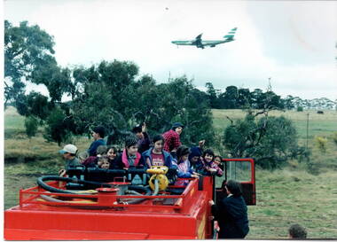
... Woodlands Park...As part of Environment Day observation, the students from Bulla Primary School enjoyed a tree-planting excursion to nearby Woodlands Park, a nature reserve situated close to Melbourne Airport. ...As part of Environment Day observation, the students from Bulla Primary School enjoyed a tree-planting excursion to nearby Woodlands Park, a nature reserve situated close to Melbourne Airport. ...As part of Environment Day observation, the students from Bulla Primary School enjoyed a tree-planting excursion to nearby Woodlands Park, a nature reserve situated close to Melbourne Airport. While they were there, the children were taken for a drive in a fire truck around the park.The excursion was aimed to give the students an awareness of their natural environment and the importance of the native vegetation in their area.A non-digital photograph of a number of children on the back of a fire truck waiting to be taken for a ride around the parkland. An aeroplane is flying overhead.woodlands park, tree planting, bulla primary school -
 Hume City Civic Collection
Photograph
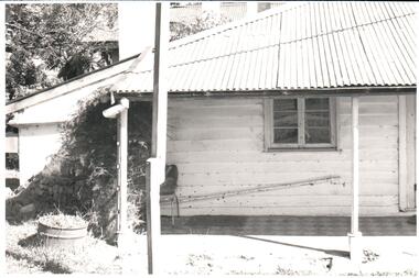
... ...woodlands park...Woodlands Homestead was erected by William Greene in 1843 and is one of the state's oldest buildings. Over the years the complex has been renovated and extended. The property has connections with the racing industry over the years along with the neighbouring properties of 'Cumberland' and 'Attwood'. In 1978 654 acres of the original property was purchased by the state government and placed under the management of the National Park... Service. woodlands homestead greene william pomeroy anne woodlands park gellibrand hill george evans collection A black and white photograph of part of a building showing the verandah with a paved floor. ...Woodlands Homestead was erected by William Greene in 1843 and is one of the state's oldest buildings. Over the years the complex has been renovated and extended. The property has connections with the racing industry over the years along with the neighbouring properties of 'Cumberland' and 'Attwood'. In 1978 654 acres of the original property was purchased by the state government and placed under the management of the National Park Service.A black and white photograph of part of a building showing the verandah with a paved floor. The hipped roof is covered with corrugated iron and the walls are weatherboard. An old steel kitchen chair is on the LHS at the end of the verandah and asparagus fern is growing up over the rear wall.woodlands homestead, greene, william pomeroy, anne, woodlands park, gellibrand hill, george evans collection -
 Broadmeadows Historical Society & Museum
Painting - Building Painting, Jean Jackson, "Woodlands" A Renovated Building, 1985
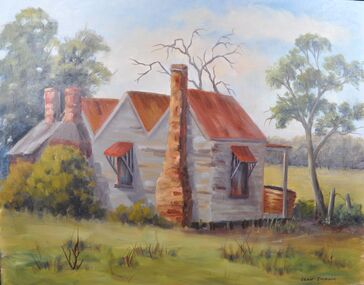
... Painting of a renovated building on the Woodlands Park....Painting of a renovated building on the Woodlands Park. Painting by a long term member of the Society. ...Painting of a renovated building on the Woodlands Park.Painted by Jean JacksonOil on board painting (unframed)Label 1 on back: 'Woodlands"/A Renovated/Building/By/Jean Jackson 1985 Label 2 on back: ME-0599 In red ink: Jean 1404GGbroadmeadows, "woodlands", renovated building, painting, jean jackson -
 Sunbury Family History and Heritage Society Inc.
Photograph, Timber road bridge, May 1986
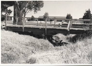
... The small wooden bridge is spanning an arm of the Moonee Ponds Creek in its upper reaches in Greenvale near Woodlands Park, possibly along Providence Road....The small wooden bridge is spanning an arm of the Moonee Ponds Creek in its upper reaches in Greenvale near Woodlands Park, possibly along Providence Road. ...The small wooden bridge is spanning an arm of the Moonee Ponds Creek in its upper reaches in Greenvale near Woodlands Park, possibly along Providence Road.A non-digital black and white photograph with a white border of a timber bridge spanning a small creek, which is under a roadway. A country home is visible on the opposite side of the road.bridges, greenvale -
 Hume City Civic Collection
Photograph, early 1980s
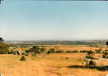
... Gellibrand Hill was incorporated with Woodlands Park and became a public reserve during the 1980s....Gellibrand Hill was incorporated with Woodlands Park and became a public reserve during the 1980s. gellibrand hill tullamarine airport melbourne skyline george evans collection A coloured landscape photograph with rounded corners taken from Gellibrand Hill and overlooking the Tullamarine Airport which is on the RHS of the photograph. ...The Tullamarine Airport opened in 1970 and replaced Essendon Airport as Melbourne's main airport terminal. Gellibrand Hill was incorporated with Woodlands Park and became a public reserve during the 1980s.A coloured landscape photograph with rounded corners taken from Gellibrand Hill and overlooking the Tullamarine Airport which is on the RHS of the photograph. The Melbourne City skyline can be seen in the distance.gellibrand hill, tullamarine airport, melbourne skyline, george evans collection -
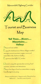 Marysville & District Historical Society
Map (Item) - Tourist and business map, Narbethong Community and Tourism Group, Narbethong Buxton Taggerty Tourist and Business Map, 04-2008
... park...woodlands rainforest retreat...A tourist and business map of Narbethong, Buxton and Taggerty. narbethong buxton taggerty victoria australia tourist and business map narbethong community and tourism group acheron valley yarra track wood's point black spur mystic mountains the meeting of the waters cathedral range danico design counted cross stitch things of sand & stone buxton zoo nursery & oddz & enz willowbank at taggerty safe trek 4wd services pnl 4wdriving buxton trout and salmon farm mystic mountains ski hire & outdoors narbethong ski hire highwood health centre cathedral view natural therapies narby cabinets plants by shelian gb timber executive signs rb automotive repairs buxton car care marysville towing & equipment hire martyn slade building design cathedral peak framing black spur roadhouse & ski hire tudor lodge roadhouse & ski hire buxton roadhouse & persian bazzar buxton post office general store & niche bar igloo roadhouse taggerty store narby eggs marapana agistment park mantirri blueberry farm carmyle farm hazelwood hazelnuts south cathedral lavender farm cathedral cherries black spur motel & caravan park woodlands rainforest retreat chestnut glade black spur inn wombat cottage abbey lake luxury b & b spa cottages blue views holiday cottages camp narbethong marapana farm stay b & b mantirri blueberry farm b & b little dene garden cottages silverstream b & b cottages nareen cabins moondai farm b & b south cathedral farm luxury b & b cottages yarrolyn caravan park sarsens rest lomah retreat pinjarra gardens kingbilli country estate henry viii manor house buxton hotel butters cafe of buxton wagtail wines little river wines lanterns at willowbank wirrawilla rainforest walk wilhemina falls the cascades This publication has been produced by the Narbethong Community and Tourism/ Group (NCTG) to promote the natural attractions, adventure activities and food/ trail from the Black Spur, through Narbethong, Buxton and Taggerty./ the information provided in this publication has been supplied by the individual/ members. ...A tourist and business map of Narbethong, Buxton and Taggerty. This map was produced by the Narbethong Community and Tourism Group in April 2008. It was produced to promote the natural attractions, adventure activities and food trail from the Black Spur, through Narbethong, Buxton and Taggerty.A tourist and business map of Narbethong, Buxton and Taggerty.This publication has been produced by the Narbethong Community and Tourism/ Group (NCTG) to promote the natural attractions, adventure activities and food/ trail from the Black Spur, through Narbethong, Buxton and Taggerty./ the information provided in this publication has been supplied by the individual/ members. NCTG takes no responsibility for its accuracy./ April 2008narbethong, buxton, taggerty, victoria, australia, tourist and business map, narbethong community and tourism group, acheron valley, yarra track, wood's point, black spur, mystic mountains, the meeting of the waters, cathedral range, danico design counted cross stitch, things of sand & stone, buxton zoo nursery & oddz & enz, willowbank at taggerty, safe trek 4wd services, pnl 4wdriving, buxton trout and salmon farm, mystic mountains ski hire & outdoors, narbethong ski hire, highwood health centre, cathedral view natural therapies, narby cabinets, plants by shelian, gb timber, executive signs, rb automotive repairs, buxton car care, marysville towing & equipment hire, martyn slade building design, cathedral peak framing, black spur roadhouse & ski hire, tudor lodge roadhouse & ski hire, buxton roadhouse & persian bazzar, buxton post office general store & niche bar, igloo roadhouse, taggerty store, narby eggs, marapana agistment park, mantirri blueberry farm, carmyle farm, hazelwood hazelnuts, south cathedral lavender farm, cathedral cherries, black spur motel & caravan park, woodlands rainforest retreat, chestnut glade, black spur inn, wombat cottage, abbey lake luxury b & b spa cottages, blue views holiday cottages, camp narbethong, marapana farm stay b & b, mantirri blueberry farm b & b, little dene garden cottages, silverstream b & b cottages, nareen cabins, moondai farm b & b, south cathedral farm luxury b & b cottages, yarrolyn caravan park, sarsens rest, lomah retreat, pinjarra gardens, kingbilli country estate, henry viii manor house, buxton hotel, butters cafe of buxton, wagtail wines, little river wines, lanterns at willowbank, wirrawilla rainforest walk, wilhemina falls, the cascades -
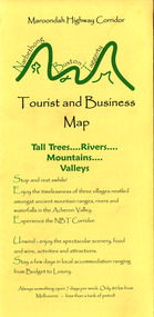 Marysville & District Historical Society
Map (Item) - Tourist and business map, Narbethong Community and Tourism Group, Narbethong Buxton Taggerty Tourist and Business Map, 04-2008
... park...woodlands rainforest retreat...A tourist and business map of Narbethong, Buxton and Taggerty. narbethong buxton taggerty victoria australia tourist and business map narbethong community and tourism group acheron valley yarra track wood's point black spur mystic mountains the meeting of the waters cathedral range danico design counted cross stitch things of sand & stone buxton zoo nursery & oddz & enz willowbank at taggerty safe trek 4wd services pnl 4wdriving buxton trout and salmon farm mystic mountains ski hire & outdoors narbethong ski hire highwood health centre cathedral view natural therapies narby cabinets plants by shelian gb timber executive signs rb automotive repairs buxton car care marysville towing & equipment hire martyn slade building design cathedral peak framing black spur roadhouse & ski hire tudor lodge roadhouse & ski hire buxton roadhouse & persian bazzar buxton post office general store & niche bar igloo roadhouse taggerty store narby eggs marapana agistment park mantirri blueberry farm carmyle farm hazelwood hazelnuts south cathedral lavender farm cathedral cherries black spur motel & caravan park woodlands rainforest retreat chestnut glade black spur inn wombat cottage abbey lake luxury b & b spa cottages blue views holiday cottages camp narbethong marapana farm stay b & b mantirri blueberry farm b & b little dene garden cottages silverstream b & b cottages nareen cabins moondai farm b & b south cathedral farm luxury b & b cottages yarrolyn caravan park sarsens rest lomah retreat pinjarra gardens kingbilli country estate henry viii manor house buxton hotel butters cafe of buxton wagtail wines little river wines lanterns at willowbank wirrawilla rainforest walk wilhemina falls the cascades This publication has been produced by the Narbethong Community and Tourism/ Group (NCTG) to promote the natural attractions, adventure activities and food/ trail from the Black Spur, through Narbethong, Buxton and Taggerty./ the information provided in this publication has been supplied by the individual/ members. ...A tourist and business map of Narbethong, Buxton and Taggerty. This map was produced by the Narbethong Community and Tourism Group in April 2008. It was produced to promote the natural attractions, adventure activities and food trail from the Black Spur, through Narbethong, Buxton and Taggerty.A tourist and business map of Narbethong, Buxton and Taggerty.This publication has been produced by the Narbethong Community and Tourism/ Group (NCTG) to promote the natural attractions, adventure activities and food/ trail from the Black Spur, through Narbethong, Buxton and Taggerty./ the information provided in this publication has been supplied by the individual/ members. NCTG takes no responsibility for its accuracy./ April 2008narbethong, buxton, taggerty, victoria, australia, tourist and business map, narbethong community and tourism group, acheron valley, yarra track, wood's point, black spur, mystic mountains, the meeting of the waters, cathedral range, danico design counted cross stitch, things of sand & stone, buxton zoo nursery & oddz & enz, willowbank at taggerty, safe trek 4wd services, pnl 4wdriving, buxton trout and salmon farm, mystic mountains ski hire & outdoors, narbethong ski hire, highwood health centre, cathedral view natural therapies, narby cabinets, plants by shelian, gb timber, executive signs, rb automotive repairs, buxton car care, marysville towing & equipment hire, martyn slade building design, cathedral peak framing, black spur roadhouse & ski hire, tudor lodge roadhouse & ski hire, buxton roadhouse & persian bazzar, buxton post office general store & niche bar, igloo roadhouse, taggerty store, narby eggs, marapana agistment park, mantirri blueberry farm, carmyle farm, hazelwood hazelnuts, south cathedral lavender farm, cathedral cherries, black spur motel & caravan park, woodlands rainforest retreat, chestnut glade, black spur inn, wombat cottage, abbey lake luxury b & b spa cottages, blue views holiday cottages, camp narbethong, marapana farm stay b & b, mantirri blueberry farm b & b, little dene garden cottages, silverstream b & b cottages, nareen cabins, moondai farm b & b, south cathedral farm luxury b & b cottages, yarrolyn caravan park, sarsens rest, lomah retreat, pinjarra gardens, kingbilli country estate, henry viii manor house, buxton hotel, butters cafe of buxton, wagtail wines, little river wines, lanterns at willowbank, wirrawilla rainforest walk, wilhemina falls, the cascades -
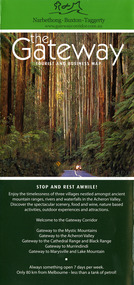 Marysville & District Historical Society
Map (Item) - Tourist and business map, Narbethong Community and Tourism Group, the Gateway TOURIST AND BUSINESS MAP, 08-2009
... park...woodlands rainforest retreat...A tourist and business map of Narbethong, Buxton and Taggerty. narbethong buxton taggerty victoria australia tourist and business map the gateway tourist and business map black spur motel & caravan park woodlands rainforest retreat chestnut glade black spur inn wombat cottage abbey lake luxury b&b spa cottages camp narbethong marapana farm stay b&b mantirri b&b little dene garden cottages nareen cabins silverstream b&b cottages buxton hotel motel south cathedral farm luxury b&b cottages cathedral view b&b retreat kingbilli country estate cathedral valley farm pinjarra gardens willowbank at taggerty sarsens rest yarrolyn caravan park danico design counted cross stitch things of sand & stone buxton zoo nursery safetrek 4wd services mystic mountains ski hire & outdoors pnl 4wdriving buxton trout and salmon farm buxton bait and tackle black spur roadhouse tudor lodge service station roadhouse & ski hire buxton roadhouse buxton p.o. general store igloo roadhouse henry v111 manor house buxton hotel butters cafe wagtail wines little river wines narby eggs marapana agistment park carmyle farm hazelwood hazelnuts cathedral view naturall therapies cre8ing growth linda hailey naby cabinets gb timber narbethong timber & trading rb automotive repairs buxton car care martyn slade building design taggerty vet clinic This publication has been produced by the Narbethong Community and Tourism Group Inc./ (NCTG) The information provided in this publication has been supplied by the individual/ members. ...A tourist and business map of Narbethong, Buxton, and Taggerty. This map was produced by the Narbethong Community and Tourism Group Inc in August 2009. It was produced to promote the natural attractions, adventure activities, and food trail from the Black Spur, through Narbethong, Buxton, and Taggerty.A tourist and business map of Narbethong, Buxton and Taggerty.This publication has been produced by the Narbethong Community and Tourism Group Inc./ (NCTG) The information provided in this publication has been supplied by the individual/ members. NCTG takes no responsibility for its accuracy./ August 2009narbethong, buxton, taggerty, victoria, australia, tourist and business map, the gateway tourist and business map, black spur motel & caravan park, woodlands rainforest retreat, chestnut glade, black spur inn, wombat cottage, abbey lake luxury b&b spa cottages, camp narbethong, marapana farm stay b&b, mantirri b&b, little dene garden cottages, nareen cabins, silverstream b&b cottages, buxton hotel motel, south cathedral farm luxury b&b cottages, cathedral view b&b retreat, kingbilli country estate, cathedral valley farm, pinjarra gardens, willowbank at taggerty, sarsens rest, yarrolyn caravan park, danico design counted cross stitch, things of sand & stone, buxton zoo nursery, safetrek 4wd services, mystic mountains ski hire & outdoors, pnl 4wdriving, buxton trout and salmon farm, buxton bait and tackle, black spur roadhouse, tudor lodge service station roadhouse & ski hire, buxton roadhouse, buxton p.o. general store, igloo roadhouse, henry v111 manor house, buxton hotel, butters cafe, wagtail wines, little river wines, narby eggs, marapana agistment park, carmyle farm, hazelwood hazelnuts, cathedral view naturall therapies, cre8ing growth, linda hailey, naby cabinets, gb timber, narbethong timber & trading, rb automotive repairs, buxton car care, martyn slade building design, taggerty vet clinic -
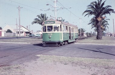 Melbourne Tram Museum
Slide, Keith Caldwell, 12/03/1960 12:00:00 AM
... See http://www.esshissoc.org.au/1070%20Mount%20Alexander%20Road.pdf It was relocated to Woodland Park during 2017? Note the Centre poles, overhead construction and street light. ...See http://www.esshissoc.org.au/1070%20Mount%20Alexander%20Road.pdf It was relocated to Woodland Park during 2017? Note the Centre poles, overhead construction and street light. ...Agfa Colour slide, cardboard mount, by Keith Caldwell dated 12 March 1960, of W5 818 running in Mount Alexander Road, North Essendon, crossing the street access for Marco Polo Street. The tram showing route 59, Essendon Aerodrome, has trolley wheels and has a second person in the cab, possibly a trainer. Unusually the tram number is placed above the headlight, In the background are the palm trees in the centre median plantation. The house with the red guttering is one that dates back to the gold mining era. See http://www.esshissoc.org.au/1070%20Mount%20Alexander%20Road.pdf It was relocated to Woodland Park during 2017? Note the Centre poles, overhead construction and street light. Also in the background is a Mobil Service station that later became a garden centre. Now a block of apartments.hand stamped "12 Mar '60"trams, tramways, mount alexander rd, north essendon, essendon airport, essendon aerodrome, route 59, w5 class, tram 818 -
 4th/19th Prince of Wales's Light Horse Regiment Unit History Room
Uniform, Service Dress WW1, c 1914
... Within a few years their properties had expanded considerably: Edward's, near Strathmerton, was called Woodland Park; the other three were known collectively as Boomagong. ...Within a few years their properties had expanded considerably: Edward's, near Strathmerton, was called Woodland Park; the other three were known collectively as Boomagong. ...Sir Murray William James Bourchier (1881-1937), grazier, soldier and politician, was born on 4 April 1881 at Pootilla, Bungaree, Victoria, eldest son of Edward Bourchier, Geelong-born farmer, and his wife Francis (Fanny), née Cope. In 1878 Edward and his three brothers had taken up four adjoining selections on the Murray River near Tocumwal. Within a few years their properties had expanded considerably: Edward's, near Strathmerton, was called Woodland Park; the other three were known collectively as Boomagong. After a private education in Melbourne, Murray returned to Woodland Park. From 1909 until the outbreak of World War I he commanded a troop of light horse at Numurkah, attending annual camps and courses. Bourchier's military service was distinguished. He enlisted in the Australian Imperial Force in August 1914 and sailed as a lieutenant in the 4th Light Horse Regiment, serving seven months on Gallipoli. After the Sinai campaign in 1916-17, during which he was promoted lieutenant-colonel commanding his regiment, he made the crucial final assault on Beersheba. On 31 October 1917 he led his men, many of them from his own district, at full gallop over two miles into Turkish entrenchments and on for a further two miles (3.2 km) into Beersheba to capture vital wells before the Turks could destroy them. Lacking sabres, the regiment used bayonets held in their hands as shock weapons. For this exploit he was awarded the Distinguished Service Order and earned the sobriquet 'Bourchier of Beersheba'. Eleven months later, after fighting north through Palestine, he commanded a joint force of the 4th and 12th Light Horse regiments (Bourchier Force) in the final advance on Damascus; on entering the city the 4th captured 12,000 Turks and set about relieving their sufferings. Bourchier was three times mentioned in dispatches. He was appointed C.M.G. in June 1919 and his A.I.F. appointment ended in October. In 1921 he was promoted colonel, commanding the 5th Cavalry Brigade, and in 1931 brigadier, in charge of the 2nd Cavalry Division. He returned to Strathmerton but later farmed a property at Katandra, which he named Kuneitra. - Source: Australian Dictionary of BiographyService dress of General Sir Murray Bourchier, complete with jacket, trousers, shirt, tie, boots (high rise),Sam Browne belt, peaked cap, medal ribbons, badges of rank, medal ribbons -
4th/19th Prince of Wales's Light Horse Regiment Unit History Room
Uniform, Mess Kit, c 1914
... Within a few years their properties had expanded considerably: Edward's, near Strathmerton, was called Woodland Park; the other three were known collectively as Boomagong. ...Within a few years their properties had expanded considerably: Edward's, near Strathmerton, was called Woodland Park; the other three were known collectively as Boomagong. ...Sir Murray William James Bourchier (1881-1937), grazier, soldier and politician, was born on 4 April 1881 at Pootilla, Bungaree, Victoria, eldest son of Edward Bourchier, Geelong-born farmer, and his wife Francis (Fanny), née Cope. In 1878 Edward and his three brothers had taken up four adjoining selections on the Murray River near Tocumwal. Within a few years their properties had expanded considerably: Edward's, near Strathmerton, was called Woodland Park; the other three were known collectively as Boomagong. After a private education in Melbourne, Murray returned to Woodland Park. From 1909 until the outbreak of World War I he commanded a troop of light horse at Numurkah, attending annual camps and courses. Bourchier's military service was distinguished. He enlisted in the Australian Imperial Force in August 1914 and sailed as a lieutenant in the 4th Light Horse Regiment, serving seven months on Gallipoli. After the Sinai campaign in 1916-17, during which he was promoted lieutenant-colonel commanding his regiment, he made the crucial final assault on Beersheba. On 31 October 1917 he led his men, many of them from his own district, at full gallop over two miles into Turkish entrenchments and on for a further two miles (3.2 km) into Beersheba to capture vital wells before the Turks could destroy them. Lacking sabres, the regiment used bayonets held in their hands as shock weapons. For this exploit he was awarded the Distinguished Service Order and earned the sobriquet 'Bourchier of Beersheba'. Eleven months later, after fighting north through Palestine, he commanded a joint force of the 4th and 12th Light Horse regiments (Bourchier Force) in the final advance on Damascus; on entering the city the 4th captured 12,000 Turks and set about relieving their sufferings. Bourchier was three times mentioned in dispatches. He was appointed C.M.G. in June 1919 and his A.I.F. appointment ended in October. In 1921 he was promoted colonel, commanding the 5th Cavalry Brigade, and in 1931 brigadier, in charge of the 2nd Cavalry Division. He returned to Strathmerton but later farmed a property at Katandra, which he named Kuneitra. Source: Australian Dictionary of BiographyMess kit of General Sir Murray Bourchier complete with peaked cap, jacket, cummerbund, shirt, tie, waistcoat, trousers, shoes, AMF lapel badges & badges of rank -
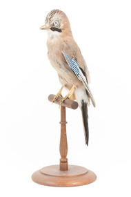 The Beechworth Burke Museum
Animal specimen - Eurasian Jay, Trustees of the Australian Museum, 1860-1880
... These birds inhabit mixed woodland, parks, orchards, and large gardens. They are generally solitary but can gather in large communal roosts during periods of cold weather. ...These birds inhabit mixed woodland, parks, orchards, and large gardens. They are generally solitary but can gather in large communal roosts during periods of cold weather. ...The Eurasian Jay is a small passerine bird occurring in Europe, northern Africa, and Asia. There are very distinct variations between the species of the Jay which assists in their identification. These birds inhabit mixed woodland, parks, orchards, and large gardens. They are generally solitary but can gather in large communal roosts during periods of cold weather. Eurasian Jays are known for their mimicry. They can often sound like a different species and during the day may mimic the birds they are attacking in order to confuse their opposition. This particular specimen has been mounted in an accurate but stylised fashion. This specimen is part of a collection of almost 200 animal specimens that were originally acquired as skins from various institutions across Australia, including the Australian Museum in Sydney and the National Museum of Victoria (known as Museums Victoria since 1983), as well as individuals such as amateur anthropologist Reynell Eveleigh Johns between 1860-1880. These skins were then mounted by members of the Burke Museum Committee and put-on display in the formal space of the Museum’s original exhibition hall where they continue to be on display. This display of taxidermy mounts initially served to instruct visitors to the Burke Museum of the natural world around them, today it serves as an insight into the collecting habits of the 19th century.This specimen is part of a significant and rare taxidermy mount collection in the Burke Museum. This collection is scientifically and culturally important for reminding us of how science continues to shape our understanding of the modern world. They demonstrate a capacity to hold evidence of how Australia’s fauna history existed in the past and are potentially important for future environmental research. This collection continues to be on display in the Museum and has become a key part to interpreting the collecting habits of the 19th century.The Eurasian Jay, as depicted in this specimen, has distinctive blue, white and dark brown stipes at the top of the wing. The body and head are light brown with a reddish undertone and there are streaks of dark brown at top the head. The tail, bottom of the wings and underneath the eyes are dark brown. This particular specimen stands upon a wooden mount and has an identification tag tied around its leg. It has pale coloured glass eyes which are accurate for this species.Swing Tag: [illegible] / to Sydney - N =99taxidermy mount, taxidermy, animalia, burke museum, beechworth, australian museum, skin, bird, jay, eurasian jay, europe, european birds, blue stripes -
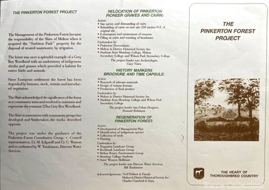 Melton City Libraries
Pamphlet, The Pinkerton Forest Project, 1992
... This occasion also marked the opening of the Pinkerton Forest Project, which saw 50 hectares of degraded woodland in Surbiton Park protected for regeneration". ...This occasion also marked the opening of the Pinkerton Forest Project, which saw 50 hectares of degraded woodland in Surbiton Park protected for regeneration". ..."The Pinkerton family is remembered in Melton in part due to the historic graves of the original settler, Margaret Pinkerton, and four of her grandchildren, which were marked by a memorial cairn in 1931. Changes to sewage flood zoning in the area in the 1990s necessitated that these burials be relocated. Members of the Melton & District Historical Society oversaw a project to relocate the Pinkerton graves and cairn 200 metres from their original site to their current resting place at Mount Cottrell. This relocation ceremony took place on 8 November 1992, with the participation of local school students and with Pinkerton descendants playing a central role. This occasion also marked the opening of the Pinkerton Forest Project, which saw 50 hectares of degraded woodland in Surbiton Park protected for regeneration". Pamphlet about the relocation of the Pinkerton graveslandscapes of significance, local identies, local special interest groups, pioneer families -
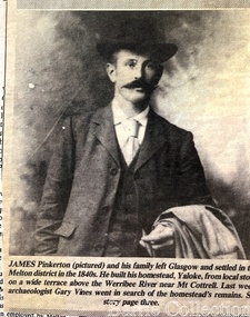 Melton City Libraries
Newspaper, James Pinkerton, 1991
... This occasion also marked the opening of the Pinkerton Forest Project, which saw 50 hectares of degraded woodland in Surbiton Park protected for regeneration"....This occasion also marked the opening of the Pinkerton Forest Project, which saw 50 hectares of degraded woodland in Surbiton Park protected for regeneration". ..."James Pinkerton, described by fellow settler Isaac Batey as ‘a fine old Scotish [sic] gentleman’, and his wife Margaret established ‘Chamois Ponds’ on Kororoit Creek in the Keilor district in 1840.44 After a fire in 1848, the Pinkerton family moved further west to a holding called Yaloke, on the Werribee River in the Melton district.45 Today, the Surbiton Park water treatment plant operates on part of the Yaloke run. The Pinkerton family is remembered in Melton in part due to the historic graves of the original settler, Margaret Pinkerton, and four of her grandchildren, which were marked by a memorial cairn in 1931. Changes to sewage flood zoning in the area in the 1990s necessitated that these burials be relocated. Members of the Melton & District Historical Society oversaw a project to relocate the Pinkerton graves and cairn 200 metres from their original site to their current resting place at Mount Cottrell. This relocation ceremony took place on 8 November 1992, with the participation of local school students and with Pinkerton descendants playing a central role. This occasion also marked the opening of the Pinkerton Forest Project, which saw 50 hectares of degraded woodland in Surbiton Park protected for regeneration".Photograph of Jame Pinkerton featured in the the Telegraphlocal identities, pioneer families -
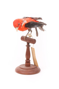 The Beechworth Burke Museum
Animal specimen - Scarlet Tanager (male), Trustees of the Australian Museum, 1860-1880
... woodlands that have oaks. On occasion, the Tanager can be seen in suburban areas including parks and gardens. ...woodlands that have oaks. On occasion, the Tanager can be seen in suburban areas including parks and gardens. ...The Scarlet Tanager is an American songbird of medium size with bright coloured plumage. They are commonly located in eastern North America and in northwestern South America. They can often be found within woodlands that have oaks. On occasion, the Tanager can be seen in suburban areas including parks and gardens. These birds are sociable and often join with other foraging flocks. They are carnivores (insectivores) and feed on insects including wasps, ants, moths, beetles, butterflies and grasshoppers. The numbers of these birds in America are declining due to exposure and starvation during the colder months. These birds can also die from collisions with man made objects which includes the TV and radio towers, buildings and cars. They also have high rates of predation and brood parasitism. However, at current the IUCN classifies this species as Least Concern and note that their numbers are stable. This specimen is part of a collection of almost 200 animal specimens that were originally acquired as skins from various institutions across Australia, including the Australian Museum in Sydney and the National Museum of Victoria (known as Museums Victoria since 1983), as well as individuals such as amateur anthropologist Reynell Eveleigh Johns between 1860-1880. These skins were then mounted by members of the Burke Museum Committee and put-on display in the formal space of the Museum’s original exhibition hall where they continue to be on display. This display of taxidermy mounts initially served to instruct visitors to the Burke Museum of the natural world around them, today it serves as an insight into the collecting habits of the 19th century.This specimen is part of a significant and rare taxidermy mount collection in the Burke Museum. This collection is scientifically and culturally important for reminding us of how science continues to shape our understanding of the modern world. They demonstrate a capacity to hold evidence of how Australia’s fauna history existed in the past and are potentially important for future environmental research. This collection continues to be on display in the Museum and has become a key part to interpreting the collecting habits of the 19th century.The Scarlet Tanager specimen stands perched on a wooden platform looking towards the ground. It has bright red/orange feathers on the main body and head with dark black feathers on the tail and wings. Overall, whilst retaining a bright appearance the bird has faded in contrast to it's original colouring This particular specimen has disheveled feathers and is missing one leg. The bill is short and pale and the specimen has been provided with glass eyes made in a dark colour. The specimen has two paper identification tags attached to the damaged leg.Swing tag: 114a / unnamed / catalogue, page 59 Cotton tag: A.4440 /taxidermy mount, taxidermy, animalia, burke museum, beechworth, australian museum, skin, reynell eveleigh johns, bird, australian birds, american, american birds, scarlet tanager, tanager, medium bird, small bird -
 The Beechworth Burke Museum
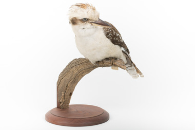
Animal specimen - Kookaburra, Trustees of the Australian Museum, 1860-1880
... This species reside in woodlands and open forests, however they can be seen in parks, wetlands, farms and any other space that is open with grass. ...This species reside in woodlands and open forests, however they can be seen in parks, wetlands, farms and any other space that is open with grass. ...The Kookaburra is a sociable bird commonly seen in small flocks. These flocks mainly consist of family members. If not in flocks, these birds are commonly seen in pairs. They have a distinct appearance with brown wings, back and brown around the eyes, with majority of the plumage being white. This species reside in woodlands and open forests, however they can be seen in parks, wetlands, farms and any other space that is open with grass. This native Australian bird can mainly be found across the eastern Australia, however they have been introduced Tasmania, South-west Western Australia and New Zealand. Although this is a taxidermy mount, it looks exactly like a Kookaburra in real life. This specimen is part of a collection of almost 200 animal specimens that were originally acquired as skins from various institutions across Australia, including the Australian Museum in Sydney and the National Museum of Victoria (known as Museums Victoria since 1983), as well as individuals such as amateur anthropologist Reynell Eveleigh Johns between 1860-1880. These skins were then mounted by members of the Burke Museum Committee and put-on display in the formal space of the Museum’s original exhibition hall where they continue to be on display. This display of taxidermy mounts initially served to instruct visitors to the Burke Museum of the natural world around them, today it serves as an insight into the collecting habits of the 19th century.This specimen is part of a significant and rare taxidermy mount collection in the Burke Museum. This collection is scientifically and culturally important for reminding us of how science continues to shape our understanding of the modern world. They demonstrate a capacity to hold evidence of how Australia’s fauna history existed in the past and are potentially important for future environmental research. This collection continues to be on display in the Museum and has become a key part to interpreting the collecting habits of the 19th century.This Kookaburra has a predominantly white body. The back, wings and tail are a light shade of brown. There is a strip of brown going across the eyes. This specimen stands upon a wooden branch and has an identification tag ties around its leg. This bird is stout in shape and has a medium length tail and a broad bill. This bill is darker on top and lighter in colour on the bottom.W8083 / taxidermy mount, taxidermy, animalia, burke museum, beechworth, australian museum, skin, reynell eveleigh johns, bird, kookaburra, australian birds, laughing kookaburra -
 The Beechworth Burke Museum
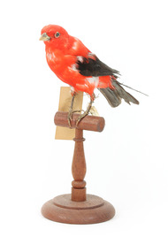
Animal specimen - Scarlet Tanager (male), Trustees of the Australian Museum, 1860-1880
... woodlands that have oaks. On occasion, the Tanager can be seen in suburban areas including parks and gardens. ...woodlands that have oaks. On occasion, the Tanager can be seen in suburban areas including parks and gardens. ...The Scarlet Tanager is an American songbird of medium size with bright coloured plumage. They are commonly located in eastern North America and in northwestern South America. They can often be found within woodlands that have oaks. On occasion, the Tanager can be seen in suburban areas including parks and gardens. These birds are sociable and often join with other foraging flocks. They are carnivores (insectivores) and feed on insects including wasps, ants, moths, beetles, butterflies and grasshoppers. The numbers of these birds in America are declining due to exposure and starvation during the colder months. These birds can also die from collisions with man made objects which includes the TV and radio towers, buildings and cars. They also have high rates of predation and brood parasitism. However, at current the IUCN classifies this species as Least Concern and note that their numbers are stable. This specimen is part of a collection of almost 200 animal specimens that were originally acquired as skins from various institutions across Australia, including the Australian Museum in Sydney and the National Museum of Victoria (known as Museums Victoria since 1983), as well as individuals such as amateur anthropologist Reynell Eveleigh Johns between 1860-1880. These skins were then mounted by members of the Burke Museum Committee and put-on display in the formal space of the Museum’s original exhibition hall where they continue to be on display. This display of taxidermy mounts initially served to instruct visitors to the Burke Museum of the natural world around them, today it serves as an insight into the collecting habits of the 19th century.This specimen is part of a significant and rare taxidermy mount collection in the Burke Museum. This collection is scientifically and culturally important for reminding us of how science continues to shape our understanding of the modern world. They demonstrate a capacity to hold evidence of how Australia’s fauna history existed in the past and are potentially important for future environmental research. This collection continues to be on display in the Museum and has become a key part to interpreting the collecting habits of the 19th century.The Scarlet Tanager specimen stands perched on a wooden platform looking forwards in a raised position. It has bright red/orange feathers on the main body and head with dark black feathers on the tail and wings. Overall, whilst retaining a bright appearance the bird has faded in contrast to it's original colouring. The bill is short and pale and the specimen has been provided with glass eyes made in a dark colour. The specimen has two paper identification tags attached to the right leg.Swing tag: 143a / unnamed / catalogue page 59 Metal tag: A4439 /taxidermy mount, taxidermy, animalia, burke museum, beechworth, australian museum, skin, reynell eveleigh johns, bird, australian birds, american, american birds, scarlet tanager, tanager, medium bird, small bird -
 The Beechworth Burke Museum
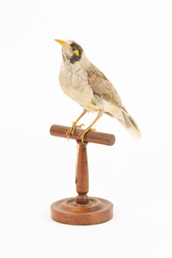
Animal specimen - Noisy Miner, Trustees of the Australian Museum, 1860-1880
... woodlands and open forests. They have also become well adapted to suburban situations and are a common sight in parks and gardens. ...woodlands and open forests. They have also become well adapted to suburban situations and are a common sight in parks and gardens. ...Noisy Miners are native to Australia and can be found on the East Coast. Noisy Miners live in northern Queensland and all along the eastern coast to South Australia and Tasmania. Noisy Miners are found in woodlands and open forests. They have also become well adapted to suburban situations and are a common sight in parks and gardens. The Noisy Miner feeds on nectar, fruits and insects. Very occasionally they will eat small reptiles and amphibians. Food is either taken from trees or on the ground. In keeping with its highly social nature, the Noisy Miner usually feeds in large groups. The Noisy miner specimen is mounted accurately. This specimen is part of a collection of almost 200 animal specimens that were originally acquired as skins from various institutions across Australia, including the Australian Museum in Sydney and the National Museum of Victoria (known as Museums Victoria since 1983), as well as individuals such as amateur anthropologist Reynell Eveleigh Johns between 1860-1880. These skins were then mounted by members of the Burke Museum Committee and put-on display in the formal space of the Museum’s original exhibition hall where they continue to be on display. This display of taxidermy mounts initially served to instruct visitors to the Burke Museum of the natural world around them, today it serves as an insight into the collecting habits of the 19th century.This specimen is part of a significant and rare taxidermy mount collection in the Burke Museum. This collection is scientifically and culturally important for reminding us of how science continues to shape our understanding of the modern world. They demonstrate a capacity to hold evidence of how Australia’s fauna history existed in the past and are potentially important for future environmental research. This collection continues to be on display in the Museum and has become a key part to interpreting the collecting habits of the 19th century.The Noisy Miner is identified by its mostly grey body and black crown and cheeks. The bill is yellow, as are the legs and the naked skin behind the eye. The name is well suited as the common calls are uttered repeatedly by the members of the colony .Despite their moderate size, Noisy Miners aggressively attack larger birds such as hawks and kookaburras. These attacks may be so vigorous that most other birds are excluded from an area occupied by Noisy Miners.Swing tag: 65a. Garrulous Honey-Eater / See Catalogue, page 19 /taxidermy mount, taxidermy, animalia, burke museum, beechworth, australian museum, skin, reynell eveleigh johns, bird, australian birds, noisy miner, garrulous honeyeater, yellow beak, honeyeater, east coast -
 The Beechworth Burke Museum
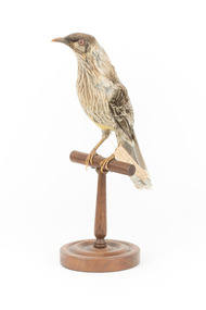
Animal specimen - Red Wattle Bird, Trustees of the Australian Museum, 1860-1880
... The red wattlebird is found across southeast Queensland, New South Wales, Victoria, South Australia, and southwest Western Australia, inhabiting open forests, woodlands, and urban gardens or parks. Known for its loud and conspicuous presence, the red wattlebird primarily forages in trees, although it occasionally searches for food on the ground. ...The red wattlebird is found across southeast Queensland, New South Wales, Victoria, South Australia, and southwest Western Australia, inhabiting open forests, woodlands, and urban gardens or parks. Known for its loud and conspicuous presence, the red wattlebird primarily forages in trees, although it occasionally searches for food on the ground. ...The red wattlebird is a passerine bird native to southern Australia. Measuring 33–37 cm (13–14.5 inches) in length, it ranks as the second-largest species among Australian honeyeaters. The species was first described by John White in 1790, and three subspecies are currently recognised. The red wattlebird is found across southeast Queensland, New South Wales, Victoria, South Australia, and southwest Western Australia, inhabiting open forests, woodlands, and urban gardens or parks. Known for its loud and conspicuous presence, the red wattlebird primarily forages in trees, although it occasionally searches for food on the ground. As one of the world's largest nectar-feeding birds, it consumes nectar from a wide variety of flowering plants, supplementing its diet with insects. Territorial and sometimes aggressive, it defends rich nectar sources from other bird species. Breeding occurs throughout its range, with the species constructing cup-shaped nests in trees and raising one or two broods annually. Despite localized declines due to habitat loss, the red wattlebird is listed as Least Concern on the IUCN Red List. This specimen was falsely identified as a yellow wattlebird in original catalogue records and is part of a collection of almost 200 animal specimens that were originally acquired as skins from various institutions across Australia, including the Australian Museum in Sydney and the National Museum of Victoria (known as Museums Victoria since 1983), as well as individuals such as amateur anthropologist Reynell Eveleigh Johns between 1860-1880. These skins were then mounted by members of the Burke Museum Committee and put-on display in the formal space of the Museum’s original exhibition hall where they continue to be on display. This display of taxidermy mounts initially served to instruct visitors to the Burke Museum of the natural world around them, today it serves as an insight into the collecting habits of the 19th century.This specimen is part of a significant and rare taxidermy mount collection in the Burke Museum. This collection is scientifically and culturally important for reminding us of how science continues to shape our understanding of the modern world. They demonstrate a capacity to hold evidence of how Australia’s fauna history existed in the past and are potentially important for future environmental research. This collection continues to be on display in the Museum and has become a key part to interpreting the collecting habits of the 19th century.The red wattlebird has predominantly grey-brown plumage, featuring red eyes, pale pinkish-red wattles on each side of the neck, white streaking on the chest, and a prominent yellow patch on the lower belly. Swing-tag: 58a. / Wattled - Honeyeater / See catalogue page 18taxidermy mount, taxidermy, animalia, burke museum, beechworth, australian museum, skin, bird, yellow wattlebird, tasmanian wattlebird, anthochaera paradoxa, australian birds, wattlebird, red wattlebird -
 Marysville & District Historical Society
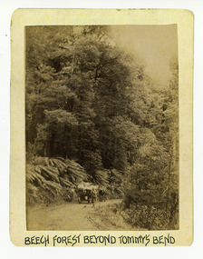
Photograph (Item) - Black and white photograph, Beech Forest Beyond Tommy's Bend, c1900
... woodland and is one of the many walking tracks in and around Marysville. It is accessible from Lady Talbot Drive which is a 24 kilometer scenic rainforest car journey which passes a number of walks and waterfalls in the Yarra Ranges National Park. ...An early black and white photograph of The Beeches, which is known as the Beech Grove, near Tommy's Bend near Marysville in Victoria.An early black and white photograph of The Beeches, which is known as the Beech Grove, near Tommy's Bend near Marysville in Victoria. Tommy's Bend is a stretch of road 10 kilometres from Marysville on the Wood's Point Road up to Lake Mountain. The Beeches Rainforest Walk is a loop that starts at Taggerty Cascades before winding through Myrtle Beech and Mountain Ash woodland and is one of the many walking tracks in and around Marysville. It is accessible from Lady Talbot Drive which is a 24 kilometer scenic rainforest car journey which passes a number of walks and waterfalls in the Yarra Ranges National Park. Lady Talbot Drive is named after Lady Sarah Elizabeth, the wife of Sir Reginald Talbot, who was the Governor of Victoria from 25th April, 1904 to 6th July 1908.ARMSTRONG COLLECTION 42 STATION STREET/ SANDRINGHAM 3191/ TEL. (03) 9521 5442/ IAN M.L. ARMSTRONG OAMtommy's bend, marysville, victoria, marysville-wood's point road, beech grove, wood's point road, lake mountain, beeches rainforest walk, taggerty cascades, myrtle beech, mountain ash, lady talbot drive, lady talbot forest drive, lady sarah elizabeth talbot, sir reginald talbot -
 Marysville & District Historical Society
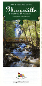
Map (Item) - Map and touring guide, Murrindindi Regional Tourism Association Inc, Marysville & The Mystic Mountains VICTORIA-AUSTRALIA, 08-2002
... A fold out map and touring guide of Marysville and the surrounding district published in 2002 by Murrindindi Regional Tourism Association Inc. marysville victoria australia map and touring guide mystic mountains tourism the beeches rainforest walk lake mountain cambarville cathedral range state park the cumberland abbey green b&b cottages anastasia fairytale cottage ashlar cottage b&b somerled mountain retreat baree mudbrick cottages blackwood cottages camellia cottage cathedral view b&b cottage riverside crossways country inn dalrymples guest cottages esa country ministries hillcrest keppels hotel motel kerami house lomatia lodge lyell guest cottages marylands country house marysville caravan park marysville holiday cottages maryton park melina cottage moondai farm b&b mountain lodge marysville mount cathedral lodge mystic mountains holiday cottages nanda binya lodge rendezvous on murchison scenic b&b the hermitage tower motel waratah house willowbank at taggerty woodlands of narbethong keppels lake mountain resort cafe lanterns at willowbank mantirri blueberry farm marysville country bakery the old woolshed cafe clearstream olives uncle fred & aunty val's old style lolly shop acheron valley alpacas country store & gallery bruno's art and sculpture garden country touch things of sand & stone willowbank gallery marysville auto & hardware marysville newsagency & general store marysville visitor information centre narbethong visitor information centre gallipoli park keppels lookout lady talbot drive steavenson falls steavenson river taggerty river acheron river black spur trail riding centre buxton trout farm lake mountain resort ski hire lake mountain ski school marysville district country club marysville ski centre narbethong ski hire rubicon horse riding country touch tours murrindindi regional tourism association inc A fold out map and touring guide of Marysville and the surrounding district published in 2002 by Murrindindi Regional Tourism Association Inc. ...A fold out map and touring guide of Marysville and the surrounding district published in 2002 by Murrindindi Regional Tourism Association Inc.A fold out map and touring guide of Marysville and the surrounding district published in 2002 by Murrindindi Regional Tourism Association Inc.marysville, victoria, australia, map and touring guide, mystic mountains tourism, the beeches rainforest walk, lake mountain, cambarville, cathedral range state park, the cumberland, abbey green b&b cottages, anastasia fairytale cottage, ashlar cottage b&b, somerled mountain retreat, baree mudbrick cottages, blackwood cottages, camellia cottage, cathedral view b&b, cottage riverside, crossways country inn, dalrymples guest cottages, esa country ministries, hillcrest, keppels hotel motel, kerami house, lomatia lodge, lyell guest cottages, marylands country house, marysville caravan park, marysville holiday cottages, maryton park, melina cottage, moondai farm b&b, mountain lodge marysville, mount cathedral lodge, mystic mountains holiday cottages, nanda binya lodge, rendezvous on murchison, scenic b&b, the hermitage, tower motel, waratah house, willowbank at taggerty, woodlands of narbethong, keppels, lake mountain resort cafe, lanterns at willowbank, mantirri blueberry farm, marysville country bakery, the old woolshed cafe, clearstream olives, uncle fred & aunty val's old style lolly shop, acheron valley alpacas country store & gallery, bruno's art and sculpture garden, country touch, things of sand & stone, willowbank gallery, marysville auto & hardware, marysville newsagency & general store, marysville visitor information centre, narbethong visitor information centre, gallipoli park, keppels lookout, lady talbot drive, steavenson falls, steavenson river, taggerty river, acheron river, black spur trail riding centre, buxton trout farm, lake mountain resort ski hire, lake mountain ski school, marysville district country club, marysville ski centre, narbethong ski hire, rubicon horse riding, country touch tours, murrindindi regional tourism association inc -
 Marysville & District Historical Society
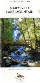
Map (Item) - Tourist map, Mystic Mountains Tourism, OFFICIAL VISITORS' MAP MARYSVILLE LAKE MOUNTAIN, Unknown
... A visitors' map of Marysville and Lake Mountain produced by Mystic Mountains Tourism for Visit Victoria. marysville lake mountain victoria australia visitor's map official visitors' map marysville lake mountain buxton narbethong taggerty visit victoria mystic mountains tourism inc graph attack p/l mystic mountains marysville triangle marysville visitor information centre marylands country house black spur steavenson falls lady talbot drive cambarville cathedral ranges wirreanda festival lake mountain summit walk summit walk loop leadbeaters loop day loop walk buxton hotel igloo roadhouse karmann waters silverstream b&b cottages buxton trout and salmon farm the niche wine bar buxton post office & general store choppers buxton roadhouse woodlands rainforest bungalows chestnut glade black spur inn wombat cottage abbey lake luxury b&b spa cottages mystic mountain ski hire & outdoors pnl 4wdriving blue views holiday units & ski hire marapana agistment park & farm stay b&b danico design things of sand & stone mantirri blueberry farm allawah country cottages amberview cottages ashlar cottage b&b black spur motel & caravan park blackwood deluxe cottages blackwood courtyard b&b dalrymples guest cottages delderfield el kanah guest house fruit salad farm kerami guest house keppels hotel lake mountain-snow gum lodge lomatia lodge lyell guest cottages magnolia house keppel waters lyrebird apartments marysville caravan park all view spa apartments riverside cottages maryton park b&b country cottages melina cottage mountain lodge mystic mountains holiday cottages nanda binya lodge rendezvous luxury cottages scenic b&b motel the cumberland south cathedral farm tower motel willowbank at taggerty woodlands rainforest retreat marysville & district country club inc mystic mountains ski hire & outdoors rubicon valley horse riding marysville trout and salmon ponds gallipoli park keppels lookout cambarville-yarra ranges national park lake mountain-yarra ranges national park lady talbot drive-yarra ranges national park cathedral range state park steavenson river taggerty river acheron river lake mountain alpine resort bruno's art and sculpture garden manical mechanicals uncle fred & aunty val's old style lolly shop carmyle farm boutique crossways historic country inn fraga's gilberts restaurant heights licensed bistro the old woolshed cafe cathedral view natural therapies crystal journey The Marysville and Lake Mountain Visitor Map and Touring Guide has been compiled and/ published by Mystic Mountains Tourism Inc. ...A visitors' map of Marysville and Lake Mountain produced by Mystic Mountains Tourism for Visit Victoria.A visitors' map of Marysville and Lake Mountain produced by Mystic Mountains Tourism for Visit Victoria.The Marysville and Lake Mountain Visitor Map and Touring Guide has been compiled and/ published by Mystic Mountains Tourism Inc. Copyright./ Production and artwork Graph Attack P/Lmarysville, lake mountain, victoria, australia, visitor's map, official visitors' map marysville lake mountain, buxton, narbethong, taggerty, visit victoria, mystic mountains tourism inc, graph attack p/l, mystic mountains, marysville triangle, marysville visitor information centre, marylands country house, black spur, steavenson falls, lady talbot drive, cambarville, cathedral ranges, wirreanda festival, lake mountain summit walk, summit walk loop, leadbeaters loop, day loop walk, buxton hotel, igloo roadhouse, karmann waters, silverstream b&b cottages, buxton trout and salmon farm, the niche wine bar, buxton post office & general store, choppers buxton roadhouse, woodlands rainforest bungalows, chestnut glade, black spur inn, wombat cottage, abbey lake luxury b&b spa cottages, mystic mountain ski hire & outdoors, pnl 4wdriving, blue views holiday units & ski hire, marapana agistment park & farm stay b&b, danico design, things of sand & stone, mantirri blueberry farm, allawah country cottages, amberview cottages, ashlar cottage b&b, black spur motel & caravan park, blackwood deluxe cottages, blackwood courtyard b&b, dalrymples guest cottages, delderfield, el kanah guest house, fruit salad farm, kerami guest house, keppels hotel, lake mountain-snow gum lodge, lomatia lodge, lyell guest cottages, magnolia house, keppel waters, lyrebird apartments, marysville caravan park, all view spa apartments, riverside cottages, maryton park b&b country cottages, melina cottage, mountain lodge, mystic mountains holiday cottages, nanda binya lodge, rendezvous luxury cottages, scenic b&b motel, the cumberland, south cathedral farm, tower motel, willowbank at taggerty, woodlands rainforest retreat, marysville & district country club inc, mystic mountains ski hire & outdoors, rubicon valley horse riding, marysville trout and salmon ponds, gallipoli park, keppels lookout, cambarville-yarra ranges national park, lake mountain-yarra ranges national park, lady talbot drive-yarra ranges national park, cathedral range state park, steavenson river, taggerty river, acheron river, lake mountain alpine resort, bruno's art and sculpture garden, manical mechanicals, uncle fred & aunty val's old style lolly shop, carmyle farm boutique, crossways historic country inn, fraga's, gilberts restaurant, heights licensed bistro, the old woolshed cafe, cathedral view natural therapies, crystal journey -
 Marysville & District Historical Society
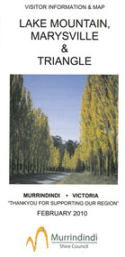
Map (Item) - Tourist map, Murrindindi Shire Council, VISITOR INFORMATION & MAP LAKE MOUNTAIN, MARYSVILLE & TRIANGLE, 02-2010
... A visitor information map for Lake Mountain, Marysville and the local district produced by the Murrindindi Shire Council in February 2010. lake mountain marysville victoria australia visitor information & map murrindindi shire council big 4 holiday park taggerty black spur inn black spur motel & caravan park bush creek buddha buxton hotel motel cathedral valley farm chestnut glade crossways historic country inn delderfield luxury b&b kingbilli country estate marapana agistment park & farm stay b&b maryton park b&b pinjarra gardens sarsens rest silverstream b&b tower motel willowbank at taggerty wombat cottage woodlands rainforest retreat buxton general store and post office buxton zoo nursery cathedral view natural therapies country touch cross country ski hire foodworks highwood health retreat lake mountain ski hire lit & beyond lj hooker maroondah outdoor equipment/bait & tackle marysville medical centre marysville patisserie marysville ski centre marysville triangle real estate marysville visitor information centre mystic mountains ski hire/outdoors pat's hairdressing penni lanes country wares plant's by shelian Murrindindi Shire Council has made every effort to ensure the information provided at the time/ of printing is correct, but accepts no responsibility for an inaccuracies or omissions. ...A visitor information map for Lake Mountain, Marysville and the local district produced by the Murrindindi Shire Council in February 2010. This information guide and map was produced after the 2009 Black Saturday bushfires destroyed most of the township of Marysville.A visitor information map for Lake Mountain, Marysville and the local district produced by the Murrindindi Shire Council in February 2010.Murrindindi Shire Council has made every effort to ensure the information provided at the time/ of printing is correct, but accepts no responsibility for an inaccuracies or omissions.lake mountain, marysville, victoria, australia, visitor information & map, murrindindi shire council, big 4 holiday park taggerty, black spur inn, black spur motel & caravan park, bush creek buddha, buxton hotel motel, cathedral valley farm, chestnut glade, crossways historic country inn, delderfield luxury b&b, kingbilli country estate, marapana agistment park & farm stay b&b, maryton park b&b, pinjarra gardens, sarsens rest, silverstream b&b, tower motel, willowbank at taggerty, wombat cottage, woodlands rainforest retreat, buxton general store and post office, buxton zoo nursery, cathedral view natural therapies, country touch, cross country ski hire, foodworks, highwood health retreat, lake mountain ski hire, lit & beyond, lj hooker, maroondah outdoor equipment/bait & tackle, marysville medical centre, marysville patisserie, marysville ski centre, marysville triangle real estate, marysville visitor information centre, mystic mountains ski hire/outdoors, pat's hairdressing, penni lanes country wares, plant's by shelian
