Showing 331 items matching "yarra river - history"
-
 Kew Historical Society Inc
Archive (Sub-series) - Subject File, Kew Historical Society, GRIMES, Charles, 1962
... ...yarra river - history...Typically files will contain primary and secondary sources. charles grimes commemorations - kew (vic.) european exploration - kew (vic) yarra river - history Charles Grimes was acting Surveyor-General of the Colony of New South Wales. ...Various partiesReference, Research, InformationSecondary Values (KHS Imposed Order)Charles Grimes was acting Surveyor-General of the Colony of New South Wales. He was the first European cartographer to map the lower reaches of the Yarra River. The reference file contains both research on the ‘exploration’ by Grimes as well as information on a re-enactment, sponsored by the Kew Historical Society in 1978, to mark the 175th year of his party’s arrival in the area of what is now Dight’s Falls. In the file is a 13-page handwritten document to be used as a script for a speech during the reenactment, which also includes details of the costumes to be worn. There are additional unpublished manuscripts in the file about Grimes and his ‘journey’ by Mr Chinner and Mavis Rolley. The file also includes newspaper articles/clippings as well as sundry published articles.charles grimes, commemorations - kew (vic.), european exploration - kew (vic), yarra river - historycharles grimes, commemorations - kew (vic.), european exploration - kew (vic), yarra river - history -
 Kew Historical Society Inc
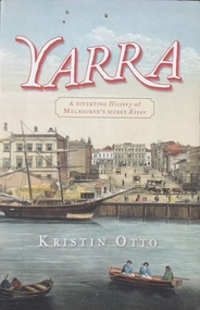
Book, Kristin Otto, Yarra: a diverting history of Melbourne's murky river, 2005
... Yarra: a diverting history of Melbourne's murky river......yarra river - history...History of the Yarra River by Kristin Otto...Kew Historical Society Inc Kew Court House 188 High Street Kew melbourne History of the Yarra River by Kristin Otto melbourne - history yarra river - history 245 p. : ill., bib., index, pbk ; 24 cm. ...245 p. : ill., bib., index, pbk ; 24 cm.non-fictionmelbourne - history, yarra river - history -
Kew Historical Society Inc
Book, Colin Jones, Ferries on the Yarra, 1981
... yarra river...ferries -- victoria =- yarra river -- history...history and/or to support the Society's collections of pictures, maps, fashion and artefacts. Reference books have entered the collection through donation, presentation, collection and purchase. ferry services -- ferries -- melbourne -- yarra river ferries -- victoria =- yarra river -- history ferries -- victoria -- melbourne -- history. ...Collingwood, Vic. : Greenhouse, 1981 108 pages : ill., map ; 26 cm. non-fictionferry services -- ferries -- melbourne -- yarra river, ferries -- victoria =- yarra river -- history, ferries -- victoria -- melbourne -- history. -
Kew Historical Society Inc
Book, Francis Jordan, Guide to historical resources of the Yarra Valley, focusing on conservation and historic landscape, 1992
... yarra river valley...landscape -- victoria -- yarra river valley -- history...history and/or to support the Society's collections of pictures, maps, fashion and artefacts. Reference books have entered the collection through donation, presentation, collection and purchase. conservation of natural resources -- victoria -- yarra river valley landscape -- victoria -- yarra river valley -- history ecology -- victoria -- yarra river valley historic sites -- victoria -- yarra river valley yarra river valley (vic.) -- history. ...[Ormond, Vic. : F.I. Jordan], 1991 31 leaves : 1 map ; 30 cm. non-fictionconservation of natural resources -- victoria -- yarra river valley, landscape -- victoria -- yarra river valley -- history, ecology -- victoria -- yarra river valley, historic sites -- victoria -- yarra river valley, yarra river valley (vic.) -- history. -
 Eltham District Historical Society Inc
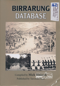
Book, Tarcoola Press, Birrarung Database compiled by Mick Woiwod, 2012
... yarra river...indigenous history...A compilation of Woiwod's research material, with information on the history of the Wurundjeri people of the Yarra Valley, from the time of first European contact. Its prime focus is the Yarra River as it has been understood by its Wurundjeri people. ...Sister publication to "Coranderrk database". wurundjeri yarra river indigenous history Wurundjeri Woi Wurrung Aboriginal Australians ISBN 9780987157423 318 pages : illustrations, maps ; 30 cm + 1 CD-ROM (4 3/4 in.) ...A compilation of Woiwod's research material, with information on the history of the Wurundjeri people of the Yarra Valley, from the time of first European contact. Its prime focus is the Yarra River as it has been understood by its Wurundjeri people. Includes a compilation of those difficult to locate "brief snatches of the action" collated under headings with in each instance, the provenance as to source and / or author included. Themes include: agriculture, law, ceremony, language, reconciliation, retribution, lifestyle, art & craft, climate, personalities, disease, death and the river's flora and fauna. Sister publication to "Coranderrk database". 318 pages : illustrations, maps ; 30 cm + 1 CD-ROM (4 3/4 in.) PDF or Microsoft Office Word 97-2003.ISBN 9780987157423wurundjeri, yarra river, indigenous history, wurundjeri woi wurrung, aboriginal australians -
 Kew Historical Society Inc
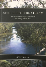
Book, Australian Scholarly Publishing Pty Ltd, Still Glides the Stream: The natural history of the Yarra from Heidelberg to Yarra Bend, 2004
... yarra river - natural history...Kew Historical Society Inc Kew Court House 188 High Street Kew melbourne yarra river - natural history geoff lacey Natural History of Yarra xii, 281 p. : ill., maps ; 22 cm Still Glides the Stream: The natural history of the Yarra from Heidelberg to Yarra Bend Book Australian Scholarly Publishing Pty Ltd Geoff Lacey ...Natural History of Yarraxii, 281 p. : ill., maps ; 22 cmnon-fictionNatural History of Yarrayarra river - natural history, geoff lacey -
 Eltham District Historical Society Inc
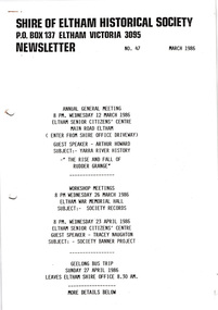
Newsletter, Newsletter, No. 47 March 1986
... Contents: • Next meeting, guest speaker, Arthur Howard: Yarra River history – “The rise and fall of Rudder Grange” • Annual General Meeting • Arthur Howard • Records/Research workshops • Society Banner project • Geelong bus trip • Heritage Week • Society Calendar ...Eltham District Historical Society Inc 728 Main Rd Eltham melbourne Contents: • Next meeting, guest speaker, Arthur Howard: Yarra River history – “The rise and fall of Rudder Grange” • Annual General Meeting • Arthur Howard • Records/Research workshops • Society Banner project • Geelong bus trip • Heritage Week • Society Calendar The Shire of Eltham Historical Society was formed in October 1967. ...Contents: • Next meeting, guest speaker, Arthur Howard: Yarra River history – “The rise and fall of Rudder Grange” • Annual General Meeting • Arthur Howard • Records/Research workshops • Society Banner project • Geelong bus trip • Heritage Week • Society Calendar The Shire of Eltham Historical Society was formed in October 1967. The first newsletter of the Society was issued May 1978 and has been published continuously ever since on a bi-monthly basis. With the cessation of the Shire of Eltham in late 1994, the Society's name was revised to Eltham District Historical Society and this name first appeared with issue No. 103, July 1995. The collection of the Society's newsletters provides a valuable resource on the history of the Society's activities, office bearers and committee members, guest speakers and subjects of historical interest pertinent to the former Shire of Eltham and the Eltham District.A4 photocopied newsletter distributed to membersnewsletter, eltham district historical society, shire of eltham historical society -
 Greensborough Historical Society
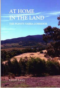
Book, Geoff Lacey, At home in the land: the Plenty-Yarra corridor, 2021
... An ecological study of the the landscape along the corridors of the Plenty and Yarra rivers, their history, development and conservation....Greensborough Historical Society 34A Glenauburn Road Lower Plenty Lower Plenty melbourne An ecological study of the the landscape along the corridors of the Plenty and Yarra rivers, their history, development and conservation. indigenous plants indigenous fauna plenty river yarra river 111 p., paperback, col. photographs, maps At home in the land: the Plenty-Yarra corridor Book Book Geoff Lacey ...111 p., paperback, col. photographs, mapsnon-fictionindigenous plants, indigenous fauna, plenty river, yarra river -
 Eltham District Historical Society Inc
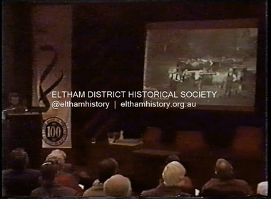
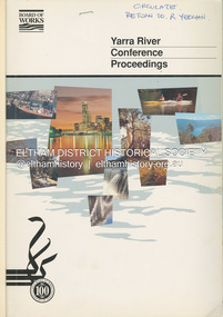
Film - Video (DVD), Melbourne and Metropolitan Board of Works, Yarra River Conference Proceedings; a Board of Works centenary event, 13-16 April 1991
... Yarra River Conference History Segment [Noted on VHS tape jackets "Due to unavoidable circumstances, the quality of these tapes in some setions is less than desired."] ...Eltham District Historical Society Inc 728 Main Rd Eltham melbourne Yarra River Conference History Segment [Noted on VHS tape jackets "Due to unavoidable circumstances, the quality of these tapes in some setions is less than desired."] ...Yarra River Conference History Segment [Noted on VHS tape jackets "Due to unavoidable circumstances, the quality of these tapes in some setions is less than desired."] The Yarra River Conference, organised by the Board of Works as part of the Centenary Celebrations, was held in the Board's Head Office Theatrette from 13-16 April, 1991. A segment of the Conference focussed on the role that the Yarra River has played in relation to the historical development of Melbourne. Conceived and presented by a group of prominent historians as a chronological 'trip down the river in time', and profusely illustrated with slides, this segment traced the various impacts that urban and rural growth, development of marine commerce, recreational uses, and environmental problems have had on the Yarra during a century and a half of European occupation. As no formal written paper of this combined presentation is available, these two video-tapes provide a record for anyone who has an interest in tis fascinating aspect of the Yarra's history. The speakers who combined to present this segment are identified on the cover of Tape 2. Tape 1 (2 hours) 1838-1863 Deputy ?? to Utility Early navigators of the Yarra River; developing the port of Melbourne; the gold rush and its effect on the new colony; punts and bridges; water supply; pollution of the Yarra; the discovery of gold and early settlement of the Yarra valley; floods of 1839 and 1863. 1863-1891 Formation of the Harbour Trust; Coode Canal; pollution of the Yarra by industry; aborigines, gold miners, timber getters in the Upper Yarra areas; bridges; the flood of 1891. Tape 2 ( 1 1/2 hours) 1892-1934: People Begin to See Beauty and Romance to the River Henley-on-Yarra; realignment of the Yarra; MMBW is responsible for a sewerage system; new docks to cope with increased overseas trade; development of recreational parks; new reservoirs; timber production and timber tramways; bushfire; flood of 1934. 1935-1970: The River is Neglected Still, Except When it Proves Useful Bushfirs of 1939; the end of many sawmills; birth of tourism; increased interest in conservation and preservation of land for open space; further augmentation of water supply system; birth of containerisation changes the port; environmental concerns gain momentum. Speakers Dr Tony Dingle *, Department of Economic History, Monash University Dr Carolyn Rasmussen *, History Consultant Prof. Graeme Davison, History Department, Monash University Mr. Tom Griffiths, Lecturer in Public History, Monash Uiversity Mr. Patrick Miller, History Consultant Mr. Colin Jones, Author and Historian * Co-authors of the Board's history, 'Vital Connections'.video recording, yarra river, conference proceedings -
 Flagstaff Hill Maritime Museum and Village
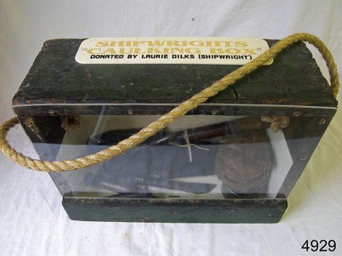
Equipment - Toolbox, Laurie Dilks, shipwright, Mid-to-late 20th century
... Many decades later Laurie worked on the Yarra River moving barges up and down the river and was fondly given the title ‘Riverboat Man’ His interest in maritime history led him to volunteer with the Maritime Trust of Australia’s project to restore and preserve the historic WWII 1942 Corvette, the minesweeper HMAS Castlemaine, which is a sister ship to the HMAS Warrnambool J202....Many decades later Laurie worked on the Yarra River moving barges up and down the river and was fondly given the title ‘Riverboat Man’ His interest in maritime history led him to volunteer with the Maritime Trust of Australia’s project to restore and preserve the historic WWII 1942 Corvette, the minesweeper HMAS Castlemaine, which is a sister ship to the HMAS Warrnambool J202. ...Caulking is a process used by shipwrights and other tradespeople to seal the gaps and cracks in boats and ships, buildings and plumbing fittings. It prevents water, air and pests from entering the through the gaps. The shipwright’s caulking box and a display of shipwright's tools are connected to the maritime history of Victoria through their past owner, user and donor, Laurie Dilks. Laurie began his career as a shipwright in the mid-1900s, following in the wake of the skilled carpenters who have over many centuries used their craft to build and maintain marine vessels and their fittings. Laurie worked for Ports and Harbours, Melbourne, for over 50 years, beginning in the early 1960s. He and a fellow shipwright inscribed their names on a wheelhouse they built in 1965; the inscription was discovered many decades later during a repair of the plumbing. Many decades later Laurie worked on the Yarra River moving barges up and down the river and was fondly given the title ‘Riverboat Man’ His interest in maritime history led him to volunteer with the Maritime Trust of Australia’s project to restore and preserve the historic WWII 1942 Corvette, the minesweeper HMAS Castlemaine, which is a sister ship to the HMAS Warrnambool J202.The shipwright’s caulking box containing caulking tools is an example of the equipment used by shipwrights in the early to mid-20th centuries. This box is connected to the maritime history of Victoria through its past owner, user and donor, Laurie Dilks. Laurie began his career as a shipwright at Ports and Harbours in Melbourne in the mid-1900s, following in the wake of the skilled carpenters who have over many centuries used their craft to build and maintain marine vessels and their fittings.Shipwright's caulking box, green wooden exterior with green and cream interior. Box has a Perspex face. A rope handle, knotted on each end, extends from one side to the other. A white rectangular plaque with rounded corners is screwed to the top and has yellow and black printed text. The donor was shipwright Laurie Dilks.Printed on plaque "SHIPWRIGHTS / CAULKING BOX / DONATED BY LAURIE DILKS [SHIPWRIGHT]'"flagstaff hill, flagstaff hill maritime museum and village, warrnambool, maritime museum, maritime village, great ocean road, shipwreck coast, caulking tools, caulking equipment, caulking box, shipwright's tools, laurie kilks, ports and harbours -
 Eltham District Historical Society Inc
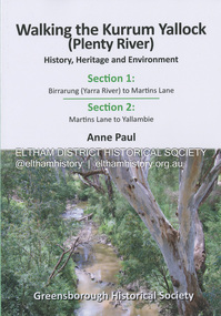
Book, Anne Paul, Walking the Kurrum Yallock (Plenty River), 25 July 2023
... The Kurrum Yallock walks aim to guide people along the River Trail, while providing insight into key aspects of our recent history, an opportunity for reflection and an enhanced enjoyment of the River's special environment and landscape. Birrarung Greensborough Historical Society Kurrum Yallock Martins Lane Plenty River yallambie Yarra ...Kurrum Yallock - the Plenty River is Melbourne's third river. It is a defining feature of the region weaving its way through local suburbs and parklands. It is often hidden from general view, emerging at bridges and along its extensive trail network. While diminished since European settlement, the River provides an important environmental, wildlife corridor and recreational resource, along with many links to its settlement heritage. The Kurrum Yallock walks aim to guide people along the River Trail, while providing insight into key aspects of our recent history, an opportunity for reflection and an enhanced enjoyment of the River's special environment and landscape.birrarung, greensborough historical society, kurrum yallock, martins lane, plenty river, yallambie, yarra river -
Eltham District Historical Society Inc
Document - Folder, Newman, Charles
... Yarra", "A brief history of Warrandyte", "The branch is broken", "Melbourne's historic home", "Land with infamous past", "Charles Newman's original grave at Monckton", and "Site of Major Newman's land". Photocopy of pages from "Templestowe - a folk history", Hazel Poulter, 1985,: "The squatter, Major Charles Newman". Charles Newman British East India Company Templestowe Vic Warrandyte Vic David Crockett Hazel Poulter James Anderson Anne Anderdon A B Owen Wurundjeri Clan of the Kulin Andersons Station on the Yarra River ...British army officer Major Charles Newman was an early settler on the Yarra River at Templestowe after serving in India in the East India Company. Later be married and moved to Tasmania, farming at Black Brush near Pontville. In 1835 he came to the Port Phillip District and explored the Yarra River, returning with his family. David Crockett and Hazel Poulter researched, respectively, Charles Newman and the Templestowe area, identifying the Newman house, Pontville, on the Yarra banks. David Crockett also researched James and Anne Anderson. Contents Newspaper article: "David fills in the gaps", Diamond Valley News, 16 December 1986.29 October 1985, p62. Story of Charles Newman and of David Crockett and Hazel Poulter's researches. Letter, A (Tony) B Owen to Eltham Historical Society, 12 March 2018, enclosing information about Major Charles Newman. Email, Eltham District Historical Society to Tony Owen, acknowledging receipt of information about Major Charles Newman. Photocopy of pages from "Glimpses of Life in Victoria", pp38-43. Flier, "Heritage Events in Nillumbik, 2005". Photocopy of pages from unidentified volume, chapter headed "The Bush", and part chapter IV "Bushrangers". Warrandyte Historical Society publication "The Wurundjeri Clan of the Kulin". Whitehorse Manningham Heritage Network search results for "Andersons Station on the Yarra Yarra", "A brief history of Warrandyte", "The branch is broken", "Melbourne's historic home", "Land with infamous past", "Charles Newman's original grave at Monckton", and "Site of Major Newman's land". Photocopy of pages from "Templestowe - a folk history", Hazel Poulter, 1985,: "The squatter, Major Charles Newman".Newspaper clippings, A4 photocopies, etccharles newman, british east india company, templestowe vic, warrandyte vic, david crockett, hazel poulter, james anderson, anne anderdon, a b owen, wurundjeri clan of the kulin, andersons station on the yarra river -
 Eltham District Historical Society Inc
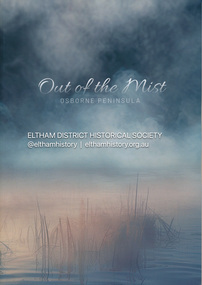
Book, Jenny Brown et al, Out of the Mist; Osborne Peninsula, 2024
... yarra river...Birrarung...Dray track...Fauna...geology...houses...indigenous history...The Osborne Peninsula on the Yarra River at Warrandyte accommodates a limited number of properties and residents (70 households). The area is rich in geology and ecology, and an unusually rich endowment of human, built and creative history. ...Eltham District Historical Society Inc 728 Main Rd Eltham melbourne The Osborne Peninsula on the Yarra River at Warrandyte accommodates a limited number of properties and residents (70 households). The area is rich in geology and ecology, and an unusually rich endowment of human, built and creative history. ...The Osborne Peninsula on the Yarra River at Warrandyte accommodates a limited number of properties and residents (70 households). The area is rich in geology and ecology, and an unusually rich endowment of human, built and creative history. Contents: Welcome: The landform: The River: Aboriginal occupation: The Miners: North Warrandyte :The Subdivision: The Lowes: The Osbornes: The Last Osborne: The Elders: The Relics: Dray Track: Water Wheel"Kauri Plaque: River track: Pines: Windmill Creek Bridge: The Koornong School: The Houses" Man Cave: MidCentury Classic: Enduring Original" Masterwork: The Muddies: The State Park: The Saving of Koornong Reserve: The Landcare Story: Flora and Fauna: The Vulnerable, Endangered and threatened: Birds: Mammals: "Waring" the wombat: Reptiles: Fish: Invertebrates: Flora: Fire. Published by the North Warrandyte (Osborne Peninsula) Landcare Group. Includes photos from EDHS collection.64 p. : ill., map ; 29.7 x 21 cm. (2 copies)yarra river, birrarung, dray track, fauna, geology, houses, indigenous history, koornong reserve, koornong school, lowe family, mining, mudbrick houses, north warrandyte, osborne family, warrandyte state park, water wheel, north warrandyte (osborne peninsula) landcare group, osborne peninsula -
![Book, Dr Judith Buckrich, Yarra Birrarung: artists, writers and the river, [2024]](/media/collectors/4f729f7b97f83e03086018a5/items/67ba8835406af522eeba63c0/item-media/67be949eac2704e0db957062/item-fit-380x285.jpg?cb=6) Eltham District Historical Society Inc
Eltham District Historical Society IncBook, Dr Judith Buckrich, Yarra Birrarung: artists, writers and the river, [2024]
... Eltham District Historical Society Inc 728 Main Rd Eltham melbourne yarra river Melbourne Yarra Birrarung: Artists, Writers and the River is an illustrated history of life on the Yarra. ...Yarra Birrarung: Artists, Writers and the River is an illustrated history of life on the Yarra. Through the lens of artists and writers, the book explores how life has flourished on the river, including recreation, industry and land use, as well as infrastructure, natural history and social history. This is the first comprehensive illustrated story of the Yarra River over the past 200 years, examined through the lives of its creatives.256 p.non-fictionYarra Birrarung: Artists, Writers and the River is an illustrated history of life on the Yarra. Through the lens of artists and writers, the book explores how life has flourished on the river, including recreation, industry and land use, as well as infrastructure, natural history and social history. This is the first comprehensive illustrated story of the Yarra River over the past 200 years, examined through the lives of its creatives.yarra river, melbourne -
 Eltham District Historical Society Inc
Photograph - Digital Photograph, Alan King, Downing-Le Gallienne house, Yarra Braes Road, Eltham, 30 January 2008
... Yarra River. This collection of almost 130 photos about places and people within the Shire of Nillumbik, an urban and rural municipality in Melbourne's north, contributes to an understanding of the history of the Shire. ...The property is a classic example of what made Eltham famous from the late 1940s to the 1960s. Covered under Heritage Overlay, Nillumbik Planning Scheme. Published: Nillumbik Now and Then / Marguerite Marshall 2008; photographs Alan King with Marguerite Marshall.; p149 The first view of the large double-storey house at Yarra Braes Road, Eltham South, is of a jutting roofline over a balcony, reminiscent of a large sailing vessel or galleon – very appropriate, considering the name of one of the first owners, Le Gallienne. The Downing-Le Gallienne property is a classic example of what made Eltham famous from the late 1940s to the 1960s and attracted so many artists and intellectuals to the area. Set in a largely indigenous bush-style garden, the mud-brick and timber house was built by Alistair Knox. It was built for economist Richard Downing, to become a founder of the welfare state in Australia and Chairman of the Australian Broadcasting Commission, and musician and composer Dorian Le Gallienne. Le Gallienne was a pioneering composer of modern music in Victoria before 1945, whose works included the Symphony in E.1 He wrote several pieces of film music for Eltham Films, including The Prize, working with its writer and artistic director Tim Burstall. Le Gallienne was also a music critic for The Argus and later for The Age. In 1967 the music critic Roger Covell argued that Le Gallienne’s Symphony, was ‘still the most accomplished and purposive . . . written by an Australian’. According to Alan Marshall the main inspiration behind the building that evolved from 1948 to 1964 was Le Gallienne. ‘He was able to see value in the simplest things and many who worked there had their eyes opened for the first time to the Eltham environment, to the bush and the trees and the fauna which lived there.’ The garden included no formality, no lawns, nor exotic plants. ‘Natural informal growth came right up to their doors and so did the indigenous birdlife.’ This informal style – consisting of mass and void – was to be developed and popularised by landscaper Gordon Ford from the 1950s. The large mud-brick and timber house, which was built in four stages and has three separate but linked sections, began as a small weekend retreat for the couple. In 1948, Downing and Le Gallienne (Dick and Dor to their friends), asked Knox to build the 36 x18 foot (11mx5.4m) building with a pitched slate roof. It was built on a concrete slab and included a fireplace, which is still in use. The second wing was built in 1954 after Downing had returned from working at the International Labour Office and the couple decided to live there full-time. The third section was built after the death of Le Gallienne in 1963, aged 48. He is buried in the Eltham Cemetery. When Downing married widow, Jean Norman (nee McGregor) and had to accommodate a large family, including her six children and one of their own, the last stage was built by 1964. At that time the house was considered one of the largest mud-brick houses in Victoria. It consists of five living areas, including a small ballroom. Several artists helped Knox build the Downing-Le Gallienne house, which was one of his first of mud-brick. They included painter Clifton Pugh, artist John Howley and actor Wynn Roberts. Ellis Stones had landscaped the first wing and Gordon Ford set the boulder steps and made a pool as part of the landscaping he completed. Inside, the mud-bricks are largely whitewashed with pine-lined ceilings and Oregon beams. A winding timber staircase in the front extends behind a glass window from the ground floor to the top. The property, of a little more than 0.5 ha, is bordered by Parks Victoria land, which extends to the Yarra River.This collection of almost 130 photos about places and people within the Shire of Nillumbik, an urban and rural municipality in Melbourne's north, contributes to an understanding of the history of the Shire. Published in 2008 immediately prior to the Black Saturday bushfires of February 7, 2009, it documents sites that were impacted, and in some cases destroyed by the fires. It includes photographs taken especially for the publication, creating a unique time capsule representing the Shire in the early 21st century. It remains the most recent comprehenesive publication devoted to the Shire's history connecting local residents to the past. nillumbik now and then (marshall-king) collection, dorian le gallienne, downing-le gallienne house, eltham, mudbrick construction, mudbrick houses, richard downing, yarra braes road -
 Eltham District Historical Society Inc
Photograph, Upper Yarra Dam, Spring Tour, 22 Oct 1995, 22/10/1995
... Yarra Glen Timber Trestle Bridge over the river flats "the longest for years in the land it was said!" Harry's dream of "better weather over the Divide" unfortunately didn't come true, but I'm sure we 36 members will retain happy memories of a day that was wet and green and filled with Bridges. Bettina Woodburn - October 1995 Record of the Society's history ...EXPLORING THE UPPER YARRA (Newsletter No. 105, November 1995, by Bettina Woodburn) We enjoyed the Spring Excursion, this year "Exploring the Upper Yarra" - in spite of the constant rain and the countryside under the cloud cover, especially in the valleys, being mainly shiny shades of green. The occasional fields of buttercups, clumps of arum lilies and splendid rhododendron and other flowering bushes became very special. The Cobb and Co coach was warm and a cosy retreat as we zig-zagged on the highways and byways to glimpse the Yarra River, upstream and down, its secret places, and particularly the many bridges. Russell excelled as 'Poet Laureate', reading from Dacre Smyth's book. This 1979 publication includes paintings of all the bridges along the river with poems and brief descriptions of each one. Some of the bridges are in out of the way places and are not very well known. We looked forward to hearing the poetry as much as seeing the ' constructions'…Big Pat (was he short or tall, lean or fat? He did win the two hundred pound reward for discovering gold and had the creek named after him), about the 'Eddies'?, and the disliked 'meccano' bridge in Warburton, etc. etc. The hot roast lunch in the old Reefton Hotel was also most welcome. It was easy to imagine it peopled by miners and early settlers. Starting by crossing the new (1974) concrete bridge at Warrandyte we headed through Wonga Park with views to the Christmas Hills and to the escarpment of the Yering Gorge, which causes flood waters to back up through the Yarra Glen plain, so avoiding disasters downstream. At the end of a long driveway we found the wooden, privately owned Henley Bridge (1935 after the 1934 floods). This facilitates access to different parts of Henley Farm and to Lilydale. Everard Park, named after Blanche Shallard's father, a State Member for 17 years, below the Highway Yarra crossing was in need of care. It is 10 miles from Yarra Glen by road but, as "Yarra Marra” canoeists well know, 32 winding miles down by water. After more delightful countryside scenes we joined the Warburton Highway at Woori Yallock. From the old Railway Station at Launching Place the Centennial Trail for walkers, cyclists and ' horse riders has replaced the rails. The line from Lilydale was opened in 1901, and the last diesel freight train ran to Warburton in 1965. It continued to rain as we had morning tea in Warburton in a shelter between footbridges. From here we continued upstream past the Bridge to O'Shannasy Lodge and Reservoir, Starvation Creek, and the Peninsular tunnel (miners dug it as at Pound Bend) which we visited (scrambling down those steps!) on our return after lunch. Our furthermost point was the Upper Yarra Dam Reserve (and vast catchment area). Finished in 1957 after ten years work and 100 years after Yan Yean, it supplies much of Melbourne's water. After crossing the 30m Launching Place Bridge to the Eltham side of the Yarra and Healesville, we saw in the distance the Yarra Glen Timber Trestle Bridge over the river flats "the longest for years in the land it was said!" Harry's dream of "better weather over the Divide" unfortunately didn't come true, but I'm sure we 36 members will retain happy memories of a day that was wet and green and filled with Bridges. Bettina Woodburn - October 1995 Record of the Society's history of activities - Spring 1995 excursionColour photographshire of eltham historical society, activities, upper yarra dam, henley bridge -
 Eltham District Historical Society Inc
Photograph, Fay Bridge, The Love Shack, 195 Laughing Waters Road, Eltham, April 2016
... For a more in-depth description and history of the property and that of Gordon and Sue Ford, see Jane Woollard's book, "Laughing Waters Road; Art, Landscape & Memory in Eltham" published 2016. Fay Bridge Collection 2016-04 Bernie's hut Birrarung Gordon Ford Gordon's Shack Laughing Waters Road Love Shack Yarra River 7 images - born digital The Love Shack, 195 Laughing Waters Road, Eltham Photograph Photograph Fay Bridge ...Gordon Ford built this shack on the Yarra at Laughing Waters Road. Bernie Bragg used to live there for a period of time. Gordon Ford and photographer Sue Winslow were married in 1965. They set up home in an old log cabin on the property Gordon had purchased in 1954 on Laughing Waters Road. Situated between the Yarra River and Overbank Road, Gordon had built a small mud-brick shack on the river and a pontoon. Over the decades the shack has been locally referred to as “the love shack”, the “rooting shack” or simply “Gordon’s shack”. Gordon and Sue commissioned local builder Graeme Rose to do a wattle and daub renovation and extension to the old log cabin on the north side of Laughing Waters Road. The work had only just been completed in 1965 when a bushfire swept through the area and destroyed the cabin. Gordon and Sue relocated to his property, Fulling, in Pitt Street, Eltham. In 1970 work started on a new house at the Laughing Waters property. Originally known as the Banana House, it is now known as Boomerang. Designed by Alistair Knox, the mud-brick house includes iron window grilles made by Matcham Skipper that puncture the curved mud walls. The grilles were made from ‘off-pressings’ from the Sidchrome tool works in Heidelberg. Gordon, Sue and family moved into the house in 1972. Their marriage fell apart and Sue moved to Sydney with the children around the same time Gordon commenced building Birrarung just below Boomerang on the Laughing Waters Road block. After the Fords moved out, Boomerang it was rented out to various share households of students, musicians, artists and environmentalists for twenty-four years. Gordon Ford sold Birrarung and Boomerang to Melbourne Water in 1999. The Laughing Waters Artist in Residence Program was developed as a partnership between Parks Victoria and Nillumbik Shire Council. Boomerang was deemed unfit for habitation so was used as a day studio only. By 2001 Boomerang was in a poor state of repair and by 2002 the last artist in residence was to use the house as a studio. Nillumbik Shire Council had been granted funds from the Melbourne Community Fund to restore both Boomerang and Birrarung but it was apparent in early 2003 that the funds would be insufficient to restore both houses. Boomerang was infested with termites which presented a risk to any occupants and so the decision was made to close Boomerang and concentrate funding on Birrarung. Boomerang was fenced off for safety and to prevent intrusion and remains ‘caged’ today (2023). However, it is readily apparent the property has been occupied by squatters over the years. By 2023 it was clear that the squatters had abandoned the property and sections of the roof structure have given away in some areas and collapsed internally. For a more in-depth description and history of the property and that of Gordon and Sue Ford, see Jane Woollard's book, "Laughing Waters Road; Art, Landscape & Memory in Eltham" published 2016.fay bridge collection, 2016-04, bernie's hut, birrarung, gordon ford, gordon's shack, laughing waters road, love shack, yarra river -
 Eltham District Historical Society Inc
Photograph, Fay Bridge, The Love Shack, 195 Laughing Waters Road, Eltham, 22 July 2016
... For a more in-depth description and history of the property and that of Gordon and Sue Ford, see Jane Woollard's book, "Laughing Waters Road; Art, Landscape & Memory in Eltham" published 2016. Fay Bridge Collection 2016-07-22 Bernie's hut Birrarung Gordon Ford Gordon's Shack Laughing Waters Laughing Waters Road Love Shack Yarra River 3 images - born digital The Love Shack, 195 Laughing Waters Road, Eltham Photograph Photograph Fay Bridge ...Gordon Ford built this shack on the Yarra at Laughing Waters Road. Bernie Bragg used to live there for a period of time. Gordon Ford and photographer Sue Winslow were married in 1965. They set up home in an old log cabin on the property Gordon had purchased in 1954 on Laughing Waters Road. Situated between the Yarra River and Overbank Road, Gordon had built a small mud-brick shack on the river and a pontoon. Over the decades the shack has been locally referred to as “the love shack”, the “rooting shack” or simply “Gordon’s shack”. Gordon and Sue commissioned local builder Graeme Rose to do a wattle and daub renovation and extension to the old log cabin on the north side of Laughing Waters Road. The work had only just been completed in 1965 when a bushfire swept through the area and destroyed the cabin. Gordon and Sue relocated to his property, Fulling, in Pitt Street, Eltham. In 1970 work started on a new house at the Laughing Waters property. Originally known as the Banana House, it is now known as Boomerang. Designed by Alistair Knox, the mud-brick house includes iron window grilles made by Matcham Skipper that puncture the curved mud walls. The grilles were made from ‘off-pressings’ from the Sidchrome tool works in Heidelberg. Gordon, Sue and family moved into the house in 1972. Their marriage fell apart and Sue moved to Sydney with the children around the same time Gordon commenced building Birrarung just below Boomerang on the Laughing Waters Road block. After the Fords moved out, Boomerang it was rented out to various share households of students, musicians, artists and environmentalists for twenty-four years. Gordon Ford sold Birrarung and Boomerang to Melbourne Water in 1999. The Laughing Waters Artist in Residence Program was developed as a partnership between Parks Victoria and Nillumbik Shire Council. Boomerang was deemed unfit for habitation so was used as a day studio only. By 2001 Boomerang was in a poor state of repair and by 2002 the last artist in residence was to use the house as a studio. Nillumbik Shire Council had been granted funds from the Melbourne Community Fund to restore both Boomerang and Birrarung but it was apparent in early 2003 that the funds would be insufficient to restore both houses. Boomerang was infested with termites which presented a risk to any occupants and so the decision was made to close Boomerang and concentrate funding on Birrarung. Boomerang was fenced off for safety and to prevent intrusion and remains ‘caged’ today (2023). However, it is readily apparent the property has been occupied by squatters over the years. By 2023 it was clear that the squatters had abandoned the property and sections of the roof structure have given away in some areas and collapsed internally. For a more in-depth description and history of the property and that of Gordon and Sue Ford, see Jane Woollard's book, "Laughing Waters Road; Art, Landscape & Memory in Eltham" published 2016.fay bridge collection, 2016-07-22, bernie's hut, birrarung, gordon ford, gordon's shack, laughing waters, laughing waters road, love shack, yarra river -
 Eltham District Historical Society Inc
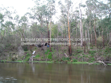
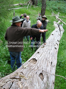
Photograph, Fay Bridge, Toe-hold tree, Heritage Excursion, Killeavey, Laughing Waters Road, Eltham, November 2016
... Heritage Excursion - Killeavey Walk and Talk - Saturday 5th November Jane Woollard’s book Laughing Waters Road Art Landscape and Memory in Eltham devotes several chapters to the property Killeavey situated on the Yarra River at the end of Reynolds Road, Eltham. Jane has written about the natural history and indigenous history of the area and stories of the family who lived at Killeavey for many years. ...Heritage Excursion - Killeavey Walk and Talk - Saturday 5th November Jane Woollard’s book Laughing Waters Road Art Landscape and Memory in Eltham devotes several chapters to the property Killeavey situated on the Yarra River at the end of Reynolds Road, Eltham. Jane has written about the natural history and indigenous history of the area and stories of the family who lived at Killeavey for many years. ...This scar or 'toe hold' tree fell over 50 yrs ago. It had died 50yrs before it fell and is estimated to be around 400 years old. It has a diameter of 1.3 m and is the only 'toe hold' tree in Nillumbik. Heritage Excursion - Killeavey Walk and Talk - Saturday 5th November Jane Woollard’s book Laughing Waters Road Art Landscape and Memory in Eltham devotes several chapters to the property Killeavey situated on the Yarra River at the end of Reynolds Road, Eltham. Jane has written about the natural history and indigenous history of the area and stories of the family who lived at Killeavey for many years. Killeavey was the home of Sir William Irvine, Victorian and Federal Parliamentarian and Supreme Court Judge. Later it was the home of his daughter Beatrice Morrison, a significant figure in the Eltham community. The original house was destroyed by fire and its replacement was demolished by Parks Victoria. Its sits high above the Yarra River and contains significant garden remnants. The surrounding bushland is valued for its significant plant communities. In September 2011 we visited Killeavey but without the benefit of the information more recently available from Jane’s research. We are fortunate that Jane will be joining us on this walk. There will be an extended stop at the house site for a discussion on the environment and history of the area. Inside the cover panels of Jane’s book is a reproduction of the complete artwork from ‘The Symbiogenesis Project: Laughing Waters 2011 by Aviva Reed and Paul Kalemba, as displayed in the Eltham Town Centre. This walk will start at 2 pm on Saturday 5th November at the corner of Laughing Waters and Overbank Roads. - EDHS Newsletter No. 230 October 2016fay bridge collection, 2016-11-05, activities, eltham, eltham district historical society, heritage excursion, kileavey, laughing waters road, parks victoria, cameron beardsall -
 Eltham District Historical Society Inc
Photograph, Fay Bridge, Rosehill Homestead, EDHS Heritage Excursion, 6 July 2019
... River Red Gums that line the route. These trees are of the spreading woodland form of this species indicating that they must have been originally growing in a reasonably open setting. The walk also includes parts of the historic Cleveland Estate and the homestead “Rosehill” established by pioneer farmer Henry Stooke. This area was the site of the first recorded European settlement in what was to become the Shire of Eltham when the Willis brothers arrived in the late 1830s. From the southern part of Cleveland Avenue there are extensive views across and along the Yarra Valley. An article on the history...River Red Gums that line the route. These trees are of the spreading woodland form of this species indicating that they must have been originally growing in a reasonably open setting. The walk also includes parts of the historic Cleveland Estate and the homestead “Rosehill” established by pioneer farmer Henry Stooke. This area was the site of the first recorded European settlement in what was to become the Shire of Eltham when the Willis brothers arrived in the late 1830s. From the southern part of Cleveland Avenue there are extensive views across and along the Yarra Valley. An article on the history ...July Excursion July 6, 2019 - Exploring Lower Plenty The predominant feature of this walk in the Bonds Road area, Lower Plenty is the large number of magnificent old River Red Gums that line the route. These trees are of the spreading woodland form of this species indicating that they must have been originally growing in a reasonably open setting. The walk also includes parts of the historic Cleveland Estate and the homestead “Rosehill” established by pioneer farmer Henry Stooke. This area was the site of the first recorded European settlement in what was to become the Shire of Eltham when the Willis brothers arrived in the late 1830s. From the southern part of Cleveland Avenue there are extensive views across and along the Yarra Valley. An article on the history of this area was contained in Newsletter edition 201, November 2011. The walk will start at the at the corner of Bonds and Stawell Roads, Lower Plenty - EDHS Newsletter No. 246 June 2019fay bridge collection, 2019-07-06, blackburn bricks, eltham district historical society, heritage excursion, rosehill homestead, lower plenty -
 Eltham District Historical Society Inc
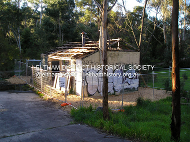
Photograph, Fay Bridge, Warrandyte cool store, 9 September 2019
... Yarra River flood plain. In 2017, through a partnership with Manningham City Council, Warrandyte Historical Society and the Warrandyte Community Association, Melbourne Water renovated the 73-year-old site and installed interpretive signs detailing its history for the community....Yarra River flood plain. In 2017, through a partnership with Manningham City Council, Warrandyte Historical Society and the Warrandyte Community Association, Melbourne Water renovated the 73-year-old site and installed interpretive signs detailing its history for the community. 2019-09-09 Fay Bridge Collection Warrandyte Cool Store Warrandyte Dairy 2 images - born digital Warrandyte cool store Photograph Photograph Fay Bridge ...Remains of the old Warrandyte Dairy — Originally constructed to store milk for delivery from Mapleoak Dairies, delivered by the Bellinger family, up until the early 1970s. The Warrandyte Dairy closed in 1987 before the land and building was purchased by Melbourne Water in 1988 to reduce flood risk to the community and preserve riverside land from development on the site which sits on the Yarra River flood plain. In 2017, through a partnership with Manningham City Council, Warrandyte Historical Society and the Warrandyte Community Association, Melbourne Water renovated the 73-year-old site and installed interpretive signs detailing its history for the community.2019-09-09, fay bridge collection, warrandyte cool store, warrandyte dairy -
 Eltham District Historical Society Inc
Photograph, Fay Bridge, Old footbridge, 195 Laughing Waters Road, Eltham, n.d
... For a more in-depth description and history of the property and that of Gordon and Sue Ford, see Jane Woollard's book, "Laughing Waters Road; Art, Landscape & Memory in Eltham" published 2016. Fay Bridge Collection Bernie's hut Birrarung Footbridge Gordon Ford Gordon's Shack Laughing Waters Road Love Shack Yarra River 1 images - Scanned from colour prints on loan Old footbridge, 195 Laughing Waters Road, Eltham Photograph Photograph Fay Bridge ...This old footbidge is situated close to the shack that Gordon Ford built on the Yarra at Laughing Waters Road. Bernie Bragg also used to live there for a period of time. Gordon Ford and photographer Sue Winslow were married in 1965. They set up home in an old log cabin on the property Gordon had purchased in 1954 on Laughing Waters Road. Situated between the Yarra River and Overbank Road, Gordon had built a small mud-brick shack on the river and a pontoon. Over the decades the shack has been locally referred to as “the love shack”, the “rooting shack” or simply “Gordon’s shack”. Gordon and Sue commissioned local builder Graeme Rose to do a wattle and daub renovation and extension to the old log cabin on the north side of Laughing Waters Road. The work had only just been completed in 1965 when a bushfire swept through the area and destroyed the cabin. Gordon and Sue relocated to his property, Fulling, in Pitt Street, Eltham. In 1970 work started on a new house at the Laughing Waters property. Originally known as the Banana House, it is now known as Boomerang. Designed by Alistair Knox, the mud-brick house includes iron window grilles made by Matcham Skipper that puncture the curved mud walls. The grilles were made from ‘off-pressings’ from the Sidchrome tool works in Heidelberg. Gordon, Sue and family moved into the house in 1972. Their marriage fell apart and Sue moved to Sydney with the children around the same time Gordon commenced building Birrarung just below Boomerang on the Laughing Waters Road block. After the Fords moved out, Boomerang it was rented out to various share households of students, musicians, artists and environmentalists for twenty-four years. Gordon Ford sold Birrarung and Boomerang to Melbourne Water in 1999. The Laughing Waters Artist in Residence Program was developed as a partnership between Parks Victoria and Nillumbik Shire Council. Boomerang was deemed unfit for habitation so was used as a day studio only. By 2001 Boomerang was in a poor state of repair and by 2002 the last artist in residence was to use the house as a studio. Nillumbik Shire Council had been granted funds from the Melbourne Community Fund to restore both Boomerang and Birrarung but it was apparent in early 2003 that the funds would be insufficient to restore both houses. Boomerang was infested with termites which presented a risk to any occupants and so the decision was made to close Boomerang and concentrate funding on Birrarung. Boomerang was fenced off for safety and to prevent intrusion and remains ‘caged’ today (2023). However, it is readily apparent the property has been occupied by squatters over the years. By 2023 it was clear that the squatters had abandoned the property and sections of the roof structure have given away in some areas and collapsed internally. For a more in-depth description and history of the property and that of Gordon and Sue Ford, see Jane Woollard's book, "Laughing Waters Road; Art, Landscape & Memory in Eltham" published 2016.fay bridge collection, bernie's hut, birrarung, footbridge, gordon ford, gordon's shack, laughing waters road, love shack, yarra river -
 Eltham District Historical Society Inc
Photograph, Fay Bridge, Moor-rul Viewing Platform, Garden Hill, Kangaroo Ground, n.d
... Yarra River starts. This landscape covers all the ancestral lands of the Wurundjeri and some of the wider Kulin nation land. The platform has been given the name Moor-rut, a name which described the fertile soils of the Kangaroo Ground area in contrast to the poorer (Silurian) country of its surrounds, which the Wurundjeri knew as 'Nillumbik' or less rich country. The full 360 degree view can be seen from the adjacent Tower of Remembrance which has 53 stairs. The viewing platform however can be accessed by wheelchair. Inside the viewing platform there are eight double sided interpretive panels giving the history...Yarra River starts. This landscape covers all the ancestral lands of the Wurundjeri and some of the wider Kulin nation land. The platform has been given the name Moor-rut, a name which described the fertile soils of the Kangaroo Ground area in contrast to the poorer (Silurian) country of its surrounds, which the Wurundjeri knew as 'Nillumbik' or less rich country. The full 360 degree view can be seen from the adjacent Tower of Remembrance which has 53 stairs. The viewing platform however can be accessed by wheelchair. Inside the viewing platform there are eight double sided interpretive panels giving the history ...OPENING OF THE VIEWING PLATFORM AT KANGAROO GROUND Nillumbik Council has advised that the viewing platform at Kangaroo Ground 27km NE of Melbourne is to be opened to the public on Wednesday, March 26th 2008 (Melway 271 , G10). The function of the platform is to provide shelter adjacent to the War Memorial Tower whilst allowing all people to enjoy the stunning panoramic views. From the platform you. can see the Dandenongs, the city of Melbourne, the You Yangs, Mount Macedon, the Kinglake Ranges and the Mt Baw-Baw Ranges where the Yarra River starts. This landscape covers all the ancestral lands of the Wurundjeri and some of the wider Kulin nation land. The platform has been given the name Moor-rut, a name which described the fertile soils of the Kangaroo Ground area in contrast to the poorer (Silurian) country of its surrounds, which the Wurundjeri knew as 'Nillumbik' or less rich country. The full 360 degree view can be seen from the adjacent Tower of Remembrance which has 53 stairs. The viewing platform however can be accessed by wheelchair. Inside the viewing platform there are eight double sided interpretive panels giving the history and information regarding this special area. The viewing platform's interpretive panels set out the Aboriginal and European history of the area and also the geology and the local flora and fauna, so that the casual visitor comes away understanding more about this significant part of Victoria. The concept of the viewing platform is part of the refurbishment project for the Kangaroo Ground War Memorial Park which has taken place since 1997 with the active approval and financial assistance of the Nillumbik Shire Council. This project has been guided by an Advisory Committee with volunteer community representatives from the local Historical Societies, the Country Fire Authority, the Returned Services League and the Wurundjeri people. Other allied groups such as the Nillumbik Reconciliation Group have been called upon for their expertise. The initial idea for the viewing platform came from Dean Stewart when he was the caretaker while living at the park. He discussed this idea with local author Mick Woiwod and Harry Gilham of Eltham District Historical Society when they were planning the refurbishment of the War Memorial Park in 1996. When the committee was formalised by the Nillumbik Council in 1997, Nicholas Pelling, representing the CFA and RSL, joined the group. Dennis Ward, local architect, then volunteered to develop the concept plan for the refurbishment of the park and later drew up the plans for the viewing platform. The Kangaroo Ground War Memorial Park and its Tower of Remembrance is located on one of the highest locations in the Yarra Valley. The Tower of Remembrance is a unique war memorial constructed from local stone standing 14 metres high. It was built in the style of a Scottish watchtower reflecting the strong Scottish influence of the first European settlers of the district from the 1840s onward. The park was opened in 1921 and the Tower of Remembrance was dedicated in 1926 recognising the local people who served in the First World War. Those who served in the Second World War were recognised by plaques dedicated in 1951 and more recently those who served in Korea, Borneo, Malaya and Vietnam by plaques unveiled in 2001. Harry Gilham, Advisory Committee Convenor - Eltham District Historical Society Newsletter N0 179 March 2008fay bridge collection, garden hill, kangaroo ground, memorial park, moor-rul viewing platform -
 Eltham District Historical Society Inc
Book, Melbourne Metropolitan Board of Works, Yarra River Conference Proceedings, 1991
... Yarra River Melbourne Conference staged by the Board of Works to present a range of papers examining the river's environment, recreational uses, natural resources, development, commerce and land use. Conference delegates included representatives from Eltham Shire Council and was held in April 1991. Session 1 Heritage and Environment: Flora and fauna / Paul Gullan. -- Geology and topography / Brian Finlayson. -- Aboriginal culture / Margaret Gardiner. Session 2 History ...Conference staged by the Board of Works to present a range of papers examining the river's environment, recreational uses, natural resources, development, commerce and land use. Conference delegates included representatives from Eltham Shire Council and was held in April 1991. Session 1 Heritage and Environment: Flora and fauna / Paul Gullan. -- Geology and topography / Brian Finlayson. -- Aboriginal culture / Margaret Gardiner. Session 2 History. Session 3: Management plans and policies : overview of responsibilities / Dr Colin Leigh. --Role of the media / Peter Cole-Adams. -- Urban development / Paul Jerome. -- Port of Melbourne area / Leigh McKay. -- Recreation / Ken Marriott. Session 4: Perspectives - the current view. Session 5: Issues, challenges, potential solutions.non-fictionConference staged by the Board of Works to present a range of papers examining the river's environment, recreational uses, natural resources, development, commerce and land use. Conference delegates included representatives from Eltham Shire Council and was held in April 1991. Session 1 Heritage and Environment: Flora and fauna / Paul Gullan. -- Geology and topography / Brian Finlayson. -- Aboriginal culture / Margaret Gardiner. Session 2 History. Session 3: Management plans and policies : overview of responsibilities / Dr Colin Leigh. --Role of the media / Peter Cole-Adams. -- Urban development / Paul Jerome. -- Port of Melbourne area / Leigh McKay. -- Recreation / Ken Marriott. Session 4: Perspectives - the current view. Session 5: Issues, challenges, potential solutions.yarra river, melbourne -
 Eltham District Historical Society Inc
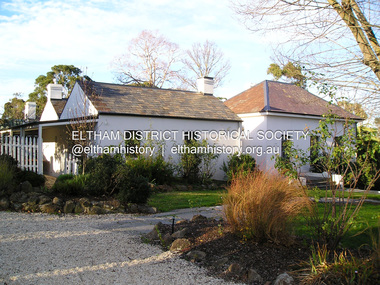
Document - Property Binder, 16 Homestead Road, Eltham, 'Handfield House'
... Yarra River is two storied. Walls timber stud framed?, asbestos cement sheet clad. Roofs flat?. Floors timber, some concrete?. Features include the modular wall design, courtyard planning, combination of single and double storey sections, internal planning and floor to ceiling glass walls. SOURCES OF INFORMATION: Information from Mr. John Handfield. CONSERVATION GUIDELINES: Keep this residence intact. Esta Handfield died in 1995 The property was sold in 1996 Property history...Yarra River is two storied. Walls timber stud framed?, asbestos cement sheet clad. Roofs flat?. Floors timber, some concrete?. Features include the modular wall design, courtyard planning, combination of single and double storey sections, internal planning and floor to ceiling glass walls. SOURCES OF INFORMATION: Information from Mr. John Handfield. CONSERVATION GUIDELINES: Keep this residence intact. Esta Handfield died in 1995 The property was sold in 1996 Property history ...Contents: 1. Morrison Kleeman Sales brochure 2008 2. Newsclipping; Advertisement, Morrison Kleeman, Eltham South 16 Homestead Road, Diamond Valley Leader, November 5, 2008, p7 (on reverse, p8 Advertisement, Morrison Kleeman, Eltham 45 Lavender Park Road) Designed by Robin Boyd for friends John and Esta Handfield, Handfield House was built 1961. In a letter dated 16 May 1989 to Blanche Shallard of the Shire of Eltham Historical Society, John Handfield advised that the house was designed by their friend Robin Boyd and that it was built in 1961. As of that date they had been the only occupants. They were still the owners when the house was included in the 1992 Shire of Eltham Heritage Study The 1992 Study advised: CULTURAL SIGNIFICANCE Designed by well-known Victorian Architect Robin Boyd after he returned from lecturing architectural students in Japan, the Handfield residence shows the influence of traditional Japanese design in its modular wall arrangements, solid and glazed panels and sliding exterior doors. The courtyard planning, floor to ceiling glass walls and the combination of single and double storey sections on the steep site illustrate quite advanced dwelling design for its time. Designed to house three generations, grandparents, their children and grandchildren, the house at the time of the 1992 study was reported to be very intact. DESCRIPTION Quite advanced design, in planning and detailing. Plan U-shaped. Single and double storied; the arms of the U are basically single storied, while the base running parallel with the Yarra River is two storied. Walls timber stud framed?, asbestos cement sheet clad. Roofs flat?. Floors timber, some concrete?. Features include the modular wall design, courtyard planning, combination of single and double storey sections, internal planning and floor to ceiling glass walls. SOURCES OF INFORMATION: Information from Mr. John Handfield. CONSERVATION GUIDELINES: Keep this residence intact. Esta Handfield died in 1995 The property was sold in 1996 Property history (source realestate.com.au) 2022 – Sold $2,240,000 September 17, 2022 by Jellis Craig - Eltham 1998 – Sold $348,500 June 20, 1998 1996 – Sold $250,000 September 9, 1996 (possibly Stockdale & Leggo) The property was offered for sale in 2008 by Morrison Kleeman with a price guide of $900,00 to $990,00 but it has not been confirmed if this sale proceeded property, eltham, houses, john handfield, esta handfield, robin boyd, 16 homestead road, handfield house, 45 lavender park road -
Eltham District Historical Society Inc
Document - Folder, Stevenson, Joseph
... Photocopy of two prints/paintings, annotated on reverse (information from R B Ness: Punt over Yarra River at Melbourne which Joseph Stevenson helped build, from "History of South Melbourne", published 1930s; First bridge over Yarra at Melbourne which Joseph Stevenson helped build. ...Photocopy of two prints/paintings, annotated on reverse (information from R B Ness: Punt over Yarra River at Melbourne which Joseph Stevenson helped build, from "History of South Melbourne", published 1930s; First bridge over Yarra at Melbourne which Joseph Stevenson helped build. ...Joseph Stevenson came to Australia in 1837, eventually settling near Kangaroo Ground. He was active in local affairs.. Contents Handwritten and typed notes by Winifred Joy Ness, 1985, "Joseph Stevenson of Kangaroo Ground". Handwritten extracts from "Pioneers and Painters" by Alan Marshall, relevant to Joseph Stevenson. Handwritten extracts from "Pastoral Pioneers of Port Phillip"by R V Bills and A S Kenyon, relevant to Joseph Stevenson. Photocopy of photographs: Stevenson daughters; a stevenson daughter with baby; Joseph Stevenson. Handwritten Stevenson family tree (on 2 sheets). Photocopy of photograph: Robert Stevenson and family, "Bankhead", Kangaroo Ground (ref 423). Photocopy of two prints/paintings, annotated on reverse (information from R B Ness: Punt over Yarra River at Melbourne which Joseph Stevenson helped build, from "History of South Melbourne", published 1930s; First bridge over Yarra at Melbourne which Joseph Stevenson helped build. Photocopy of Death Certificate: Joseph Stevenson, 1 November 1878. Photocopy of Death Certificate: Ruth Sevenson, 1 November 1868. Photocopy of Marriage Certificate: names illegible 16 November 1868 Photocopy of extract of Marriage Certificate: Joseph Stephenson and Ruth Boyd, 14 June 1837. Newspaper article: "Resting in peace", Diamond Valley News, 23 March 1982. Judith Furphy and early Kangaroo Ground families buried in Kangaroo Ground Cemetery. Newspaper article: "Grounds for celebration", Diamond Valley Leader, 23 November 2005. Lynette Beale traced her ancestor Joseph Stevenson to Kangaroo Ground. Letter Diana Bassett-Smith to EDHS, 10 August 2005. Donation of a moulding plane marked Joseph Stephenson, property of descendants.Newspaper clippings, A4 photocopies, etcjoseph stevenson, ship willington 1837, ruth stevenson nee boyd, david stevenson, jane stevenson, kirk's bazaar, first punt across yarra river, princes bridge melbourne, stevenson street melbourne, saltwater creek, river plenty, christmas hills, david christmas, diamond creek, isabella stevenson, robert stevenson, five mill creek, watson's creek, "bankhead" kangaroo ground, ellen stevenson, yarra glen road, yarra glen cemetery, stevenson's corner kangaroo ground, stevenson's creek, presbyterian church kangaroo ground, eltham district road board, margaret stevenson, ruth stevenson, emma stevenson nee peers, margaret hargreaves nee stephenson, robert peers, cyrus peers, charlotte peers, jane mess nee stevenson, robert mess, pearl mess nee mills, james mess, george mess, janet mess, joseph mess, william mess, alexander mess, barbara mess, isabella mess, ruth gosling nee mess, john gosling, jessie gosling, evelyn sinclair nee gosling, william gosling, vera rowland nee gosling, florrie rawland, ethel rawland, john rawland, isobel gilson nee mess, bruce mess, joy mess nee masefield, janet crook nee mess, rodney crook, judith rodgers nee mess, ray rodgers, dean crook, jenine crooks, carolyn rodgers, merryn rodgers, beryl nansen nee mess, robert nansen, gerry oliming, roberta oliming nee nansen, bernard nansen, michele nansen nee blackie, rohan nansen, janet nansen nee britton, vera cope nee mess, cliff cope, graeme cope, louise cope nee thimpton, shannon cope, lucas cope, peter cope, marilyn cope nee turnley, oliver cope, sarah cope, kelvin cope, donald mess, joan mess, geoffrey mess, peter mess, rosemary mess, kerrie mess, isobel gibson nee mess, ellen stevenson nee armstrong, james stevenson, john stevenson, elizabeth stevenson, joanna stevenson, ellen little nee stevenson, william little, francis little, janet little nee armstrong, ruth lorimer nee little, david lorimer, ruth cameron nee lorimer, francis lorimer, val wade, elizabeth lorimer, david kelso, willaim lorimer, jean lorimer nee hewitt, nancy mitson nee lorimer, stan mitson, john hewitt, alison hewitt, john cameron, beryl ryan nee cameron, robert cameron, maryann ryan, peter ryan, margaret ryan, steven wade, andrew wade, jonathan wade, jennifer wade, ruth sadlernee stevenson, thomas sadler, alexander sadler, isabella booth nee sadler, angus sadler, heather sadler, ruth sadler, andrew sadler, nancy sadler, benjamin sadler, robert sadler, alice sadler nee smith, margaret smith, david sadler, anne mcclusky nee sadler, hope sadler, anne carson nee sadler, ruth edwards nee carson, david carson, joseph sadler, isabella bond nee sadler, ian bond, ruth bond, isabella bond, john sadler, thoas sadler, mary sadler nee stewart, stewart sadler, keith sadler, glen sadler, peter sadler, terry sadler, pamela sadler, armstrong family kangaroo ground, bell family kangaroo ground, rogerson family kangaroo ground, barr family kangaroo ground, harkness family kangaroo ground, jardin family kangaroo ground, thompson family kangaroo ground, johnson family kangaroo ground, walters family kangaroo ground, sir ewen camerson, flora margaret cameron, ewen cameron, sir ewan camerson, sir herbert gepp, "garden hill" yarra glen road, andrew moss museum kangaroo ground, lynette beale, noel beale, mick woiwod, diana bassett-smith -
 Eltham District Historical Society Inc
Photograph - Digital Photograph, Marguerite Marshall, View of the Yarra River from 'Worlingworth', 10-26 Banoon Road, Eltham, 30 January 2006
... history connecting local residents to the past. Nillumbik Now and Then (Marshall-King) Collection Banoon Road Donald Thomson Dorita Thomson Eltham Worlingworth Born digital image file View of the Yarra River from 'Worlingworth', 10-26 Banoon Road, Eltham Photograph Digital Photograph Marguerite Marshall Marguerite Marshall Alan King ...'Worlingworth', Eltham, home of noted anthropologist the late Professor Donald Thomson and his wife Dorita Thomson. Covered under Heritage Overlay, Nillumbik Planning Scheme. Published: Nillumbik Now and Then / Marguerite Marshall 2008; photographs Alan King with Marguerite Marshall.; p127This collection of almost 130 photos about places and people within the Shire of Nillumbik, an urban and rural municipality in Melbourne's north, contributes to an understanding of the history of the Shire. Published in 2008 immediately prior to the Black Saturday bushfires of February 7, 2009, it documents sites that were impacted, and in some cases destroyed by the fires. It includes photographs taken especially for the publication, creating a unique time capsule representing the Shire in the early 21st century. It remains the most recent comprehenesive publication devoted to the Shire's history connecting local residents to the past. nillumbik now and then (marshall-king) collection, banoon road, donald thomson, dorita thomson, eltham, worlingworth -
 Bendigo Historical Society Inc.
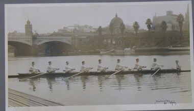
Photograph - PHOTOGRAPH OF ROWING TEAM, 1920
... History House 11 Mackenzie Street Bendigo goldfields ORGANIZATION Club/society rowing team Rowing Team Yarra River Burlington Burlington Melb Black and white photograph of an 8 man rowing team on the Yarra River Melbourne showing city buildings in the background, mounted on grey card within a thin black wooden frame, markings read 'Burlington Melb' Photograph PHOTOGRAPH OF ROWING TEAM ...Black and white photograph of an 8 man rowing team on the Yarra River Melbourne showing city buildings in the background, mounted on grey card within a thin black wooden frame, markings read 'Burlington Melb'Burlington Melborganization, club/society, rowing team, rowing team, yarra river, burlington -
 Greensborough Historical Society
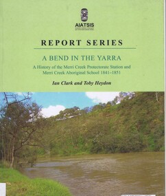
Book, Ian D. Clark et al, A Bend in the Yarra: a history of the Merri Creek protectorate Station and Merri Creek Aboriginal School 1841-1851, by Ian D. Clark and Toby Heydon, 2004_
... A history of Aboriginal cultural institutions in colonial Victoria, in this book the interaction between Wurundjeri people and government officials and settlers at the confluence of the Merri Creek and Yarra River....Greensborough Historical Society 34A Glenauburn Road Lower Plenty Lower Plenty melbourne A history of Aboriginal cultural institutions in colonial Victoria, in this book the interaction between Wurundjeri people and government officials and settlers at the confluence of the Merri Creek and Yarra River. merri creek aborigines victoria Paperback book, 90 p. black & white illus A Bend in the Yarra: a history of the Merri Creek protectorate Station and Merri Creek Aboriginal School 1841-1851, by Ian D. ...A history of Aboriginal cultural institutions in colonial Victoria, in this book the interaction between Wurundjeri people and government officials and settlers at the confluence of the Merri Creek and Yarra River.Paperback book, 90 p. black & white illusmerri creek, aborigines victoria -
 Greensborough Historical Society
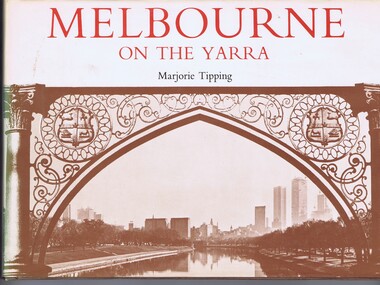
Book, Lansdowne Press, Melbourne on the Yarra, 1977
... Photographs from the collection of the RHSV and later photos by Ian McKenzie and Irvine Greene. melbourne yarra river A pictorial history of Melbourne, illustrated with both old and new photographs 96 p., illus., maps. ...A pictorial history of Melbourne, illustrated with both old and new photographs96 p., illus., maps.non-fictionA pictorial history of Melbourne, illustrated with both old and new photographsmelbourne, yarra river