

Historical information
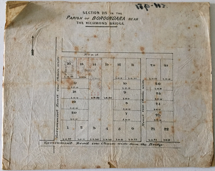
Despite the plans claims that it is a subdivision near the Richmond Bridge, Section 115 was located at what is now Camberwell Junction. While the plan only lists government roads rather than named streets, the section was located on the east side of Burke Road, stretching up the hill from the current Junction. Research on Trove, conducted by Kerry Fairbank, discovered an advertisement for unsold lots in Section 115 which clarifies the extent and location of subsequent land sales in the original section. The original article can be viewed through the link in the catalogue record. The interesting link to Kew is the reference to James Beavan as the purchaser of lots 14 and 15. The historian Gwen McWilliam has notes that a Mr Beavan changed his name from Bevan. The Bevans were descendants of the Derricks family of Kew.
Significance
This subdivision plan is the earliest original map or plan in the collection which shows parts of what is now the City of Boroondara, dating from circa 1853. It provides important information for researchers on subsequent subdivisions following the original land sales in [Camberwell] Boroondara. The site, on the east side of Burke Road is a highly-significant and historic site. This is believed to be the only extant copy of the subdivision in public collections.
Physical description
A small plan on parchment listing 28 lots, between one and two acres each, for sale in Section 115 in the Parish of Boroondara, dating from 1853 when the portion was subdivided.
Inscriptions & markings
Obverse: Lot 16 "Joseph Duval", Lots 14 & 15 "James Beavan". Other annotations (measurements) are unreadable.
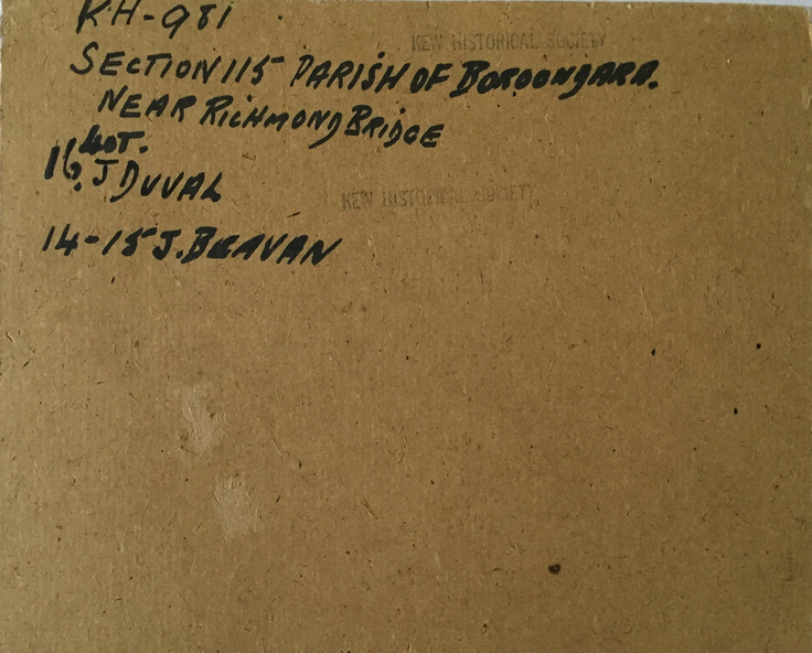
Reverse: "KH-981 / Section 115 in the Parish of Boroondara / Near Richmond Bridge / 1640T. / J Duval / 14-15 J. Beavan
Subjects
References
- Advertising (1853, June 20). The Argus (Melbourne, Vic. : 1848 - 1957), p. 4 [Transcript] SATURDAY, 25th JUNE.Twelve allotments of Land in the parish of Boroondara, 4 miles from Melbourne, and 1½ east of Richmond Bridge, being the unsold portion of section 115. J HURREY will sell by auction, at his rooms, 107, Elizabeth street, on Saturday, 25th inst., at twelve o'clock precisely. The remaining unsold portion of the splendid lot of ground, No. 115, in the parish of Boroondara, varying from one to two acres each, having extensive frontages upon roads one chain wide. The soil is a dark brown, and the land is admirably adapted for market gardeners, or from its great elevation, for Villa sites from which there will be a magnificent and uninterrupted view of Hobsons Bay, and Richmond and Collingwood, when the wood in the fore ground is cleared which will soon be the case as the land has been sold. Title-Grant from the Crown. Terms at Sale.