


Historical information
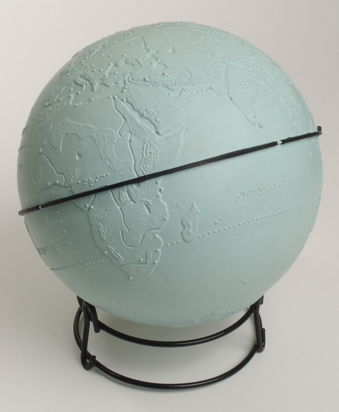
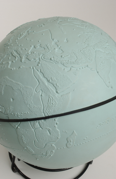
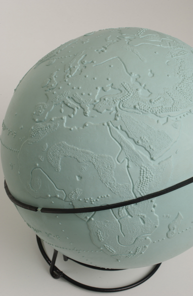
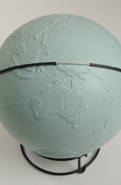
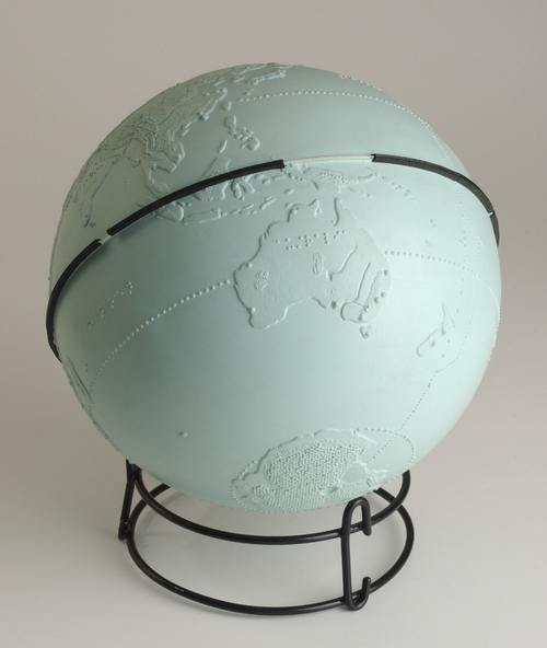
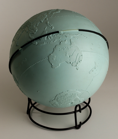
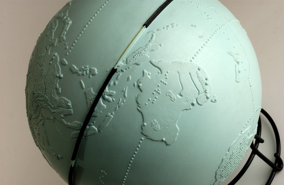
Used to teach geographical information, this tactile globe was most likely produced by the RNIB and used at the RVIB Burwood School. Equator is raised and marked in black rubber. Topography land masses and meridians are tactically represented, and includes place names in Braille. A different shade of green is used to represent land masses, and major rivers are shown as well.
Physical description
Green plastic tactile globe with metal stand.
Inscriptions & markings
Various