


Historical information
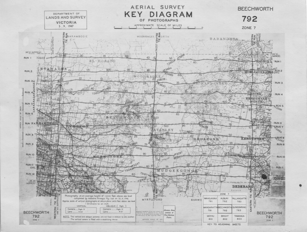
This image is an Aerial Survey, Key Diagram of Beechworth and surrounding area. Issued by Department of Lands and Survey, Victoria in 1947. Photographed at an average height of 12300 feet above sea level, areas depicted are; Beechworth, Stanley, Bruarong, Baranduda, Muagegonga, Myrtleford, Everton, Wooragee North Tarrawinge, Dederang, Kergunyah North, Kergunyah, Yackandandah, El-Dorado, Barambogie, Murmungee, Barwidgee, Oxley, Carraragarmungee
Physical description
Black and white rectangular photograph. Image is printed on matt photographic paper and has a white un-printed border.
Inscriptions & markings
Obverse:
AERIAL SURVEY, KEY DIAGRAM OF PHOTOGRAPHS, APPROXIMATE SCALE OF MILES /
DEPARTMENT OF LANDS AND SURVEY VICTORIA 5.9.1947. BEECHWORTH 792 ZONE 7.
Reverse:
BMM7010.1 (written in pencil)