Historical information
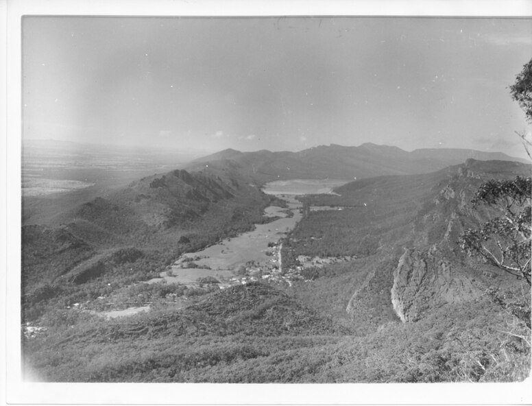
Photo has been taken from Boroka Peak/lookout, of the Fyans Valley and the township of Halls Gap. The Grampians/Dunkeld Road can be seen running North/South along the right edge of the valley and Lake Bellfield is the water at the end of the valley. Photo is typical of those taken by Forrests Commission at the time
Physical description
a photo of a valley, mostly cleared, flanked by two mountain ranges. A large body of water can be seen at the far end of the valley (middle of photo). Buildings and roads visible in the valley. Plains can be seen beyond the far mountain range on the left side of the scene.
Inscriptions & markings
no.42