Historical information
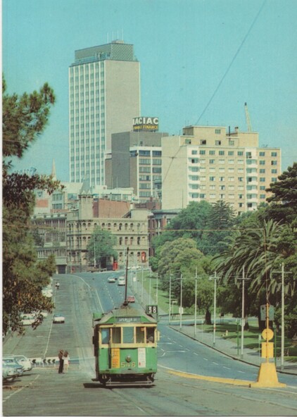
One of a series of postcards published by National View by Murfett Publishers Australia. Has the details on the rear with place for a stamp, address etc, and logo. Shows W2 546 (Spencer St Route 38), possibly about to pick up passengers at the Jolimont Road Stop.
At the time Wellington Parade was effectively a one-way street with extensive car parking on the south side. Shows a Safety Zone on the north side of the tram tracks. Has the CRA building, the hotel on the corner of Flinders and Spring St that was demolished for Shell House.
See Reg Item 3555 for a later view by the same company.
Significance
Yields information about the appearance of Wellington Parade, Jolimont, mid to late 1970's.
Physical description
Postcard - National View - plain edges, Wellington Parade looking west towards the CBD. Card No. P-1014-2