Physical description
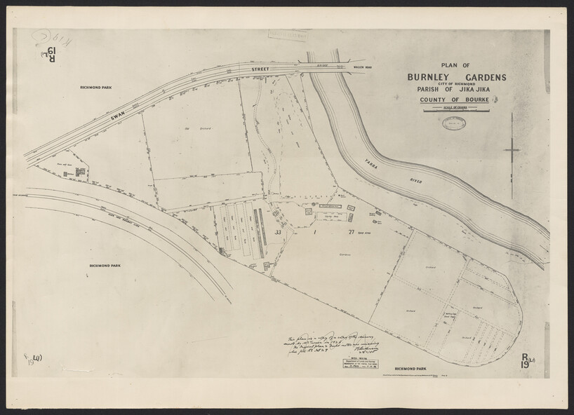
Photograph made in 1948 from a copy of a survey of Burnley Gardens made in 1926. Shows Burnley Gardens bound by Swan Street to the north, Yarra River to the east, Richmond Park to the south west. Photographed at Dept. of Lands and Survey, central plan office, 7/12/1948. Plan shows old orchard, fowl sheds, coops and yards, milking shed, silo, nursery, glass house, fattening pens, dairy, garden, orchards area in southwest area. Reduced photograph of 1927 plans at B0489 A, B & C
Inscriptions & markings
"This plan is a copy of a copy of the survey made by Mr. Turner in 1926. The original plan and field notes are missing. See file Rs 3529" Signed by ? Anderson