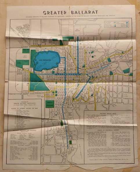


Significance
Yields information about Greater Ballarat, including trams, buses, locations and streets. Has a strong association with George Netherway.
Physical description
Four colour map of Ballarat, showing streets, places of interest, Parks, tram routes, bus routes, railway lines, prepared by G. C. Netherway, Greater Ballarat Association.
Shows suburbs names, location of places of interest, some development north of Howitt St, in Wendouree. Map is part diagrammatic and is not entirely to scale. Includes the Lake Wendouree Rowing course
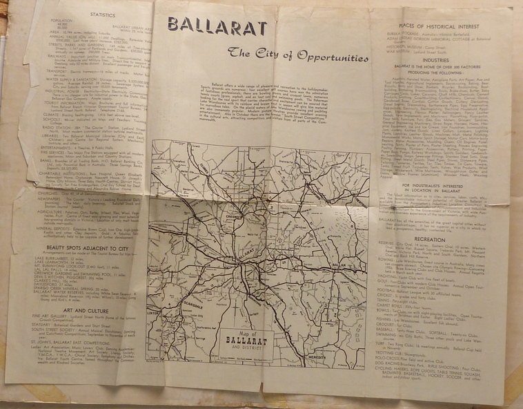
On rear is a road map of the Ballarat area, lists of statistics, beauty spots, look outs, art and culture, points of historical interest, industrial products and recreation.
Printed by Waller & Chester on paper produced by Ballarat Paper Mills Pty Ltd.
See Reg item 2074 for photographic image of this version of the map.
See Reg Item 2776 for another version of this map.
Contained originally within Reg Item 5507 at the back of the binder. For items see btm5507 loose items list.pdf
John Whiting in an email of 17-9-2021 noted:
The rowing course along Lake Wendouree is noted, so perhaps this map is post 1956?
The Mt Pleasant tram line is shown to terminate at Morton St, not Cobden St (which of course is incorrect)
Someone's come along and drawn in black ink the branch of the View Point tram line!