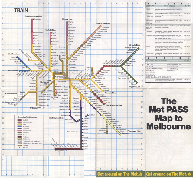
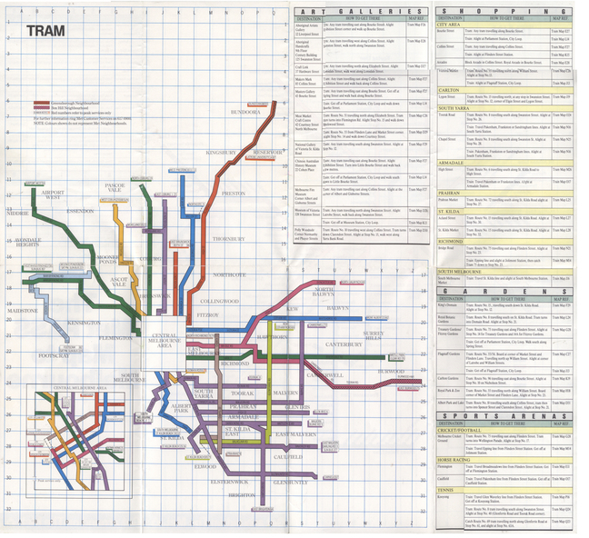


Physical description
Folded Map of Melbourne Rail and Tram lines, titled "The Met PASS Map to Melbourne"
Tram Map - probably soon after conversion of the St Kilda and Port Melbourne lines to Light Rail, though these are not shown. Opened November 1987.
Rail Map - shows Route 96 north section as Light Rail, co-ordinated bus routes, and the Altona line as going to Werribee. This route was opened in 1985.
Date of Map c1988/1990.
Has details of Museums, Art Galleries, Shopping, Gardens and Sports Arenas.
See also Reg Item 379 for a similar item.