Physical description
Image from CD (Compact Diskette for use in computers) - see Reg Item 135.
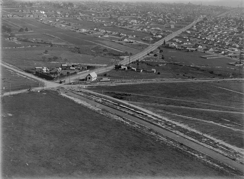
Image titled "Kew Burke Rd' on CD, of looking at the East Kew Tram terminus with the city skyline in the background, c1925. Photo published in the Bellcord No. 16, Oct. 2012. From the article with the photograph;
The terminus was located at the intersection of High St, Burke, Kilby and Doncaster Roads.
We are at the outer edges of Melbourne’s suburbia at the time, unlike the current tram terminus of today. Burke Road, north of Doncaster Road is clearly under construction in preparation for the new river crossing. The vacant block of land in the foreground will remain so for another ten years or so. In 1960 the new Dickens Supermarket was built on this site and the intersection became known locally as Dickens Corner. The narrow track on the left hand side of the photo is Doncaster Road.
The tram at the terminus is a straight-sill single trucker of one of the G, K, Q or R classes. It is finished in the late MMTB chocolate and cream livery.
A cable grip car body has been placed as a tram shelter at the terminus. The church was subsequently relocated to Francis Street Yarraville where it still stands today as a private residence. Behind the large hedge on the south side of High Street is Smith’s Dairy. Part of this land would be sold to the MMTB for a planned new tram depot Behind the large hedge on the south side of High Street is Smith’s Dairy. Part of this land would be sold to the MMTB for a planned new tram depot but by the early 1960s it was transferred to the Education Department for construction of the Kew High School. The last portion of the dairy closed in the 1970s.