


Physical description
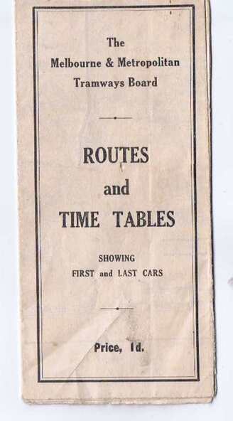
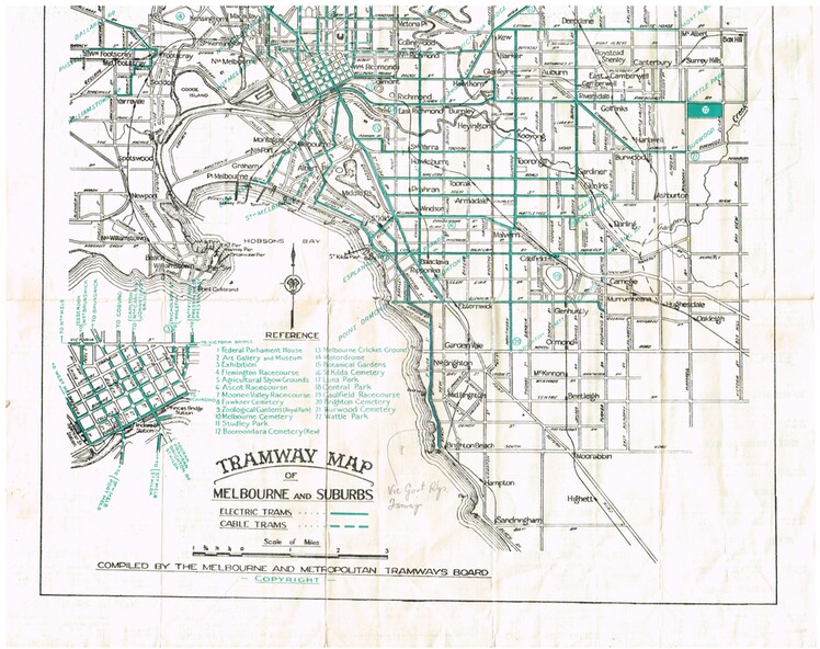
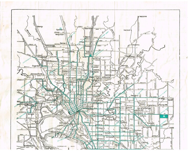
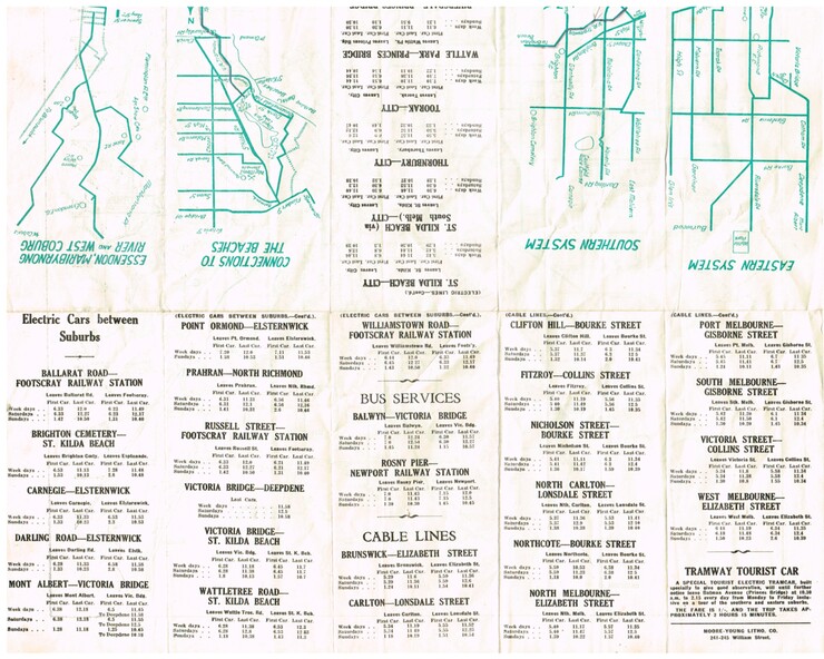
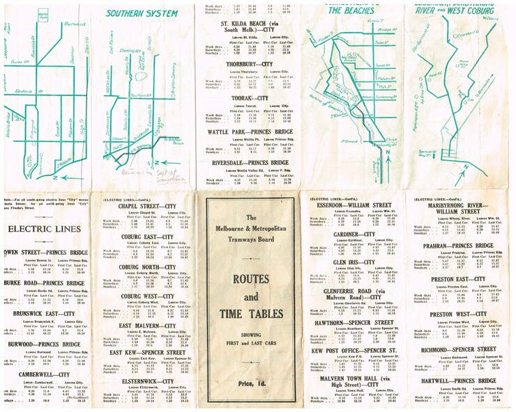
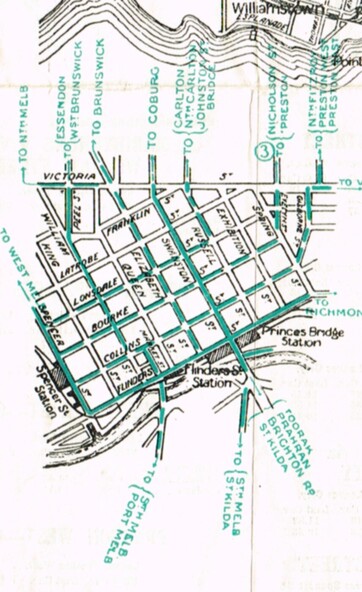
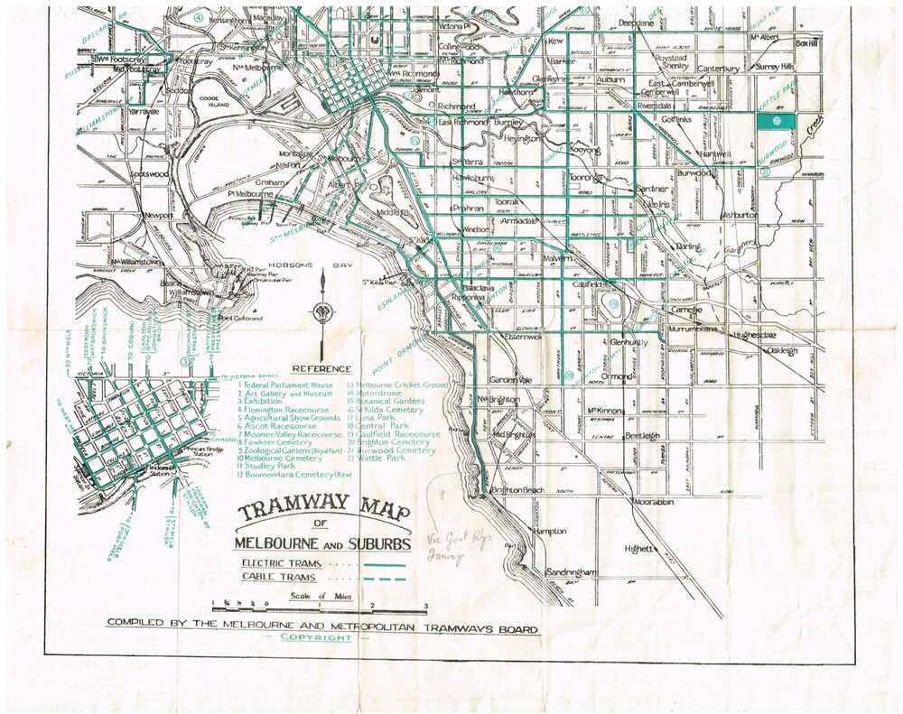
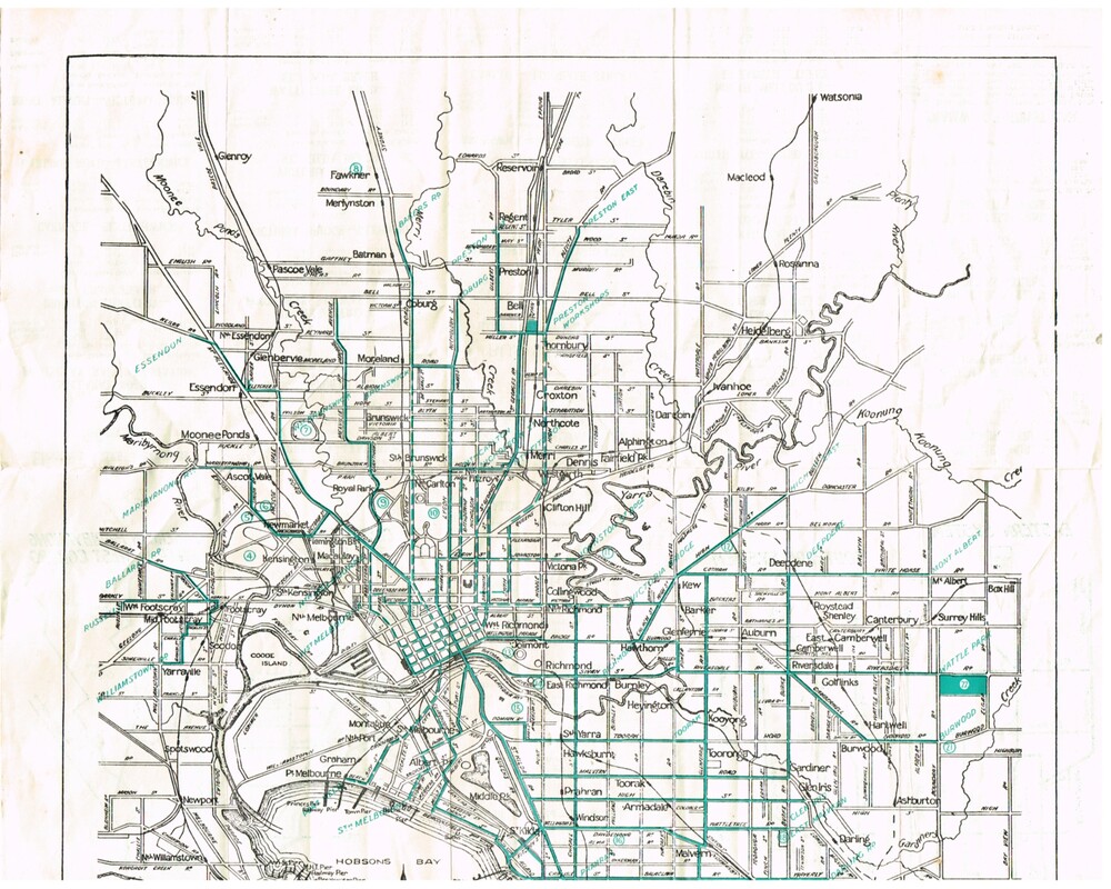
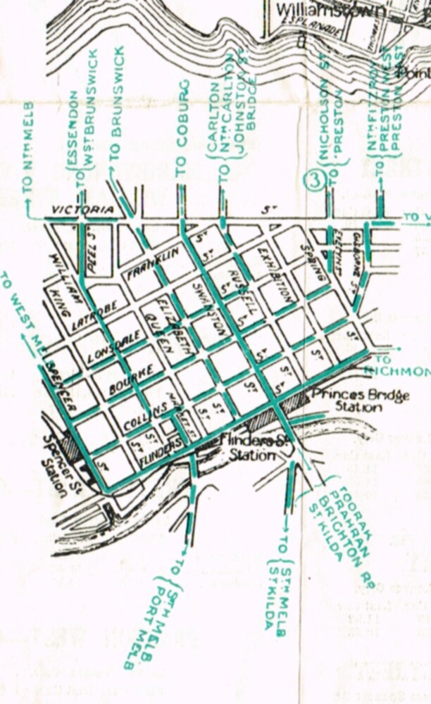
Folded map (5 x 3) by Melbourne and Metropolitan Tramways Board, c1927, of Melbourne tramways, showing tram routes (cable, electric and VR), railway lines, major points of interest and major streets. Titled "Routes and Time tables showing first and last cars". On rear shows maps of lines for the Eastern, Southern, Connection to Beaches and the Essendon, Maribyrnong and West Coburg lines.
Dated c1927, shows the St Kilda Road lines to electric. On the bottom right hand corner has a reference to the Tramway Tourist Car - and the tours it does. (Reg Item 800 dated March 1927, shows the tram under construction).
Second copy from Keith Kings Collection - in poor condition - added 10/8/2017
Inscriptions & markings
The VR line has various hand written notations indicating it.
Subjects
- trams,
- tramways,
- map,
- mmtb,
- tourist trams,
- y class,
- vr,
- cable trams,
- routes,
- timetables