Historical information
Warning: This object includes historical language referring to First Nations Peoples which is no longer appropriate but has been recorded for historical purposes.
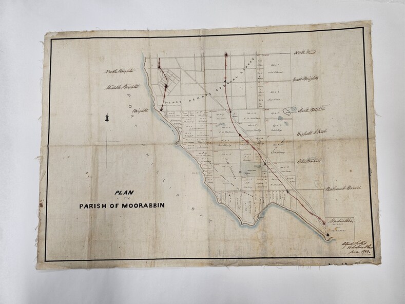
Produced in 1853, this map shows the land holdings of European families. While the majority of holdings are small there are also large land holdings as can be seen with Henry Dendy's Special Survey. Of particular note is the "Reserve for Aborigines" which was established in approximately 1841 and consisted of over 830 acres. This area is the current location of Mordialloc township and Attenborough Park, in Mordialloc, is the last remnant of the reserve.
An Alfred Sikes, possibly the surveyor/cartographer who drew this parish plan, purchased land in Berwick in 1854.
Physical description
A handrawn map on fabric, with blue markings representing the coastline to Port Phillip Bay, red markings representing a proposed train line to Mordialloc, major roads and street, as well as a "Reserve for Aborigines", which constituted approximately 830 acres. In the bottom right hand corner, the map has been signed and dated.
Inscriptions & markings
Handwritten in ink: Alfred Sikes / 38 Collins St East / June. 1853