


Historical information
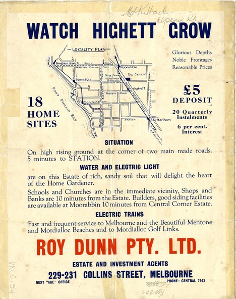
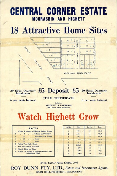
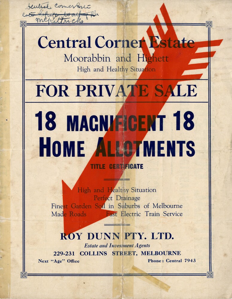
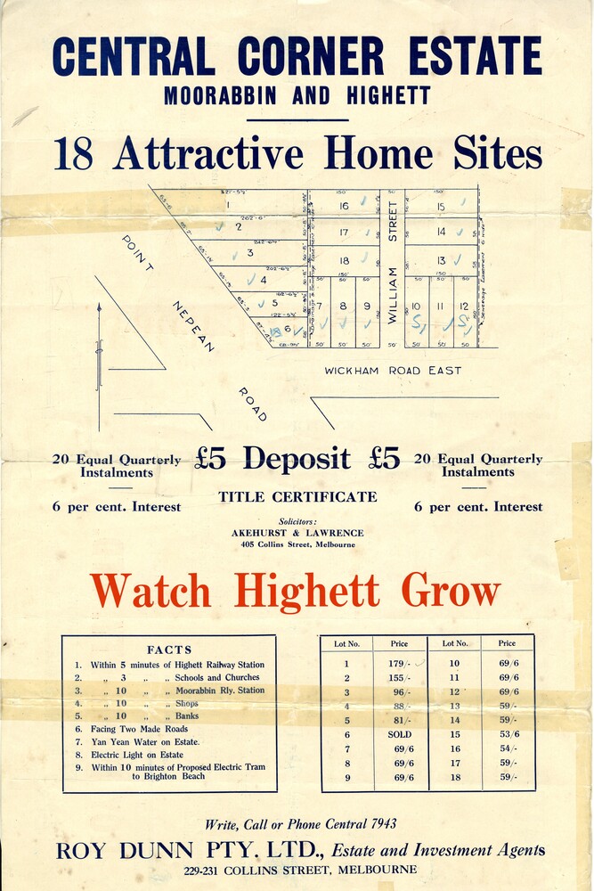
Sales plan for land in the suburbs of Highett and Moorabbin, bordered by Point Nepean Road and Wickham Road East incorporating William Street
Significance
The developing urban area of Highett and Moorabbin within the City of Kingston. This land sale pamphlet illustrates the subdivision of land within the municipality and the changing demographic of the district as new houses are constructed close to infrastructure.
Physical description
Colour pamphlet advertising for private sale land in the Central Corner Estate in Moorabbin and Highett. Incorporates a map of the estate bordered by Point Nepean Road and Wickham Road East, with subdivisions also available on both sides of William Street.
Inscriptions & markings
Handwritten in blue pencil on subdivision plan: a tick is drawn on subdivisions 2-18
Handwritten in blue pencil on subdivision 6: a box with an x inside
Handwritten in blue pencil on subdivisions 10 and 12: S
Handwritten in black ink on front page: [indecipherable] / McKittricks
Handwritten in grey pencil on rear page: McKilhick / Nepean Rd
Handwritten in grey pencil on rear page upside down: 160000 / 15 8300 [crossed out]