Historical information
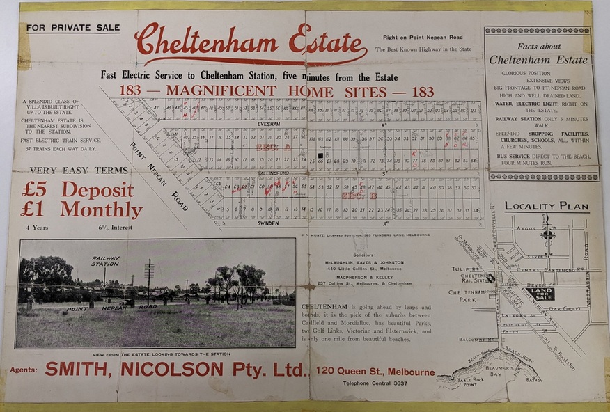
Sales plan for land in the suburb of Cheltenham, bounded by Point Nepean Road and Swinden Avenue, including Evesham Road and Wallingford Street.
Significance
The developing urban area of Cheltenham within the City of Kingston. This land sale pamphlet illustrates the subdivision of land within the municipality and the changing demographic of the district as new houses are constructed close to infrastructure.
Physical description
Colour pamphlet advertising for private sale Cheltenham Estate. Incorporates a map of the estate bordered by Point Nepean Road and Swinden Avenue, including Evesham Road, and Wallingford Street.
Inscriptions & markings
Handwritten in red ink on subdivison 45: D / H
Handwritten in red ink on subdivision 46: Anderson
Handwritten in red ink on subdivisions 88, 87, 77 and 56: K / D
Handwritten in red ink on subdivision 86: D / H
Handwritten in red ink on subdivision 63 and 62: Hudson
Handwritten in red ink on subdivision 59 [indecipherable]
Handwritten in red ink on subdivision 58: aB
Handwritten in red ink on subdivision 57: Lavosh
Handwritten in grey pencil on subdivision 28, 26, 24, 67, 58, 49: B
Handwritten in grey pencil on subdivisions 78 and 79: Paint
Handwritten in purple pencil on subdivsion 114 and 86: B