Physical description
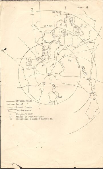
Two maps of the Whipstick - Sheet A and Sheet B. Sheet A shows the Whipstick in relation to Bendigo and some surrounding places. Bitumen roads, gravel, forest tracks, Mallee Areas, Flagstaff Hill, fenced in reservations and reservoirs are marked. Also, a circle and part circles of 5-, 10-, 15- and 20-mile radius is marked. North & South are marked. Sheet B is an enlarged area of the Whipstick Scrub area. North and South is marked. There are a number of letters written over both maps.