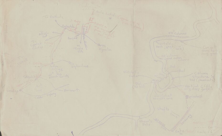
Physical description
Two hand sketched maps on same sheet of paper, one of the location of the Barfold Gorge in relation to surrounding towns, Mt Alexander and Turpin;s Falls. The second map is a part of the Campaspe River location of the Barfold Gorge. Shown is the location of columns, pools, type of rock, Mitchell's Falls, tunnel, cave, Queen's Falls, house, windmill, fences and places where access to the bottom of the gorge is possible. Car track and scale of 1 mile = 6 inches are also shown.