Document - MARKS COLLECTION: NEW CHUM LINE OF REEF MAP
8300.38
Reuse this media
Can you reuse this media without permission?No (with exceptions, see below)
Conditions of use
All rights reserved
This media item is licensed under "All rights reserved". You cannot share (i.e. copy, distribute, transmit) or rework (i.e. alter, transform, build upon) this item, or use it for commercial purposes without the permission of the copyright owner. However, an exception can be made if your intended use meets the "fair dealing" criteria. Uses that meet this criteria include research or study; criticism or review; parody or satire; reporting news; enabling a person with a disability to access material; or professional advice by a lawyer, patent attorney, or trademark attorney.
Attribution
Please acknowledge the item’s source, creator and title (where known)
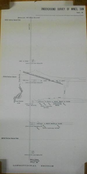
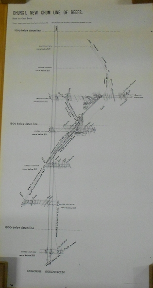
Plan (copy) of New Chum Line of Reef. Plan has been copied in two sections. On top of plan 'Underground survey of mines Sandhurst, New Chum Line of Reef', plan shows longitudinal and cross section views of the workings on the reef. Shaft No. 76 marked. Datum line on top indicates 750' above sea level, on bottom of plan, bottom of shaft 2022.24 below sill. Drawn by Arthur Everett, Mining Department, Melbourne, 1884.