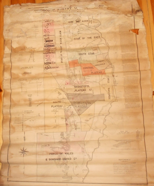
Physical description
Large buff coloured map, wooden strip on bottom, top hanger missing, showing mine boundaries in Ballarat mining area. Mines include from top of map Bonshaw No. 1; Band and Albion Consolidated Company; Central Bonshaw; North Bonshaw; Star of the East block Claim; Star of the East; South Star; Owen's Freehold; Central Plateau; Sebastopol Plateau Company; Sebastopol Star; Sebastopol Plateau No. 1; South Plateau; Prince of Wales; Bonshaw United company; Gay's Freehold. Map prepared by Robert Alan, under the direction C.W. Langtree, Secretary for Mines, and Chief Mining Surveyor.