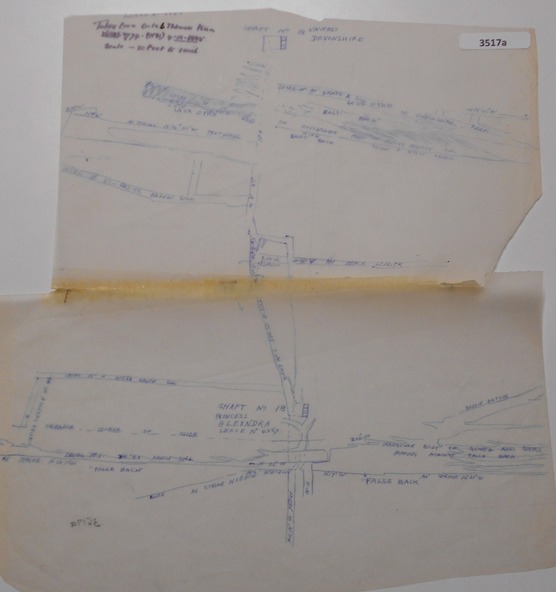
Map - DEVONSHIRE MINES - MAP WITH UNITED DEVONSHIRE & PRINCESS ALEXNDRA (ALEXANDRA)
3517
Reuse this media
Can you reuse this media without permission?No (with exceptions, see below)
Conditions of use
All rights reserved
This media item is licensed under "All rights reserved". You cannot share (i.e. copy, distribute, transmit) or rework (i.e. alter, transform, build upon) this item, or use it for commercial purposes without the permission of the copyright owner. However, an exception can be made if your intended use meets the "fair dealing" criteria. Uses that meet this criteria include research or study; criticism or review; parody or satire; reporting news; enabling a person with a disability to access material; or professional advice by a lawyer, patent attorney, or trademark attorney.
Attribution
Please acknowledge the item’s source, creator and title (where known)
Hand drawn map taken from Caleb Thomas Plan, Sheet 774 (No ?1) 4/12/1885. Map shows shaft No 18 (Princess Alexndra [Alexandra], Lease No 4567) and shaft No 19 (United Devonshire) depths of some of the levels and geological information. Two mismatched pieces of drafting sheet stuck together with sticky tape and staples.