Physical description
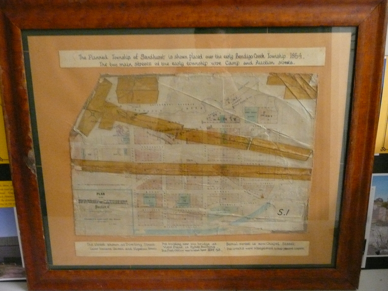
Coloured- The planned township of Sandhurst is placed over the early Bendigo creek township of 1854. The two main streets of the early township were Camp and Auction streets. The street shown as Dowling street later became Queen & Hopetoun streets. The building near the bridge at View Point is Pykes Building. The Post Office was located here in 1854 - 58. Bernal street is now Chapel street. The creeks were straightened to their present courses. Streets on map are. Pall Mall - Bridge - McCrae - Hargraves - Lyttleton - Myers - Mollison - McLaren - Mitchell - Williamson - Mundy - Bernal - Baxter - Larritt - Bramble - McIvor - Bull. Also shown on map: Bendigo Creek - Government Reserve - Present Cemetery - Proposed diversion of creek. FH 562 Deframed 2022
Inscriptions & markings
Lithographed at Surveyor Generals Office. Melbourne. July 25. 1854. By R. Meikle.