Physical description
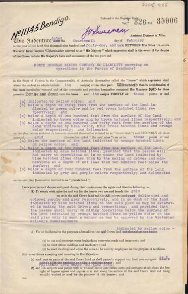
6 page document plus map : Gold mining lease No. 11145 between Crown ( King George VI) and North Deborah Mining Company, Parish of Sandhurst, dated 14th February, 1941. Map: Lease No. 11145 'Mining District of Bendigo, County of Bendigo, Parish of Sandhurst. Total area 48 acres, 3 roods, 22 perches. Map has extensive colour key indicating depths below surface that will be mined. Crown land and surface excised shown in orange cross-hatching. Lease holdings on map: 10753, 11020, 1363 T.L., 1115 T.L., 11013, 11062, 11033, 9988. Dam shown on 11013. Railway line marked through centre of map. Map refers to central area of Bendigo and includes reference to Hargreaves Street, Violet Street, Lily Street, Breen Street and Sullivan Street.