Physical description
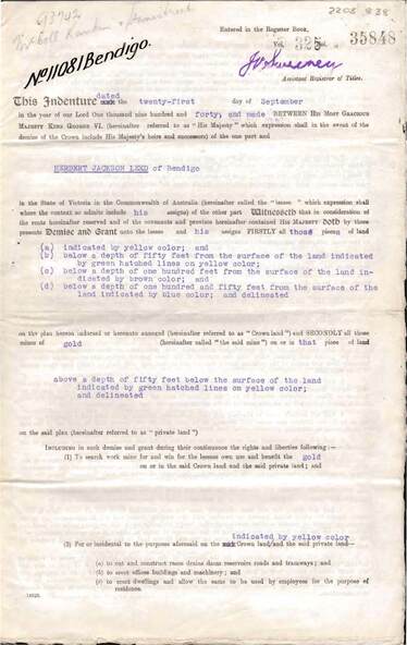
Six page document plus map, dated 21st September 1940, between the Crown and Herbert Jackson Leed, for the land shown on the accompanying map 'indicated by yellow colour' Depths indicated on lease document. On map: Mining District of Bendigo, County of Bendigo, Parish of Sandhurst. No. 11081. Net Area 24 acres, 3 roods, 3 perches. Signed by Herbert Leed and ?Walsh, Warden Clerk, Bendigo. Map shows lease holding 11081 coloured yellow. Other leases: no's. 9882 11081, 11034, 11080. Streets: Fletcher Street, and Belle Vue Road. Gullies: Derwenters Mistake Bully and Pig Face Gully on lease 11081. Quarry Hill Recreation Reserve marked and some residential allotments. Water race indicated on map. On back of document: ; Deborah United Gold Mining Company No Liability of Charing Cross Bendigo is now the proprietor of the within described estate by transfer registered on 21st November 1940 and numbered 1795202.