Historical information
SOUTH FREDERICK THE GREAT MINE Location Unreserved Crown Land along the southern boundary of Sebastian School, east of Three Chain Road, Frederick the Great/Carshalton Reef, Sebastian Map Reference Raywood 1:25000 - BV488.447
Mine site: Capped shaft still surrounded by its mullock paddock. At the base of the paddock on the northern side is a concrete winding engine foundation measuring 8 by 4 feet, and standing 2 feet high. The foundation has ¾-inch mounting bolts. Battery site 70 metres to the west of the mine site are the concrete foundations of a 10head battery. The foundations measure 16 by 11 feet, and stand 4 feet high. Part of the battery's loading ramp still survives, and on the eastern side of the battery foundations is a large concrete engine foundation. Near this engine foundation is a 3 foot square concrete pad, which still retains a circular impression. Presumably this was a stand for a gas producer cylinder. Located between the battery and the mine site is a rubbish dump which contains sections of an iron stack, and perhaps the remains of the gas producer cylinder. History Period of activity: 1871 (South Frederick the Great); 1881-1889 (Amalgamated South Frederick the Great); 1897-1906 (South Frederick the Great); 1933-1937 (South Frederick the Great) Line of reef: Sebastian/Carshalton Maximum recorded annual production: unknown Total production: 511ozs obtained from 1773 tons between 1934 and 1937 Deepest working level: 300 feet (Amalgamated South Frederick the Great) Deepest shaft: 307 feet (Amalgamated South Frederick the Great)(below water level) Source: City of Greater Bendigo: Marong Heritage Study
chrome-extension://efaidnbmnnnibpcajpcglclefindmkaj/http://images.heritage.vic.gov.au/attachment/70493Mining Sites
Physical description
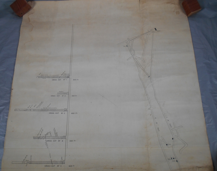
Transverse and longitudinal plans on one sheet, of South Frederick The Great Mine, Sebastian.
Forms part of the Margaret Roberts Collection of mining records.