Historical information
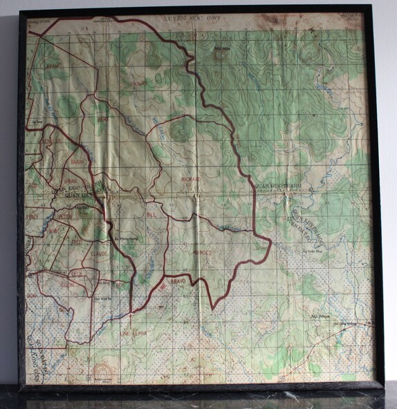
Part of a single sheet from the Vietnam 1:25 000 topographical map series (L7014) covering the area around the town of Xuyen Moc in the southern province of Phuoc Tuy (modern Ba Ria - Vung Tau). Used during the war, this shows Areas of Operations given men's names.
Physical description
Square topographical map with district boundaries, vegetation and terrain features. Relief shown by contours. Has been laminated and framed.
Inscriptions & markings
Sheet 6430-11-SW/ Edition 2/Series L 8015